Download Agreement, Release, and Acknowledgement of Risk:
You (the person requesting this file download) fully understand mountain climbing ("Activity") involves risks and dangers of serious bodily injury, including permanent disability, paralysis, and death ("Risks") and you fully accept and assume all such risks and all responsibility for losses, costs, and damages you incur as a result of your participation in this Activity.
You acknowledge that information in the file you have chosen to download may not be accurate and may contain errors. You agree to assume all risks when using this information and agree to release and discharge 14ers.com, 14ers Inc. and the author(s) of such information (collectively, the "Released Parties").
You hereby discharge the Released Parties from all damages, actions, claims and liabilities of any nature, specifically including, but not limited to, damages, actions, claims and liabilities arising from or related to the negligence of the Released Parties. You further agree to indemnify, hold harmless and defend 14ers.com, 14ers Inc. and each of the other Released Parties from and against any loss, damage, liability and expense, including costs and attorney fees, incurred by 14ers.com, 14ers Inc. or any of the other Released Parties as a result of you using information provided on the 14ers.com or 14ers Inc. websites.
You have read this agreement, fully understand its terms and intend it to be a complete and unconditional release of all liability to the greatest extent allowed by law and agree that if any portion of this agreement is held to be invalid the balance, notwithstanding, shall continue in full force and effect.
By clicking "OK" you agree to these terms. If you DO NOT agree, click "Cancel"...
There is only one trip report on Big Agnes and five more on Mt. Zirkel, so I decided to write this one up, which combines a backpacking loop and the two highest peaks in the wilderness area.
I get bored when I read (and write!) long trip reports with lots of explanations, so here we go. I will just give info on the routes as I show the pictures that I hope are useful for future ascends.
Highly recommend this forgotten area of Colorado, we saw nobody on our ascent to Big Agnes and 2 people on Mt. Zirkel over Labor Day weekend.
Summary of the weekend:
Day 1:
Trailhead: Slavonia Mine (8,400 feet)
Set up of first camp: 3.6 miles clockwise (9,800 feet), Gilpin Creek Trail
Day 2:
Big Agnes (12,060 feet)
Distance round trip from camp: 5.2 miles
Set up of second camp: 2.8 miles clockwise (10,100 feet)
Day 3:
Mt. Zirkel (12,180 feet)
Distance round trip from camp: 9.1 miles
Day 4:
Finish the loop at TH
Distance from camp: 4.6 miles clockwise, Gold Creek Trail
We thought this was a remote area, lots of wildlife, we saw two bears on our way to camp the first day. One of them was next to the trail not paying attention to us, just eating his berriesâ¦
Big Agnes (12,060)
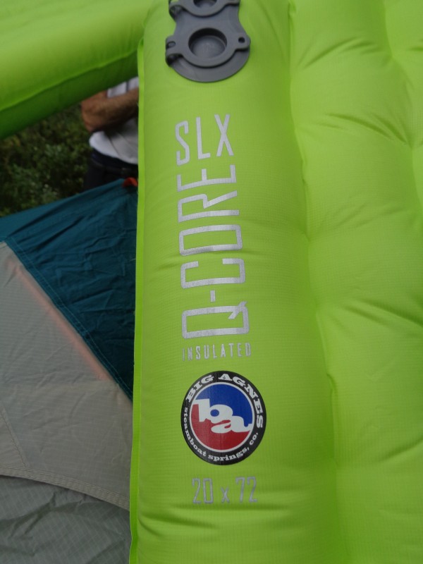
First goal: Big Agnes, yes I love this pad!
Our camp in the willows:
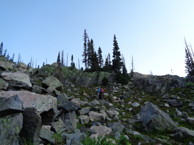
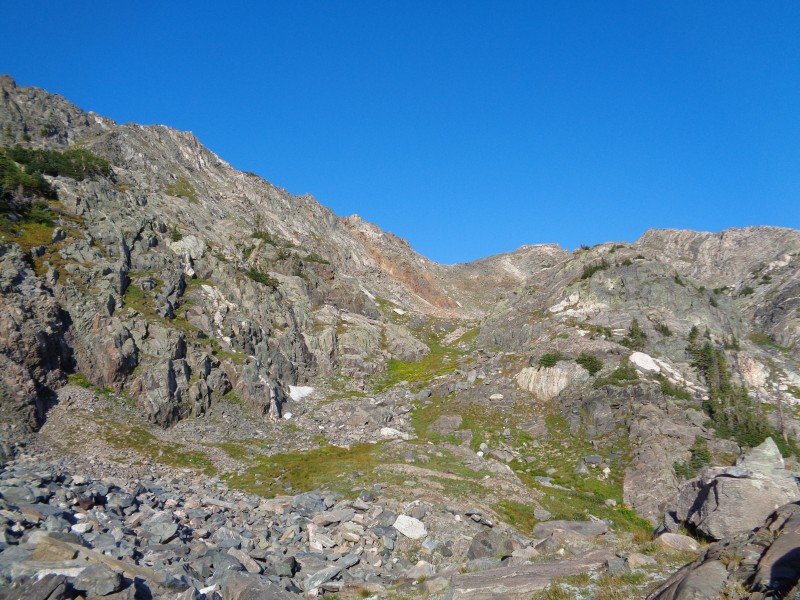
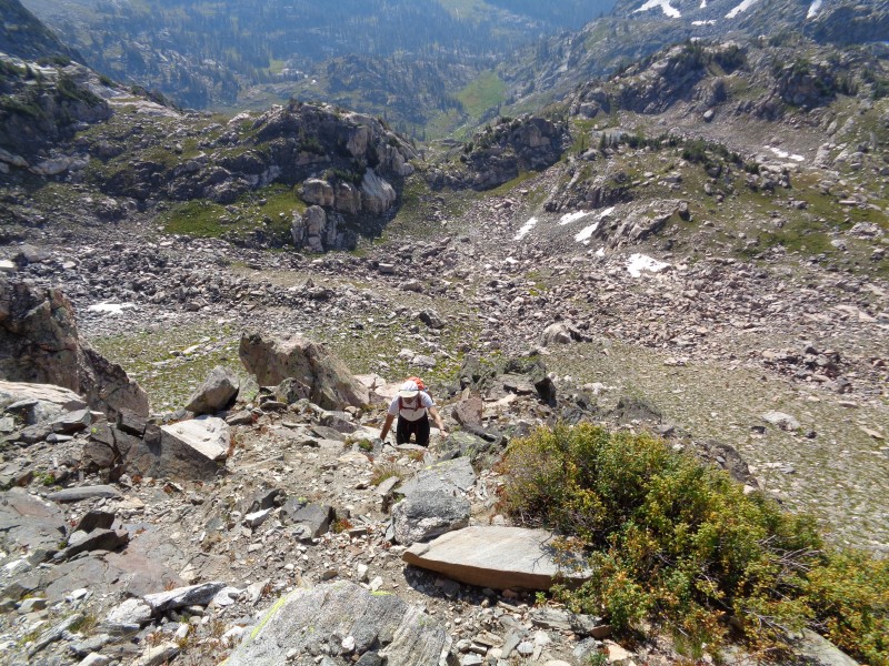
This route required bushwhacking and route finding skills. It took longer than we thought, given the distance and elevation, the total ascending time was 3 hours and a half.
The first part goes through willows, we just kept going north next to the creek.
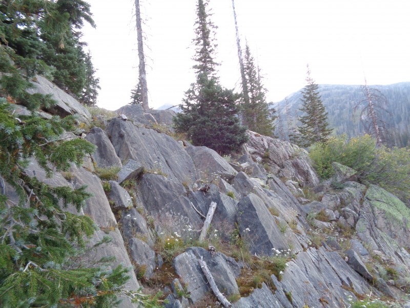
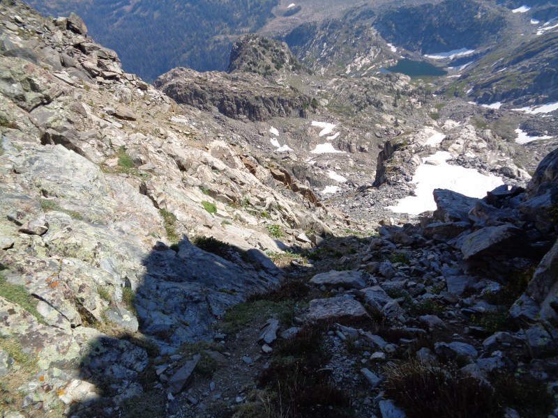
We ascended these rocky slabs on the way up Big Agnes:
The goal is to bypass this rocky point on the left:
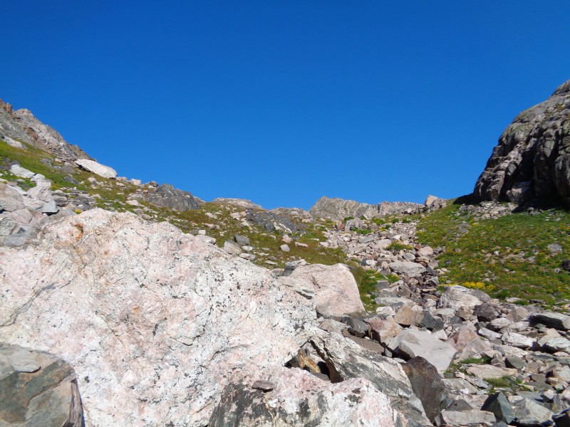
Rock glacier to be ascended:
Looking back:
En route to find the tarn:
Another rocky glacier to ascend:
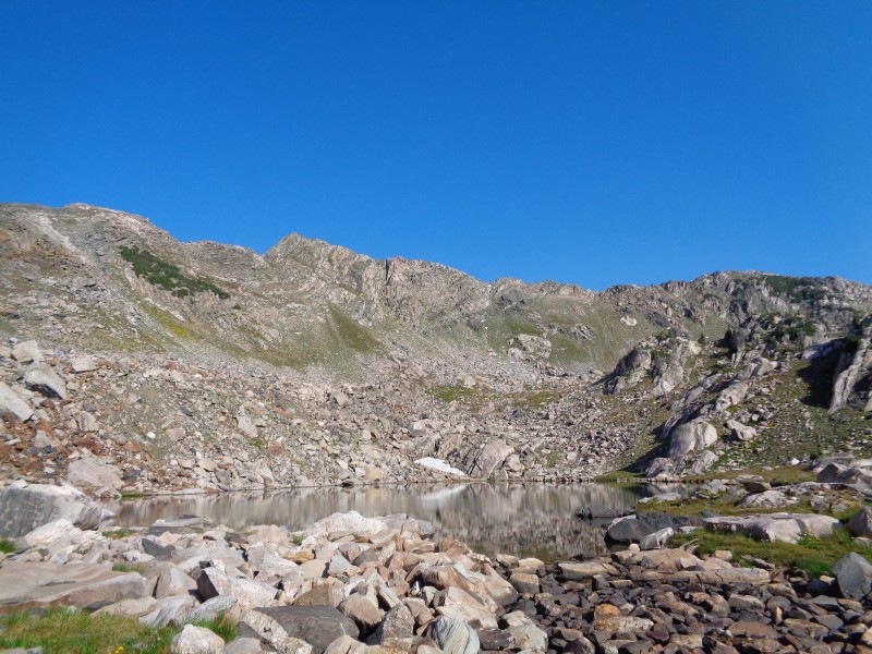
Finally the tarn!
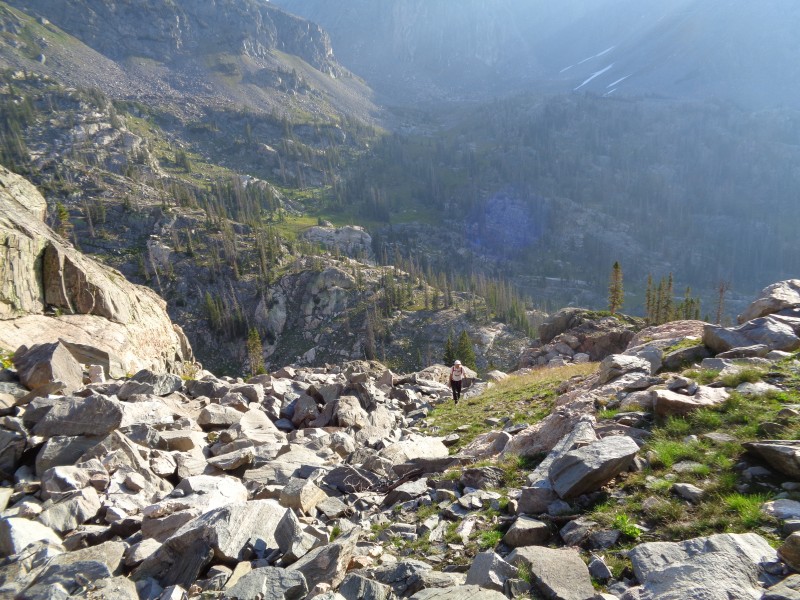
From here the next goal was to ascend to the saddle, we chose the route on the right, it looked more solid but required some class 3. On the descent we used the obvious path in the middle:
Looking back to the tarn:
Some scramble:
Looking back again:
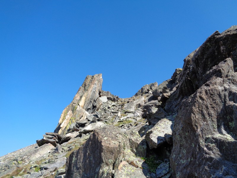
Once in the saddle we could see the remaining of the route, but that peak is not Big Agnes yet! We went in between the two gendarmes seen in the picture:
A closer look:
Looking back:
Mmmh, so which one is the summit?
We ended up summiting both points, not sure if the most prominent one is the real one, my gps was reading almost the same exact elevation.
The second summit required to go on the east side of the ridge and descending a bit:
On the summit looking back at the false summits:
On the way down we took a slightly different route, still on the west side of the peak:
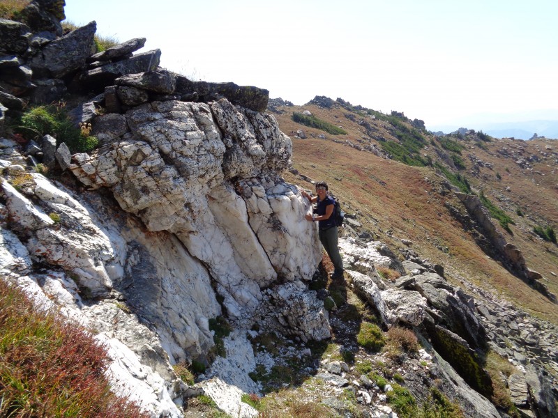
Found a really good chunk of milky quartz rock!
And mica, by the way Mica Lake is just on the west side of Big Agnes.
Mt. Zirkel (12,180)
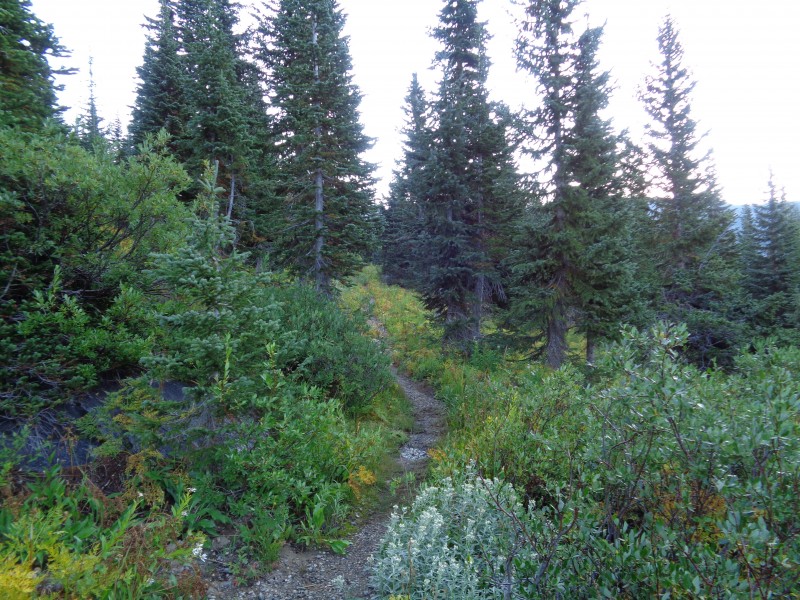
After setting camp the night before just below the junction with red dirt pass trail, we started our trek in the morning.
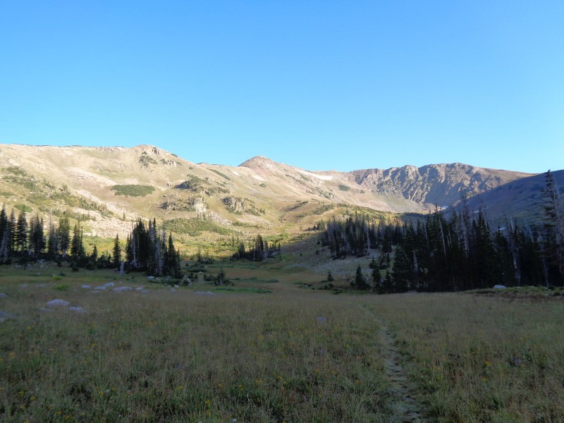
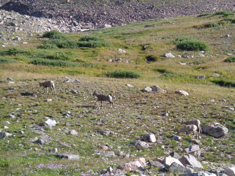
Meadow that opens up and you can see red dirt pass in the distance
Big horns
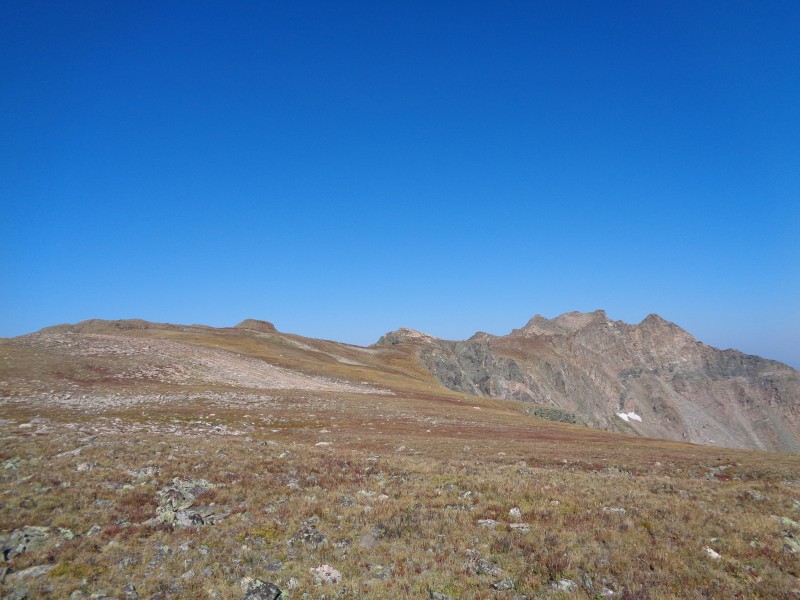
Looking back, we couldn't have asked for better weather
On top of red dirt pass at 11,500 feet
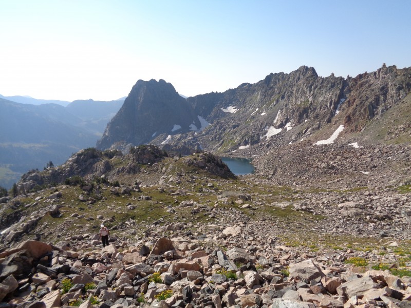
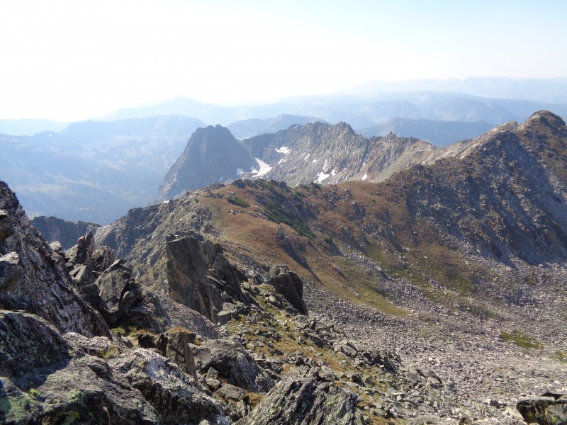
Mt. Zirkel in the distance, wait, which one is it??
Big Agnes view, no wonder there are so many tops.
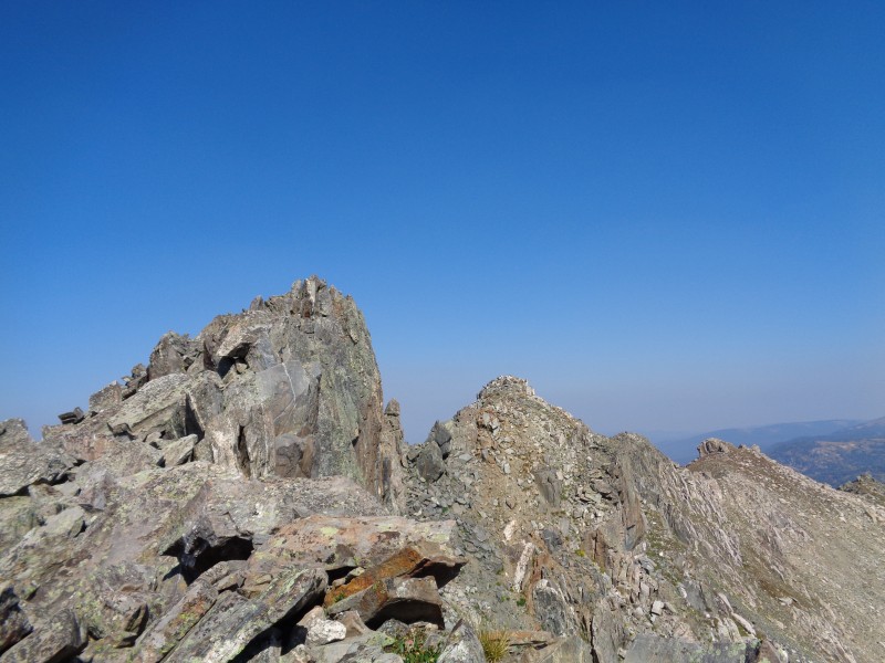
A closer look to Mt. Zirkel, again we ended up ascending the two main rocky points (just in case), we found the register on the farthest right.
From here it looks like the most prominent top is the left, but the register was on the right one
All in all an excellent trip that combines backpacking, hiking to the top of the highest peaks in the Mt Zirkel wilderness and a great wildlife experience. Keep it wild and well!
My GPS Tracks on Google Maps (made from a .GPX file upload):
I'm pretty sure we spoke on the trail as you descended from Red Dirt Pass! I talked to a couple of people that told me they did Big A from an unconventional way the day prior, and looking at your route I would say it was probably you two.
Your morning on Mt Zirkel was certainly better than my mid-afternoon summit, as the smokey haze got progressively worse throughout that day.
I went back the following weekend and did Big Agnes from Mica Lake, and that was a nice trip.
Thanks for the added report! Cool area, and I'm glad I took the time to hike there while I was working in Steamboat!
d_baker--OMG, the famous d_baker, yes I remember meeting you up there! I have read your posts over the years and I did not know it was you! I remember you mentioned you were working in Steamboat, and we thought it was pretty cool, that is a very beautiful area to live in. This is a small world indeed... Yes, we got worried when we saw ashes falling in our tent that night, the air quality got much worse. Luckily the fire area was far away, but still it was very hazy the next day.
MtnHub--Doug we missed you this year! did you make it to CO? for us it was a very slow Summer, not much hiking till later in the season. Yes, I highly recommend Zirkel, and this particular area of Colorado.
Having done four routes on Big Agnes yours is surely an unconventional way to climb this peak. Your photo "Looking back to the tarn" also shows a seldom climbed peak. When I climbed that peak in 1990 I found a register in a glass bottle placed in 1939. As to the summits of Big Agnes, the late Colorado peak bagger Bob Martin hand level determined in 1995 that "a point a couple hundred yards south, with an equal number of contours, is slightly higher" than the main summit. So cheers to your loop trip in a great area of the Zirkels, Big Agnes and the Sawtooths.
I was impressed by and curious about Big Agnes when I did Zirkel last year. Thanks for the beta!
Caution: The information contained in this report may not be accurate and should not be the only resource used in preparation for your climb. Failure to have the necessary experience, physical conditioning, supplies or equipment can result in injury or death. 14ers.com and the author(s) of this report provide no warranties, either express or implied, that the information provided is accurate or reliable. By using the information provided, you agree to indemnify and hold harmless 14ers.com and the report author(s) with respect to any claims and demands against them, including any attorney fees and expenses. Please read the 14ers.com Safety and Disclaimer pages for more information.
Please respect private property: 14ers.com supports the rights of private landowners to determine how and by whom their land will be used. In Colorado, it is your responsibility to determine if land is private and to obtain the appropriate permission before entering the property.