| Report Type | Full |
| Peak(s) |
San Luis Peak - 14,023 feet |
| Date Posted | 09/23/2017 |
| Modified | 09/13/2018 |
| Date Climbed | 09/21/2017 |
| Author | huffy13 |
| Additional Members | Flood |
| September San Juan Seclusion on San Luis Peak-But That Wind..... |
|---|
Had a window of opportunity open up that allowed me to break loose one more time this year to do another summit hike, this time I was going to have the pleasure of hiking with a friend and coworker, Billy (username Flood) that I had not yet gotten to hike with despite years of us trying to coordinate our schedules to do so. We had discussed heading out to get Wetterhorn, but being so late in the hiking season and the fact that we had only a day and a half before I needed to be home, we opted for a closer hike, San Luis Peak from West Willow Creek. This route just made more sense and was more convenient for me because we were heading out on Wednesday morning, hiking Thursday early and then I had to be back home to get some sleep so I could start my work shift on Friday at 4 AM. We left home around 8 am central time on Wednesday and arrived at the West Willow Creek TH around 5 pm mountain time and immediately set up camp, crashed out around 8 pm, hoping to get a decent night's sleep. The small stream nearby helped soothe my nerves, but bugling bull elk nearby and the occasional sound of airlines overhead kept us from getting a great night of rest...still, a rough night in the mountains is better than most nights anywhere else. 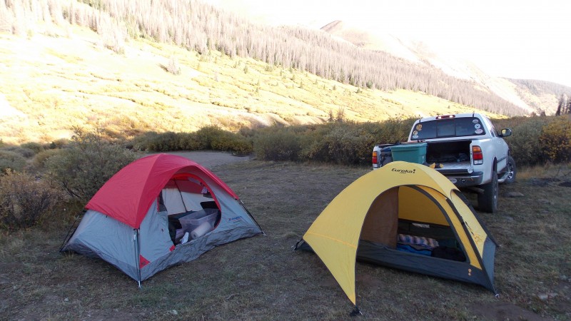 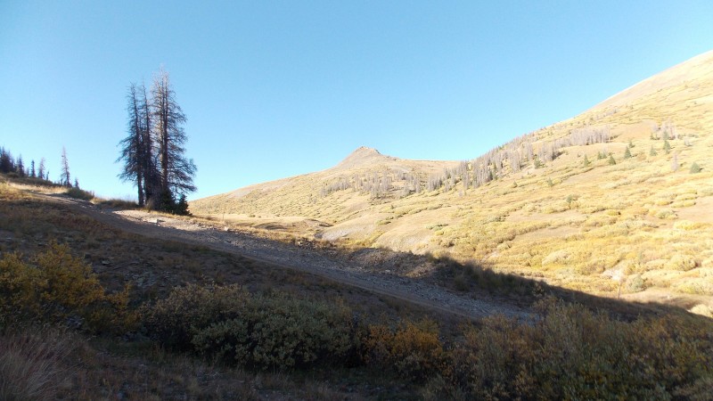 We woke up at 4 am, had some breakfast, warmed up in Flood's truck for a while and started our hike right at 5 am, heading up the first steep slope that skirts just on the south shoulder between PT 12,540 and an unnamed 13er that runs along the continental divide. This first 1/2 to 3/4 miles is probably steepest, hardest part of the whole hike, gaining close to 1000 ft in that span before crossing over a shoulder and a slight descent into the first basin to the east of West Willow Creek. 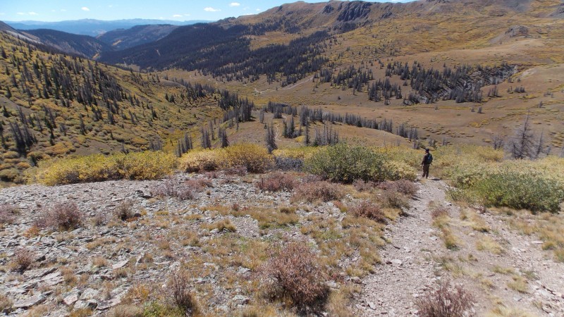  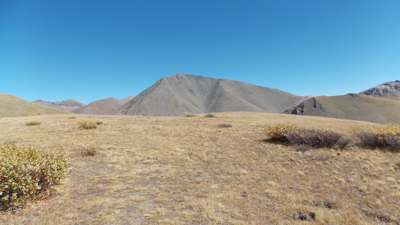 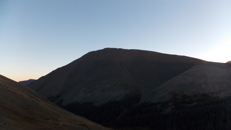 Once on the crest of that first shoulder you descend a few hundred feet into a forested area, most of which is dead now, probably from the beetle kill that has been plaguing that area for a few years now. This area actually concerned me quite a bit due to the very strong winds that were going on this day, I was concerned with trees getting blown over on us....but it turned out to be uneventful.  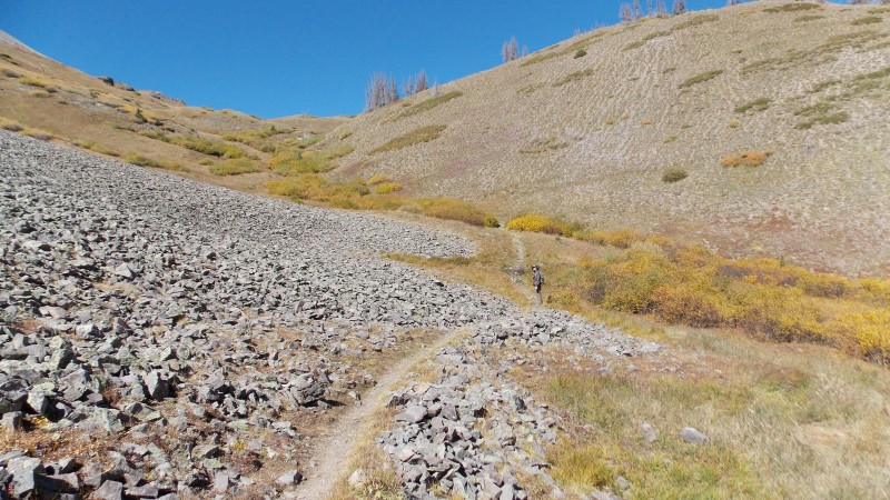 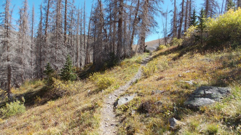 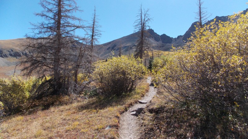 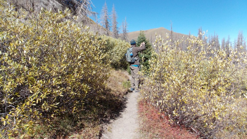 Once through the forest the trail gently ascends while skirting around the west side to the south and then on the east side of the first of two basins. It's a really well defined and easy to follow trail throughout. A good portion of this trail is also a span of the Continental Divide Trail and Colorado Trail.  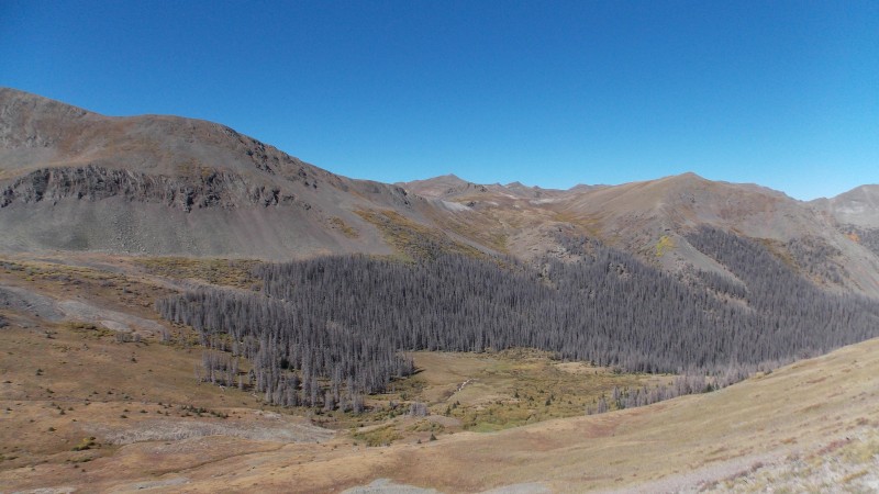  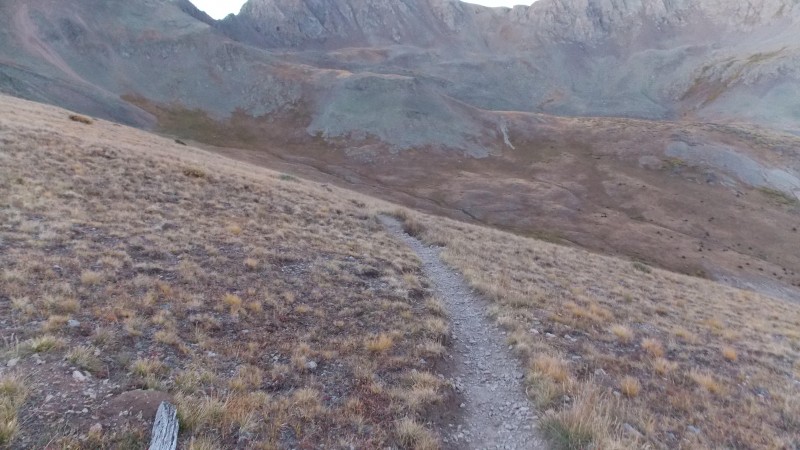 After skirting the first basin you go over a second pass-like shoulder between two 12,000+ft points into a second basin that is also known as Bondholder Meadows. Just like the first basin, the trail skirts from the west side of the basin, to the south, and then along the east side, gently ascending until it reaches the base of the south ridge of San Luis Peak. 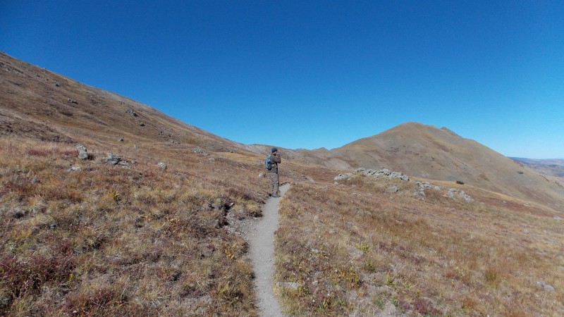  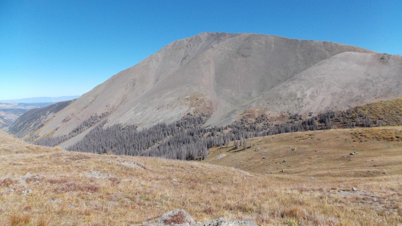 Now, the wind was blowing a little early on the hike, but the forecast had mentioned 30 mph winds at Creede so we were expecting wind....nothing could have prepared us for the hurricane force winds that awaited us once we reached the south ridge and the shoulder that connects San Luis Peak and Unnamed 13,155. The wind was literally strong enough to knock us off our feet. It was blowing in from the west/northwest, so we tried to stay on the east side of the ridge, hoping San Luis would offer a little shelter from the blasts of cold air. 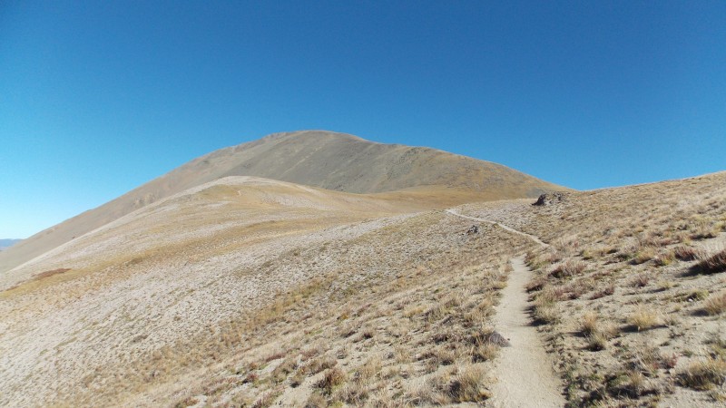   I did not really get any quality pictures once on the ridge due to the fact that I was trying to keep from being knocked over, my hands were freezing, and I was slowly losing the ability to care about even finishing this peak....however, after a lot of encouragement from Flood (who is an absolute beast, BTW), a little cussing the wind and lots of determination, I finally made the summit around 9:30 or so, about 10-15 minutes behind Flood. 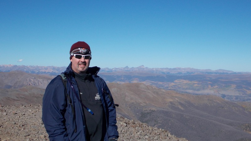 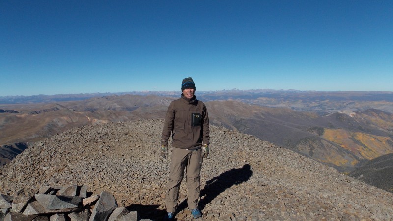 The views from San Luis Peak are pretty amazing, most of the Sawatch is visible, all the Sangres are prominently dominating the east horizon, as well as most of the San Juans...especially Uncompahgre and Wetterhorn to the northwest. 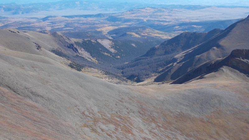  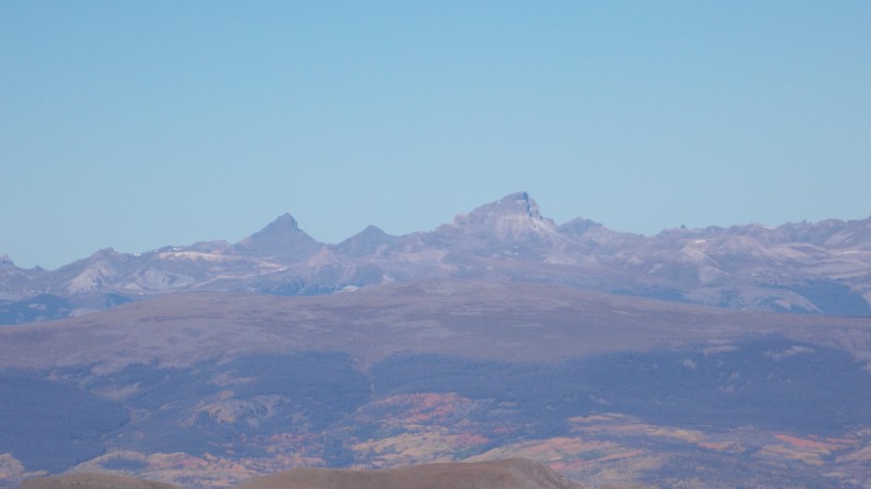 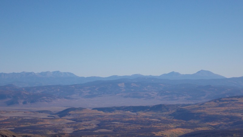 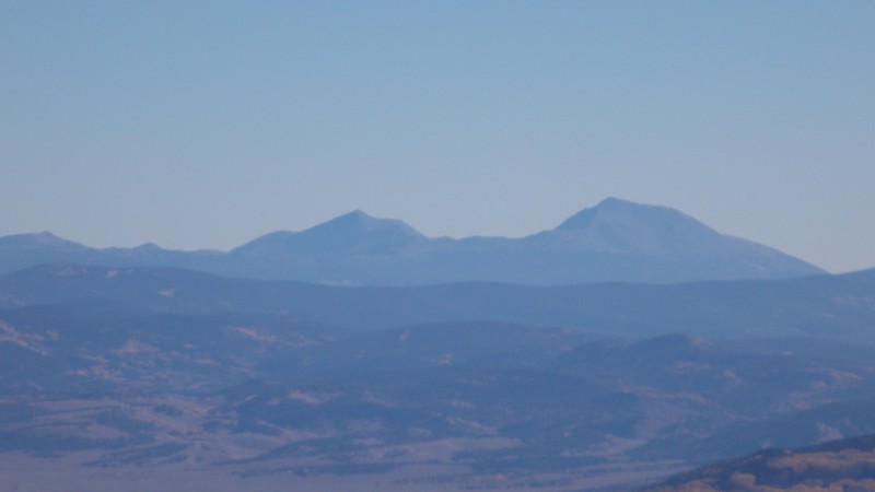 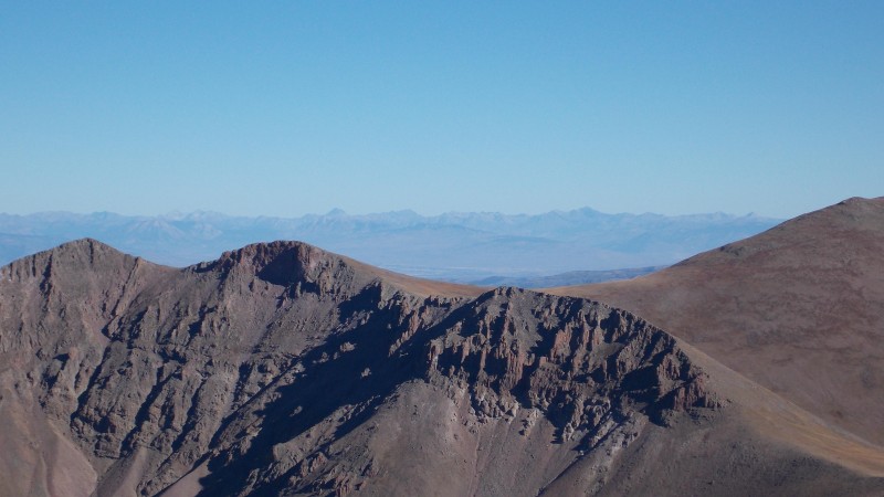 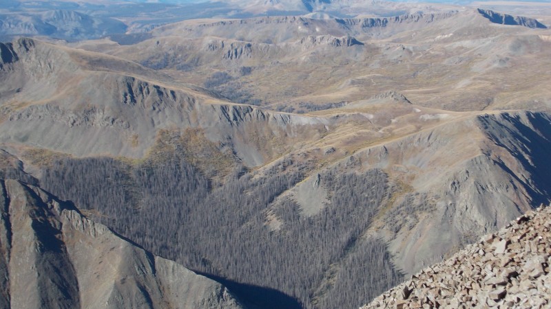  We only spent about 10 minutes on the summit (mostly behind the rock wind shelter) and then made our descent, trying to stay off the ridge proper, instead, trying to stay slightly on the east side of the ridge. We arrived back at the TH right around 12:40 pm, giving us a round trip time of just over 7.5 hours for the nearly 11.5 mile hike, according to Flood's GPS. The trip home was uneventful, but we enjoyed seeing near peak foliage and even got to see some bighorn sheep, elk, deer, moose, tons of pronghorn, some bluebirds, marmots and pika, etc....one of the most wildlife filled trips I've ever had. I wish we had more time to be able to check out the mining history of the Creede area. I will go back when I have more time to check out all the area has to offer. 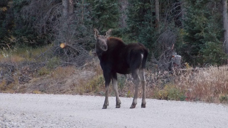 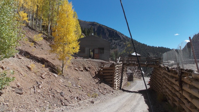 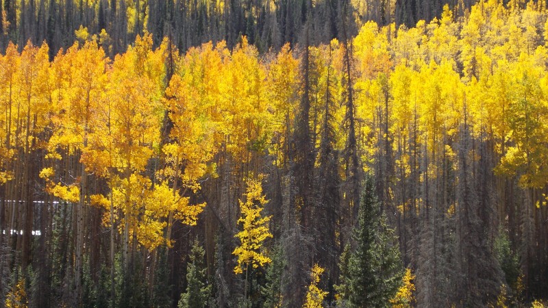  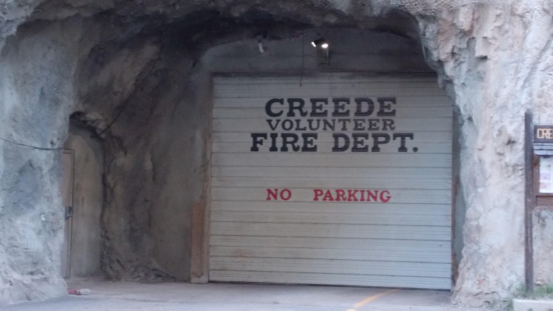  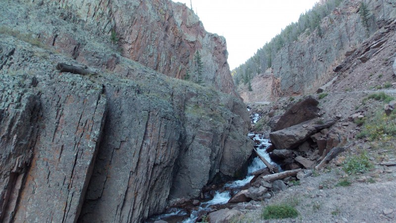 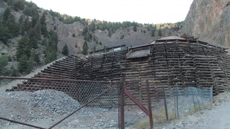 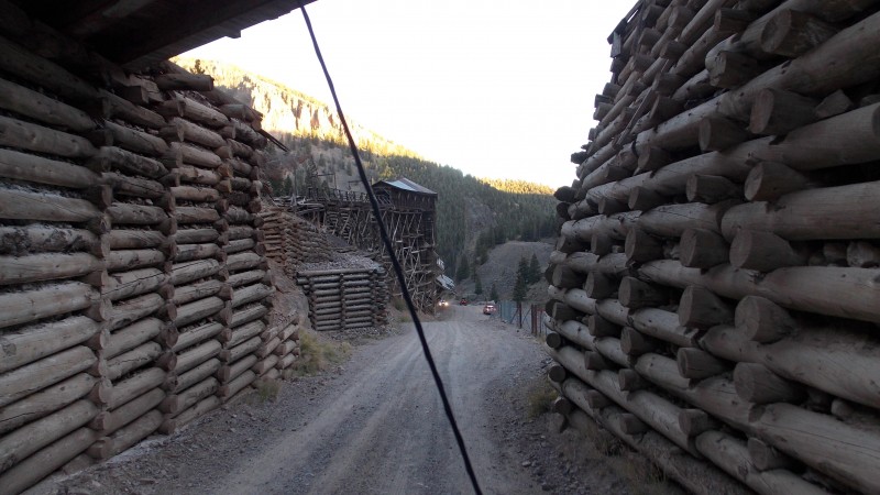 Ok, as usual, my personal insights, thoughts and advice about this hike: First off, this is actually a really great hike and would have been far more enjoyable had Flood and I not been fighting the horrible winds for one third of the hike. Getting to West Willow Creek TH is on a good dirt road that only gets really rough for the last mile to mile and a half, it is very steep in places though. It is also a lot shorter drive than going to Stewart Creek TH, so if you are concerned about being crunched for time, West Willow Creek, while not quite as scenic as Stewart Creek, may be a better option. There are many cool mining structures and info along the road too, so try to make time to check that stuff out. The trail is pretty well defined throughout, there is one place at the first pass next to PT 12540 that the trail gets a little hard to discern in the dark, but a little light and it quickly becomes defined again as it begins it's descent into the first basin. The route to San Luis is also part of the Colorado and Continental Divide Trails, so it is in great shape. The trail itself is actually one of the easier hikes I've done, the weather is all that made it difficult at all...really, aggravating is more accurate a term. Wildlife was another factor from this TH, we did see lots of wildlife, and heard it all night long...but it was still awesome despite the constant bugling of the elk. There is some water on this hike and on the drive to the TH despite it being so late in the fall, but I can see the stream crossings possibly being as issue if the runoff was stronger. Once on the hike there are a few small stream crossings that you could possibly filter water if you needed to. Other than that, I highly recommend bagging San Luis Peak from this route, it's fun and really, one of the gentlest routes I've seen...especially for being a non-standard ascent route. Thumbnails for uploaded photos (click to open slideshow):
|
| Comments or Questions | ||||||
|---|---|---|---|---|---|---|
|
Caution: The information contained in this report may not be accurate and should not be the only resource used in preparation for your climb. Failure to have the necessary experience, physical conditioning, supplies or equipment can result in injury or death. 14ers.com and the author(s) of this report provide no warranties, either express or implied, that the information provided is accurate or reliable. By using the information provided, you agree to indemnify and hold harmless 14ers.com and the report author(s) with respect to any claims and demands against them, including any attorney fees and expenses. Please read the 14ers.com Safety and Disclaimer pages for more information.
Please respect private property: 14ers.com supports the rights of private landowners to determine how and by whom their land will be used. In Colorado, it is your responsibility to determine if land is private and to obtain the appropriate permission before entering the property.


