| Report Type | Full |
| Peak(s) |
Mt. Valois - 13,173 feet Organ Mountain - 13,040 feet Amherst Mountain - 13,164 feet "Peak Twenty Two" - 13,107 feet Sheep Mountain - 13,073 feet Emerson Mountain - 13,147 feet "Peak Twenty One" - 13,084 feet "Overlook Point" - 13,005 feet |
| Date Posted | 09/27/2017 |
| Modified | 11/08/2023 |
| Date Climbed | 09/06/2017 |
| Author | Chicago Transplant |
| Lonely Peaks of the Weminuche |
|---|
Lonely Peaks of the WeminuchePeaks climbed (in chronological order) Mount Valois (13,185'): 496th Highest - 9/5/17 Organ Mtn B (13,032): 620th Highest - 9/6/17 Amherst Mtn (13,165'): 508th Highest, P1K - 9/6/17 "Peak Twenty Two" (13,105'): 566th Highest - 9/6/17 Sheep Mtn D (13,070'): 595th Highest - 9/6/17 Emerson Mtn (13,140): Soft Rank - 9/6/17 "Peak Twenty One" (13,085): Unranked - 9/6/17 Overlook Point (12,998'): 638th Highest - 9/7/17  Introduction I have tried, luckily with a good degree of success, to get in at least one trip to the Weminuche in some fashion each year. Sometimes it may be for 4 days, or even a week, and other times even just a day trip to something more accessible. Its not only Colorado's largest Wilderness area, but one of the farthest to drive to for most, and home to a large number of high, rugged and remote peaks that remind us a bit of the old pioneers of these peaks. Back before CFI trails and hordes of people, to places that sometimes don't even have a cairn let alone a summit register. In general, unless it was created by an animal, you can forget about trails altogether. It can be refreshing for the soul, not just as a break from the grind of a busy work schedule, or the monotony of routine; but as a way to reconnect to what makes mountains special and not just another tick on some arbitrary list you decided to chase. Even within the Weminuche itself there are varying degrees of civilization, the draw of the 14ers in Chicago Basin or to a lessor extent that of the Centennials, to through hikers on the Continental Divide Trail or people wanting the alpine beauty of Highland Mary Lakes. But there are places where the peaks see little traffic, many of the peaks on the "Least Climbed (ranked) 13ers" list on Lists of John live in the remote corners and this report features 5 out of the least climbed 14 as of this writing. They are hard to get to, low in elevation, and with little published information that I could find. I won't give away all their secrets, but hopefully for those who search deep into the Weminuche, whether for a list or the solitude, they will find some helpful information here. Even the driving approach is tough. There are two main access routes that most people take to get here - Endlich Mesa (or Burnt Timber w/o 4WD), and Lime Mesa. The other report on this site (by Futhermore for course) used Endlich Mesa, this trip was via Lime Mesa. For Lime Mesa, we approached from Durango after having climbed Hesperus in the morning. My girlfriend and I got a later start on that one than we intended as we just couldn't seem to rouse ourselves out of bed. Follow 550 to 15th and turn right, then left onto County 250. We followed that for about 10 miles to the turnoff for Missionary Ridge Road, taking that right. (NOTE: You can also stay on 550 to Trimble Lane (which is the best alternative if coming from the north to avoid going all the way to town), you will meet 250 about 4 miles south of Missionary Ridge Road in that case.) Missionary Ridge road is a long, washboarded, shelf road that seems like it will never end. Indeed it climbs about 5000' from town to the trailhead, so it takes a while to get back there. The road was easy to follow, at about 16 miles stay straight on FR 682 with signs for Henderson Lake, past the lake stay right on FR 081 (now about 22.5 miles from pavement) and follow the now rougher road. In about 2.5 miles there is a large parking area after a steep section, which might be the end of the line for some. I was able to go another .5 miles in my Outback to a small parking area before the road really gets rough, near about 10,900'. The trailhead is still 2 miles away at 11,500', over some rocky and muddy sections that definitely require 4WD and some clearance. It took us over an hour from Durango to the upper 2WD trailhead. Here we finished packing our overnight packs and hit the trail, at about 5pm. Hoping for a decent campsite before the sun set (which didn't quite workout). 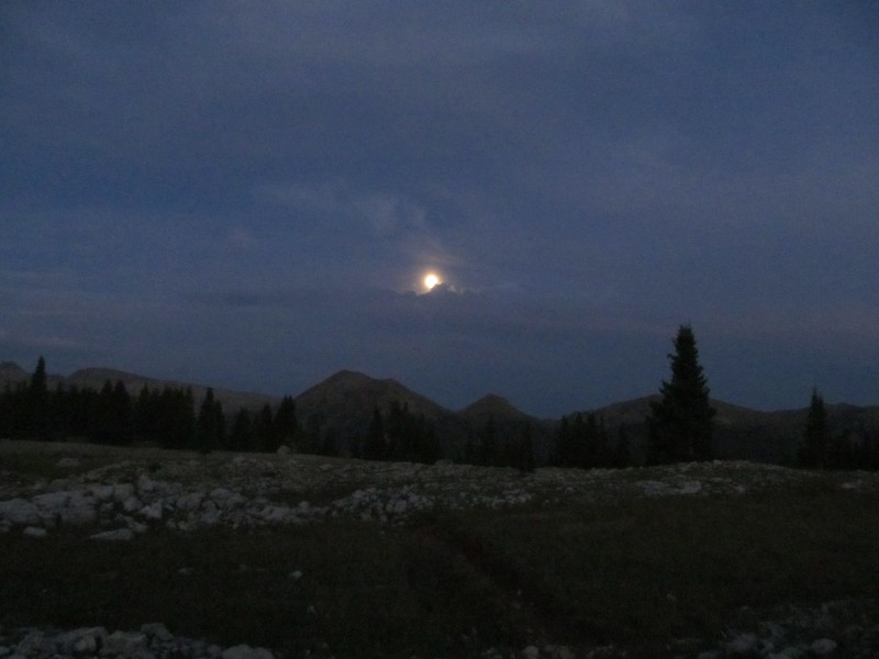 Approach Hike: 9/4/17 With the late start, we really were unsure just how far we would make it. There was a bench on the maps above the Missouri Creek crossing around 11,200' and that seemed like a reasonable goal. All we knew was that we were getting over West Silver Mesa even if we did have to hike in the dark. We didn't want that reclimb on the peak days! We followed the road initially until an abandoned road/trail with a "no motorcycles" stick after a short distance. This short cut trail was rough and steep, and probably not worth it. Beyond there was still over a mile of road to the trailhead and a few ups and downs. Finally arriving at the trailhead we quickly made it to a signed turnoff for City Reservoir at 11,600' (overgrown, but the trail is there) and descended to join the Burnt Timber trail, maybe a mile total so far from the 4WD trailhead, and 3 from the car. We contoured and then descended to cross West Virginia Basin near 11,500', then ascended over a small ridge to an elk filled meadow near 11,600' again. A long descent took us to Virginia Basin, where we crossed again, this time just below 11,000'. From here it was time for the crux of our approach, the 800' climb over West Silver Mesa at 11,800'. We topped out on the mesa at last light to catch the moon rising over Sheridan Mountain. 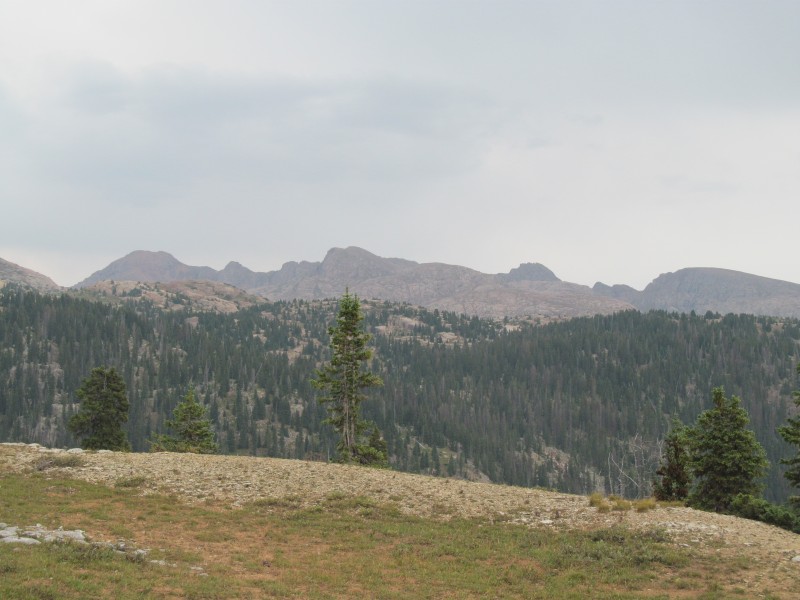 With our light gone, the headlamps came on and we followed the braided trail down hoping to be able to find good camping where we had spied on the map - a small ridge dividing Missouri Creek from an unnamed side stream near 11,200'. While contouring across a steep slope, we saw what looked like the lights of a tent below and passed a trail split that headed that way. Here is where the confusion of approaching in the dark and trails that aren't on our map set in. First problem was that the trail started to go uphill and there was a sign nailed to a tree that said "Trail" with an arrow pointing behind us. We took this to mean we were supposed to have taken the trail split back a few feet, so down we went. We crossed a stream (the light of the tent was no tent after all, it was the reflection of the moon in the stream crossing) and started looking for a flat spot to camp now that we were after 8, and in darkness. We found a nice grass spot overlooking a grassy meadow 50 feet below. This must be the 11,200' bench we wanted to camp at! (It wasn't... just missed it). It was a good camp though, actually better than where we wanted to camp, we just were not where we thought we were which came back to bite us a little bit the next morning. 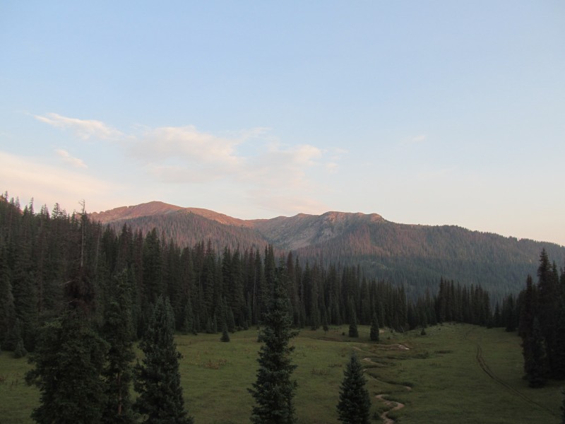 Mount Valois: 9/5/17 So thinking we were camped on the main trail and that we needed to descend for Missouri Creek, we left camp in the dark and headed downhill. Missouri Creek was only supposed to be about 150-200 feet below us, but we kept descending. No creek yet. We just thought it meant we camped higher than we thought originally. Maybe in the dark we only dropped to 11,500? There is another bench on the map there, that is quite possible. So down we keep going. We spit out into the valley and the trail heads for a creek. We find a crossing and head towards a large (but unoccupied as far as we could tell) camp with several large canvas tents and a few permanent hitch posts. What is this? Not wanting to hang out, we follow a trail as it starts to head down hill, but the valley is too wide to be Missouri and this just feels and looks totally wrong. I turn on the GPS and we are at 10,600' and had just crossed the Florida River. City Reservoir is a 3/4 mile bushwhack away, and 300 feet above us. What I should have done was turn on the GPS the night before and confirmed where we were camped. It was after dark and we just wanted to set up the tent, snack and crash. So it didn't happen. What to do? Well we don't want to lose camp, we know we can retrace whatever trail we are actually on and get back to camp, so we decide that is the right call and head back up. We pass our camp and head back to the spot we descended on the side trail the night before and see the "trail" sign on the tree. The trail keeps going and soon crosses Missouri Creek, and works its way over to City Reservoir. By now we have decided Valois is the better option, and the bigger loop will have to wait until tomorrow due to our delays. Its after 8am already. Below the reservoir on the Endlich Mesa trail we see 4 campers whose tents are less than 5 feet off the trail standing around a campfire that is maybe 15 feet from the trail and 25 feet from the river. I guess even the remote corners of the Weminuche are not "gaper free". City Reservoir is long, even in its low state of later summer. It was probably close to 3/4 of a mile from one end to the other. At the back end the trail gets steep fast and we work our way up towards what is marked on the map as "Logtown (site)", just below Marie Lake (best middle name ever by the way, my mom, niece and girlfriend all share it). Along the way the creek passed a section where it followed some slabby rocks and was really quite beautiful. 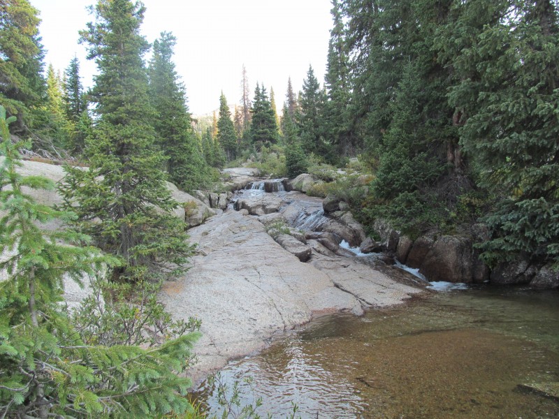 Finally we are starting to feel close to the mountain objectives we had set for this trip, and the lower slopes of Valois' south summit come into view. They are surprisingly rugged, grass benches split by granite cliffs. Some great looking camp sites in this area as well, we had talked about a 4 day back here with some other friends and had this area targeted as a potential base camp for it, that would have been a really great base camp. By the way, the Montana fires were giving us a bad haze the entire time, so the pictures are all really hazy. Unfortunately that limited the long distance views, but some of the color near sunrise/set did get quite dramatic as a result. 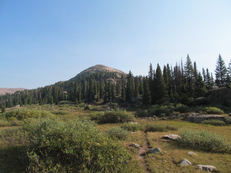 We crossed to the base of the slopes, and started looking for and find the weaknesses through the cliff bands and trees. Some easy scrambling here and there if we dead-end, but we make quick work of this section and soon reach treeline where the rugged granite benches continue for a while. This part was quite enjoyable and reminded me of several other areas of this part of the Weminuche where grass weaves through granite boulders and cliffs, whether Chicago Basin, Sunlight Basin or even (though much less steep) Jagged.  Near the false summit the terrain flattened and the granite gave way to gentle talus and grass slopes. 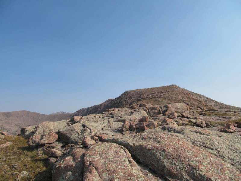 Cresting the false summit, we were surprised to see that the route to Valois was going to be across a long catwalk section of ridge. The terrain was easy, not much harder than normal class 2 walking, and not overly exposed. It was a fun section of ridge and really made the peak for us. The summit itself is a very large flat plateau and not particularly interesting except from its views, the farther to the northeast edge of the summit plateau you get, the better. 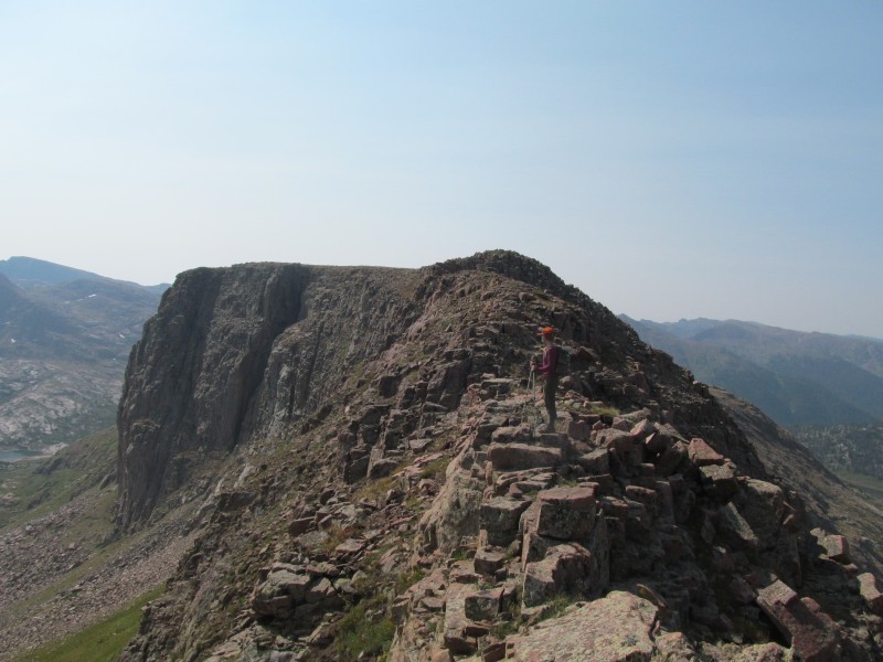 The views of tomorrow's peaks above the beautiful Castilleja Lake below. (Castilleja is the genus for the plant more commonly known as Indian Paintbrush). Beyond and below that lake are a few unnamed tarns, one in particular that would be a fantastic camp on a bench towering over the edge of a steep drop toward Johnson Creek. 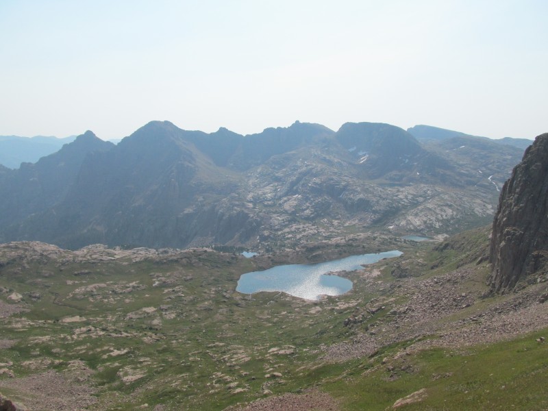 From here we contemplate our descent options, and how to get to Amherst and Organ for tomorrow. The slopes on this side of Amherst do not look appealing, and neither do the cols to cross the ridge. Should we try and descend to Castilleja Lake so we can explore the basin on that side, which is tomorrow's approach, and see if anything good jumps out at us? Perhaps descending to Trimble Pass and back over the Silver Mesa trail, or even climbing Aztec? But its almost 11am and we don't know if we should trust the weather for that much above timberline travel. Castilleja Lake wins, and we reverse towards the catwalk where a steep but mostly grassy gully drops to the basin towards the lake. 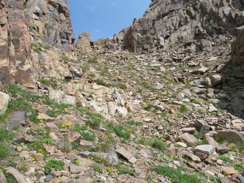 We contour around the east side of the lake, getting some pretty nice views of Valois and its south summit's impressive cliffs. For such a gentle flat summit, it sure looks dramatic from below on the east! Here we enjoy a long break, and my girlfriend even gets in a quick nap while I try and plan for tomorrow and how to get back to camp today. 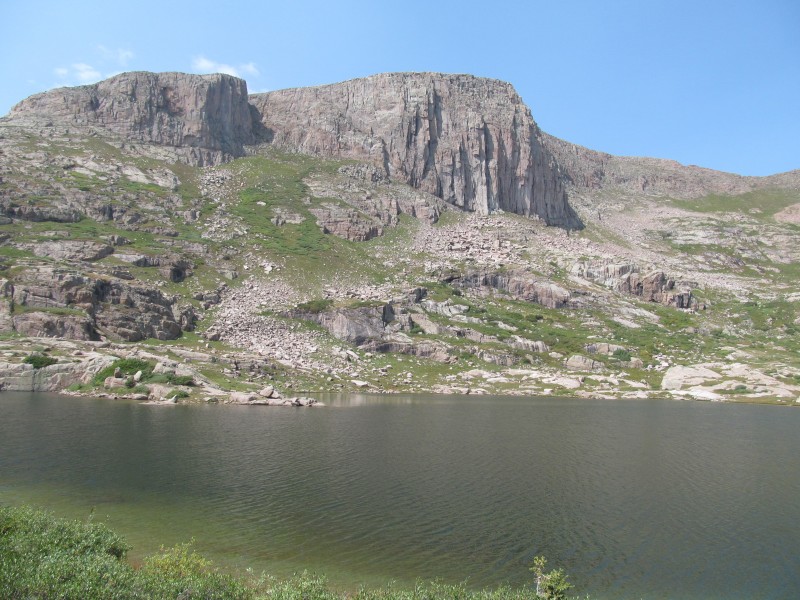 From here we don't know what the route back to camp holds, but the terrain on the east side of the creek looks good so we work our way down from the lake and hope there isn't going to be too much willow whacking. We cross between two smaller unnamed lakes and start following the upper Florida trying to find good meadows through any willows. We could see slopes above that looked like they would provide easy passage to the south side of Peak Twenty One that seemed like a good place to head up tomorrow. We make a mental note as we may be bushwhacking this in the dark tomorrow! 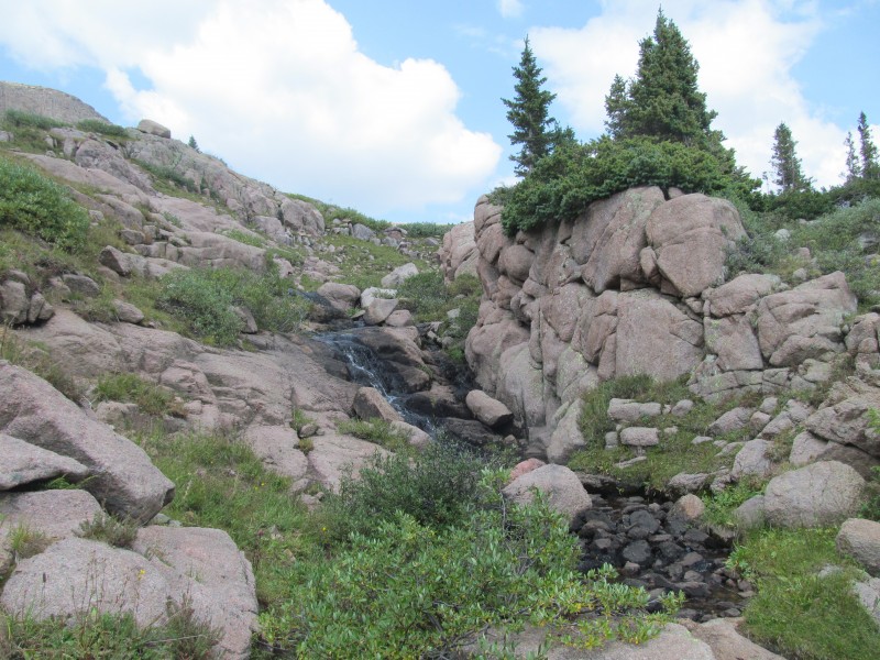 To our surprise we found a good game trail, when it fizzled out we just keep going in the same general direction, trying to patch game trails and meadows together. Eventually we met up with an even stronger trail, one that surprisingly takes us all the way to the earlier slabby section of creek above City Reservoir, where an easy creek crossing and a short bit of trail lead us back on the main trail. This is going to come in handy tomorrow! No 'schwacking through the dark for us, we'll have a trail to follow after all! 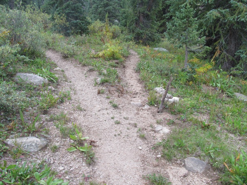 We pass by City Reservoir where we find yet another illegal camp, this one is basically IN the reservoir. With the low water, we are quite sure that this guy would have been camping underwater if he had set up shop here back in June. I know people don't like rules, but really the 100 feet away from water and trails is just common sense, it shouldn't even need to be a rule, plus who wants to camp 5 feet from a trail or basically in the lake? I can't imagine its a particularly enjoyable experience for them. It made us kind of glad to be camped off as far from the lake as we were even if we did have a bit og a hike right now to get there. Luckily the reclimb to our camp from the reservoir went quickly, and we stopped at a nice side stream near Missouri Creek to pump some water. We arrived just in time for an afternoon storm, happy we didn't try for Aztec or the high Silver Mesa trail as we may have been exposed to the weather if we had. A nice peaceful dinner and a restful afternoon followed, although we should have brought a book to help pass the 6 hours or so we had to sit around, the Trails Illustrated maps did keep us occupied planning other trips though! We slept well, knowing we had the approach dialed in and could do it easily in the dark. Amherst Group: 9/6/17 It was dark indeed to start our hike today. This was going to be the bigger day and we wanted a good early start, we aimed to be up near the base of the route we saw to Peak Twenty One by about sunrise, and we had no trouble following the trail today. As noted above, the game trails do start to fade out, but we were able to keep on track and piece them together to our intended stream that we planned on following. Above us was a bit of a canyon that we called "Big Snow Canyon" as it was still holding a lot of snow on one side. We figured the day before it would make a good landmark for our departure into the unknown, and it did. 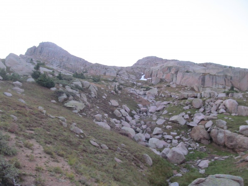 Some easy bushwhacking through light willows along the stream brought us to entrance to our canyon, which was quite a cool little passage. Easy walking on tundra and some talus between walls of granite with remnants of winter's snow to one side. We imagined just how loaded with snow this place must get, hence our moniker.  As we neared the end of it, we picked up a game trail that came from above on our left. This was the start of a series of such trails this day that made travel through this area pleasant and efficient. The view beyond in the early light was particularly nice on this smoky morning. We passed through the divide and contoured high and left towards the Emerson-Twenty One saddle, not sure exactly which way we were going to go to get to Organ.  We took a short break in this area in order to weigh our options. One would be to try and head to the Emerson-Amherst saddle, which looks like a lot of elevation loss to get below some cliffs on talus/scree; then a scree filled re-climb to the ridge where who knows what we will find on the other side. Yeah, not too interested in that. Option 2 would be the Emerson-Twenty Two saddle, which is pretty grassy and even has a game trail leading us that general direction. Again, who knows what is on the other side but this is easier to get to from here and the contours on the map make it look promising on the back side. We hit this so-called "Emerson Pass" and lo and behold, game trails head down the other side towards a bench below a couple of cliffs. We decide to go for it, at least to the bench, where we can make a decision about what lies ahead from there. 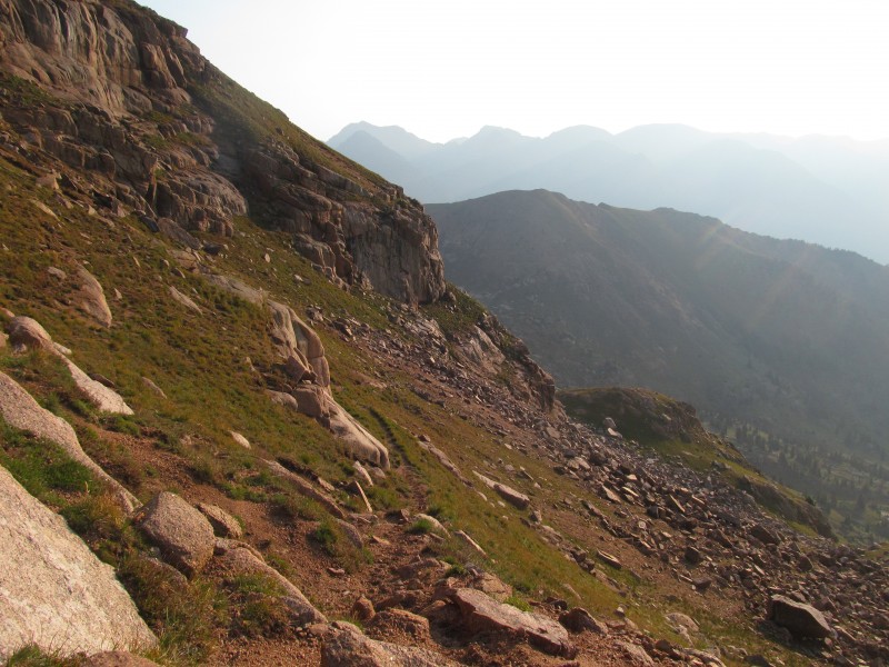 We turn that corner and the game trails keep going, across grassy slopes with occasional granite cliffs and benches for as far as we can see - almost all the way to the Amherst-Organ saddle. Jackpot! This is going to be an easy traverse. Any fears we had about long sketchy gravely traverses or the like vanish and spirits are high. The terrain is pleasant and we don't have to lose much elevation (we only ended up about 150 feet or so below the Amherst-Organ saddle I think). Those goats know what they are doing. The traverse below Emerson only took us about 45 minutes. 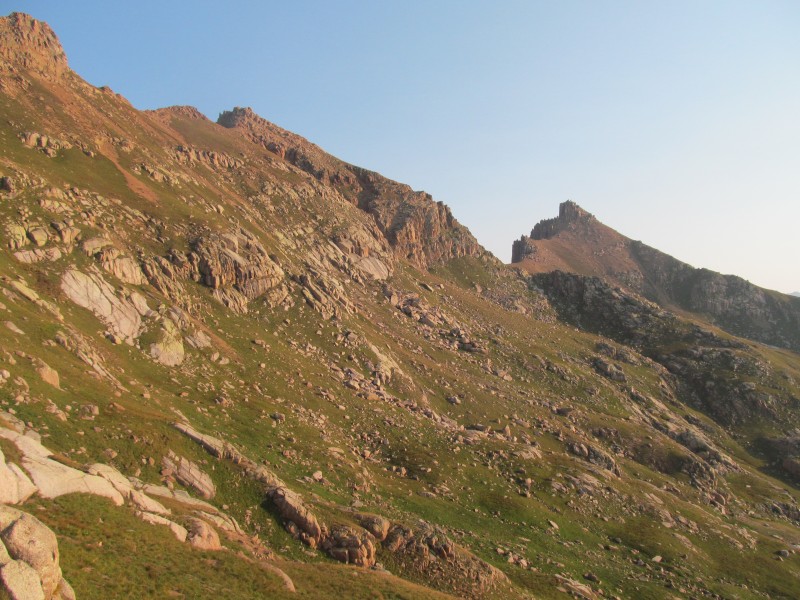 Here we had a short steep climb up grass (100 feet maybe) and the view of our remaining route from the top was complete. The saddle is an easy side-hill away, and the ridge up Organ looks very reasonable. We are very pleased with our approach route, especially after spying some notches in the Emerson-Amherst ridge above us that make that not look like a great option. 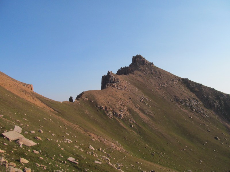 Some of the notches: 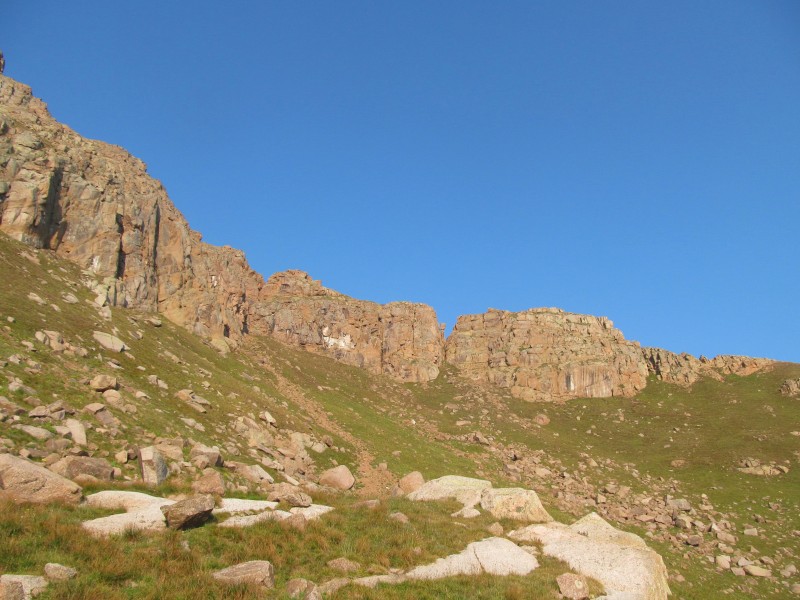 From the saddle the ascent to Organ's summit area is pretty straight forward, although there is a fair amount of loose gravel. Its easy terrain, and there are some bits of climbers/game trails forming in some places that help. The views towards the north really start to open up and Johnson Creek is a spectacular looking drainage. Makes me want to hike up it someday, you can actually use it to get into Chicago Basin from the Vallecito River via Columbine Pass. Some cool tower formations on that side of Organ's ridge as well, the namesake is quite appropriate.  The terrain steepens as you approach the summit area and there is more grass here with interspersed granite boulders. The peak started to remind me of Sunlight or Jagged, and it looks more imposing that it actually is.  As we got closer to the jumble of blocks at the top, we angled to the left of the vertical slabs and found good terrain, but it seems there are multiple ways to access the top. From below, just try and pick the best line and there are a few opportunities to traverse to the highest blocks without getting in trouble. 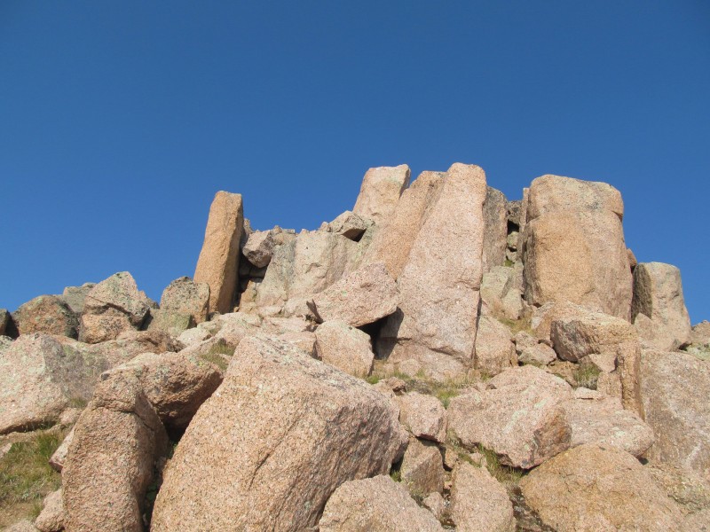 One last scramble along the ridge line brought us up to the summit boulders, the image was taken on the descent. Third Class minimum required to get up through this area, but you can easily increase that difficulty depending on your exact line. 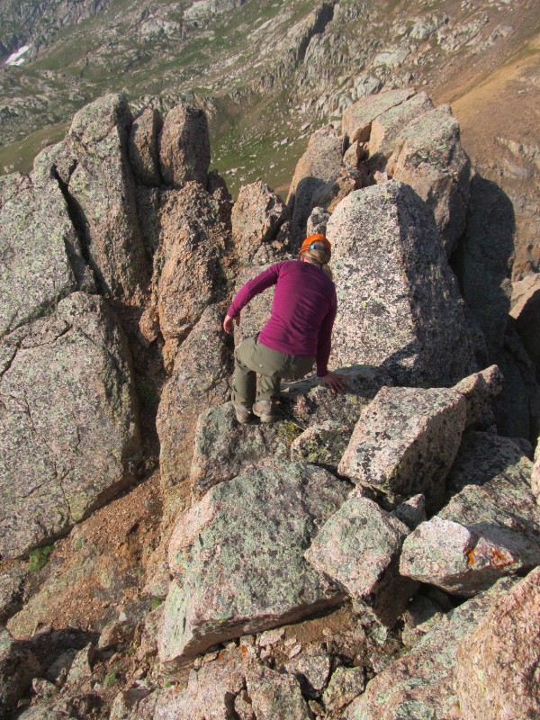 This peaks is definitely reminiscent of Sunlight when you reach the boulders at the top, there are a few of them, but the highest one is not too difficult. Again, "Organ" is a very appropriate name, the Johnson Creek side of the peak is festooned with organ pipe towers. Some exposure up here, but the block is really solid and we found it pretty comfortable to scramble up. The first move to the lower boulder on its right side was a bit reachy for my 5'-2" girlfriend. It was a bit of a mantle move, pushing up on your hands until you can manage to get a knee up and gain your footing to take on the higher true summit boulder, which has a very Sunlight-esque step-across move, though perhaps a little less committing. 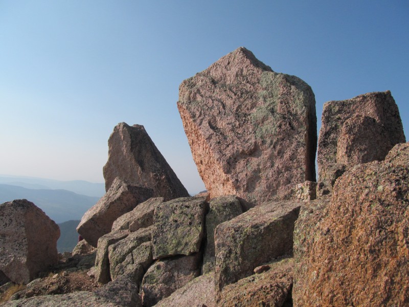 Organ was our favorite of the peaks we did in this area, the whole of our week long trip really. Its just a fun place to scramble around and the views were spectacular. This is a rarely visited corner of the Weminuche, and we wondered if these may have been some of the last 13ers to have even been climbed in the state given their low stature and remote nature. We descended generally the same way we came up and worked our way to the saddle with Amherst. The ascent up Amherst was not that enjoyable, that steep slope is a lot more tedious than it looks, the footing just really wasn't great. Some loose gravel and hard pan that doesn't inspire much confidence, but really just steep class 2. 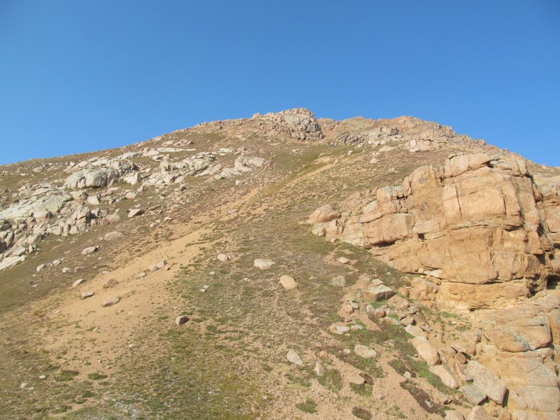 The summit views were really nice though, and the peak is on the 1000' Prominence List. There were two summits, but the first one we came to was definitely the higher. No register here, or Organ. It is kind of nice to explore these areas and feel like nobody has really been here before, or at least they haven't been here in a while.  For the descent we started along the ridge crest towards Emerson planning to bail back down to our goat trails when we got past some cliffs that are directly below the initial part of the ridge. We scouted all of that from below on our traverse to Organ and its pretty easy route finding. We did find some fun short class 3 down climbs, and this would make a nice ascent route of Amherst once past all of the difficulties on the Emerson side.  We dropped back down to the goat paths, and traversed around then back up to "Emerson Pass", where it was time for our next route finding challenge on Peak Twenty Two. You could probably stay pretty high and go over Emerson as well, but given the notches we saw from below and the snow in the gully we would have needed to regain the ridge, we liked sticking with the known route and our goat paths. It was easy travel, and the maybe 250 vertical feet or so back to Emerson Pass was quick and painless. Emerson is a soft-ranked anyway, so almost 300 feet of gain to go over it so it was pretty much a wash. 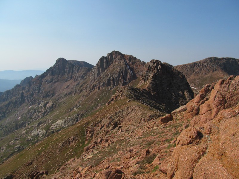 Peak Twenty Two is an interesting little outcrop, not much prominence (325' I think) and at the time it was LOJ's least climbed ranked 13er. From the pass, we initially climbed on the ridge crest until some difficulties forced us to a grassy traverse across the face. Pretty easy traverse and the terrain is very stable and not exposed. 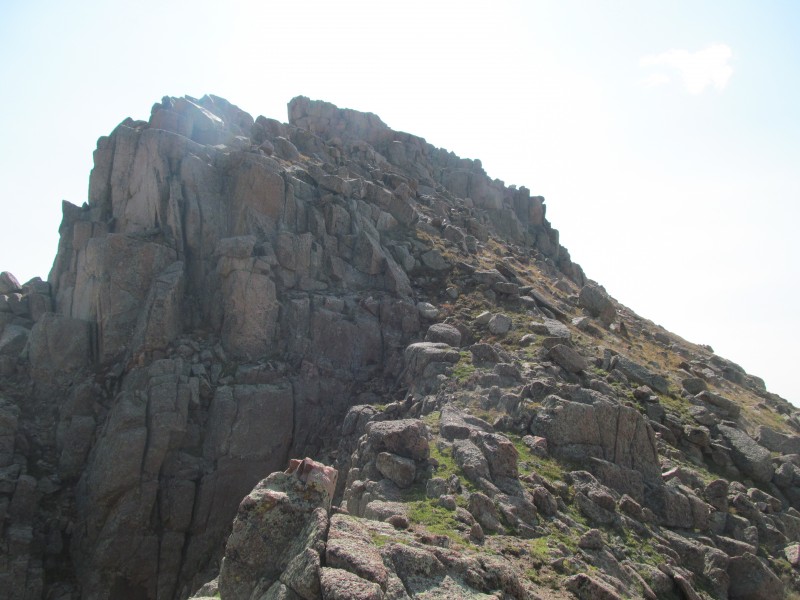 We went until we saw a good place to regain the summit area, but in reality we probably went up a bit too early. We made our ascent more difficult than it had to be, but it was pretty fun. Some exposure, and definitely Class 3. We initially went left on a sloped ledge across the bottom of the towers in this picture.  Then scrambled up to the summit towers on some class 3 rubble, where we didn't find a good way up to the true summit as it was steep and slabby blocks on this side. 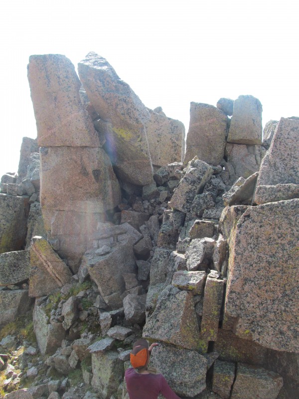 I dropped around on an exposed ledge and found a good way up to the summit blocks from the south. From there I could see an easier route without the exposure and my girlfriend retraced and went around to this likely standard ascent route. The ridge here was mostly Class 2+, just a couple of easier Class 3 moves were required and very little exposure. 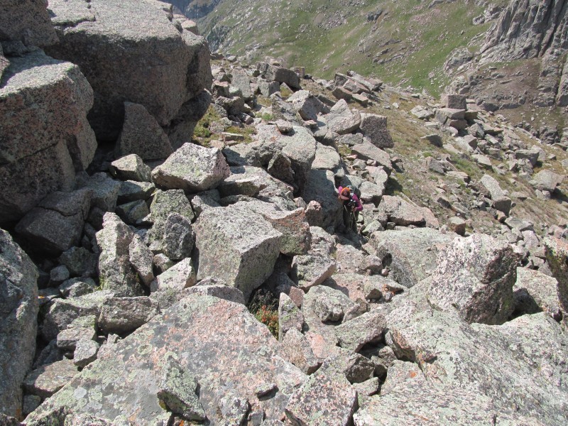 The true summit boulders themselves were much easier from this side as well, its almost like an entirely different peak. 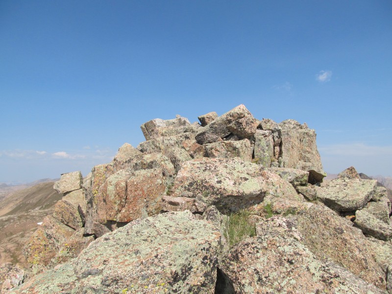 The lower part of the ridge on this south side of the peak towards Sheep is actually really steep and well guarded, so we retraced our route, traversed below all the summit difficulties to the north ridge and descended grassy slopes once we cleared all of the cliffs to avoid having to go all the way to "Emerson Pass". Sheep has a stiff ridge as well, but we got a good look at the peak and the gully used to gain its summit. There were even visible goat trails up the gully! 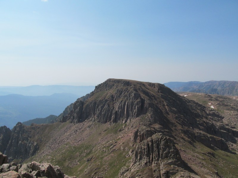 There were goat trails on our initial traverse as well, first on grass as we traversed below Peak Twenty Two. 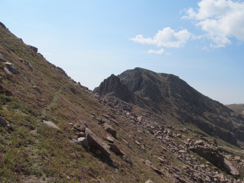 Then bypassing some cool towers on grass ledges to the west before working through some talus to pick up the trail again near the base of Sheep. The climb of Sheep directly from this point would be a stiff one, as the image below shows. 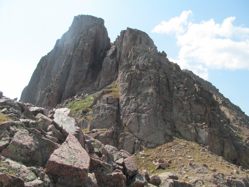 Traversing talus around the bottom of these cliffs, we then found the goat paths up the gully to Sheep's very flat summit area. Nice views though, you can get a good look at Vallecito Reservoir from up here and it looks even bigger from here than it did back when I drove around it on a different trip.  We retraced our descent but this time kept going past Twenty Two all the way back to "Emerson Pass", getting a good look at Twenty Two from there. 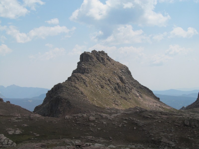 From here it was a quick jaunt up soft ranked Emerson (sans Pack)  And unranked Twenty One (also sans pack) 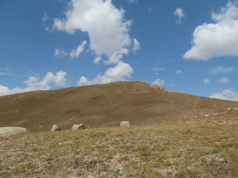 Nice views of the Amherst-Emerson Ridge from Twenty One. 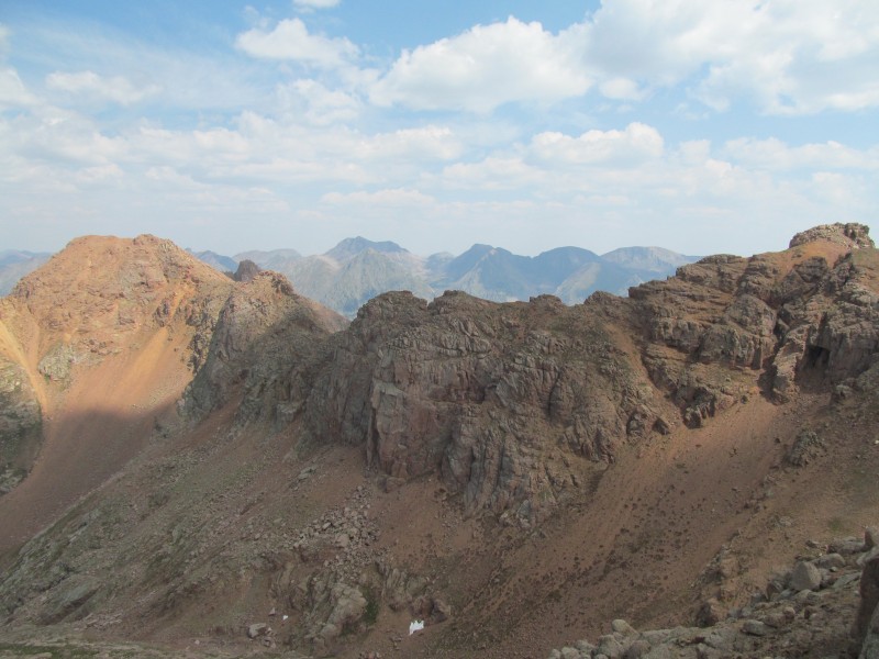 As well as Castilleja Lake and its gorgeous neighboring tarns. 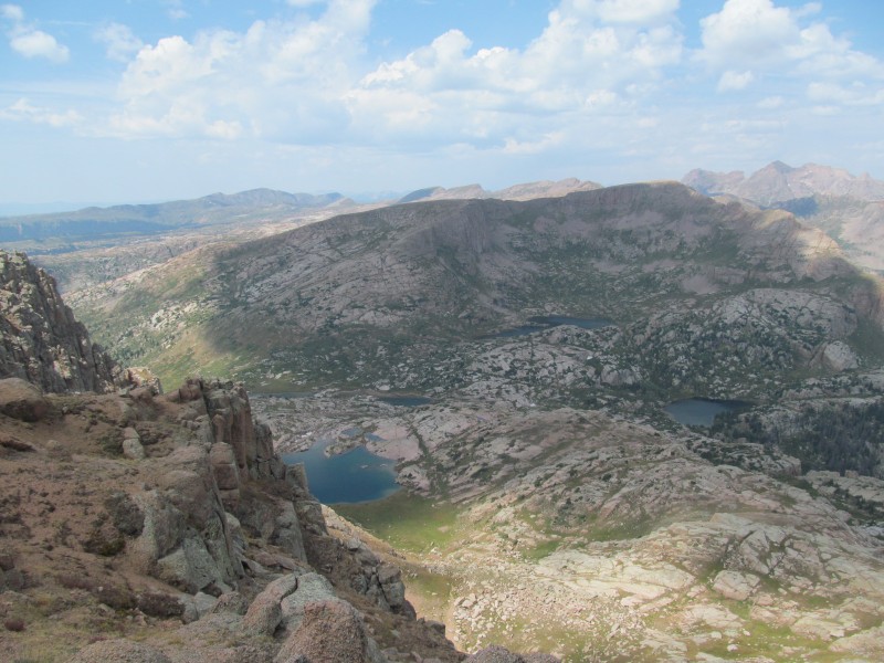 All that was left now was to retrace our morning back through Big Snow Canyon, down the network of game trails to our slabby creek crossing, past City Reservoir and back up to camp for a quick bite and then to pack out. It was a pretty grueling pack out having all of these remote peaks under our belts. The climbs over West Silver Mesa and the ridge between Virginia and West Virginia creeks especially took a toll. From West Virginia it was a surprisingly easy climb back on to Lime Mesa where we were treated to a great alpenglow on the grass as the sun began to fade. Back to the trailhead ten minutes later and it was just 2 miles or road back to the car and some dinner and a good night's sleep before the boots and packs come back on again, at least tomorrow they will be lighter. 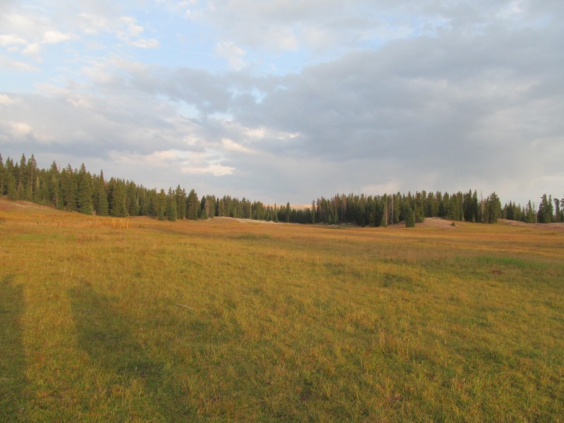 Epilogue: Overlook Point: 9/7/17 Given how far of a drive back to Lime Mesa it was, we had one more peak in our sights. I guess we could have tacked on a few more 12ers next to it, but it was Overlook Point at 12,998' that had our attention. Its Colorado's highest 12er, and might actually be a 13er anyway. Its only 2 feet short, and given the recent changes that led to everyone debating whether Sunlight Spire (13,995') should be a 14er, there is a good chance this will end up on the 13er list someday. Plus its called Overlook Point and its across Chicago Basin from some pretty spectacular peaks, there may be some great views in our future on this one. Our morning starts with a familiar hike up the road to the trailhead (there is supposed to be a bypass trail on the left somewhere but nothing jumped out at us) and across Lime Mesa past our City Reservoir turnoff. The ridge is pretty flat and tree covered through here, but as you get to Dollar Lake the views open up of the ridge beyond, the peaks we had packed in for, and even more peaks to the west such as the LaPlatas.  The trail beyond the lake was pretty good as it swung west then through some grass and granite slopes before ascending to a saddle at about 12,500 that is over Ruby Lake. From here the namesake of the peak and of the whole ridge (Mountain View Crest) are quite apparent and you get a great view of Pigeon and Turret immediately upon cresting the saddle.  From here its an easy stroll to the summit, just turn left and follow the ridge through grass and talus over the false summit, then descent some steeper talus (a little loose) and follow the remaining summit ridge to the relatively flat high point.  It sits upon a nice bluff above the lakes and the summit views are some of the best around... 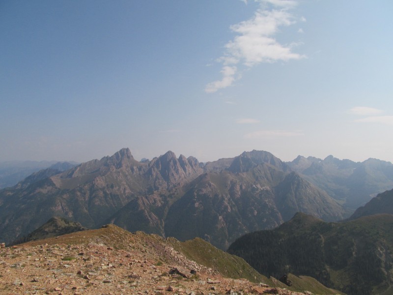 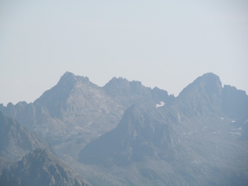 We descended a little more directly to the trail from the summit, then followed the trail back to the road and eventually the car. A few snacks, and a long drive back to Durango where a $6 day pass at the rec center gave me my first shower in 6 days. Resupply at Natural Grocers, and then off to find a nice dinner spot in town. We chose Ken and Sue's and had a lovely meal of salmon flat bread, salad, pork tenderloin, and stuffed chicken breast on their back patio. We had leftovers, but not that many! We really enjoyed our little mini-backpack trip. It broke up the week long trip nicely, and we were able to get a few other remote (at least drive-wise) peaks on this trip including Lavender and Hesperus (Babcock was still snow filled in the gullies, an unfortunate orphan) and Middle/Dolores. Most of the peaks we did on this trip are not things that we could have done in a 2-day weekend trip from home, so being able to string a few together was a great way to spend a week, and it was nice to be able to explore Durango a little bit as well. My girlfriend's cousin recently moved there, and we got to climb Lavender with him on the trip as well, which was a great time. There is a certain sadness as well to realizing that the big backpack trips to the Weminuche are winding down, really only 2 more major trips and I could knock out my remaining 13ers in the area. But at the same time there is a joy in knowing we can come back any time to explore or revisit any place we want. We were already talking about repeating Organ sometime, and we have some friends with these still on their agenda, so maybe that will happen sooner rather than later. Thanks for reading, hope I left enough information out there to give you a few surprises if you head this way in your own adventures. Thumbnails for uploaded photos (click to open slideshow):
|
| Comments or Questions | ||||||||||||||||||||||||
|---|---|---|---|---|---|---|---|---|---|---|---|---|---|---|---|---|---|---|---|---|---|---|---|---|
|
Caution: The information contained in this report may not be accurate and should not be the only resource used in preparation for your climb. Failure to have the necessary experience, physical conditioning, supplies or equipment can result in injury or death. 14ers.com and the author(s) of this report provide no warranties, either express or implied, that the information provided is accurate or reliable. By using the information provided, you agree to indemnify and hold harmless 14ers.com and the report author(s) with respect to any claims and demands against them, including any attorney fees and expenses. Please read the 14ers.com Safety and Disclaimer pages for more information.
Please respect private property: 14ers.com supports the rights of private landowners to determine how and by whom their land will be used. In Colorado, it is your responsibility to determine if land is private and to obtain the appropriate permission before entering the property.


