| Report Type | Full |
| Peak(s) |
Baegundae Peak - 2750 |
| Date Posted | 09/09/2017 |
| Date Climbed | 08/04/2017 |
| Author | nyker |
| Of Missiles and Mountains...and Kimchi |
|---|
|
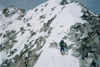
For a fairly small country, South Korea has a lot of outdoor areas, some of which is located pretty close to the urban center of Seoul. There is also some nice traditional architecture to be seen in many of the Shrines and Temples in the city.  This peak surprised me and when I started out, I wasn't even sure I'd be able to find it. And yes, you read above correctly, 2,750ft is the elevation, with starting point just above sea level. I was expecting this to be a simple hike/stroll in the forest through one of the more popular outdoors areas in Seoul, in a park called Bukhansan National Park. However, it turned out to be a pretty cool adventurous ascent of a signature peak of Bukhan Mountain in its namesake Park, near Seoul Korea. This was a mountain area pretty much located right on the outskirts of the metropolitan area of the city. I wasn't expecting a strenuous hike but it was pretty hot, with the thermometer getting to over 100 degrees before 9:00am, I took a screen shot of my phone when I started: 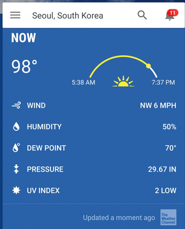 How to get there This peak is located in a National Park right in Seoul. Taxi's are pretty inexpensive in Korea (roughly $9.00 for the ride, about the same as a bus) and was the easiest way to get to the east entrance of the park. I started at the Jeongneung information center, which seemed the most straightforward way from the city though there were shorter more direct routes from other entrances to the park. You can drive there also if you rented a car. I got to the trailhead, or I should say "a trailhead" - I wasn't sure this was the right path and I figured at worse I'd have a nice hike through a forest where I had never been so my expectations were managed. I had a map, but it wasn't entirely helpful, but thought I could figure it out with my compass. Bukhan Mountain was towards the top right in the center of the map (you can see 837.5m) and my starting point is in the lower right of the map. The starting elevation is not much above sea level so while the peak is not tall for most mountain standards, it has roughly 2,700ft of vertical gain with a couple ups and downs and add in the 100 degree day, made for some profuse sweating. I ascertained the route to be ~8-9 miles and 2,700ft gain if I stayed on what looked like the way to get there. I knew of Bukhan Mountain, but wasn't sure where to start, the route or terrain and upon getting to the park I found navigating the trail maps a bit confusing and nobody I saw there in the morning spoke English. The Ranger station was not open but two people at the gate were nice and very helpful and with some animated pointing and diagrams, I was able to figure out which way to go. My map...of limited help 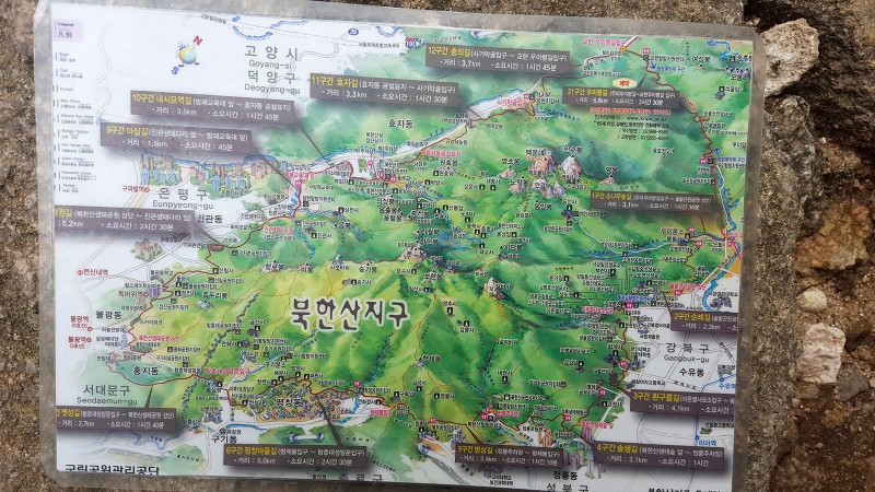 The hike started in a forest and continued in a wooded area for about 2km or so (~1.2mi) until you see a sign pointing to one of the Gates on the mountain. There are several gates on the mountain built into the wall that circles the city. 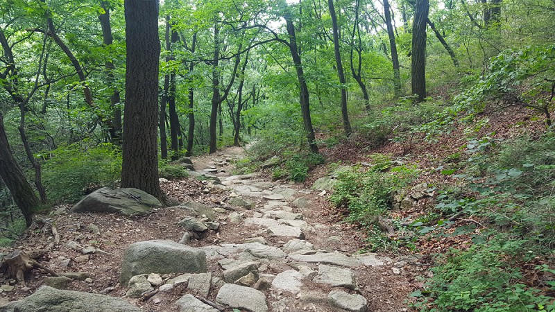 A cool beetle - it was about 3 inches long with antenna the same length. 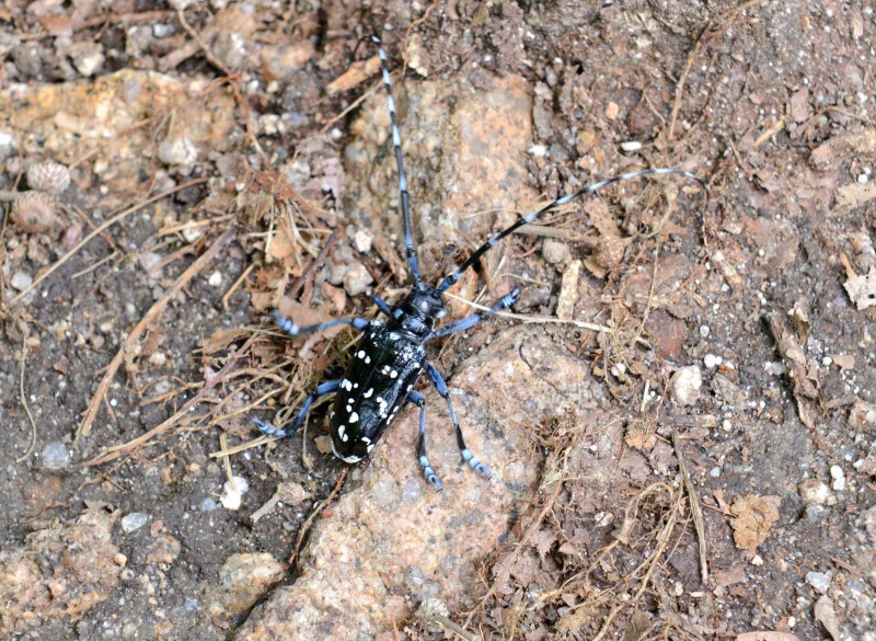 In spots the route gets pretty rocky and steep but nothing to worry about unless you're trying to bring a bike here. 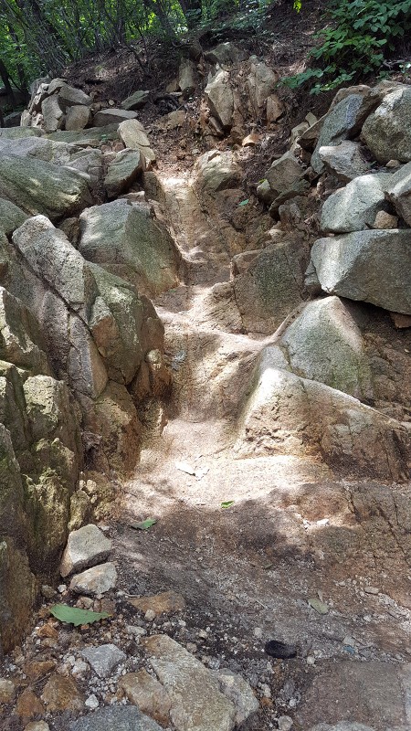 After hiking for about an hour, the below view is seen at which you can finally see the mountain. Also at this point, you reach a junction where you can turn left or right, each way walking along the historically significant Seoul Fortress Wall. 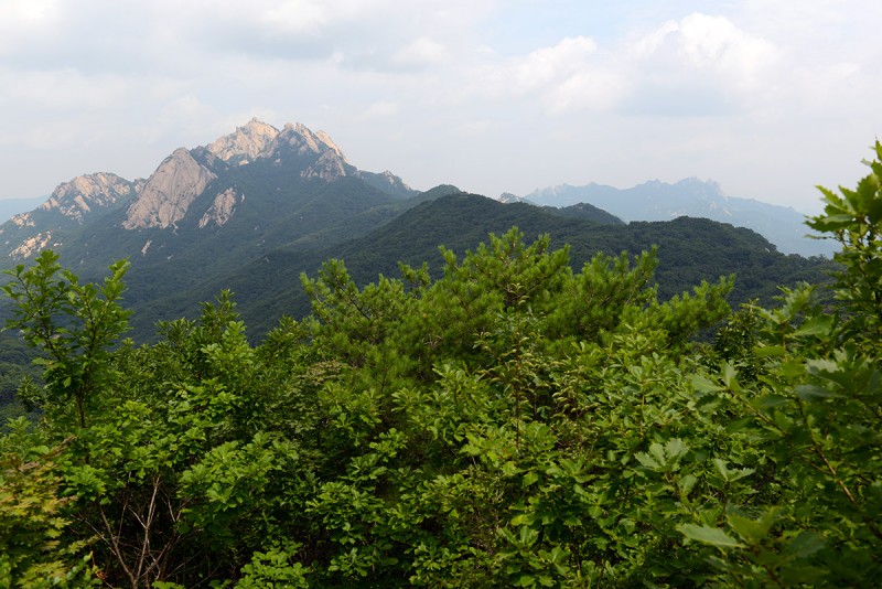 Seoul Fortress Wall There is a wall around the city of Seoul called Hanyangdoseong, which for 18.6km follows the ridge lines of the four main mountains of Seoul as well as the city in certain places. The wall was built in the 1300's to keep invaders out and to protect the city. It is reminiscent of a smaller version of the Great Wall in China. From the direction I started the trail ends at a gate called Bogungmun Gate. This is what the top part of the wall looks like: For some reason, there were hundreds of dragonflies around the wall, particularly in more open spots. 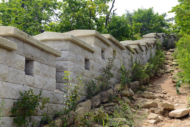 The top of the gate is the flat cemented potion in this picture below. The route goes up the rocky path, following the wall which itself, follows the contours of the mountain. It's a pretty cool hike up. The bottom photo shows the only the top portion of the wall. 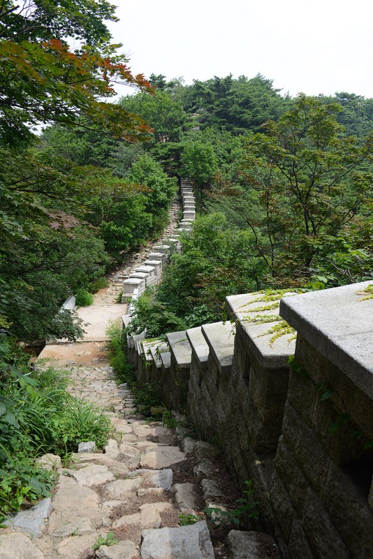 This sign appeared along part of the trail â‘ not sure what it was warning not to do or where not to go, but made me laugh: 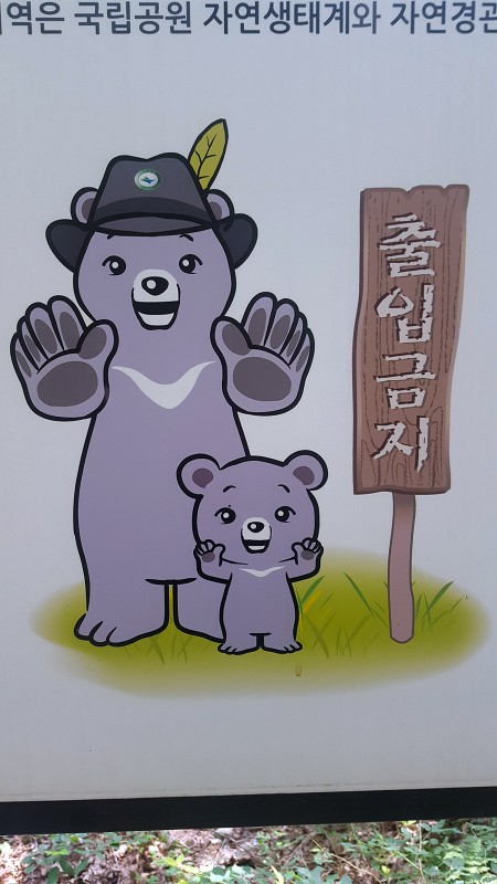 Other shots of the wall â‘ most of this is steep hiking, which in the temperature today, was tough. If you look closely, you can see a few dragonflies at the top part of the photo. These were everywhere. 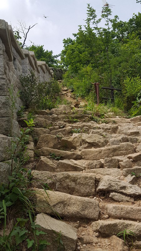 You won't really find much English here, but some of the signs are rather animated, literally, and you can usually figure out what they're telling you! This one below is saying to watch out for rockfall and boulders falling, haha. Seriously though, it is a risk on several sections, despite the cute cartoon sign. 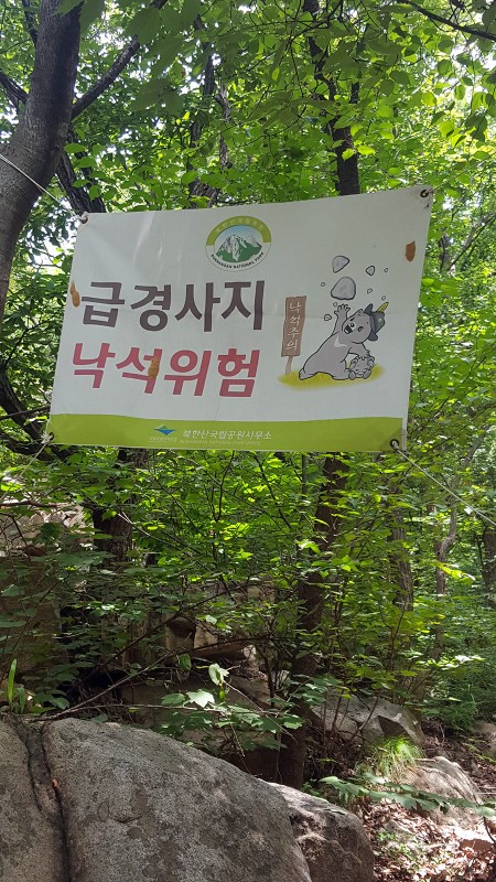 Another section of the wall with a nice easy trail - the route follows this up. There is also often a lower path in the forest that parallels the wall in many spots, not sure why. 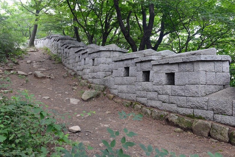 In some sections it gets very steep and disappears into the overgrown forest 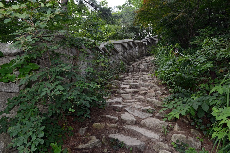 A few km further along, you'll run into another gate (called Daedongmun) which has a structure built over it, which appears like a rest stop to have lunch. There are also some signs here, they were in Korean so not sure what they said. 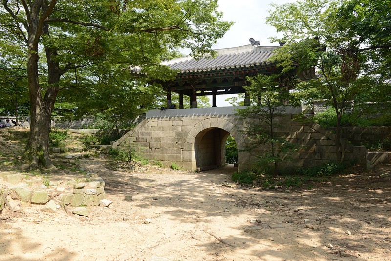 Looking out into the forest from inside the top of the gate you get a calm feeling, despite the fact that missiles were being launched 30 miles away...  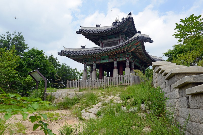 Another sign points the way, 3.1km to go (top right sign):  Baegundae Peak is the highest of the three subpeaks which comprise Bukhan Mountain. 3.1km from here. I was a bit worried as I had underestimated this hike in the heat and was almost through the water I brought with me, but figured I'd keep walking as I had seen some streams with people drinking from them (unfiltered). Apparently the water from this mountain is popular to drink straight from the rock - though I was apprehensive to do that particularly before a long flight the next day. The route along the wall gets steeper in sections, some of which last several hundred steps, reminds me of the Mist Trail in Yosemite up to Vernal Fall, though I would have loved to have been doused in a cool waterfall today given the heat. At this point I was soaked through all my clothes with sweat including my cap. 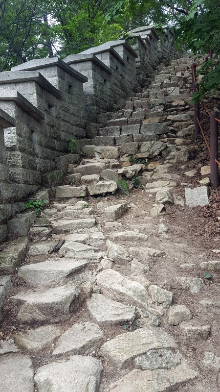 There are a few trails threading through the forest, so I was careful to pay attention to my surroundings and take some shots of the trailsigns to reference later in case I take a wrong turn since anyone I ran into didn't speak English. Baegundae Peak proper appears on another sign, which comforts me that I am headed the correct direction. Getting closer. 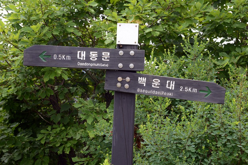 The route travels through more deeper forest, then suddenly opens up to reveal a stunning landscape of granite and bare rock. It is here I can now see Bukhan Mountain and Baegundae Peak. The peak is to the right in the first photo below - the rounded summit block can be seen now. 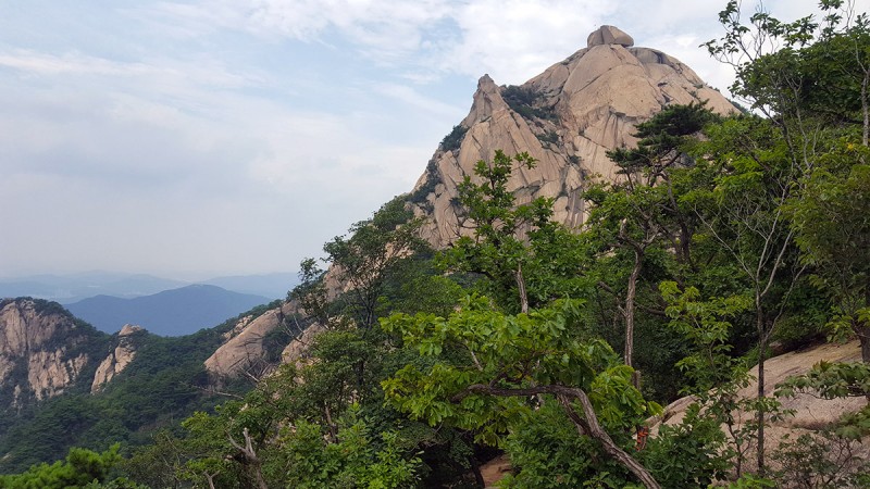 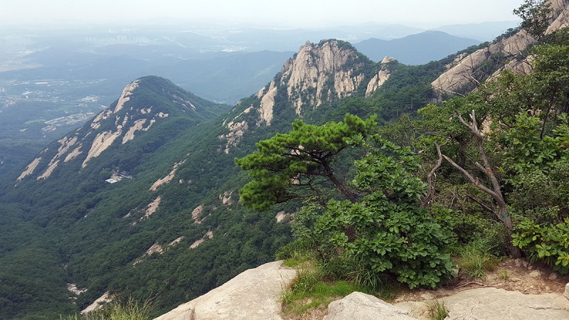 As I climbed up higher, the surrounding city could be seen (this photo is washed out due to the direction of the sun). It was unnerving was that a bit further from the city in those hills was North Korea only ~30-35 miles way. 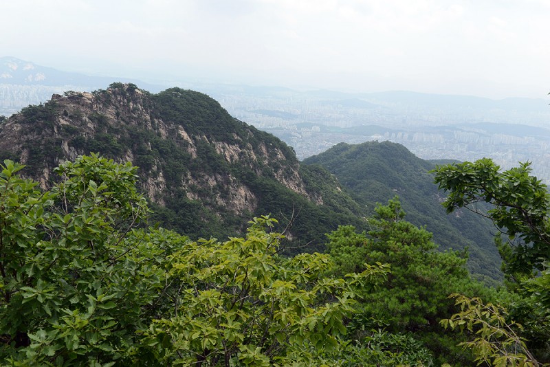 Bukhan Mountain is below, close still... The high point in the middle is summit. There is a flag on top, barely visible from here. The route climbs directly up the right side of the rock. 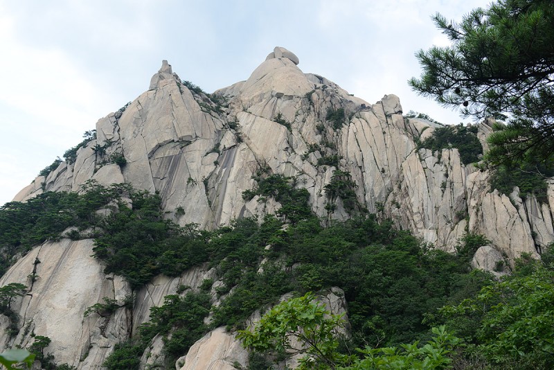 It was around here that posts with cables started appearing as the exposure increased and the route now traversed on bare rock with steep drop-offs on the sides. 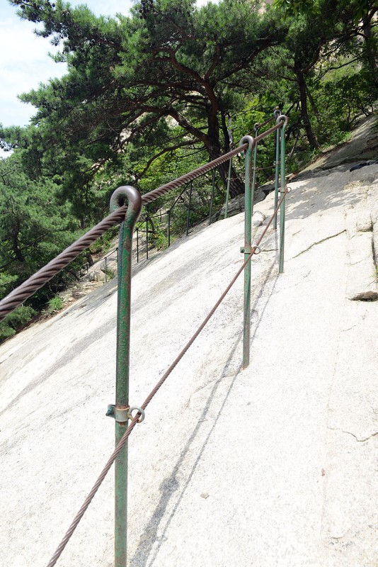 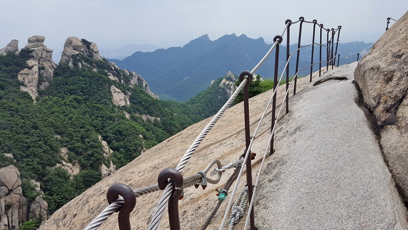 Another part of the wall appears, this one is newer, a reconstructed portion of the lower wall. The route climbs right up along the wall on the rock. This part reminded me of the rock on North Eolus, very dry and clean and solid. Made for fun scrambling.  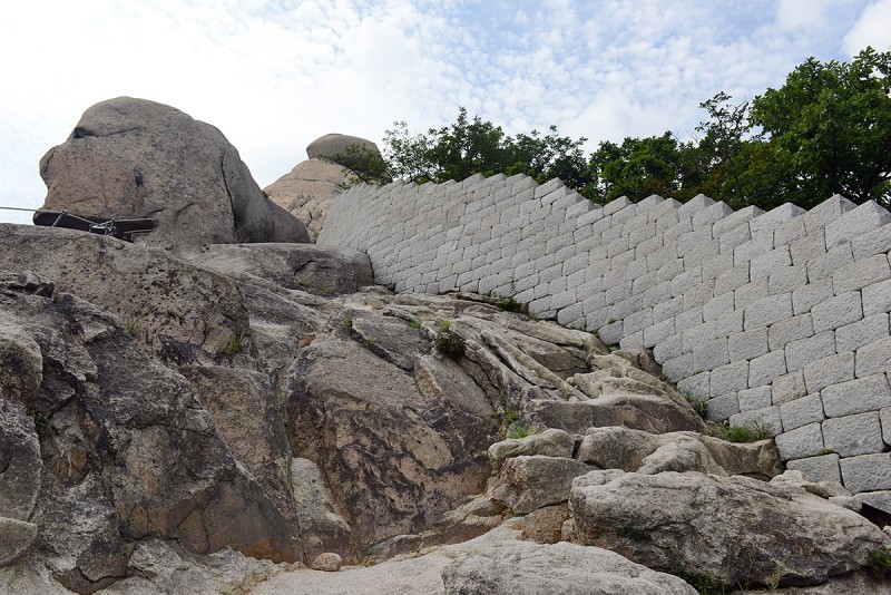 Another view closer up. The route is directly up the right side of the mountain to the seemingly precariously placed split boulder on top, on top of which is the summit. Looking closely, there is a flag on the summit to the left. 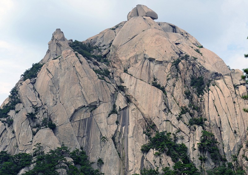 The climb up reminded me of Half Dome and is complete with half inch cables just like its seemingly sister peak in the Sierra Nevada in Yosemite.  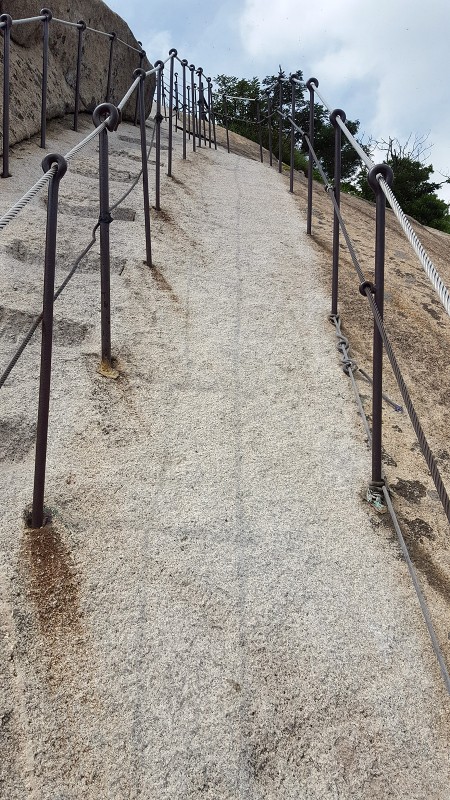 From what I heard this peak can get equally crowded as Half Dome in better weather. Later on, when I finished, I found out fewer people were out today because of a heat advisory that caused a few tours to be cancelled and Park rangers to recommend visitors not to hike today. The route continues straight up and was steep, in the exposed places there was a cable, in other places was bare rock. 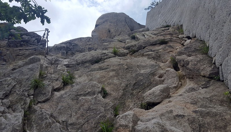 As I got higher the summit appears and is a just short steep climb up some bare rock with a cable in place, just like Half Dome to reach the top. The views were great, although the heat and haze coupled with the midday sun and smog apparently blowing over from China obscured a better view of the surroundings. It was a beautiful day and a wonderful place particularly located to close to a major city. You can see another dragonfly in the photo if you look towards the top. 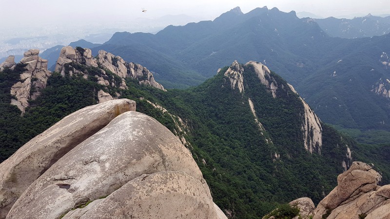  As I descended, a flat spot appeared here and there where you can see the sprawling city of Seoul below. 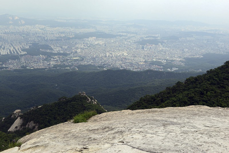 Just beyond the view of the city in these photos in the distant mountains was North Korea... I was glad to have done this, but in hindsight should have been better prepared, brought more water and gotten more detail on this in English ahead of time which could have saved some time and made the hike in more comfortable. There are also some Shrines lower down at the base of the mountain in the forest that I would have gone to had I had the extra time. Nonetheless it was a pleasant surprise and a great hike, despite the dehydrating heat. I'd definitely recommend doing this if you are in the area. Thumbnails for uploaded photos (click to open slideshow):
|
| Comments or Questions | |||||||||||||||
|---|---|---|---|---|---|---|---|---|---|---|---|---|---|---|---|
|
Caution: The information contained in this report may not be accurate and should not be the only resource used in preparation for your climb. Failure to have the necessary experience, physical conditioning, supplies or equipment can result in injury or death. 14ers.com and the author(s) of this report provide no warranties, either express or implied, that the information provided is accurate or reliable. By using the information provided, you agree to indemnify and hold harmless 14ers.com and the report author(s) with respect to any claims and demands against them, including any attorney fees and expenses. Please read the 14ers.com Safety and Disclaimer pages for more information.
Please respect private property: 14ers.com supports the rights of private landowners to determine how and by whom their land will be used. In Colorado, it is your responsibility to determine if land is private and to obtain the appropriate permission before entering the property.