| Report Type | Full |
| Peak(s) |
Emerald Peak - 13,916 feet Iowa Peak - 13,840 feet |
| Date Posted | 09/05/2017 |
| Modified | 09/06/2017 |
| Date Climbed | 09/02/2017 |
| Author | nyker |
| 13er Twofer in the Sawatch |
|---|
 In the cool crisp morning air, sunrise was breaking over my left shoulder as I heard the alarm calls of the squirrels in the blue spruce lining the trail of Missouri Gulch. As I hiked further in feeling the comforting weight of my pack on my torso, I felt immediately at home despite my unacclimatized lungs reaching deeply for what air they could gather in the thinner air. I hadn't been able to take any days off for a while to come out to Colorado until this past weekend, which was somewhat of a last minute trip, but nonetheless, worked out ok. Target: 13ers! Emerald and Iowa peaks are two 13ers (ok, maybe Iowa isn't technically a ranked Centennial) located behind Missouri Mountain on the other side of Elkhead Pass which seemed to fit the bill nicely. They are located in a stunning basin surrounded by high peaks on all sides and reached after walking through aspen and coniferous forests which then opens up into rich alpine meadows. Climbing both today would net approx. 6,000ft of vertical gain. The route begins and follows the great Missouri Gulch trail that eventually leads up to neighboring Fourteeners Mount Belford, Oxford and Missouri Mountains. The night before coming here, I recall the forum post about the mountain lion spotted right around the turnoff on this trail, I imagined right around where this is in the below photo:  With the probability of a mountain lion encounter apparently now higher than normal, I was on full alert, with my trusty Benchmade strapped to my chest. My senses were now at DEFCON 1 as I hiked into Missouri Gulch towards the Missouri headwall framing the meadow to the south. Every rock and log seemed like a resting mountain lion waiting to pounce on me. Suddenly, a fat marmot jumped off a rock making a big commotion and caused me heart rate to hit my V02 max. While on the lookout, I didn't see any cougar nor any sign around there, but did see a scat further up the trail a few hundred yards that looked like it was from a lion which had hair and bone fragments in it. I moved on⦠To reach both peaks, you break off from these trails and follow another nice trail up and over Elkhead Pass. From here, routefinding becomes more important as you won't be on a trail most of or all of the way from this point. This was the first sign that these peaks might be tougher than their neighboring 14ers. The fantastic ridge and complicated looking summit of Missouri Mountain frames your view the whole way in: 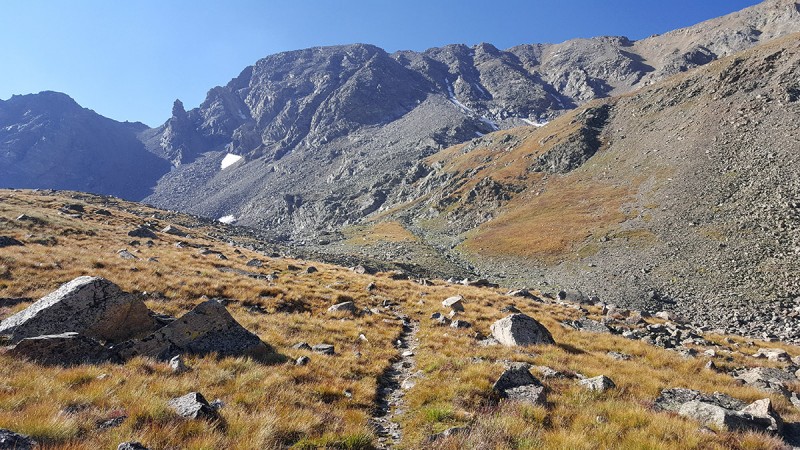 A view of Missouri from part of the way up the route towards Elkhead Pass. Bluebird day in the morning 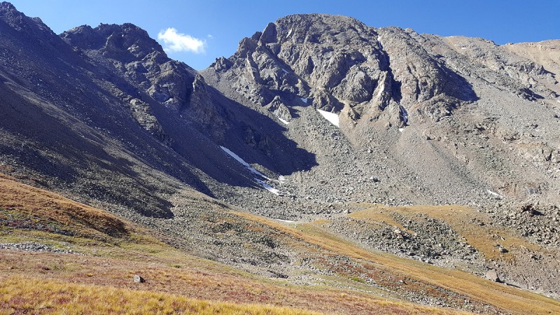 This shot below was taken just above the turnoff from the Missouri Mountain split. You can see that namesake trail switchbacking up the side of the mountain to the left in the photo. The nice marshy/meadow filled will willows is down towards the right in the photo. Lush and green with slowly running water, as I walked by in the early morning, I imagined that area was full of bears, lurking. 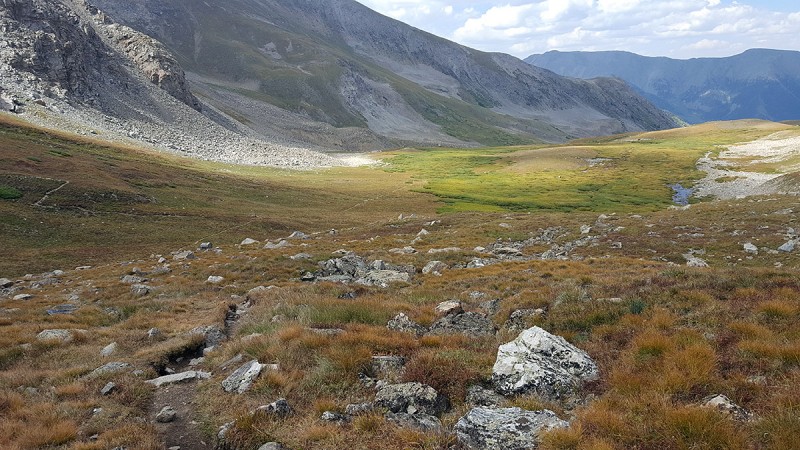 Climbing higher up towards the pass, the alpine goundcover plants were starting to display vibrant fall colors, carpeting the high mountain slopes with shades of crimson and reds. Mount Belford is off to the right here. 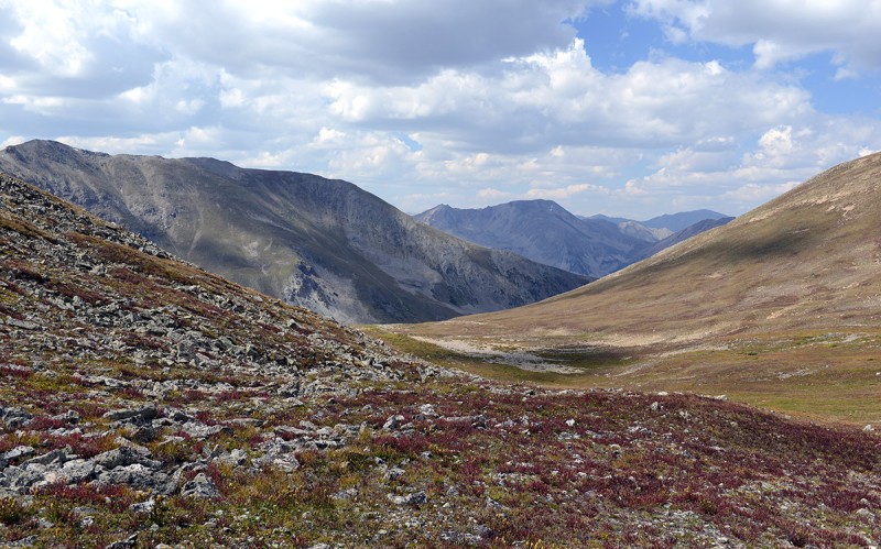 Just after reaching to the top of the pass, the intimidating eastern view of nearby summit of Missouri Mountain dominates the terrain. Emerald Peak is the triangular peak to the far left with the slopes of Iowa seen in between the two. 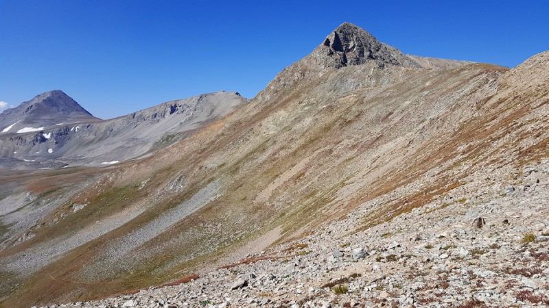 The beautiful Missouri Basin is below with Emerald Peak framing the scene to the right. This is where you'll have to start paying closer attention. 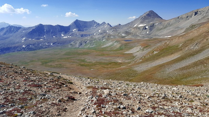 As I climbed higher, the rising sun warmed the air and more of the Sawatch Range came into view, I felt like I was seeing an old friend. Routefinding: Up until Elkhead pass, you just follow the easy trail to the top of the Pass. You'll have to leave the trail coming off the other side of Elkhead Pass and make your way to the peaks ①there are as usual a few ways to do this. Assuming you do Emerald first: On the photo below, I marked up the rough lines I followed and suggest others to follow and the route I suggest not to follow: I say suggest not to follow, but either way will work and get you to the top, but in my experience, they differ in complication and terrain comfort. 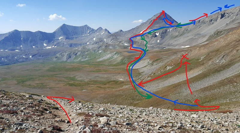
The initial route off the Pass is straightforward, you just follow the trail down, descending a few hundred feet as it snakes its way down the southwest side of the Pass. A mistake I made, or at least I felt I made was to exit the trail too early and start traversing the grassy slope towards the base of Emerald, thinking I could cut off the elevation drop and stay higher up. I ran into rough terrain, some cliffy-outcroppings and was generally not a comfortable route walking across a steep hill with many loose sections, which looked like I'd have to drop down anyway after a few hundred yards heading towards Emerald. After the point where I drew an X in red, I backtracked, then found and descended a more grassy area with some mixed boulders, lost some elevation and then aimed and went between two large boulders which lined up directly in the line with Elkhead Pass exit and the start of the climb up the ramp to the base of Emerald. I felt the loss of elevation and the need to regain it, was better than to traverse the slopes earlier on at least where I exited. On the photo, there are two key differences between blue vs red lines: 1. Stay on the trail longer and exit lower down and 2, once you ascend the ramp up Emerald, move to the flatter saddle area to climbers right (north/northwest), rather than climbing straight up the ridge (red route) which I did, which is full of rougher rock and multiple frustrating false summits. Once I was on top of Emerald, and starting down towards Iowa, I saw a spotty trail starting down from one of the false summit type areas, which then lead to the Emerald-Iowa saddle and was much easier than the ridge climb up and put me in a better more direct position to shoot over to Iowa. This loosely defined trail off the summit is steep and slippery scree in some parts but it beat the rocky poorly defined ridge walk up the east side that teases you with multiple false summits. Under the base of Emerald Peak, lie two nice alpine lakes, which not surprisingly were emerald in color when the light hit them right. If you followed the right route, you should see a view similar to this as you approach the peak, if not, consider retracing your steps until you are in a spot resembling this line towards the peak as this will set you up for the easiest line up. 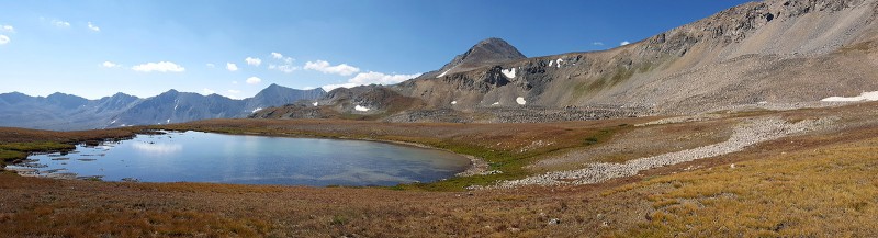 The landscape here was stunning and remote. Framed by 13,000ft and 14,000ft peaks in all directions, soft looking rolling hills and alpine meadows and clear cold lakes made for a sublime setting. Wish I had more time to take it all in, but with an aggressive schedule after lingering a few minutes to enjoy the moment, I figured I'd best be on my way up. Moving closer in enroute to the base of the final pitches up to Emerald and the ramp which is off to the right in this photo and not visible here, but in the photo above is located about exactly in the middle of the photo above the right edge of the lake 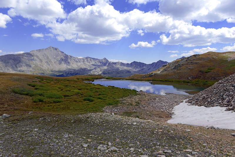 The next three shots were taken on the slope/ramp as you climb up from the second lake towards the base of the east ridge of Emerald Peak In Photo #10, you can see Elkhead Pass and the trail there down into the Basin which is right in the center of the photo and is situated at the saddle of the Missouri and a far right peak in the distance, right above the far lake in the photo: 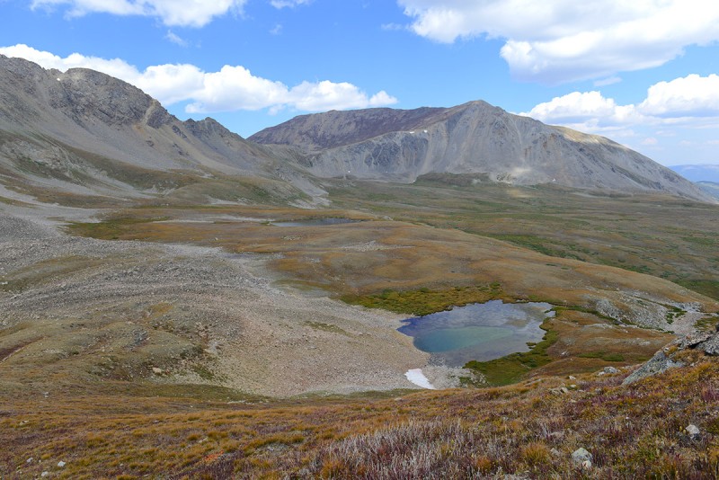 The below shot shows the long ridgleline of Iowa on the left, Missouri on the right. The lakes are to the right, not visible in this photo. 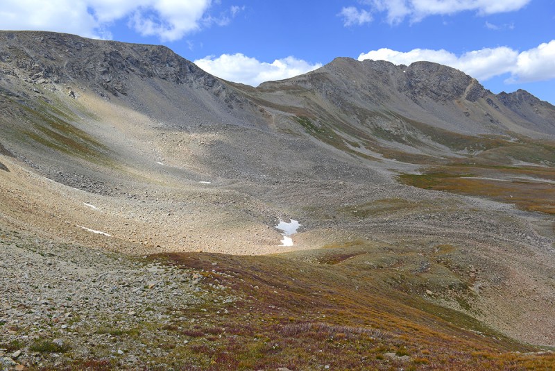 Iowa Peak (taken on the descent later)  Once you hike up from the lake (see above marked photo showing the route lines), you come to the base of Emerald â‘ while I climbed straight up the ridge here, I'd recommend moving over the north (climbers right) to the flatter saddle area and climbing up that way. In the photo below, a lone Mountain Goat greeted me right under Emerald. If you see the goat, that is basically the line I followed up. 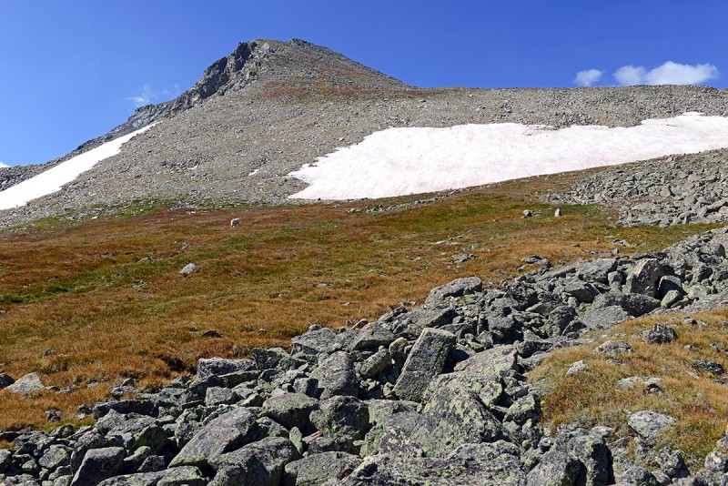 I made a composite photo showing three sections of terrain coming up from the lake. The flat rise of the ramp at the top, then the steeper section where the goat was (which I don't recommend repeating as above) and then the initial climb up the scree and talus. The summit-looking peak in the bottom photo is NOT the summit, but one of a few false summits that lead you on. 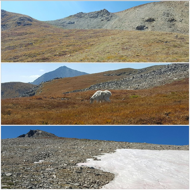 Moving higher, but yet again, this is not the summit, keep climbing! You'll also need to traverse marginally to the right here to avoid being cliffed out as there was a gulley separating points from this angle. 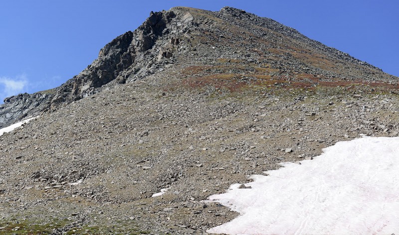 The summit is finally reached after small plateau is reached then a last push to the top. This plateau is consequently where I discovered a trail of sorts leading to the Emerald-Iowa saddle. 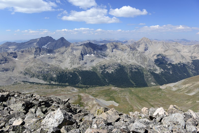 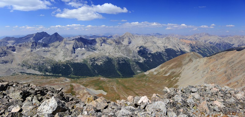 Talus defines the base of Emerald 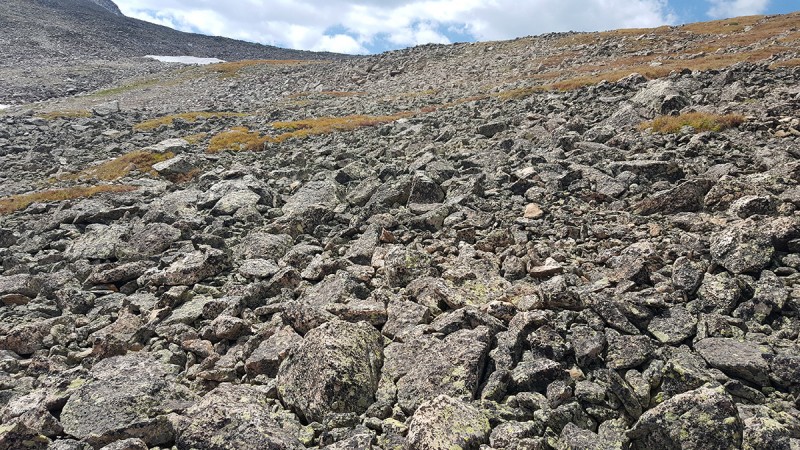 As you leave Emerald, leaving the talus behind 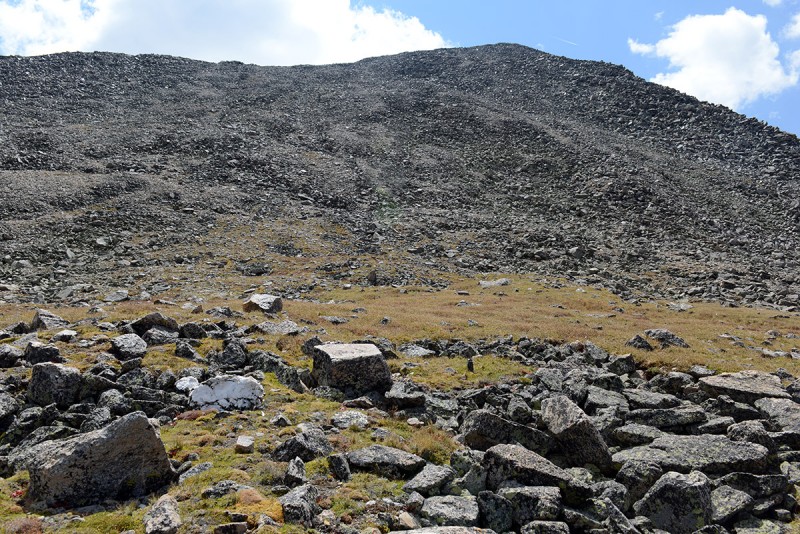 The views from descending down towards the saddle were great. The east slope of Iowa, Missouri, Mount Belford and top of Mount Oxford are seen in the image below  Looking west in the heart of the Sawatch and beyond 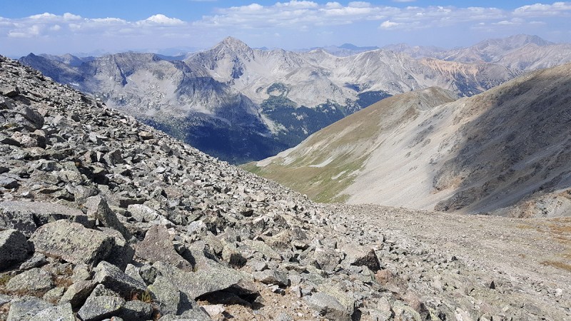 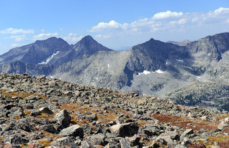 Panorama from the Emerald-Iowa Saddle with Iowa right in the center This is the view you should see coming off of Emerald if you want to climb Iowa. From here, aim towards climbers right where the real summit is. 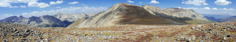 The view of Iowa as you start your ascent up its gentle slopes from near the saddle. 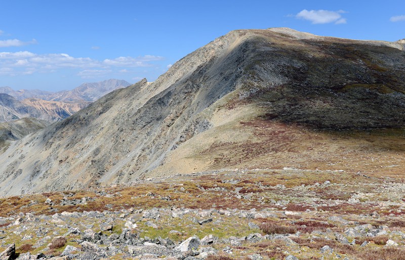 The terrain going up. This part was just a steep hike on tired legs after getting up and down Emerald. Pockets of lichen covered granite mixed in with the red groundcover plants making for a nice Autumn scene. 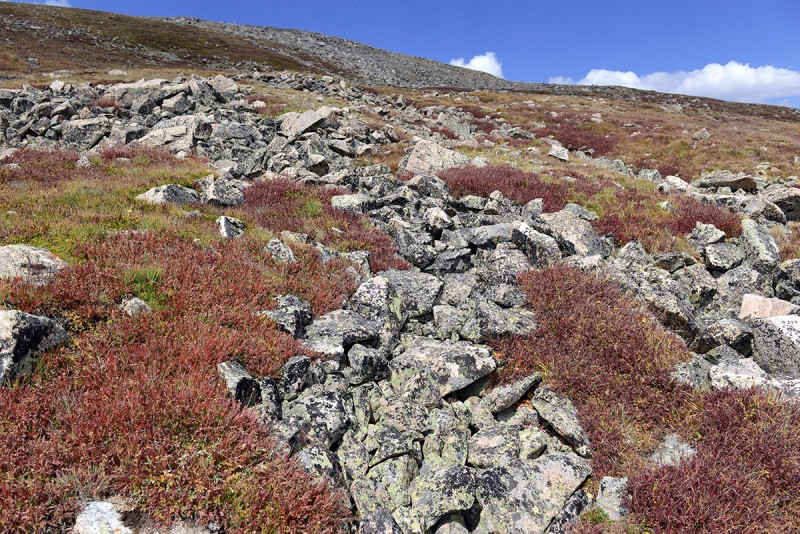 As I was hiking up, I ran into fellow 14ers member Zeke (aka nickgendill), who was coming down from Iowa heading over to Emerald. Looking back, the steep talus slopes of Emerald are behind you 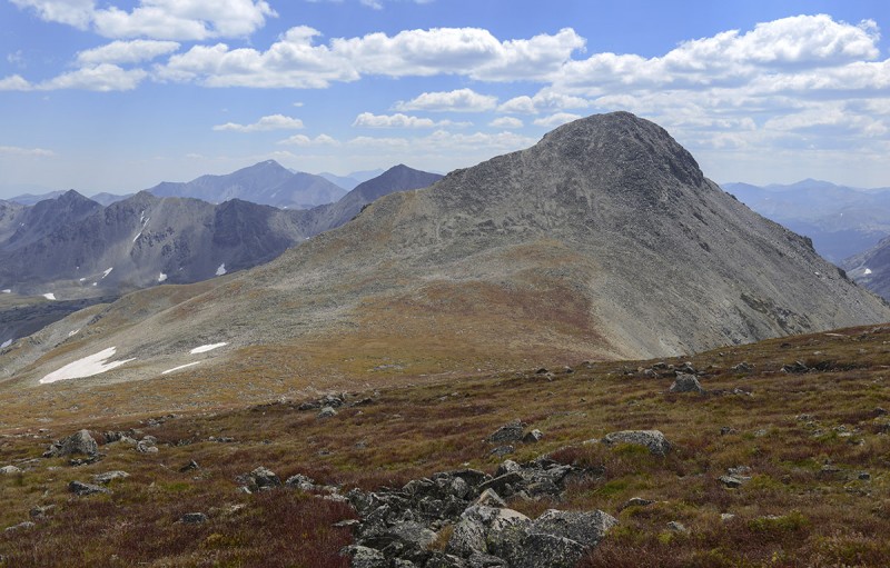 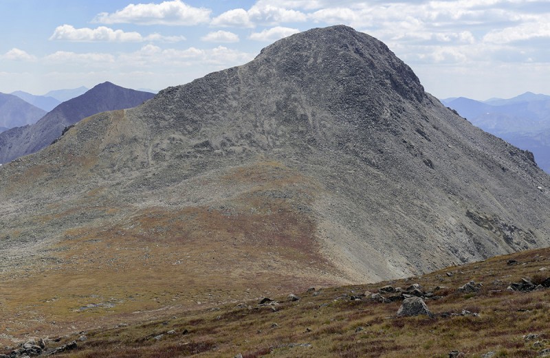 The summit of Iowa reached without much fanfare, but a summit canister greets you, as does tremendous views of the mountains all around you. 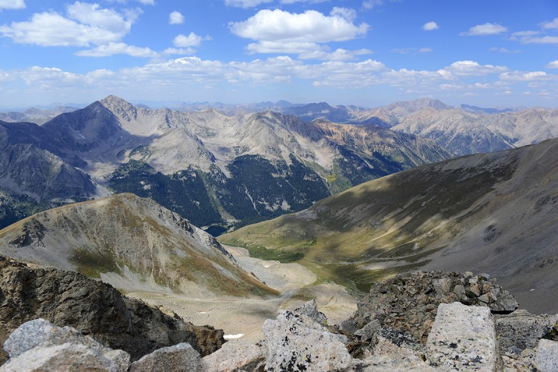 The aggressive slope of Missouri Mountain is right in front of you - for purposes of getting your directional bearing, Belford is to the right here, not fully in view. 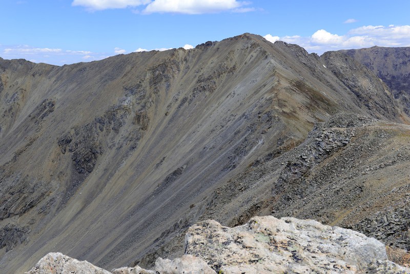 Summit registers 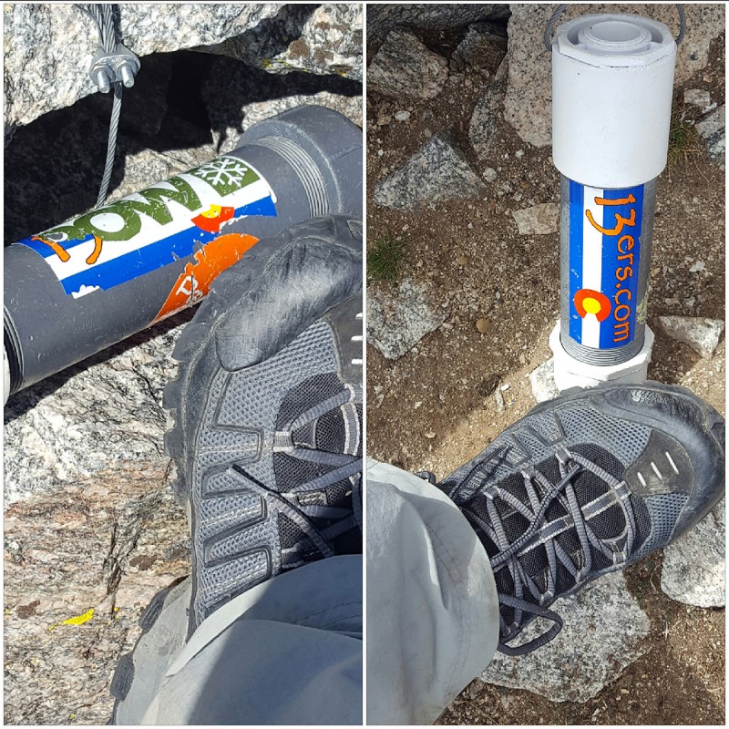 Coming down of Iowa, I was on the lookout for the turnoff, lets call it âThe Easy walk offâ area to re enter the basin below. It was located around the photo below, but just further to the east.  The angle of the terrain is mellow immediately before it drops off steeply into the basin. 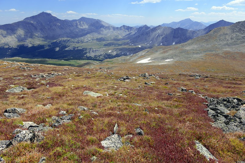 Take note that there are cliffs underneath much of this area and the basin, and some other very steep and messy scree slopes, so chose your descent wisely. If you can't find it, just go back the way you came up under the base of Emerald. It's not worth getting off route here and dealing with a cliff or that scree which then leads into boulder fields before entering the basin since there are plenty of safer alternative ways down with a little extra walking. In short, these peaks were a great pair of mountains to climb, albeit making for a good workout taking most of the day. For a change today, the weather cooperated and was characteristic of a nice Fall weather pattern in the Rockies allowing a long day out under clear skies. Given you will be high up most of the day and especially when on the other side of Elkhead Pass that you'll have to re-climb coming back, choose these peaks when you have a bluebird weather day, since you'll be totally exposed to weather on most of the entire route once you exit the forest before the junction, where the turn off to Belford is the opposite direction. On the hike out, the aspen higher up were starting to turn and in some spots higher up seemed to be nearing peak in pockets. I imagine in another week or two foliage will be at or near peak. 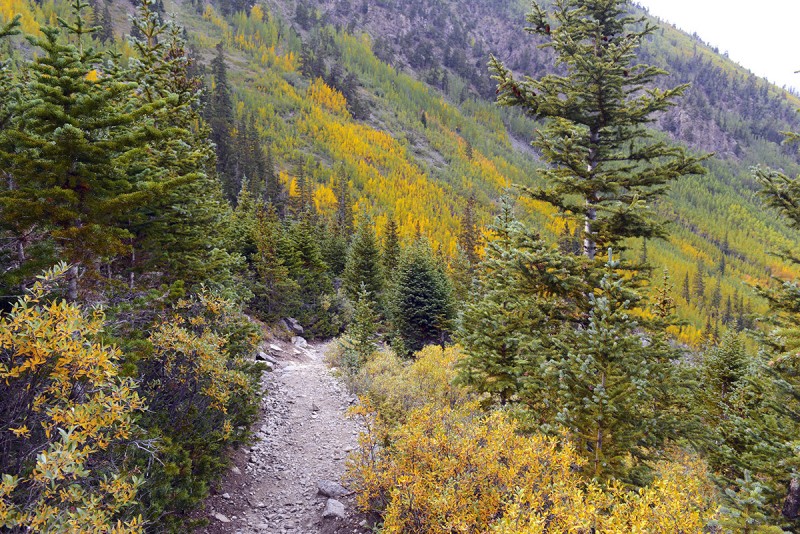 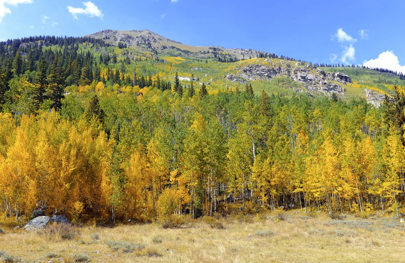 Thumbnails for uploaded photos (click to open slideshow):
|
| Comments or Questions | |||
|---|---|---|---|
|
Caution: The information contained in this report may not be accurate and should not be the only resource used in preparation for your climb. Failure to have the necessary experience, physical conditioning, supplies or equipment can result in injury or death. 14ers.com and the author(s) of this report provide no warranties, either express or implied, that the information provided is accurate or reliable. By using the information provided, you agree to indemnify and hold harmless 14ers.com and the report author(s) with respect to any claims and demands against them, including any attorney fees and expenses. Please read the 14ers.com Safety and Disclaimer pages for more information.
Please respect private property: 14ers.com supports the rights of private landowners to determine how and by whom their land will be used. In Colorado, it is your responsibility to determine if land is private and to obtain the appropriate permission before entering the property.


