I read a few reports about this route but not many. I wanted to put together a quick TR on Gannett as it may be helpful to some. (sorry for my terrible writing)
The route is Tourist Creek. The TH is Green River Lakes outside of Pinedale, WY. My GPS said it was ~44 miles round trip (GPX below) and it was both mentally and physically challenging. From what I understand, if you like snow use Glacier or one of the East side routes. But, if you like technical scrambles, route-finding, and lot's of boulder hopping (boulders the size of microwaves to cars....for miles) then try Tourist Creek.
We stayed at a hotel in Pinedale Thursday evening. Friday September 1st we drove to the TH and started the hike at 6am. The first 12 miles from TH to the 3 Forks area (where you cross the Green River) gains almost 800' so we made good time and crossed at 10:30am. We ate lunch on the "V-Shaped" rock moraine at the base of Tourist Creek.
Finding our way up Tourist Creek is challenging. There is no trail. The minute you start hiking up you encounter thick forest areas, large sections of boulders and talus, and a little of both. This section gains 2,000' in about 2 miles so it's tough and we ended up at lake 10,090 around 2pm. Then we headed up more boulders, encountered more route finding challenges, and eventually located the Lake "11,000" which we got to around 4:30pm. We fueled up and descended down to a small alpine lake which we passed on the North, up a small headwall, and set up camp between Scott Lake and Skinny Lake around 6pm.
Saturday September 2nd was day two and started at 4:45am as we left camp with summit bags, pons, and axe. We got above Skinny Lake by 5:45am, up Minor Glacier by 7am, traversed the snow finger and ascended the scree to the ridge around 9am, and were on the summit by 10am. We only spent 10 minutes up there as we wanted to get the class 4 down-climb over with and then rest. We ended up descending to camp by noon.
Packed up and ready to go we retraced our steps and got to Lake 11,000 around 1pm. Now comes the tricky part. Working our way down towards the upper Tourist Creek basin was challenging and even the GPS didn't guarantee the route. We ended up going low and got into a very large boulder field that was very exhausting. Leaving so early, the summit, then the ascent to Lake 11,000, and now it's 2:30pm and hot in a boulder field. Ugh...we took a needed break.
Finally, we exited Tourist Creek and got to 3 Forks to wade the Green River for the last time. The time was 5:30pm and we were beat. Unfortunately, we didn't want to camp in the forest only to have to hike out the next day. So, we decided at 6pm to make the 12 mile trek out and got to the truck at 11pm. Wow, what a day.
So, day 1 we did 18 miles in 11 hours and Day 2 we did 26 miles in 18 hours and our bodies showed it. From scratches, to bruises, to blisters, and dehydration but we made it. I went in at 156lbs and came out at 148lbs losing 8lbs in 2 days.
Couple of thoughts:
1) this is for people wanting a challenge. clearly, you can go in on the East side, take 5 days, and not beat yourself up. Although that side has it's challenges.
2) be skilled in route-finding, rock climbing, snow travel, and I'd suggest...you absolutely love boulder hopping.
3) plan your meals and weight appropriately or this can be a setback.
Here are a few websites I used for info and pics:
1) http://brothersoutdoors.com/?p=480
2) http://www.summitpost.org/gannett-via-torist-creek/812052
I would be happy to help others interested in this unique route on an amazing peak. If you have questions about gear, food, logistics, or just want to discuss...feel free to contact me.
Safe travels,
Jon
I have a few photos coming that I'll add later.
*Just noticed the GPX has a few errors. It looks as if we crossed a lake, we didn't.
My GPS Tracks on Google Maps (made from a .GPX file upload):
Thumbnails for uploaded photos (click to open slideshow):
")
 route from camp to summit")
 Summit in view as we head to camp")
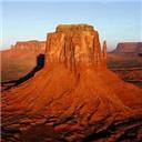
 in the middle of the boulder field")
|
")
 route from camp to summit")
 Summit in view as we head to camp")
 in the middle of the boulder field")