| Report Type | Full |
| Peak(s) |
Sunlight Peak - 14,061 feet Windom Peak - 14,089 feet Mt. Eolus - 14,087 feet North Eolus - 14,042 feet "Phoenix Peak" - 13,904 feet Rio Grande Pyramid - 13,825 feet San Luis Peak - 14,023 feet Mt. Shavano - 14,230 feet Tabeguache Peak - 14,158 feet |
| Date Posted | 09/14/2017 |
| Date Climbed | 08/21/2017 |
| Author | dwoodward13 |
| Wemi Rambling Plus Sawatch Bonus |
|---|
|
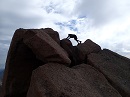
August 21st thru 30th: Sunlight Peak, Windom Peak, Mt. Elous, North Elous, "Phoenix Peak", Rio Grande Pyramid, San Luis Peak, Mt. Shavano, Tabeguache Peak Mileage: Approx 110 miles Elevation Gain: Approx 35k feet Note stats for each day are based on Caltopo lines and are approximate As part of my annual late summer Colorado trip, I wanted to stay in the area of the San Juans and also take the peak difficulties up a bit. I decided it was time to hit up Chicago Basin and stick around the area and knock out some peaks around Creede. On the way back to my parents house in KC, I made a late addition to hit up Shavano/Tabeguache since they were on the way. After a weekend visiting some friends in ABQ, I headed up to Purgatory to hit the trail the next morning. August 21st Approx 15 miles, 4300' gain Because I'm a sucker for spending money, I loaded up the backpack at the Purgatory TH to head into Chicago Basin at around 7am. It was actually not too bad. I reached Needleton about 10:45am, so I pretty easily beat the train and wouldn't stay I was moving at an extremely fast pace. The only time hiking it really got to me was around NY Creek crossing when the mileage started to accumulate, but once I started seeing views of the basin, that put some extra energy in my legs. I decided to camp high--I was right around the turn off to Twin Lakes. I never even saw a goat or marmot in the basin, so that was nice not having to deal with any issues with them.  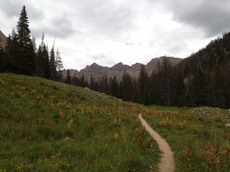 August 22nd Approx 6.5 miles, 4300' gain Woke up to overcast skies which was a little unsettling. Hiked up to Twin Lakes trying to decide what the weather was going to do and met and teamed up with two guys from Denver. We started up Sunlight and eventually decided we were just looking at standard overcast skies and continued upward. I have to say Sunlight was an absolute blast. Some more advanced moves all on solid rock, with a bit of exposure to keep things spicy. We didn't have any issues route finding as we all had print outs of the route descriptions and there were plentiful cairns. At the top we stopped to assess the final move a bit. I was the 2nd one up and really didn't have much trouble--I went up to the right side. I think its more mental than anything. Only pause I had was coming down on if it was easier to jump down off the 2nd highest block or stretch. I choose to jump--I'm still here so you know I stuck the landing! 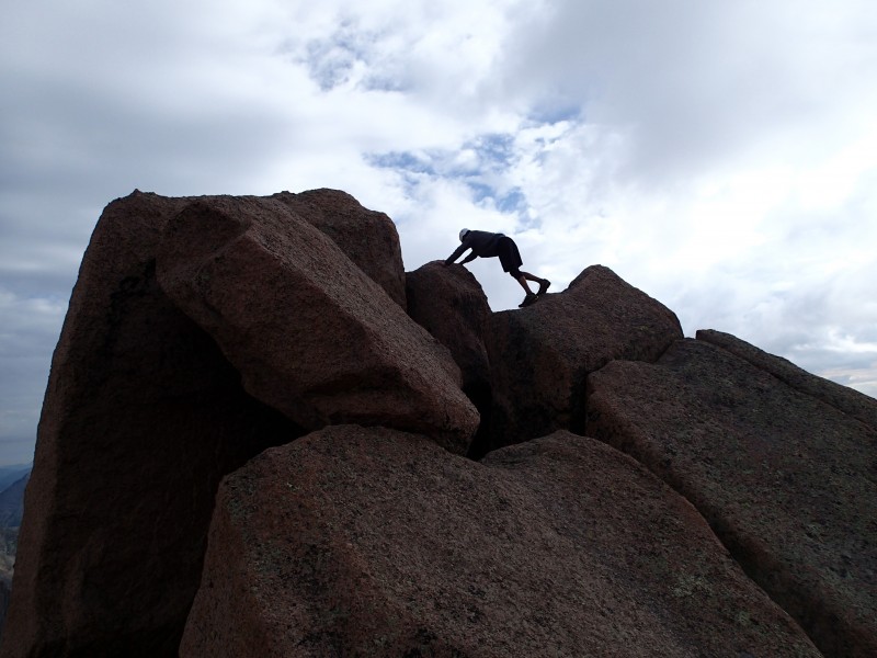 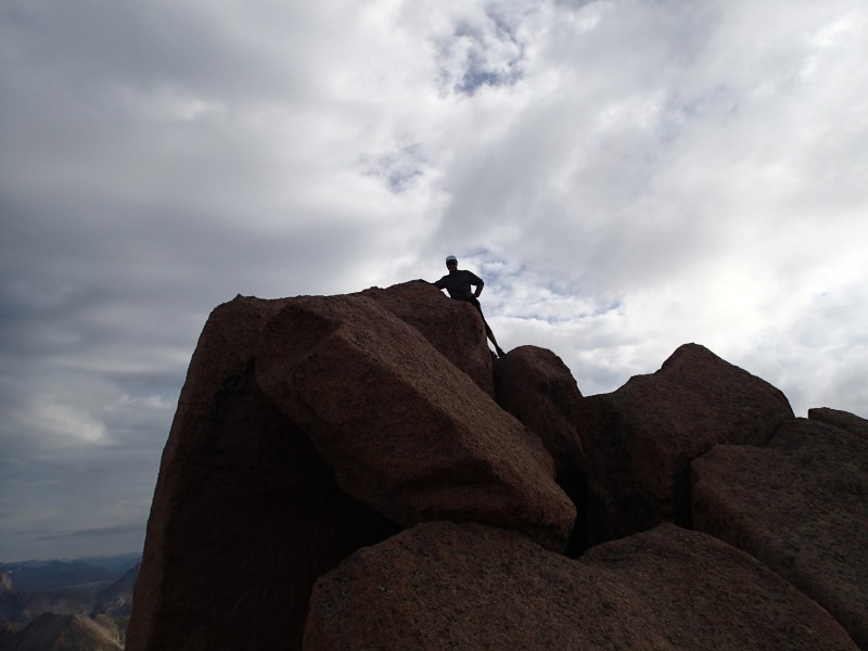 We found a nice contour over the Pk 18/Windom saddle staying high on some rock benches. It got a little tedious rock hopping, but was well worth saving elevation. Windom went pretty easy with plenty of cairns and awesome views of Sunlight Spire and Peak. We decided to head down to Twin Lakes and make a decision on attempting to hit Elous since the weather seemed to be holding. 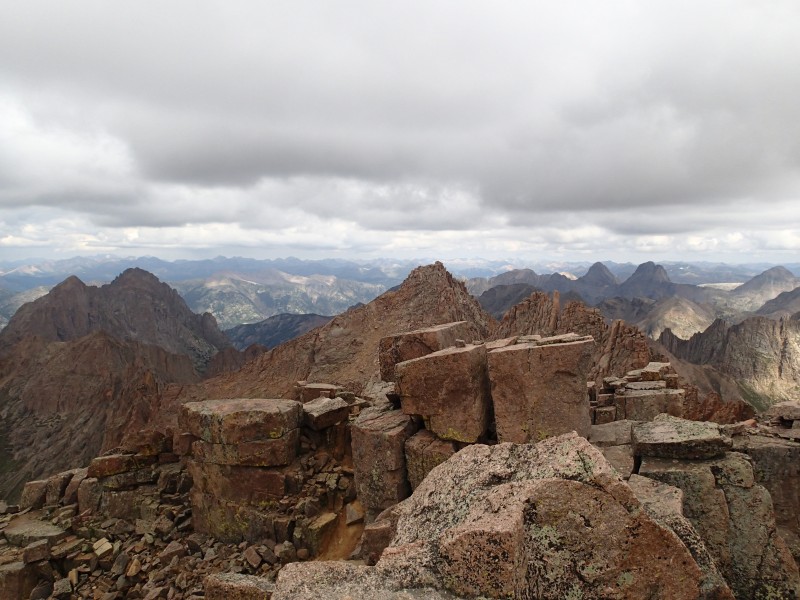 We made our way partway up to Elous and at that point I thought that more threatening clouds were starting to move in so I headed back while the other two guys continued up. It ended out being fine, and they both made both summits. Oh well there will always be tomorrow. August 23rd Approx 5 miles, 3300' gain I made my way up bright and early under clear skies to Twin Lakes. It was an amazing place to watch the sunlight start to hit the peaks around and reflect off the few clouds in the sky. After letting some fog burn off on the upper slopes of Elous, I made my way up. The trail was straight forward and getting to and up the notch was no big deal and I decided to hit Elous first. The catwalk was fun, and I didn't think was as I thought it might be. In most places its about as wide as a sidewalk, but still obviously a place you don't want to trip. 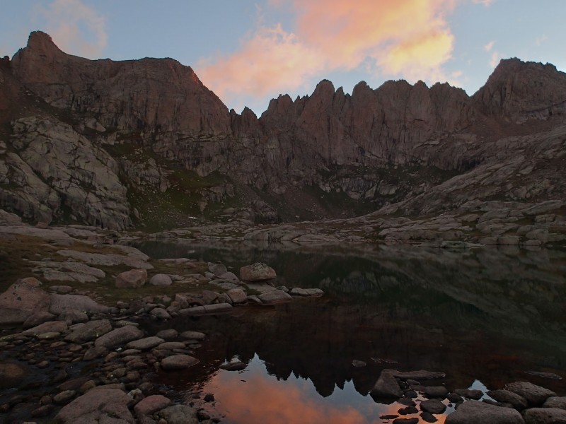 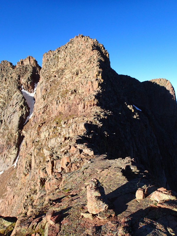 Once I got to the upper slopes I bungled the route finding a bit. I think I actually went too far to the left before started to ascend and had to backtrack. There are a ton of dueling cairns around which can mix things up. Basically if you think a move is too hard, backtrack a bit and check out behind you and there likely is an easier way. I made my way up and chilled under perfect skies for 30 minutes before making my way back across the catwalk. The way heading down was much easier on the upper slopes for sure. Hitting up N. Elous took maybe 5 minutes on perfectly solid rock sticking close to the ridgeline. The views back down to the basin that N Elous and Glacier Point create almost seem like an alien environment, even with its own lake! 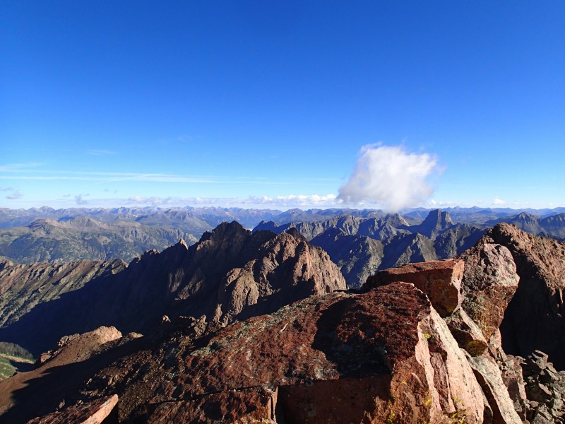 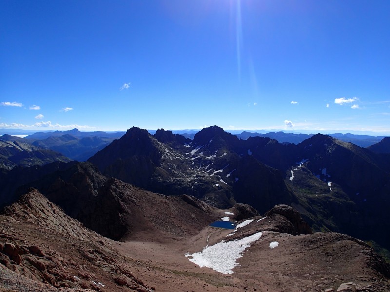 I headed back to Twin Lakes and thought about going for Jupiter that afternoon, but just decided to take life easy and go for that one the following morning.  August 24th Approx 17.5 miles, 3000' gain I woke again to overcast skies, and started heading up to Jupiter. The turnoff to Jupiter is right at a stream crossing. There is a faint trail thru some grass, and they a more defined trail further up on a hill that is visible from the stream intersection. Basically if you cross the stream and miss the turnoff, keep looking left and you will see a trail up on a hill and would be able to bee-line to it. 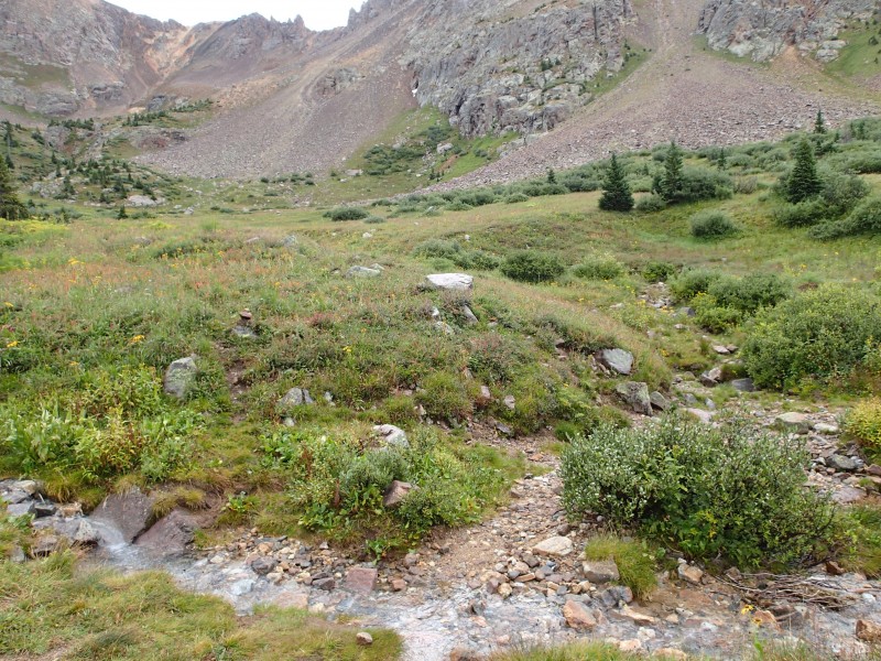 I made it to about 12,000' before the weather looked like it was headed in the wrong direction so I headed back to camp to pack up and head back to the TH. After about 10 minutes of getting all my gear ready to pack and having it strewn all over the place, I looked down the valley and I could no longer see the valley After the rain stopped I packed up and headed back toward Purgatory. I was fine right up until I crossed the Animas and started heading up Cascade Creek, which then it became a test of will power, and I paid my "train fee". I gritted thru and got back to the car with a big goofy grin on my face because of the last few days and all the fun (some type II) had.  August 25th I took a rest day as I made my way over to Creede, stopping to fish the San Juan and Rio Grande. I decided I would hit "Phoenix Peak" the next day as it was close to town and seemed to have easier stats. I camped at the Rio Grand CG 9 miles west of town, which is an absolute gem. Its an old FS CG that is no longer operated by the FS, so its free and maintained by volunteers (donations encouraged) just feet from the river---highly recommended. August 26th Approx 17 miles, 5300' gain Based on my scouting the previous day, I didn't think my Camry could make the it to the end of the 2wd 502 road, so I parked at the ATV staging area and road walked it. I quickly discovered that the portion I turned around the day before was the only remotely difficult spot, and I could have easily made it to the end of the 2wd section--nothing like adding 6 miles to a hike! I also made another blunder missing the trail shortcut to Phoenix Park shown on maps, and instead followed the 4wd road to it which added a bit of elevation and more distance. The trail cutoff is immediately to the right of the info signs telling about the restoration of a large meadow at the end of a 2wd road, it may be faint thru the grass in places. The turnoff to the Stock Driveway was well marked, but I had a bit of and issue finding a place to cross East Willow Creek and ended up dunking the trail runners. Off to a good start!! 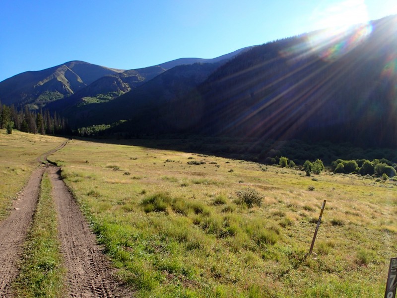 The trail was easy to follow up until coming to the 2nd creek crossing. Even with an excellent TR/GPS track (https://www.14ers.com/php14ers/tripreport.php?trip=11901) I made the common mistake of crossing too early like Roach mentions. There is a log bridge someone made, with what appears to be a trail on the other side. I took it and I have no idea where that trail goes but its not the correct way. Continue up on the north side of the creek until you are above all beaver ponds and once you are above all the ponds there are a few cairns and the correct place to cross. The trail on the other side is pretty thin, but does have quite a few cairns in the trees and you can see a cut in the underbrush as well. I had really no issues sticking with it.  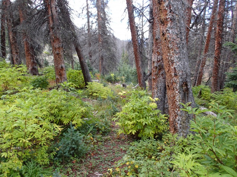 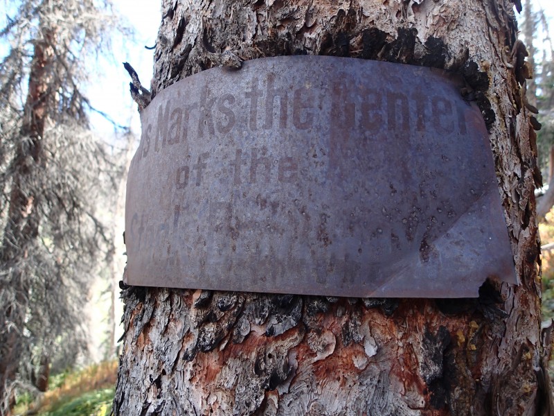 Once at treeline, the route is pretty obvious. I ascended a rib, and then did a ascending traverse to a saddle. From there it was just a matter going over a few false summits and making my way to the giant cairn that marked "Phoenix Peak". It was almost like being in another world compared to the peaks of Chicago Basin, but rewarding all the same. With a good weather forecast that was holding, I spent a bit of time before heading back down. Knowing the crossings on the way down made things much easier. I found good places to cross further upstream on East Willow Creek and kept the feet dry! 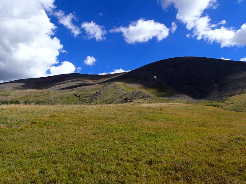 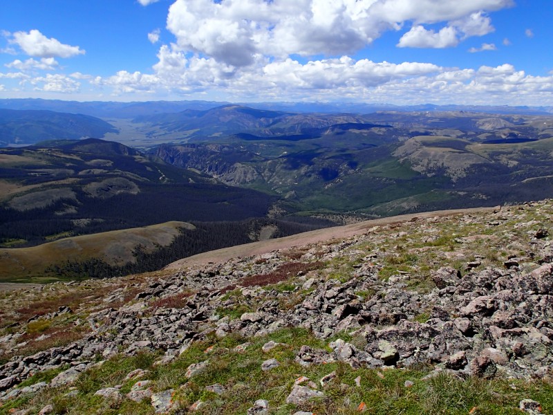 I successfully found the trail cutoff and slogged back down the 2wd road to the car before filling up water in town and heading out to Rio Grande Reservoir for Rio Grande Pyramid. The TH is basically in the 30 Mile CG, but I camped in a open field next to the river about 200 yards before the turn to the CG. August 27th Approx 21 miles, 5000' gain Roach says "fit individuals" do RPG as a day hike, so I knew I was in for some fun when that's what I was planning to do. The weather forecast was good so I had that going for me. The trail up to Weminuche Pass was really nice and only took be about 1.5 hours given the modest elevation gain. The turnoff to the Opal/Skyline trail was marked like Roach says with a faint large sign post and then some cairns further up. The trail was well cut in for the most part. About half way to the turnoff for RGP from the Pass, there is a large area of deadfall. I took a faint trail to the left that descended, but it never relinked past the deadfall and only continued downward. I ended up bushwacking back uphill to find the trail. Once you reach the deadfall section, stay high and don't get suckered! 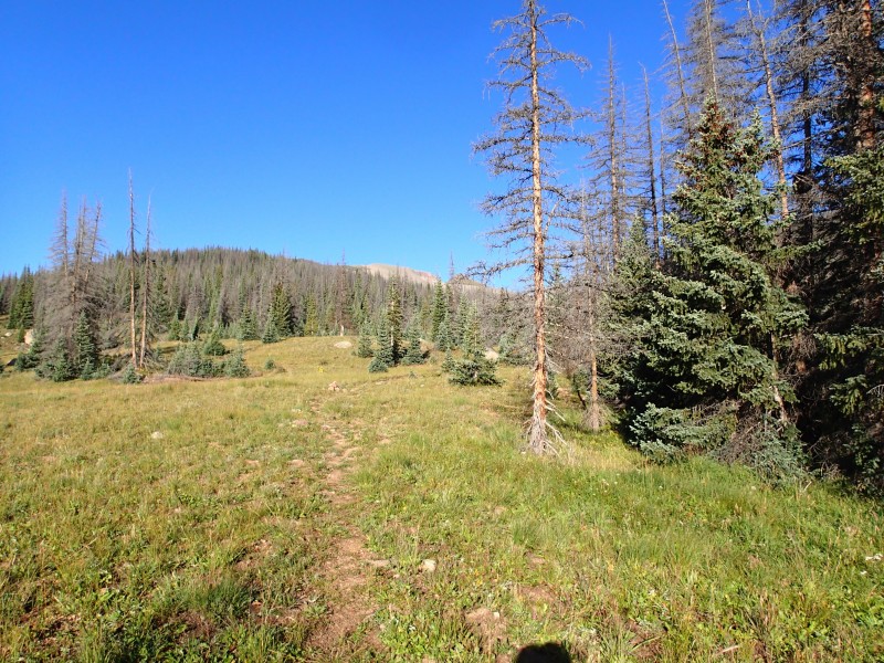 After a bit of willow bashing, I made my way to the turnoff that marks the start of the RGP trail, which was well used. This took me to a saddle which is pretty much where it ended. From there it was a pick my own line affair. I made my way up some steep loose dirt to the 2nd small saddle near 13,185' and from there continued upward sticking to the left when there were outcroppings on the ridge, trying to stay on the stable talus  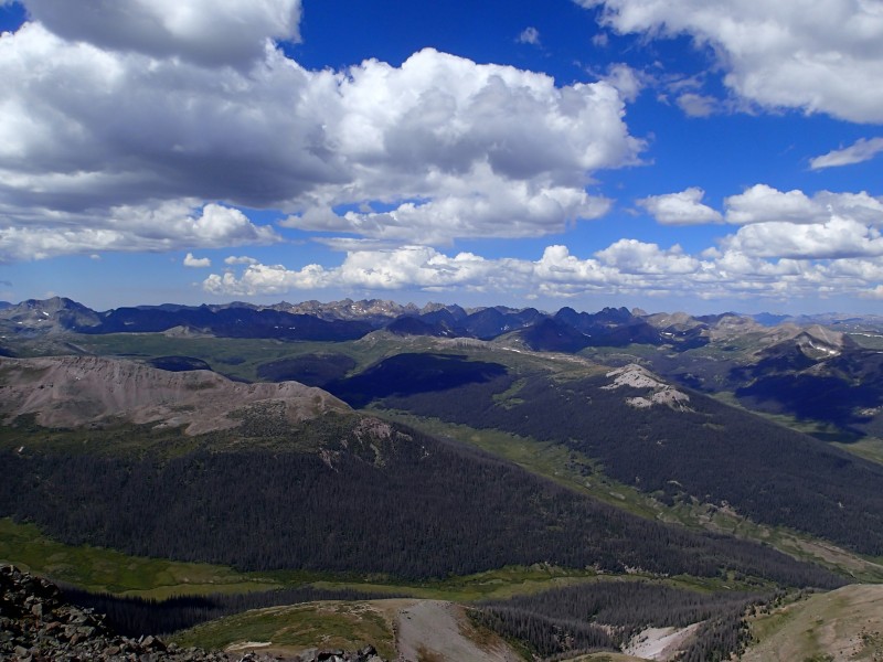 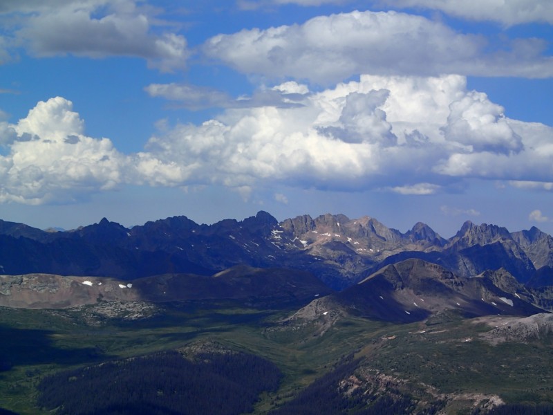 On the way down I almost ate it a few times on the ever shifting talus and was running low on water. I decided to continue along the Opal Lake Trail, then link up with the CDT, which both got below treeline faster and had water much earlier than making it all the way back to Weminuche Pass on the ascending route. This had the bonus of making a mini loop out of it and minimal extra elevation gain. 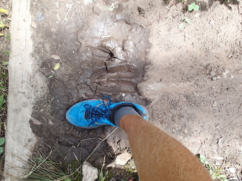 I made it back to the Pass pretty quickly and all that was left was a slog back to the car, but the spectacular Weminuche Valley just off the trail kept me company. At the end of a very, very long day, I set up camp in the same spot as the previous night and hit the sack right after taking an ice bath in the Rio Grande. August 28th I took another rest day and slept in and fished the Rio Grande as I lazily made my way back into Creede. I checked out the mining museum in town which was pretty interesting, then made my way up to Equity Mine for San Luis the next day. I went up the Bachelor Loop but did it in the reverse direction as typical--I started up 504 across from the baseball fields in town and it was no problems for my Camry. After reaching the 504/503 "Y" junction, i started looking for dispersed camping options and there were a few pulloffs but some looked better than others. August 29th Approx 14 miles, 4400' gain I packed up and drove the short bit up to the mine turn around and walked about 100 yards down to the 4wd road to the start of the 4wd road. The road hike wasn't too bad and got to the start of the trail quickly. The road turns sharply off to the left and there are a few FS thin brown signs marking the start of the trail. After a short ways you will come to another junction, with the San Luis Pass trail heading to the left, and the old road 'shortcut' to the right. The old road is pretty steep in places but shaves some distance off. Once I reached the saddle, the CDT was easy to find just below me. The trail was really nice as it wound its way thru two different basins before the trail to San Luis started. 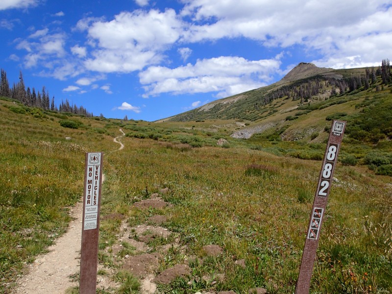 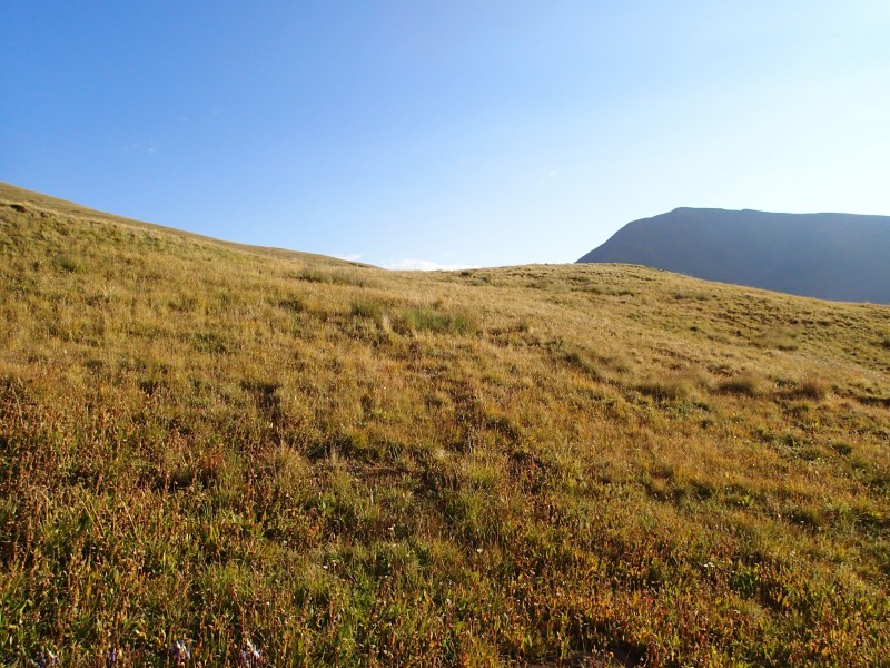 The trail was well marked with cairns and obviously worn rock the entire time. It was a bit demoralizing after what seem like 5 or 6 false summits, but I made it to the top in good time. Haze from the wildfires had just started to move in so that was a bit disappointing, but I was glad to be up there. I didn't stay too long as clouds were building and headed back down. I got back to the car shortly and decided to just continue back down the 504 road I came up since I didn't know how steep/rough 503 was. 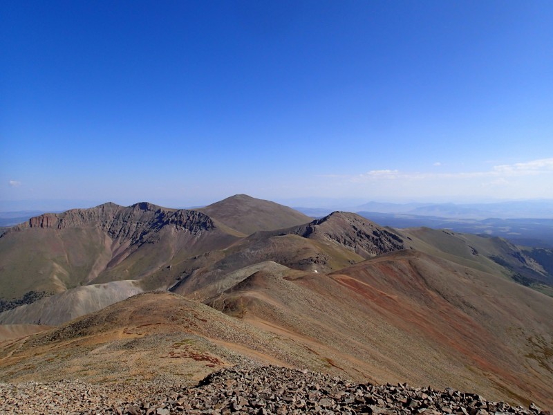 I stopped and took a tour at the Last Chance Mine which was really cool and I'd recommend it if you are interested in that kind of thing. Jack, the now owner of the mine who spent the last 17 restoring it, took us thru one of the portals and showed us the veins that the miners were going after, as well as some of the original areas that were mined out, some as much as 200 feet up from the ground we were standing on--all really incredible.  The time had come to leave the paradise that was Creede, but I decided on my way back to Kansas City, to hit up Shavano/Tabeguache since it was on the way. I made my way to the TH and camped just beyond the marked parking area in a dispersed camping pullout and got really for the final day. August 30th Approx 10 miles, 5500' gain Got started at about 5:30 as I wanted to make sure I had enough time to get over to Tabeguache and back before storms started. The trail was pretty rocky with plenty of ankle rollers as I made my way to treeline. Got to treeline in good time and stumbled upon some sort of sheep that I hadn't seen before. They certainly weren't mountain goats, elk, or deer, but didn't appear to be bighorn sheep, although they were young. 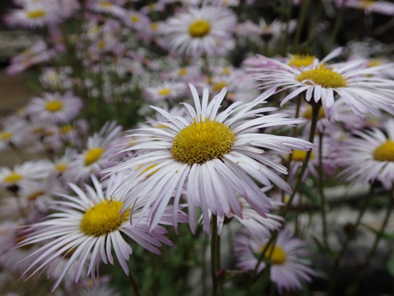 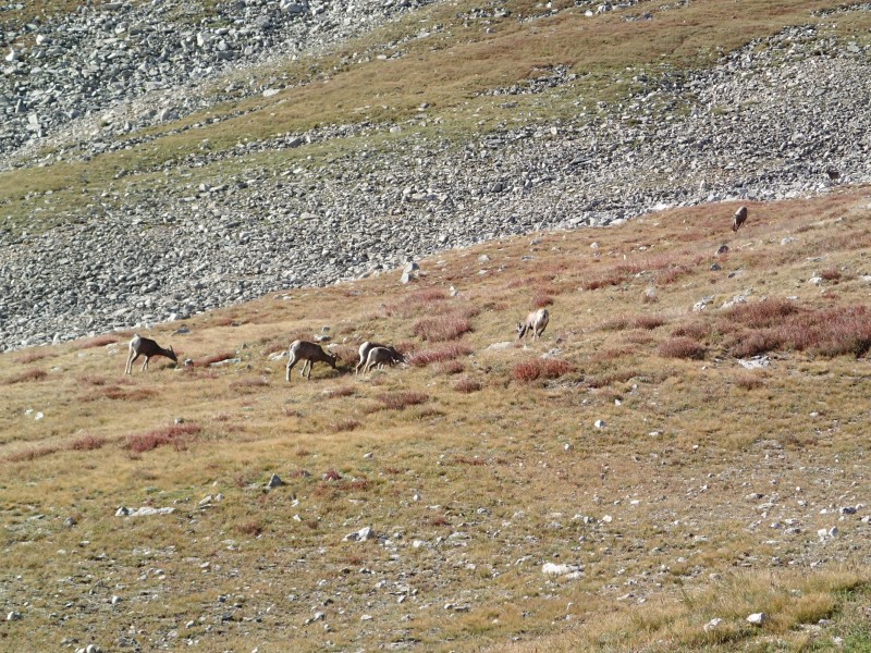 From the saddle up to Shavano, I picked what I thought was the most expedient route given the maze of options. Took a short break and was joined by another hiker and we made our way over to Tabeguache together while contemplating the correct pronunciation of "Tabeguache". Looking over from Tabeguache, it seemed like it was going to be a slog but I didn't think it was too bad at all. We kept just right of the ridge on the way down to the saddle, then just went straight up the ridge following segments of trail up to Tab. We didn't stay too long as clouds were brewing, and by the time we got back to Shavano, it was starting to get pretty dark. I slowly made my way back down soaking it all in and reflecting on the back on the last 10 days, knowing that when I got to the car it was going to be over.   Sadly--like all good things--the trail had to end, and I made my way to CO Springs for a much needed shower and real bed, before heading back to KC. Looking back this was probably one of the best trips I've had. It was a lot of work and there were some no so fun times, but I think the gauge of how a trip went, is how soon you want to start planning the next one. And I've already started. Thumbnails for uploaded photos (click to open slideshow):
|
| Comments or Questions | |||||||||
|---|---|---|---|---|---|---|---|---|---|
|
Caution: The information contained in this report may not be accurate and should not be the only resource used in preparation for your climb. Failure to have the necessary experience, physical conditioning, supplies or equipment can result in injury or death. 14ers.com and the author(s) of this report provide no warranties, either express or implied, that the information provided is accurate or reliable. By using the information provided, you agree to indemnify and hold harmless 14ers.com and the report author(s) with respect to any claims and demands against them, including any attorney fees and expenses. Please read the 14ers.com Safety and Disclaimer pages for more information.
Please respect private property: 14ers.com supports the rights of private landowners to determine how and by whom their land will be used. In Colorado, it is your responsibility to determine if land is private and to obtain the appropriate permission before entering the property.