Download Agreement, Release, and Acknowledgement of Risk:
You (the person requesting this file download) fully understand mountain climbing ("Activity") involves risks and dangers of serious bodily injury, including permanent disability, paralysis, and death ("Risks") and you fully accept and assume all such risks and all responsibility for losses, costs, and damages you incur as a result of your participation in this Activity.
You acknowledge that information in the file you have chosen to download may not be accurate and may contain errors. You agree to assume all risks when using this information and agree to release and discharge 14ers.com, 14ers Inc. and the author(s) of such information (collectively, the "Released Parties").
You hereby discharge the Released Parties from all damages, actions, claims and liabilities of any nature, specifically including, but not limited to, damages, actions, claims and liabilities arising from or related to the negligence of the Released Parties. You further agree to indemnify, hold harmless and defend 14ers.com, 14ers Inc. and each of the other Released Parties from and against any loss, damage, liability and expense, including costs and attorney fees, incurred by 14ers.com, 14ers Inc. or any of the other Released Parties as a result of you using information provided on the 14ers.com or 14ers Inc. websites.
You have read this agreement, fully understand its terms and intend it to be a complete and unconditional release of all liability to the greatest extent allowed by law and agree that if any portion of this agreement is held to be invalid the balance, notwithstanding, shall continue in full force and effect.
By clicking "OK" you agree to these terms. If you DO NOT agree, click "Cancel"...
It has been quite a long time (close to two years) since I stood atop of a Colorado 14er. When I do get out to hike, I have been focused on the less crowded Centennial Peaks. When Rohit brought up doing Longs Peak again, I was a little hesitant. I have already hiked it five times using three different routes. I just wasn't interested in joining the masses on a Saturday morning. After a little discussion, we decided that we would attempt the Longs Peak Grand Slam and if we were feeling up to it, try for the Radical Slam.
Rohit and I decided to grab some sleep at the Lily Lake parking lot in a new truck bed tent that I built out of PVC pipe. It was quite comfortable and we were both able to snag about 3 hours of sleep before meeting a friend at the Longs Peak trailhead at 2 AM. The parking lot was full, go figure, so we had to park a little way down the road. We met Thomas, who was just going to do Longs Peak with us, at the trailhead and started down the trail around 2:10 AM. We were all able to keep a decent pace and by 3:30 AM we all at a little stream below Chasm Lake. I had decided to only take 1 liter of water to this point to keep weight lower, then treat 3 liters of water for the big push. While we were treating water, I snapped a few pictures of the stars.
Starry skies while treating water.
Milky way!
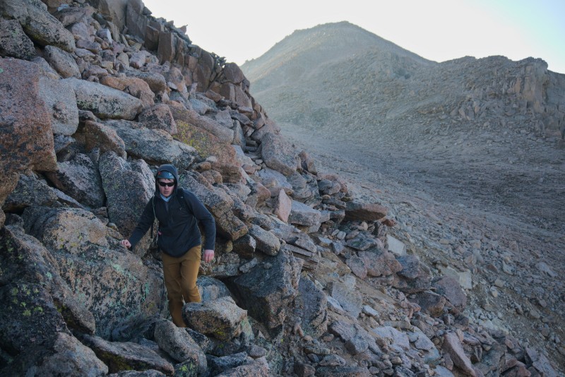
We continued up the Loft along climbers right to avoid the loose scree. Before too long, we were out of the Loft and climbing up towards Mt Meeker.
First light from high in the Loft
Thomas took a break on the large flat saddle between Longs Peak and Mt Meeker while Rohit and I went up to the summit of Mt Meeker, just in time for sunrise!
Rohit on Mt Meeker's summit before sunrise.
Meeker summit selfie. (Photo by Rohit)
Capturing sunrise.
Meeker Summit.
Sunrise.
After a few beautiful moments on top of Mt Meeker, we descended back down to the saddle and met back up with Thomas. We crossed the saddle and descended into Keplingers Couloir via Clarks Arrow.
Descending into Keplingers Couloir.
Clarks Arrow! (Photo by Rohit)
Near the Palisades.
Heading towards the Homestretch
Climbing up! (Photo by Rohit)
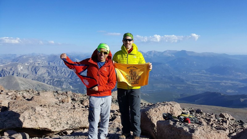
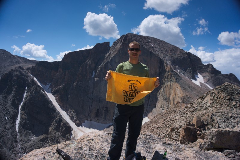
After finding Clark's Arrow, we progressed up to where the route meets up with the Homestretch. At this point, we said our goodbyes to Thomas so that we could hurry along with our objectives for the day. Shortly after departing with Thomas, we topped out on Longs Peak. It was my sixth time on top of Longs Peak and still haven't grown tired of the views from the summit!
Longs Peak Summit!
Longs Peak Summit!
Rohit and I had a little food, snapped a few pictures, and then left the summit. We descended the Homestretch (with a brief reunion with Thomas along the way) with hundreds of our closest friends until we reached the sign indicating a right turn. We, of course, ignored the sign and continued descending, much to the confusion of the other hikers. This was the way to Pagoda Mountain.
Descending the Homestretch (Photo by Rohit)
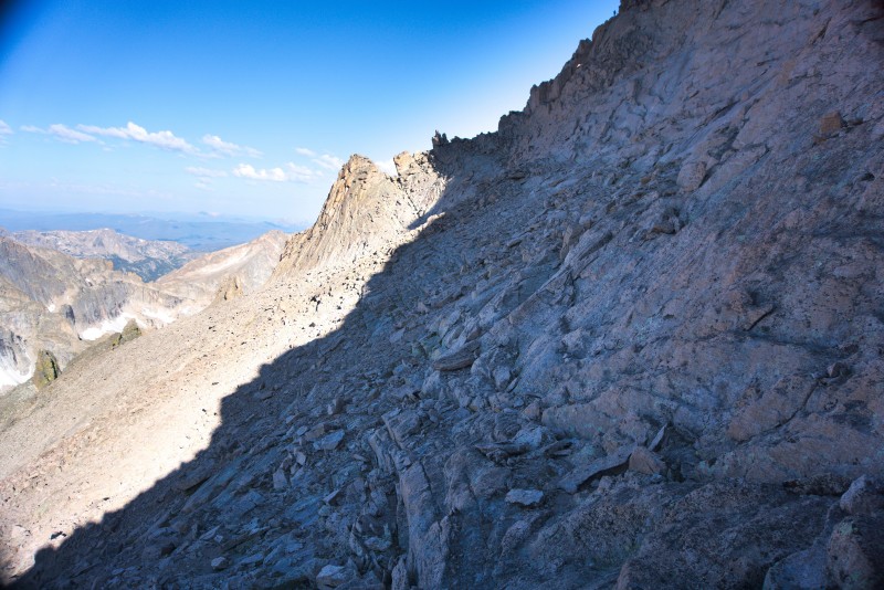
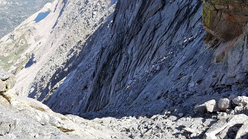
After we had descended about 200 feet below the sign, we start to turn and head towards Keyboard of the Winds. The traverse went smoothly and we were soon standing atop of the cliff we were supposed to descend. Thanks to some previous research, we found ourselves in the perfect place to descend the cliff band.
Traversing below the Narrows.
Descending the cliff by Keyboard of the Winds
Descending the cliff by Keyboard of the Winds (Photo by Rohit)
Keyboard of the Winds
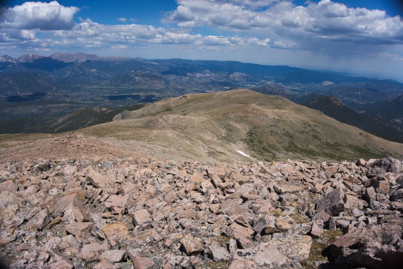
We hiked past Keyboard of the Winds and in another thirty minutes we were standing on top of Pagoda Mountain. This was the first time I had seen this perspective of Longs Peak. Seeing the massive mountain from here made me appreciate the mountain all over again.
Pagoda Summit!
Pagoda Summit!
Looking at Longs Peak from Pagoda Mountain
Looking at the Keyhole from Pagoda Mountain
We quickly left the summit of Pagoda mountain and went back to Keyboard of the Winds. We found the gully between the first and second key and started making our way down. The downclimb was easy and we were soon traversing around several rock ridges. We met back up with the crowds of people at the bottom of the Trough and we continued along the Ledges until we were at the Keyhole.
Gully we down climbed at Keyboard of the Winds (Photo by Rohit)
More downclimbing.
Traversing to the Ledges. (Photo by Rohit)
The Keyhole
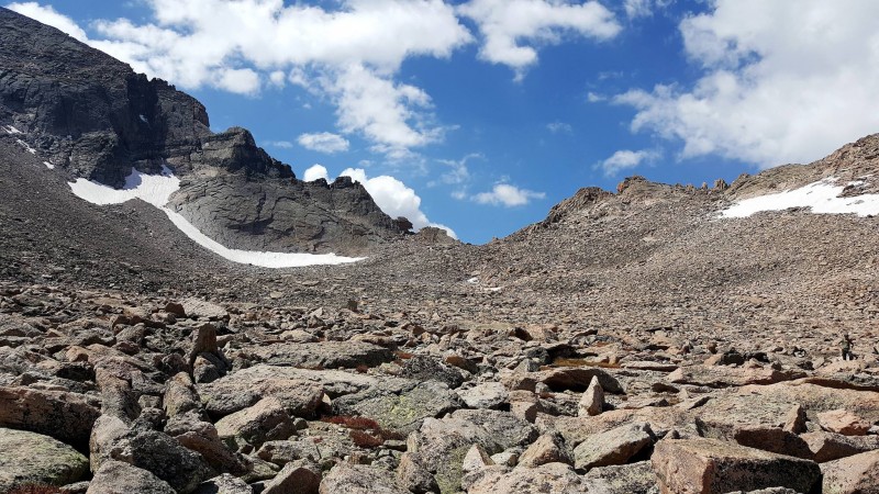
We again departed with the crowds and moved along to Storm Peak. This is where the fatigue was starting to creep in to my legs. The last little bit of climbing up to the summit of Storm Peak was difficult for me, but I made it! Summit number 4 for the day. Not too bad! It was at this point that I ran out of water, so, the next goal was to find some. We left the summit of Storm Peak and descended into the Boulder Field where we started looking for water. We found a hole in the boulders that was large enough to gather water, so we sat and treated several liters.
Storm Peak Summit
Storm Peak Summit
Boulderfield (Photo by Rohit)
After we replenished our hydration bladders, we started up Mt Lady Washington. At this point, it was a âmind over matter' game. My legs didn't want to continue, but my mind did. We slowly trudged up the summit and were greeted with spectacular views of the Diamond of Longs Peak. We had done it! All 5 summits of the Grand Slam were completed. I wanted to throw in the towel (no, not the Terrible Towel) and head to the truck but Rohit convinced me to give the Radical Slam a shot. I don't know why I let him talk me into this crap.
Mt Lady Washington Summit.
Mt Lady Washington Summit (Photo by Rohit)
Looking down the ridge towards Battle Mountain
We descended the north ridge of Mt Lady Washington towards Storm Pass. The descent of the ridge felt extremely long and by this time, my feet had started to hurt. We made surprisingly good time to Storm pass and within an hour of leaving the summit, we were standing on Battle Mountain!
Battle Mountain Summit (Photo by Rohit)
Battle Mountain Summit (Photo by Rohit)
After some very quick pictures, we went north along the gentle ridge to find a good place to descend towards Estes Cone. We could weave through the Limber Pine easily and were soon traveling through the forest. After checking the map a few times, we ended up on the Storm Pass trail around 200 yards away from the Estes Cone trail. Unfortunately, or perhaps fortunately, I had checked the time and we decided that we were out of time. I promised my wife that I would call her by 5 PM, and since there is not cell service in the area, I couldn't modify the plans. It was 2:30 PM and we still had to ascend Estes Cone, hike 2.5 miles to the Longs Peak trailhead, and drive out of the mountains into cell service. With how my legs felt, I knew we were not going to make it up another peak and back in time. We pulled the plug and headed for the truck.
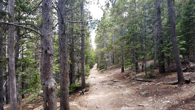
Trail back to the Longs Peak ranger station.
After what felt like the longest two miles I have ever experienced, we met back up with the standard Longs Peak trail a mere half mile from the ranger station. The next half mile felt just as long as the previous two miles. Eventually, and to the gratitude of my legs, we made it back to the ranger station. We had been hiking for a "mere" 13 hours and gained somewhere close to 8,900 feet of elevation. Our legs were shot!
Thanks to my mother-in-law for helping me clean up some of the nighttime pictures!
Thumbnails for uploaded photos (click to open slideshow):
'Wobbly legs' -- yeah, I bet! I did 9000' once upon a time many years ago, so I know the feeling. But what a great feeling of accomplishment too, huh?! Thanks for sharing your trip! :D
day after you helping a timid friend finally get to the top after her 4th try. At 3am the parking lot was packed, had to park on the street and a sea of headlights began. We turned our headlamps off to find the star Lyra near the Big Dipper (personal meaning) and Whoa!!!
Caution: The information contained in this report may not be accurate and should not be the only resource used in preparation for your climb. Failure to have the necessary experience, physical conditioning, supplies or equipment can result in injury or death. 14ers.com and the author(s) of this report provide no warranties, either express or implied, that the information provided is accurate or reliable. By using the information provided, you agree to indemnify and hold harmless 14ers.com and the report author(s) with respect to any claims and demands against them, including any attorney fees and expenses. Please read the 14ers.com Safety and Disclaimer pages for more information.
Please respect private property: 14ers.com supports the rights of private landowners to determine how and by whom their land will be used. In Colorado, it is your responsibility to determine if land is private and to obtain the appropriate permission before entering the property.
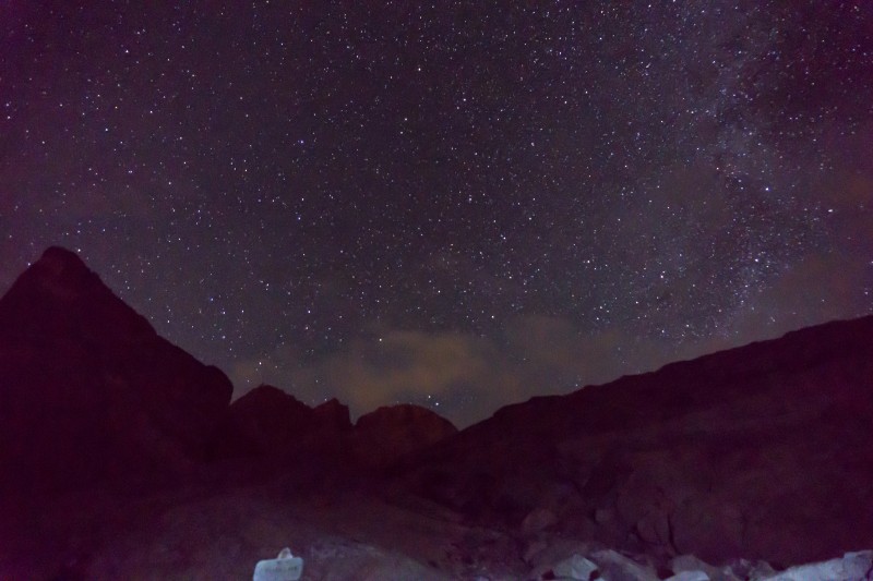


 Starry skies while treating water.")
 Milky way!")
 First light from high in the Loft")
 Rohit on Mt Meeker's summit before sunrise.")
 Meeker summit selfie. (Photo by Rohit)")
 Capturing sunrise.")
 Meeker Summit.")
 Sunrise.")
 Descending into Keplingers Couloir.")
 Clarks Arrow! (Photo by Rohit)")
 Near the Palisades.")
 Heading towards the Homestretch")
 Climbing up! (Photo by Rohit)")
 Longs Peak Summit!")
 Longs Peak Summit!")
 Descending the Homestretch (Photo by Rohit)")
 Traversing below the Narrows.")
 Descending the cliff by Keyboard of the Winds")
 Descending the cliff by Keyboard of the Winds (Photo by Rohit)")
 Keyboard of the Winds")
 Pagoda Summit!")
 Pagoda Summit!")
 Looking at Longs Peak from Pagoda Mountain")
 Looking at the Keyhole from Pagoda Mountain")
 Gully we down climbed at Keyboard of the Winds (Photo by Rohit)")
 More downclimbing.")
 Traversing to the Ledges. (Photo by Rohit)")
 The Keyhole")
 Storm Peak Summit")
 Storm Peak Summit")
 Boulderfield (Photo by Rohit)")
 Mt Lady Washington Summit.")
 Mt Lady Washington Summit (Photo by Rohit)")
 Looking down the ridge towards Battle Mountain")
 Battle Mountain Summit (Photo by Rohit)")
 Battle Mountain Summit (Photo by Rohit)")
 Trail back to the Longs Peak ranger station.")


