| Report Type | Full |
| Peak(s) |
Peak Six - 13,712 feet Peak Ten - 13,494 feet "East Windom" - 13,469 feet |
| Date Posted | 08/19/2017 |
| Modified | 09/22/2019 |
| Date Climbed | 08/07/2017 |
| Author | wombat |
| San Juan Shenanigans |
|---|
|
Day 1: In Hike to Leviathan Lake Since my brother Steve and I were driving his vehicles across the country, we were blessed with a two trailhead round trip. After driving from El Paso, we slept for a couple hours, dropped a vehicle at Purgatory TH, and made our way to Vallecito TH. After a tad over 13 miles we ventured up Leviathan Basin. At about 13.3 miles, the Leviathan trail veers off to the left from the Vallecito Trail. The trail is generally well defined due to the presumably high volume of equine traffic. Trail Description: After hiking off the Vallecito trail and through a horse meadow you cross the Vallecito to the West side. The Vallecito has about half the volume here as the crossing six miles downstream. After crossing the Vallecito, walk through another horse meadow; do not follow the meadow South. It is possible to lose the trail here, but use this opportunity to cut North and cross Leviathan Creek. Now the long walk up the Basin begins. The trail is well defined and almost strictly uphill until it reaches grassy areas. After reaching the upper horse meadow found at the generally flat area at 11500, route finding becomes difficult. From the upper horse meadow your goal is to follow the spur to the base of the Leviathan lake headwall. Climb up Leviathan Lake from the East side. Do NOT go too far South to the actual creek before climbing up to Leviathan Lake. We climbed up the creek, cliffing ourselves out and losing 45 minutes as we slowly made our way around the lake counterclockwise. 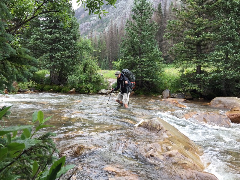 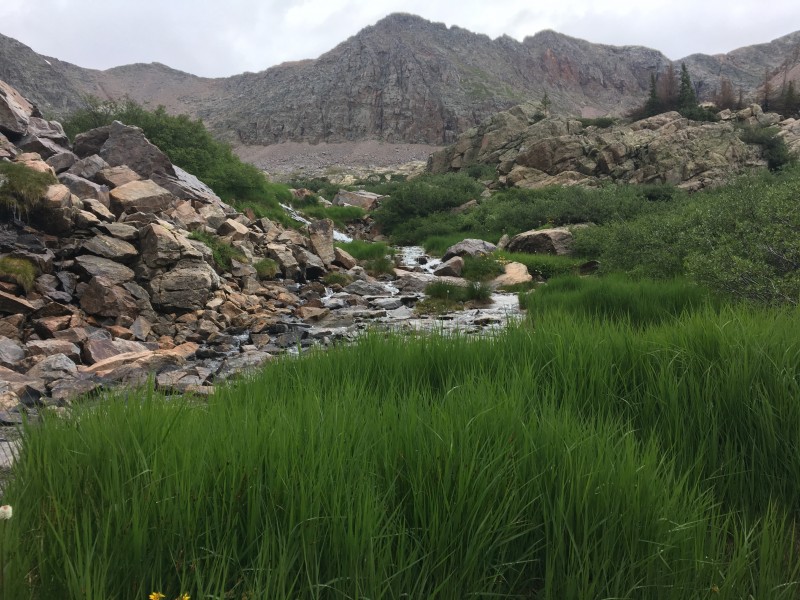 Leviathan Lake is as barren (fish wise) as it is blue; nor is it rife with camping spots. There are a couple pads on the West or East side of the lake. We finally arrived at the West Side, set up camp, and passed out. 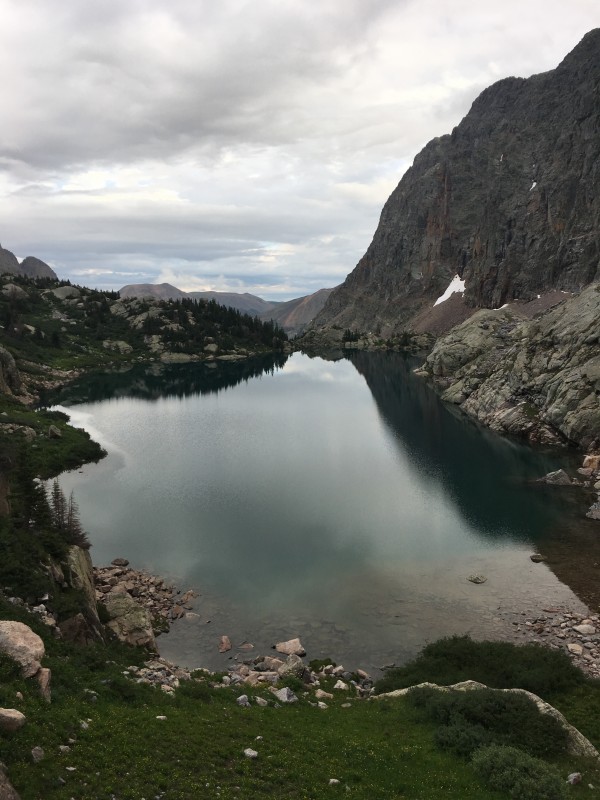 Initially this hiking trip was supposed to be a sweep of some peaks in the area. The plan was to do 9, Silex, Guardian, then play it by ear. Unfortunately, Steve messed up his back lifting furniture out of his house - he found himself miraculously able to traverse long distances and restrictive terrain under load, but generally unable to perform Class 3 maneuvers or use upper body strength. Day 2: Peak Six The next morning we decided to give some light Class 3 a shot. Steve popped an 800 Ibuprofen and we made our way to Peak Six â‘starting at the Peak Six -13475 saddle. After a false summit we made it up Peak Six. Beautiful peak, but we only found one entry in the summit log this year. Steve was tentative about more Class 3, in order to enable concurrent recovery for later days, so we scree skied directly East back to Leviathan Lake. We spent the next couple hours casting and strengthening our hypothesis that Leviathan was indeed fishless. 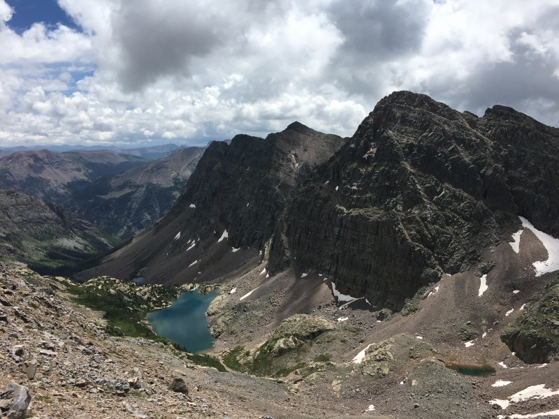 Day 3: Move Camp to Sunlight Lake and Peak Ten The next morning, we decided Sunlight Lake was our best bet, a known commodity from last summer. We climbed up Leviathan Pass and made our way down to the base of Jagged. We stayed high to check out Jagged's East shoulder, a neat little tarn resides! After toughing out a 20 minute deluge we persisted to Sunlight Lake. We dropped the tent and made our way to Peak 10. 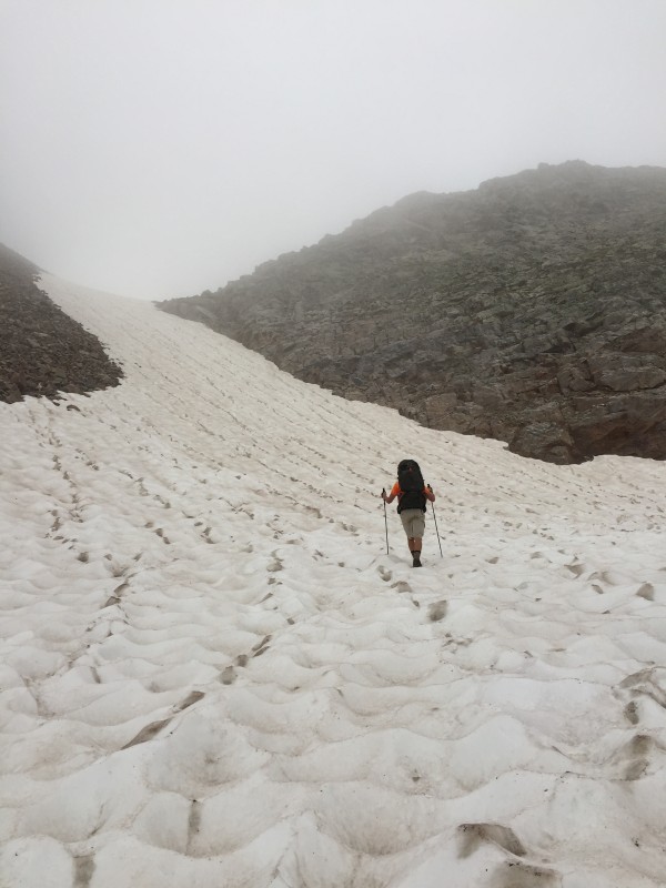 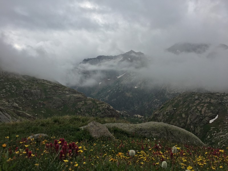  Rosebrough's Hiking the San Juan's has been my go to, because it is vague enough to be concise and usually I can fill in the blanks on this site â‘ unfortunately there was no beta here, so Rosebrough was it (generally accurate): 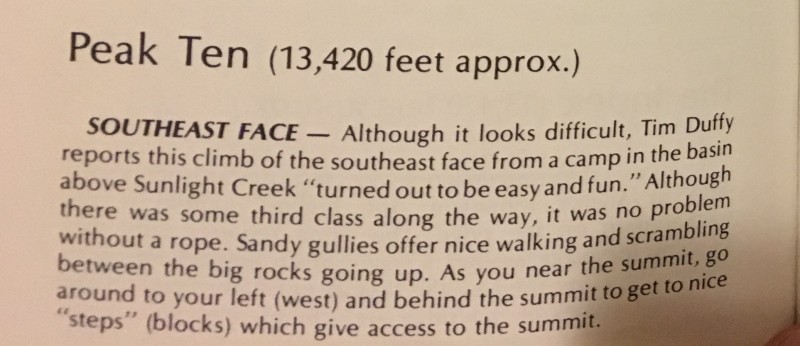 FWIW, here is some further Peak Ten fidelity and supporting photographs: To climb Peak Ten, use grass slopes to achieve the Jagged-Gray Needle-Peak Ten bowl. Traverse underneath Alligator Rock (see picture), but stay above the couloir that steeply drops off right below the Alligator's snout. Next, continue in an upwards traverse to the left (but not straight up) and obtain footing above the bald slab area (will be obvious past the Alligator)â‘ a boulder field with slabs that stand out in the surrounding boulder area. (You can go straight up from half way to the slabs with difficulty- but the orange path is easier). There are some cairns in this area that can guide you closer. The final line seems to be a choose your own adventure path. There are about four possible lines to the summit here, but the one depicted on the photo was the best line we found. 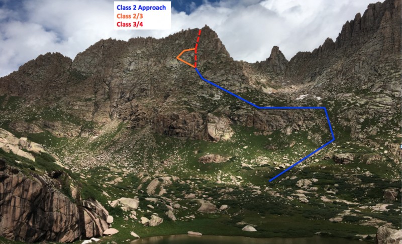  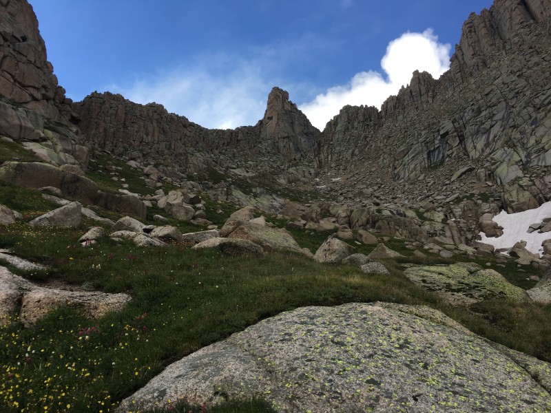 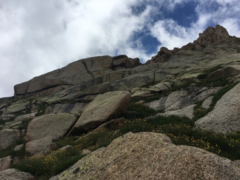 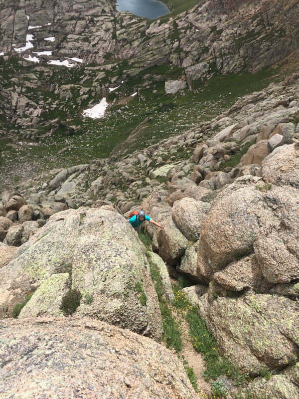 We summited Peak Ten but were unable to go mount the summit block (Class 5+?). Maybe there is a way around, but I wasn't able to find it. We hurried down during hail and lightning, cowering under rocks enroute. Bad weather day, glad we didn't go for Peak Nine-Silex-Guardian. A pika/marmot/squirrel/chipmunk critter chewed through the tent and had a dinner of my backpack straps, but fortunately didn't affect any load-bearing components. Day 4: East Windom, Explore Lake 13100, Point 13229, and attempt at Greylock The next morning we made our way up to East Windom by way of Upper Sunlight lake (Lake 12545 on Storm King Quad) and Windom-East Windom saddle. Choose the Left Side (East) of the lake to circumnavigate. We then slogged up the talus to the Windom - East Windom saddle. Before the easy stroll up the backside of East Windom, we stopped at lake 13,100 below Windom. Wow! 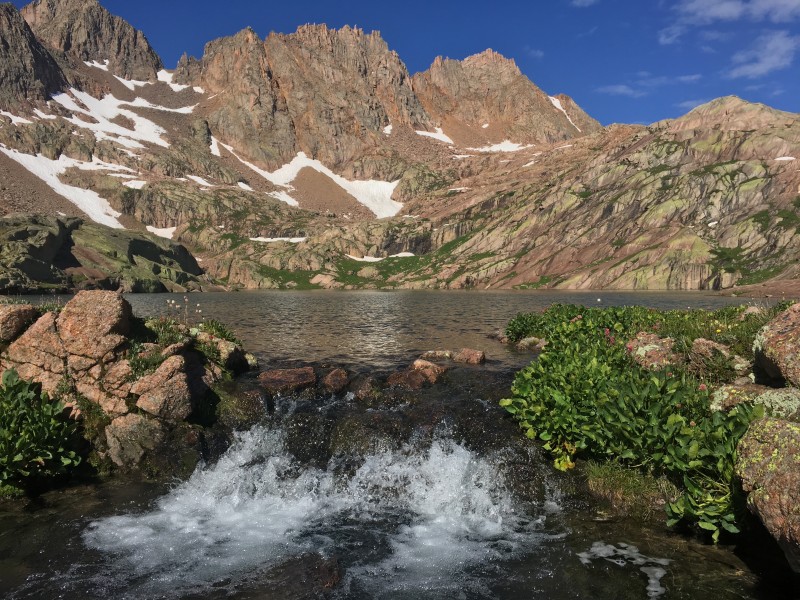 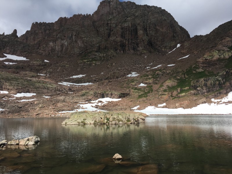 We hiked down under Lake 13100 to view Grizzly Gulch - a beautiful basin for a future day!  At East Windom we viewed hikers on both Windom and Sunlight. We began the ridge walk to Greylock. At the saddle of East Windom-13229 saddle look up the Southern side for an easy Class 3 route up 13229. After 13229, we were met with a fierce noon thunderstorm. Uncomfortably squatting in the lightning position under some rocks 50 meters under peak 13229, we observed lightning pound the Jagged ridge line. The threat didn't clear for another hour before we were able to keep hiking towards Greylock. As we neared the Greylock-13229 fierce class three saddle we decided to head back as another storm moved in. It wasn't all a loss; we thoroughly enjoyed the waterfalls and choose your own adventure grass ledges all the way back to camp! 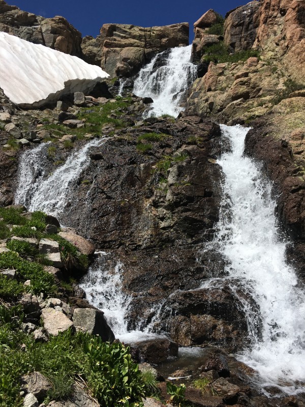  Day 5: Sunlight Lake past Jagged to Noname Basin to Ruby Basin The next morning, we decided to head to Noname Basin. We went by way of Jagged maintaining 13000 foot altitude under Jagged through boulder fields. When presented with the opportunity, I climbed up and down the first crux on Jagged â‘ which wasn't that bad, so I can now gauge difficulty for a trip next year.  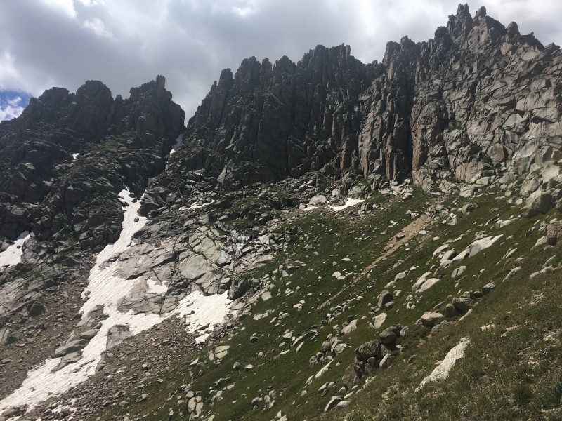 We slogged down Jagged pass and into Noname Basin. Under Peak 5 we rested, and were about to start a quick Peak 5 to 4 Traverse and camp in lower Noname until we set our sights on the Peak 12-Monitor Saddle. I know that Steve is more of a lake bagger, and I will be back again for these peaks; so on to Ruby Lake we went!  Peak 12- Monitor Saddle looks like a mere couple hour hike (wrong) when you are eye level from Upper Noname. Ignoring the contour map we proceeded. Soon we found out that we would descend the trail some 1500 feet well into the tree line before we could ascend. At Noname Creek we encountered the oddly placed galvanized trashcan, but proceeded- forcing ourselves through some 200 meters of willows. We ascended the creek that terminates on the SK Quad at Monitor Peak- rather than the main creek originates from the mushroom shaped 11754 lake. The smaller stream is quite manageable with little overgrowth and some cairns. The small stream we chose also offers many dry rocks to hop between during the late summer. However when we opted to leave the stream, as the dry rocks turned into wet black rock slabs we were met with some Class 3, bushwhacking challenges. Above treeline, we side sloped south and uphill towards the saddle. Finally at four in the afternoon we achieved the saddle. The ascent from Noname to the saddle was the toughest part of the trip. (We didn't leave Sunlight Lake till 930 expecting an easy day- Hah!)  I opted out of the easy stroll up Peak 12 (the unmarked peak on the SK Quad to the immediate Southeast of Monitor), to maximize daylight at Ruby Lake and catch a couple fish. In the idyllic meadow under Pigeon-Turret we encountered professorstinky and his group; they were the only hikers we would encounter in four basins (Leviathan, Sunlight, Noname, Ruby). Finally made Ruby Lake at 6:30; an exhausting day under load. We hiked from Sunlight Lake under Jagged to Jagged Pass into lower Noname Basin and up to Peak12-Monitor Saddle before reaching Ruby Lake. In a competition reminiscent and equally exciting to a 1915 "deadball era" Baseball game, I beat Steve on a game of catch and release fishing, 2-0!  Day 6: Hike Out On the way to Purgatory from Ruby Lake I confirmed my findings from the Chicago Basin-Ruby Basin trip I completed in June: the 2-2-2 rule. At a relatively brisk pace it is two hours from Ruby to the Animas (downhill of course!), two more hours from Needleton to crossing the Animas at Cascade Creek Confluence, and a final two hours from the confluence to the Purgatory Parking Lot. We rented a tow dolly and drove to New York without time or access to a shower! A very fragrant drive across the USA! Thanks for reading!  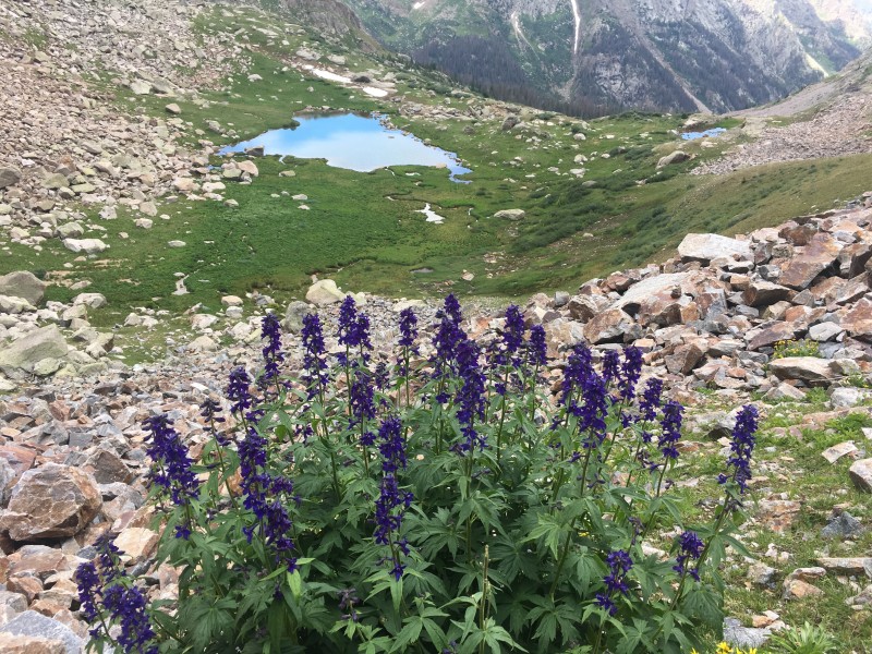 Thumbnails for uploaded photos (click to open slideshow):
|
| Comments or Questions | ||||||||||||
|---|---|---|---|---|---|---|---|---|---|---|---|---|
|
Caution: The information contained in this report may not be accurate and should not be the only resource used in preparation for your climb. Failure to have the necessary experience, physical conditioning, supplies or equipment can result in injury or death. 14ers.com and the author(s) of this report provide no warranties, either express or implied, that the information provided is accurate or reliable. By using the information provided, you agree to indemnify and hold harmless 14ers.com and the report author(s) with respect to any claims and demands against them, including any attorney fees and expenses. Please read the 14ers.com Safety and Disclaimer pages for more information.
Please respect private property: 14ers.com supports the rights of private landowners to determine how and by whom their land will be used. In Colorado, it is your responsibility to determine if land is private and to obtain the appropriate permission before entering the property.


