| Report Type | Full |
| Peak(s) |
Unnamed 13305 - 13,305 feet "Lake Fork Peak" - 13,333 feet |
| Date Posted | 08/18/2017 |
| Modified | 08/24/2017 |
| Date Climbed | 08/12/2017 |
| Author | quaternion |
| Obscure 13ers and Solitude in Sayres Gulch |
|---|
|
After climbing N. Maroon last weekend, and enjoying the festival-like happenings around Crater Lake and Maroon Lake, I decided to opt for the solitude of some obscure Sawatch 13ers. These mountains are not spectacular, but they provide a great outing and a worthy reminder of why I climb obscure 13ers. My TH was at the mouth of Sayres Gulch, right on the South Fork Lake Creek Rd ... Road 399 per Google Maps, Road 391 per the USGS quad. Either way, it's the road that heads south from Independence Pass Road right at the TH for La Plata's NW Ridge Route. Note that the road crosses the North Fork on a solid bridge ... no need for driving through water. There is a fair amount of camping along this road (although the loud partying of other campers, and even a gunshot resounding through the valley after I was in bed, don't make me want to rush back to camp there). About 2.5 miles in on the South Fork Lake Creek Rd you reach a junction. Turning hard left takes you down a short spur with parking, and a footbridge across the creek. Turning slightly left leads to a stream crossing, and would allow you to drive up into Sayres Gulch (see photo). Since I thought I might make a loop out of my hike, I left my car at this junction, and hiked in across the footbridge across a striking little gorge! 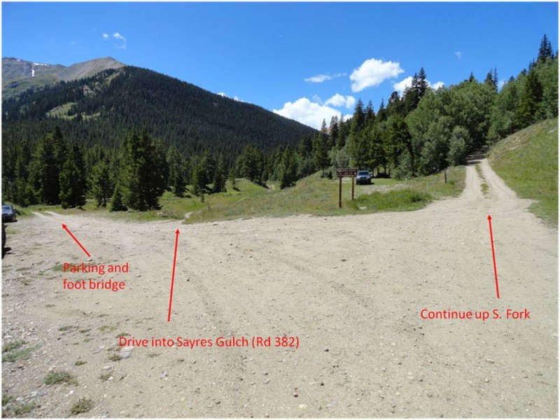 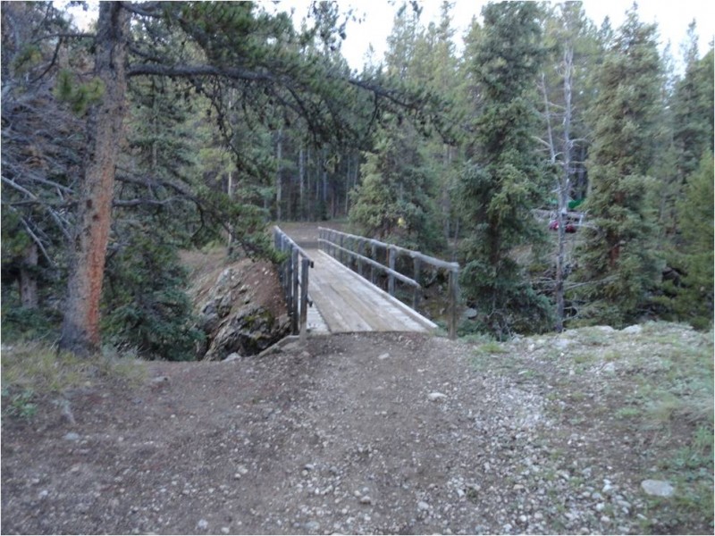 Shortly after the footbridge you come to a junction; specifically, the road from the drivable stream crossing comes in from the right, and the road into Sayres Gulch goes left. (This is a bit confusing, as the USGS Quad doesn't show any of this, but does show a different intersection which would be just a little further up ... if it still existed.) 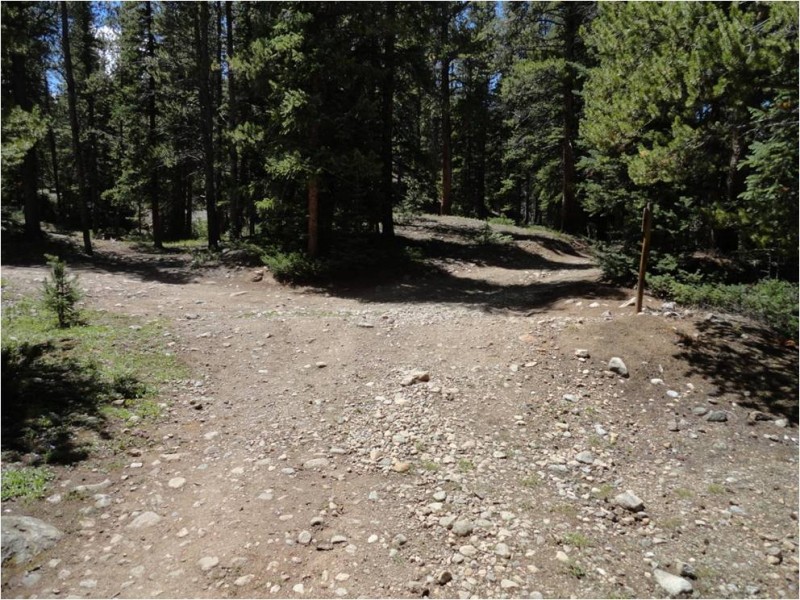 My plan was to climb PT 13,295, and then if it looked reasonable to run the ridge N to 'Lake Fork Peak' (PT 13,322) ... so off I went toward the head of the gulch. The road extends for about 2 miles before reaching the Wilderness boundary. This is a beautiful valley and a pleasant hike. 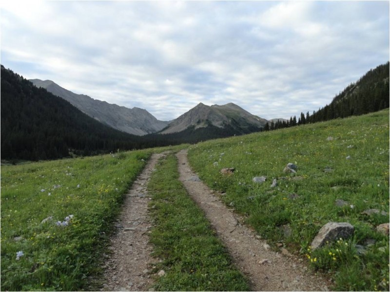 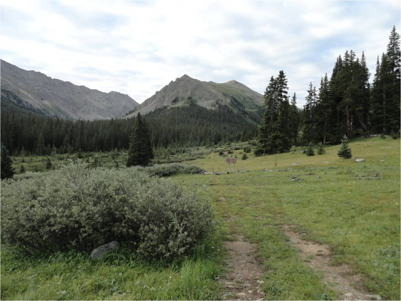 The trail continues for another mile plus and then gradually becomes less discernible in the willows. I crossed from the west side to the east side of the creak at about 11,450' to minimize the bushwhacking. Eventually the willows give way to grass, and the grass gives way to talus, and the talus leads to the east ridge of PT 13,295. The talus and the ridge are straightforward. The summit of PT 13,295 provides fantastic views in all directions. From the TH to this summit was 5.2 miles and about 2800' of elevation gain. 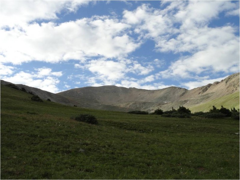 This is where the real exploration began. The next goal was to summit unofficially named Lake Fork Peak, or PT 13,322. The ridge turned out to offer some good variety, including unpleasant broad but loose slopes, narrow and exposed solid class 2+, the occasional hand placement, and one minor loose downclimb on the west side to get to the saddle (which has a trail crossing it!). Then it was up more class 2 ridge to the summit (total distance and elevation gain to this point was 7.4 miles and 3800'). 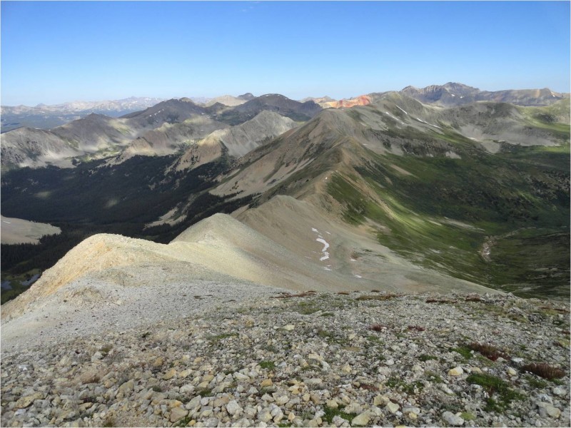 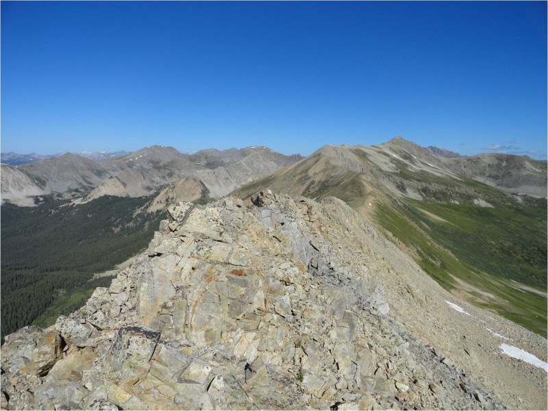 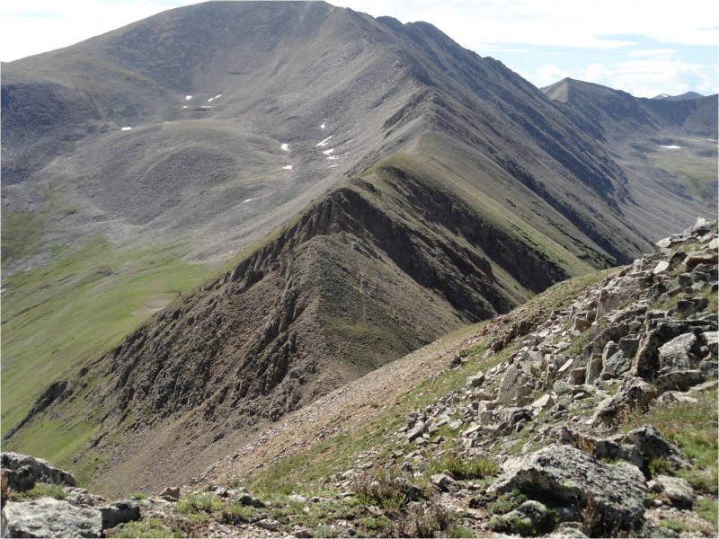 The summit of Lake Fork Peak also has beautiful views. The benchmark on the summit would have us believe that the summit is only 13,318', but it felt to me like a solid 13,322'. 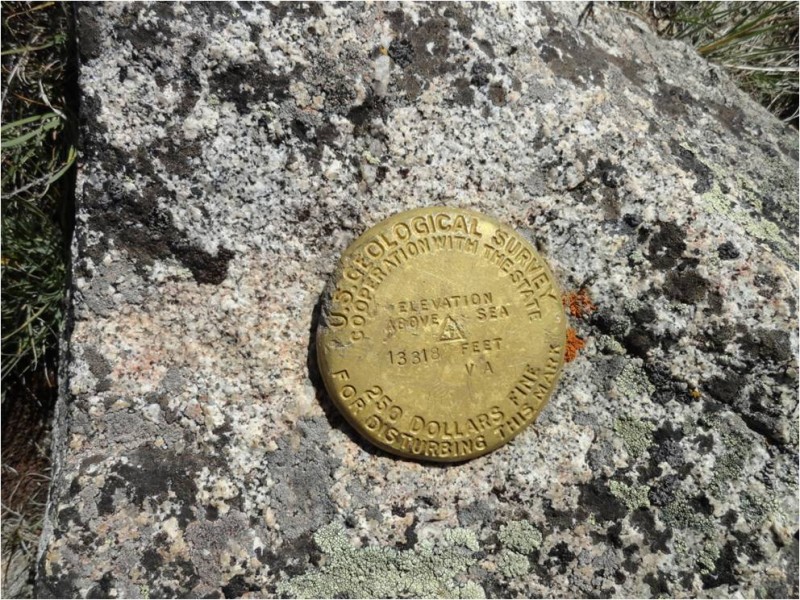 I considered heading down the west face to Lake Pass and then bushwhacking over to Middle Mtn. But the slope looked miserable (like bowling balls stacked at the angle of repose) and I couldn't see any reasonable path through the willows, so I decided to forego the suffer-fest. I dropped a few hundred(?) feet back down the south ridge, and cut east down very reasonable grass and talus slopes. I had to skirt some minor cliffs and pick my way around/through some willows, but nothing of particular note. I rejoined the barely discernible trail in Sayres Gulch just below 11,400', and enjoyed a leisurely hike back to the car. The battery on my 'fully charged' Garmin Forerunner died (it's old ... finally motivated me to replace the darn thing), so I can only estimate the total RT distance, but I'd put it at just under 12 miles (and 3800' of gain). For reference, my timeline was just over 2.5 hours from the TH to the first summit, on second summit before the 4.5 hour mark, and just under 7 hours car to carâ¦not racing. Bottom line is that these two peaks combine comfortably ⦠in case anyone else ever wants to combine them. Thumbnails for uploaded photos (click to open slideshow):
|
| Comments or Questions |
|---|
|
|
Caution: The information contained in this report may not be accurate and should not be the only resource used in preparation for your climb. Failure to have the necessary experience, physical conditioning, supplies or equipment can result in injury or death. 14ers.com and the author(s) of this report provide no warranties, either express or implied, that the information provided is accurate or reliable. By using the information provided, you agree to indemnify and hold harmless 14ers.com and the report author(s) with respect to any claims and demands against them, including any attorney fees and expenses. Please read the 14ers.com Safety and Disclaimer pages for more information.
Please respect private property: 14ers.com supports the rights of private landowners to determine how and by whom their land will be used. In Colorado, it is your responsibility to determine if land is private and to obtain the appropriate permission before entering the property.

