| Report Type | Full |
| Peak(s) |
Mount Karamatsu - 8845 |
| Date Posted | 08/15/2017 |
| Date Climbed | 08/10/2017 |
| Author | nyker |
| Japan Alps 1 - Mount Karamatsu |
|---|
|
A week in the Japan Alps Rising steeply and immediately from the rice fields and green valleys, the mountains of the Northern Japan Alps are impressive for their ruggedness and aggressiveness. Out of the rich dense green forests rise stunning alpine peaks often with sharp jagged summits. Located in the Nagano Prefecture in western Japan, for most of the year they are caked in white as the region receives a prodigious amount of snow, but for a brief period in summer, the melting snows give rise to a verdant landscape so green it looks photoshopped. Though this view is only possible when the frequent clouds and rain are absent. 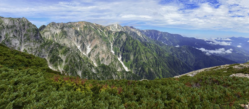 When thinking about mountains in Japan most people think of the venerable Mount Fuji with few other peaks if any coming to mind. A Mount Fuji climb is a great experience and unique adventure on a mountain that culturally significant landmark in Japan. However, beyond the sprawling cities, the land of the rising sun is a land of mountains quite similar in terrain as you'd find in the Southern Alps of New Zealand or indeed the Rockies in the U.S. Mountains are revered in Japan perhaps more so than we love our mountains in the U.S. Figuring prominently in Shinto, mountains have always been the home of the gods and as such to be treated as sacred and with the highest respect. After not being able to take any vacation all year and with many days of business travel, I was badly in need of seeing some mountains and since in the area, I hoped a week in the Japan Alps would fit the bill. After a half of a day travel from Tokyo using a combination of subway/bus/train and liberal use of the Google Translate app draining my phone's battery, I was in the mountains. The Climb From the first day I left Tokyo it rained nonstop and I was getting pretty bummed out thinking I'd never step foot in nor actually see the mountains I came for. As luck would have it, a typhoon hit Japan just as I arrived. After getting up early each day and then waiting three days for the residual effects of Typhoon Noru and associated rain to stop, there was finally a short weather window on Thursday morning and I was ready to go as early as needed. This was the clearest it got for the first three days with a whiteout from a few hundred meters up. 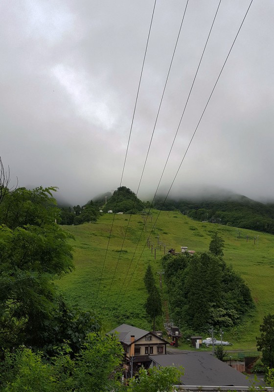 This trip was somewhat difficult to plan since there is little "meaningful" information in English about these peaks in sufficient detail to comfortably plan a trip similar to the ease with which a trip to Colorado, the Sierras or the Cascades could be planned. There were plenty of bilingual guides available, but I didn't want to use a guide, nor pay for one and wanted the freedom to explore the peaks at my own pace even though this would be a bit more troublesome. Given the lack of detail and confusing/contradicting information I received from speaking with folks, I figured I'd start with a peak located closer to town and more straightforward to get to. This seemed to be Mount Karamatsu. Elevation gain would be roughly +3,000 vertical ft and mileage ~8 miles. Karamatsu is all but invisible for most of the approach hike and is only seen once you hike for two hours up and then surmount the false summit. You can see just the tip of Karamatsu in the peak identifier sign in the photo below, just peaking out on the far left: 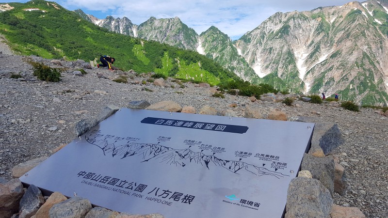 The other peaks visible on the route up are the three famous peaks of Hakuba  The key to climbing these peaks is to organize transportation and know what options exist since many trailheads are only reachable via gondalas or ski lifts with no trails leading up before then, so this limits what you can do in a day since most of these lifts don't start operating until 6:30am or 7:00am, fairly late for getting an alpine start. Due to the terrain and low starting points, these mountains seem to climb higher than their elevation suggest they might. Karamatsu-dake has an elevation of just under 2,700m, (~8,850ft), though from the scenery, weather and surroundings you'll feel like you're on a peak much higher. This is one of the easier peaks to plan to do in one day, though you still need to plan to start when the gondala starts located in Happo village (reachable by bus or train from Tokyo). You'll need to take a gondola and two ski lifts to the starting trailhead. Unfortunately, the first shuttle up starts at 7:00am and the last one down is 4:30pm, so that is your window to hike and climb if you are doing this as a day hike and you're not staying up in one of the mountain huts (where you need advance reservations). Hiking mountains is popular in Japan and you will likely not be alone at the start or at the gondola stations. Everyone was pretty well outfitted (or over outfitted). At the gondola station  Heading up the lift 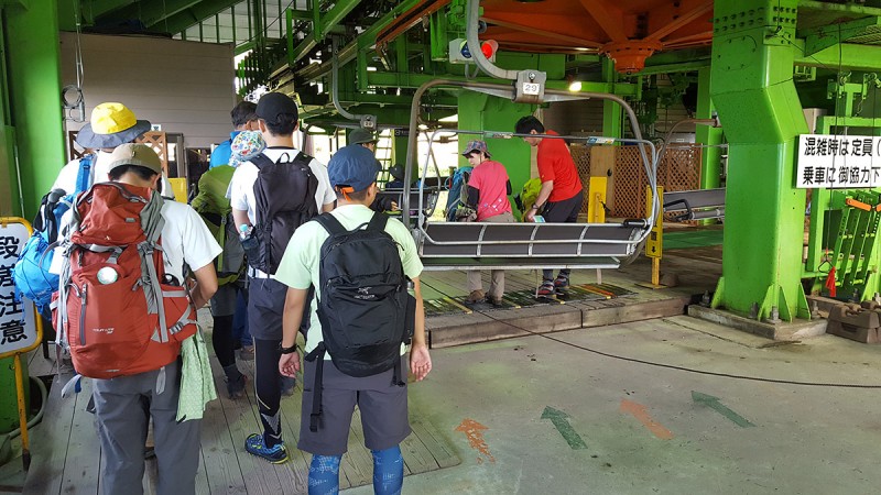 When I asked around for a way to just start hiking from the base, I got many perplexed looks and many said it "just wasn't done", or you're not allowed, with one person telling me that local "authorities" will actually stop you and make you come down. In the gondola car heading up  Climbing up goes in and out of a forest, mostly on a trail 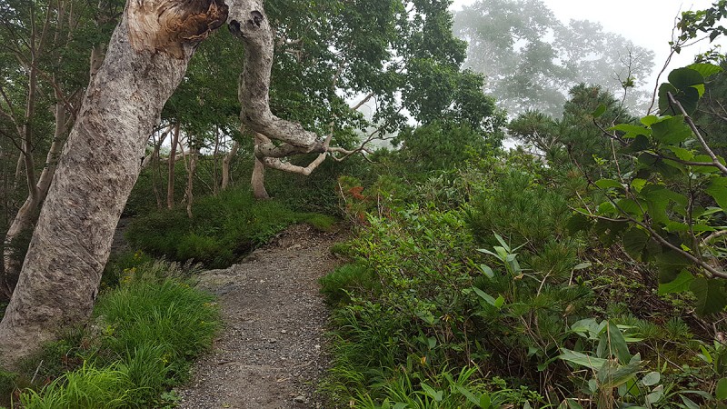 Trees bent over dominate certain sections of forest and coupled with the fog, makes for a surreal setting. These trees are called "umabuna" trees due to their deformed shapes from the weight of winter snow.  Shortly after starting up, you'll come across three large cairns on the approach hike up, this is the first one. 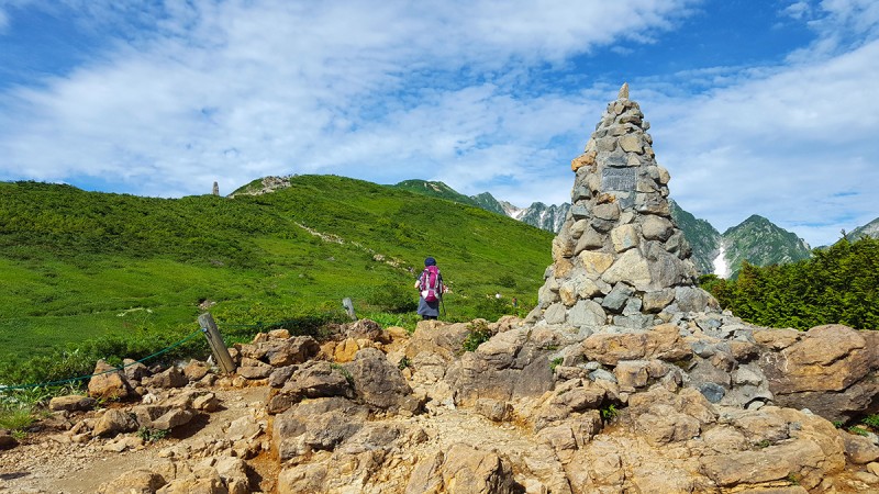 In a dramatic moment, the mountains unfold in front of you. Boardwalks were there to protect the fragile alpine plants and to help prevent erosion. I had to stop here and just take it in. This is what I came for. 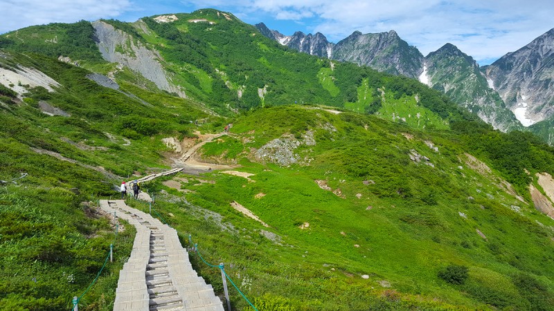  After a short distance up, you'll see a turn off to the right, which leads to a beautiful picturesque lake which if calm will reveal a nice scene of the sharp mountains reflecting in the water. This side trip takes 20-30 minutes depends on which route and how long you want to stay there so keep that in mind if you're in a rush to make the last lift down. I was lucky to see this as when I came back down it was cloaked in fog and cloud. 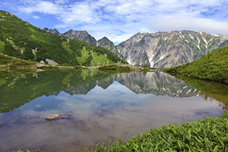 The surrounding green mountains rise above the clouds, snow starts to appear as you climb higher. You also enter brief tracts of forest as you climb up. 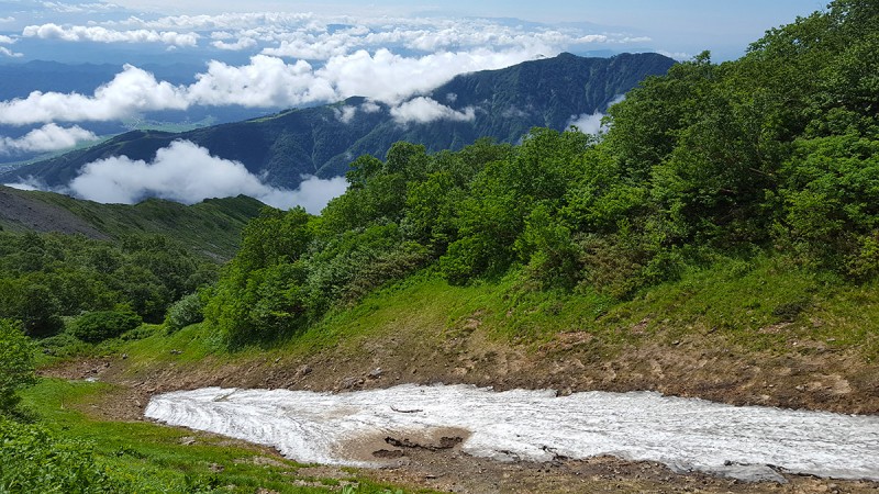  Most of this route is easily marked on a class 1 /2 trail with some light scrambling here and there, similar to a class 2 route on a typical Sawatch peak: 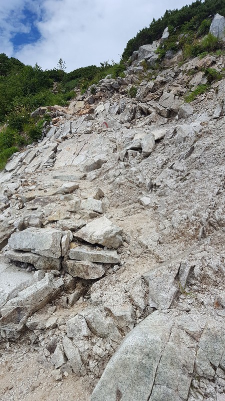 As in many routes in Japan, on sketchier sections, you'll find chains to support hikers and climbers, so you'll get a bit of air here: 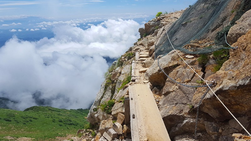 As you hike up higher, you get a better view of the mountains around you, and reminded me of the colors of the San Juan Mountains in summer. Wildflowers also filled many of the meadows. 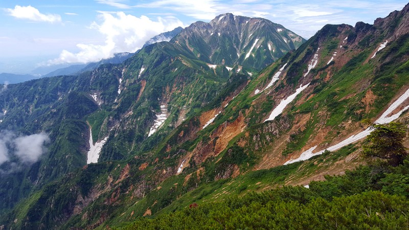 The main peak in the photo above is Goryudake, also reached by this same approach, but takes another 5-6hrs roundtrip to the T junction where this approach tops out ①so I'm not sure if this would be doable in a day while being able to make the last lift down and might require a stay in the hut nearby. While commonplace in the U.S., "out and back" peak bagging in daytrips from the trailhead is not that popular in Japan and the vast majority of hikers will be staying at any of the numerous huts on the mountains, often for multiple nights and then base their climbs from there. What this means is that you need to get a better understanding of elevation gain, round-trip miles and terrain before planning a one day ascent. Most available details on climbing peaks is geared towards multiple night stays at huts and as such most climbers you'll run into are carrying overnight gear in 80L packs. This was the main frustration of planning day ascents and climbs of the mountains here. The route continues on a nice trail lower down, note the clouds increasing 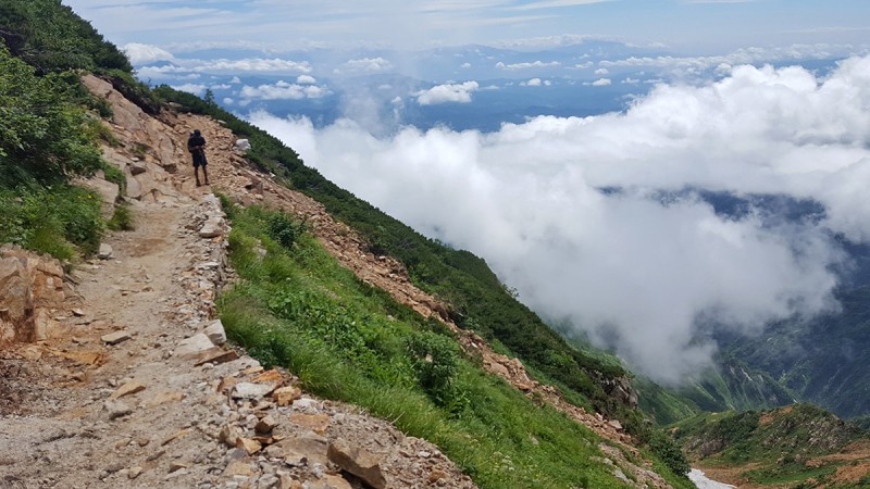 The views of the surrounding peaks gets better as you get higher, provided the clouds stay at bay  A look into the valley below reveals some decent amount of snow, and what imagine might be good Spring couloir climbing if you're able to start down there and be here earlier in the season. Note that now, however the snow higher up has some significant cracks, so not the best time to do a snow climb here. 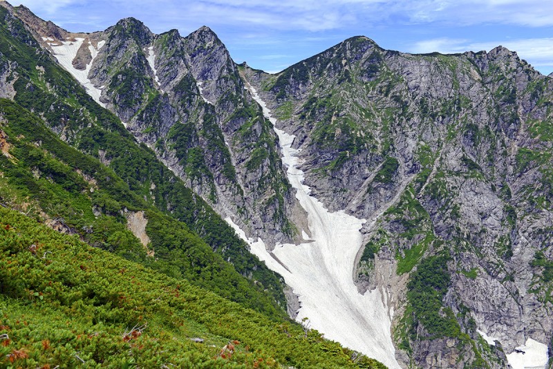 A break in the trail reveals a great rest spot with a marker 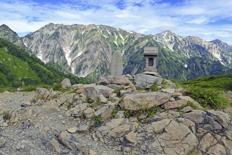 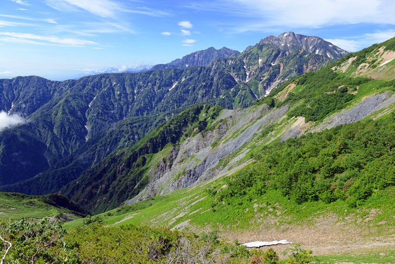  The false summit is soon encountered, which is reached by a trail skirting the edges of the top then over the top; The true summit still cannot be seen from here... 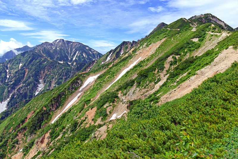 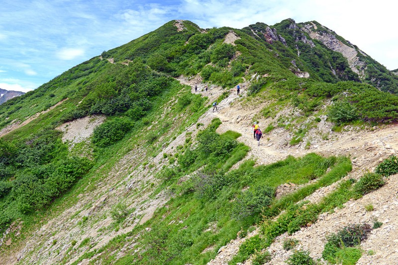 A plateau is reached after climbing up and over the false summit and is a good place for a break if needed. The true summit can finally be seen now and is only a short 20-30 minutes away on a mild slope up.  Getting closer⦠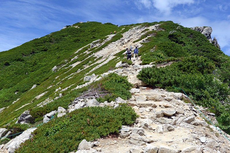 A look from above back on the higher route and the large mountain hut located at the T-junction and ridgeline where several other peaks can be reached on a multi-day trip going the other two directions (right and left from this viewpoint) Two climbers taking their selfies. The trail zigzagging up from the bottom is another approach. 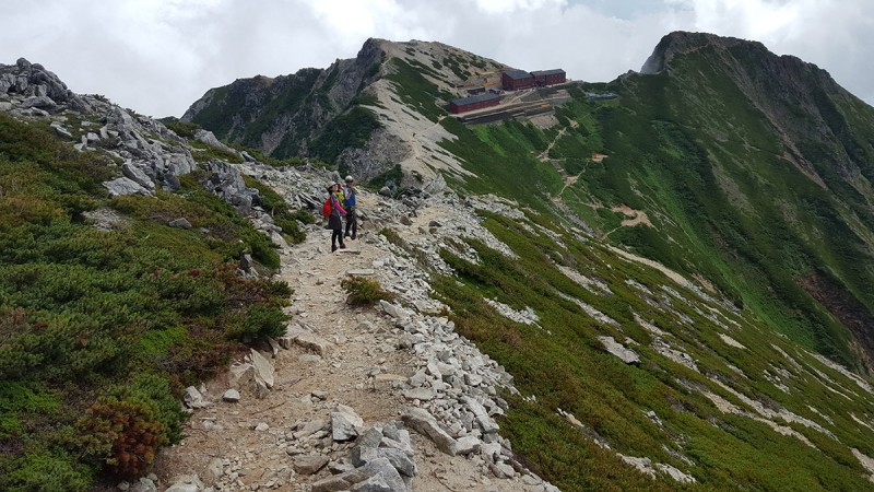 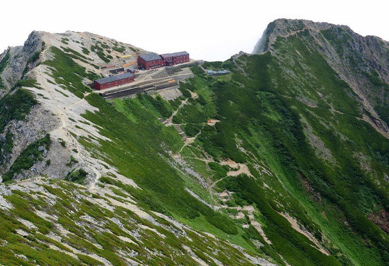 Finally the summit is reached! Two marked posts mark the true summit on the mountain 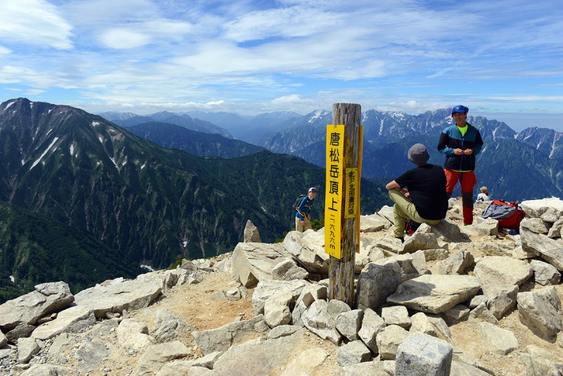 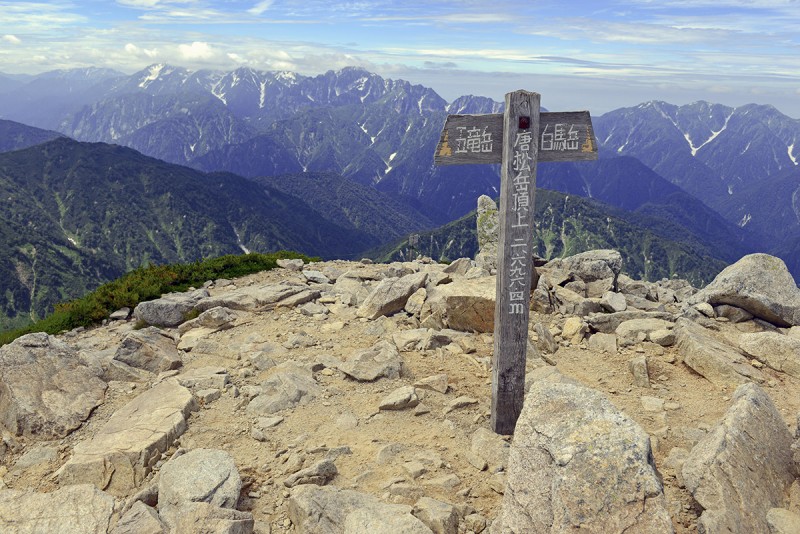 The views from the top especially while the sky was clear before weather moved in was fantastic.  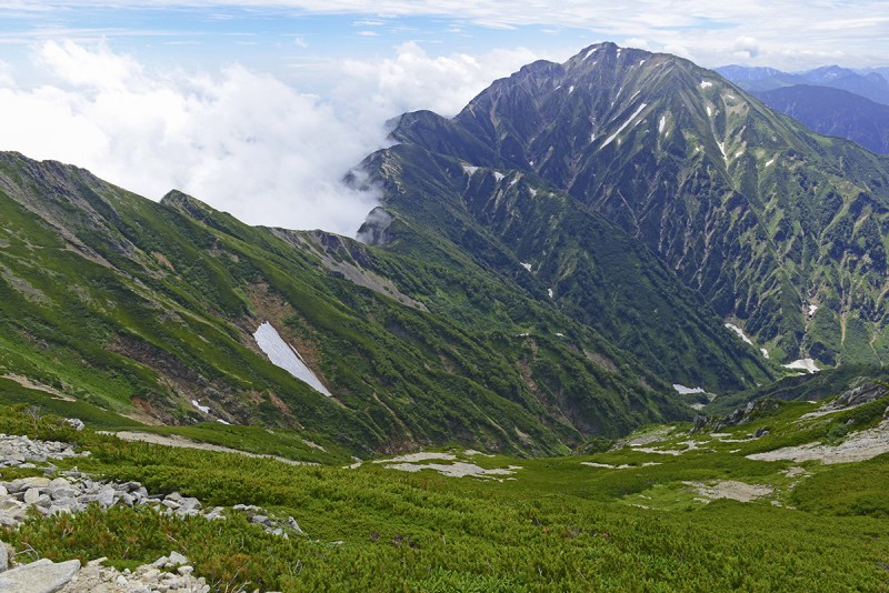 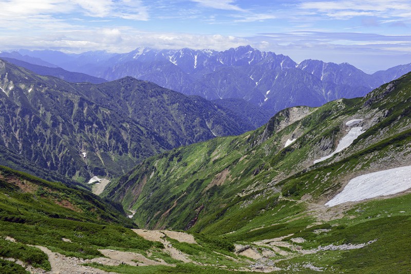 Had to keep the tradition of a Summit Snickers on top...Japanese style! 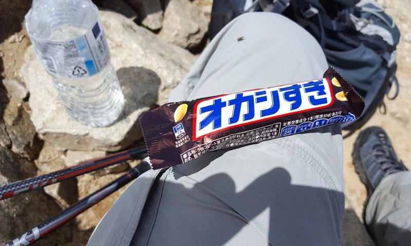 Clouds moving in 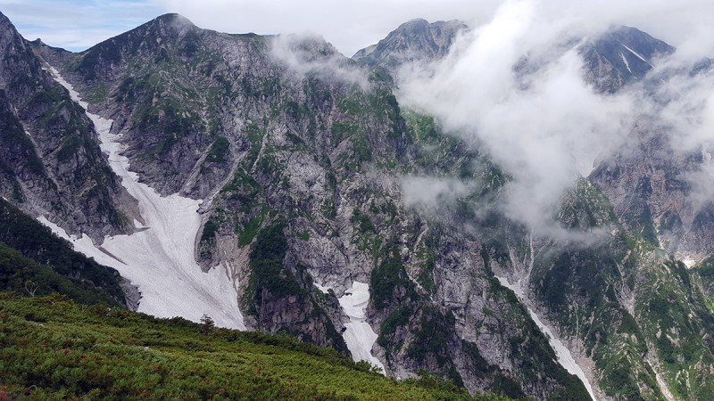 Whiteout moving in within 20 minutes after coming down from the summit which would continue the rest of the week 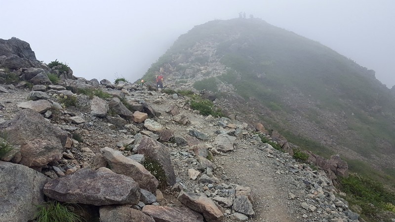 This would be the view for the rest of the day 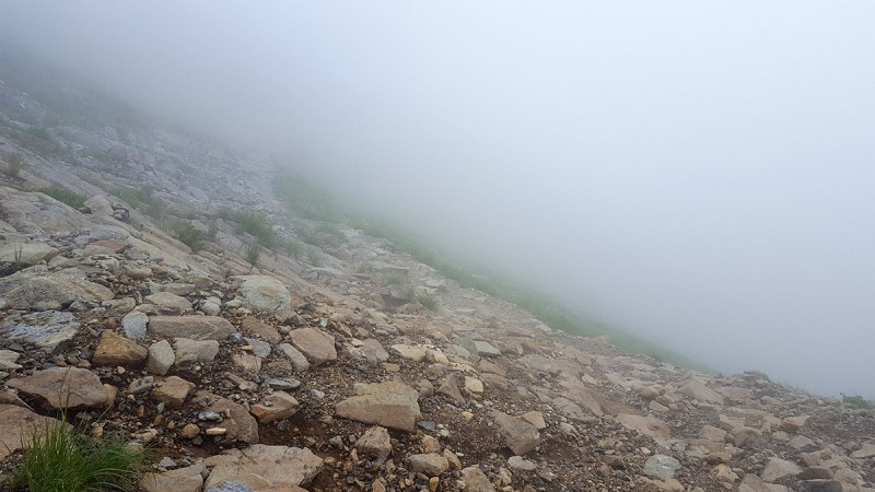 Despite being located across the world and was not easy to organize, I felt at home here hiking and climbing up the Mountains of Japan and I'm sure anyone who loves the 14ers in Colorado will feel the same if you could manage some uncertainty in your trip planning. Another unique thing about this area is that unlike Fuji san, where you'll likely run into people from a dozen countries, virtually all the hikers and climbers I saw and met were local Japanese. Back in town a view of the foothills under the peak with a ricefield in the foreground 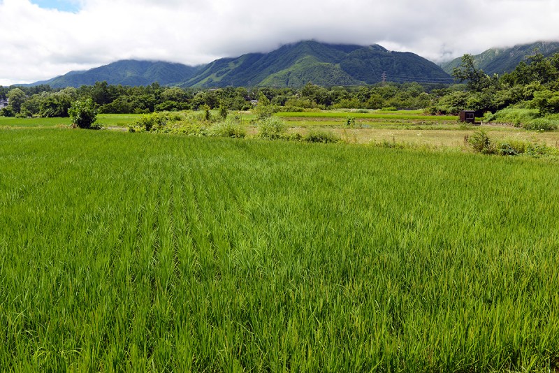 Climbing two peaks I realized I only scratched the surface of what's to see and do in the Japan Alps and I'll be back⦠I'd highly recommend this area for anyone looking for a great trip or certainly if in the region and in need of fresh air. Thumbnails for uploaded photos (click to open slideshow):
|
| Comments or Questions | ||||||
|---|---|---|---|---|---|---|
|
Caution: The information contained in this report may not be accurate and should not be the only resource used in preparation for your climb. Failure to have the necessary experience, physical conditioning, supplies or equipment can result in injury or death. 14ers.com and the author(s) of this report provide no warranties, either express or implied, that the information provided is accurate or reliable. By using the information provided, you agree to indemnify and hold harmless 14ers.com and the report author(s) with respect to any claims and demands against them, including any attorney fees and expenses. Please read the 14ers.com Safety and Disclaimer pages for more information.
Please respect private property: 14ers.com supports the rights of private landowners to determine how and by whom their land will be used. In Colorado, it is your responsibility to determine if land is private and to obtain the appropriate permission before entering the property.


