Download Agreement, Release, and Acknowledgement of Risk:
You (the person requesting this file download) fully understand mountain climbing ("Activity") involves risks and dangers of serious bodily injury, including permanent disability, paralysis, and death ("Risks") and you fully accept and assume all such risks and all responsibility for losses, costs, and damages you incur as a result of your participation in this Activity.
You acknowledge that information in the file you have chosen to download may not be accurate and may contain errors. You agree to assume all risks when using this information and agree to release and discharge 14ers.com, 14ers Inc. and the author(s) of such information (collectively, the "Released Parties").
You hereby discharge the Released Parties from all damages, actions, claims and liabilities of any nature, specifically including, but not limited to, damages, actions, claims and liabilities arising from or related to the negligence of the Released Parties. You further agree to indemnify, hold harmless and defend 14ers.com, 14ers Inc. and each of the other Released Parties from and against any loss, damage, liability and expense, including costs and attorney fees, incurred by 14ers.com, 14ers Inc. or any of the other Released Parties as a result of you using information provided on the 14ers.com or 14ers Inc. websites.
You have read this agreement, fully understand its terms and intend it to be a complete and unconditional release of all liability to the greatest extent allowed by law and agree that if any portion of this agreement is held to be invalid the balance, notwithstanding, shall continue in full force and effect.
By clicking "OK" you agree to these terms. If you DO NOT agree, click "Cancel"...
Going solo this trip, I started from the Silver Dollar Lake Trailhead, accessed via Guanella Pass. Parked in the lot immediately to the right, although plenty of people go up the quarter mile or so to the trail.
Start: 6:30 a.m.
Summit: 9:25 a.m.
Back to car: 11:30 a.m.
~7.5-8mi., round trip (estimated based on my imperfect GPS track.) Track you see below was hand drawn, which I used to guide me up the peak, even though the way there was obvious/intuitive.
Last year, I summited Square Top and Wilcox on separate trips, so it was time to come back and tackle Argentine. There are a variety of ways to get there, but I really enjoy the Silver Dollar Lakes area, and opted to find my way up through there.
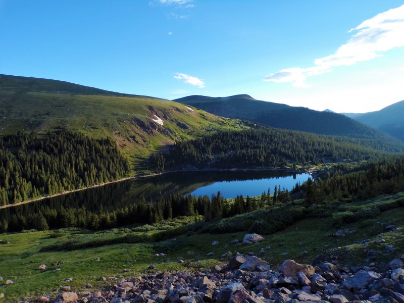
The route I took was quite straightforward: Follow the Silver Dollar Lake trail all the way up to the top lake, Murray Lake. The trail is well-defined up to here, as you might image, with these lakes being quite popular Front Range destinations.
Naylor Lake Silver Dollar Lake Murray Lake
Upon reaching Murray Lake, the trail peters out, as for the traditional user, final destination has been reached! I still have awhile and aways to go yet, though.
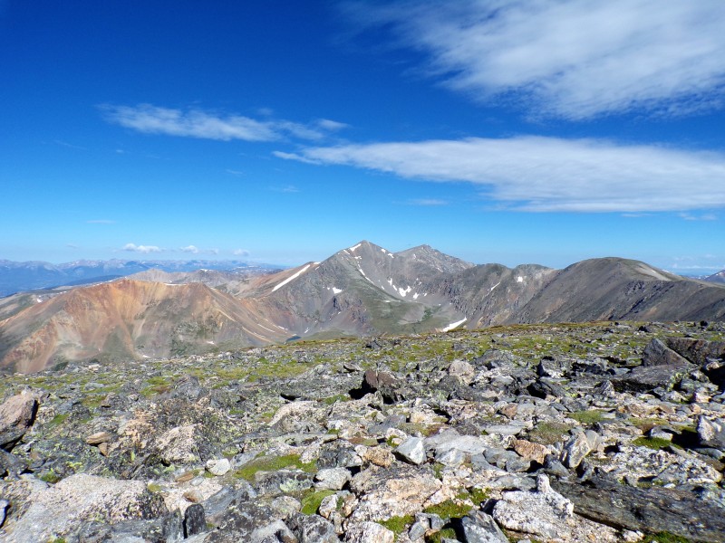
I took some time here to survey my planned route, and to scout out potential deviations from my plans. I understand quite a few people tackle Argentine from Square Top, and looking at the landscape, I could reasonably have worked towards the Square Top saddle from Murray Lake. My initial plan was to go from the Wilcox side, so even though mileage ultimately might have been more, I decided to stick with the original plan. Looking north from my vantage, I spied the familiar Wilcox, and forged on in that direction.
Wilcox
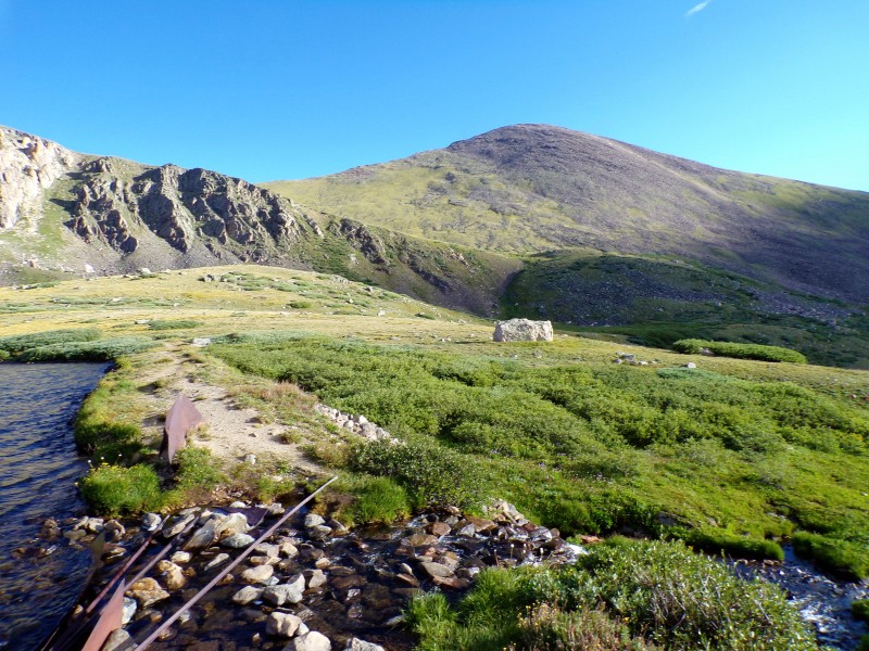
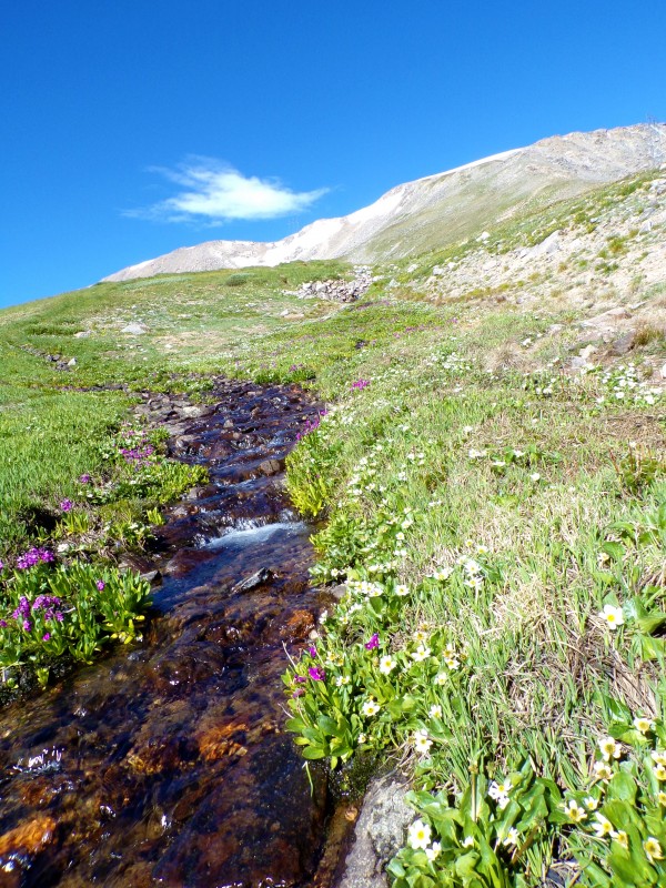
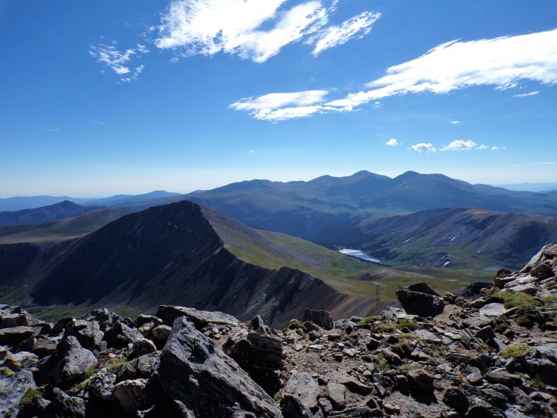
I headed towards the gully just right of center in this image. At the top of the gully, I started going just about due west. In the valley here there is an abundance of willows, and farther on past the willows is a trickling mountain stream. This stream pointed me in exactly the direction I wanted to go.
Follow the stream
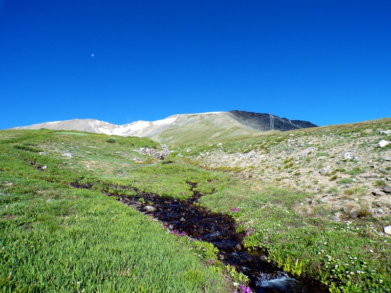
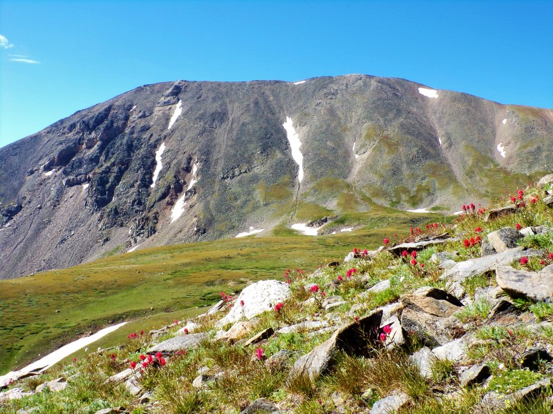
Views started to open up, and I was again treated to a visual of my target. I opted to stay a little lower than the ridge for most of my remaining ascent up Argentine.
At the top of the ridge, I turned due north for the remaining tenth of a mile or so to the summit proper.
Looking towards Argentine
Great views: Grays/Torreys, Wilcox, Square Top in the immediate vicinity. Grays/Torreys
I didn't spend too long at the summit, so started to meander down, enjoying expansive views and colorful wildflowers. Wilcox Wilcox/Square Top Square Top
I think this is a great alternative route for those not intending to get all 3 in the area in one go (like me, who summited Square Top and Wilcox at other times). Straightforward, fun, and scenic.
My GPS Tracks on Google Maps (made from a .GPX file upload):
Did you use a GPS device to record your tracks? Or did you just draw up lines on a map and save it in GPX format? The reason for asking such questions is because I noticed that your tracks did look very straight from point to point.
rpdawes, I think the RT was actually closer to 7.5-8 (edited my report to reflect that). Looking at my post-hike GPS track, it actually looks like it was closer to 3.9 one way, but I was meandering a bit, so definitely was somewhat inefficient with my route to start!
The GPS included here was hand-drawn pre-hike so I had something to follow on the way up. I used the maps.me app to keep me somewhat on track, although because it is quite intuitive once you get to Murray Lake, I didn't really refer to it much.
I think we ran into you and said a brief hello on the summit! Pleasant day, and much less windy than on Squaretop. Your route directly up Argentine looked like a very serene one.
Caution: The information contained in this report may not be accurate and should not be the only resource used in preparation for your climb. Failure to have the necessary experience, physical conditioning, supplies or equipment can result in injury or death. 14ers.com and the author(s) of this report provide no warranties, either express or implied, that the information provided is accurate or reliable. By using the information provided, you agree to indemnify and hold harmless 14ers.com and the report author(s) with respect to any claims and demands against them, including any attorney fees and expenses. Please read the 14ers.com Safety and Disclaimer pages for more information.
Please respect private property: 14ers.com supports the rights of private landowners to determine how and by whom their land will be used. In Colorado, it is your responsibility to determine if land is private and to obtain the appropriate permission before entering the property.