| Report Type | Full |
| Peak(s) |
Blanca Peak - 14,350 feet Ellingwood Point - 14,057 feet Little Bear Peak - 14,041 feet |
| Date Posted | 08/09/2017 |
| Modified | 08/10/2017 |
| Date Climbed | 07/29/2017 |
| Author | arianna2 |
| Blanca, Ellingwood, Little Bear Trio |
|---|
|
We decided to do some of the Sangre de Cristo range as a backpacking trip like we did for the Crestones. It works well for us to take a couple of nights to hike 3 peaks and get some fishing time in. Hats off to those who can do this all in one day. Never could I! It is so beautiful up at the high lakes so why not enjoy it for awhile. Here is the breakdown for the 3 day, 2 night trip. Hopefully I can include some information that is useful for someone. DAY 1-The road trip and fishing The weather report by the NOAA for this particular weekend was crappy. We pretty much decided to go anyway because in our experience, the weather reports are so generalized through this site and don't seem to be the most accurate for determining whether to climb or not. I checked out the forum to see what other people were saying and low and behold there was a thread, already a couple pages long, about this very topic. Thanks for the tip, whoever it was, on checking the mountain-forecast website (https://www.mountain-forecast.com). Maybe we were just fishing for any report that was better, but it definitely seemed like a more focal accurate report for where we were going. It turned out to be pretty close. We stayed in Alamosa, enjoying the perks of the indoors for one last night before heading out early. We wanted to beat the heat. We enjoyed driving on the Lake Como Road for about.... 30 seconds. Wowww, is what I was thinking as my body was being jolted every which way. I would agree with the river bed analogy someone recently reported. We had read quite a few different reports on how people parked at 8800 and as they walked up and looked back they felt they could have gone higher. We have a Jeep Grand Cherokee and figured it could maybe make it but we weren't sure if there was somewhere to turn around if it got too nasty and well, let's face it, I don't think I could have tolerated much more of the road anyway. We parked at about 8750 ft. We had also figured the hike was part of the fun of the trip anyway. The road actually does get better, in some ways, up to about 10,000 ft. There are certainly basketball, volleyball, watermelon (and whatever other fruit or ball) sized rocks but most were in the middle of the road. There would be some maneuvering you would have to do but it was at least better than all the jolting and jarring of the first part of the road. There are several places to park or turn around through the switch backs. There is also a couple of larger areas that the crawlers and other such jeeps would park. 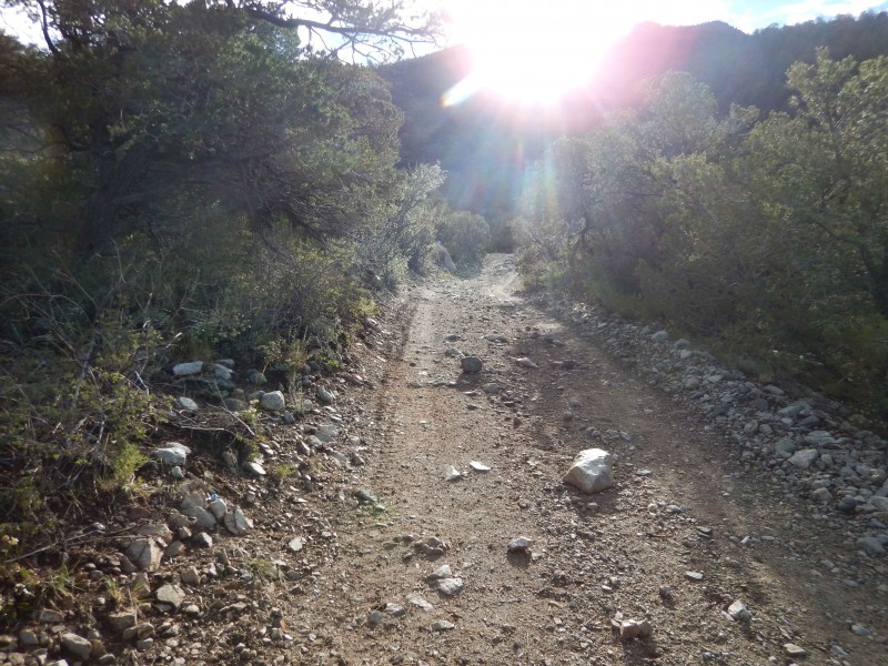 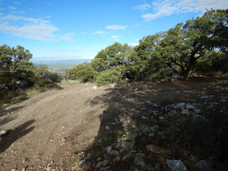 There is a final stopping point for the standard SUV's. I was hoping to see one of the crawlers having fun and luckily, one did come crawling past us. We played leap frog as we would catch up to them when they were high centered and getting the winch out. They would pass us again and then we would catch up when they were repairing something underneath it. Took us about 3.5 hours to get to the lake and set up camp. There are very nice camping sites around the lake and by the creek feeding it.  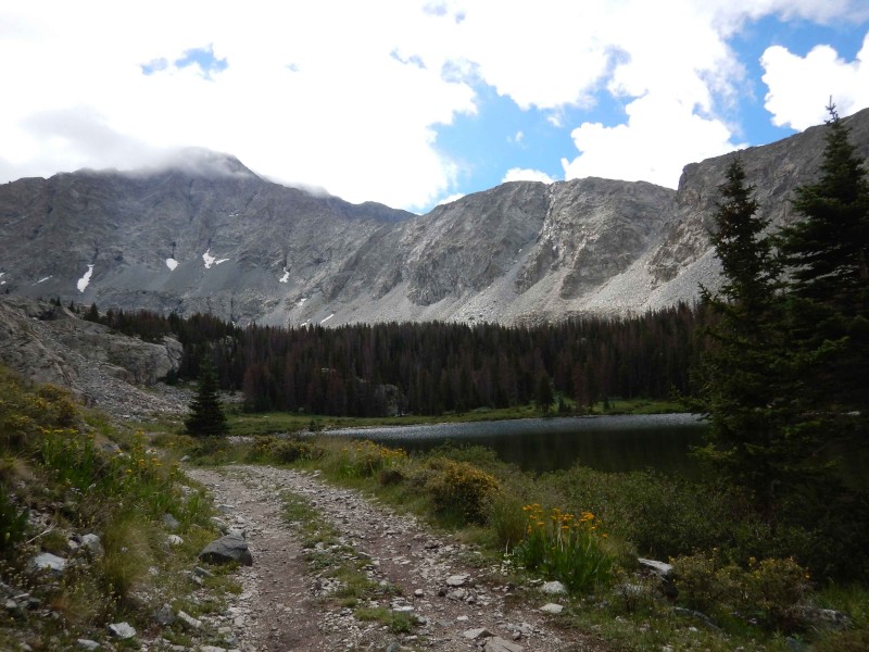 We spent the afternoon fishing. Nice cutthroat trout up higher. 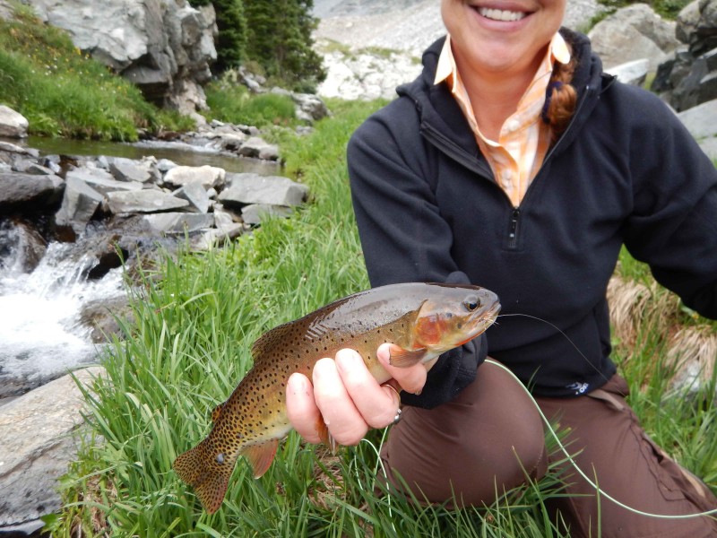 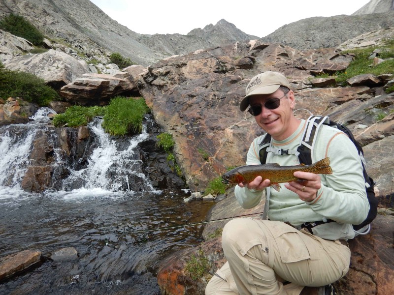 Back at camp we ate our dinners while the mosquitos ate theirs. They were out in full force most of this trip, the worst I have seen it at this elevation. 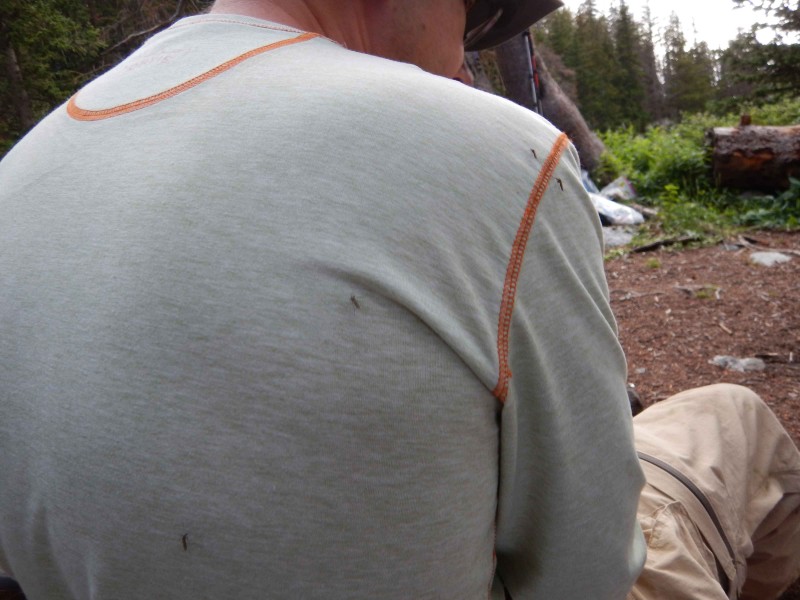 DAY 2- Blanca with traverse over to Ellingwood We started around 5am. The whole way up we watched and waited for the thin fog flying high through the valley and up on the mountain tops. We figured that it would burn off once the sun came up. Unfortunately, it never did burn off. It did move out of the way sometimes and we could actually get some sort of view. 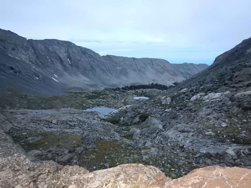 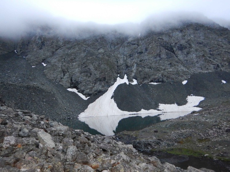 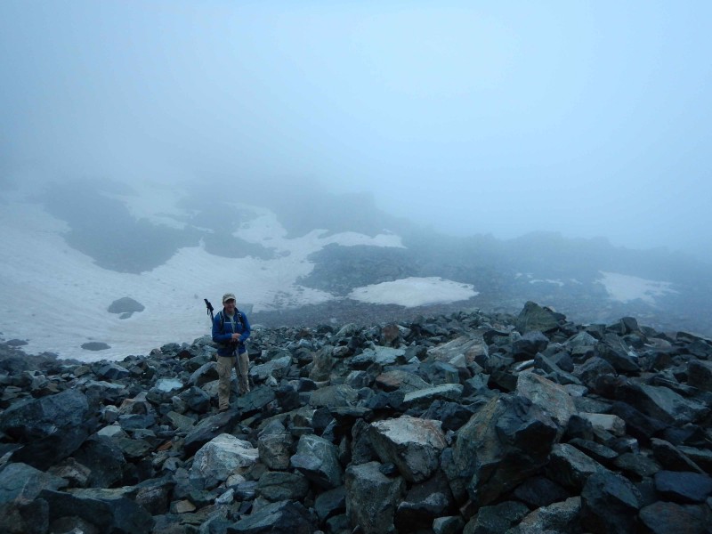 The ridge up to Blanca's summit is fairly well cairned and straight forward. A lot of rock hopping. There was some wind at the top and we had the worst view ever so we didn't stay on the summit longer than it took to take a couple pictures. It took us a little more than 3 hours to get there.  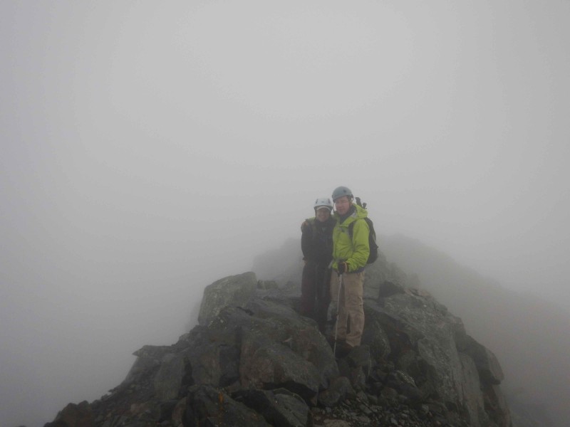 As we were coming back down the ridge we pondered whether it was safe to make our way over the traverse to Ellingwood. One group already started over, another group thought it was risky. The fog did not look threatening but who knew if it would turn into something or if it was hiding something else. It was only 8:30 so we decided to move on. I suppose that there was a couple areas of exposure on the traverse but we couldn't see much. It was quite fun getting across. It was very well cairned after the initial couple hundred feet from the huge cairn at the Blanca ridge. 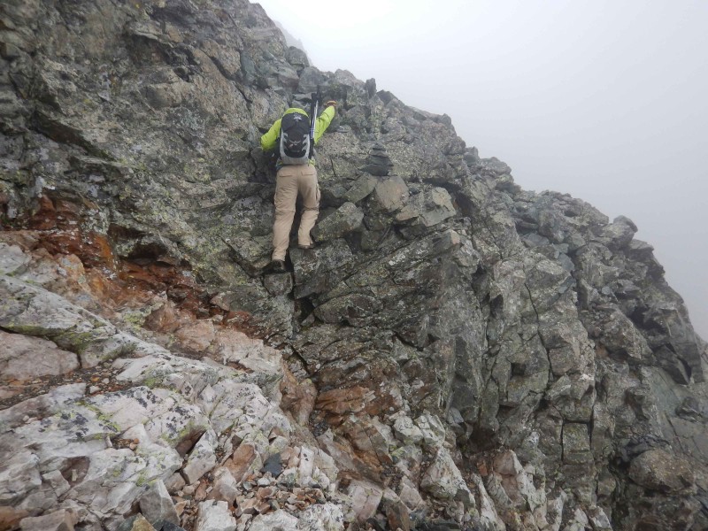 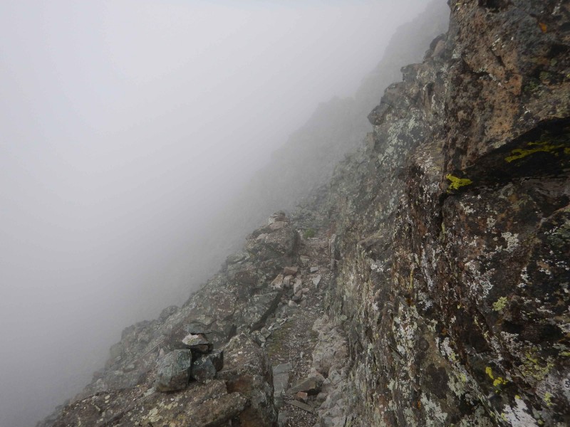 A couple hours and we were over on the Ellingwood summit. The fog moved aside for a little while to give much better views. 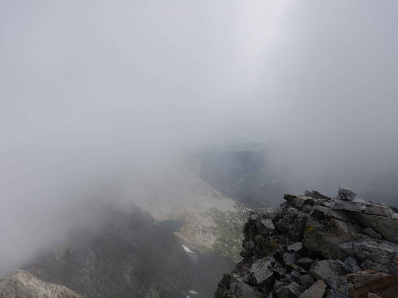 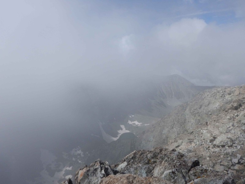  After eating and hanging out on the summit for a little while we finally headed down. We found the route pretty confusing. You can follow the wrong cairns at times as there are many paths you can take. I could see how it could be difficult to find the traverse route because you have to come down a ways and move over and see the right cairn. We actually happened upon it while we were thinking we were working our way down. We ultimately followed the standard route in general but it was hard to know that at the time. Another hour of rock hopping. Who knew there could be so many rocks in one place. 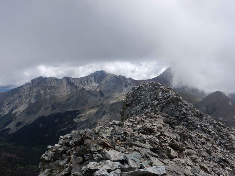 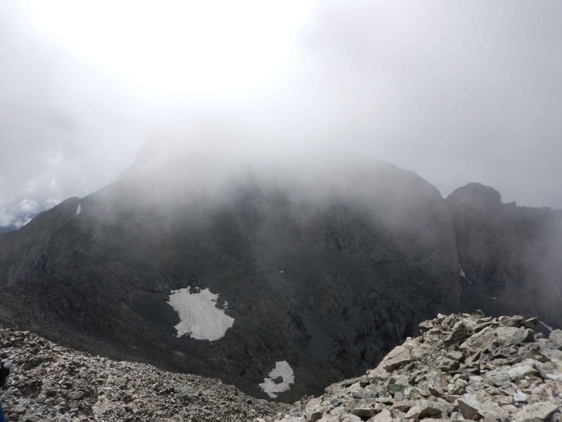 Once we got back to the main route we looked back up and you still can't see an exact route. We figured it is probably easier to find it going up rather than coming down. Doesn't matter, you know which general direction you need to go.  We had brought our fly rod to try out Crater Lake and the Blue Lakes again. A lot of nice sized fish in the lakes but they weren't real interested in biting. By about 2 that same fog that had been around all day had gotten thicker. The first few rain drops came down and we got out the rain coats and a short time later the thunder came and it poured so quickly that by the time we could set our packs down and get out and put on rain pants we were pretty well soaked. We got back to camp and took a nap while the rain fell. It finally subsided and we hung out a few clothes to dry. Not much luck with that but overall it wasn't a problem. Probably a good idea though to either have a waterproof pack or a dry sack in the pack for your extra clothes or layers you took off. While hanging out at the campsite, a couple people stopped by to see which mountain we were climbing the next day and so by the end of dinner we had a group of 5 meeting up to climb Little Bear together. DAY 3- Little Bear The gully was loose. The rain from yesterday helped to make the gravel/dirt areas a little more tacky. I used microspikes which I like to do on this kind of incline with loose gravel. I think it makes a big difference. We got to the ridge with a little more daylight and thankfully, no weather. For the next part, you guessed it, more rock hopping. 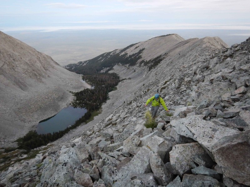 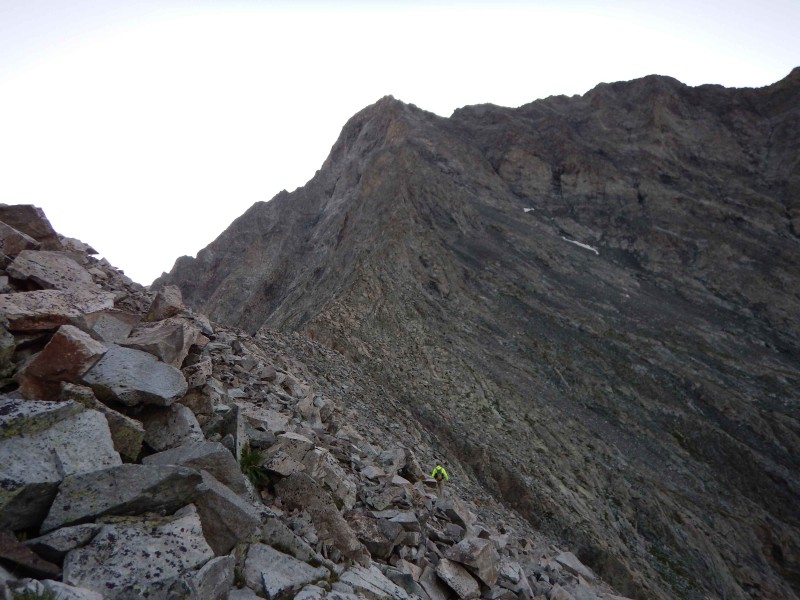 We finally made it to the bottom of the hourglass. There was a lot of water coming down the polished right side. We had to climb much more to the left due to the water on the rocks. It actually became pretty difficult pretty quickly. There were at least two spots that were vertical. One person turned around at that point. I wonder if the amount of water made more of our route more difficult than it needed to be. I am not sure but wonder if the right side would have been easier. For us, it would have been too slippery but we did have to come down closer to the water anyway. The rock is stable, except for all the little rocks on every ledge, but does require some climbing skills. If you haven't done rock climbing before, it might be a good idea to go to your local indoor rock climbing gym a time or two. Like I said, maybe it would have been a little easier if there wasn't as much water coming down. It was too intense to be able to take many pictures on our way up plus they turned out a little dark. 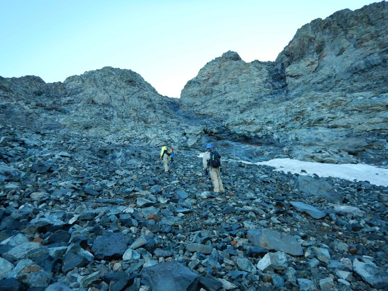 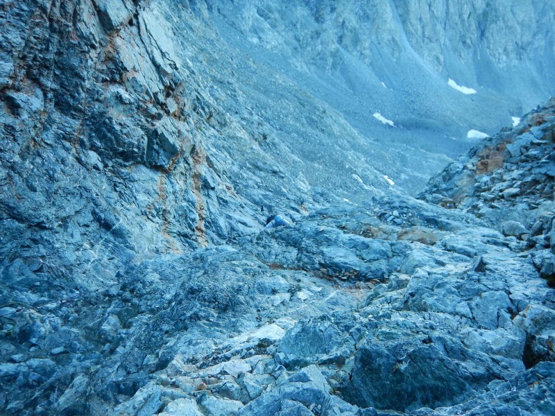 Above the hourglass is easier but still requires being very careful and looking closely for cairns. One big rock had a crack in it and a part of it just broke off in my hand. I was able to hold it and set it down before it fell down below me onto other people. You can make the route harder if you don't follow the cairn that gets you to cross over into another gully area. I should have taken a picture of it but I didn't. Just remember to look up on the ridges for cairns. 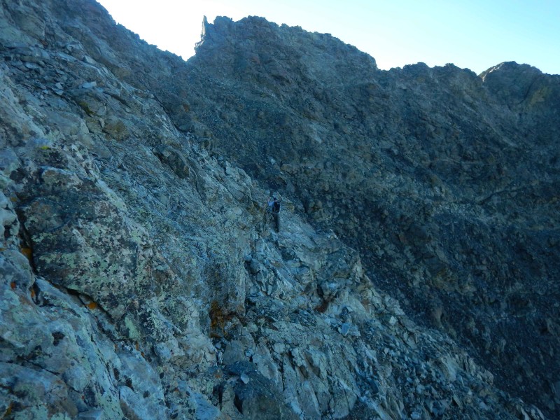 It took us about 3 hours to get to the summit and it was a beautiful blue bird day so far.  We were nervous about how going back down was going to be. Only one significant rock was bumped but it went right down the hourglass and got a few others going. No one was following us and this was why we joined up with the others to do this peak. You would rather hike with someone you don't know then have someone you don't know either a half hour ahead of you or a half hour behind you.  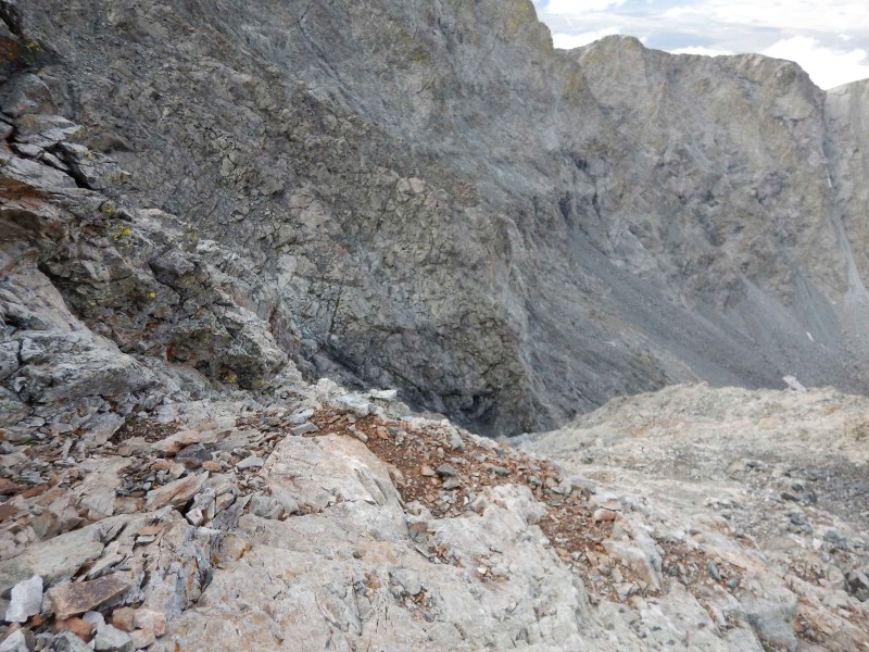 It was slow going getting back down the hourglass. You just have to take your time and find good hand holds. Because of those vertical sections we did come down closer to the rope. It sure looked new and was tempting to some of the group but probably just shouldn't be used. 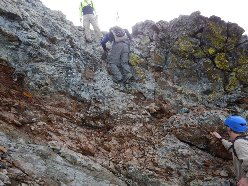 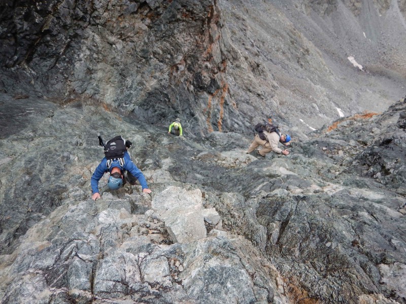 It took awhile to get across the mountain to the beloved loose gully. There are a few spots to have to climb over in this area but no exposure and is not difficult. It takes a good 3 hours though to get back down this peak.   Never necessarily a fun time taking down camp and strapping on that 30+ pound pack and hiking down 3000 feet but we did it and got back to Alamosa in time for a great Italian dinner at Bistro Rialto 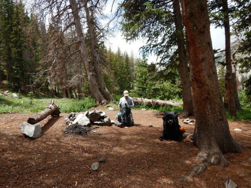 Thumbnails for uploaded photos (click to open slideshow):
")
|
| Comments or Questions | |||||||||
|---|---|---|---|---|---|---|---|---|---|
|
Caution: The information contained in this report may not be accurate and should not be the only resource used in preparation for your climb. Failure to have the necessary experience, physical conditioning, supplies or equipment can result in injury or death. 14ers.com and the author(s) of this report provide no warranties, either express or implied, that the information provided is accurate or reliable. By using the information provided, you agree to indemnify and hold harmless 14ers.com and the report author(s) with respect to any claims and demands against them, including any attorney fees and expenses. Please read the 14ers.com Safety and Disclaimer pages for more information.
Please respect private property: 14ers.com supports the rights of private landowners to determine how and by whom their land will be used. In Colorado, it is your responsibility to determine if land is private and to obtain the appropriate permission before entering the property.


