Download Agreement, Release, and Acknowledgement of Risk:
You (the person requesting this file download) fully understand mountain climbing ("Activity") involves risks and dangers of serious bodily injury, including permanent disability, paralysis, and death ("Risks") and you fully accept and assume all such risks and all responsibility for losses, costs, and damages you incur as a result of your participation in this Activity.
You acknowledge that information in the file you have chosen to download may not be accurate and may contain errors. You agree to assume all risks when using this information and agree to release and discharge 14ers.com, 14ers Inc. and the author(s) of such information (collectively, the "Released Parties").
You hereby discharge the Released Parties from all damages, actions, claims and liabilities of any nature, specifically including, but not limited to, damages, actions, claims and liabilities arising from or related to the negligence of the Released Parties. You further agree to indemnify, hold harmless and defend 14ers.com, 14ers Inc. and each of the other Released Parties from and against any loss, damage, liability and expense, including costs and attorney fees, incurred by 14ers.com, 14ers Inc. or any of the other Released Parties as a result of you using information provided on the 14ers.com or 14ers Inc. websites.
You have read this agreement, fully understand its terms and intend it to be a complete and unconditional release of all liability to the greatest extent allowed by law and agree that if any portion of this agreement is held to be invalid the balance, notwithstanding, shall continue in full force and effect.
By clicking "OK" you agree to these terms. If you DO NOT agree, click "Cancel"...
Geissler Mountain West (13,301 ft) Geissler Mountain East (13,380 ft)
Sunday, 9 July 2017
Route: Lost Man Loop Trail > Ascend to Saddle > Ascend Geissler West > Traverse to Geissler East > Descend Lost Man Loop Trail via pass
Distance: ~5.3 miles R/T
Gain: ~2500 feet
Ben and I needed something to do earlier in the month during a surge of monsoon moisture, so I suggested this pair of 13ers near Independence Pass, which have been on "the list" for a while. We met up at his place in Vail and then headed off to the trailhead to camp for the night. The early morning came quick, and it was a chilly one. Perhaps that was result of the high, exposed trailhead where we slept. We slept in for at least half an hour and took our time preparing for the day. We were worried about storms developing early, but the rising sun revealed a cloudless sky. With a somewhat small objective, we should be fine.
We departed from the 11,500' trailhead and started making our way up the Lost Man Loop trail. We passed by lone pine trees, small outcroppings of willows, and scattered wildflowers. The small wooden bridge across the Roaring Fork was broken in two, but remained easy to cross.
Alpenglow views.
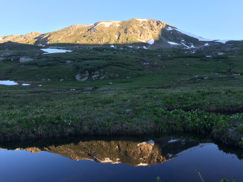
Reflections with Geissler Mountain West.
At about 12,200', we decided to leave the trail and head north-northwest toward the saddle between the two peaks. We crossed a bog, a mellow slope, and a talus field before making our way up the upper grassy slope to the 12,800' saddle.
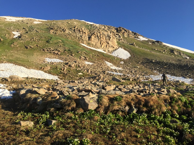
Shortly after leaving the trail to begin the cross-country portion.
Making our way up and to the right toward the saddle.
At the saddle, the view opened up. Williams Mountain is front and (almost) center.
Views to the back and a look from where we came (down and to the left).
Gaining the saddle revealed outstanding views northwest toward the Williams Mountain group. We ascended westward up the ridge through class 2 terrain with just a few instances of class 2+ scattered about. Upon reaching a bump (or a false summit), the true summit revealed itself just a minute's walk away.
Looking up the ridge to Geissler Mountain West.
View of the true summit from the false summit.
We lounged on the summit for a few minutes to enjoy the views and snap some photos. The sky was sill perfectly clear and blue on this beautiful summer morning.
Benlen himself.
Grizzly standing not too far away. Pretty sexy, huh, skiers and splitboarders?
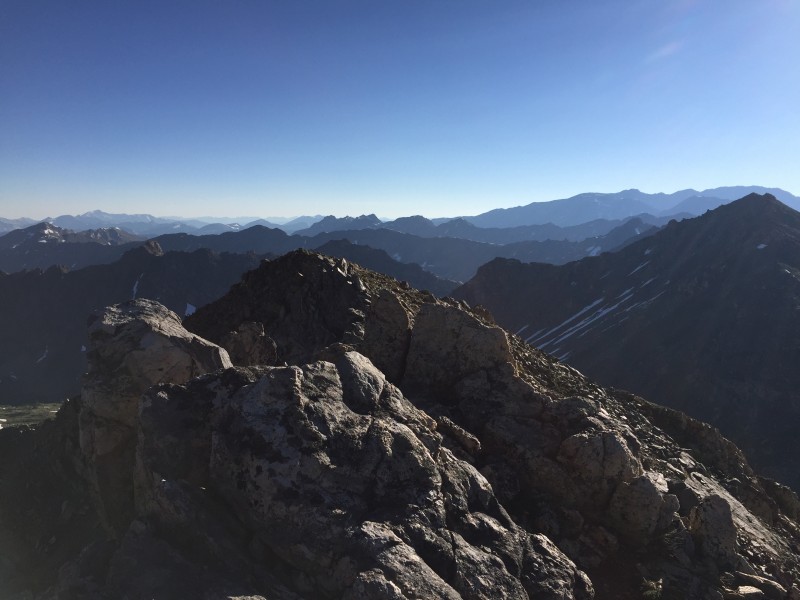
Ridge after ridge after ridge.
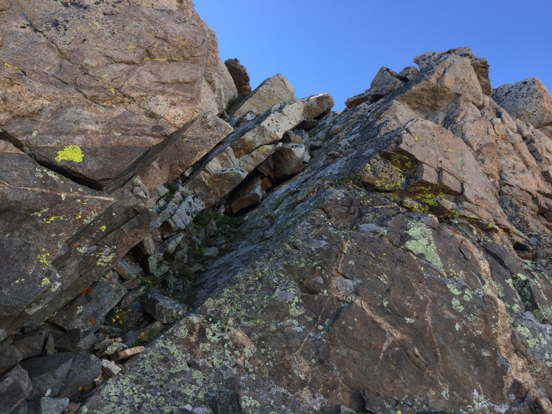
We departed the summit and went back down the ridge to the saddle, then immediately began the ascent up the eastern peak. This ridge can also be kept to class 2+ at the most, but we decided to have a little bit of fun and spice it up with just a couple squirts of class 3.
The start of Geissler East's west ridge.
Just a bit of spice. Mild.
Ben makes his way up the mild spice.
We knew about the false summits before starting this ridge. If I remember correctly, there were 4-5. However, if you know something is going to be a false summit before reaching it, is it truly a false summit?
Wonderful views during the "East west" - or "west East" - ridge ascent.
We reached the real summit not too long after starting up the ridge from the saddle, and this time took a while to appreciate the moment since the weather was being nothing short of spectacular. The views were outstanding in every direction, but in particular toward the Elks in the west. That is one fine mountain range.
Almost all-encompassing view from Geissler East.
After our summit break, we continued our eastward trajectory, which brought us down the east ridge of Geissler Mountain East. I'll say it one more time: east. There was actually a use trail to follow along most of the ridge down to the pass between Lost Man Lake and Independence Lake. We reached the Lost Man Loop trail at the top of the pass, which also happens to sit at around 12,800'. From there, we turned south to descend toward Independence Lake.
Lost Man Lake seen from the pass.
Independence Lake seen from just below the pass.
One interesting thing to note is that Lost Man Lake to the north was just about completely thawed out, while Independence Lake to the south was almost completely still covered in ice. Both lakes seemed to be at about the same elevation.
We hiked down the trail, skirting Independence Lake, passing our turnoff point a couple of hours prior, and continued toward the trailhead. The late morning yielded plenty of day hikers and a few trail runners out enjoying the day.
Making our way down the trail.
The Geisslers, in all their glory, from the Lost Man Loop trail.
Waterfall seen from near the trailhead on the descent.
It wasn't long before we arrived back at the trailhead and packed up. In all, the outing took us about 6 hours roundtrip. The Geisslers proved to be a perfect objective for when a shorter day may be necessary...or any time, for that matter. Thanks for reading!
~Tony
Thumbnails for uploaded photos (click to open slideshow):
I would add these peaks to my short list too, but my darn short list is already too long, LOL. Williams Group out there looks fun too. I need more off time!
... what Sunny1 wrote - your pics brought back some fond memories.
Caution: The information contained in this report may not be accurate and should not be the only resource used in preparation for your climb. Failure to have the necessary experience, physical conditioning, supplies or equipment can result in injury or death. 14ers.com and the author(s) of this report provide no warranties, either express or implied, that the information provided is accurate or reliable. By using the information provided, you agree to indemnify and hold harmless 14ers.com and the report author(s) with respect to any claims and demands against them, including any attorney fees and expenses. Please read the 14ers.com Safety and Disclaimer pages for more information.
Please respect private property: 14ers.com supports the rights of private landowners to determine how and by whom their land will be used. In Colorado, it is your responsibility to determine if land is private and to obtain the appropriate permission before entering the property.

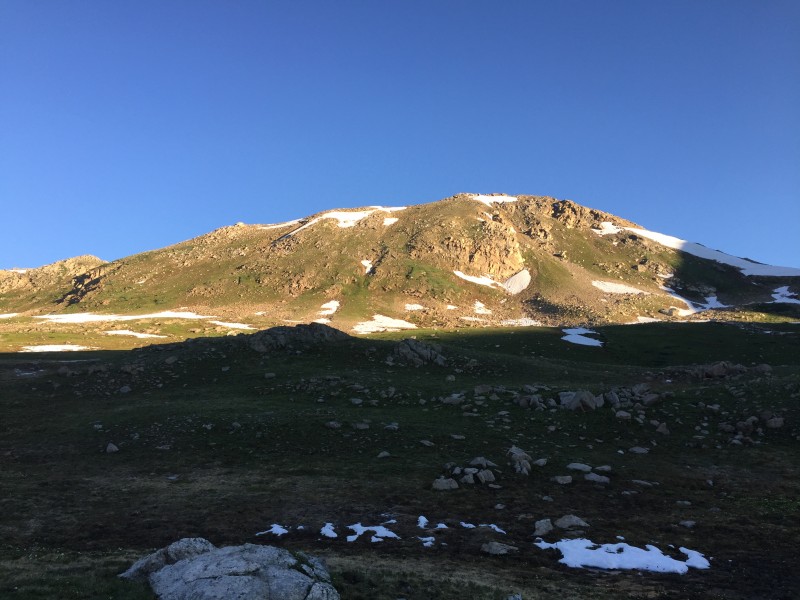


 Alpenglow views.")
 Reflections with Geissler Mountain West.")
 Shortly after leaving the trail to begin the cross-country portion.")
 Making our way up and to the right toward the saddle.")
 At the saddle, the view opened up. Williams Mountain is front and (almost) center.")
 Views to the back and a look from where we came (down and to the left).")
 Looking up the ridge to Geissler Mountain West.")
 Benlen himself.")
 Grizzly standing not too far away. Pretty sexy, huh, skiers and splitboarders?")
 Ridge after ridge after ridge.")
 The start of Geissler East's west ridge.")
 Just a bit of spice. Mild.")
 Ben makes his way up the mild spice.")
 Making our way down the trail.")
 Waterfall seen from near the trailhead on the descent.")


