| Report Type | Full |
| Peak(s) |
"T 0" - 13,739 feet Campbell Peak - 13,213 feet Silver Mountain - 13,473 feet "V 5" - 13,164 feet Boskoff Peak - 13,134 feet |
| Date Posted | 07/21/2017 |
| Date Climbed | 07/02/2017 |
| Author | Chicago Transplant |
| Hits and Misses in the San Juans |
|---|
Hits and Misses in the San JuansPeaks climbed (in chronological order) "Woods Peak" (13,123'): 548th Highest - 6/11/17 "V5" (13,156'): 518th Highest - 6/25/17 Silver Mountain B (13,470'): 274th Highest - 7/1/17 Campbell Peak (13,024'): not ranked - 7/2/17 "T0" (13,735'): 134th Highest - 7/2/17 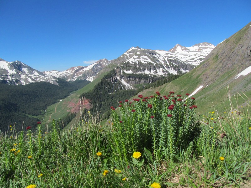 Introduction My girlfriend and I made a few trips to the San Juans over the last 6 weeks including skiing some repeats, climbing some new 12ers, and a few random 13er "orphan" pick ups. It seems in the game of chasing all of the 13ers in Colorado there are always a few that get missed, either because they didn't combine well with a neighbor (T0), or weather forced you off a ridge early and you had to leave them behind (Silver). Sometimes they are intentionally orphaned because you just don't want to combine them with their neighbors (Woods, South Lookout). I thought I would put a collection of a few short trip reports for some of those to highlight a few alternate routes that I thought others might find useful. Most were hits, one was a bit of a miss, but even misses can be useful information for people trying to plan an outing. Sometimes things that look good on a map work out great, and other times not as much, but we had a great time exploring all of these in their own rights. I hope some of you find this useful for your future outings, safe travels! Woods Peak: Southwest Ridge from Woods Lake (June 11, 2017) After skiing PT 13510B on the 10th, we were planning on skiing this guy's neighbor, 13540B. We just could not get a preview of the slopes to determine if there was enough snow to make it worth it, and the lower part of the route seemed like it would be a lot of ski carry from the little bit of recon we did do. Instead we decided on a plan B, and gave the skis a rest day to hike the Southwest Ridge of "Woods Peak". Having read other trip reports, it sounded like the ridge from "Woods Peak" to neighboring "Big Bear Peak" was loose, difficult route finding and just not an enjoyable experience. In a sense, we reverse orphaned Woods, knowing we did not want to run the combo. What we found was that the Southwest Ridge of "Woods Peak" is quite enjoyable, it may be the most enjoyable peak in the area actually as the ridge has the best rock I have found so far in the San Miguel Mountains and there is a nice trail approach. I'd even repeat this route. Most trip reports kind of gloss over "Woods Peak" and focus on the challenging traverse that ensues after, so I thought it would be nice to give a little more detail for this lovely peak. 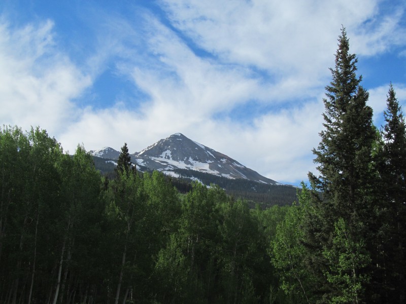 There is a good day use parking lot before the campground that accesses the trail, you can also use this as an access point to pack-in for the Wilson Group and Navajo Lake. The morning was a bit overcast, so my pictures are mostly from the hike out when the images were nicer. The early trail follows aspens and skirts the shoreline of Woods Lake where you get good views of the Middle-Dolores group, looks like some ski opportunities there! 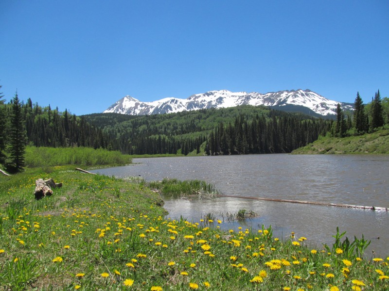 The trail was easy to follow and well signed at the junctions around the lake, the only tricky part for us was a switchback a couple of mile farther in that was snowed over, but older footprints and a nearby melted out patch got us on track pretty easily. Eventually the trail became completely snowed over near an old cabin, I think this was still below the Elk Creek trail turnoff. At this point we saw a glimpse of ridge through the trees beyond and just bushwhacked the snow straight for treeline. Here a snow covered slope blocked easy passage, but some drier terrain around the bottom let us skirt most of it on the left where we soon were in a snow-free meadow looking up at the ridge. A nice couloir appeared as well, oh well, the skis are in the car.  The ridge route:  We traversed grass slopes above the tongue of snow on the right side of the previous photo, but in full summer conditions, you would just be able to take the trail to the ridge crest at about 11,600' and avoid our steep sidehilling. From the ridge crest the early going was primarily grass, and was a mostly pleasant stroll, a strong wind being the only detractor for us. Around 12,400' the ridge steepened at a rocky step with some snow filled gullies. This section was a little tedious with some looser rocks, we went up to the left of all the snow. Overall, not bad and more stable than not.  Above that a short section of looser orange scree, but there were some hints of climbers trail here and it was better than it looks! The wind, however, was really getting annoying and we stopped for a break in a spot where we could get out of it. The good news was that the views of El Diente and Wilson were opening up nicely to our right (southeast) and you could see the still mostly frozen Navajo Lake far below. 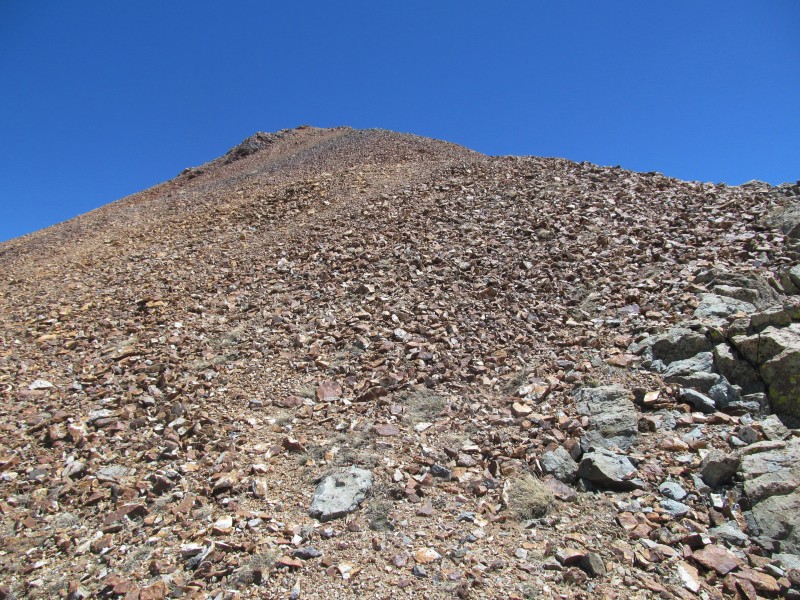 Wilson and El Diente:  Above the orange scree the rock transitioned to a lovely gray rock that was stable, with broken slabs that provided some fun class 2+ scrambling, including a neat little staircase like section. This part of the route was very enjoyable and is the main reason why this is my new favorite peak in the San Miguels. 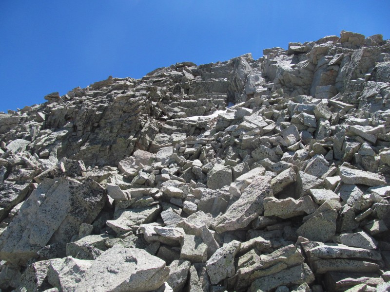 Upper ridge: 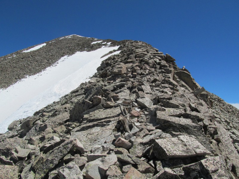 The other reason were some great views! Being at the western end of the range, there were some pretty long views to the northwest through southwest, and great views of the Wilsons and El Diente. We were not upset to be singling this peak out and abandoning "Big Bear". There is no easy way up that peak, but the route on the PT 13540 side is more reasonable than what we were looking at. Besides, more trips to the San Juans are better than less, right? 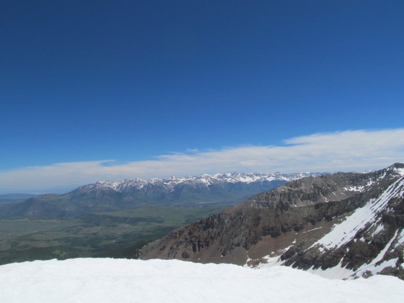 Big Bear Peak:  "V5": Southwest Face from Clear Lake Jeep Road (June 25, 2017) We officially hung up our skis the weekend before after a sun-cup fest on the Geisslers, so we decided to head back down to the San Juans for some hiking fun. We enjoyed a Saturday spent climbing some 12ers near Engineer Mountain (because who can resist climbing a peak named Jura Knob?), complete with some fantastic early season wildflowers. If you are looking for a wildflower hike, the slopes of Jura Knob from the Engineer Mountain trail deliver!  We found a nice little camping area between Molas Lake and Silverton in the shadows of the Grand Turk before heading down to the South Mineral Road in the morning for another reverse orphan. Not knowing how rough the Clear Lake road might have gotten, we thought splitting South Lookout and its complex route finding into its own future day would make the most sense given our likely longer approach. So we parked at the bottom of the Clear Lake road and started hiking aiming for "V5". Turns out the road is not too bad and I could have gotten up a pretty long way, maybe even all the way to the snow that was stopping traffic at the base of the upper switchbacks at 11,400'. The road wasn't terrible to hike, its just that it is a road and there is always something less interesting about hiking a road. At least there were some nice views into Ice Lake Basin to hold our attention! 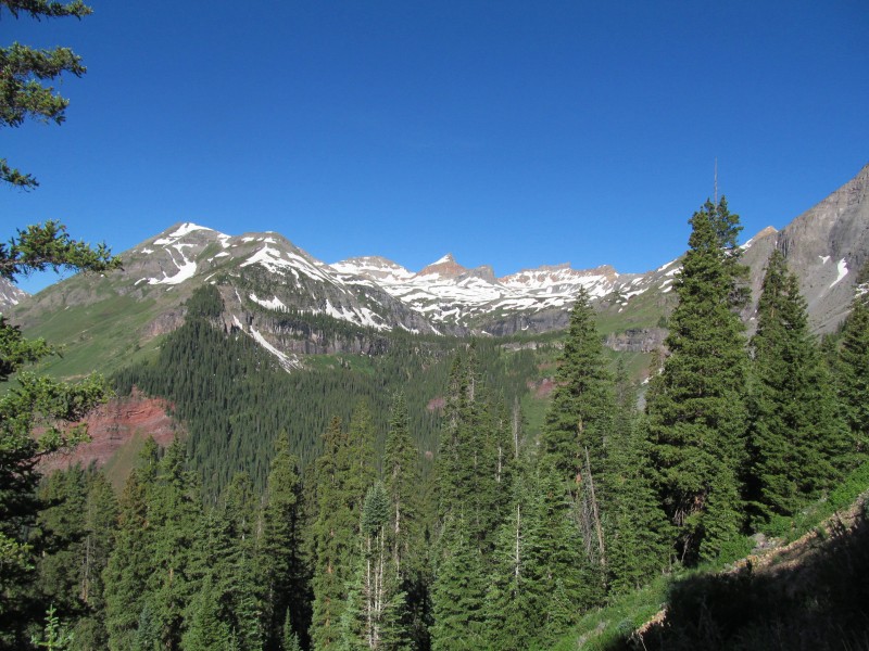 As we got further up the road the views of the south side of "V5" started to open up and we saw a long steep grass slope that went almost all the way to the ridge crest, with an old mining road criss-crossing it up high. We stayed on the main road past a few snow patches that stopped vehicular access to the lake at the time, and then tried to see if we could find the bottom of the upper abandoned road. We saw what we thought might be the start, but it was rocky and looked like it may have had a rock slide over it up higher, so we contoured back across toward the steep grass we had spied earlier and just went straight up for a bit.  There were some great wildflowers along this section (see photo 1) and despite being steep, the route was enjoyable. It certainly gained elevation quickly! As a reprieve from the steepness, when we hit the old abandoned road we took it for a bit, switchbacking up and across our ascent gully. We left the road where it crossed a ridge that went up to the main ridge crest of the peak. Along the road were more good wildflowers and the views back towards Ice Lakes basin and Clear Lake were spectacular. 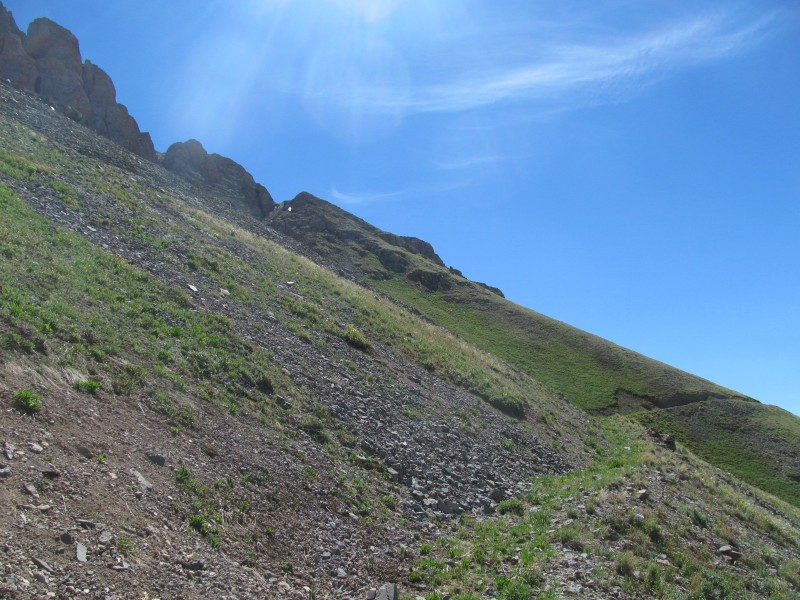 Clear Lake: 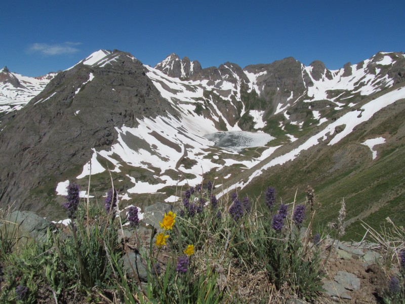 The ridge was steep, but the lower part was grassy and easy traveling, I think a lot of people descend this way to the old mining road and then traverse it back to Clear Lake when they combine this peak with South Lookout. The key to the route up "V5" is to find the notch that keeps the route at a reasonable class 2+, you can see it in this photo, to the left of our grassy ridge. We stayed on our little ridge all the way to the top and tried to traverse ridge direct but peering into the notch decided it best to go back and traverse around on some good ole San Juan hard pan slopes. 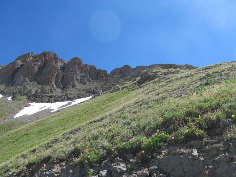 Hard pan traverse: 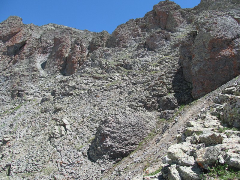 The gully that leads to the notch is pretty reasonable, a little bit loose but staying to the side gave some good hand holds and we were not knocking a bunch of stuff down on top of each other (image below taken from the top on the way down). About halfway up it we noticed a nice looking exit chute that was steeper, narrower, and looked like some solid scrambling so we figured "why not?" and gave it a go. It went at mostly class 3 with one short class 4 step then easy terrain led up to the main ridge crest which is just a pleasant class 2 walk to the highest point and some fine views.  Our side gully: 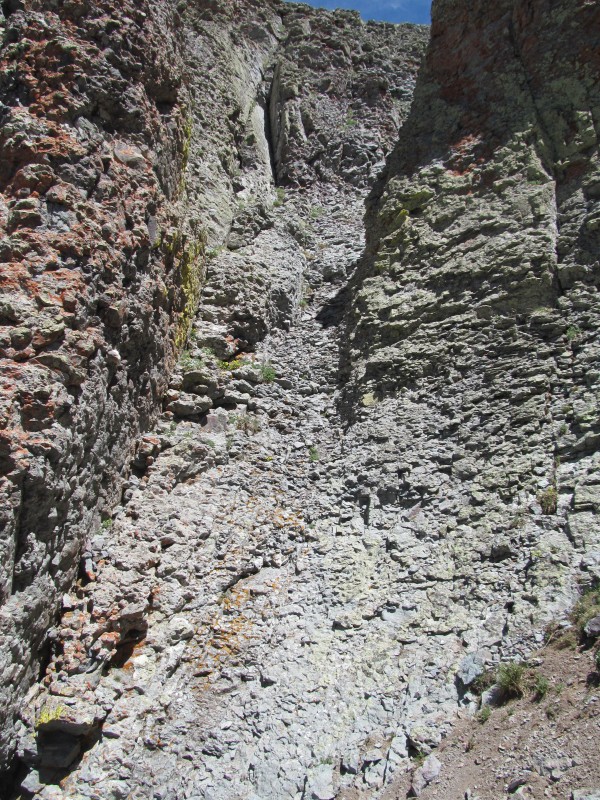 Final ridge:  Summit views towards the Weminuche were nice, this zoomed view shows Pigeon, Eolus and more with Snowdon in the foreground  We enjoyed the summit on this beautiful day and went to scope out the ridge towards South Lookout, definitely doesn't look like it goes on that side, very steep drop offs. I think people who combine the peaks end up traversing high all the way around to the same gully we took to access the summit ridge. We reversed our route, this time staying in the main class 2+ gully, and back down the steep grass all the way to the main road and back out to our car. Silver Mtn B: Southwest Ridge (etc) from Gold King Basin (July 1, 2017) Originally the first weekend of July was supposed to be a trip to the Sangres for us, but my girlfriend's brother from Portland was in for the weekend visiting her folks in Rifle, so why not stop for dinner in Rifle then head to the San Juans again? This gave us a little later start, so we ended up camping on the Dallas Divide and finishing our drive in the morning. The road to Alta Lakes is narrow and a bit rough in places, but overall was a reasonable drive. A little above is a turn for Gold King Basin and surprisingly my Outback could make it up this road, unfortunately the upper basin was overrun with campers and we ended up turning around and finding a place to park a little lower on the road, but the short morning walk was not bad. Its a beautiful basin! Our route looked steep, the morning light on the slope was bad, but here is a picture from later in the day looking at the slope we used to access the ridge. 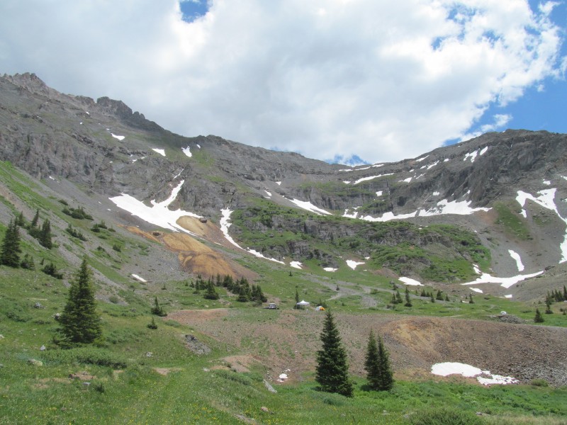 I had looked at topo maps and satellite photos and thought this would be a reasonable route. I did not want to do the normal route straight up from Ophir for a couple of reasons. One its more vert with a lower trailhead, and two we a similar route to get up San Joaquin Ridge and the finish slopes were miserable scree that we slid back one step for every two forward. I figured this route would go, and it did, but it wasn't really that pleasant and probably would have just been better from Ophir. Certainly less complicated. Anyway, the road fizzled out into some old rock slides and we left it on the right side of the yellow scree below the mine structure in the previous photo. Crossed that snow slope, and worked our way through the adjacent cliffs to the grassy strips above. Once again the flowers were in full force! 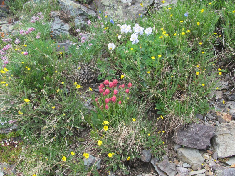 There were a few cliff bands we had to navigate and some patches of scree. It was not just a straight shot up grass like V5 had been, but it went quick and we were on the ridge crest before we knew it. I don't think it even took an hour to make the 1500 foot ascent. We topped out near the "12936" point on the topo map. The grass fizzled out as we split the upper snow fields in picture 24; picture 26 is from there looking down. The last bit was on some class 2 talus with some mix of grass, a bit junky but we did our best to keep to the most stable of the bunch. 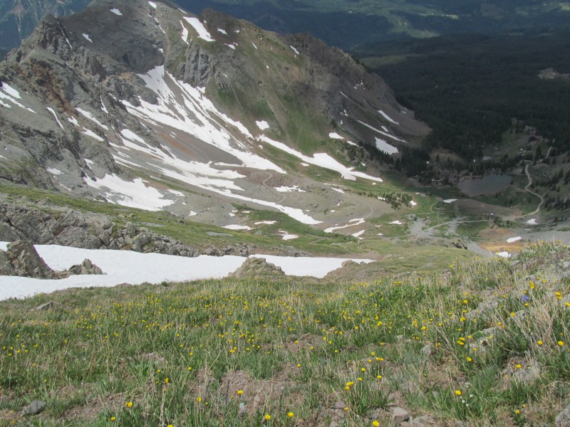 Now from here on the map and satellite images, this ridge looks like it should be a walk. Its why I picked this route. That turned out to not be true. From the crest what was above us looked unclimbable, and we didn't really want to traverse to the left of it as that looked miserable. A mix of loose and hard pan, and just not sure if it was going to lead us anywhere. So we tried our hand at the right (south) side. It certainly went, was fairly clean, and it was mostly class 2. At first there was plenty of grass, with a few little ridglets to cross with a class 3 move or two thrown in once and a while. It was steady progress, and it didn't look too far. Just don't get too high or some loose rock and hard pan get in the mix. The lump in the distance is what we thought was the summit (its not) so we just kept traversing that way planning to regain the ridge when it got reasonable. 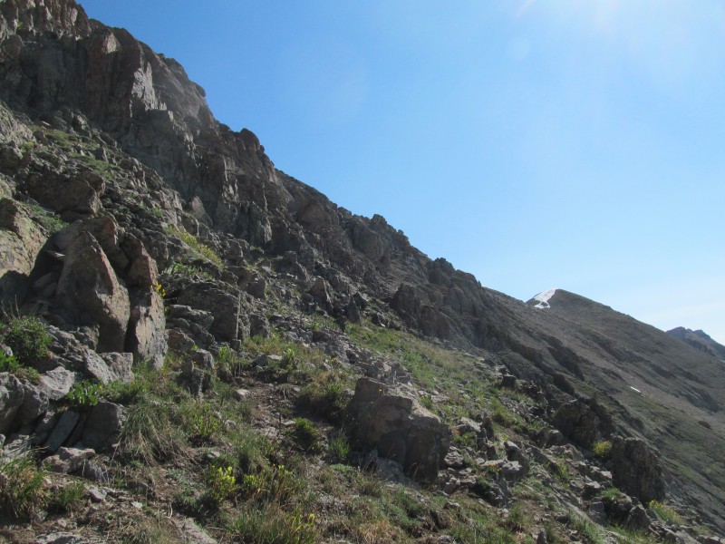 Eventually the ridglets faded out and we found ourselves on some kind of small bench feature, almost like it was a really old trail that undulated its way along. It started to fade and the slope ahead went full scree, so we left it and went up the grass to limit our scree intake. 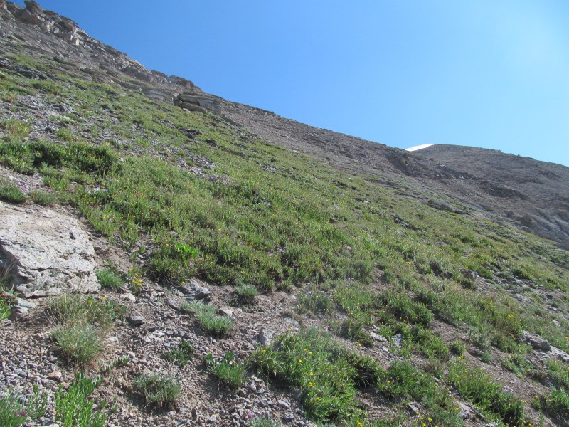 This is about the time we realized that had we done the route from Ophir, we would have found ourselves in this exact position, finishing to the ridge on the exact same scree slope. It was a kind of "oh well" moment, happy to find a route that went but it probably wasn't the best route after all. It even seemed that the route from Ophir would have been entirely on a nice grass slope to the point we were at. You win some, you lose some I guess, but we were (mostly) having fun.  We topped out on the grass and had a steep scree slope with some hard pan mixed in, not the most pleasant and we really didn't feel like down climbing it later. There was a more straight up scree slope farther to the east, maybe a scree surf descent option for those coming from Ophir? In either case we trudged the couple of hundred feet on the scree, struggling to find the best route that was not too loose and managed to make the saddle in one piece.  We started up what we thought was the summit but quickly realized it wasn't. Some snow on the ridge had us on more scree to bypass, so it was an unfortunate waste of our time. The true summit was up a ridge that at first glance seemed formidable, but in reality was solid, enjoyable class 2+ scrambling to the high point. 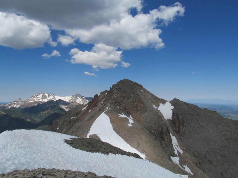 A closer look at the 2+:  Lots of notes in the register about ski descents, and from our spot there seemed to be a nice chute direct off the summit into Bear Creek. That is probably the best route for this peak, it may need a repeat to redeem itself. Silver ended up being my 200th San Juan 13er, so it had that going for it. It really wasn't that bad of an ascent, just not our favorite of the spring. For our descent we decided to try our hand at the original plan, the southwest ridge (more of less) direct. This would avoid the scree/hard pan descent as well as the long traverse on the south side. Of course the lower towers/steps we had seen around 13k were now something we would have to figure out how to get around from above without having previously climbed. Hey, this was meant to be an exploratory adventure of an alternate route, right? I reconnoitered out a ways and decided we could make it work, so went back up the summit and we agreed to give it a shot. The initial gully off the summit block was semi-stable class 2 with one small chockstone step partway down. Not loose enough to be miserable, but not stable enough to be fun either, especially going up. 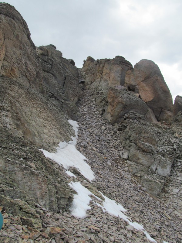 The next section was reasonable, class 3 on decent rock. One exposed steeper downclimb we backtracked, went around on loose ledges on the left and found a good 3rd class staircase back to the crest. From there it was actually pretty good quality rock and basically just class 2 for a good stretch. This was how far I had explored before deciding it would go. The image below looks back at the summit after we re-crested our class 3 stairs. 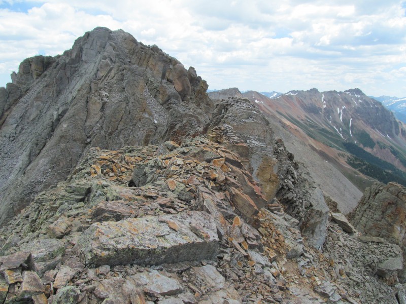 We had to cross the remains of an old cornice, (at the top of another ski descent option - a chute to Alta Lakes) which had a bit of a snow ledge cutting across it that provided safe passage. The other side of which was a small up-climb on class 2+ terrain that brought us to the convergence point of the two ridges that come up out of Gold King Basin, the SW ridge (which led back to our ascent slopes) and the northwest ridge that may or may not go as well but we didn't explore it. 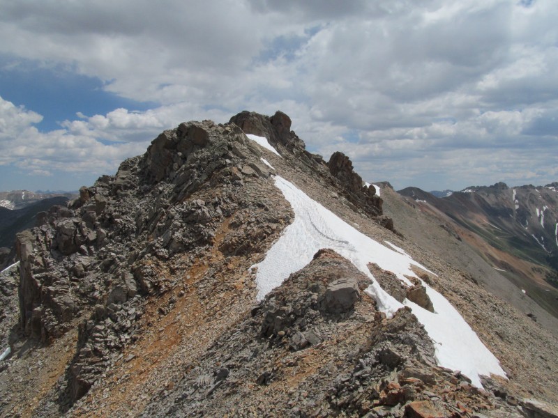 The gully between the two looked like it could provide a bail out, or we could bail south through some junky gullies/ledges and back to our earlier ascent traverse. We knew we could get down if we needed to, but stayed on the ridge for a bit more because our curiosity got the better of us. Soon looking the down the ridge looked like this:  We managed to find a way down, initially at class 3 until a larger step near the bottom turned class 4 and was a bit reachy for my 5'2 girlfriend. 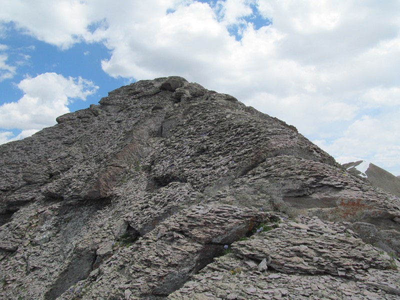 This was definitely the crux of the ridge route, below this some easier scrambling led to a nasty looking gully. It did not disappoint on that front. Unfortunately I didn't take a picture of it. As we went down it the rocks would "settle" with each step in a chorus of clinking like when the recycle truck dumps a bucket of glass bottles into its hopper. Going up this would have truly sucked, and we were glad our ascent route did not explore this side of the ridge, we might have given up. We were on the north side now, and traversed below the cliffs that had sent us to the south in the morning. The traverse also did not disappoint, but was more stable than the gully! 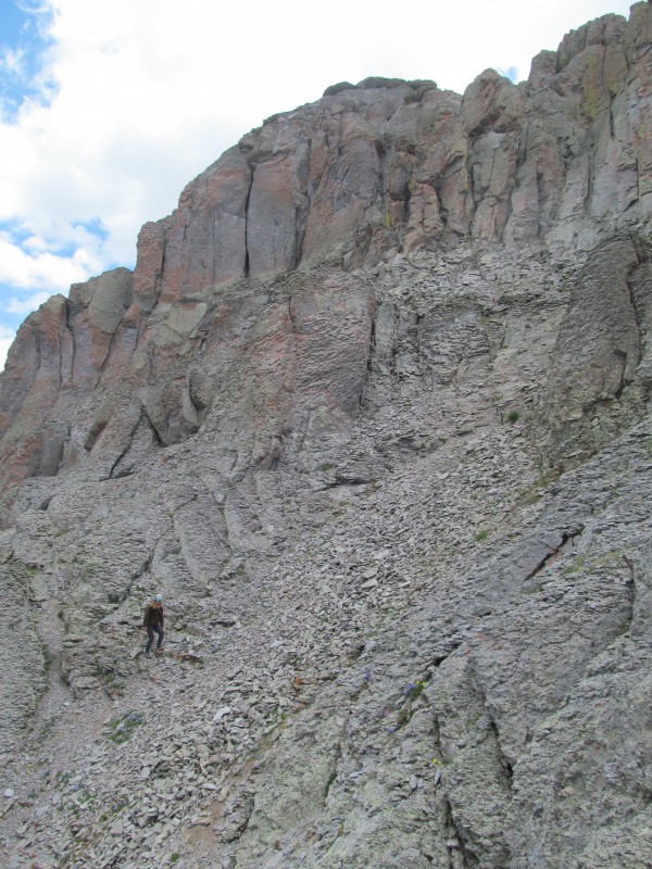 All that was left now was the 1500' descent of the grass and interspersed cliffs we had come up. At least we knew we were home free now. 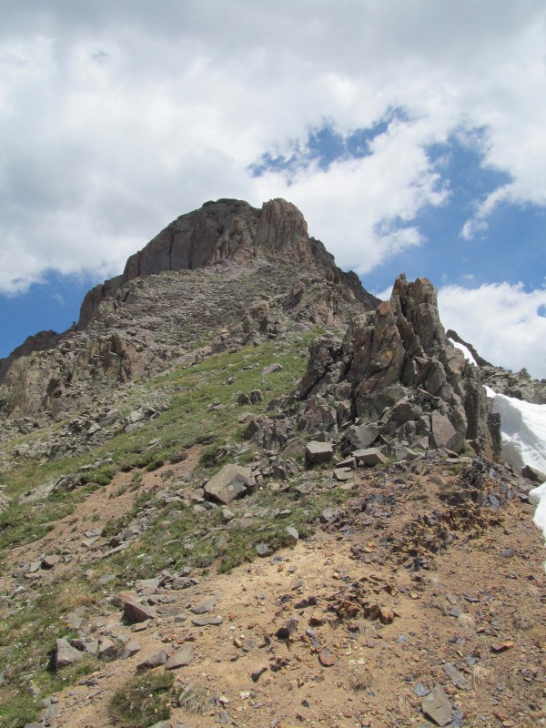 We drove into Telluride, got some food at the market (mmm cherries) and headed up to the Mill Creek trailhead to camp for our next day's adventure on "T0". I forgot how narrow that early shelf on the road is, gladly we didn't have anyone come up it or down it on either of our drives! We enjoyed a lovely meal and read some of David Robert's biography and went off to sleep with visions of the Brooks Range in our heads. T0: Via Southeast Ridge of Campbell (June 26, 2017) For some, "T0" conjures up bad memories of nasty scree. Indeed, what most people consider the standard route is nothing more than an ocean of the stuff. We could see it later in the day from the Campbell ridge and wondered why so many people subject themselves to such torture. The route over Campbell is a much more pleasant outing, yeah it comes with a little bushwhacking and a steep grass gully, but at least you don't slide backwards with each step! Pick your poison I guess. 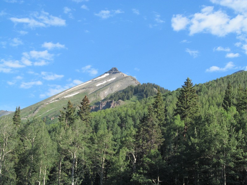 We started out up the Deep Creek Trail, passing the junction with the Sneffels Highline Trail, descending off the ridge and then passing the junction with the Eider Creek trail, crossed a few small creeks and ascended a small rise until we crested a long flatter section around 10,600'. Somewhere around here we decided to bushwhack north weaving through some deadfall until we spied a meadow to our right at the base of a long steep grass gully. 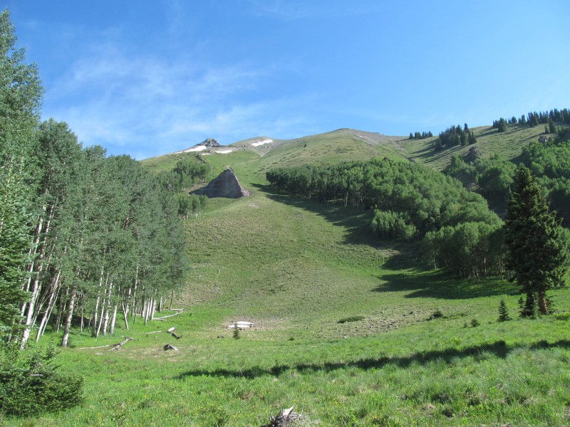 Having done a few of these recently, it really wasn't that bad. Put your head down and plug away. We stuck towards the right side to take advantage of some early shade. We hit the ridge around 12,200 after a 1400' push. The ridge was good - stable rock, nice views of the surrounding area and of T0 and of the basin we were not sad to be skipping. 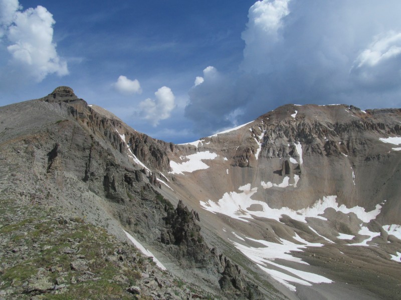 We made good progress and were soon nearing the crux of the route, a cliff band on Campbell at around 12,800'. You can go left and bypass it on class 2 terrain, or just take it head on. The ridge side of the cliff band has a nice little class 3 section that pops you back on top. Fun on stable rock. 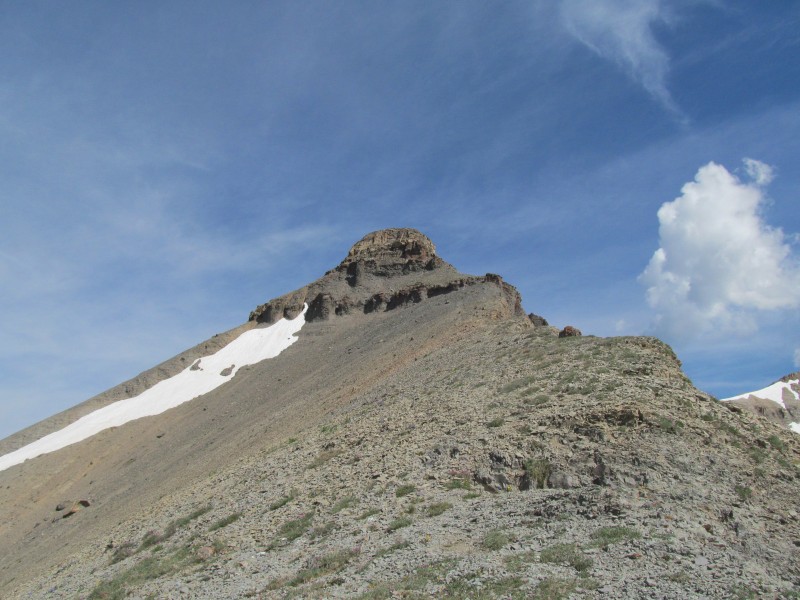 Close up of the crux: 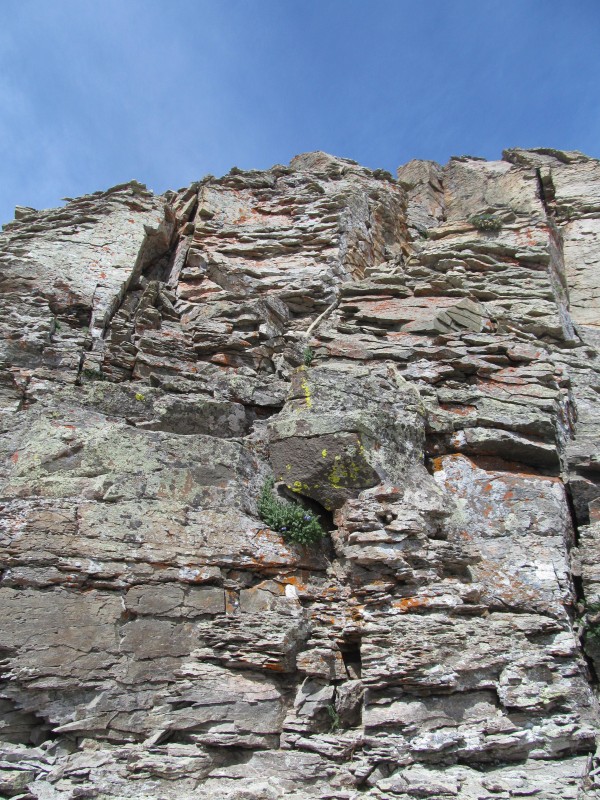 From here its just a class 2 walk to the summit of Campbell where we took a few sips of water and pressed on. There is some clinky dinner plates on the ridge, but its generally stable, abeit a little noisy. One short steep section on the way down off Campbell to the saddle was a little loose. From the saddle its more of the same clinky dinner plates, but here there is even a decent climbers trail so that the looser parts are manageable. One section of red rock near the summit being a bit loose and the trail coming in handy. 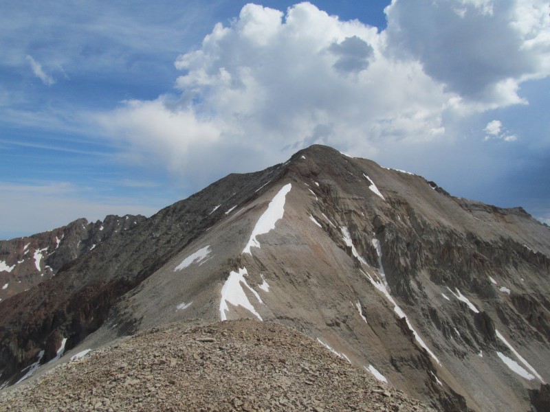 Views up top are great, "T0" is a bi-centennial at 13,735' and it lies to the west of the taller peaks so the views are wide and far. The view east to Sneffels and Dallas is good, and south to the Wilsons is inspiring. The view to Sneffels also showed us that way was starting to gather some storm clouds so we quickly took off back for Campbell without even a summit snack. Sneffels/Dallas: 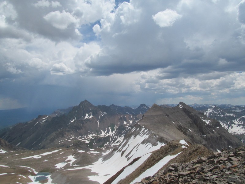 Campbell and the Wilsons: 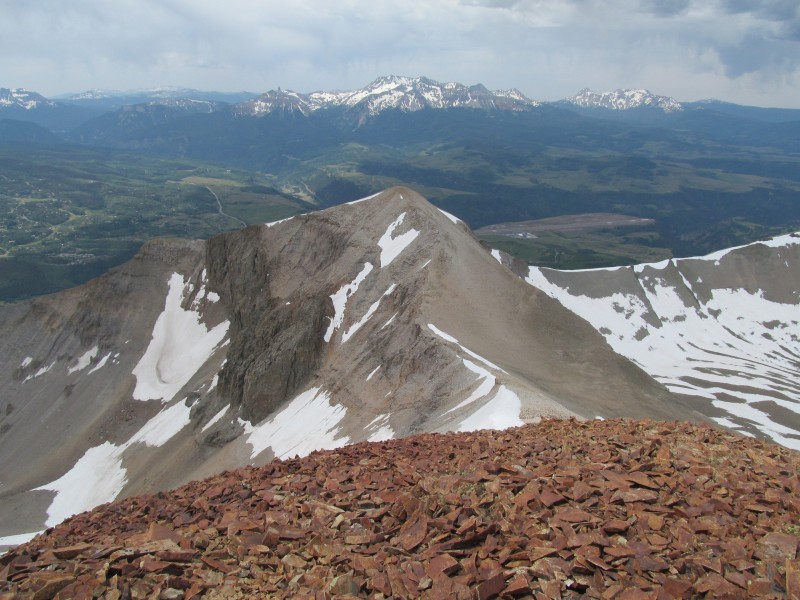 The descent went quick. When we got to the crux we found another grassy gully and decided to bail early so we could beat any weather before it got organized. Aiming for some trees, we did end up having to downclimb a weird steep cleft in a cliff hidden in the trees that was awkward on some steep dirt squeezed with vegetation. Below it we took an angling traverse line more or less in the direction of where we had come up earlier, crossing a couple of meadows, picking up pieces of game trails, over some deadfall, and then on to the trail. A few sprinkles and a few rumbles of not-to-distant thunder as we reversed our trail route from the morning back to the trailhead. Happy to have another successful San Juan summit. Conclusion I hope some of you found some useful information for some variations or just plain alternate routes for these peaks. My girlfriend and I had a good spring in the San Juans, a few ski descents early that gave way to some beautiful wildflower summit hikes later. Of the routes for these 4 peaks, all but Silver I would recommend fully as great ways to climb these peaks. In particular as Woods does not combine well with its neighbors, its a great solo peak outing, and of course avoiding the scree basin on "T0" by climbing over Campbell was a welcome alternate. With so many peaks they can't all be great outings, and Silver may not have been the best route, but it was a fun exploration into an unknown route and worked out well in its own right. All the other routes I knew went and had seen at least some information on previously. Its hard to find something new, and hopefully there are a few more alternates out there to explore. I have done a few others over the years, and not all have made the internet in the hopes that others will get that same sense of exploration. Enjoy the adventure, happy hiking.  Thumbnails for uploaded photos (click to open slideshow):
|
| Comments or Questions | |||||||||
|---|---|---|---|---|---|---|---|---|---|
|
Caution: The information contained in this report may not be accurate and should not be the only resource used in preparation for your climb. Failure to have the necessary experience, physical conditioning, supplies or equipment can result in injury or death. 14ers.com and the author(s) of this report provide no warranties, either express or implied, that the information provided is accurate or reliable. By using the information provided, you agree to indemnify and hold harmless 14ers.com and the report author(s) with respect to any claims and demands against them, including any attorney fees and expenses. Please read the 14ers.com Safety and Disclaimer pages for more information.
Please respect private property: 14ers.com supports the rights of private landowners to determine how and by whom their land will be used. In Colorado, it is your responsibility to determine if land is private and to obtain the appropriate permission before entering the property.


