Download Agreement, Release, and Acknowledgement of Risk:
You (the person requesting this file download) fully understand mountain climbing ("Activity") involves risks and dangers of serious bodily injury, including permanent disability, paralysis, and death ("Risks") and you fully accept and assume all such risks and all responsibility for losses, costs, and damages you incur as a result of your participation in this Activity.
You acknowledge that information in the file you have chosen to download may not be accurate and may contain errors. You agree to assume all risks when using this information and agree to release and discharge 14ers.com, 14ers Inc. and the author(s) of such information (collectively, the "Released Parties").
You hereby discharge the Released Parties from all damages, actions, claims and liabilities of any nature, specifically including, but not limited to, damages, actions, claims and liabilities arising from or related to the negligence of the Released Parties. You further agree to indemnify, hold harmless and defend 14ers.com, 14ers Inc. and each of the other Released Parties from and against any loss, damage, liability and expense, including costs and attorney fees, incurred by 14ers.com, 14ers Inc. or any of the other Released Parties as a result of you using information provided on the 14ers.com or 14ers Inc. websites.
You have read this agreement, fully understand its terms and intend it to be a complete and unconditional release of all liability to the greatest extent allowed by law and agree that if any portion of this agreement is held to be invalid the balance, notwithstanding, shall continue in full force and effect.
By clicking "OK" you agree to these terms. If you DO NOT agree, click "Cancel"...
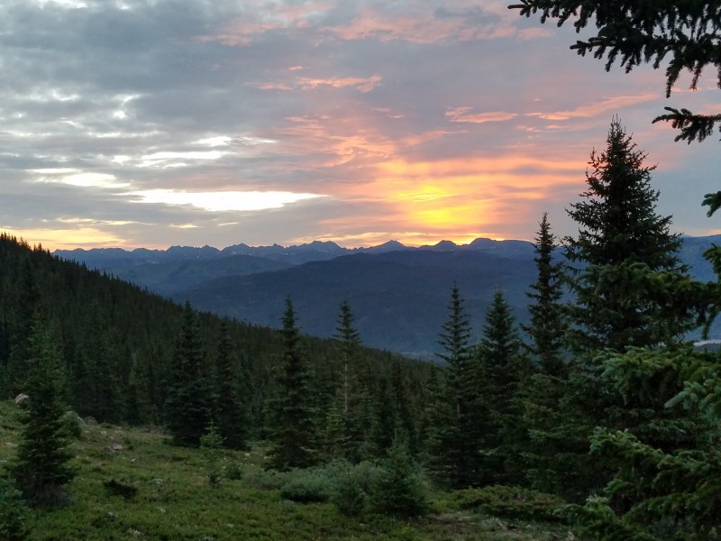
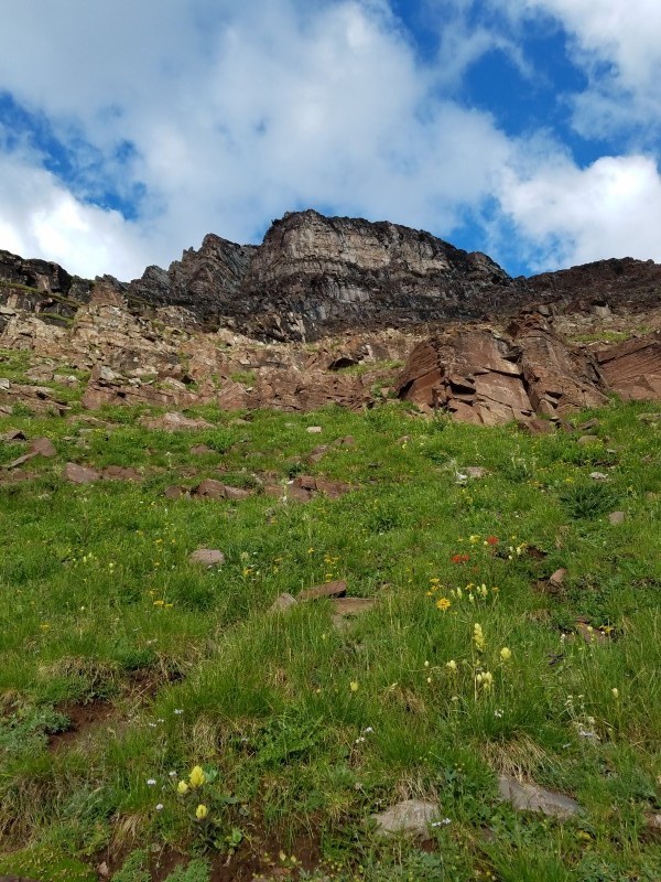
When a whole month of summer has gone by and you have only been out to the mountains once, and even that was cut short by being called in to work, it's nice to take a week to really wear yourself out. I had been looking at doing Kelso Ridge for nearly three years now, but training for running and a sprained ankle last summer put hiking anything, for that matter, on the back burner. With my ankle better (yet still having limited flexibility in my hamstring), and a day off of work, I made plans to do the Ganley Traverse. Looking at Google Earth, I planned to park around halfway up the road, ascend up Kelso's northern arm, reach Torreys via the classic Kelso Rigde, traverse across to Grays, and wrap around the lengthy ridge to the namesake Ganley Mountain before dropping back into Stevens Gulch. I packed 100 ounces of water, plenty of food, my rain jacket, a helmet, and a large first aid kit, including an ankle brace, since I am a bit untrusting of the strength of my right ankle and hamstring still.
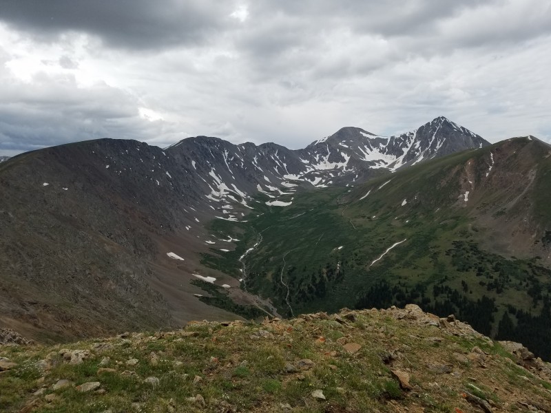
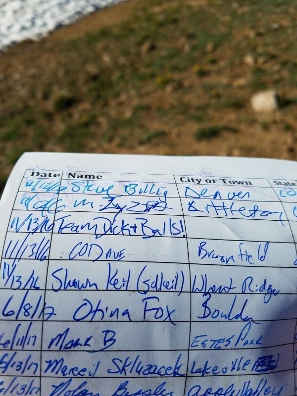
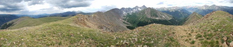
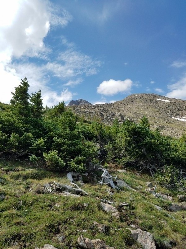
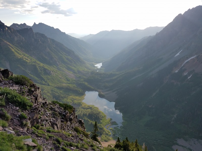
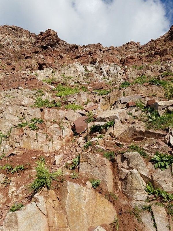
As with everything, something has to go wrong. I had set my alarm to get up at 3 a.m. to get ready, but I must have dismissed the alarm, because I found myself waking up at 5 instead. Already grumpy about losing time and possibly jeopardizing completing what I had planned, I cooked up some eggs, loaded up the car, and set off on I-70 to the Bakersville Exit. On the Stevens Gulch Road, I switched to 4WD and climbed my up the easy sections. Once at the notoriously rutted out spot, I hugged the left side, but the road seems to have gotten worse since I last was up here a year ago for a CFI trip, as the clearance of my truck wasn't enough and I got stuck. I reversed back down the hill and tried again, sticking so far left that my side mirrors brushed against the branches of the bushes and trees. After successfully making it past, I continued another tenth or two of a mile until I reached a dilapidated house on the right side of the road. Parking the car, I checked my phone for the time; 7 a.m., it read. I told myself that I would plan on just making it to Grays before hiking back down, since surely the weather would deteriorate by then. Commencing the hike, I dropped down on the side road leading down to the stream, and from what I could tell, there was no dry way to get across, so I took off my shoes and socks and walked across the shallow, yet frigid, waters. After overcoming the screaming barfies on my feet, I followed the remaining length of the road up the gully until choosing the arm to the right. It seems that there is some sort of social or game trail on the edge of the arm, as there is a faint path to follow the arduous ascent up Kelso. Three-quarters of the hike consisted of grass and stable rock, but toward the end, the mountain became pellet sized scree, making progress minimal due to how difficult it was to not slide down. I soon topped out, and found myself at the empty summit in about an hour, with Grays and Torreys standing in front of me. I signed the register, encountering some familiar names, and made the descent down the ridge. While I was hiking down, what looked to be a Flight For Life helicopter buzzed past, toward the area of the Torreys. It hovered around for a few minutes, but never seemed to pick anybody up. Other than that, the hike down Kelso was uneventful, save for the exposed downclimb, just before reaching the trail to Kelso Ridge.
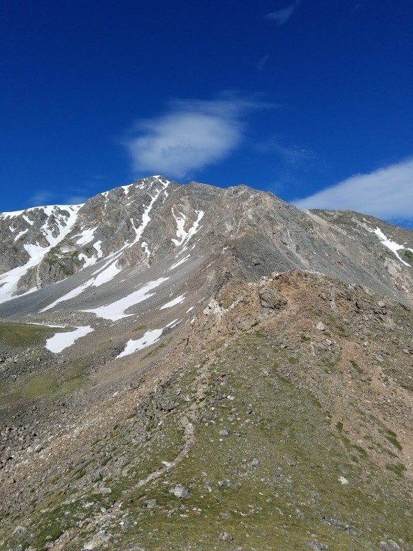
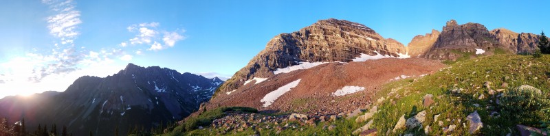
Looking up on the gentle section of Kelso The view back down just after the loose rock Interesting team
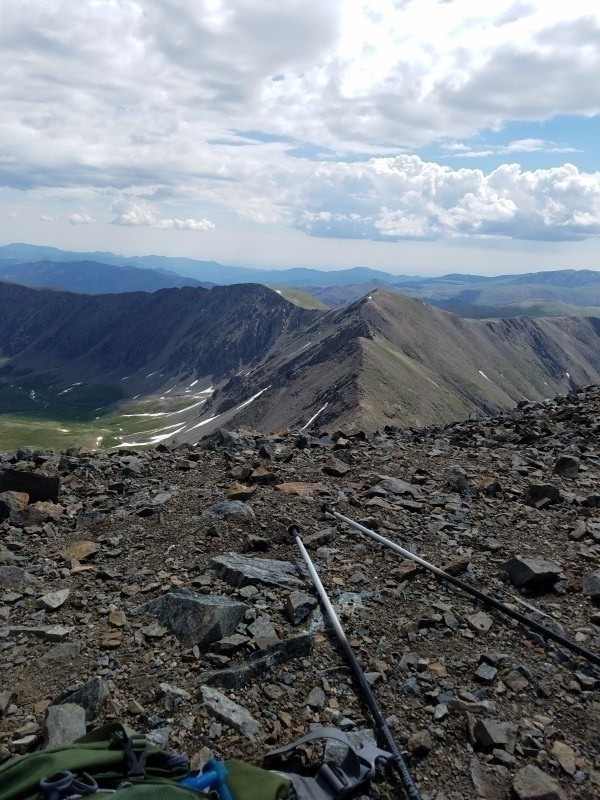
Summit of Kelso, looking at G&T Perched over the start of Kelso Ridge
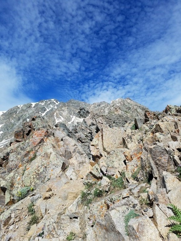
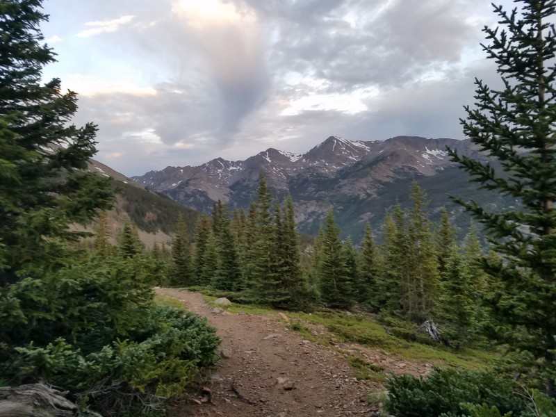
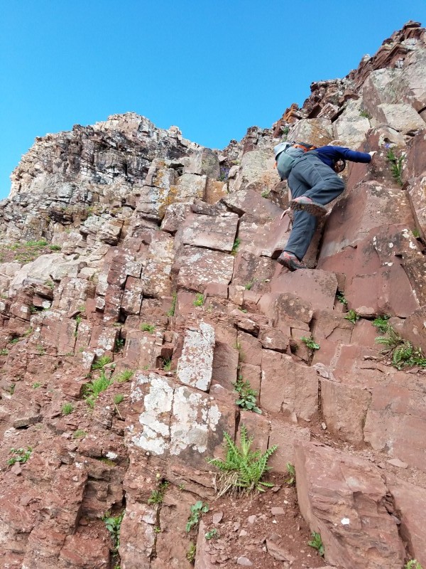
Once on the first real trail for the day, I cruised up with ease. Reaching the first challenge, I strapped on the brain bucket, and tried to choose lines that looked fun. Despite this being my first time doing class 3 on a 14er, there was never a point where I was scared, and I even tried to make things spicier by sticking to the ridge proper as much as possible. About halfway up, I started catching up to the groups on the route.
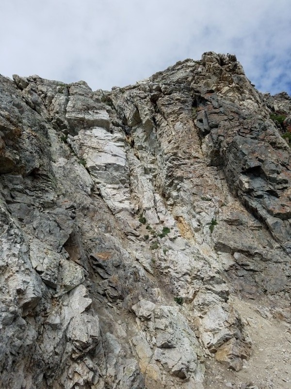
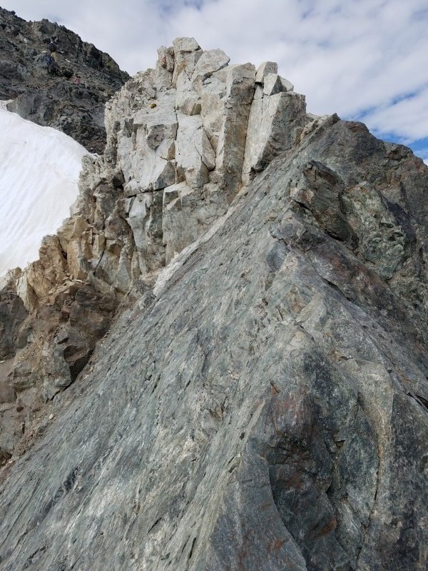
Rant Time {Despite the route being loose at times and having the potential for rocks to hit your head, not a single hiker had a helmet. I guess I can partly understand the lack of a helmet; people don't own them, or think the probability of being hit is low (which it probably is for such a low angle route), however, the people hiking the route seemed like they would need a helmet the most from all of the gravel they were pushing down. On top of this, several of them didn't even have packs. After having to dodge from scree being pushed down by hikers bear crawling up the loose slopes, I made sure to steer clear of the other hiker's paths and stuck to the edges. When I reached the penultimate wall before the Knife Egde, some hipsters kept trying to help we choose handholds and a line despite me saying, "Thanks! I know where I want to go". Finally passing the last group, I made it to the Knife Edge. From reading and looking at pictures, it seemed like it would be a whole lot scarier, but I was actually unphased and slightly unimpressed. Nevertheless, I made sure to take in the experience, but the whole thing took about twenty seconds and was only fun due to the exposure. Looking for a bit more, I climbed on top of the white wall while the group behind yelled, "Dude, you're a monster". I'll send an autograph if you want one. Just as I was starting to enjoy looking back on the knife edge, three folks and a dog starting descending from above. Innocently, they asked if descending this way is feasible. Trying to be nice, I told them that descending the knife edge with a dog would be a bad idea, and that there are several spots with exposed and technical sections. Now bitter, he started saying that everywhere he read told him to descend off of Torreys; I definitely don't know where that came from, but I kindly said they be better off going back over Torreys on the way they came up. Thinking that I was done with all of the nonsense, the last party that I had passed had now made to the knife edge. Yelling to me, they too asked for a way to avoid the edge, specifically the white wall. After walking them through it, I rediscovered why I hadn't done a 14er in the summer in over three years. I was greeted with a woman taking care of business no further than twenty feet from the summit, and found myself surrounded by about thirty hikers, all with their cardboard signs and selfie sticks...well actually I didn't see a single selfie stick, but you get the point. A bit overwhelmed, I didn't really take time to enjoy the summit, and instead headed straight over to Grays, telling myself that I'll come back to Torreys in the winter where I can take in the views.}
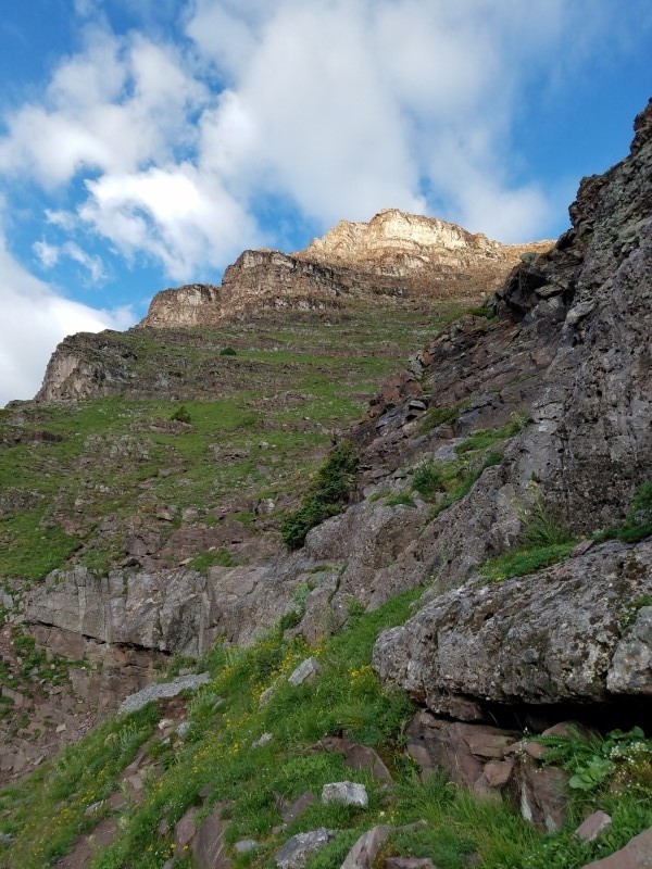
First "difficulty" The Dull Edge. Climb the white wall for bonus points
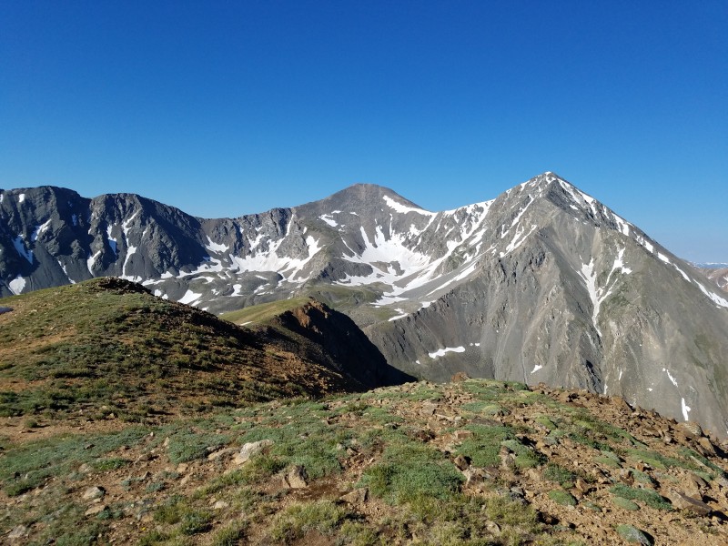
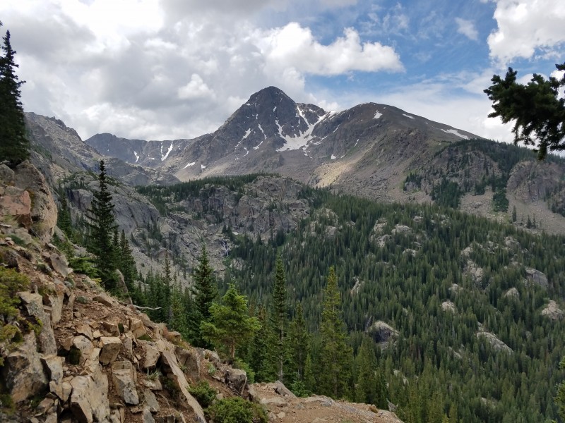
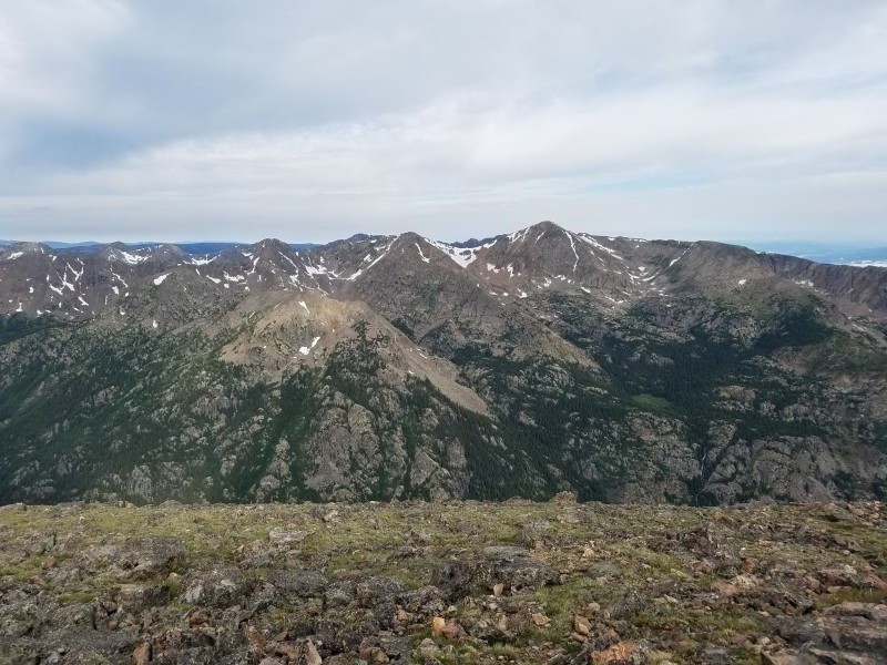
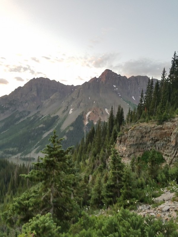
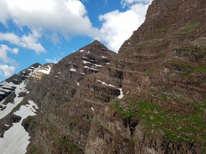
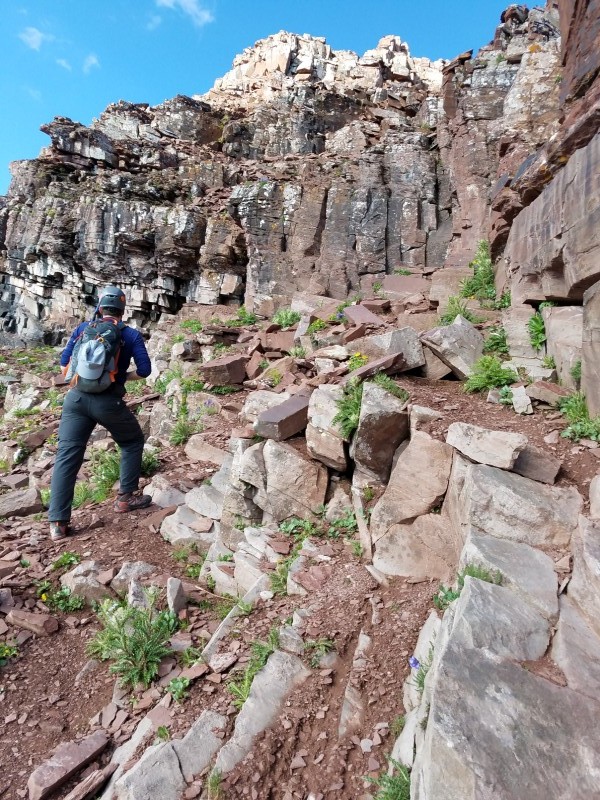
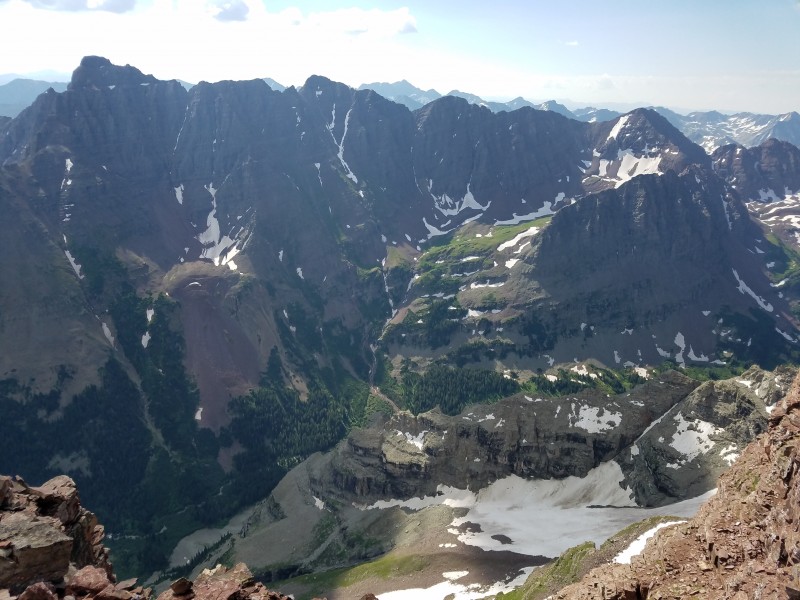
Navigating around the conga line of people, I breezed over to Grays in just over 30 minutes. Here there were much less people, and I took the time to sit down, eat and enjoy the mountain. The weather was still holding up, so I decided to commit to the rest of the route from here on out. Looking around me, to the west I could pick out the famous Cross Couloir, to the north, the Herman Gulch group, and to the east, the undulating ridge before me.
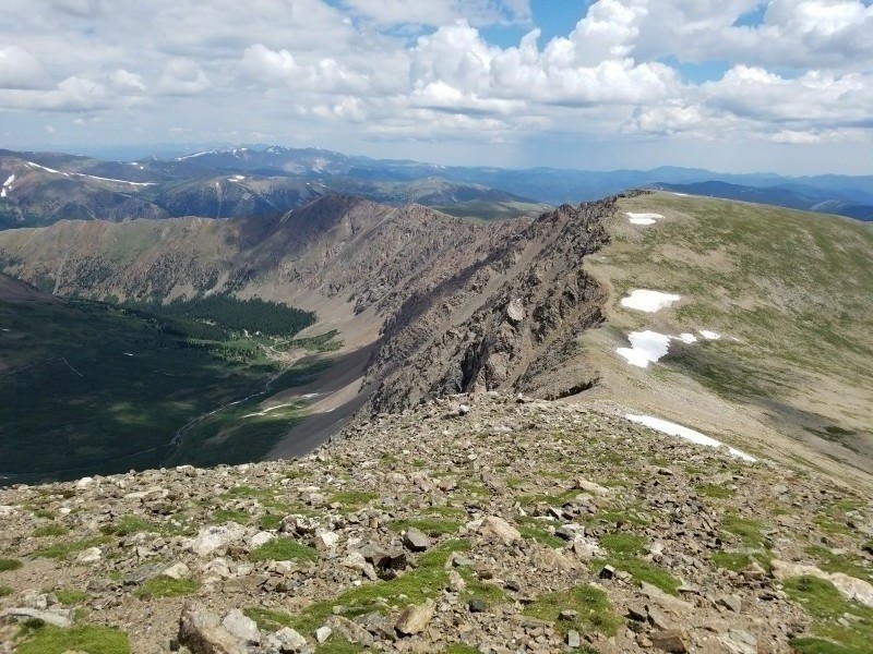
View of Edwards from Grays
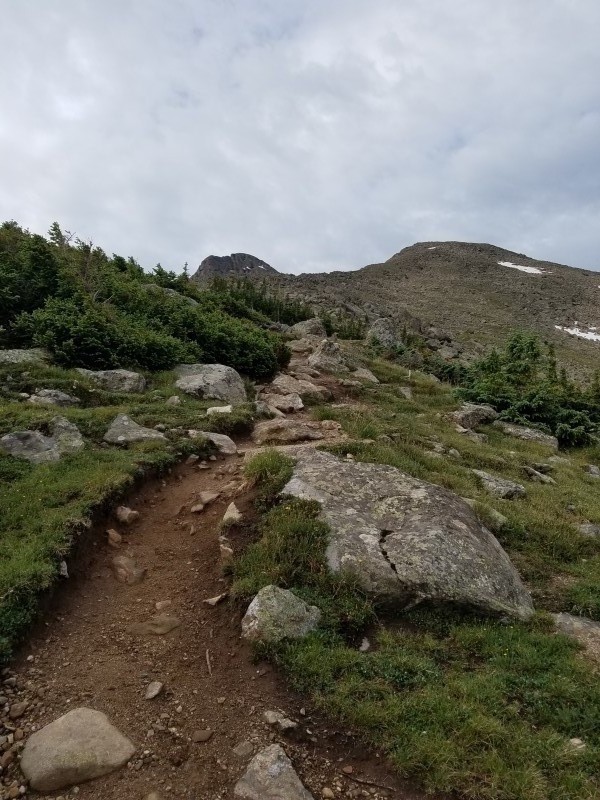
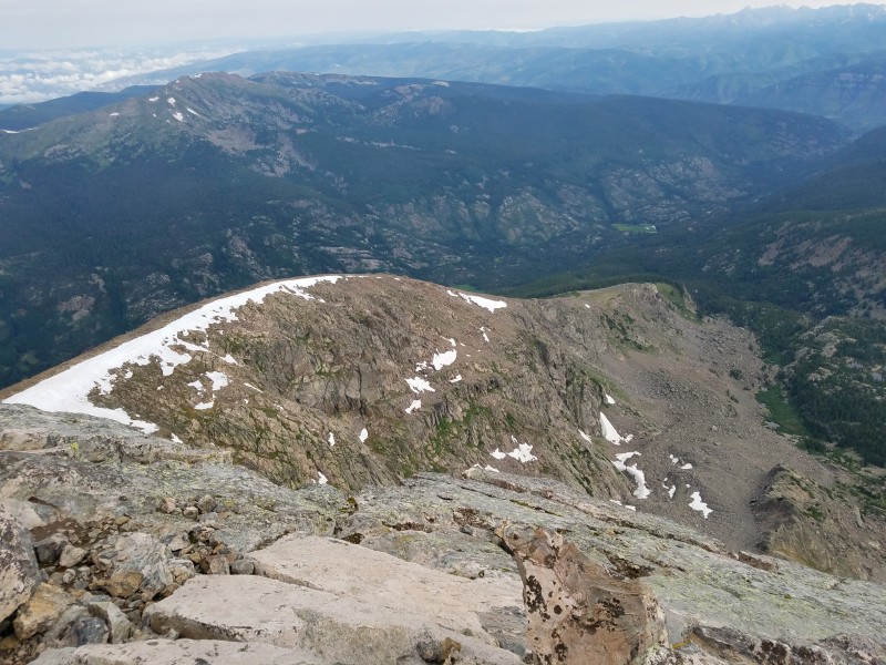
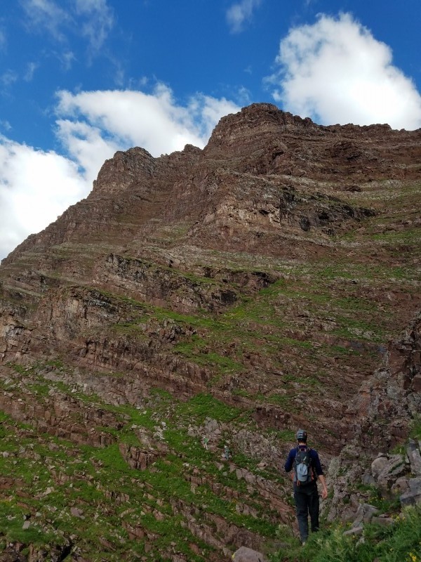
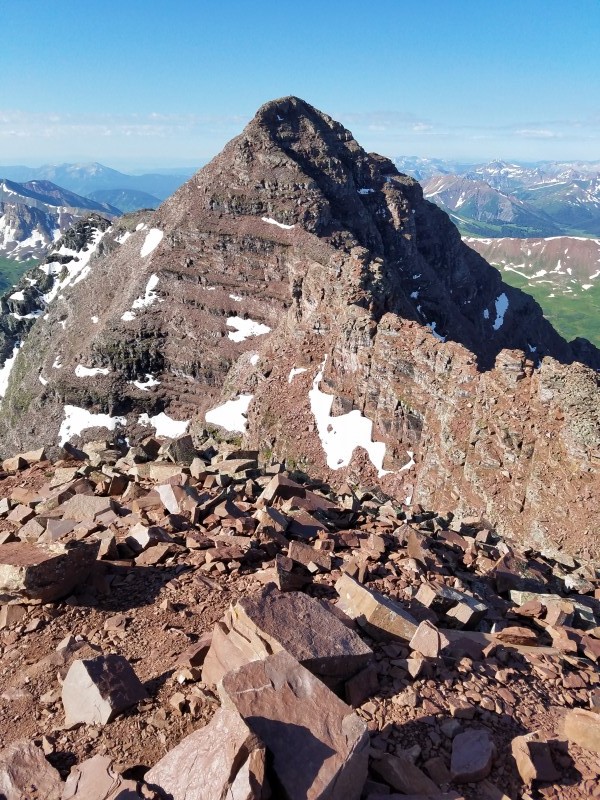
From earlier in the day, I could see that it was a long way between Grays and Edwards, so I made sure I was mentally prepared for the several bumps that lay in front of me. The ridge proper can get rocky and exposed at times, so I chose to sidehill to cut on time, and it surprisingly ended up being most time efficient way to travel, but it put a lot of strain on the the calves. Just when it seemed like I would never reach Edwards, its summit cairn popped into view, sans summit register. From here I was able to have views of the the valley below me, as well as the gentle group of Square Top, Argentine, and Wilcox.
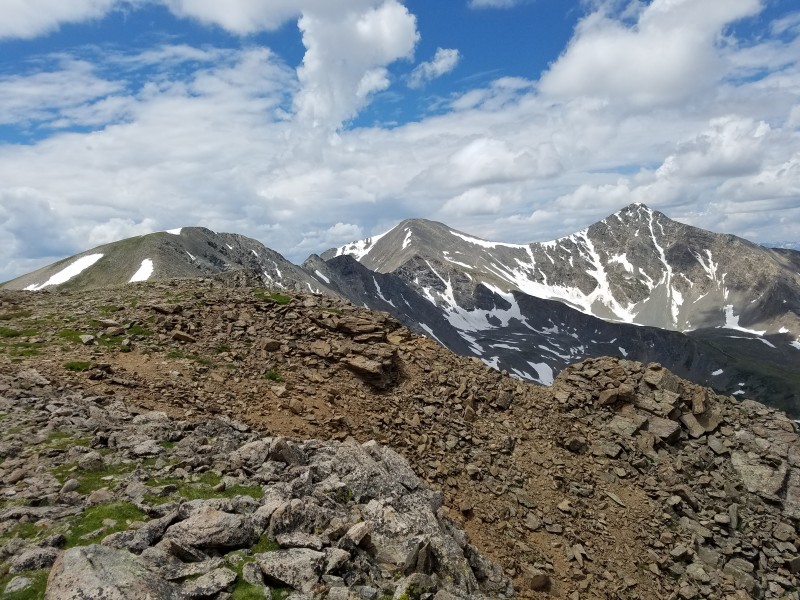
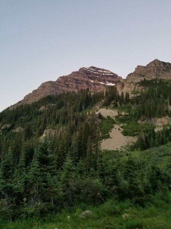
From Edwards, looking at McClellan and the long ridge to go
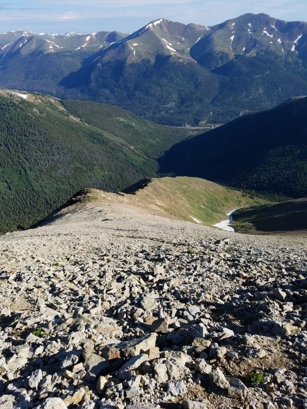
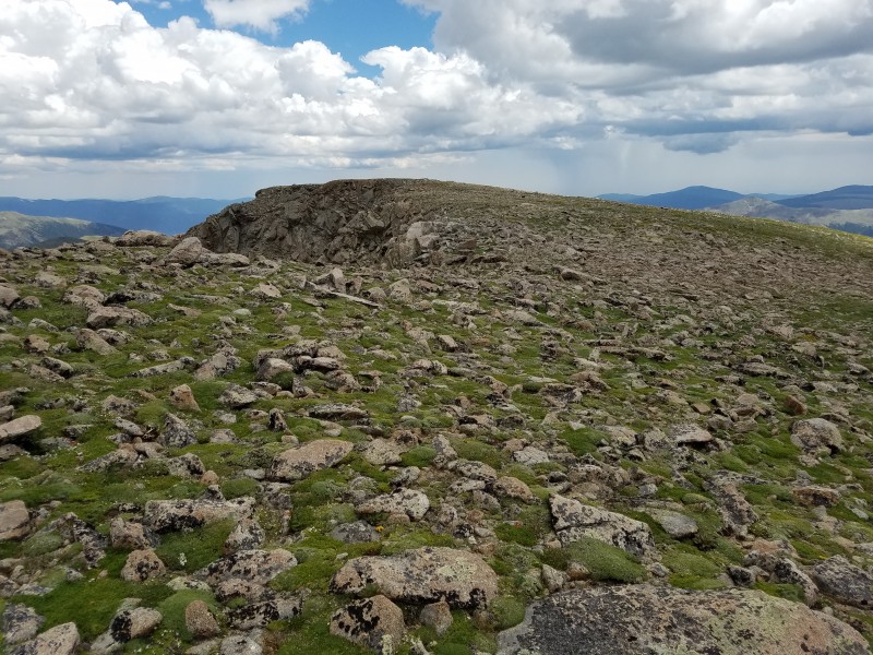
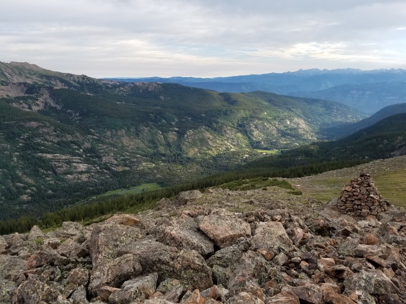
Seeing that it was starting to get cloudier, I quickly ate half a sandwich and made my way to McClellan. It was nice to be able to walk on soft grass again after dealing with rock for so much of the hike. I hiked across the top of McClellan, not stopping, and aimed for the road that skirts the ridge. On my way, I ran into a man and his dog who drove up the road to the very top. We didn't talk much, but exchanged a couple words before I set off again. Taking advantage of the road, I picked up my pace. Rain was now falling east of me, and the clouds were starting to get even darker. Despite the terrain being easy, it seemed like the ridge never ended. I was also starting to feel all the wear on my feet, but pushed on, knowing I was almost home free. I took the road as far as I could, only leaving it to reach the final summit of the day, Ganley Mountain. The top consists of a antenna and a solar panel, and arguably had the best view of the day, since it captured the whole day minus the details of Kelso Ridge.
The lofty summit of McClellan A look back on the day Looking at the entirety of the Ganley Traverse
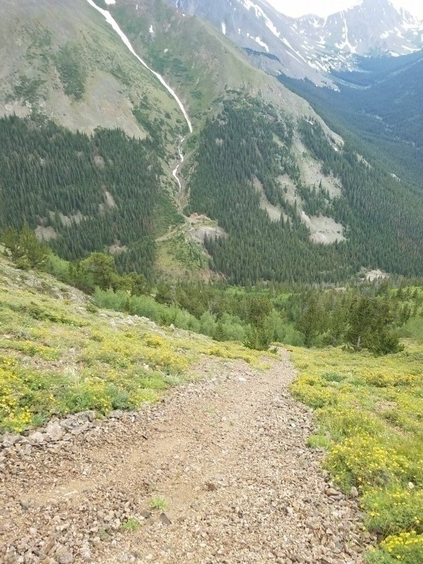
At this point the skies were really dark, and I high tailed it back to the road where I left my pack and completed the final mile at elevation. Right before I reached the final bump of the day, the rain began to fall, and I heard my first thunder to the east. Seeing the trees below me, I started descending down the gully, hoping that this wouldn't be one that cliffs out, like so many of the gullies along the ridge line. The initial descent was very steep, but once I found scree, I was able to ski down with lots of control. Finally at treeline, I stuck to the bottom of the gully, as that was the cleanest way to go down. There was some bushwhacking to be done, but since I had done more than a couple Jeffco off-route hikes, it was a piece of cake compared to them. Regardless. on my descent, the rain started to pick up again, and I found myself slipping quite often on the tall grass, dead trees, and occasional rocks on the steep terrain. I had to take my time to not slip, and when I did, my pack was thankfully there to prevent me from hitting my head. For what seemed an hour to descend, I finally reunited with the road and spent a miraculous five minutes to get back to the car. How is that for planning?
The scree-ski from the last bump on the Ganley Ridge
Mt. of the Holy Cross
July 24, 2017
11.28 Miles
5,566 Feet Gain
8 Hours
I finally mustered up the courage to take a weekend off of work (I'm not being sarcastic) and head up to the hills to do two incredibly scenic peaks. On Friday night, I met up with Adam and made the drive to Half moon campground. It was pouring rain nearly the whole way there, making the roads flooded and the visibility even worse. Winding up Highway 24, we missed the Tigiwon Road turnoff and made it past the town of Redcliff before turning back around and looking for it again. In what can only be described as foolish, we found the turnoff on the second attempt, clearly marked, and barely outside of Minturn. Driving higher and higher, fog cloaked the trees and made the mountain road eerie. All I could think of is the opening scene of Outlast, which happens to take place at the fictional (possibly) Mount Massive Asylum. All that was missing was lightning and a staticky radio static about the Arapaho Forest Service spraying for boxelder bugs around Leadville. Spookiness surrounding, we parked the car and went to bed for a 5 a.m. start.
After a mediocre sleep and a cold burrito, I was ready to hit the trail. We started right before first light and were rewarded with a sunrise over the Gore Range atop Half Moon Pass. So far in the hike, I was a bit confused to where Holy Cross was, and even thought that it could be one across the valley, in the proximity of Mt. Jackson, but turning the corner I was blown away with the towering face and rocky valley of the real mountain for the day. I had never really been impressed with the Sawatch, save for Ellingwood Ridge and only a bit with the profile and prominence of Mt. Massive and Mt. Princeton, but the splendor of the mountain made me find myself in awe. Throughout the entire hike I was entertained with the various scenery and angles of the peak; I even enjoyed the descent down the pass. After reaching the summit, low clouds began to form in the valley below and ride their way to the summit, almost like a roller coaster. For the first mountain in a while, I was thoroughly enjoying the entire experience.
Sunrise over the Gores For some reason, I was thinking one of these might by Holy Cross The excellent trail leading to the ridge So much Potential Energy... Looking at the entirety of the Ganley Traverse From the summit looking down on the ascent ridge Anyone up for an ascent up the prow of HC?
After spending a good bit on the summit, we took a leisurely pace back while saying hello to those who passed by. Notable encounters were at least three or four families with the kids not looking happy to be here, as well as a trail runner who was running the flat part of the ridge and would later pass us again when we were about a half mile from the trailhead. I was a bit surprised of the lack of people here on a Saturday, but since I hadn't done a summer weekend 14er in over three years, my recent Grays and Torreys ascent and memories from hikes like Bierstadt and Elbert may have skewed my expectation on some of the harder to reach peaks. I'll definitely want to do this mountain again.
A look back on the serene Cross Creek Valley Final Glimpse
North Maroon Peak
July 23, 2017
9.6 Miles
4,880 Feet Gain
8 Hours
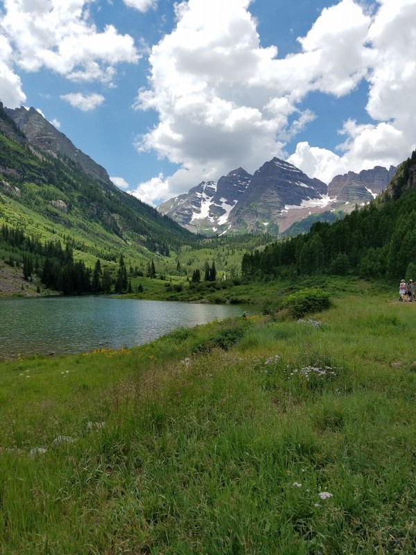
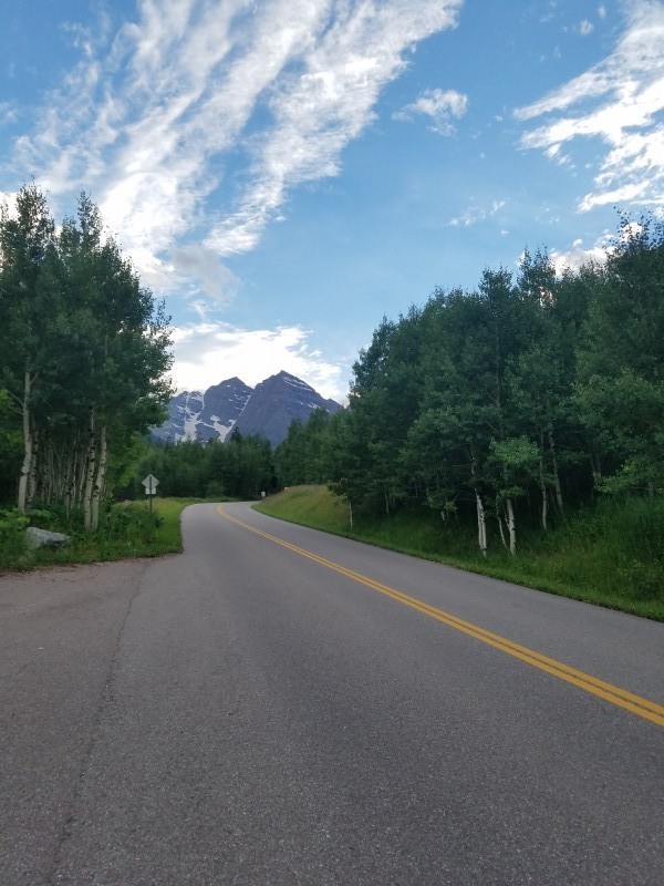
We got back to the car in one piece, and set off further west on I-70 toward Aspen. We ate a dietitian approved lunch of sandwhiches, fries, and ice cream in Eagle and resupplied in the burning sun of Glenwood Springs. Starting on the road again, I was entranced by Sopris' dominating profile, as I had never been to this part of the state. Even though Sopris was the star of the show, the gentle red hills and sagebrush offered a pleasant contrast too. Turning at the roundabout, we originally intended to stay the night along one of the pull offs near Castle Creek, but a ranger soon came and forced us to move. He was very friendly and told us we could camp further up the road or car camp at the Maroon Lake Overnight Lot as long as we kept a "low footprint", which to me was even better since it meant we could be right at the trailhead in the morning. Going up the Maroon Creek Road this time, I received my very first glimpse of the Maroon Bells, veiled by the evening dusk. Because of the darkness, the size of the two peaks appeared augmented, and I was honestly a bit intimidated at the sheerness of North Maroon's face. After driving back down from the day lot to the overnight lot, I set up my sleeping gear, ate dinner, and read riveting articles the about latest political scandal, bashes on Chris Froome's Tour dominance, and a controversial bike path to the music school, in a newspaper I picked up in Aspen. With the paper set aside, it was finally late, and I went to sleep.
My first ever view of the Maroon Bells, and an intimidating view at that
When the alarm went off at 4 a.m., I was reluctant to get up. I was pretty groggy from the day yesterday and I found I was also soaked from condensation in the car due to the windows only being slightly open to stay discrete in the lot. My shirt and socks were super damp, so I dug into my clothes bag and picked out yesterday's. After eating another cold burrito, we hit the trail just after 4:30, along the crystal clear night sky and crisp air. The initial approach was great; good flat trail. Once we picked up the Snowmass Trail, the ascent began and after a short while, we encounter the cairned junction down to Minnehaha Creek.
Down the Gunsight
Making our way up the terrific trail toward the rock glacier, the first morning light struck North Maroon and Sleeping Sexton, making the mountains give off their iconic maroon tint. After rock hopping through the assorted hues of maroon, white, and even green rock, we continued along the final stretch of great trail before reaching the first gully. After strapping on our helmets, we made the slow an steady climb on the abnormally solid grass and stone; not once did I ever feel like I was about to slip, which is good for me because I can be a bit clumsy and trip hard, most notably on sidewalks and on tiny rocks. Reaching the point where the gully really constricts, we curved around toward the second gully, catching the first glimpse of Maroon since joining the North Maroon Trail. From here, the route was a bit steeper and more loose, and it required moves with larger step ups.
North Maroon towering up ahead Early morning view of Pyramid Entering the first gully Taking a photo of everyone taking a photo at us Just go up Peak at Maroon Heading toward the second gully Having to step up higher now
Finally, we reached the notch at the top of the second gully, marking the junction with the ridge. From here, we attempted to find a way through the cliff band, but ran into some difficulties. The first try, we followed under the cliff band too far, right before the cliffs overhang. It was a two step problem in a chimney-esque location, where the first move was doable, but the second was blocked by an awkward chockstone. Unable to pass, we backtracked right before the notch, but no weakness looked under Class 5, albeit very short. As we were looking, a couple who we had just passed in the second gully came up and were able to find a weakness. For those wondering, it is distinguished by a left to right down-sloped rock wedge, which allows you to get enough leverage on your feet before pulling yourself upward.
This isn't your typical hike no more The wedge is just to the right
With the first real difficulty passed, we continued upward until encountering the crux of the route: the final chimney. I went first. The first move was really awkward, as I had to really lunge forward to stick the move in the narrow fit. From there on out, the moves were very simple and there were plenty of holds. Topping out, I took a lot of care on where I stepped so I wouldn't slip on the pea sized gravel back into the chimney. After moving out of the way, the couple, followed by Adam, climbed to the top. I think the other had a bit of difficulty, however, my superior climbing skills made the ascent a piece of cake. I'm now taking requests for my superior guiding service. You can find the forms here. Everyone now above the chimney, our newly formed group of four ascended the final section through the loosest part, where slabs would stay solid for a second before giving away, made it to the sheer cliff, and lastly jaunted our way to North Maroon's small summit. From here, there were unobstructed views of Snowmass and Capitol, as well as Maroon, just a short distance away. With clouds beginning to form, though friendly looking, we finished up eating and basking in perfect weather and started the downclimb. On the way down, we passed several groups, all making their final approach to the summit. At the chimney, we made things a bit easier for the downclimb and lowered the packs with some paracord I had in my essentials bag. For the most part, the descent was uneventful, save for the pair of goats hanging out in the second gully, and one occasion where I was downclimbing facing out and bumped the bottom of my pack, which would have sent me for a nose dive into the ground if I wasn't holding on to rock. Right before the traverse around to the first gully, I knocked my first rock down and watched it as it careened down the face, certainty making it into the valley far, far below. Reunited with the main trail, we encountered the swarms of people flocking to Crater Lake, covering all the entire spectrum of appearance: sporty, dressed to the nines, no pack, huge pack, cheery, miserable. No matter what is was, it was on that trail. After washing up in the restrooms, I said farewell to the Bells, and made the drive over Independence Pass, along with a mandatory stop at Which Wich for a celebration of my first Elk 14er, and Adam's Elk Range finisher.
The beautiful Pyramid group Summit Pano from North Maroon
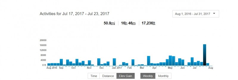
After a full night's sleep, and some time spent loading all the GPX tracks to Strava (or it didn't happen, right?), I found ended the week with 50.9 miles, almost 17 hours worth of activities, and a whopping 17,236 feet of vertical. On top of a 3000m steeplechase race in Boulder on Thursday night, it is pretty safe to say that my feet didn't fail me, but they sure are looking pretty ugly.
Looks like my elevation gain needs work...
Afterword of sorts: After about 10 months of pain in my hamstring, a long awaited MRI and doctor meetup uncovered that I had a herniated disk pushing into my nerves, causing agitation during elongating activities like running and stretching. The pain is beginning to move down into my upper calf, and making it painful to run. This may be a bit of my fault for the damage I've done, since I listened to physical therapists tell me that I shouldn't see a doctor quite yet, and I probably made the problem worse by running steep trail races and steeplechase. Looks like my name of CreekRunner will have to change to CreekBiker, as I can't run until I get the problem fixed. The good thing is that I can still hike, so looks like I won't be spending as much time trying to get that sub-40 Green summit from Chautauqua, and more time hiking and biking.
Thumbnails for uploaded photos (click to open slideshow):
Glad you were able to make it along and solid job on a loose class 4 peak!
Caution: The information contained in this report may not be accurate and should not be the only resource used in preparation for your climb. Failure to have the necessary experience, physical conditioning, supplies or equipment can result in injury or death. 14ers.com and the author(s) of this report provide no warranties, either express or implied, that the information provided is accurate or reliable. By using the information provided, you agree to indemnify and hold harmless 14ers.com and the report author(s) with respect to any claims and demands against them, including any attorney fees and expenses. Please read the 14ers.com Safety and Disclaimer pages for more information.
Please respect private property: 14ers.com supports the rights of private landowners to determine how and by whom their land will be used. In Colorado, it is your responsibility to determine if land is private and to obtain the appropriate permission before entering the property.