Download Agreement, Release, and Acknowledgement of Risk:
You (the person requesting this file download) fully understand mountain climbing ("Activity") involves risks and dangers of serious bodily injury, including permanent disability, paralysis, and death ("Risks") and you fully accept and assume all such risks and all responsibility for losses, costs, and damages you incur as a result of your participation in this Activity.
You acknowledge that information in the file you have chosen to download may not be accurate and may contain errors. You agree to assume all risks when using this information and agree to release and discharge 14ers.com, 14ers Inc. and the author(s) of such information (collectively, the "Released Parties").
You hereby discharge the Released Parties from all damages, actions, claims and liabilities of any nature, specifically including, but not limited to, damages, actions, claims and liabilities arising from or related to the negligence of the Released Parties. You further agree to indemnify, hold harmless and defend 14ers.com, 14ers Inc. and each of the other Released Parties from and against any loss, damage, liability and expense, including costs and attorney fees, incurred by 14ers.com, 14ers Inc. or any of the other Released Parties as a result of you using information provided on the 14ers.com or 14ers Inc. websites.
You have read this agreement, fully understand its terms and intend it to be a complete and unconditional release of all liability to the greatest extent allowed by law and agree that if any portion of this agreement is held to be invalid the balance, notwithstanding, shall continue in full force and effect.
By clicking "OK" you agree to these terms. If you DO NOT agree, click "Cancel"...
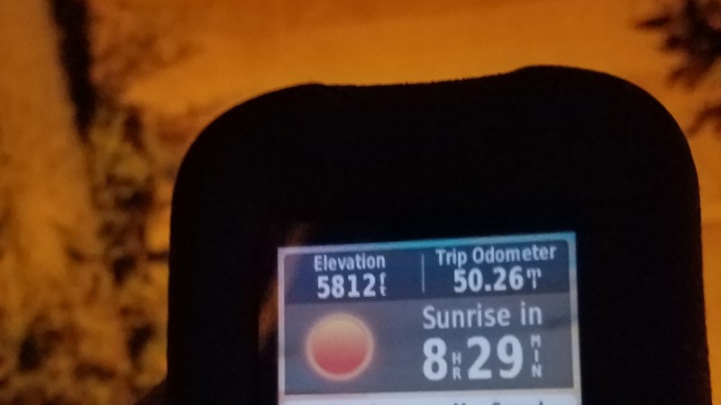
Thorodin's 50 Starrs is a 50-mile hiking event I developed. By definition, Thorodin's 50 Starrs is the event such that a person starts hiking at the Chautauqua Trailhead, hikes to the summit of Thorodin Mountain and Starr Peak, and makes sure to hike at least 50 miles before returning to the Chautauqua Trailhead on the same calendar day as having started. No mechanical aid is allowed (trekking poles are o.k.), and no departing the course unless by foot. Companions and support stations are fine--I was accompanied for about 13 of the total miles and I had support stations about every 14 miles.
I decided to call it Thorodin's 50 Starrs because that name includes both peak names, "Starrs" also connotes the amount of night hiking, the total mileage is 50, and "50 Starrs" connotes the American flag which is fitting as I did this the week of July 4th.
My route was as follows:
Gregory Canyon Trail
Flagstaff Road
Gross Dam Road
Crescent Park Drive
Highway 72
Twin Spruce Road
Gap Road
bushwhack to summit of Thorodin and Starr
For the return, I reversed the route, detouring a few times to increase my mileage to 50 by the time I got back to Chautauqua. I decided to make a double marathon of it, since I was already so close, so I walked home after returning to Chautauqua. The total stats were:
53.5 miles
2 miles vertical gain
22 hours 10 minutes starting at midnight
Here is how I felt every 10 miles, explained by emojis:
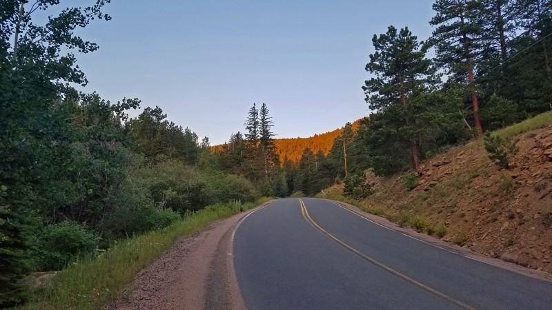
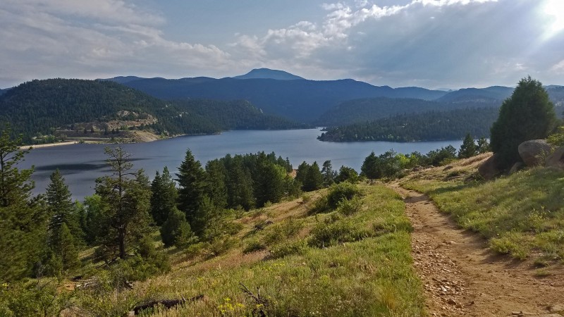
I started hiking at exactly midnight from Chautauqua. The initial steep climb to Flagstaff Road went quickly, and then I hiked even faster once on the road. I passed Kossler Lake about 1:40 a.m., and started descending to Walker Ranch. Along the way, I could see Starr Peak looming in the distance. The moon provided a lot of light until it set about an hour before sunrise.
After this shot was taken, I continued to make decent time, crossing South Boulder Creek at 3:55 a.m. and reaching my first aid station at the "town" of Coal Creek on Hwy 72 about 5:00 a.m.
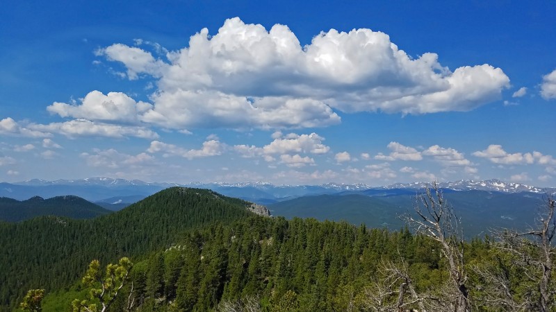
Starr Peak (my destination) from Flagstaff Road
After carefully hiking a short section of Hwy 72, I turned right on Twin Spruce Road, which is really just the lower part of Gap Road. This was a less scenic portion, as it was a deep forested canyon, but sunrise still brought a welcome breath of light. I have often said that miles hiked before sunrise don't count against how many you can do that day, and I was testing the theory this time, having walked 15 miles before sunrise.
Sunrise on Twin Spruce Road
Every good trek has prayer flags strung up alongside...these were on the lower part of Gap Road.
Prayer flags
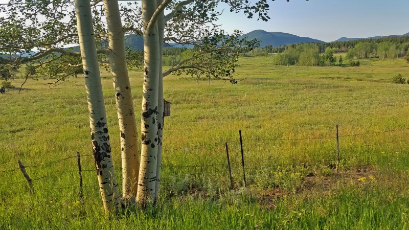
Around mile 19, the trees opened up to reveal a nice meadow.
Meadow on Gap Road
Eventually, I entered Golden Gate Canyon State Park, and the road turned to dirt.
Golden Gate Canyon State Park
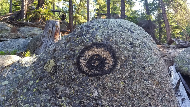
I met my mom at about mile 21.5 at the Gap Road pullout, which was our trailhead for climbing Thorodin and Starr. There is no trail going to these peaks, and the bushwhacking is bad in spots. I found this lichen bulls-eye marking our path. Coincidence? Definitely.
Lichen bulls-eye
After gaining 1,100 vertical feet in a mile, we reached the lofty and beautiful summit of Thorodin Mountain at 9:00 a.m. You can see the Thorodin/Starr massif from most points in Boulder's foothills, and it was fun to finally be at the summit.
Summit of Thorodin Mountain
Starr Peak, a mile to the northeast, promised that the bushwhack was not yet over.
Starr Peak from Thorodin
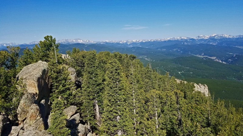
On the way to Starr, I took a short detour to Thorodin's unranked subsummit to the northeast, which is incorrectly marked in Google Earth as being the true summit of Thorodin. On the descent to the saddle with Starr, I walked into a tree branch, scraping a line from my nose to my jaw. Ouch! After surviving the talus and deadfall, we arrived on the summit of Starr Peak, which is a rock to the south of a big radio building. The sky, which was perfectly clear an hour ago, was now beginning to fill with puffy clouds as expected since the forecast called for afternoon thunderstorms.
Thorodin Mountain from Starr / view from turnaround point
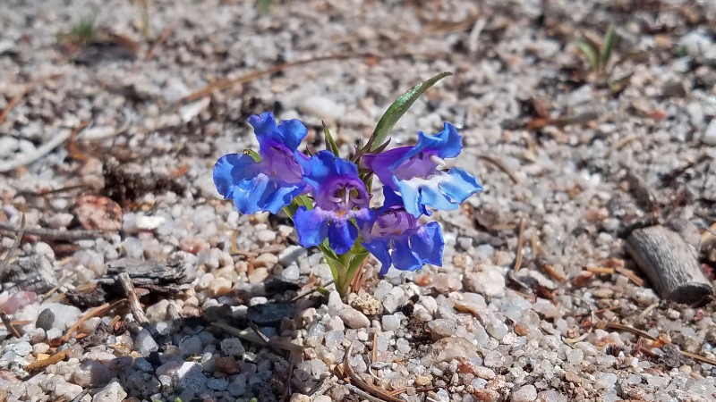
We skirted the other summits to descend as easily as possible back to the car (which had my lunch) at the Gap Road pullout. This blue flower was growing in a very sandy part of the slope.
Flower on descent
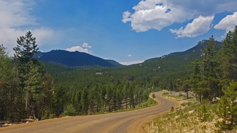
After resting for an hour at the Gap Road pullout, I headed back down Gap Road. The scenery was nice (Tremont Mountain on the left, Thorodin Mountain on the right) but the noon sun was intensely hot.
Gap Road views
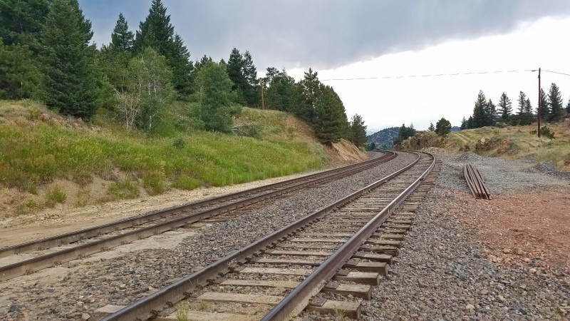
I made good time back to Coal Creek, where clouds started blocking out the worst of the sun's heat. On the climb back up Crescent Park Drive, however, I slowed considerably, now averaging only a little more than 2.5 mph. Shortly after crossing the train tracks, people started looking concerned and sometimes stopping to see if I was o.k.
Railroad crossing
Eventually I made it back to the parking lot above Gross Reservoir before 5:00 p.m., and I detoured to eat dinner at the shore. Starr Peak loomed as the highest point on the horizon, blocking Thorodin, which is farther away.
Gross Reservoir
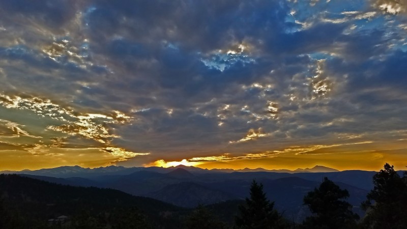
At this point my feet hurt badly, but duct tape helped hot spots. I made it up the final big incline to Kossler Lake and passed Panorama Point at sunset.
Sunset from Panorama Point
I sprinted the last 50 feet back to Chautauqua, arriving at 9:09 p.m. for a time of 21:09 on Thorodin's 50 Starrs.
Back to Chautauqua and just over 50 miles
At that point, I figured I had hours left and might as well hike home, making it a double marathon. I made it home 1 hour and 1 minute later, clocking an overall time of 22:10 for 53.5 miles.
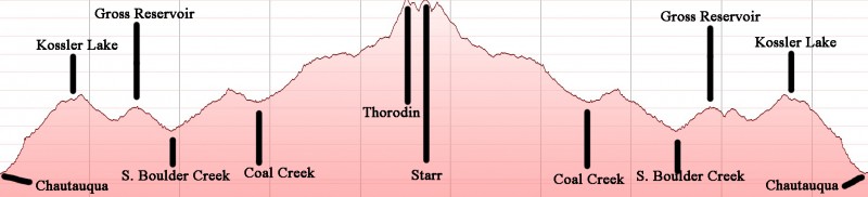
Here is a satellite view of the route and an elevation profile.
I enjoyed pushing my limits on Thorodin's 50 Starrs, and I would highly recommend this event to anyone wanting to try a 50-mile hike near Boulder with good views and fun peaks. There are endless potential variations. Someone could do it unsupported; I think a suitable name for an unsupported version would be "Thorodin's 50 Water Bottles." I leave you with a couple quotes:
"Long distance runner, what you standin' there for? Get up get out, get out of the door!" Grateful Dead
"For no particular reason, I just kept on going....I'm pretty tired, I think I'll go home now." Forrest Gump
My GPS Tracks on Google Maps (made from a .GPX file upload):
Super awesome that you did this. I'm not familiar at all with trails up that far but I would wonder if there was a way to do this with less road and more trail use. Great work, way further than I'd ever want to go! Haha.
Yeah, a trail certainly would have been preferable, at least during the day. I think there aren't a whole lot of trails in the middle section due to a lot of private property around there, but it's probably possible to change some of the miles over to trails. I originally wanted a lot of it to be on roads so that I could easily bail, because I was pretty sure going in that I wouldn't make it all the way back to Chautauqua.
Caution: The information contained in this report may not be accurate and should not be the only resource used in preparation for your climb. Failure to have the necessary experience, physical conditioning, supplies or equipment can result in injury or death. 14ers.com and the author(s) of this report provide no warranties, either express or implied, that the information provided is accurate or reliable. By using the information provided, you agree to indemnify and hold harmless 14ers.com and the report author(s) with respect to any claims and demands against them, including any attorney fees and expenses. Please read the 14ers.com Safety and Disclaimer pages for more information.
Please respect private property: 14ers.com supports the rights of private landowners to determine how and by whom their land will be used. In Colorado, it is your responsibility to determine if land is private and to obtain the appropriate permission before entering the property.