Download Agreement, Release, and Acknowledgement of Risk:
You (the person requesting this file download) fully understand mountain climbing ("Activity") involves risks and dangers of serious bodily injury, including permanent disability, paralysis, and death ("Risks") and you fully accept and assume all such risks and all responsibility for losses, costs, and damages you incur as a result of your participation in this Activity.
You acknowledge that information in the file you have chosen to download may not be accurate and may contain errors. You agree to assume all risks when using this information and agree to release and discharge 14ers.com, 14ers Inc. and the author(s) of such information (collectively, the "Released Parties").
You hereby discharge the Released Parties from all damages, actions, claims and liabilities of any nature, specifically including, but not limited to, damages, actions, claims and liabilities arising from or related to the negligence of the Released Parties. You further agree to indemnify, hold harmless and defend 14ers.com, 14ers Inc. and each of the other Released Parties from and against any loss, damage, liability and expense, including costs and attorney fees, incurred by 14ers.com, 14ers Inc. or any of the other Released Parties as a result of you using information provided on the 14ers.com or 14ers Inc. websites.
You have read this agreement, fully understand its terms and intend it to be a complete and unconditional release of all liability to the greatest extent allowed by law and agree that if any portion of this agreement is held to be invalid the balance, notwithstanding, shall continue in full force and effect.
By clicking "OK" you agree to these terms. If you DO NOT agree, click "Cancel"...
âHope and Despairâ
June 24, 2017
Quail, Hope, Ervin & Blaurock from the Willis Gulch trailhead (up little Willis and down biggie)
Foreword
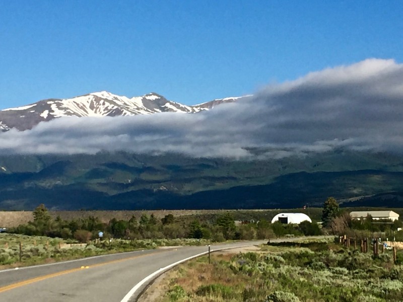
Before getting to this wonderful day of alpine sunshine, I drove by an arresting inversion north of Twin Lakes.
Inversion a few miles in on 82 from 24.
Part 1: My heart quailed en route to Mt Hope
I planned a big day of five peaks - Quail, Hope, Ervin, Blaurock, Rinker - but got a suburban rather than alpine start, heading up the trail from the Willis Gulch parking at 7:33 am. Just days after the solstice and with a perfect forecast,I nonetheless remained hopeful of success in my endeavor.
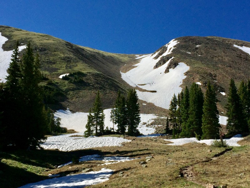
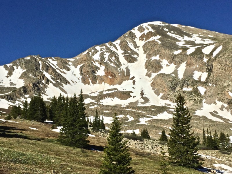
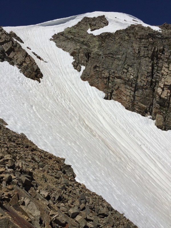
The well-established trail presented no difficulties and I found myself in the upper basin in under two hours. Looking left, a shallow snow gully offered access to Quail. To my right, Mt Hope loomed large, the Hopeful Couloir still presenting an abundance of snow.
Benign gully to Quail's upper west face.
Mt Hope from the same vantage. Hopeful!
The snow up the gully to Quail proved benevolent: low-angled, well-compacted, and soft enough to sink by toes in just enough. About three quarters of the way up, I abandoned the snow for grassy slopes to head directly for Quail's gentle summit.
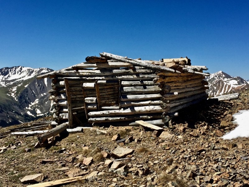
I was amazed to see the still-standing structure of an old cabin up here. I began walking toward it, when something sprang from the ground only twenty feet or so ahead of me to the left: a juvenile mule deer. It bounded past the cabin, lost to sight before my heart stopped racing. I chuckled inwardly at how much I'd been startled, and that I'd not seen the young deer, curled up on the ground on some flat rocks in the grass.
Sure, it's not much, but look at the views! Location, location, location!
After checking out the cabin, I turned to the west and started down the ridge toward Hope. I was not excited to see how much elevation I would lose. It's nearly 1,000 feet down to the saddle between the two peaks. I thought I might have company on Hope, as a half dozen hikers had reached the saddle from the Sheep Gulch trail, but they all either continued over the saddle and into the Little Willis basin, or turned around. I enjoyed the east ridge and arrived at Hope's summit at 12:15, about an hour and a half from when I had left Quail.
Upper east ridge to Hope.
Upper Hopeful Couloir.
Part 2: Hope to Despair
Continuing west over Hope's expansive summit, the ridge leading to Ervin did not look promising. I saw a cluster of ragged spires of some yellow crumbly-looking rock, with spots of snow between here and there. Likely not enough snow to aid progress over unstable slopes, but just patches of ice to make the way more rotten.
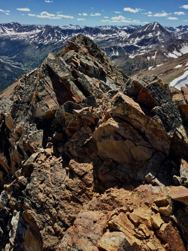
The ridge at left in foreground is the nasty gnar to Ervin.
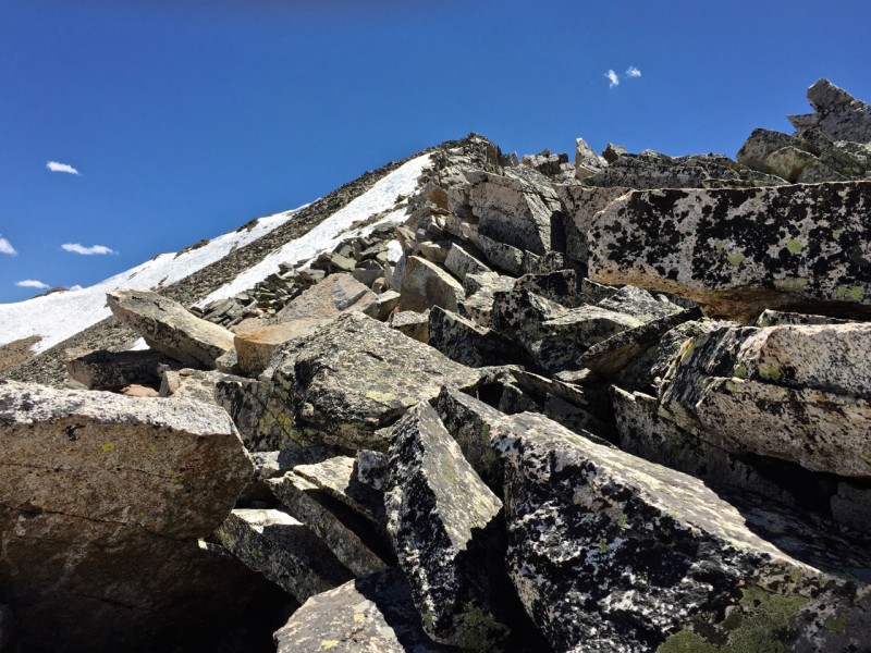
The way to those rotten spires, though, was very straightforward, and I found a use-trail traversing well beneath the ridge crest. Initially, I found this expedient, but it soon grew tedious as the faint trail disappeared and the terrain became a tiresome traverse across innumerable gullies of scree. Looking ahead, though, I took heart at what looked to be solid terrain to the summit.
The Gullies of Hell Traverse.
Glad to have the gullies behind me, I reached a white rock section of ridge. What had looked promising from afar turned out to be the same white devil rock of Capitol's summit; slabs the size of kitchen appliances (dishwashers, not mixers) tottered beneath me. I would not recommend this route to anyone, I thought: danger ought to come with a lot more fun.
Really? A rock the weight of my car is wiggling beneath me?!
Part 3: Ghosts of Mountaineers Past
âErvin, you bastard, you sure as hell don't want me here. What do you have waiting for me on the other side?â These words I mused on the summit, as I looked beyond it to Blaurock.
âShut your whining,â Ervin replied, âI climbed mountains; not merely scampered across some broken ground from one to the other.â
Interesting summit cairn/post on Ervin.
I left Ervin to his thoughts and continued on the ridge toward his neighbor, Blaurock. The terrain didn't inspire confidence: it appeared to be more rough, rotten rock with treacherous gullies beneath. However, I was pleasantly surprised to find the ridge crest fairly solid, requiring only one notable deviation to the south. Soon, I neared the saddle between these two climbing companions.
Looking across the ridge west to Blaurock from Ervin.
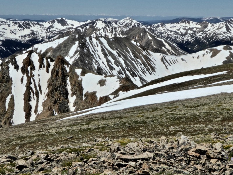
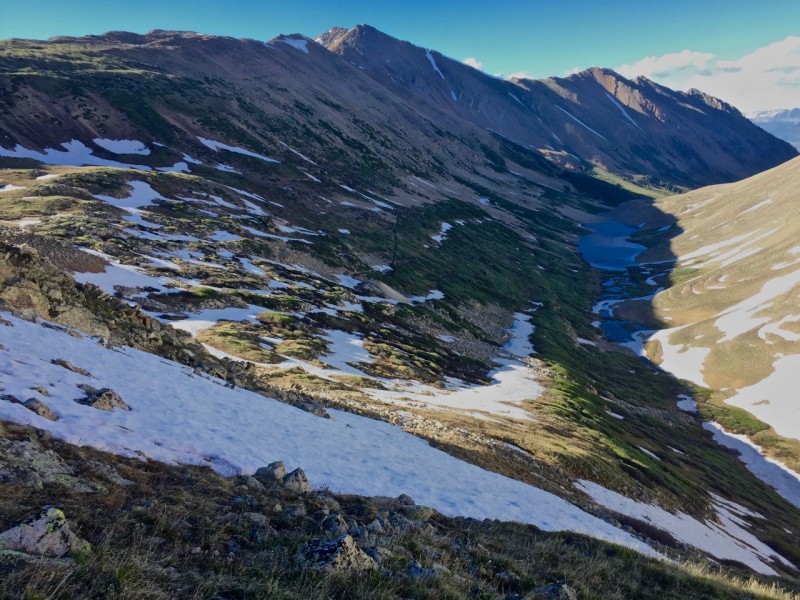
From the saddle, I gazed north up the valley. It was 4:20 and I thought that Rinker might prove out of of reach for this day.
The sinuous valley from the Blaurock-Ervin saddle.
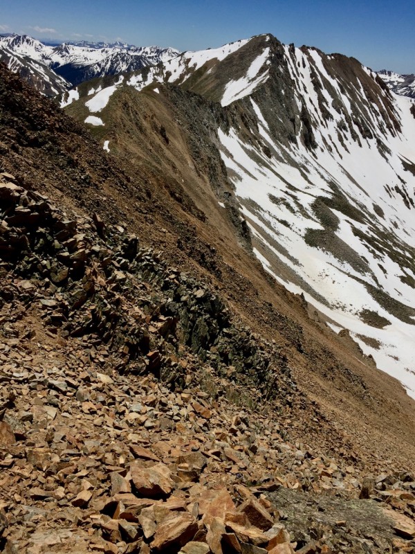
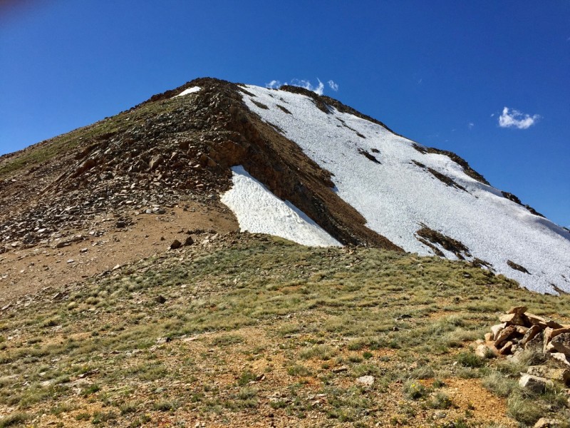
Turning my eyes west, the ridge up to Blaurock appeared rather tame: just some grass and talus walking. I figured correctly that the true summitlay out of sight, but didn't anticipate a brief, fun 2+ scramble section and rather narrow ridge walk to the summit.
Tame from afar, but with just enough spice to put a "+" to the class 2.
âNice, Carl, this was a helluva lot more fun than that junk Ervin threw at me.â
âLeave the guy alone,â Blaurock replied, âhe's got short man syndrome. Just look.â
I did. I looked back across to Ervin, and realized what an un-summit it appears to be, thanks to those crappy yellow ramparts rising to Hope's western flank. It's just a bump on the ridge between those heights and Blaurock.
Looking over to Ervin (little guy in the shadow), across Carl's impressive snow-stache.
âCould've been me,â Carl intoned. âNot that you have any reason to talk, as I doubt any mountain will be named after you.â
âToo true, Carl; I just want to see your other side, to see if that ridge will drop me over to Rinker." âOl Blaurock didn't respond, but I imagined I heard a chuckle as I looked down at the steep ridge of unstable blocks. It was 5:15 and Rinker would have to wait. If only I'd begun at 5:30 instead of 7:30.
Part 4: Bushwhack
I headed back down to the saddle, and then down north into the Big Willis gulch. The descent was amicably-angled and I made good time dropping to the mid-twelves in elevation.
My eyes easily espied a prominent ramp, vestige of an old mining track I'm sure, and I bee-lined for it, hoping it would provide an efficient path through the lower basin. I also kept looking up at Rinker, telling myself that it was not for today/tonight. The old road, unfortunately, was completely overgrown in many places, making the going a bit rough. At one point, I thought I saw a trail down by the lake and so followed game trails down to it; only to find that it itself was a short-lived game trail. I eventually ended up traversing steadily back upslope through willows to regain the old trail in slightly better condition that soon improved noticeably. I had at least the setting sun alighting on the scenery to make the unpleasant travel of the valley bearable, and now I had solid trail to speed me on my way ahead of the dark.
Heading toward the old road, with the initially wide west ridge to Rinker at top left.
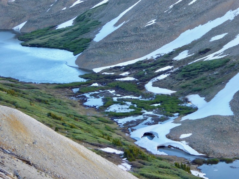
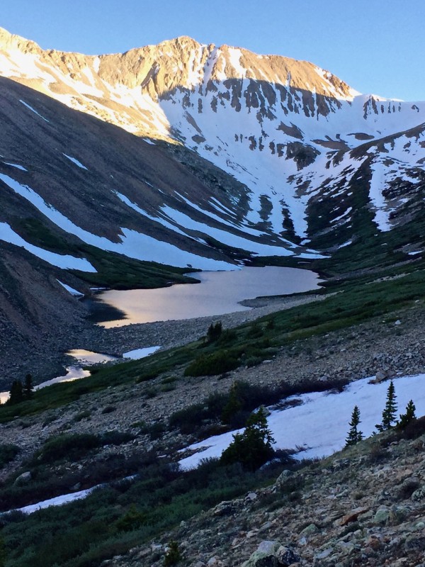
Cool snow bridge between Willis Lake and unnamed lake.
Ervin finally looks prominent from down in the willows.
Thumbnails for uploaded photos (click to open slideshow):
It's the voices in your head, they explain everything. "Hey, you should climb the vertical wall of choss" "That never ending ridge looks reasonable as a day climb" "I know there is nice grass ramp right in front of me, but that overhanging tower is the way to go"
Nice report, fun read, thanks for sharing! Hope to see you in the hills!
Thanks, Dave, Shawn & Jay. I hope you're all off to some peak experiences this summer. Shawn, how do you know the voices in my head?! They've told me all of those things at different times!!
Nice work with reaching more cool, quality 13er mountain summits. Also, excellent trip report. Very well-written. Mt. Hope A - Quail Mtn are classic pinnacles.
Thanks for sharing this beta too. Looks like you had an extremely memorable adventure up there! Glad reading that you're getting after these peaks consistently. Keep climbing safe and strong!
The summit welcome hut on Quail still looks good! Hope it was fully stocked for you!
Caution: The information contained in this report may not be accurate and should not be the only resource used in preparation for your climb. Failure to have the necessary experience, physical conditioning, supplies or equipment can result in injury or death. 14ers.com and the author(s) of this report provide no warranties, either express or implied, that the information provided is accurate or reliable. By using the information provided, you agree to indemnify and hold harmless 14ers.com and the report author(s) with respect to any claims and demands against them, including any attorney fees and expenses. Please read the 14ers.com Safety and Disclaimer pages for more information.
Please respect private property: 14ers.com supports the rights of private landowners to determine how and by whom their land will be used. In Colorado, it is your responsibility to determine if land is private and to obtain the appropriate permission before entering the property.