| Report Type | Full |
| Peak(s) |
Mount Fuji - 12388 |
| Date Posted | 07/05/2017 |
| Modified | 09/24/2017 |
| Date Climbed | 07/02/2017 |
| Author | nyker |
| The Split Personality of Mount Fuji |
|---|
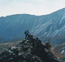
 There is a Japanese proverb about climbing Mount Fuji that I never understood: "He who climbs Mount Fuji is a wise man; he who climbs twice is a fool" Never understood it that is â¦until I climbed it again last weekend. The first time I climbed to the top of Mount Fuji (see link below), the weather and conditions were great and it was no more than a long hike with a good amount of elevation gain to ascend. 2016 Mt Fuji Climb However, as is the case for many mountains, conditions and weather changes bring out the Dr. Jekyll and Mr. Hyde personalities that taller mountains possess. It's easy to forget how quickly things can turn south when higher up in extreme environments even on a supposedly "walk up" peak, especially when past experiences in the same terrain have been favorable and made it seem easy. For those who are not that familiar with Mt Fuji, Fuji-san is not just the country high point, but a spiritual and highly sacred, symbolic icon of Japan. (The mountain is known by many names such that Mt Fuji = Fuji-san = Fujiyama) Given the flat landscape for dozens of miles in any direction, Mount Fujiyama dominates the sky when clear. The bus station in Kawaguchiko is shown below.  The factors that make Fuji prone to harsh weather include its prominence relative to surrounding area, elevation, its exposed nature, steep barren slopes, loose terrain prone to rockfall and proximity to the ocean. Once on its slopes above treeline, (which is effectively the entire route) there is little shelter to protect climbers from its often heavy rain or snow this mountain receives. It's the wind however, which has reached 200mph in the past here which is one of the biggest factors determining the type of day you will have on Fuji. Local Police (stationed on the mountain) and local Guides had commented several people have died from being blown off their feet then falling or having their tents blown off the mountain with them inside. This past weekend, the wind was the key factor, even in the parking lot which was blowing my loaded pack along the asphalt before starting out. Higher up it was blowing hard and was deafening as it roared through the many erosion barriers on the mountain, reaching speeds similar to one would see on Mount Washington in New Hampshire. It was impressive to experience that, though a bit scary as I climbed higher. After this weekend, I have a newfound respect for Fuji-san. Located in Fuji-Hakone-Izu National Park, the greater area near the mountain is a rare piece of wilderness in Japan. Many moods of Fuji 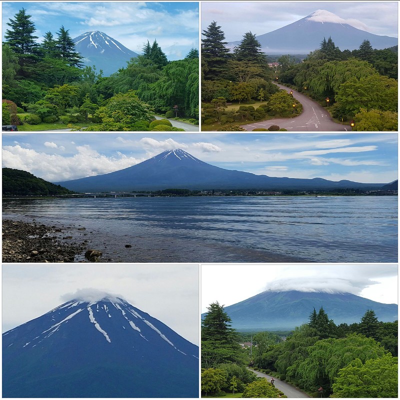 The Climb During daylight hours, the Fifth Station trailhead has more people than many small rural towns, and is often teeming with 2,000 or more people coming in droves packed in tourist busses. I targeted a start time at the trailhead of 4:30AM. Despite the July 1st âopening" of the climbing season, the 5th Station trailhead above was expectedly quiet then and as you can see from photo, was already light as sunrise was roughly 4:30AM. The start of the Yoshida route is up to the right. The only noise was the wind howling through the trees. 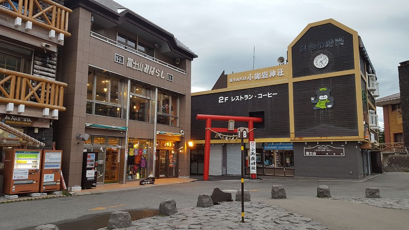 Shrine near the trailhead 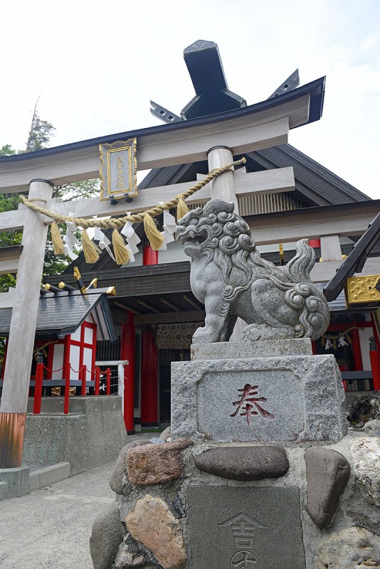 For reasons of convenience and time constraints, I climbed the Yoshida Route. You can get to the trailhead from Tokyo using a combination of buses, taxis, trains or subways (or car if you know someone locally). Roundtrip distance on this route is roughly 8 miles with an elevation gain of +4,840ft, a bit more if you choose to climb the sub peaks on the summit rim. If you're contemplating climbing the mountain, research the logistics beforehand to make your life much easier. With the variability of weather and conditions on this mountain, coupled with the number of different hikers you will encounter, no two climbs will ever be the same even on the same route at the same time of year. The standard way to climb Fuji is to climb partially up the mountain to a Mountain hut and stay overnight, then aim for the summit the following morning early to see sunrise, leaving your hut at 2:00AM-3:30AM. However, 95% of all people do it this way so you'll be climbing in massive crowds of people. There is a better way (but you won't see the sunrise from the top and will have to work a bit harder). Rather than join the mass crowds that climbed up the night before and stayed in the various huts in order to see sunrise from at or near the crater, I opted to do a day climb again similar to a normal day hike of a 14er. Oddly, while popular in the U.S., one-day climbs are discouraged on Mt Fuji with 1-2 night stays in the huts more the norm. When a hiker opts for a hike with a very early start time (i.e. an alpine start), they are referred to as "bullet climbs", which are also discouraged. The official season on Fuji is July 1 to early September. I still find it amazing that in only 10 weeks of âofficial climbing seasonâ roughly 300,000 attempt to climb Fuji. I am not sure what the success % rate is, but judging from this weekend, it's probably below 50%. Shoulder season climbs in May, June or Late September often will be less crowded but could face more questionable weather. Winter ascents in November to April apparently need permission from local Police and aspiring climbers need to submit climbing applications. A nice colorful illustration of the route on the mountain. 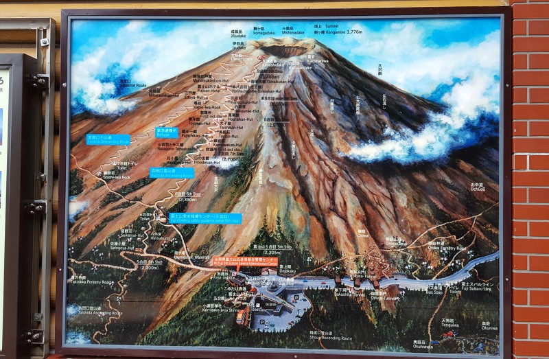 There is a spot where you are asked to pay a volunteer fee of 1000 Yen to climb the mountain. For doing so, you get a nice little wooden amulet of Mount Fuji as your receipt and cool souvenir and is to be hung on your pack during the climb up. After this station, the trail begins.  The view of the forest and distant mountains is beautiful as clouds were forming over the peaks. After a short gentle descent, you reach the turn off to go up the mountain. You can't miss the sign below:  The weather for the couple of days before my climb was terrible for being on such a mountain, nonstop wind and rain. A short climb to 9,000ft the day before was met with sideways rain and 50-60mph winds all day. On this morning, while the rain was expected to eventually stop, the wind was ctually forecast to be stronger up high. I managed my expectations and figured I'd climb up as far as I could safely get and reassess the situation as I went and retreat if I felt it was too dangerous. After a brief fairly flat approach, the route begins to switchback immediately up the mountain. No snow is left down low so the trail is a dirt track, which in the wind on the morning, meant blowing sand and gravel. A buff or mask was helpful to protect your face and help not breath in sand not matted down by the recent rain, which luckily soon stopped after starting. The wind, however kept blowing. Many barricades have been placed on the mountain to help control erosion, which is a constant threat on a mountain so steep and popular with hikers which is also devoid of trees to help stabilize the loose volcanic ground. 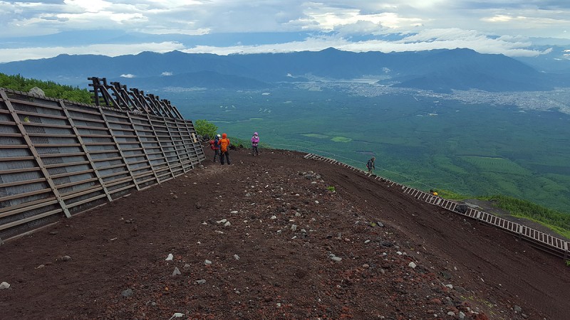 You won't find a wilderness experience climbing Fuji but you'll get a unique cultural experience that you won't get on any other mountain. As it was the weekend, I was expecting more people on the mountain than what you'd find on a weekday. On the ascent, I saw maybe 50 people climbing up. However, more people were returning down due to the weather conditions and then later on in the afternoon as the storm finally cleared, there were another couple hundred coming up and another couple hundred probably in all the huts now coming down. Despite this, I never once needed to wait in a queue to hike up.  The weather was starting to take a turn for the worse as visibility dropped to maybe 100-150ft. 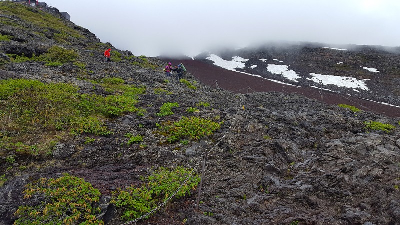 The red Torii and hut atop a steep rocky climb 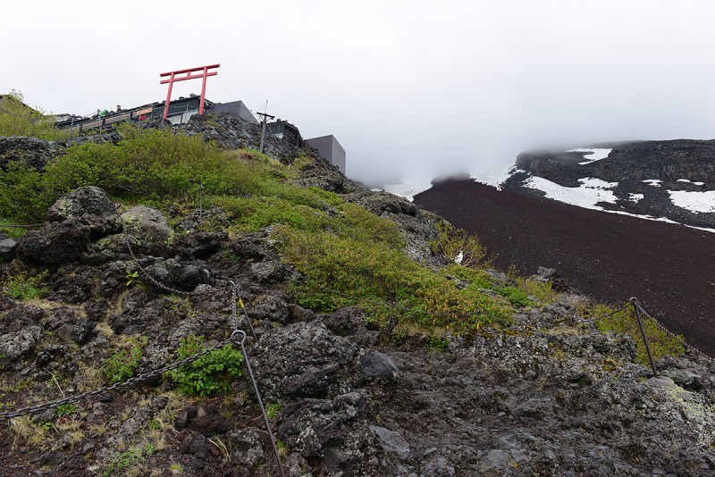 The view of a hut/station with local climbers, many dressed in "yama" (mountain) fashion 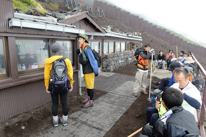 As the terrain steepens, the route becomes rockier and turns more Class 2 scrambling, with some Class 3 if you wanted to make it harder. These rocks are slippery when wet or icy and footing unstable if windy so you'll see chains running up many parts of the mountain. 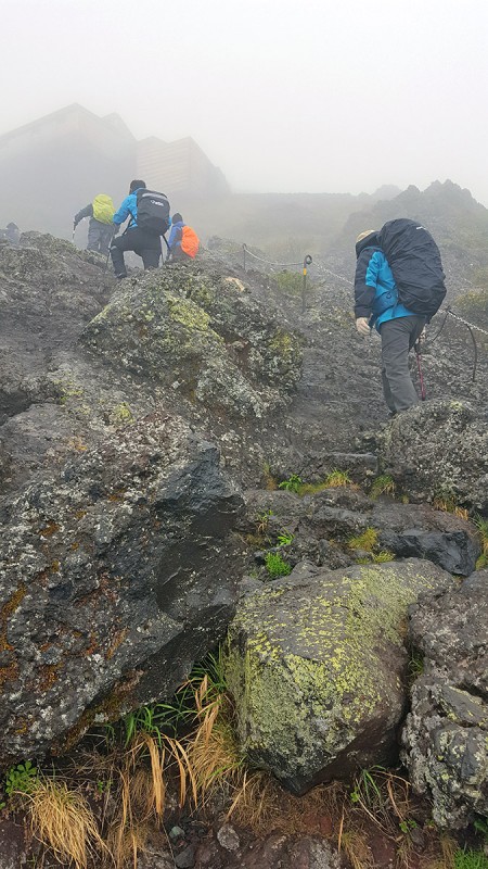 As I climbed higher, snow started to be seen. Clouds enveloped the mountain and soon would be in a white out. As this route climbs up the north aspect of the mountain, I'd expected more snow to linger here than other sides and that's what I found. (this pic was taken on way down) 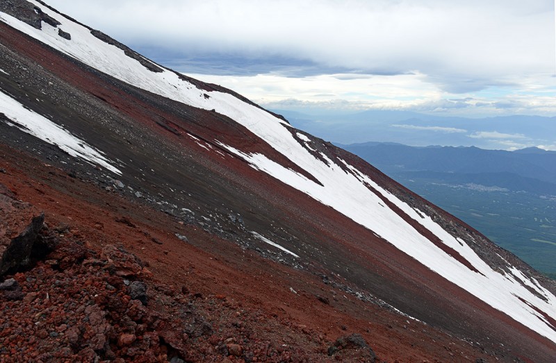 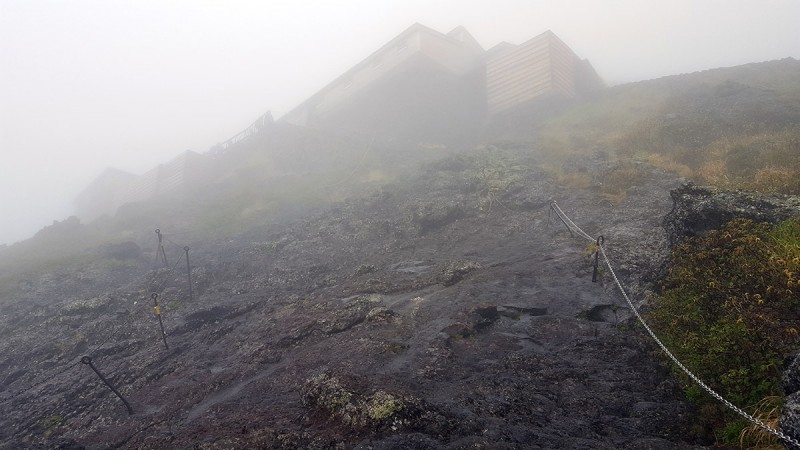  There were many people coming down after having turned around higher up due to strong winds and earlier on, heavy rain. This wasn't the best omen. Some rockfall was reported as well. A distance away from the route, I did see a coffee table sized boulder roll down from higher up and then breakup as it careened down the peak. Eerily, given the noise from the wind, I didn't hear a thing as it flew past. Lower down, escape options were plentiful as the terrain was not yet technical or steep rock, so I felt worse case I could still turn around with ease if needed. 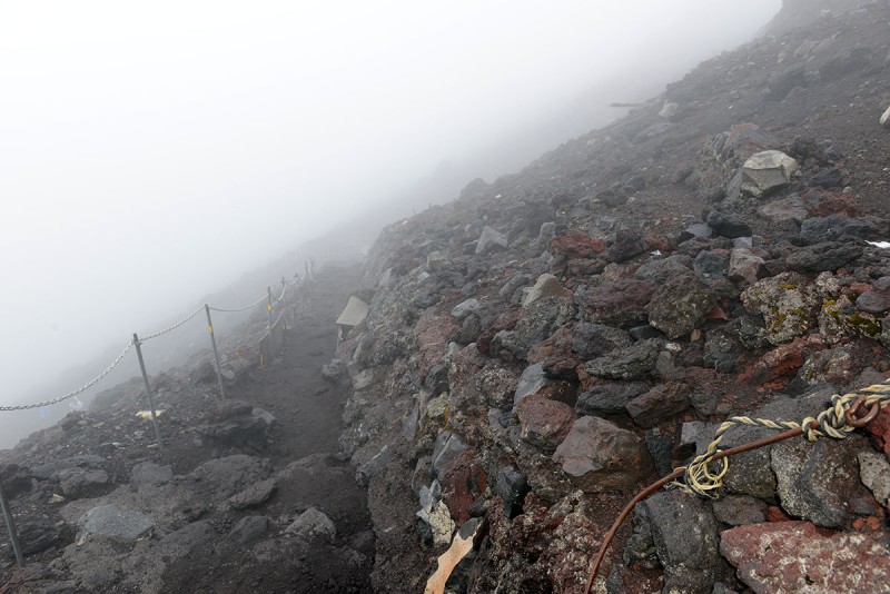 I found snow helped show off the lines of the slopes of the mountain more so than the relatively featureless terrain seen in lower snow years.  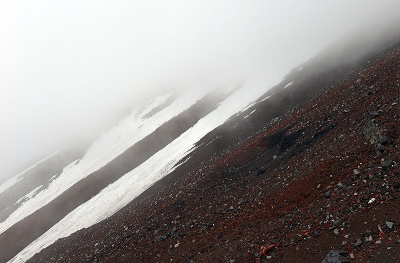 The second gate or Torii was soon in sight, a promising sign of upward progress. 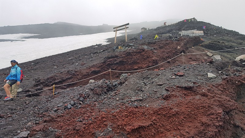 It was around this point where a huge group of guided climbers passed by. Dressed in an assortment of colorful hiking outerwear, it made for a quintessential Fuji-esque scene.  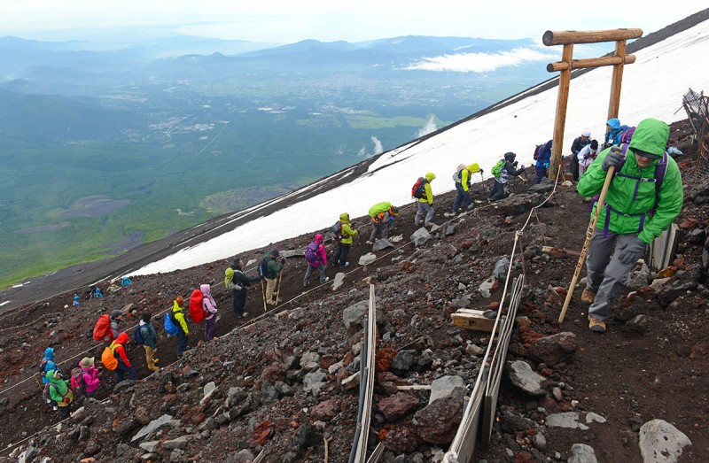 Many people were carrying the traditional wooden Fuji san climbing stick (a "pilgrim staff"); As a climber makes their way up the mountain, each station can be visited where they can get a stamp burned into their stick with the mark of that station with the location and elevation, evidencing the climb to the top which makes a good souvenir (as long as you don't mind checking it in luggage on the flight home). Many of the sticks had a Japanese (or other) flag attached at the top. In the wind today, some of these flags blew off never to be seen again. Interestingly I saw dozens of hats and scarves all over the mountain that must have been blown off the heads of hikers. As the route winds its way up the mountain, snow starts to become more prevalent and many parts of the route have ropes and chains through the remaining snow and/or sections cut through the snow.   Soon, though what seemed like an eternity given the wind and conditions, the lion guardians and Torii gate just under the summit are reached (called the Toriiohashi). The angle of this section of the route blocked the wind. Good place for a short break. 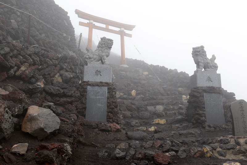 Just above the gate is the last section up to the summit crater. For the folks that hadn't turned around, most stopped at the last station which is located just under the rim of the crater. Given the conditions, the whiteout made it impossible to see the actual summit, so most folks either weren't aware there was more to go to reach the true summit or just decided to turn around at the topout point on the crater rim. The Yoshida Route tops out almost exactly opposite across from the summit which located on the other side; From that point where the Yoshida Route reaches the crater it's another 20-40min hike to get there to the high point, known as Kengamine Peak, which is the true summit at 3,776m (~12,388ft). Today, this was easier said than done. The image below was the most clear it got into the crater on the ascent around it.  Most sections leading to around the crater were actually blocked off with rope or chains, indicating it was closed. However, there was one way to the left (east) that was open though you had to ascent the small subpeak to get around. This peak is called Joujudake Peak. At that moment, another guy there named âYoungâ from China just arrived and wanted to go to the summit; so we teamed up and cautiously moved slowly on towards the true summit, agreeing we'd turn back if conditions got too sketchy. The shots below are views along the crater rim on the way back during a brief clearing window. 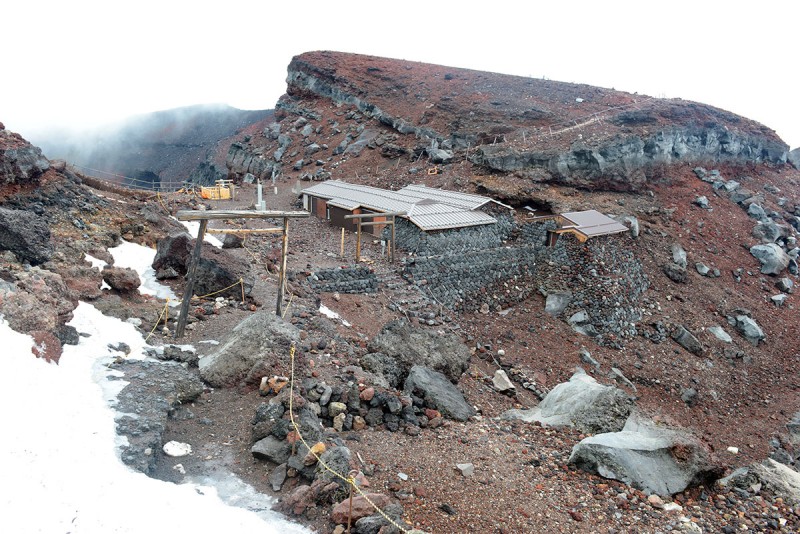 The hike around the crater, up and over the sub peaks is called âOhachimeguriâ which translates simply into âwalking around the craterâ in Japanese. A couple of the peaks were covered in ice and snow and would have made for treacherous climbing today with the wind and as only one side was open, i.e. the east side, we did an âout and back" route to the true summit as a loop wasn't possible. Young a hiker visiting from China, moving over the crater rim: 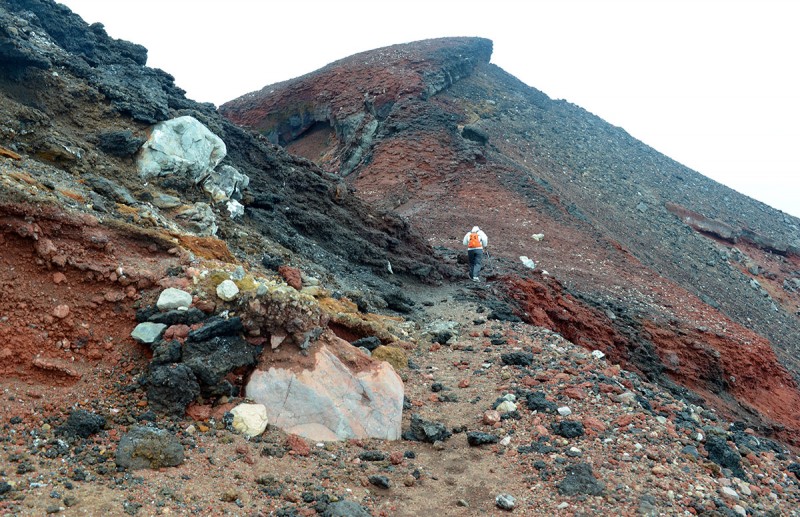 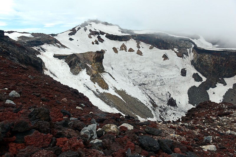 After circumnavigating about half of the crater, at 3,715m, you'll pass the Sengentaisha Okumiya Shrine near the top out point of another route (The Fujinomiya Route), than you'll come across the below sign, indicating only 2km more to the top. (pic taken on the descent) Almost there! 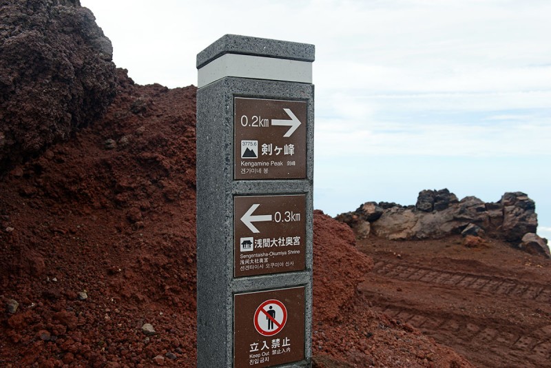 A view of the last pitch up the ramp to the top. The crater is to the right in the photo. 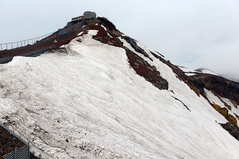 A climber making his way up the final stretch to the top.  The summit marker on Kengamine Peak! I am holding on to it since the wind was exceptionally strong.  Views looking down into and across the summit crater 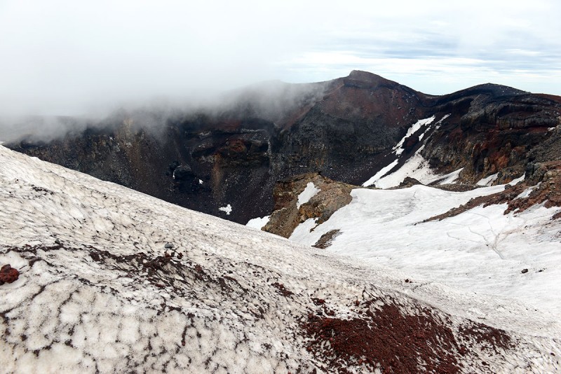  Views across the crater as we circumnavigated back; the buildings in the photo is where the Shrine is located.  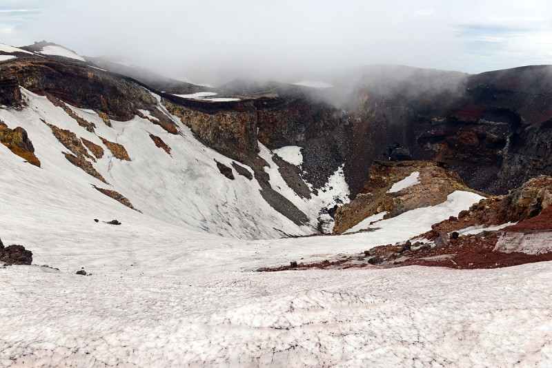 Note on the Wind: Wind is major factor on Mt Fuji that I underestimated. The wind was blowing strong all day, ~75-100kph according to the weather report in the morning. However it grew fierce as we circumnavigated the crater and in one section which was about 150ft long, prevented us from standing up and blew me 3-4 feet into a group of boulders. We had to crawl on our stomachs as low as possible to avoid getting picked up by the wind. It was scary and made it hard to breathe in such wind speeds. A local guide I ran into lower down mentioned it was gusting around 150+kph (~93mph), which seemed accurate. When I was last on Mt Washington, the anemometer read 89mph and while difficult to move normally I was still able to walk through it with my poles in that speed. Moving across the crater on Fuji, I'd say it was it was higher as we were unable to stand up and had to crawl on all fours or risk getting blown into the rocks. I don't know what the wind chill corrected temperature was, but with 3 layers on (base, softshell, hardshell) hat, buff and medium weight gloves, I was borderline comfortable while walking. If I stopped, I'd put another warm layer on top until I kept moving again. Below the 7th station, the weather improved dramatically and made for a nice descent in the sunshine and reduced wind. Another thing to note on this mountain is the wide variety of people, experience levels and associated gear or lack thereof you'll see. Many shops had for sale oxygen canisters for climbers and I saw many people carrying and using them. 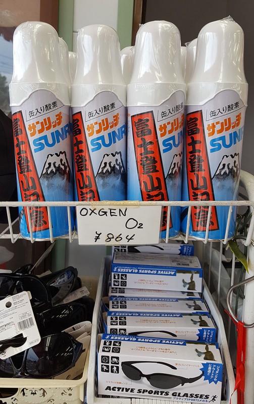 There were hikers clad in full-on mountaineering gear with 6000m boots, insulated waterproof pants and gaiters, thick down jackets and 80L packs. Others had trail runners, windbreaker with no pack. There were people in the 80s and small children who were 4yrs old walking up on their own steam. There were people running on the mountain preparing for the upcoming Fuji marathon. Some hikers had tight jeans and sneakers, some had helmets and ice axes. I have no idea of who or how many of these people made it to the summit, but they were there on the mountain. Also, importantly, remember to pack some 100 Yen coins for the toilets. There are no wag bags on the mountain, but there are several pay toilets as the only viable option to go... Given the heavy usage on the peak and zero shelter under which to answer the call of Mother Nature, its best to make use of these. The coins are to tip the workers that keep the restrooms clean, cleaner than most fast food restaurants. 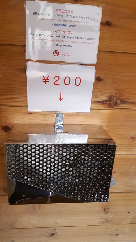 The remainder of the descent was uneventful and just a hike down, passing dozens of climbers coming up for the night. After a rough day, what better way to wrap up with some good local cuisine! (nte the fishtank in the back ..there were a few more fish in there a half hour before).  The little towns and the area around the base of the mountains have some great places to stop and see and get away from the hustle and bustle of the city and take a walk, mediate or gaze on the awesome mountain you just climbed. 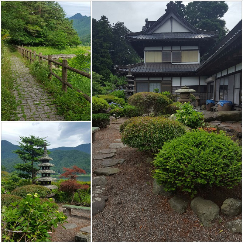 Despite the old proverb, I don't regret climbing Fujisan a second time, and would like to try other routes. If you're in Asia, I'd highly recommend visiting Japan to do some hiking and come to see Mount Fuji or plan a trip to come see the land of the rising sun. While hiking here has its challenges in language and culture, it's really a great experience and you'll have the option of climbing up an iconic peak. Thumbnails for uploaded photos (click to open slideshow):
|
| Comments or Questions | |||||||||||||||||||||
|---|---|---|---|---|---|---|---|---|---|---|---|---|---|---|---|---|---|---|---|---|---|
|
Caution: The information contained in this report may not be accurate and should not be the only resource used in preparation for your climb. Failure to have the necessary experience, physical conditioning, supplies or equipment can result in injury or death. 14ers.com and the author(s) of this report provide no warranties, either express or implied, that the information provided is accurate or reliable. By using the information provided, you agree to indemnify and hold harmless 14ers.com and the report author(s) with respect to any claims and demands against them, including any attorney fees and expenses. Please read the 14ers.com Safety and Disclaimer pages for more information.
Please respect private property: 14ers.com supports the rights of private landowners to determine how and by whom their land will be used. In Colorado, it is your responsibility to determine if land is private and to obtain the appropriate permission before entering the property.