Download Agreement, Release, and Acknowledgement of Risk:
You (the person requesting this file download) fully understand mountain climbing ("Activity") involves risks and dangers of serious bodily injury, including permanent disability, paralysis, and death ("Risks") and you fully accept and assume all such risks and all responsibility for losses, costs, and damages you incur as a result of your participation in this Activity.
You acknowledge that information in the file you have chosen to download may not be accurate and may contain errors. You agree to assume all risks when using this information and agree to release and discharge 14ers.com, 14ers Inc. and the author(s) of such information (collectively, the "Released Parties").
You hereby discharge the Released Parties from all damages, actions, claims and liabilities of any nature, specifically including, but not limited to, damages, actions, claims and liabilities arising from or related to the negligence of the Released Parties. You further agree to indemnify, hold harmless and defend 14ers.com, 14ers Inc. and each of the other Released Parties from and against any loss, damage, liability and expense, including costs and attorney fees, incurred by 14ers.com, 14ers Inc. or any of the other Released Parties as a result of you using information provided on the 14ers.com or 14ers Inc. websites.
You have read this agreement, fully understand its terms and intend it to be a complete and unconditional release of all liability to the greatest extent allowed by law and agree that if any portion of this agreement is held to be invalid the balance, notwithstanding, shall continue in full force and effect.
By clicking "OK" you agree to these terms. If you DO NOT agree, click "Cancel"...
Little Bit of Spice and Something Nice (The Wilson Group)
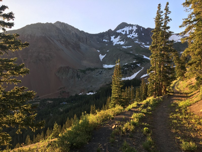
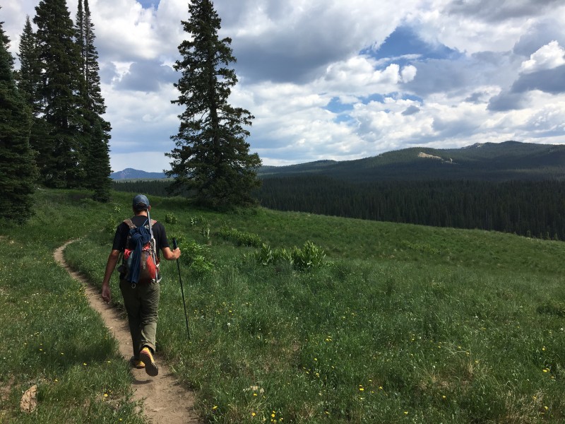
When you live in El Paso but still have an irresistible urge to get back in the Colorado mountains, sometimes you have to be willing to drive for it. I wasn't going to be able to make it back to Ohio for July 4th weekend so my hiking partner (jbradish) brought up the idea of the Wilson Group and I couldn't pass it up. So on an extended July 4th weekend I left work from EP and drove up to Golden. Once I was in town I stopped at REI for some poles and an ice ax, picked up a couple friends, and then we were off to the San Juans. We got to the Rock of Ages trailhead late but another friend drove up from Los Alamos and saved a spot. After a beer and setting up the tents we called it a night. We slept in until 5am and finally got started on the trail about a half hour later.
Day1: Something Nice (Rock of Ages TH -> Wilson Peak -> Point 13,540 B -> Elk Creek Basin):
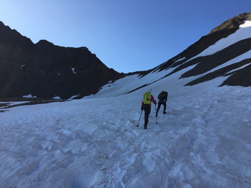
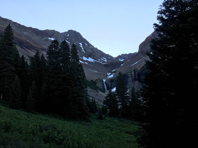
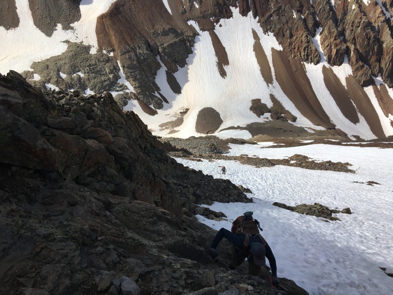
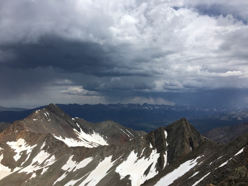
Clear skies and the sunrise made for a pleasant approach to the basin but soon the snow made its' presence known.
Shortly after the ROA saddle came into view the snow hiking started. After seeing 2 other hikers go high to the right and not have much luck, we stayed low in the basin until we were below saddle and took a diagonal route up. This is where we met up with a hiker on her last two 14ers. 10+ years in the making after summiting El Diente for her first she was circling back to bag Wilson Peak and Mount Wilson.
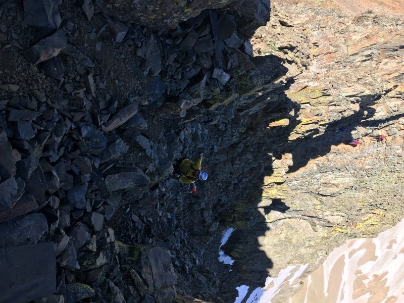
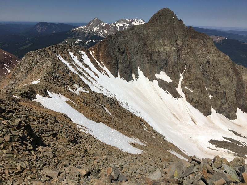
Class 3 area
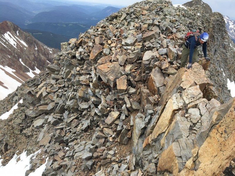
After reaching the saddle we took off the traction started up the rest of the route snow free with some Class 3 areas. Once we reached the summit we met Glen (glenmiz) and his son. Such a nice guy and I really enjoyed talking with him.
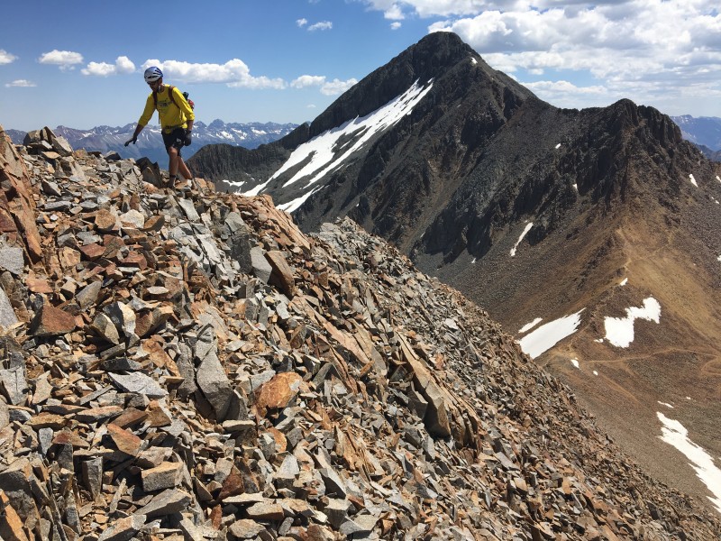
Heading up Point 13,350 B
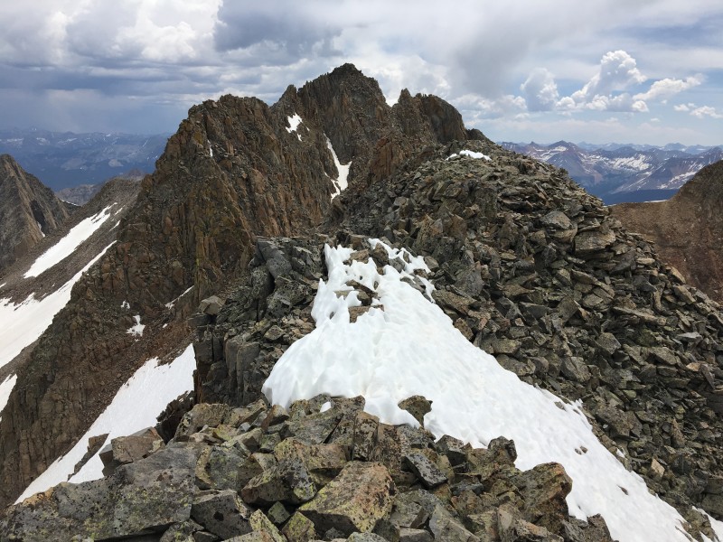
We descended back to the saddle and my hiking partner and I decided to go for some extra credit (mainly because I talked him into it. Our other two friends descended back into Silver Pick Basin but we continued back up towards Point 13,540 B. The rock was loose but Class 2 all the way up. Once on the ridge you get an amazing walk to the summit with great views of both Navajo and Silver Pick Basins. We checked the register and there was only a few signatures in the last two years. I know many people don't care to sign them (we didn't) and the pen didn't work but it was still cool to be on a peak that so few take the extra effort to get to.
Looking over at Big Beak Peak
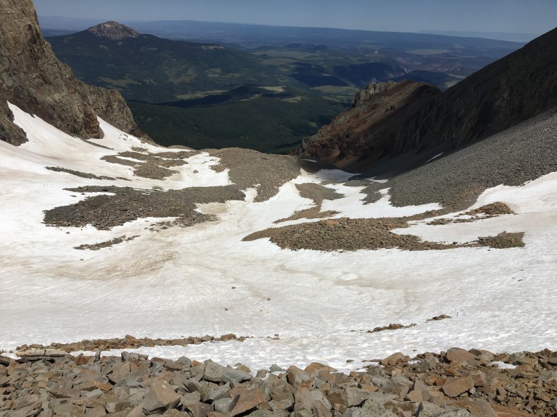
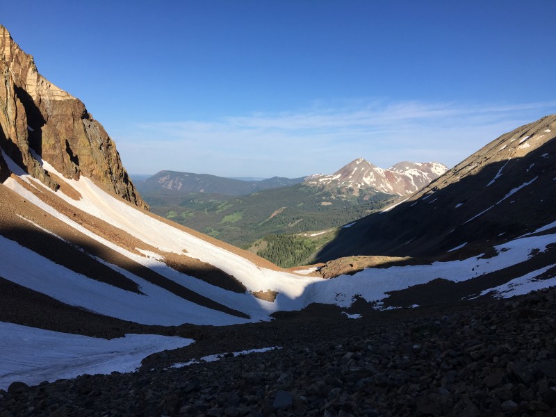
We thought about going over to Big Bear Peak but we know that was a little more difficult (Class 3. See other trip reports) and we want ed to save energy. That was the "Nice" part because the descent wasn't the greatest. After reading a couple older trip reports I knew we could descend the Elk Creek Basin (School Bus Basin) but with all the snow it became difficult to navigate from the saddle.
Old mining ruins Looking down into Elk Creek Basin (School Bus Basin)
A lot of loose rock made for a tricky descent but eventually we met up with the Elk Creek Trail and connected back with Rock of Ages Trail. Better bet would've been to ascend the Elk Creek basin because you can follow the old mining road more easily. Also, ascending/descending on the saddle closer to the base of Big Bear Peak would've made for an easier hike. All in all I thought it was a fun alternative.
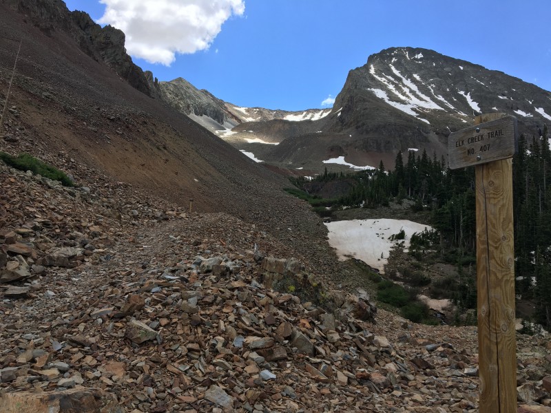
Looking back from ROA/Elk Creek Trail split
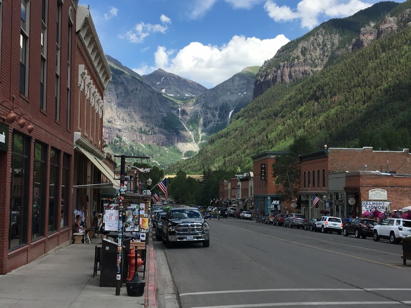
On our our way to Kilpacker TH we stopped in Telluride for Pizza and beers at Brown Dog Pizza where a couple guys new the bartender (small world). This was my first time in Telluride and I'm still not sure that place is real. Just amazing scenery and that backdrop...
I still don't know if this place is real
Day 2: A Little Bit of Spice: (Kilpacker TH -> El Diente -> Wilson Traverse -> Mt. Wilson):
Started at about 5am after hearing about some of the steep snow going up El Diente. The approach through the meadows from Kipacker is just amazing. My hiking partner and I continued on to El Diente/Mt. Wilson while the other two took the route to Navajo Lake.
About 4.5 miles in you come across a really cool waterfall which was bursting from all the runoff.
small snow patches on the approach
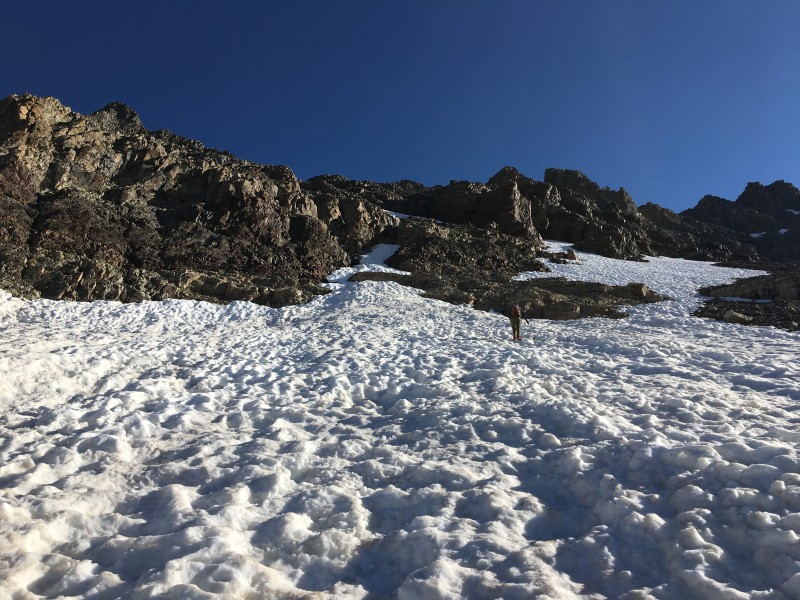
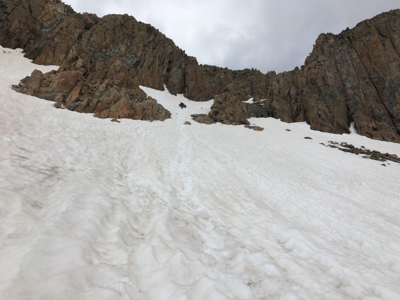
After reaching the split the snow consumed the route up to the organ pipes (good thing I bought those poles and ice axe!). At the split we met the same lady from the previous day now on her final 14er attempt (unfortunately she would turn around because of the snow. The mountain will always be there).
The steep snow made for some a challenging ascent but we made it to the gully. From the gully to the Summit just involved some Class 3 which was welcomed after all the snow. After running into Glen and his son again on the summit and talking with a few others we were uncertain of whether to go for the traverse. The snow hike took a lot of energy but we felt pretty good and after checking the weather we felt motivated to do it.
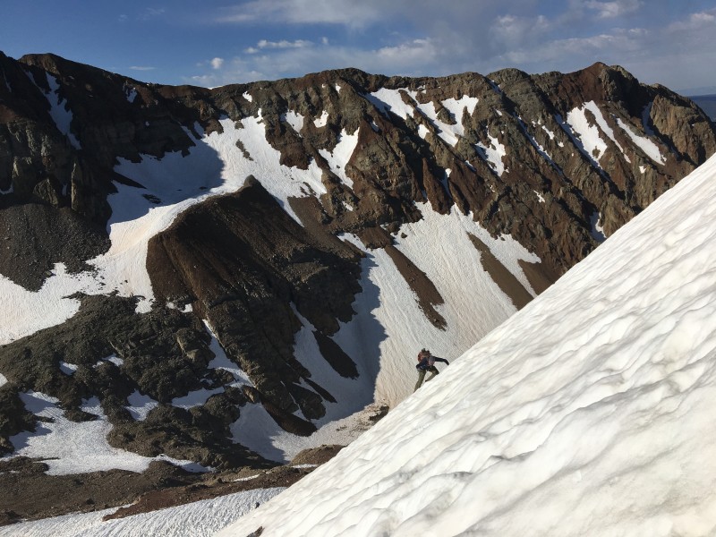
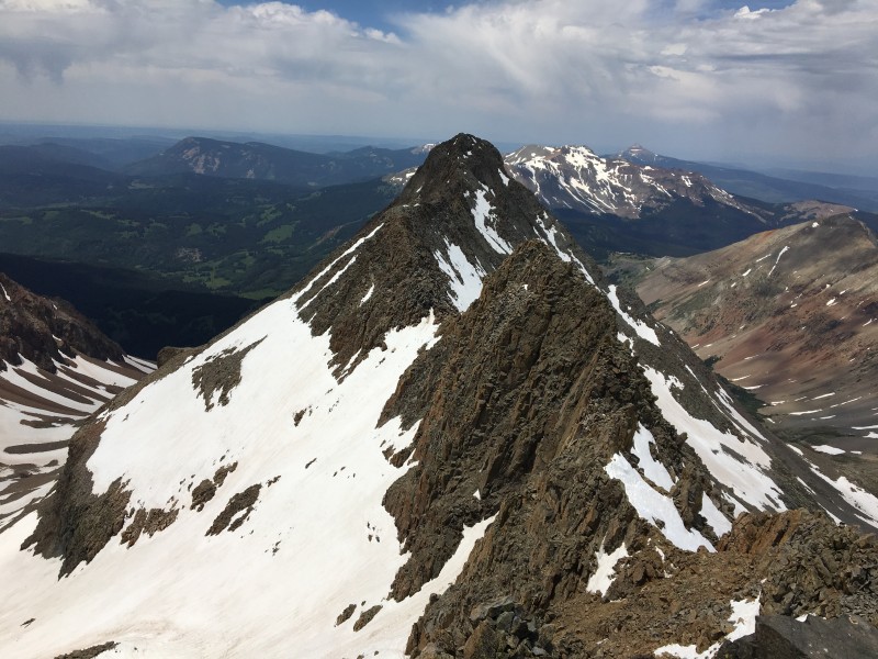
The traverse was tricky and definitely "Spicy" in some spots as described and the snow was minimal but it was all manageable.
A "small" storm north of Wilson Peak formed quickly and gave us a roaring reminder to stay focused and keep moving. After a little over 2 hours we made it to Mt. Wilson and it started to snow a little. With the looming clouds we didn't stay long. Took a few pictures and headed down Mt. Wilson.
Thankfully we were able to glissade most of the way down from the crossover.
After that the sun came out it was 5 miles back to the TH and 6 hour drive back to Denver which brought an end to another amazing trip in the San Juans!
Side Note: On our way back to the TH we came accross and older gentleman who told us he either the first or second ascent (I can't remember all the knowledge he was throwing out there ha) of El Diente in Winter in the 70's. I didn't catch his name but I'm curious if there are record of that information. If anyone can direct me somewhere to that info that'd be greeeeaaatt.
Thumbnails for uploaded photos (click to open slideshow):
William Bueler's Roof of the Rockies, A History of Colorado Mountaineering is a good resource for the history of climbing mountains in Colorado. According to Bueler, the first winter ascent of Mt Wilson was in Jan 1971 by Don Monk, Phil Schmuck, B. Eckhardt, J. Wise, and M. Wise. I believe some members of that party did El Diente during that same trip. (I can check on that.)
Caution: The information contained in this report may not be accurate and should not be the only resource used in preparation for your climb. Failure to have the necessary experience, physical conditioning, supplies or equipment can result in injury or death. 14ers.com and the author(s) of this report provide no warranties, either express or implied, that the information provided is accurate or reliable. By using the information provided, you agree to indemnify and hold harmless 14ers.com and the report author(s) with respect to any claims and demands against them, including any attorney fees and expenses. Please read the 14ers.com Safety and Disclaimer pages for more information.
Please respect private property: 14ers.com supports the rights of private landowners to determine how and by whom their land will be used. In Colorado, it is your responsibility to determine if land is private and to obtain the appropriate permission before entering the property.