Download Agreement, Release, and Acknowledgement of Risk:
You (the person requesting this file download) fully understand mountain climbing ("Activity") involves risks and dangers of serious bodily injury, including permanent disability, paralysis, and death ("Risks") and you fully accept and assume all such risks and all responsibility for losses, costs, and damages you incur as a result of your participation in this Activity.
You acknowledge that information in the file you have chosen to download may not be accurate and may contain errors. You agree to assume all risks when using this information and agree to release and discharge 14ers.com, 14ers Inc. and the author(s) of such information (collectively, the "Released Parties").
You hereby discharge the Released Parties from all damages, actions, claims and liabilities of any nature, specifically including, but not limited to, damages, actions, claims and liabilities arising from or related to the negligence of the Released Parties. You further agree to indemnify, hold harmless and defend 14ers.com, 14ers Inc. and each of the other Released Parties from and against any loss, damage, liability and expense, including costs and attorney fees, incurred by 14ers.com, 14ers Inc. or any of the other Released Parties as a result of you using information provided on the 14ers.com or 14ers Inc. websites.
You have read this agreement, fully understand its terms and intend it to be a complete and unconditional release of all liability to the greatest extent allowed by law and agree that if any portion of this agreement is held to be invalid the balance, notwithstanding, shall continue in full force and effect.
By clicking "OK" you agree to these terms. If you DO NOT agree, click "Cancel"...
Mt. Bierstadt South/East ridge via Abyss Lake trail
My initial plan for this trip was to ascend/descend the south ridge of Mt. Bierstadt via the Abyss Lake trail. I was going to be in Colorado for 1 day and I was looking for some solitude so this route seemed like a good choice. I was able to get some beta from SummitPost and Derek's trip report regarding Bierstadt's south ridge and I think I would have had a good time on it had I not succumbed to grander plans.
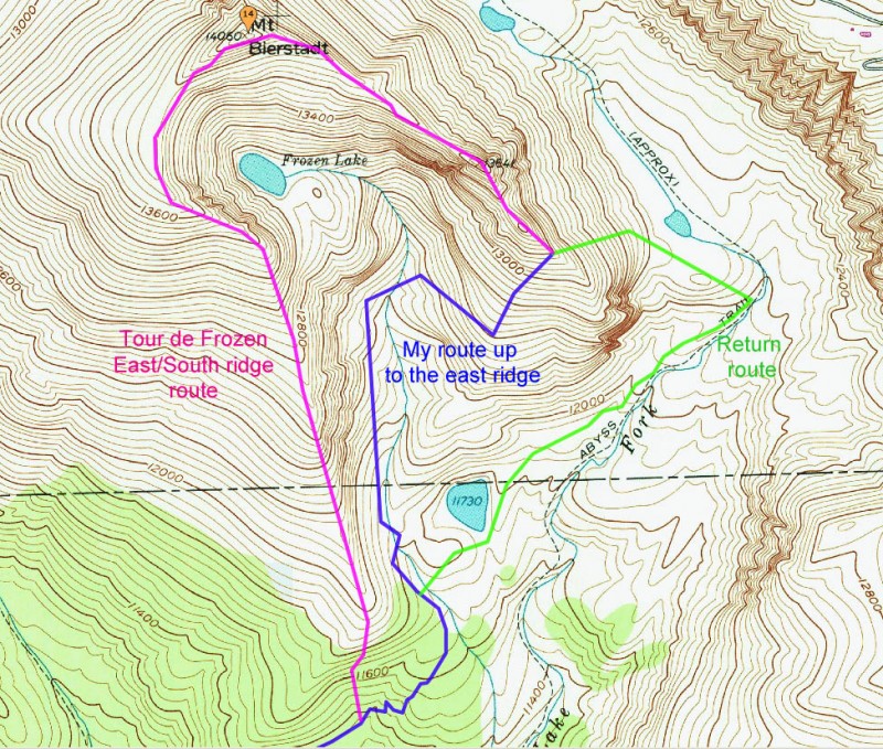
The problem is, I've always salivated over East ridge and Tour D'Abyss trip reports. I thought that as long as I was feeling good and the weather was holding (it was crystal clear all day) that I would climb the east ridge to where the class 3 scramble starts and if possible ascend the rest of the east ridge then descend south ridge...a loop I will coin the 'Tour de Frozen'. I knew full well that there was a good chance I wouldn't summit (and I didn't) but I was ok with that.
I work for an airline so I get cheap flights. I can make quick trips out from Toronto for a day or two on my days off. This is great for the bank account but not so good for acclimatization. My flight was delayed and I didn't get my rental car until 1:00 a.m. at DIA. After a quick stop at a 24 hour Walgreens to pick up some provisions I was back on the road and got to the Abyss Lake trailhead around 3:30 where I squeezed in a 2 hour nap before I hit the trail at 5:30 am. Normally I would start even earlier but the weather forecast was severe clear so I appreciated the extra hour sleep.
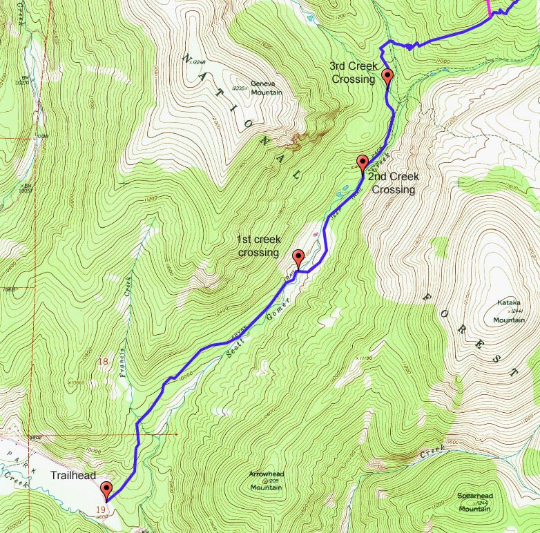
Initial approach on Abyss Lake trail My route in blue and green. Tour de Frozen in purple
The first 4 miles or so of the Abyss Lake trail are very well maintained and gradually gain 1000'. There are 3 creek crossings that have narrow but sturdy log crossings. After the third creek crossing you get a view of the nose of the south ridge.
View of start of south ridge after the 3rd creek crossing. Trail roughly in blue. Highpoint is a false summit
The beta and topo maps from 14ers.com are a bit confusing at this point. The topo map posted at the trailhead is fairly accurate though (except the two Rosalie trail intersections break off in the opposite direction from what it depicts). Pretty straight forward, just follow the Abyss Lake trail signs until you hit the switchbacks up the west side of the nose of the south ridge.
Trail map on sign at Trailhead. Fairly accurate except for Rosalie trail intersections.
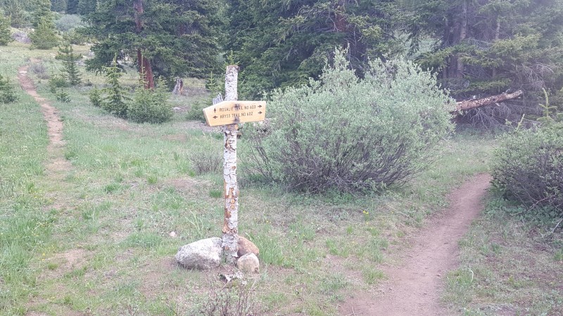
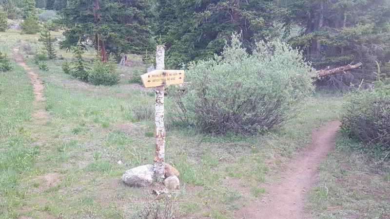
Signage is clear for Abyss Lake trail
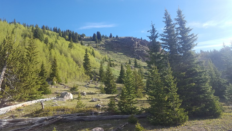
The SummitPost route description and Derek's trip report mentioned bushwhacking directly up the south ridge crest to the tree line. It appears to me that this bushwhack can be almost completely avoided by continuing on the trail another 500 yards or so to the southeast flank of the ridge where there is a moderate grassy slope that tops out above the tree line.
grass slope up southeast flank of south ridge that tops out above treeline
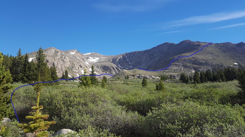
I was feeling pretty good at this point and the spectacular views of the east ridge called out to me so I continued past the south ridge. Shortly after passing the south ridge I lost the trail. As you come up to the drainage below Helms's Lake there are dense willows and lots of swampy areas. I worked my way north along the side of the willows staying as high as possible. Eventually I reached a boulder field which offered a dry, willow free route across towards the east ridge. The boulder hopping was fun and pretty straight forward.
South ridge to the left, Bierstadt summit center, east ridge on the right. Blue line shows my route
Once on the northeast side of the Frozen lake drainage, I walked up to the grassy plateau overlooking Helm's Lake and enjoyed the view for a few minutes before tackling the next 800 feet up the east ridge. A little bit of routefinding required on the way up but basically an easy class 2 climb.
Roughly the route to join the class 3 scramble section of the east ridge Looking back down my route in blue. Green is roughly the Abyss Lake trail through the willows. Trailhead in distance
I picked a line that topped the ridge at the same point where the standard route tops out from the other side (about 13,200'). I was pleased to get a view of the class 3 scramble and point 13,641. Seeing as this would be my first class 3, solo, with no acclimatization and already a bit worn out from 7 miles of hiking I made the fairly easy decision to bail at this point.
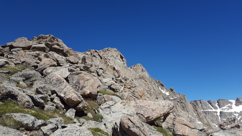
East ridge scramble...I'll be back for you!
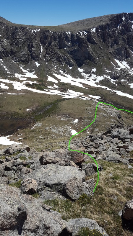
I descended down the north side of the east ridge via the standard route then angled across the valley towards the creek where I picked up the Abyss Lake trail again.
Route down the standard route slope (standard route gully opposite). Picked up the Abyss Lake trail just to the right of the
The trail was quite swampy and I lost it numerous times in the willows below Helm's Lake. I could always see where I needed to go, but the willow bashing was less than fun at that point in the day. The rest of the hike out to the trailhead was uneventful.
All in all, a beautiful day with enough route finding and elevation gain to challenge a noob flatlander like me. Any day above 13,000 is a good day in my books. I got the solitude I was looking for; I only saw two other hikers all day, down low on the Abyss Lake trail.
The east ridge is still on my list but I need to prepare more for it and I'm not sure if I'd do it as the Tour d'Abyss or as my originally planned 'Tour de Frozen' route. I will definitely come back and ascend/descend via South ridge soon though.
Thanks for reading!
Thumbnails for uploaded photos (click to open slideshow):
An interesting route choice - I like that a lot. I thought I had done every route possible up and down Bierstadt but this is one way to approach it I hadn't thought of. I'm sure you'll come back and get it.
I like this route as well. Been thinking of trying this for some time! Really surprised you haven't been this way Jay? In 62 trips up, it never crossed your mind? This is a long day, but can be made shorter with some variation by making it a point to point with a shuttle. It wouldn't bother me at all to make this 2 trips up instead of a loop.
Bierstadt sometimes draws some negative commentary, but it's a fine mountain -- it just happens to be very popular and is popularity is evident in the damage done to the west slopes route.
Did a little research on this! Abyss TH to Southridge is about 5 miles. Abyss TH to about 13,000' on Eastridge is about 6.5 miles. RT on the Frozen Tour is 14.3 miles. Measured it out on Caltopo! Might be better for a point to point? For me anyway!
I've done the East Ridge and I've done the South Ridge. I just never thought of hooking them together. Duh! I can blame that lack of judgement/planning on old age.... :)
Caution: The information contained in this report may not be accurate and should not be the only resource used in preparation for your climb. Failure to have the necessary experience, physical conditioning, supplies or equipment can result in injury or death. 14ers.com and the author(s) of this report provide no warranties, either express or implied, that the information provided is accurate or reliable. By using the information provided, you agree to indemnify and hold harmless 14ers.com and the report author(s) with respect to any claims and demands against them, including any attorney fees and expenses. Please read the 14ers.com Safety and Disclaimer pages for more information.
Please respect private property: 14ers.com supports the rights of private landowners to determine how and by whom their land will be used. In Colorado, it is your responsibility to determine if land is private and to obtain the appropriate permission before entering the property.