Download Agreement, Release, and Acknowledgement of Risk:
You (the person requesting this file download) fully understand mountain climbing ("Activity") involves risks and dangers of serious bodily injury, including permanent disability, paralysis, and death ("Risks") and you fully accept and assume all such risks and all responsibility for losses, costs, and damages you incur as a result of your participation in this Activity.
You acknowledge that information in the file you have chosen to download may not be accurate and may contain errors. You agree to assume all risks when using this information and agree to release and discharge 14ers.com, 14ers Inc. and the author(s) of such information (collectively, the "Released Parties").
You hereby discharge the Released Parties from all damages, actions, claims and liabilities of any nature, specifically including, but not limited to, damages, actions, claims and liabilities arising from or related to the negligence of the Released Parties. You further agree to indemnify, hold harmless and defend 14ers.com, 14ers Inc. and each of the other Released Parties from and against any loss, damage, liability and expense, including costs and attorney fees, incurred by 14ers.com, 14ers Inc. or any of the other Released Parties as a result of you using information provided on the 14ers.com or 14ers Inc. websites.
You have read this agreement, fully understand its terms and intend it to be a complete and unconditional release of all liability to the greatest extent allowed by law and agree that if any portion of this agreement is held to be invalid the balance, notwithstanding, shall continue in full force and effect.
By clicking "OK" you agree to these terms. If you DO NOT agree, click "Cancel"...
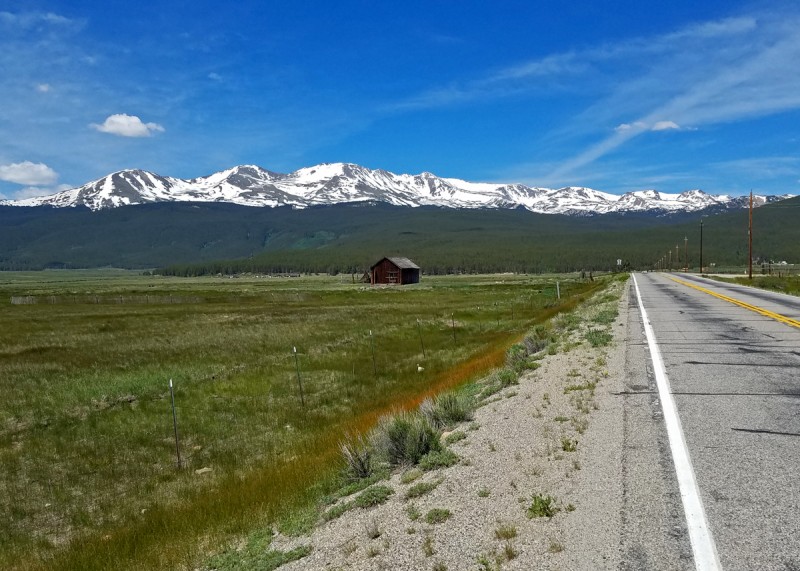
What better way to climb the second highest peak in the Rocky Mountains than to leave the trailhead in the afternoon? I don't see anything that could possibly go wrong with that plan. As I hiked solo toward Mt. Massive from the Leadville Fish Hatchery just before 2 p.m., I just hoped that the National Weather Service was very, very reliable in its forecast.
"I set out running but I'll take my time."
I followed the Highline Trail from the Fish Hatchery. Although the views were generally lacking, the solitude was enjoyable, as I only saw 3 people the entire day, and all of them were below my route's junction with the Colorado Trail. I left the trail at 11,300 ft. as though I were headed for the East Ridge route on Massive, but instead I veered left at treeline in order to climb South Massive first.
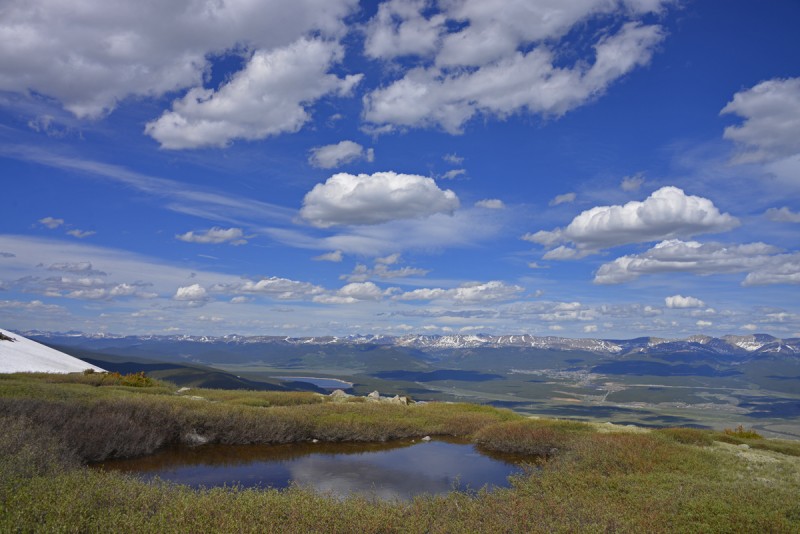
I made the first 5 miles to the meadow above treeline in just under 2 hours, which was not bad considering the huge, slushy snowdrifts on the off-trail portion.
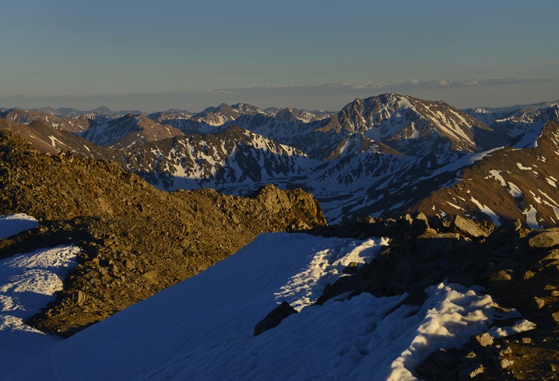
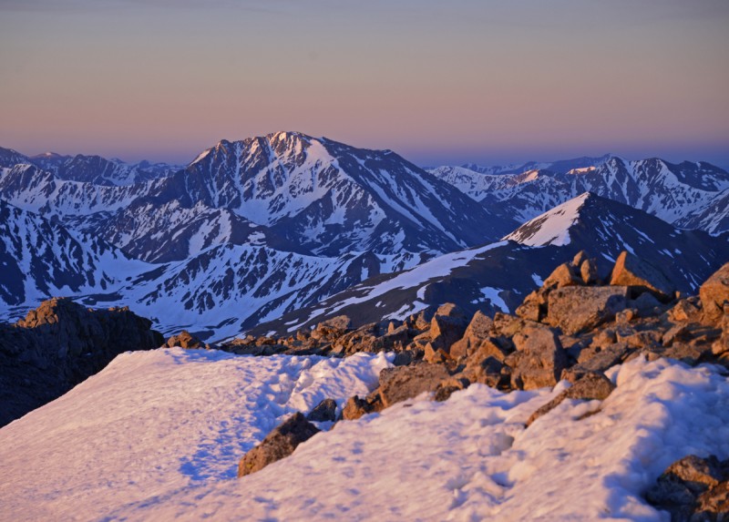
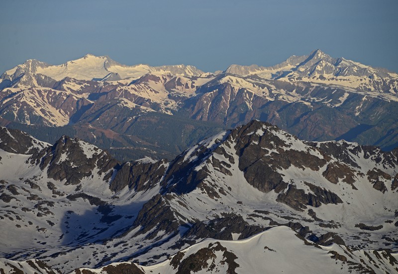
Mosquito Range from the 12k meadow
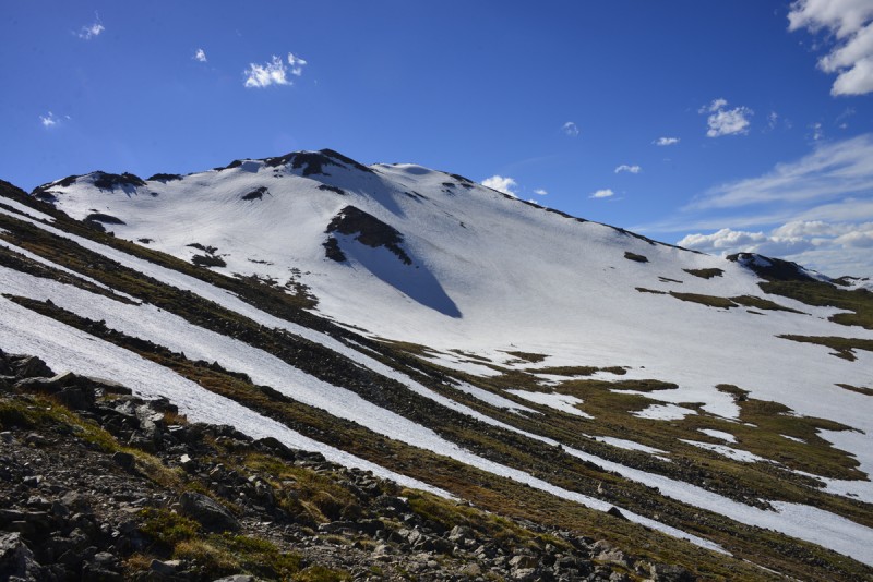
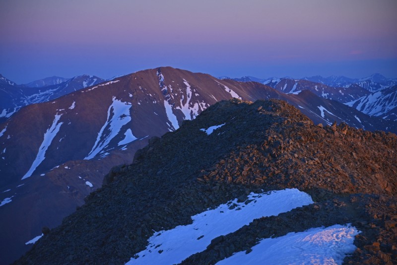
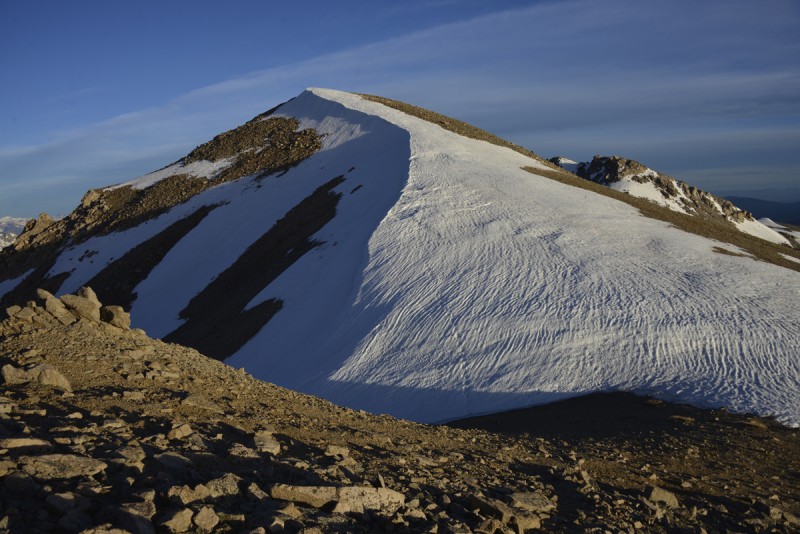
I intersected the standard Mt. Massive trail for a few hundred yards before departing to climb a direct route up South Massive. The clouds began to clear over Massive proper, as promised by the NWS.
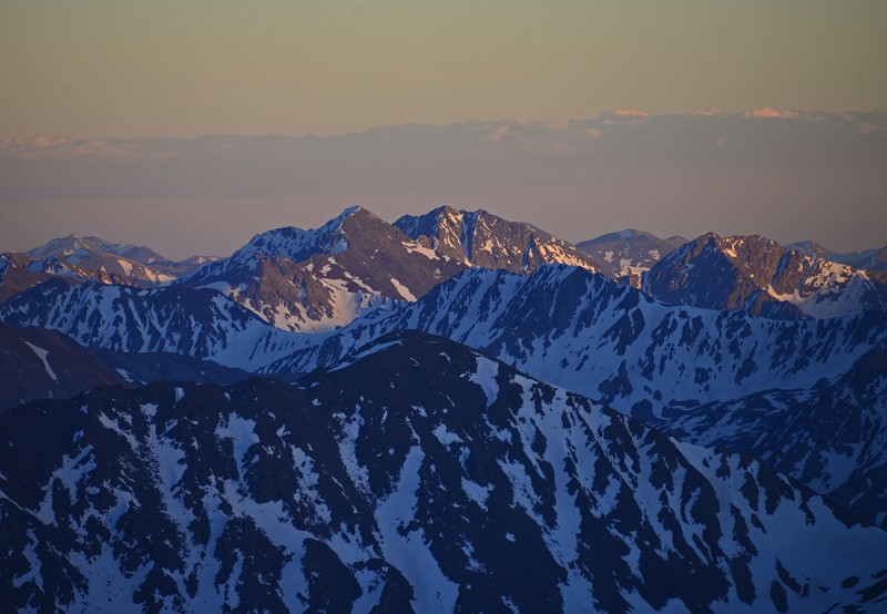
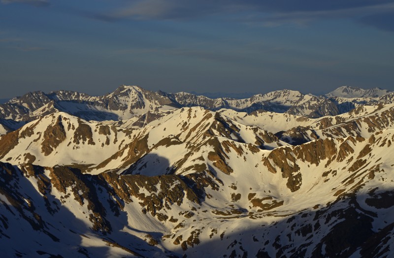
Mt. Massive as seen while climbing S. Massive
I reached the rock obelisk that forms the summit of South Massive around 5:45 p.m., and the early evening light was making Elbert and company look especially beautiful.
Mount Elbert and company from S. Massive
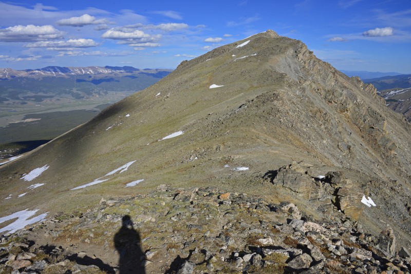
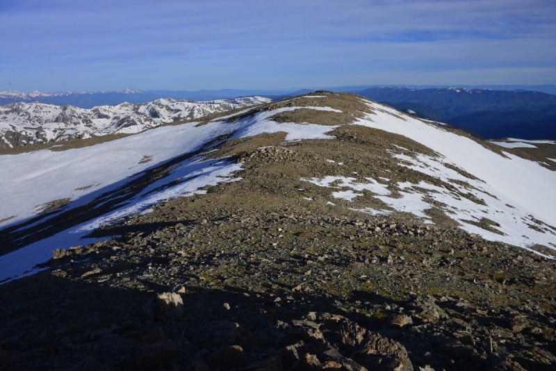
Shadows grew longer as I traversed to the true summit of Mount Massive.
S. Massive as seen while climbing Mt. Massive
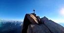
I summited Mt. Massive, a new personal elevation record at 14,421 ft., around 6:30 p.m.
"While the firelight's aglow strange shadows from the flames will grow."
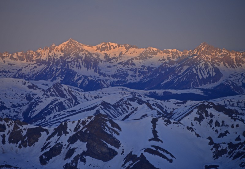
The early sunset light began to make La Plata glow with unearthly fire.
La Plata from Massive's summit
"Eyes alight with glowing hair, all that fancy paints as fair."
Sunset also touched the flanks of Huron and the Apostles with a different hue.
Huron and the 3 Apostles from Massive's summit
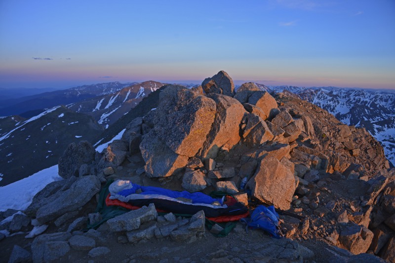
I set up my bivy system (consisting of a tarp, inflatable pad, bivy sack, and sleeping bag) a few feet below the summit block on the only flat ground around.
Bivy at the summit of Mt. Massive
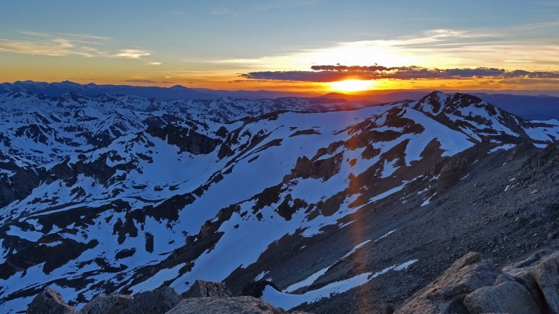
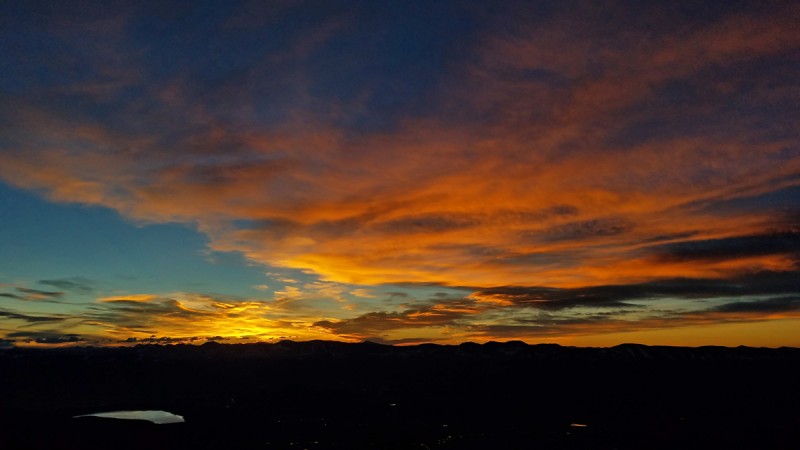
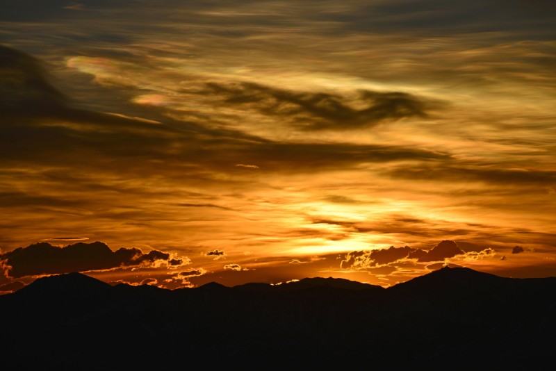
Sunset lit up a thin bank of clouds to the west. I was feeling fairly confident that the weather would hold, just as NWS had predicted.
Sunset from Mt. Massive
Alpenglow touched the flanks of Mt. Elbert, the high point of the Rockies.
Alpenglow on Mt. Elbert
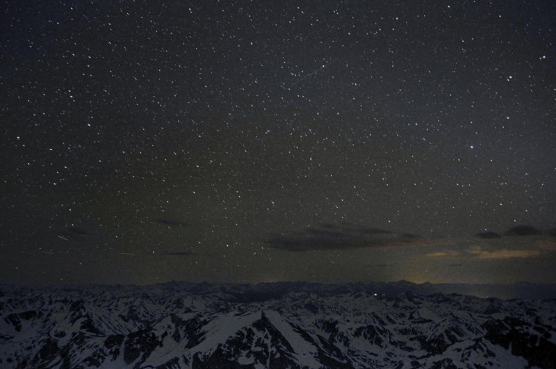
"Counting stars by candlelight, all are dim but one is bright, the spiral light of Venus rising first and shining best."
I never had any problems with sleeping at the high altitude, but the noisy wind woke me up every few hours.
Stars over the Elk Range
"Fire! Fire on the Mountain!"
The first light of dawn ignited Mt. Sherman.
Mt. Sherman at sunrise
A thin layer of clouds had blown in overnight, providing the perfect sunrise display.
Sunrise from Mt. Massive
"Sleeping and perchance to dream."
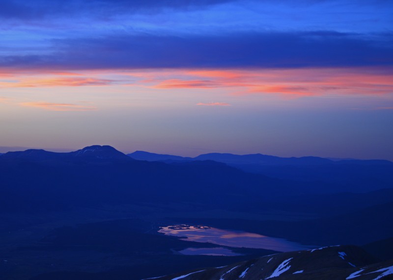
The Buffalo Peaks and Twin Lakes took on a cool pink cast.
Buffalo Peaks and Twin Lakes
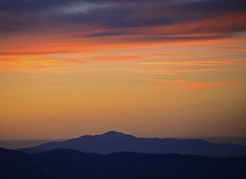
Pikes Peak looked larger than life against a pumpkin-orange sky.
Pikes Peak
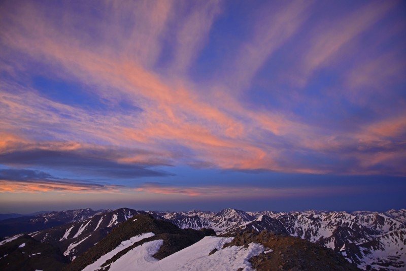
Striated clouds over the central Sawatch stole the show for a few minutes during sunrise.
Sunrise over Elbert, La Plata, etc.
The core sunrise grew ever more intense.
Sunrise over Quandary and the DeCaLiBron
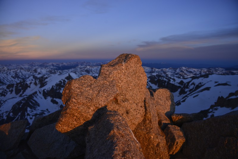
The pinnacle of Massive caught some stunning light as well.
Summit of Mt. Massive at sunrise
It's amazing how much difference a few minutes made in the view of La Plata.
La Plata at first light La Plata a few minutes later
"Standing in a shaft of light...rising up to Paradise."
Grizzly Peak caught a distinctive yellow hue.
Grizzly Peak A at sunrise
Castle, Conundrum, and Cathedral were more orange and pink. I guess dragging a 300mm lens up a 14er was worthwhile...
Castle and company
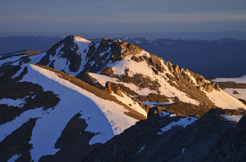
As the sunrise died down, I headed on to my next objectives, Massive Green, North Massive, and the Hunter-Fryingpan Wilderness HP. I had spent about 11 hours on the summit of Mt. Massive.
Massive Green and North Massive
Snowmass and Capitol stole the show for awhile. The connecting ridge looks so benign from a distance.
Snowmass and Capitol
Massive Green was an easy hike.
Massive Green
I took a direct route to North Massive that required a fun little scramble. The summit view of the Hunter-Fryingpan Wilderness was spectacular.
Looking west from North Massive
Pt. 14169, sometimes called Far Northwest Massive, was a low-prominence summit on the Continental Divide that was very easy to tag. The wind was getting out of hand at this point, so I descended quickly.
Pt. 14169
I headed east from Pt. 14169, linking some glissades and dropping into a remote basin north of Massive's east ridge. Along the way, I spotted a herd of 14 elk.
Elk herd
Shortly before rejoining the Highline Trail to make a lollipop-shaped route, I was rewarded with a final view of Massive above a little lake.
Final view of Mt. Massive
I returned to the car a little after 10 a.m., glad to have completed a "Massive" hike.
--All lyrics credit Grateful Dead--
My GPS Tracks on Google Maps (made from a .GPX file upload):
You are more courageous than me, of that there is no doubt. Last time I camped in an exposed area above treeline an electrical storm convinced me that there are better places to camp.
That looks like a great way to do all those massive peaks. Do you happen to have travel time, mileage, elevation? Just to get a rough idea.
Caution: The information contained in this report may not be accurate and should not be the only resource used in preparation for your climb. Failure to have the necessary experience, physical conditioning, supplies or equipment can result in injury or death. 14ers.com and the author(s) of this report provide no warranties, either express or implied, that the information provided is accurate or reliable. By using the information provided, you agree to indemnify and hold harmless 14ers.com and the report author(s) with respect to any claims and demands against them, including any attorney fees and expenses. Please read the 14ers.com Safety and Disclaimer pages for more information.
Please respect private property: 14ers.com supports the rights of private landowners to determine how and by whom their land will be used. In Colorado, it is your responsibility to determine if land is private and to obtain the appropriate permission before entering the property.