Download Agreement, Release, and Acknowledgement of Risk:
You (the person requesting this file download) fully understand mountain climbing ("Activity") involves risks and dangers of serious bodily injury, including permanent disability, paralysis, and death ("Risks") and you fully accept and assume all such risks and all responsibility for losses, costs, and damages you incur as a result of your participation in this Activity.
You acknowledge that information in the file you have chosen to download may not be accurate and may contain errors. You agree to assume all risks when using this information and agree to release and discharge 14ers.com, 14ers Inc. and the author(s) of such information (collectively, the "Released Parties").
You hereby discharge the Released Parties from all damages, actions, claims and liabilities of any nature, specifically including, but not limited to, damages, actions, claims and liabilities arising from or related to the negligence of the Released Parties. You further agree to indemnify, hold harmless and defend 14ers.com, 14ers Inc. and each of the other Released Parties from and against any loss, damage, liability and expense, including costs and attorney fees, incurred by 14ers.com, 14ers Inc. or any of the other Released Parties as a result of you using information provided on the 14ers.com or 14ers Inc. websites.
You have read this agreement, fully understand its terms and intend it to be a complete and unconditional release of all liability to the greatest extent allowed by law and agree that if any portion of this agreement is held to be invalid the balance, notwithstanding, shall continue in full force and effect.
By clicking "OK" you agree to these terms. If you DO NOT agree, click "Cancel"...
"S 4" is another of the Sneffels Range summits that Kylie and I have been chasing for a while. Dwarfed by its much taller neighbors to the east and south, "S 4" can be had by a relatively easy hike to nearly 13,000' followed by a short scramble to the top. From the ridge which connects it to "S 6" to the west, it has just 302 feet of prominence. The north and east flanks of "S 4," however, are guarded by more imposing features--its east face is especially huge, rising almost 2,000 feet from the cliffs at its base.
It is on this face that we hoped to find a weakness leading to the summit. Satellite photos reveal a criss-cross pattern of deep gashes on the east face, and one in particular appears to span nearly the full length of the face. In May last year, I bushwhacked up the opposing slopes to get a broader view but was unable to pick out the line. Then in mid June, Kylie and I hiked the Blue Lakes trail to have a closer look. At a clearing below the east face, we looked up to see a couloir devoid of snow and choked with massive boulders. With no choice but to wait another winter, we returned this year in mid April. This time the route was filled in, but we had underestimated the approach in early spring conditions and by late morning were too late to climb.
Knowing now what to expect, we left Montrose at 3 am on Sunday. We were able to drive to within half a mile of the Blue Lakes trailhead and started the approach at 4:30. From the trail markers, we followed a reasonable bootpack along the Blue Lakes trail as it climbs the hillside above the East Fork of Dallas Creek. After the tracks petered out, we put on snowshoes for the mercifully brief side-hilling to the clearing at 10,700' beneath the broad northeast face of "S 4." There we left the Blue Lakes trail and climbed southwest through trees to the base of the couloir, which is marked by a large outcrop and some hoodoos on the right.
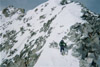
From the entrance at 11,300', the route climbs moderate to steep snow beneath imposing walls for 500 feet before curving to the right. After another 700 feet of steep snow, the crux is reached at 12,500'. This is a huge chockstone blocking upward progress, which may be surmounted by a short ice or mixed step on either side.
Above the crux, the angle gets even steeper as the couloir continues for 400 feet directly towards a cluster of bulky towers that can be seen from the bottom of the face. Before reaching the towers, the couloir veers right behind an outcrop and climbs 150 feet to a snow arete, which separates the upper part of the route from a large northeast-facing snowfield, marking the end of the couloir proper.
The route follows the snow arete briefly to the wall above, then traverses diagonally to the right across the top of the adjoining snowfield, towards an obvious exit, which may be corniced. This option leads to the wrong side of a 15-foot notch on the summit ridge, though it may be linked to the summit with a little effort by downclimbing one of two short, unexposed 3rd or 4th class chimneys on the north side to access the notch. The simpler finish is probably to bypass the obvious exit, instead continuing to traverse horizontally around a corner, under a small offset tower, and directly into the notch.
Not wanting to be on the snowfield any longer than necessary, we took the obvious exit and downclimbed to the notch, strolling onto the summit at 9:45 am. Greeted by spectacular views of the surrounding peaks, we had a snack and reviewed the climb. It certainly had surpassed our expectations, providing a really aesthetic and direct route that was consistently steep and interesting. Despite not freezing overnight, the snow was in decent condition (for May) all morning with the exception of the high snowfield traverse, which was a bit scary as a result.
To descend, we retraced our steps to the notch, downclimbed a short gully into the high basin to the south, and snowshoed down the scenic basin to lower Blue Lake. As we hiked past the east face again, we got a good look at the couloir to the left (south) of our route, which rises ruler-straight for around 1,300 feet before ending just below the southeast ridge. It looks like it could be linked to the ridge, or possibly to the upper east face.
A note on timing: This route melts out very early relative to north- and east-facing couloirs nearby, which must be due at least in part to its comparatively low elevation (it runs from 11,300' to just over 13,000'). With less snow, the route probably becomes quite difficult--the crux chockstone is just the top of a stack of gigantic boulders which can be observed when the couloir is dry--with more, the crux might be only a steep roll, and I would not be surprised to learn this line has been skied in a good snow year; if not, I think it would make for a great descent on planks.
Morning clouds
Couloir entrance
Starting up the runnel
Minor constriction at the bend
Crux ahead
Climbing the right side
Kylie tops out the crux
On steep snow above the crux
Approaching the towers
Steep snow to the arete
Traversing the snowfield
Up the obvious exit
Kylie tops out the ridge
Summit on the other side of the notch
Downclimb to access the notch
Views from the summit
Mt. Sneffels
Dallas Pk.
"S 5", "S 6", Mears Pk, "S 9", Wolcott Mtn.
Descending the south gully
Looking up the south gully
At lower Blue Lake
Another nice-looking couloir on the left side of the east face
Our route
Another perspective, taken the year before. Yellow = Easier finish
Route map
GPS Track(s) on Google Maps (made from a .GPX file upload):
That last photo was taken May 11 last year, after it dumped for a few weeks.
The runnel is impressive, but it wasn't there mid April.
Caution: The information contained in this report may not be accurate and should not be the only resource used in preparation for your climb. Failure to have the necessary experience, physical conditioning, supplies or equipment can result in injury or death. 14ers.com and the author(s) of this report provide no warranties, either express or implied, that the information provided is accurate or reliable. By using the information provided, you agree to indemnify and hold harmless 14ers.com and the report author(s) with respect to any claims and demands against them, including any attorney fees and expenses. Please read the 14ers.com Safety and Disclaimer pages for more information.
Copyright: Route information, text, risk factors, maps, GPX files, charts, photos, 14ers.com-created map imagery, flythroughs, and other content provided in this route description are copyrighted by 14ers.com and may not be copied, reproduced, republished, distributed, modified, or used to create derivative works without prior written permission.
Please respect private property: 14ers.com supports the rights of private landowners to determine how and by whom their land will be used. In Colorado, it is your responsibility to determine if land is private and to obtain the appropriate permission before entering the property.