Download Agreement, Release, and Acknowledgement of Risk:
You (the person requesting this file download) fully understand mountain climbing ("Activity") involves risks and dangers of serious bodily injury, including permanent disability, paralysis, and death ("Risks") and you fully accept and assume all such risks and all responsibility for losses, costs, and damages you incur as a result of your participation in this Activity.
You acknowledge that information in the file you have chosen to download may not be accurate and may contain errors. You agree to assume all risks when using this information and agree to release and discharge 14ers.com, 14ers Inc. and the author(s) of such information (collectively, the "Released Parties").
You hereby discharge the Released Parties from all damages, actions, claims and liabilities of any nature, specifically including, but not limited to, damages, actions, claims and liabilities arising from or related to the negligence of the Released Parties. You further agree to indemnify, hold harmless and defend 14ers.com, 14ers Inc. and each of the other Released Parties from and against any loss, damage, liability and expense, including costs and attorney fees, incurred by 14ers.com, 14ers Inc. or any of the other Released Parties as a result of you using information provided on the 14ers.com or 14ers Inc. websites.
You have read this agreement, fully understand its terms and intend it to be a complete and unconditional release of all liability to the greatest extent allowed by law and agree that if any portion of this agreement is held to be invalid the balance, notwithstanding, shall continue in full force and effect.
By clicking "OK" you agree to these terms. If you DO NOT agree, click "Cancel"...
Little Bear to Blanca Traverse, in less than ideal conditions
Earlier this winter, I'd hatched a plan with Dan to go climb something in the Tetons, likely the Stettner on the Grand, on this weekend. However, as the time came closer the Tetons kept getting more, and more, and more snow (I believe Jackson Hole ended up getting a record snow year). Since we didn't have any particular desire to die in an avalanche, we decided to look elsewhere for an objective. After realizing that everything we wanted to do was North facing, and likely unconsolidated. Just so happens that Little Bear was mentioned in conversation, and we realized we both wanted to do the Little Bear -> Blanca traverse, and that spring conditions would likely make the ascent up Little Bear more ... bearable.
After a good bit of back and forth, and reading of various trip reports, we decided that ropes and a light rack would probably be advisable, as we didn't know how spring conditions would affect the route. Ended up packing two 30m twin ropes, a light assortment of cams and nuts, an ice screw, and two tools each (two alpine tools for Dan, one alpine tool and one ice tool for me).
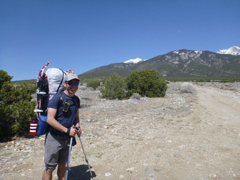
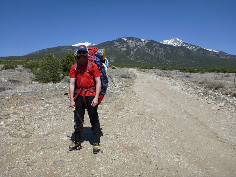
Woke up early Friday morning, and finished packing, just in time for Dan to roll up out front. Threw my gear in the car and headed out on 285, going for the scenic route, ... only to realize 45 minutes out that I'd forgotten my crampons at home. D'OH! After heading back to my house and picking up my 'pons, we decided to save time and take the fast route down I-25. 4ish hours later we arrive at our stopping point at ~7900 feet about 2 PM, threw our ridiculously heavy packs on our backs, and headed up the trail.
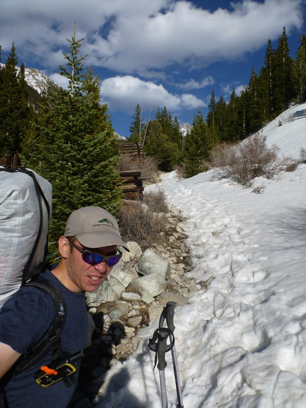
Found snow around 10k that would block vehicle travel:
Then open ground after that, and finally solid snow covering most of the road after that. Of course with the temps we were seeing, snow conditions were a bit ... wet:
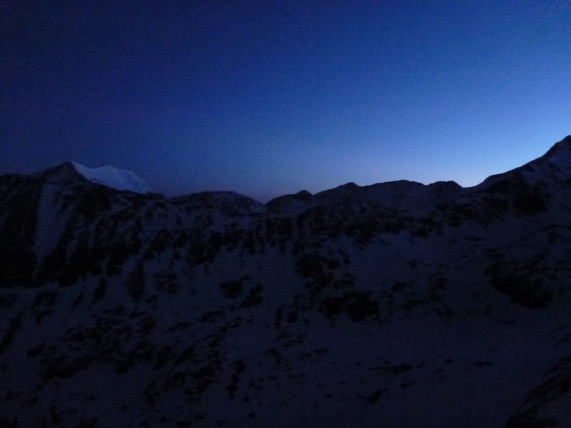
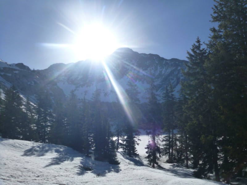
After a couple more good miles, we finally made it to the lake just at sunset (after ~5 hours of hiking), to these gorgeous views:
Put the tent up, got food in us and snow melted, set our 3 AM alarm and crashed.
Oof. 3 AM is early.
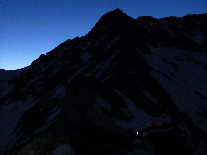
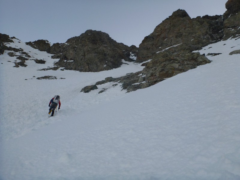
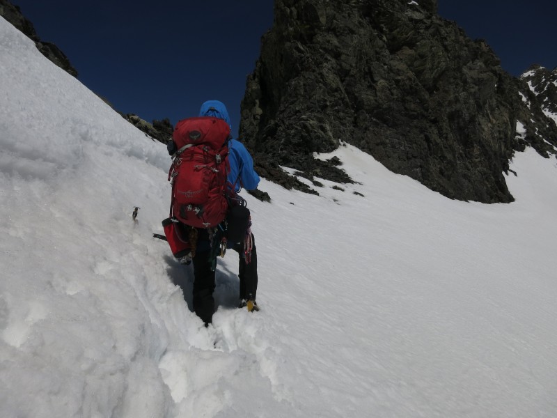
Got up eventually, threw our harnesses on and gear into our packs, and headed out at about 4:15. Looping CCW around the lake (not wanting to cross it, or try to cross the creek), we ended up postholing through the trees, until we popped out beneath the approach couloir. We found what started as a skin track zig zagging up it, and started following, only to find it turning into a straight-up-the-couloir booter. Towards the top, it seemed to get steeper, to the point where we pulled our second tools out (keep yours handy). Finally, got to the top, and started moving towards Little Bear. Cairns were more or less easy to find on the way over, and eventually it started to lighten up:
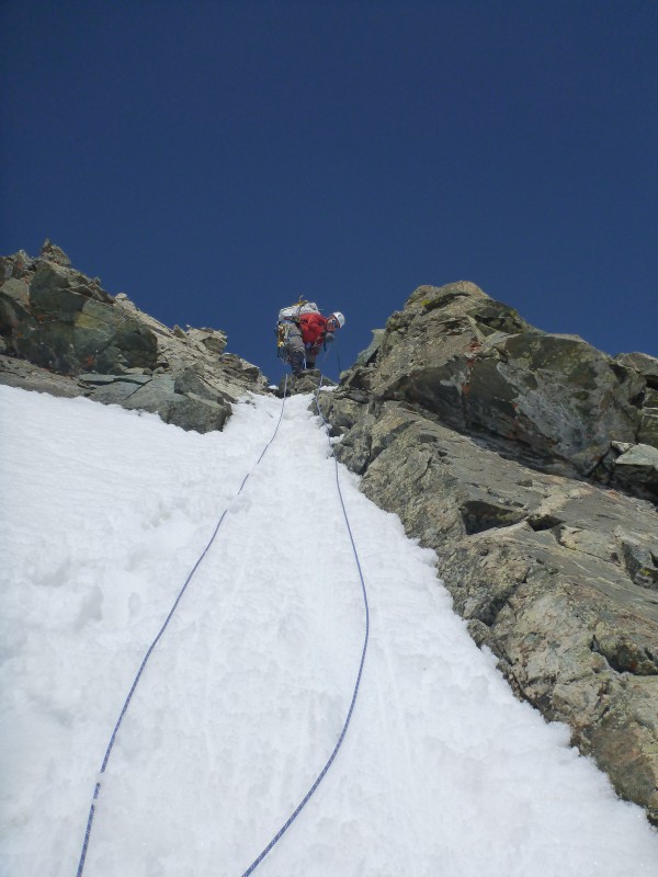
Worked our way around to the base of the hourglass on decent enough snow, only to find a LOT of wet-slide debris beneath it.
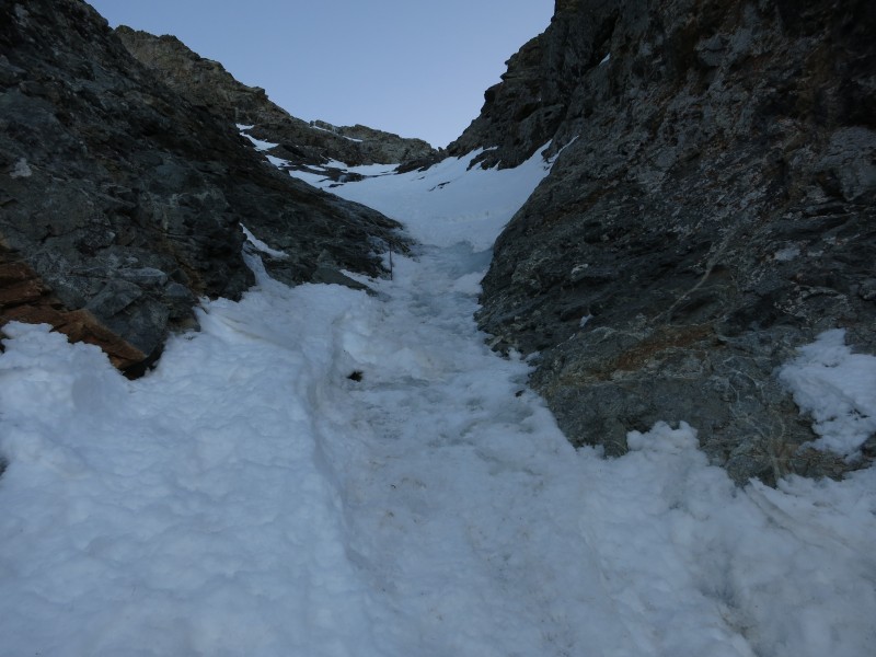
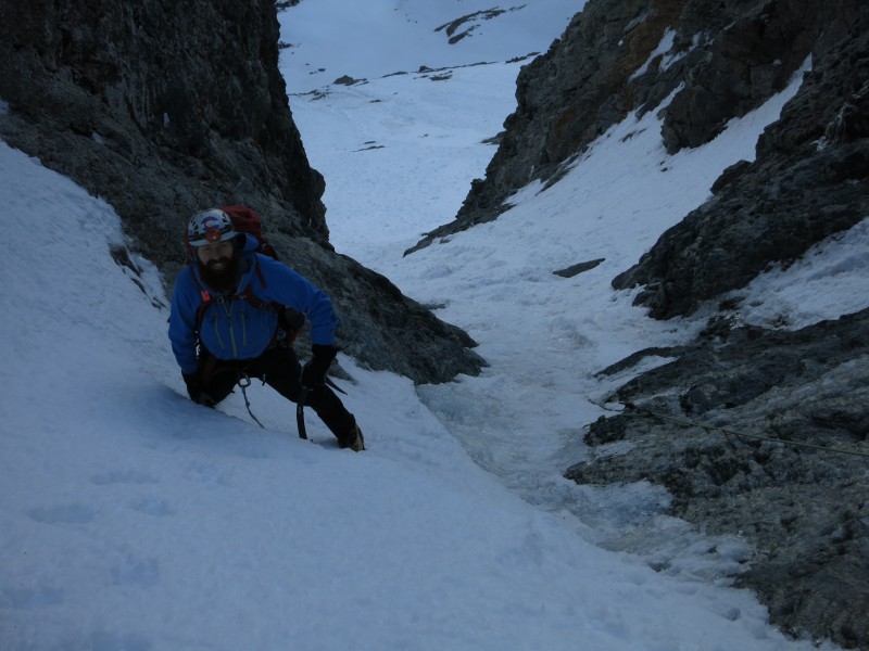
As we made our way up, we eventually realized that the hourglass had slid recently, leaving only ice behind in ~15 feet in the middle of the choke.
Decent snow above and below, but definitely not continuous snow. Fine for us, as we each just pulled our second tool out and charged right up.
For the record, this is the current anchor for the hourglass. Looks like cable that's been wrapped twice, although we didn't stop to inspect. Not having placed it myself, I don't know that I'd trust it, but that's me.
Also of note - the rope tied to the anchor is of a different color than the two ropes tied together that were exposed from the snow in the choke, meaning the fixed line is made up of at least 3 different sections of rope - that's a whole lot going on there.
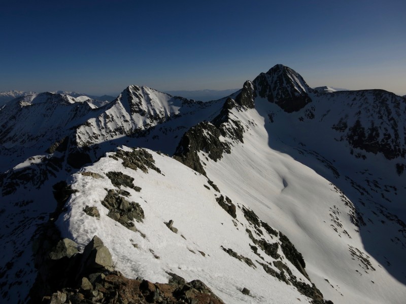
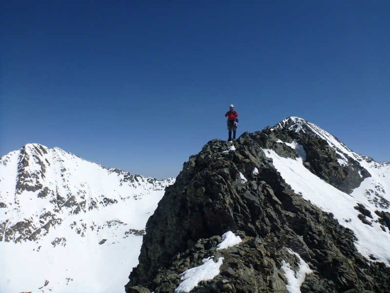
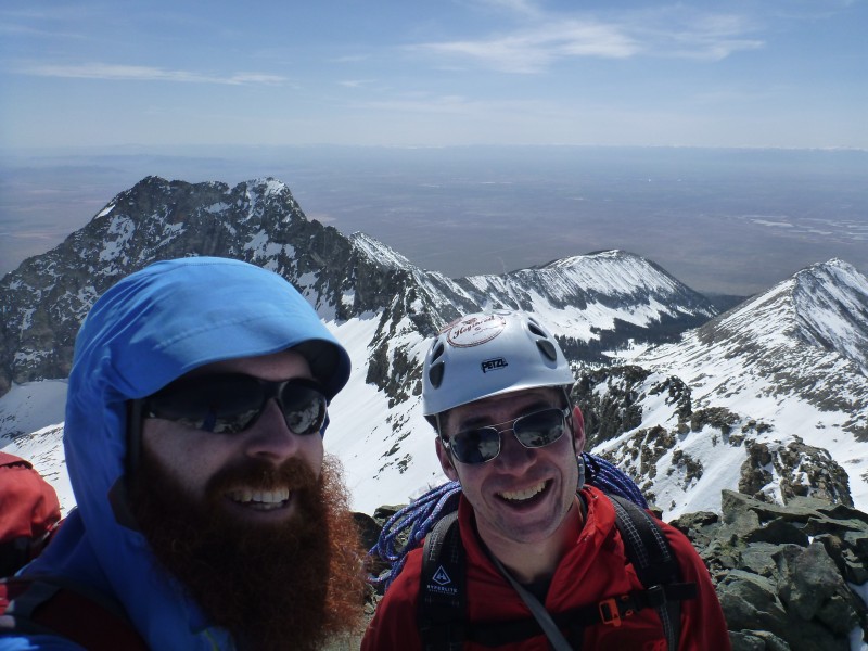
Finally got to the summit at ~7:15, and finally had a look at what lay ahead:
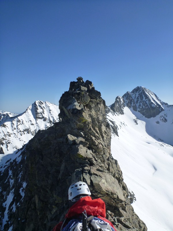
Deciding not to stick around too long, we started down the ridge with crampons on, but ended up taking them off and hanging tools on our harnesses a couple hundred feet down the ridge once we realized it was mostly dry.
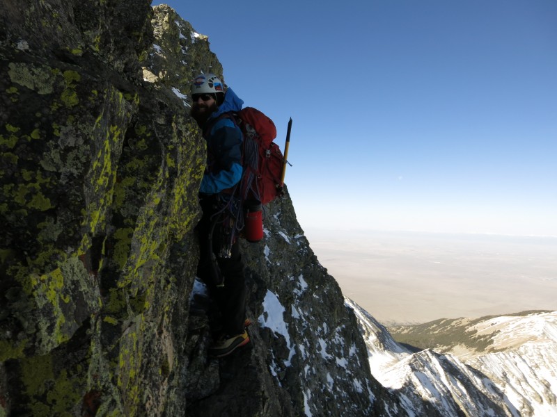
After making our around various obstacles, including an awkward belly crawl on my part on the bypass around Captain Bivwacko Tower (for which I'm thankful Dan didn't have his camera out), we eventually were forced onto one of the ridge sections, after seeing the bypass on the RH side covered in snow. However, as we came to the end of that ridge section, we realized there was no good downclimb, and ended up using our ropes and gear for the only time on the route, and rigged a rappel.
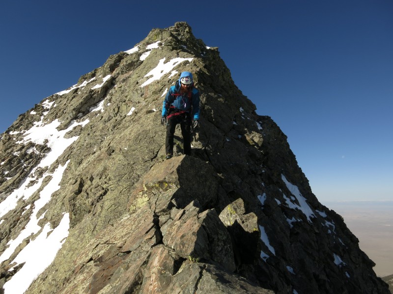
Continuing from there, we were forced to the ridge top numerous times, always finding the bypasses that would have been on the RH side blocked by wet/loose spring snow. Finally, at either the 2nd or 3rd tower, we were faced with either a 5-not-easy climb, or snow, and we chose the snow. Probably ended up being the riskiest part of the day, but we just took it one at a time, and did our best to spread weight out (helped with not post-holing to our thighs).
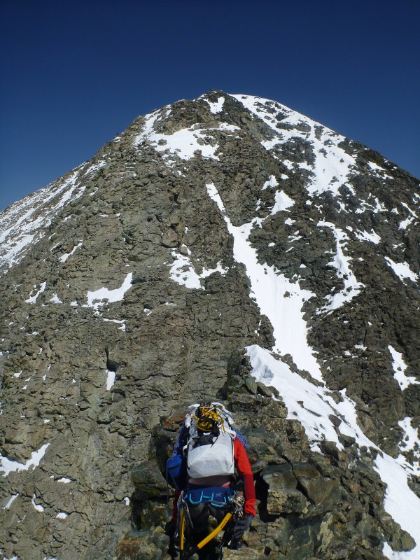
Finally, made it to the last class 4 ridge section, complete with its own sketch downclimb.
From there, only had the ascent up class 2-3 to the summit of Blanca!
Descended the standard route of Blanca, passing a lot of wet slide debris and pinwheels along our way:
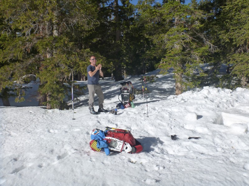
Bonked our way back to camp (almost 14 hours of movement will do that to ya), ate large dinners, drank our celebration beers, and crashed. In the morning, woke up at a quite-a-bit-more tolerable 6 AM, had a leisurely breakfast, packed our gear up, enjoyed sunrise:
And hiked the ~2 1/2 hours back out to the car.
Takeaways - That's a long, hard ridge. 'Strenuous', you might say. It just doesn't let up, especially if your bypasses are blocked by snow. While Little Bear seems to be greatly improved as a snow-climb, I'd guess the traverse is much better without. We were often either forced off-route onto seldom-climbed ridge tops with narrow, loose sections, or forced onto wet/loose snow which threatened to slide from beneath us. Next time, we'll definitely pay more attention when CAIC warns of week freezes, even if freeze-level is MUCH lower than we'll be, and slopes involved should have lots of radiant cooling. That said, it was a gorgeous route, with amazing views of all the peaks and valleys around.
Note on the gpx, ignore the squiggly nature of it, I believe it's from Dan's watch. Although there was a good bit of trial-and-error routefinding involved.
My GPS Tracks on Google Maps (made from a .GPX file upload):
Nice effort Greg! What a cool climb! I also approve of the beard, hate combo. That beard gets any bigger you're going to have to give it a name! Re: the rope. I can never understand why anyone would trust their lives with that that raggedy crap.
Awesome Day, looks like. Extra points for doing the traverse to snag Blanca. Thank you for the beta and pictures. Thoughts on snowshoes? I'm doing a trip April 29th. Night temps estimated at?
Appreciate it.
We definitely needed snowshoes for the approach, hiking up in the afternoon. For us, nighttime temps were enough to freeze snow outside the trees, but only barely, and snow beneath trees did not get a very good freeze. Maybe got down to the high 20's. If you're just doing Little Bear, might be worth wearing/carrying them from camp to the base of the approach couloir, and stashing them there for your way out, just to not hate life going back around the lake.
I am just impressed you guys started from even lower on that road than myself (7,900 ft). I passed a dark sedan en route to my highpoint in a Subi @8,300 ft.
Oh and the freeze was bomber, as good as it gets in spring! I had to wait for 2 hours on Saturday for snow to warm up. You may have hit some unconsolidated powder in the trees that haven't gone thru full melt-freeze cycle yet. It was skiing really nicely tho :D
And the HG rope was fine. We tugged on it pretty hard on the way down. There are actually 2 anchors - the upper one that you describe, which we rapped off it (with our own rope) last winter and the lower one, above HG, which is completely buried still. Glad you guys were prepared and didn't need to use it. We contemplated bringing a rope, mostly for rapping into the Baby Thunder but decided against carrying that extra weight, ha!
Took me a while to find the time to read this one closely - not being a technical climber, I had to go over parts of it a couple times. Anyway, great report on a helluva route.
Caution: The information contained in this report may not be accurate and should not be the only resource used in preparation for your climb. Failure to have the necessary experience, physical conditioning, supplies or equipment can result in injury or death. 14ers.com and the author(s) of this report provide no warranties, either express or implied, that the information provided is accurate or reliable. By using the information provided, you agree to indemnify and hold harmless 14ers.com and the report author(s) with respect to any claims and demands against them, including any attorney fees and expenses. Please read the 14ers.com Safety and Disclaimer pages for more information.
Please respect private property: 14ers.com supports the rights of private landowners to determine how and by whom their land will be used. In Colorado, it is your responsibility to determine if land is private and to obtain the appropriate permission before entering the property.