Download Agreement, Release, and Acknowledgement of Risk:
You (the person requesting this file download) fully understand mountain climbing ("Activity") involves risks and dangers of serious bodily injury, including permanent disability, paralysis, and death ("Risks") and you fully accept and assume all such risks and all responsibility for losses, costs, and damages you incur as a result of your participation in this Activity.
You acknowledge that information in the file you have chosen to download may not be accurate and may contain errors. You agree to assume all risks when using this information and agree to release and discharge 14ers.com, 14ers Inc. and the author(s) of such information (collectively, the "Released Parties").
You hereby discharge the Released Parties from all damages, actions, claims and liabilities of any nature, specifically including, but not limited to, damages, actions, claims and liabilities arising from or related to the negligence of the Released Parties. You further agree to indemnify, hold harmless and defend 14ers.com, 14ers Inc. and each of the other Released Parties from and against any loss, damage, liability and expense, including costs and attorney fees, incurred by 14ers.com, 14ers Inc. or any of the other Released Parties as a result of you using information provided on the 14ers.com or 14ers Inc. websites.
You have read this agreement, fully understand its terms and intend it to be a complete and unconditional release of all liability to the greatest extent allowed by law and agree that if any portion of this agreement is held to be invalid the balance, notwithstanding, shall continue in full force and effect.
By clicking "OK" you agree to these terms. If you DO NOT agree, click "Cancel"...
It had been a month since my last alpine climb (Culebra) and two weeks since my last ranked peak (Diablo), so I wanted to climb something more than the Flatirons over my long Easter break. I considered several options but eventually turned them all down for some combination of route condition/weather/distance.
Easter morning I looked at the 14ers.com conditions reports for ideas and saw a report from d_baker on the Dragon's Tail Couloir on Flattop Mountain. This climb had been on my radar for some time, but I had no idea that it might be in condition this early. Dragon's Tail forms a large fork halfway up. Cooper says that the left side is preferred early season because of a cornice in the right side, but d_baker's conditions report showed that the right-hand (east) cornice was easily passable, so I decided to climb that variation to avoid mixed climbing on the left. CAIC's final daily forecast for spring 2017 came out Sunday and showed "low" with the main problem being loose-wet. NOAA was forecasting low winds with 35% cloud cover in the morning increasing in the afternoon. I packed up some gear and created a plan with the option of adding on an ascent of Hallett Peak after the couloir.
The alarm was set for 3:30 because the Sherpas said the snow would be better, or some such nonsense.
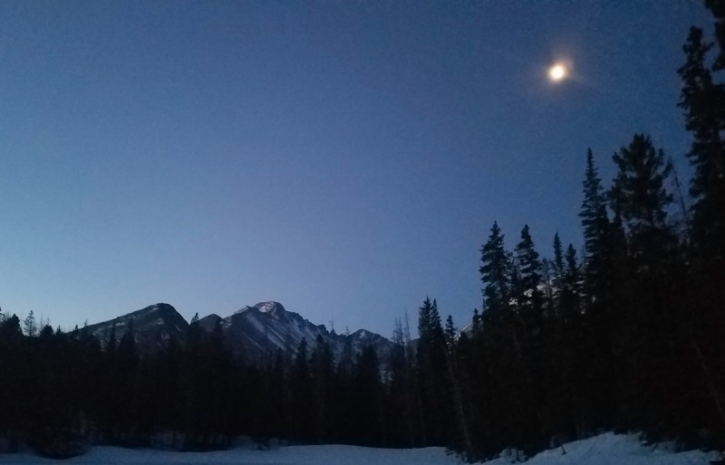
I was the second car into the Bear Lake parking lot around 5:30 a.m. One advantage of getting an alpine start is avoiding the $20 RMNP entrance fee. Another advantage is seeing Longs predawn.
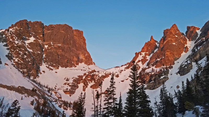
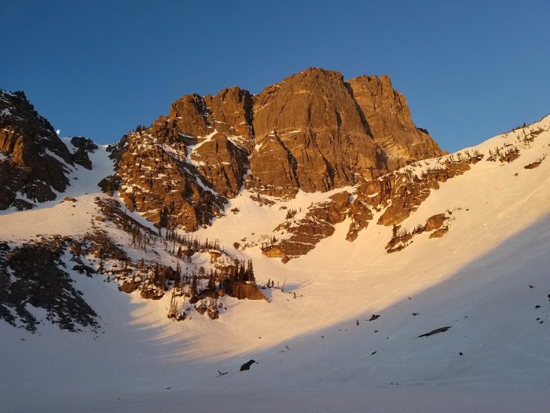
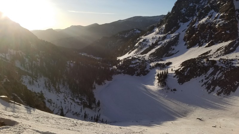
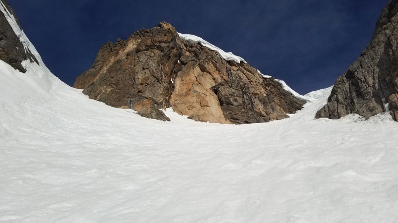
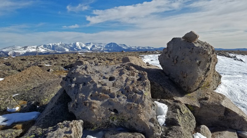
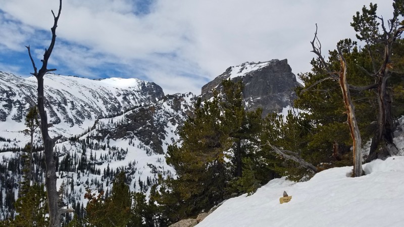
I had some embarrassing route-finding issues in the forest, where footprints seemed to go in several directions, all of which seemed wrong. But before long, I was looking into Tyndall Gorge as the sun's first rays hit the rock faces. Dragon's Tail is the striking snow line on the right edge of the photo; Hallett's north face forms the left block.
Emerald Lake was frozen, making it easy to walk around the north shoreline. Dragon's Tail starts wide at the bottom before narrowing and splitting. In this view, the right variation (which I climbed) is visible as continuous snow from the lake to the ridge.
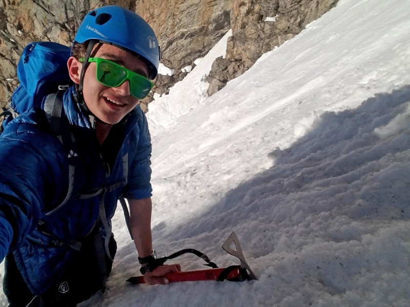
It was fun to put on crampons again--the last time I used them was on the Continental Glacier last August. In addition to my usual ice axe, I brought a spare to use in my left hand. It was already getting fairly warm, so I wore only fleece and a light jacket and no gloves. Maybe winter really is over? Hallett's north face continued to look majestic as I started up the apron of Dragon's Tail.
There was evidence of some small loose-wet avalanches on the apron, serving as a reminder to be off the snow before it heated too much. Luckily, the aforementioned proverbial Sherpas were correct, and the snow was beautifully crisp in the morning.
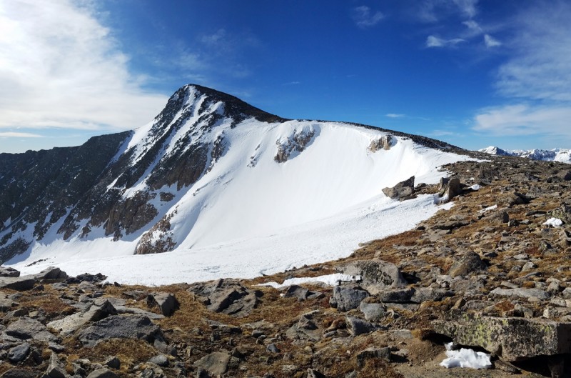
Looking back to Emerald Lake from the top of the apron and the base of the real couloir:
The first part of the climb was quite wide and somewhere around 35 degrees or so. This was a great slope for practicing pied a canard with piolet canne.
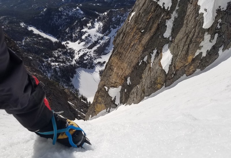
Before long, the lake was looking fairly far down.
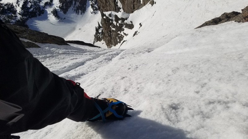
As I neared the fork, my inclinometer showed an average slope angle around 45 degrees. I continued with pied en canard, but switched both ice axes to piolet appui (middle dagger). About this point, I was becoming grateful for the extra confidence of two axes.
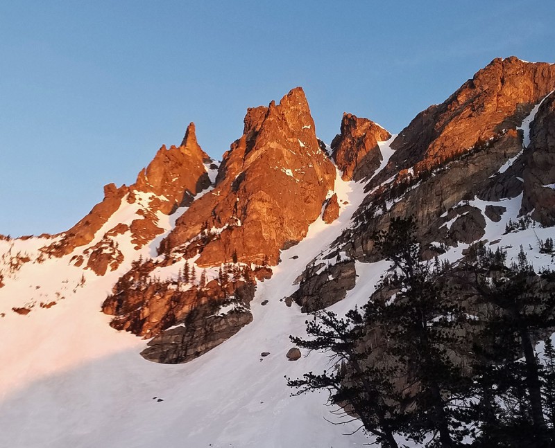
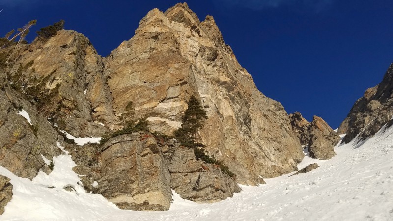
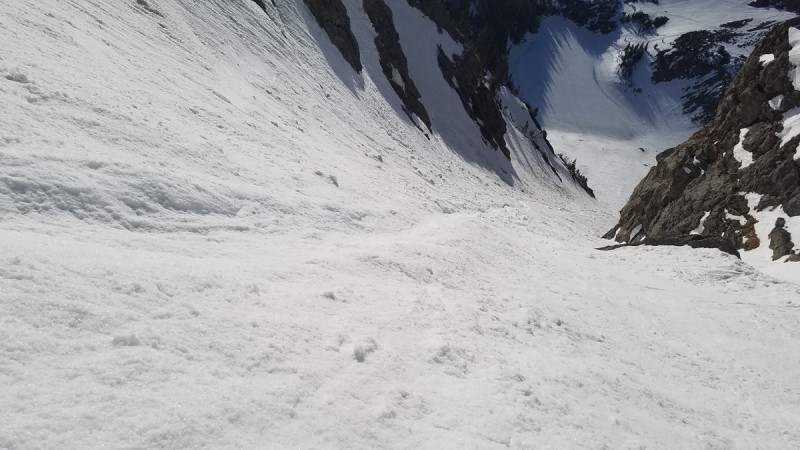
This view looks up just below the major fork. The left option has a mixed pitch; the right option apparently often has a large cornice, but not today.
Looking down at a now-distant Emerald Lake from near the fork:
Climbing into the climber's-right (east) fork:
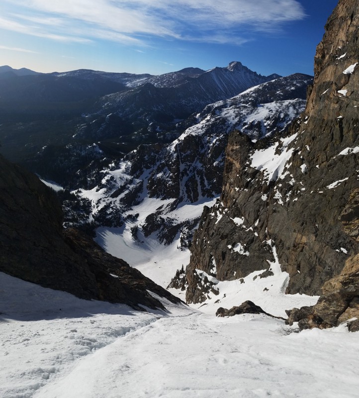
Longs Peak popped in and out of view throughout the climb, always looking majestic.
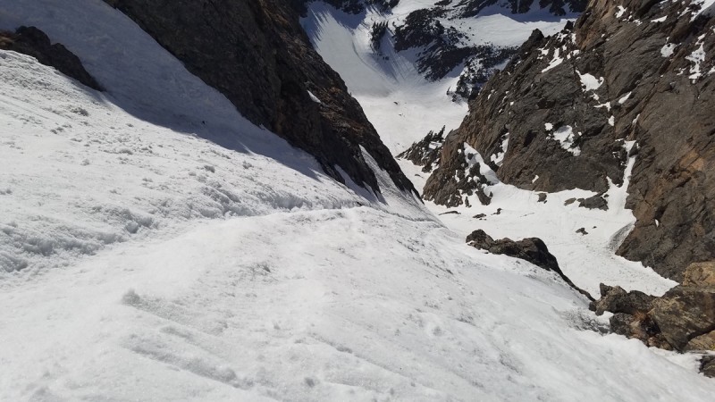
Another looking-down picture, this time from halfway up the right fork:
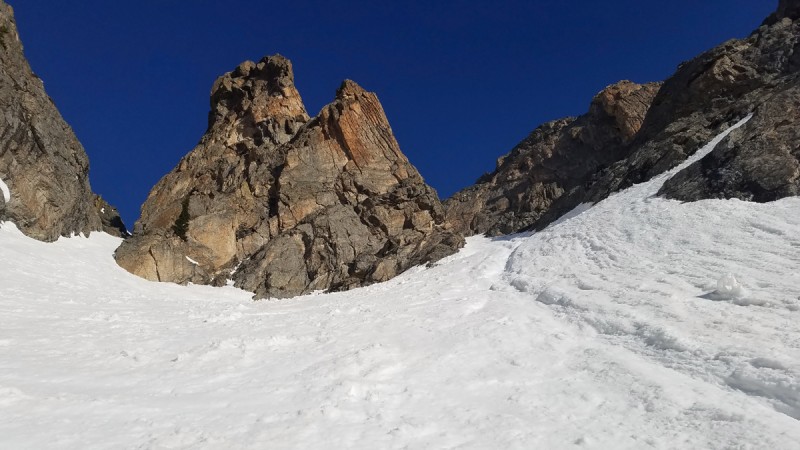
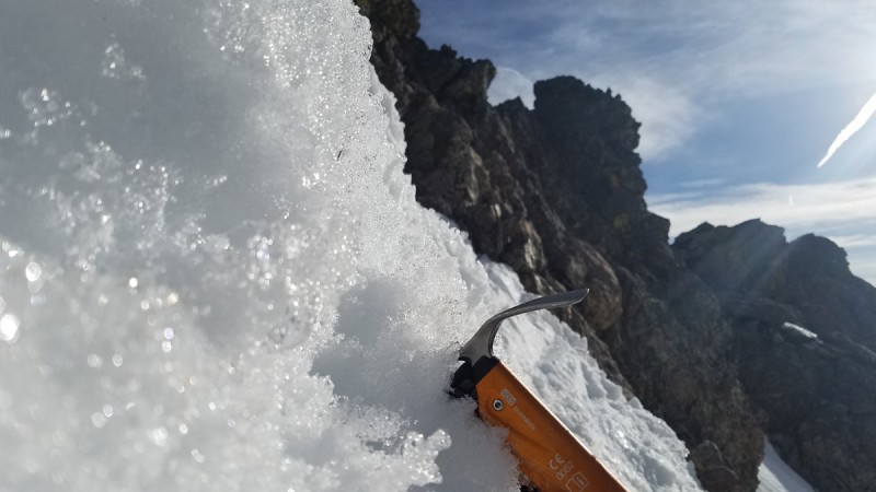
Just below the top, the right branch forks a second time. Cooper says the left option here is a steep exit that bypasses the right-hand cornice, but today the cornice in the exit is negligible so I took the climber's right way out.
Yet another looking-down picture, this time taken from just below the top-out.
At the easiest exit, the slope was measuring anywhere between 49 and 57 degrees, with the most common reading being around 50 to 52. To the left, the cornice went vertical for a few feet, so a climber can currently choose an exit steepness between ~50 and ~90. Exiting over the easiest side, I felt best using a half dozen steps of German technique (front pointing) to get over the lip.
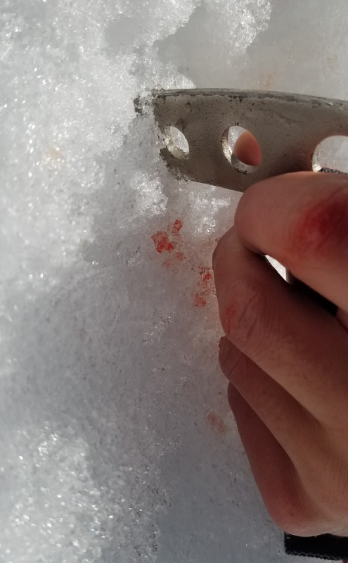
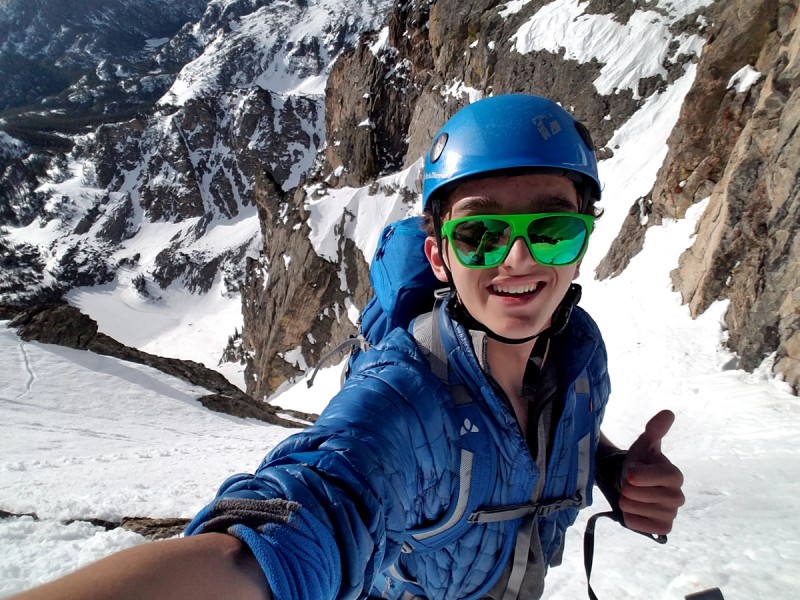
About 1,800 feet of snow climbing on sharp ice crystals had scraped my knuckles, making for pictures that look gnarlier than it really was.
Glad to have made it up a wonderful route on a calm, warm, sunny day!
I reached the barren moonscape of lower Flattop Mountain around 8 a.m., which meant that I climbed from the lake to the ridge in almost exactly an hour. Even this early, I was seeing nearly-constant pea-sized ice fall with occasional poker-chip sized pieces, and I didn't want to wait around to see just how large a chunk would come down.
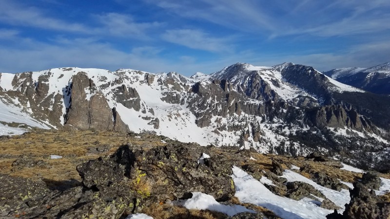
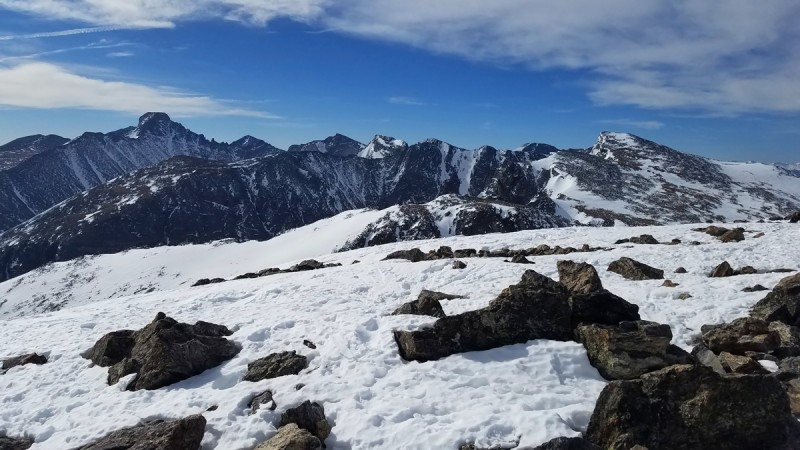
Stones Mountain as seen from the top of Dragon's Tail:
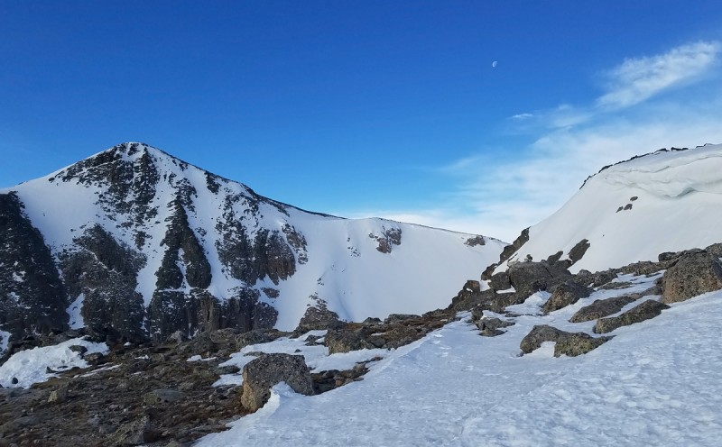
I've always been more inclined towards summits than just climbs, so from the top of Dragon's Tail I decided to head west and south around the rim of Tyndall Gorge to the summit of Hallett Peak, seen here on the left. A trifecta of white: snow, cloud, and moon:
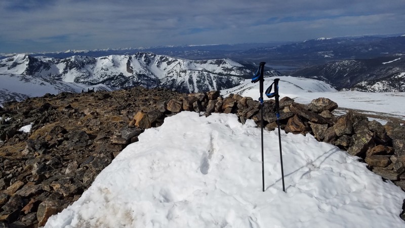
On the way, I stopped to touch the highest rock on the well-named Flattop Mountain. This is the summit boulder with the Mummy Range in the background.
Hallett and Tyndall Glacier as seen on the traverse:
I summited Hallett around 9:15 under increasingly cloudy skies and moderate (for the Divide) winds, just like NOAA predicted.
Despite only being a 12er, Hallett felt remarkably remote and had nice views of Longs et al.
I descended quickly, making it back to the car before 11:30 for a sub-6-hour round trip. I was a little surprised at this time, considering it was >8miles and 3,800 vertical, with 1,800 of that on steep snow. Here is a parting view of Hallett from the Flattop Mountain Trail.
As the Tyndall cirque faded in my rear-view mirrors, I remembered that this time last year my snow-climbing experience was limited to the St. Mary's Glacier.
The Dragon's Tail Couloir earns a classic rating from me. The combination of moderate difficulty, easy approach/descent, famous location, and inspiring views all wrapped into a clean, aesthetic line makes this climb deserving of a place on every snow climber's to-do list.
Thumbnails for uploaded photos (click to open slideshow):
A few pictures in you had a bare hand on your axe and I thought...I hope he put on gloves! Then the bloody knuckles at the end gave me the answer. Personal opinion...any time I have an ice axe out, I at least have on thin liners to protect my hands. Climbing is one thing, though obviously can still do damage - if you ever started sliding, a self arrest would be gnarly without gloves on.
Great climb though! I've done the left fork a couple times now, including a couple weeks ago. Go back and try it some time - the rock step is a good intro to mixed climbing.
Caution: The information contained in this report may not be accurate and should not be the only resource used in preparation for your climb. Failure to have the necessary experience, physical conditioning, supplies or equipment can result in injury or death. 14ers.com and the author(s) of this report provide no warranties, either express or implied, that the information provided is accurate or reliable. By using the information provided, you agree to indemnify and hold harmless 14ers.com and the report author(s) with respect to any claims and demands against them, including any attorney fees and expenses. Please read the 14ers.com Safety and Disclaimer pages for more information.
Please respect private property: 14ers.com supports the rights of private landowners to determine how and by whom their land will be used. In Colorado, it is your responsibility to determine if land is private and to obtain the appropriate permission before entering the property.