Download Agreement, Release, and Acknowledgement of Risk:
You (the person requesting this file download) fully understand mountain climbing ("Activity") involves risks and dangers of serious bodily injury, including permanent disability, paralysis, and death ("Risks") and you fully accept and assume all such risks and all responsibility for losses, costs, and damages you incur as a result of your participation in this Activity.
You acknowledge that information in the file you have chosen to download may not be accurate and may contain errors. You agree to assume all risks when using this information and agree to release and discharge 14ers.com, 14ers Inc. and the author(s) of such information (collectively, the "Released Parties").
You hereby discharge the Released Parties from all damages, actions, claims and liabilities of any nature, specifically including, but not limited to, damages, actions, claims and liabilities arising from or related to the negligence of the Released Parties. You further agree to indemnify, hold harmless and defend 14ers.com, 14ers Inc. and each of the other Released Parties from and against any loss, damage, liability and expense, including costs and attorney fees, incurred by 14ers.com, 14ers Inc. or any of the other Released Parties as a result of you using information provided on the 14ers.com or 14ers Inc. websites.
You have read this agreement, fully understand its terms and intend it to be a complete and unconditional release of all liability to the greatest extent allowed by law and agree that if any portion of this agreement is held to be invalid the balance, notwithstanding, shall continue in full force and effect.
By clicking "OK" you agree to these terms. If you DO NOT agree, click "Cancel"...
And so we found ourselves on April 21 five years ago, gearing up in the upper lot at the Maroon Lake trailhead, being cross-examined by a supposedly experienced local who questioned our intended line ("I mean ... how are you going to get over the Punk Rock Band???"), when it occurred to me that I had not brought my axe. Gueza and rmiller were unimpressed. Nevertheless, we discussed options -- either I could run into town and buy one, or we could ski something nearby with less exposure where a whippet would suffice. Rmiller and I had both skied Castle, but Gueza had not and a plan was hatched to do the Conundrum/Castle double. So we regrouped and bivied near treeline a couple drainages over in order to be in position for an early start.
That trip produced a chattery descent of Conundrum, a powdery descent of Castle's N face and some of my best sunrise shots yet:
But it left me feeling guilty for causing the change in plans and hungry for another trip up the Maroon Lake road. Every season since, N Maroon has been tops on the list, but the timing never seems to come together.
This time Gueza and I found ourselves some six miles from the upper lot, but fully equipped and motivated. Well, I guess without a sled or bikes (nor trail runners for me ), not fully equipped, but well enough equipped for the terrain above the summer trailhead. A 1am departure time was agreed upon in order to overcome the initial challenges presented by miles of dry but gated asphalt. That long-awaited trip up the Maroon Lake road would be on foot. My answer to the inevitable inquiry of "what's the hardest 14er?" is always "the first one of the year," so I think it is generally nice to start the 14er season off with a "tune-up" peak. With the list short and stout, I guess a slog on N Maroon must do.
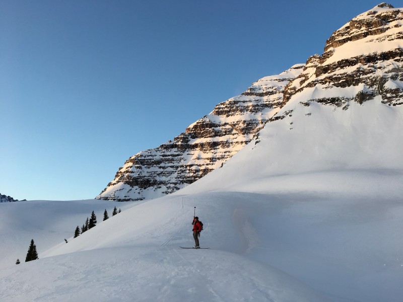
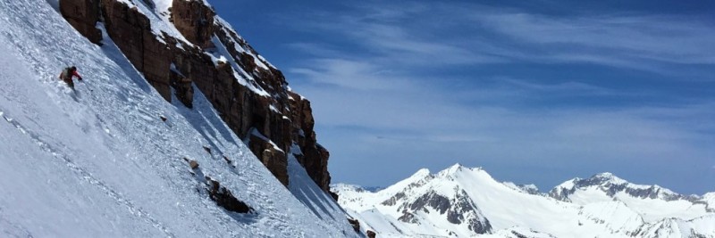
The going was slow and steady, but too slow for more quality sunrise shots. In the precious moments when those were available, we were knee deep in the slot used to gain access to the upper basin. But we found our way around the corner and considered our objective:
The solar aspects had transitioned to a springish snow pack, but we had questions about how much swimming would be involved in getting up the N face. We picked out the most likely route from below and then began to leave the tell-tale marks of N face virgins. Thankfully, the snow was only rotten in spots and those marks were for the most part only about boot deep.
Gueza navigating the sneaky crux traverse:
And higher still, wishing there was a bit more snow on Cap:
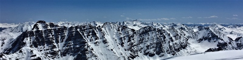
Thanks to the cold that prevailed on the N face, we topped out 11 hours after leaving the car and enjoyed the perspective while readying ourselves for the ski:
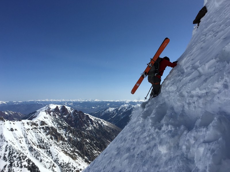
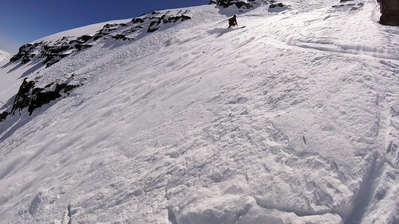
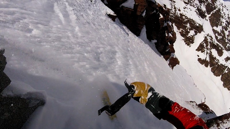
The Punk Rock Band was in what I imagine is better than average condition and largely did not live up to the hype. I caught a frame shot of Gueza making his first turn after the band:
A feel for the exposure over the E face:
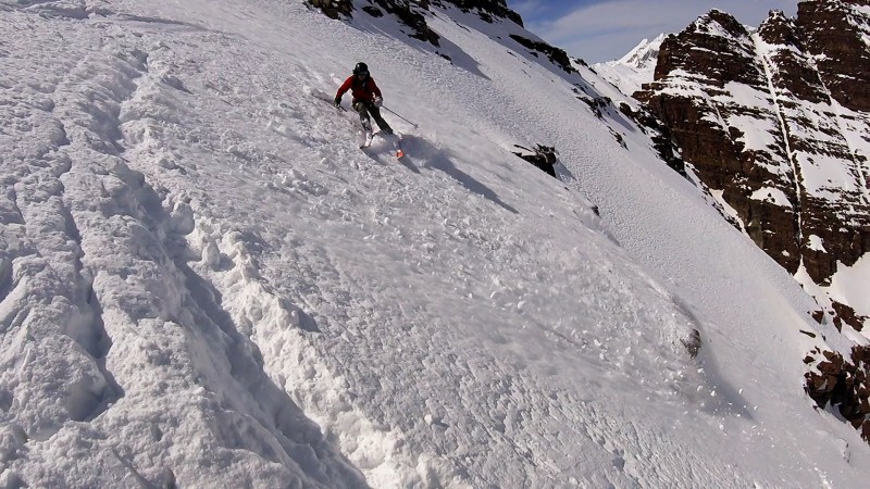
The slow bootpacking meant that the down would be a sloughy grin-fest:
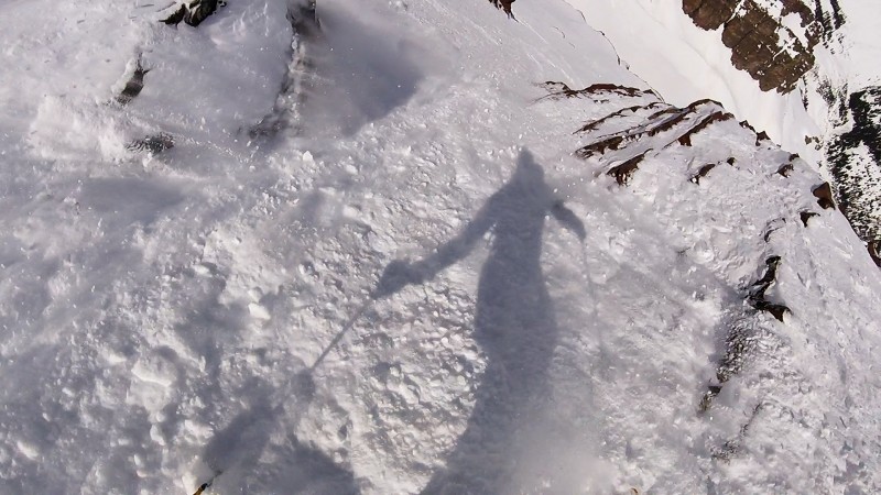
Fun learning how to use the frame-grab feature of the helmet cam:
And here's the edit. (Lots of vert and two skiers means that most of it is the sped-up nausea-inducing type). YouTube picks the most random frame grabs for the album cover:
We managed about 3.3 miles of the road on skis on the way out. The remainder was soul-crushing. Pro tip: plan ahead to avoid walking out on the assfault.
Thumbnails for uploaded photos (click to open slideshow):
I love seeing telemarkers rip intense lines. Congrats to you fellas.
Caution: The information contained in this report may not be accurate and should not be the only resource used in preparation for your climb. Failure to have the necessary experience, physical conditioning, supplies or equipment can result in injury or death. 14ers.com and the author(s) of this report provide no warranties, either express or implied, that the information provided is accurate or reliable. By using the information provided, you agree to indemnify and hold harmless 14ers.com and the report author(s) with respect to any claims and demands against them, including any attorney fees and expenses. Please read the 14ers.com Safety and Disclaimer pages for more information.
Please respect private property: 14ers.com supports the rights of private landowners to determine how and by whom their land will be used. In Colorado, it is your responsibility to determine if land is private and to obtain the appropriate permission before entering the property.


")
")
")
")
")
")
")
")
")
")
")
")
")
")
")