| Report Type | Full |
| Peak(s) |
Mt. Sneffels - 14,155 feet |
| Date Posted | 03/29/2017 |
| Modified | 03/30/2017 |
| Date Climbed | 03/19/2017 |
| Author | RyGuy |
| Additional Members | JQDivide, globreal, bmcqueen |
| 24 hours of winter in Ouray |
|---|
|
Peak: Mount Sneffels (14,150') Distance: 13.5 miles from the standard winter closure below Camp Bird @ 9,150 feet Vertical: ~5,000 Time: 2:50AM-12:42PM. (9 hours, 52 minutes. Summit @ 8:22AM) Trailhead: Yankee Boy Basin Route: Standard route. (Through V-notch on the ascent, down the summer class 3 bypass) The team: Brad McQueen (bmcqueen), Britt Jones (globreal), Joel Quevillon (JQDivide) and Ryan Richardson (RyGuy) If I have learned anything about climbing 14ers in winter, it's that planning them is an exercise in patience with a large side order of coordinating and communication with partners. You have an ever-shrinking list of peaks you are targeting. Then you have to go check all your partner's peak lists to see who might be interested in some of the target peaks. Once you have partners lined up, then you have to wait while keeping a tight eye on the weather and snow conditions. And of course, always have a backup peak or two, ideally in another mountain range that you can quickly pivot to if conditions dictate to bail on the primary peak. With the last weekend in calendar winter approaching, I was looking for something fun to finish the winter out with. With a large ridge of high pressure parked over the state for the better part of the last week, this opens up some fun possibilities. I have been in discussions all winter with Brad, Joel and Britt about various peak goals we all had, and after getting six Sawatch peaks done, I was hoping to change up things a bit. I really wanted to start working on the San Juans in winter. I emailed the guys to see who would be interested in Uncompahgre, Redcloud/Sunshine, or Mount Sneffels. I knew the only peak we all didn't have in winter was Sneffels, but wasn't sure if everyone was free. Everyone quickly replied they were free and liked the idea of the San Juans. Mount Sneffels it is! Now we just needed to sort out all the logistics and see how the weather and conditions shaped up. By Thursday night, I was all packed, and ready to go. My itinerary for my SPOT crew was written and passed along to Brad, Britt and Joel for reference. Hotel rooms in Ouray booked. The weather was looking to be quite warm for winter. High of 40F @ 11,300 feet with a bit of a breeze for Sunday. Not exactly a typical winter forecast, but we'll give it a shot. Given how warm it was going to be, we quickly decided a 3AM start was essential to avoid afternoon post-holing and the possibility of wet slide avalanches. Saturday morning I picked up Brad at the Dino lots, and we took off for Buena Vista. There, we met up with Britt and Joel and all hopped into Joel's suburban for the trip down to Ouray. As we arrived in Montrose, we got our first look at Mount Sneffels and the Dallas Divide as well as the latest CAIC forecast. 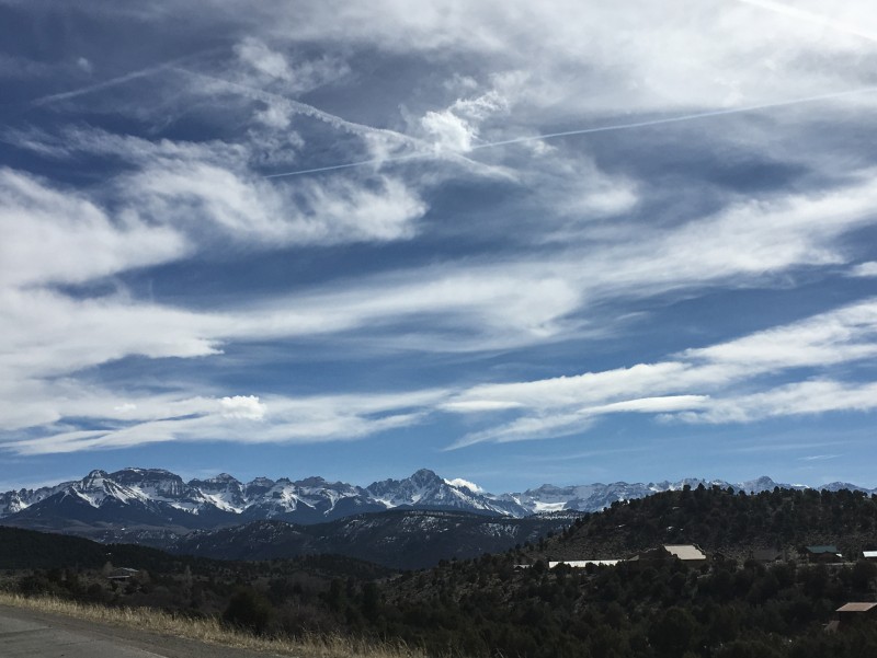 While the Dallas Divide and Mount Sneffels looked stunning as always, the CAIC forecast didn't look so good. Lots of yellow and orange instead of the green we had been seeing the last week. To add insult to injury, it was nearly 80F in Montrose. This wasn't looking good at all for snow conditions up high. 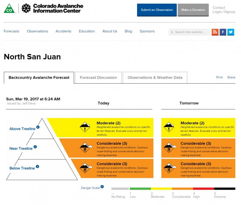 The specifics of what we were dealing with weren't a big surprise given the temperatures, but were disheartening nonetheless. 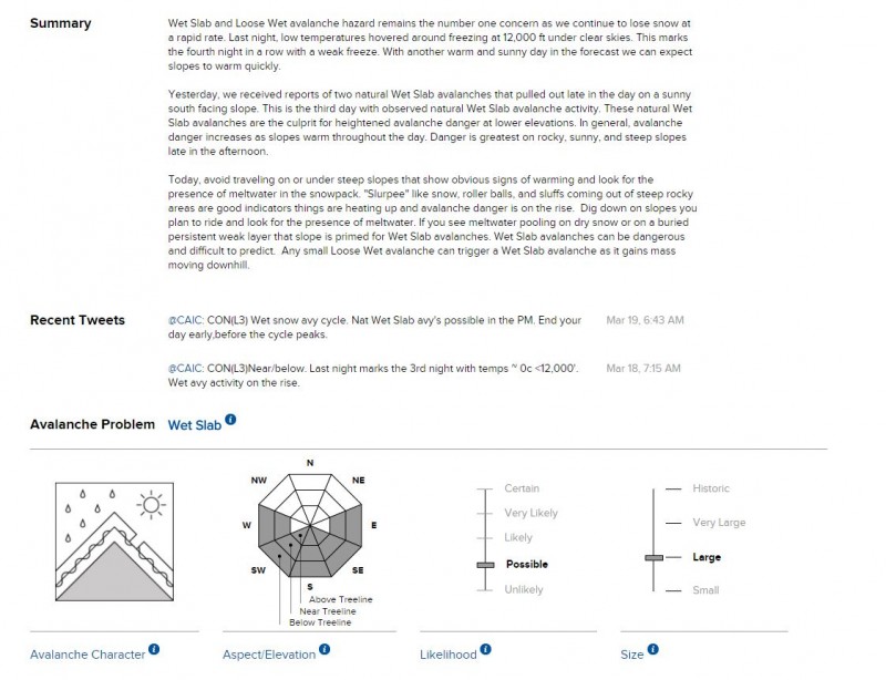 Ugh. Could be worse I suppose, but still not what we were hoping for. 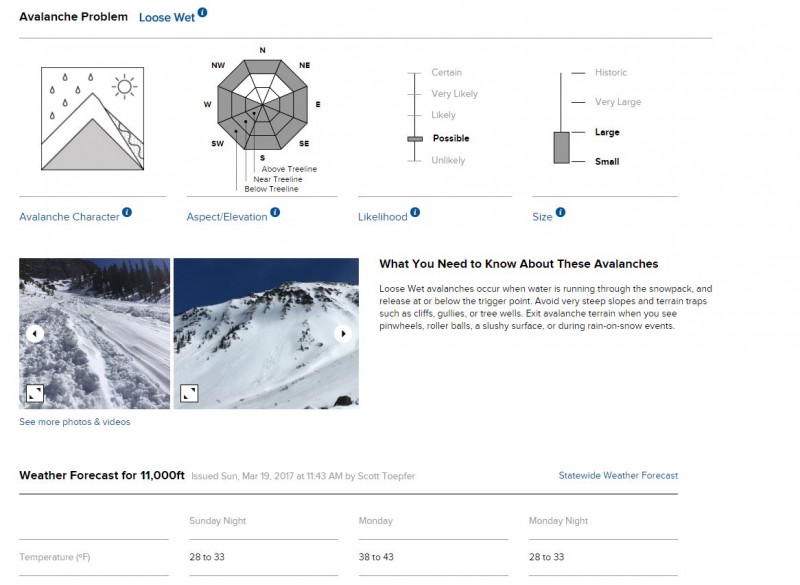 After reading through the CAIC update to everyone in the car, we quickly got into a discussion about our planned 3AM start time, and even alternate routes. We were facing very spring-like conditions that we typically wouldn't see for another few weeks. While the warm temperatures would help consolidate the snowpack, it also needed cold freezes at night to help it bond together well and we hadn't been getting much the last few nights. If we could get a good freeze overnight and get up and down very early, these conditions could actually work in our favor. But timing was absolutely critical. By comparison, this route holds a lot of avalanche danger most of the winter. Eventually we decided we would be best sticking to our original plan of heading up the road a bit before 3AM. Although that meant trying to get to bed early enough to actually get some sleep. Getting up around 2AM was going to be rough. Heck, I stay up that late sometimes! Hopefully a combination of some melatonin and a carefully executed carb-bomb dinner would help. After arriving in Ouray around 3:30PM, we decided to go confirm the winter closure was at the gate at 9,150' below Camp Bird or see if somehow we might get lucky and the gate was open and we might be able to start higher. We got to the gate and it was indeed locked. Oh well. 14 miles and 5,000 vertical it is! We drove back to Ouray and checked into the Timber Ridge Lodge and got everything all laid out for the next morning. Any time we could spend now getting everything prepped meant that much more sleep tonight. Once everything was ready, it was only 5:30PM, so we decided to go check out Wiesbaden Hot Springs since the main Ouray Hot Springs are undergoing renovations. It's a quaint, but nice little place. More of a mature feel to it. It also has an interesting vapor cave that is certainly worth the $15 for a visit. The outdoor pool has awesome views of the surrounding mountains. We spent a good hour enjoying the hot springs. With it being nearly 60F in Ouray, it was pretty darn enjoyable! It was also fairly evident we all spend a ton of time completely covered in gear given how pale we all are. And no, the shattered window pane behind us didn't happen when the shirts came off! 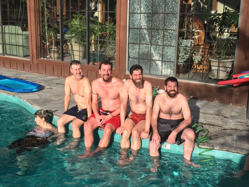 After the hot springs, it was time to do some serious carb loading. Joel recommended a place called The Outlaw and in we went. Excellent place, and good atmosphere. Certainly will come back for dinner again sometime. 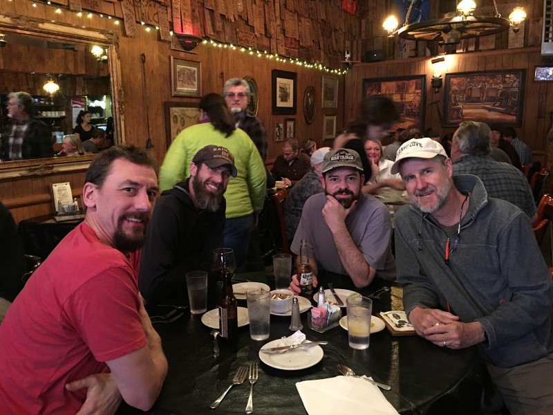 With dinner done, it was 7:45PM and time to get back to the hotel and try and get some sleep. Alarms were set for 2AM, with the goal to depart the hotel by 2:30AM. After a few hours of light sleep, my alarm went off. I am not the most chipper person that early, but got dressed quickly and headed out to the car. Breakfast wasn't in the cards as usual, but oh well. Britt said he didn't sleep, but was well enough rested to give Sneffels a shot. We arrived at the TH at 2:40 and were ready to start up the road by 2:50AM. This sign greeted us at the gate:  Good reminder of what we were going into. This isn't Quandary's east ridge and this sign isn't just a photo op for tourists. After a quick avalanche beacon check, Britt led us in prayer, then we started walking up the dry road. It was pleasantly nice for the middle of the night in calendar winter. It was roughly 38F with a clear sky and 60% moon lighting our way. It was weird starting a winter hike 3:00AM with just a base layer, and nothing on my head or hands. We were hoping somehow the snow got a good freeze higher up. That would give us a wider safety margin and hopefully spare us from the dreaded trap-doors that tend to appear as the snow warms up and softens later in the day. We also had a discussion via email before the trip about the importance of getting up to Sneffels and back down as early as we could to help ensure we stayed safe. Brad challenged the group to go as light as possible to help ensure speed though the danger zone. While packing, I decided to see if I could get my standard winter pack under 40 lbs total. Those of you who know me well know that lightweight isn't really a term I have in my vocabulary. However, I managed to get my pack down to 32 lbs with full avalanche gear and 3L of water. Not bad at all! As we started up the road, I was already noticing the 8+ lbs missing from by pack and feeling pretty good. Not long after we departed, the snow along the sides of the road suddenly grew into the 10-15 foot high range for 50 yards or so. We all marveled at the height of the snow on both sides of the road, hoping it wasn't that deep higher up. Pretty impressive Snow canyon! With the lighter packs, we managed to tear up the road and hold a roughly 2 MPH average for the first 90 minutes until we reached another gate and mining building. Not recognizing this place, I quickly checked my GPS and in our haste, we blew right by the turn-off to get into the upper Yankee Boy Basin! Crap. As I looked closer at the GPS, I realized we were only 200 feet below the road we were looking to be on, so we backtracked about 100 yards and climbed over a 5 foot snow wall and up onto an open slope that would take us up the 200 vertical feet to the road. As we climbed the snow wall, we saw footprints just below us, also heading directly up. Looks like we weren't the only group to make this error recently. We make quick work of the hill, and get onto the right road. We quickly realize snowshoes are now mandatory, so we pause to put on snowshoes and take a quick snack break. I look at my GPS and call out the stats to Brad, Britt and Joel. We've managed to go 3.5 miles and 1,800 vertical in just an hour and 40 minutes. As we are paused and a bit shocked by our progress, we see headlamps coming up below us. It's not like this is Quandary Peak in winter. Who the heck is also trying Sneffels this weekend? As they get up to our location, Joel recognizes them. He introduces us to Sarah Hettenbach and her two climbing partners. We exchange pleasantries, strap on our snowshoes and then start to get underway again. Not quite as fast in snowshoes, but fast enough. Every time I check our GPS, we are way ahead of schedule. None of us can really believe the time we are making on the ascent. The afterburners are lit, and there is no looking back! Soon, the sky begins to lighten in the east as we reach the base of the ramp up to the Kismit/Sneffels saddle at 12,800. The colors are absolutely amazing. Snowshoes are stashed and crampons and ice axes come off the pack. We start up the ramp, which is sadly lacking in snow. It's not nearly as miserable as it is in summer, but still not ideal, especially with crampons on. Brad admiring the sunrise above the Yankee Boy Basin. 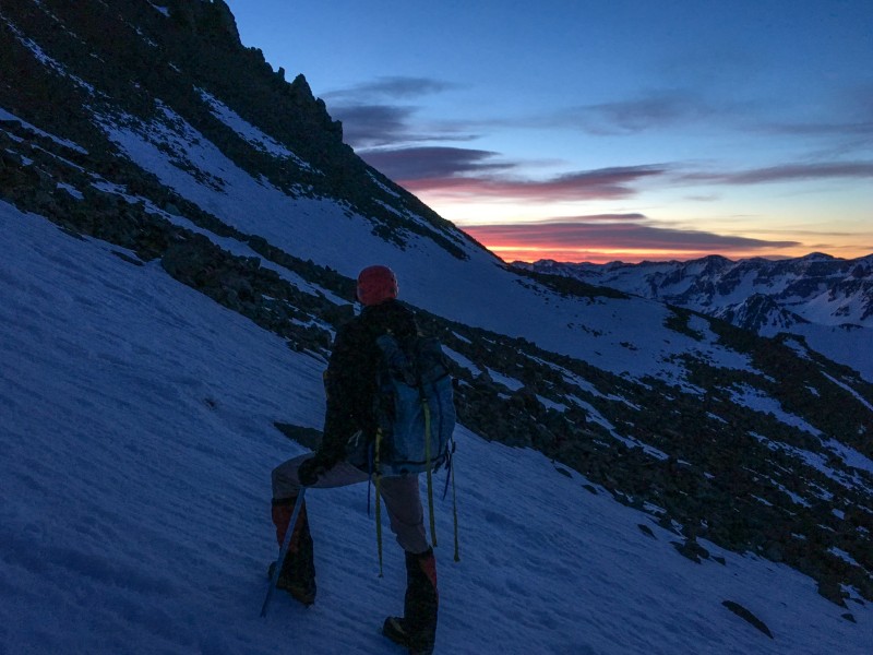 As it continues to get lighter, we can finally see details on the nearby peaks. The Moon over Gilpin Peak (13,695') 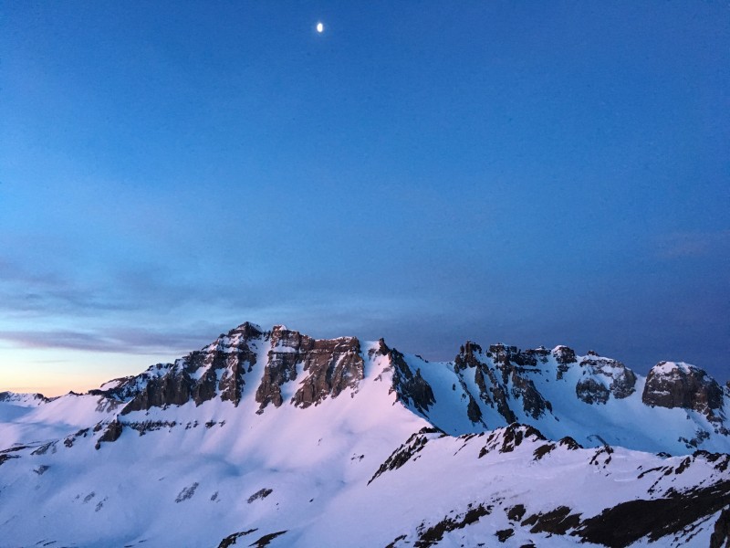 Only 35 minutes after we stash our snowshoes, Brad and I crest the Kismit/Sneffels saddle and stop to admire the view around us with Joel and Britt right behind. Brad taking in the view. 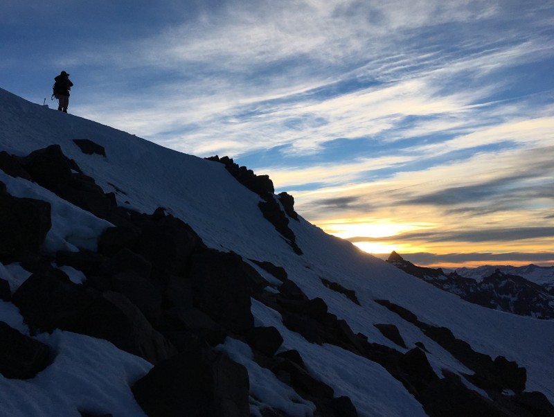 Looking southwest over Telluride at the Wilson group and Dallas Peak. It turns out that Sarah and Dominic Meiser were near the summit of Dallas Peak around the same time this photo was taken. 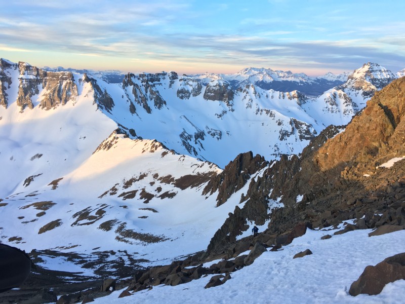 The sunrise over Teakettle Mountain and the Dallas Divide. Uncompahgre and Wetterhorn on the horizon at left.  After a brief break, we start heading up again. 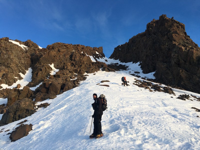 Brad and I heading up the lower Lavender Couloir. 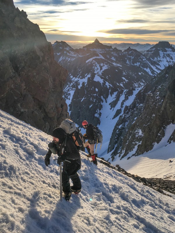 At the start of the couloir walls, Britt takes a quick break to revel in the sunlight and views. 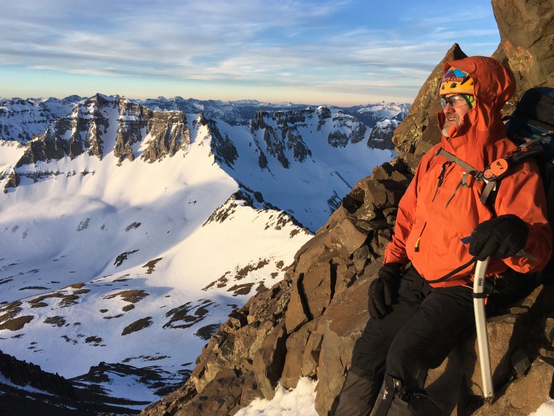 Despite the sun's appearance being quite welcome, it also means we are on a timer and we need to be quick and keep an eye on the snow conditions. We are now basically racing the sun.  Britt and I just before the V-notch, we stop before heading up the rock wall. 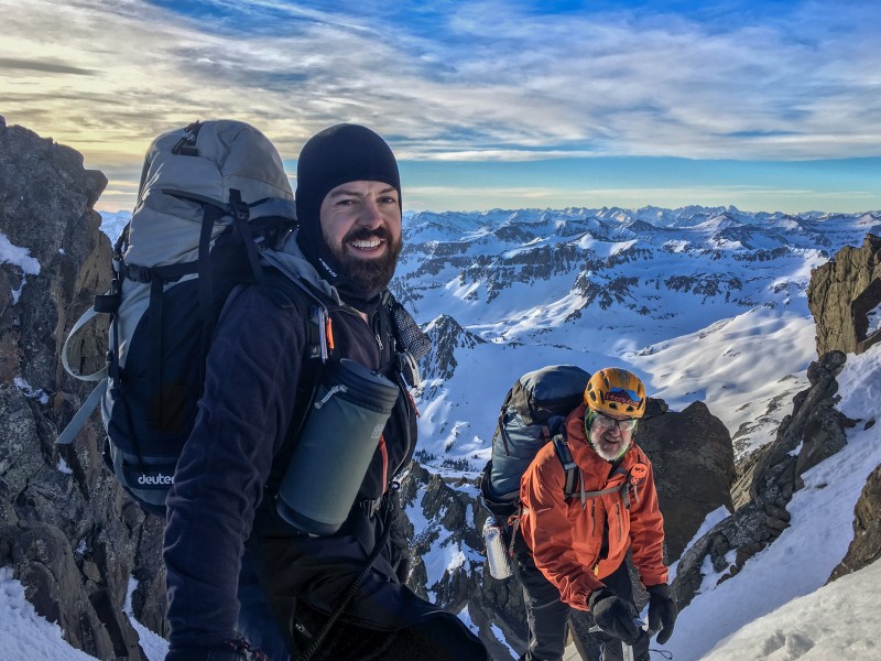 After a brief pause, I start climbing up towards the V-notch to see what we will be dealing with. Thankfully the V-notch is fairly easily passable and I continue up and through the rocks. Looking down from the V-notch, I can see Brad is working his way up the rock, while Britt and Joel take a breather before following. This section initially gave us some concern during planning, given what I had read on several trip reports and knowing it typically is the crux of the route on Mount Sneffels. But with careful moves, it wasn't too bad at all. Although a fall here would have been very bad. 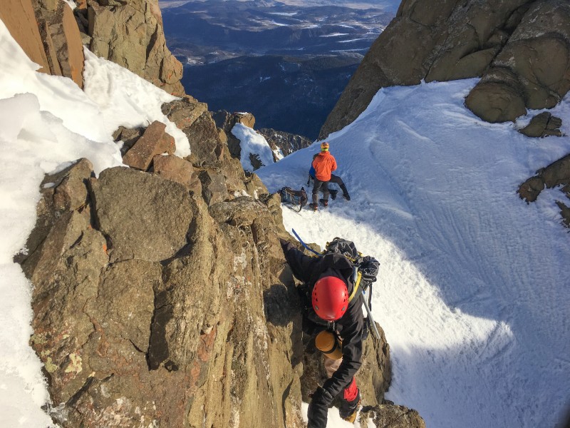 Looking down the Lavender Couloir from the top of the V-notch at Sarah and her group coming up. 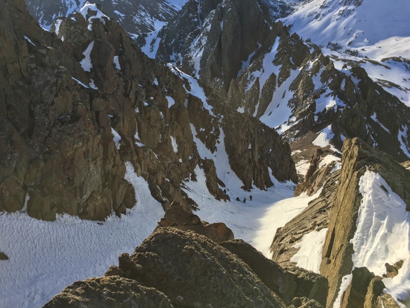 Once past the V-notch, the remaining route to the summit was just a steep snow and rock ridge. Care was needed as there was a nice drop-off to the north and the cornice at formed on the ridge that was hard to avoid. 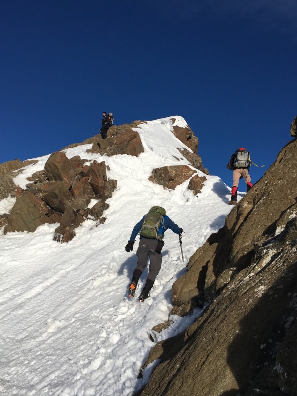 Me navigating on the upper ridge towards the summit. 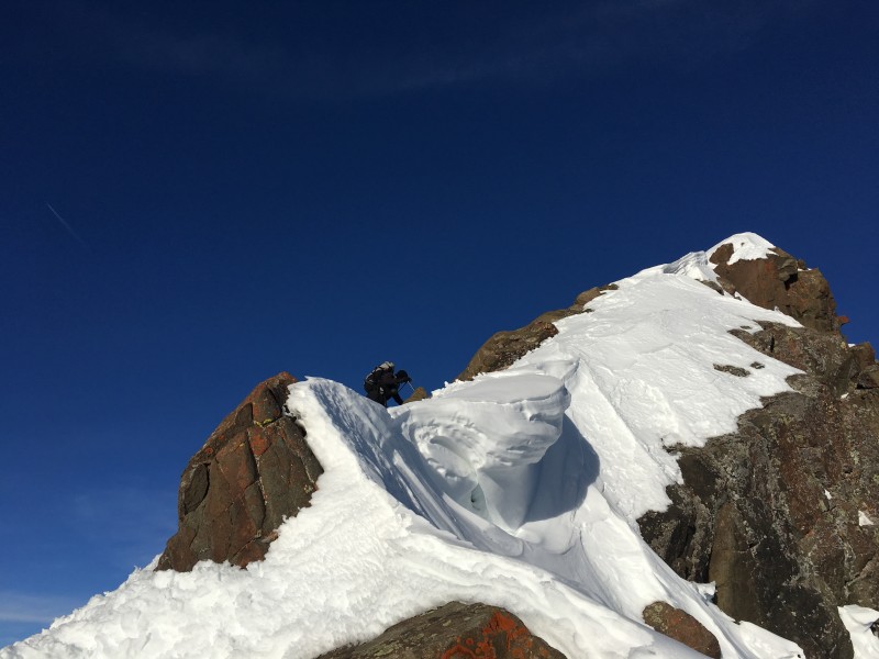 Britt and Joel reaching the summit. 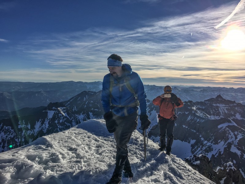 At 8:22AM, we all reached the summit of Mount Sneffels! What an amazing day! It was just below freezing with a slight breeze. The views of the majestic San Juans never disappoint! Somehow we had blitzed up nearly 7 miles and 5,000 vertical in only 5.5 hours. Not bad at all! 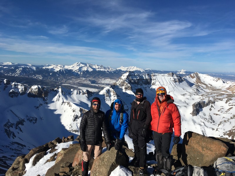 With the timer continuing to tick away, we spent just under 30 minutes on the summit, and then begin the descent to avoid the snow getting too soft. I opted to head down the summer class 3 bypass section to avoid going through the V-notch again. It was a steep snow down-climb, but made for a fun descent and gave us good practice for some upcoming steeper climbs. It was later dubbed The Ryan Route. 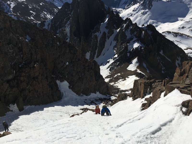 Brad traversing out of the steeper down climb back onto the Lavender Couloir.  The team coming down the Lavender Couloir. 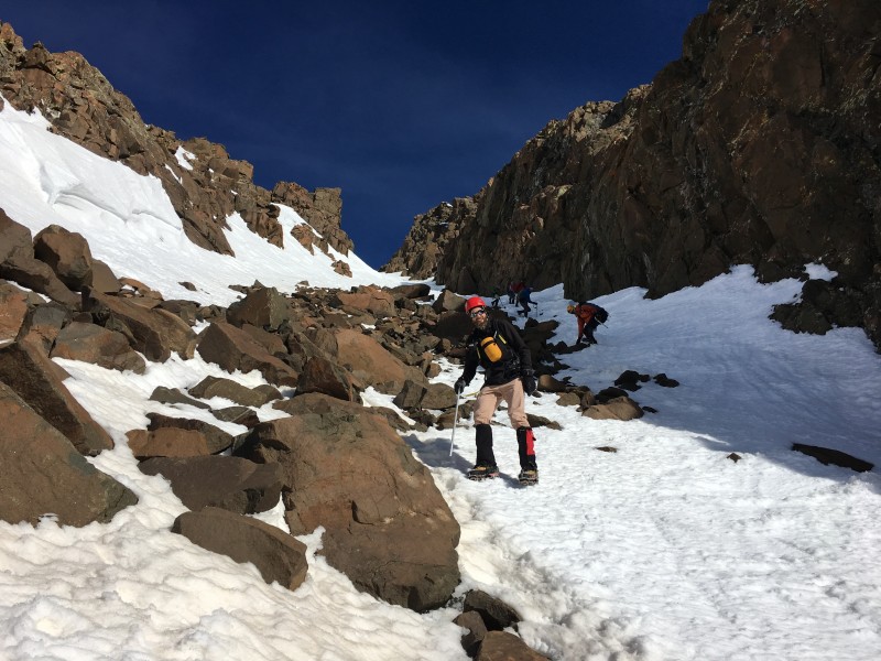 Once we were back to the Kismit/Sneffels saddle, we take a quick break before heading back to the snowshoe stash. As I reach the snowshoes, I look over and notice something we didn't see on the way up. A wet slide that came down parallel to the standard route, but over about 60 yards. Initially I wondered if it was recent since I didn't recall seeing it on the way up. Although it was pretty dark. A closer look at pictures from earlier in the morning reveal it was there. We just didn't see it. Our best guess is it came down sometime in the last day or two. Certainly good reason to be quick about swapping crampons and ice axes for snowshoes and get moving again. 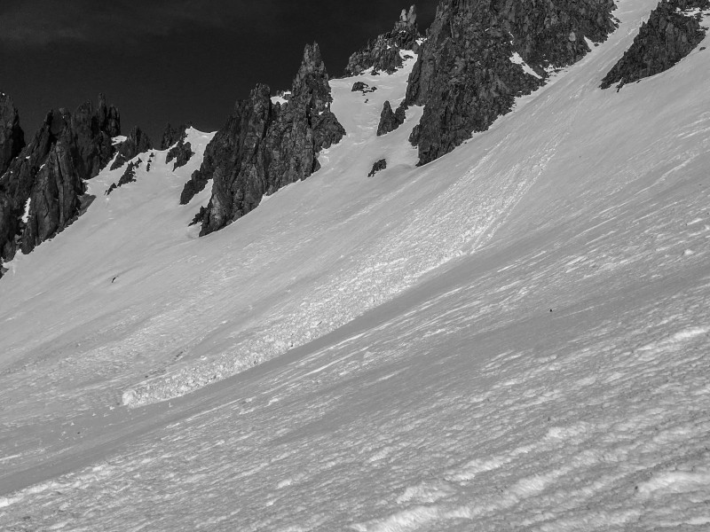 Looking down the upper Yankee Boy Basin with Teakettle, Potosi and Stoney Mountain dominating the views. 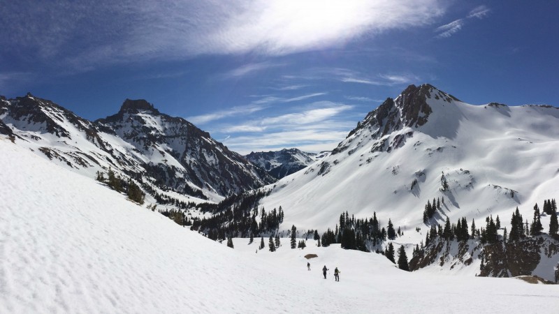 Joel enjoying being back at the upper summer TH.  Looking down the valley as Brad and I light the afterburners on the descent. Thankfully we were heading down early enough the snow was still fairly supportive in snowshoes. Although if we had been an hour later, I am not sure we would have been so fortunate. 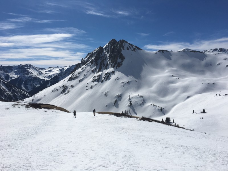 As we get lower on the road, the avalanche chutes and debris fans get bigger and bigger. This one had buried the road under several feet of debris, which was then later cleared by the mine operators. We knew we would be passing under quite a few chutes on the way in, but even with the moon, we really couldn't see much. It was a bit unnerving now that we could see everything. Although the most impressive was yet to come. 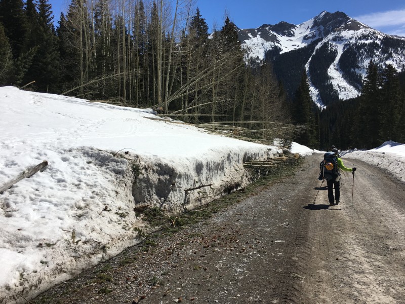 Looking up at a large chute just southeast of Potosi Peak. 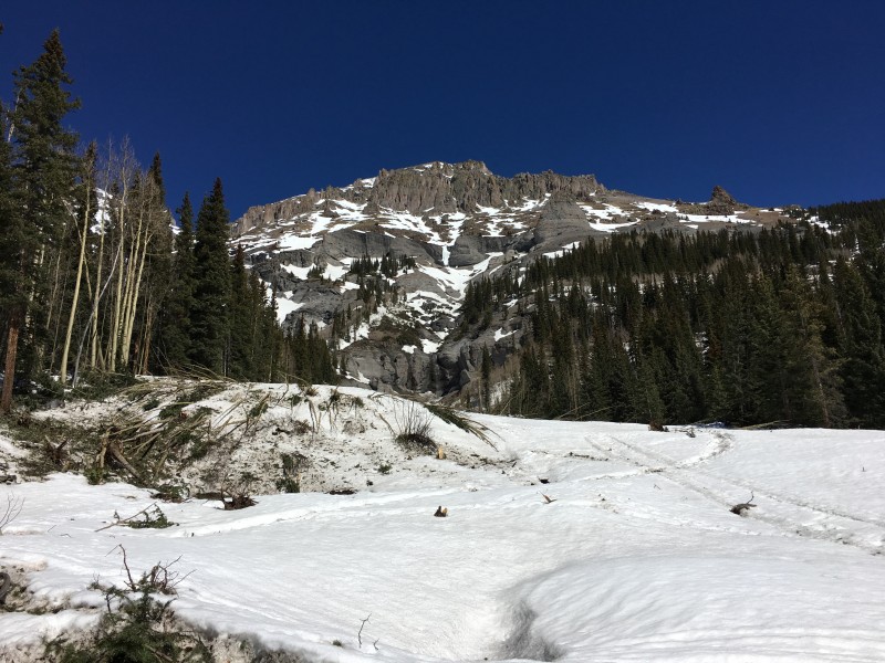 As we got lower on the road, lots of melt was now running off the overhanging sections of road, making for a fun shower if you really wanted. Despite how warm it was getting, we opted to skip the shower and keep moving to get back to the car. 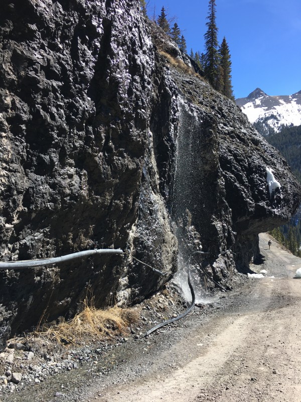 As we rounded another bend in the road, we realized the road had two giant walls of snow on either side. It was the snow canyon we had seen early in the morning. Except we realized it wasn't just high drift across the road. It was a massive avalanche. Turns out this is a well-known slide path called the Waterhole Slide that runs pretty large from time to time. 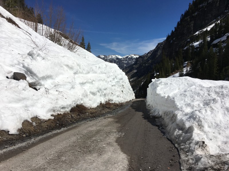 The avalanche had come down on the right side of the road, dammed the river and then ran across the road from the right side of the image to left and piled up. The scale of the debris pile was pretty impressive. 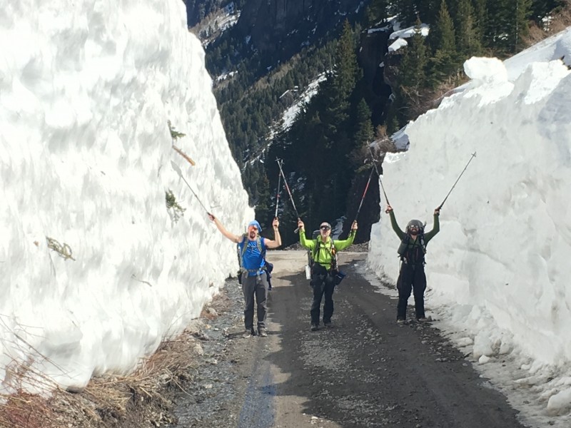 All these ice blocks weren't there on the way up. Solar heating apparently dislodged them sometime during the morning. Glad we weren't standing there when it all came down. 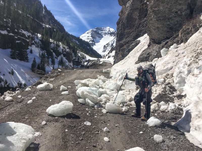 As we were stopped looking at all the ice blocks in the road, we noticed a couple of guys standing in the road ahead. One was belaying someone who was climbing on the steep rock above the road, and a third guy was standing back and watching. Given how small the climbing community is, we wondered the chances were that we know at least one of them. As we got closer, the guy on belay looked quite familiar. But without a green dinosaur suit, he was a bit harder to recognize! 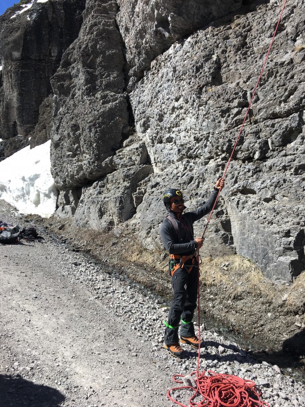 Obviously all of us knew Jomah! But who was with him? None other than Michael Davis (BoggyB) and high up on the rope was Ryan Marsters (Monster5). Small world indeed! We quickly exchanged pleasantries and discussed what we were all doing in Ouray. Turns out, Jomah, Michael, Kylie and Ryan had done Dallas Peak the day before and were just out having some fun. Click here to see Monster5's TR on Dallas Peak the day before. 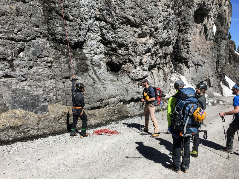 After sharing about our recent adventures, we mentioned grabbing lunch in Ouray, and the guys said they'd love to join us. (Michael's wife Kylie would also be joining us as well). We got back to the car and checked the time. It was still before 1PM. We had somehow gotten up and down the mountain in under 10 hours! As we all started to take off our gear, Britt walked over to a snow drift and started digging around. He fished a 6-pack of beer out of the snow, and brought it over to the group to enjoy. (He had stashed it right before we left the car.) Not a bad way to end a stellar day in the San Juans! As we drove back to Ouray, we passed the Ouray County Search & Rescue building. Out front one of their vehicles was parked. Glad we didn't need to call SAR! Looks like this vehicle has seen better days, but hey, if you need a rescue, they take Visa and MasterCard! (Just kidding, they don't charge of course but I wonder why they have the logo on this old vehicle.) 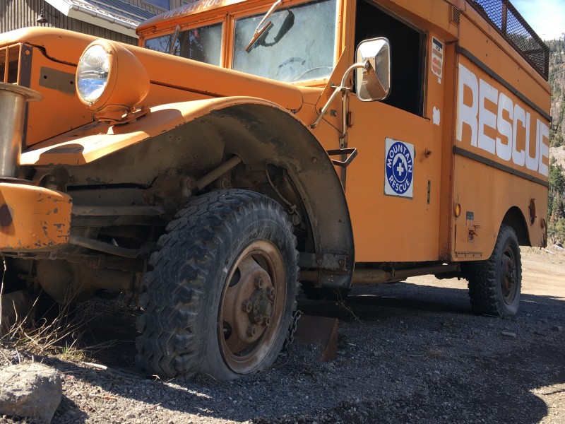 After a stop at the Ouray Brewery for celebratory beers and lunch, we all parted ways and begin the long drive towards home. What a weekend! As we headed out of Ouray, I looked at the time. 2:55PM. We were heading out just less than 24 hours after we had arrived, but what a 24 hours it had been! A calendar winter ascent of Mount Sneffels, a hot Springs visit, great dinner, lunch with good friends. It was a perfect finish to an already stellar winter season. Thanks for reading! -Ryan Thumbnails for uploaded photos (click to open slideshow):
|
| Comments or Questions | ||||||||||||||||||||||||
|---|---|---|---|---|---|---|---|---|---|---|---|---|---|---|---|---|---|---|---|---|---|---|---|---|
|
Caution: The information contained in this report may not be accurate and should not be the only resource used in preparation for your climb. Failure to have the necessary experience, physical conditioning, supplies or equipment can result in injury or death. 14ers.com and the author(s) of this report provide no warranties, either express or implied, that the information provided is accurate or reliable. By using the information provided, you agree to indemnify and hold harmless 14ers.com and the report author(s) with respect to any claims and demands against them, including any attorney fees and expenses. Please read the 14ers.com Safety and Disclaimer pages for more information.
Please respect private property: 14ers.com supports the rights of private landowners to determine how and by whom their land will be used. In Colorado, it is your responsibility to determine if land is private and to obtain the appropriate permission before entering the property.


