Download Agreement, Release, and Acknowledgement of Risk:
You (the person requesting this file download) fully understand mountain climbing ("Activity") involves risks and dangers of serious bodily injury, including permanent disability, paralysis, and death ("Risks") and you fully accept and assume all such risks and all responsibility for losses, costs, and damages you incur as a result of your participation in this Activity.
You acknowledge that information in the file you have chosen to download may not be accurate and may contain errors. You agree to assume all risks when using this information and agree to release and discharge 14ers.com, 14ers Inc. and the author(s) of such information (collectively, the "Released Parties").
You hereby discharge the Released Parties from all damages, actions, claims and liabilities of any nature, specifically including, but not limited to, damages, actions, claims and liabilities arising from or related to the negligence of the Released Parties. You further agree to indemnify, hold harmless and defend 14ers.com, 14ers Inc. and each of the other Released Parties from and against any loss, damage, liability and expense, including costs and attorney fees, incurred by 14ers.com, 14ers Inc. or any of the other Released Parties as a result of you using information provided on the 14ers.com or 14ers Inc. websites.
You have read this agreement, fully understand its terms and intend it to be a complete and unconditional release of all liability to the greatest extent allowed by law and agree that if any portion of this agreement is held to be invalid the balance, notwithstanding, shall continue in full force and effect.
By clicking "OK" you agree to these terms. If you DO NOT agree, click "Cancel"...
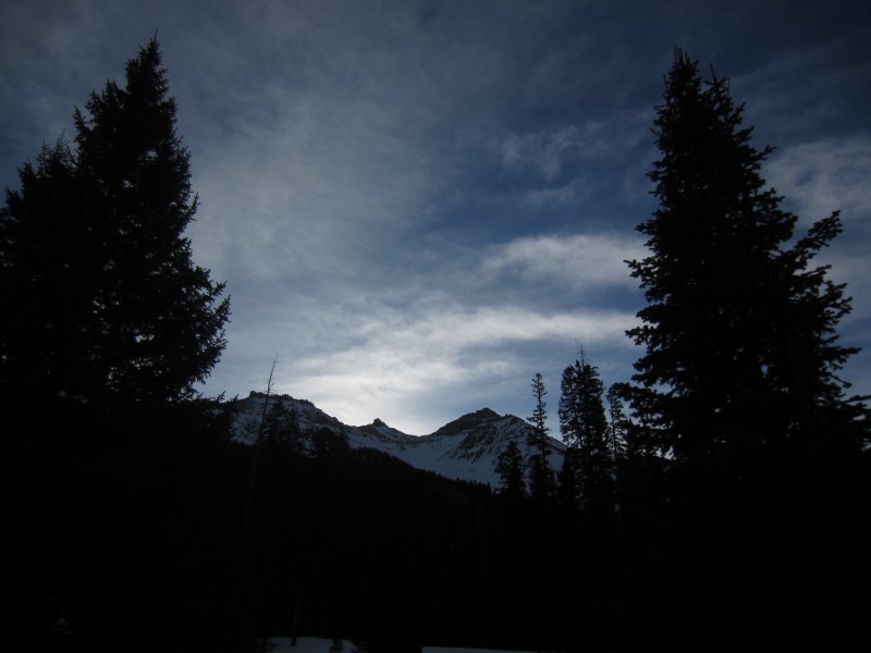
Anyone else dreaming about winter? I thought I would post a couple reports that I started back in March last year and never finished. A little teaser to the upcoming winter climbing season.
Vermilion
Date...Saturday, March 11th
Time...7am - 2pm
Distance...7.3 miles
Elevation Gain...4165 feet
Trailhead...Winter Closure on Hope Lake Road at 9900'
Route...NE Ridge to Vermilion $ Couloir - SW Ridge of Golden Horn
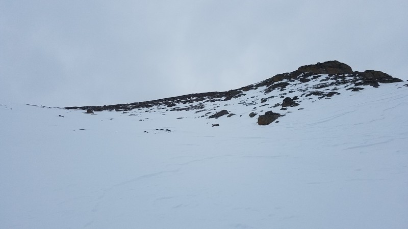
Vermilion is one of my favorite peaks...interesting and steep on every side. This would be my 3rd time up it and I wanted to try a different route. I've been up the standard west side route in April and from the Ice Lake side in July. The valley between Golden Horn and Vermilion looked like a doable option on the map so I decided to give it a shot. I remembered seeing a helicopter drop people off in this valley when we were on the summit in April, so that made me feel better about the avy potential on the approach slopes. The crux would be the NE ridge. I think it goes at class 3 in the summer, but there are a couple sections that I assumed could be difficult in winter conditions.
There is pretty good snowmobile traffic from the road closure to the summer trailhead. From the summer trailhead I immediately cut up and into the trees making my way into the valley beneath Golden Horn.
The snow was in great condition and I didn't have any problems getting around the 2 minor rock bands leading up to the saddle between GH and Vermilion.
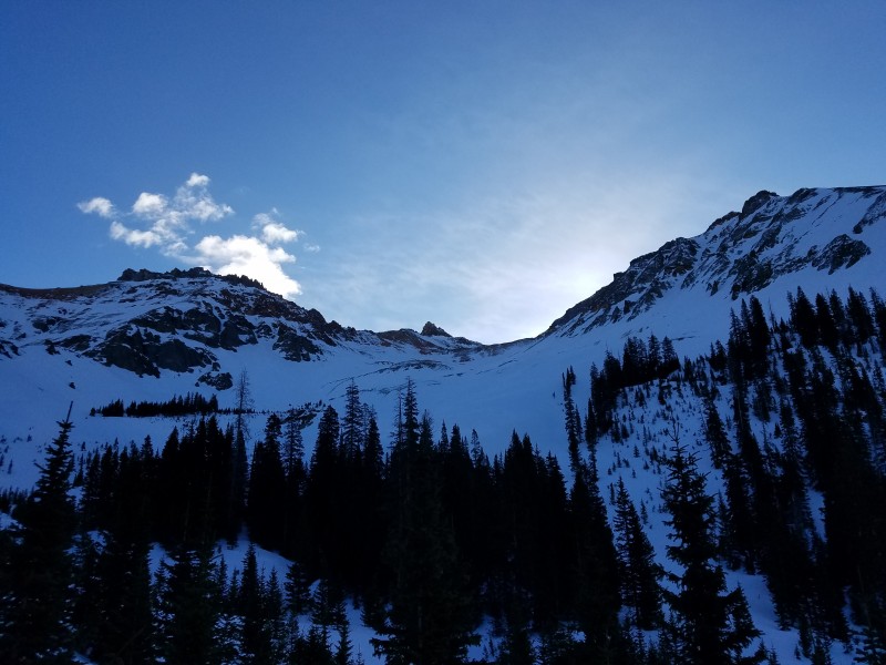
Golden Horn and Pilot Knob
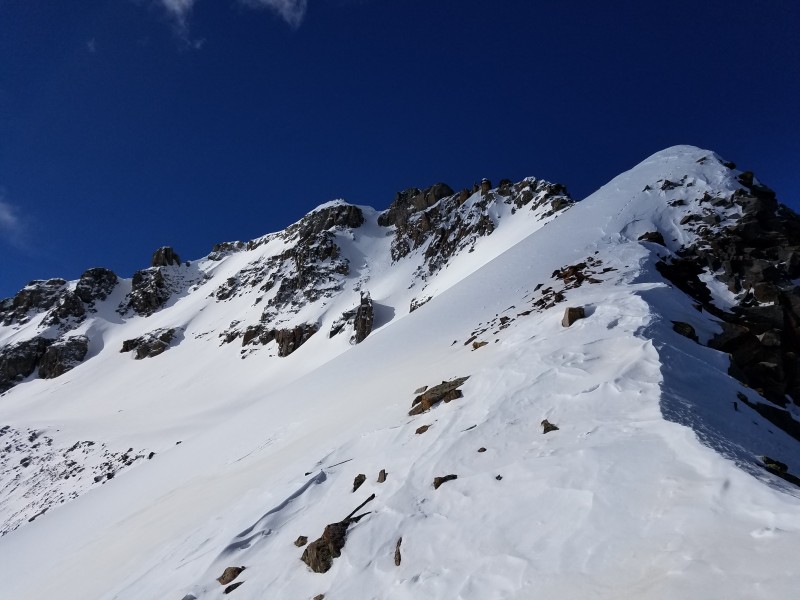
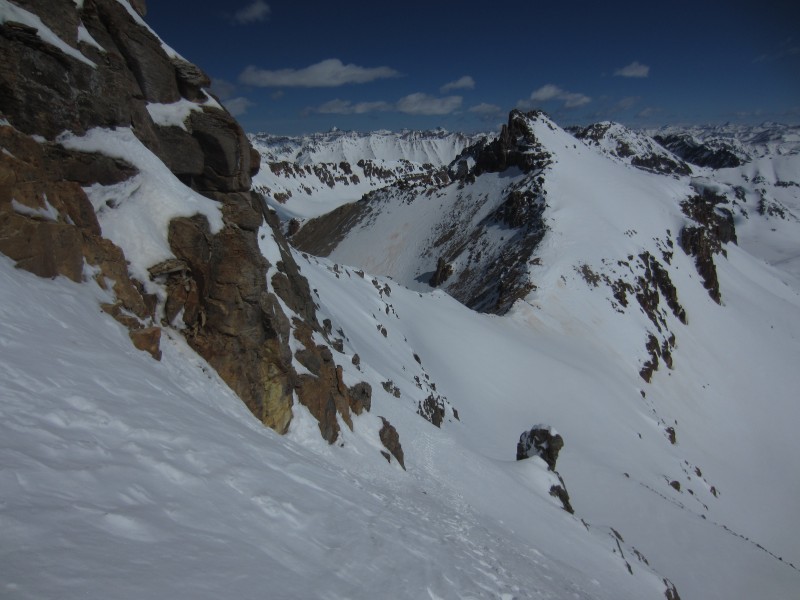
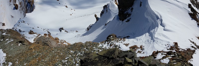
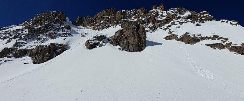
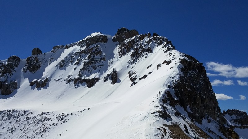
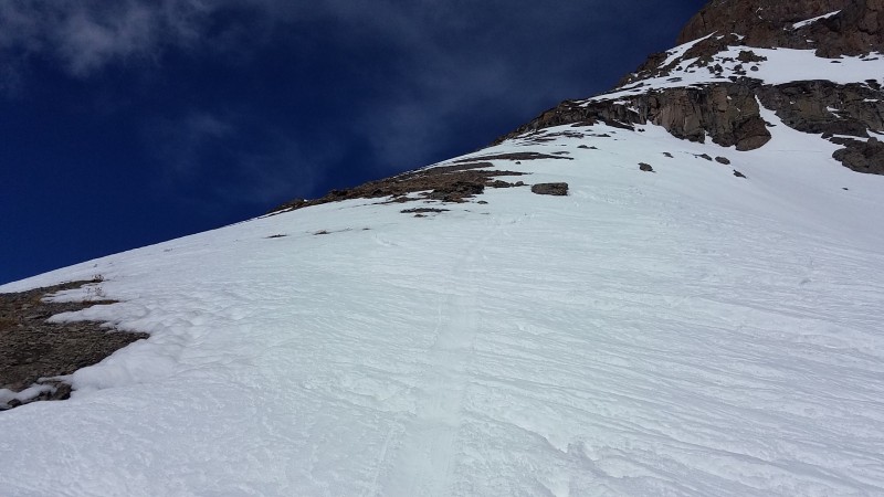
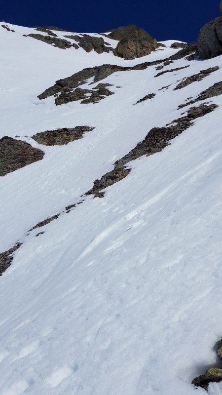
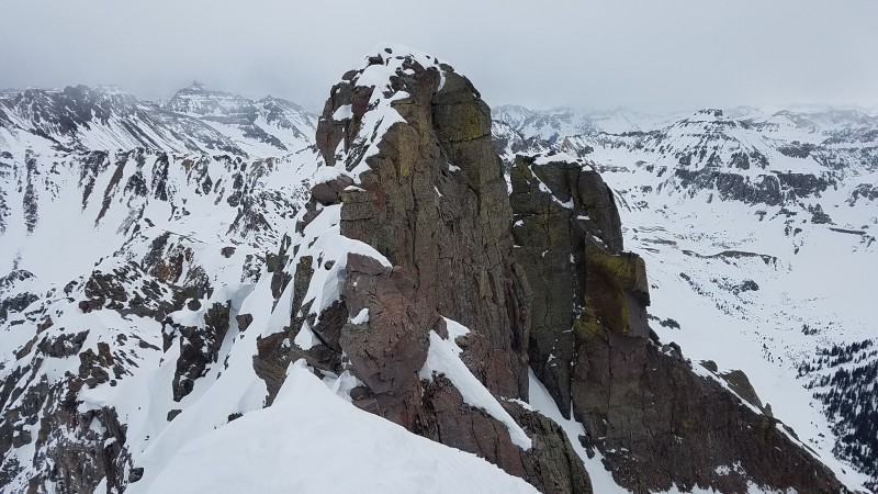
The NE ridge didn't look too bad from here so I started out with the intention of staying on it the whole time. I got to around 13,600' before hitting the first obstacle...a minor tower that would have to be bypassed on steep snow to the left or a tricky down-climb to the right. In the distance I could see the cliff band under the summit that needs to be avoided by traversing across the east side of the peak and into the couloir. If the snow wasn't so perfect, I would have continued and tried to make it work. But I saw an immediate traverse and climb of the Vermilion Dollar Couloir to be a more inviting option.
NE ridge
Looking back at traverse
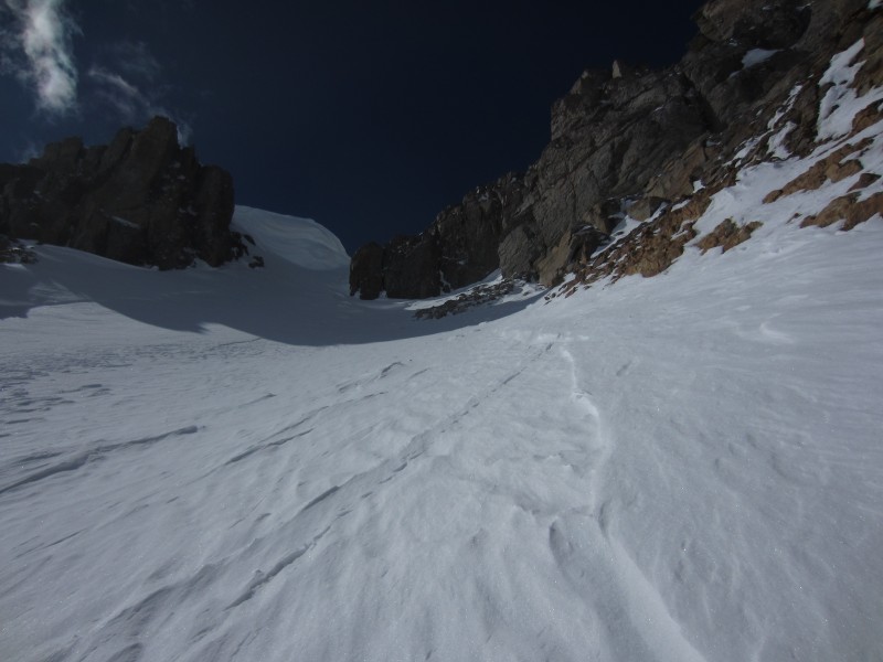
Looking up at the impressive cornice at the top of the couloir
Top of the couloir on the right, NE ridge on the left
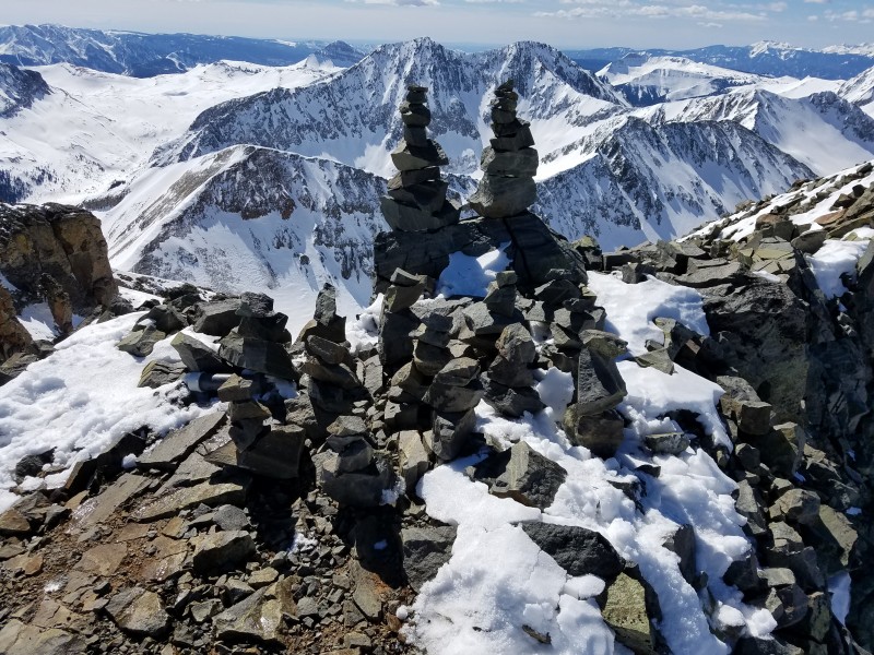
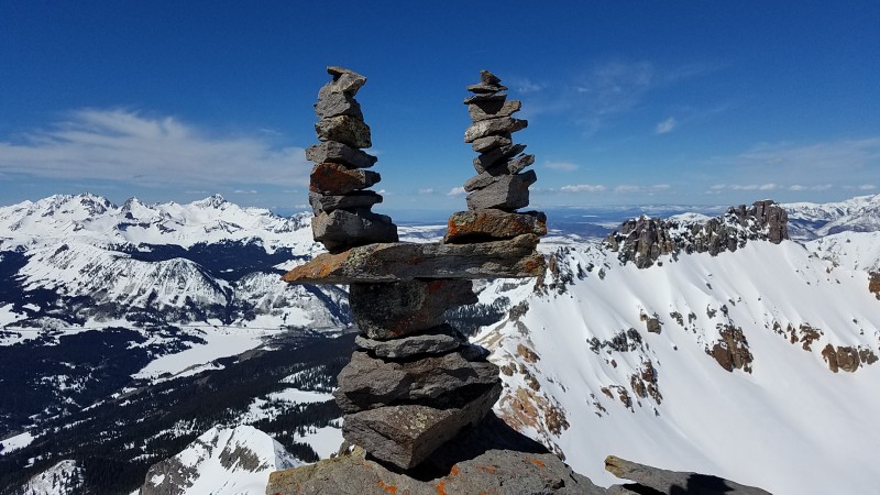
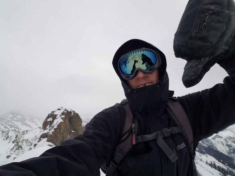
When Dani and I were up here in April of 2010, it was my brother's 30th birthday and we did a little summit birthday celebration. This time my parents were having a small re-wedding celebration back in Connecticut. As a nod to this special occasion, I built a wedding ceremony using cairns on the summit. Congrats Mom & Dad!
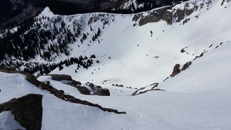
On the descent, I decided to go straight down the couloir and cut across a flat bench area.
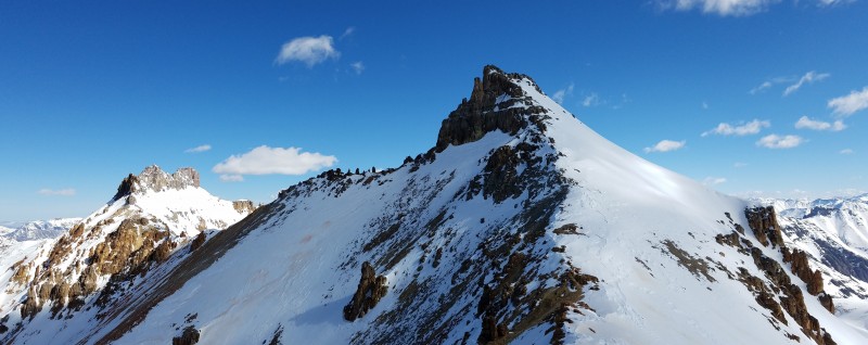
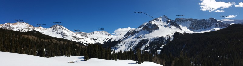
The reward for tagging Golden Horn is this view...
The wind was non-existent and I spent a lot of time up here soaking it all in. And of course I had to build my Brooke & Ben cairns.
Hard not to walk around this area without your head on a swivel. Hope Lake is an awesome place.
Strava map
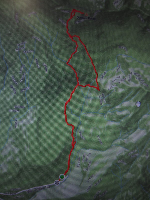
Dallas
Date...Sunday, March 12th
Time...6:15am - 2:15pm
Distance...6.6 miles
Elevation Gain...4455 feet
Trailhead...Mill Creek
Route...Southwest Face to West Ridge
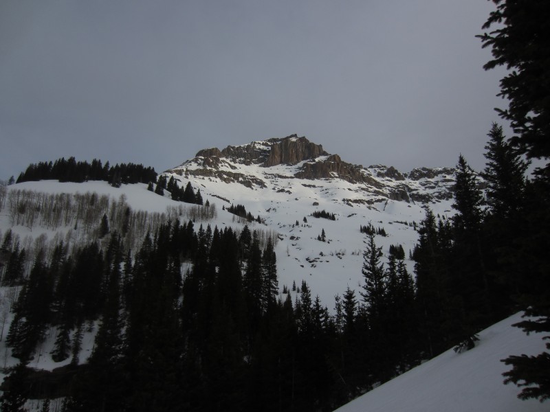
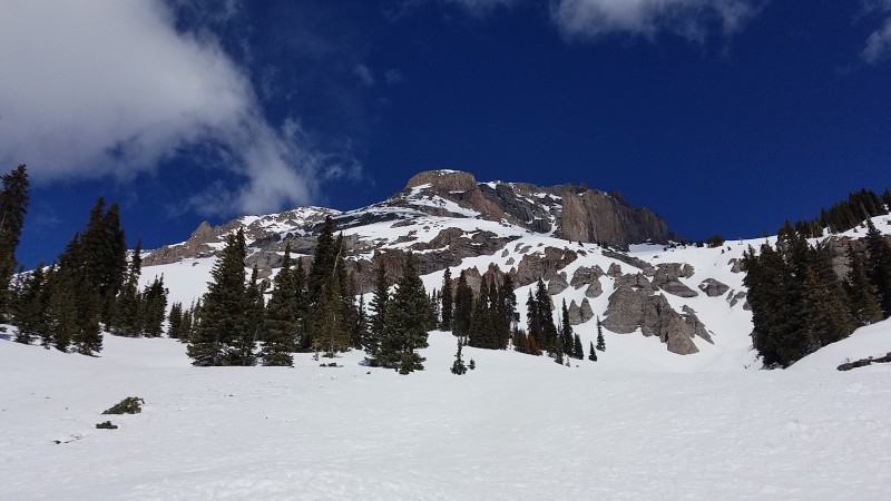
On the drive back to Ridgway I stopped to take this picture of Dallas.
I first got the idea of climbing the west side of Dallas after climbing South Wilson last winter. The snow conditions weren't ideal on that trip, so I shelved it for another day. After experiencing such safe conditions on Vermilion, I felt like this was the time. The idea was to climb up to the south ridge, traverse above the cliff band to the SW face, up the face to the Dallas / West Dallas saddle and up the west ridge to the summit. I posted a question earlier this year about the west ridge and John Prater sent me some great pictures from his climb in June of 2006. On that climb he and his partner roped up for the final section of the ridge. His description of that section was "easy 5th class, but quite exposed". In hindsight, I should have taken that information more seriously. Instead I saw the word easy, looked at the pictures and convinced myself I could solo it in winter conditions. That was dumb. John is a far more accomplished climber than I am and he wanted a rope in dry conditions. As I'm writing this now, I don't know why I thought I could do it. I think it was just that I fell in love with the idea of this route and nothing was going to stop me from attempting it.
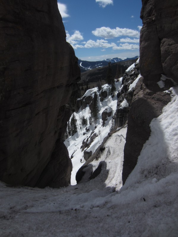
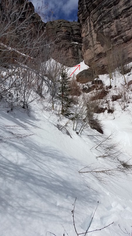
I took a direct approach on the way in...something like the shortcut mentioned in Roach's book. I stayed uphill on the left side of Mill Creek and didn't have much trouble getting into the upper basin. From there you have to find a way through a large cliff band of the left. I tried and was turned back several times before finding a steep snow/ice slope that angled up and left above the cliffs. I didn't get a picture of this, but here were a couple sections I explored to give you an idea of what this looks like.
Soon after getting above the cliffband, the south face of Dallas comes into view...Dun Dun Dun.
From here, it took about 3 hours to traverse up and across the south face to the sw ridge and up the sw face to the saddle with West Dallas. I can tell when the climbing is difficult by the frequency of my picture taking. In those 3 hours, I took one picture. The sw face is a lot more confusing up close that it is from a distance. Here are some pics I took on the descent...
South Face
SW Ridge
Traverse to SW Face
Looking down SW Face
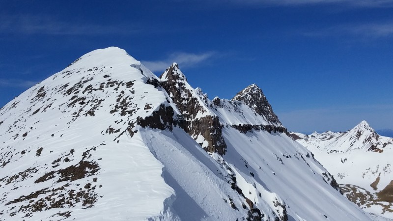
Looking up at the West Ridge
I was happy to put the face behind me and get on more solid ground. Now I was faced with the biggest unknown of the day...could I get the west ridge to go. The start of the ridge was really mellow and it got me prematurely optimistic. How hard could the final section of ridge be if I'm walking up easy, class 2 terrain? Then I crested the ridge and was greeted with this view.
Damn! I think I knew immediately that I was going to have to turn around. I gave it my best shot, but this ridge was terrible. Imagine a ridge made out of cairns, topped with snow. Everything was unattached. I had to clear snow and test everything before moving forward. Rocks were falling away after every movement. I slowly made it about halfway across the ridge before being faced with a mandatory rappel...maybe only 10 - 15 feet. I had a 30m rope, but I never really considered bringing it out. The anchor options were scary. Even if I could find a rock I could trust, I wasn't prepared for that kind of commitment. I would have had to leave the rope in place to get back up and I was pretty sure more protection would be needed further along the ridge. Here is my highpoint.
I sat there for a while and tried to fight off feelings of failure and disappointment and just enjoy this crazy place I found myself. Maybe the books were wrong and I was sitting on the true summit. In reality, I think I was 10 - 20 feet lower. I threw some small rocks towards the summit. Would it count if I hit it? I thought about my failed attempt on Jagged and how I really didn't want to come back to either of these peaks in winter. Then the sun came out and cheered me up a little bit. Until I realized I had to get the hell out of there. I didn't want to be on that face when the snow warmed up. I retraced my steps down the face, across and over to the sw ridge and back down to Mill Creek. I chose a more direct route on the way back down.
West Dallas
A look back at the south side of Dallas on descent...I got a couple fun little glissades in there
Found this shortcut through the cliff band on the way back down
Best guess at my route
Strava map
It's a good thing memory is short in mountaineering. After this day I was pretty sure I would throw in the towel on this winter centennial project. A couple days later I was planning a trip to Aspen to finish out the Elk cents.
Thumbnails for uploaded photos (click to open slideshow):
And you can start knocking out more winter summits! Your trip reports are superb, really show what is possible when you are willing to push yourself. Good luck this winter, can't wait to see more stellar reports from you.
As a fellow parent, fully agree on giving kids shots of rum to build mountaineering stamina. But just a tip, in the summer I give mine chilled vodka. Refreshing! :lol:
Tornado...Thank you. Just trying to pay forward all the inspiration other members have given me over the years.
Tom...Chilled vodka sounds nice. I think I'll have some right now.
Rob...Thanks man. That means a lot.
Caution: The information contained in this report may not be accurate and should not be the only resource used in preparation for your climb. Failure to have the necessary experience, physical conditioning, supplies or equipment can result in injury or death. 14ers.com and the author(s) of this report provide no warranties, either express or implied, that the information provided is accurate or reliable. By using the information provided, you agree to indemnify and hold harmless 14ers.com and the report author(s) with respect to any claims and demands against them, including any attorney fees and expenses. Please read the 14ers.com Safety and Disclaimer pages for more information.
Please respect private property: 14ers.com supports the rights of private landowners to determine how and by whom their land will be used. In Colorado, it is your responsibility to determine if land is private and to obtain the appropriate permission before entering the property.


")
")
")
")
")


