Download Agreement, Release, and Acknowledgement of Risk:
You (the person requesting this file download) fully understand mountain climbing ("Activity") involves risks and dangers of serious bodily injury, including permanent disability, paralysis, and death ("Risks") and you fully accept and assume all such risks and all responsibility for losses, costs, and damages you incur as a result of your participation in this Activity.
You acknowledge that information in the file you have chosen to download may not be accurate and may contain errors. You agree to assume all risks when using this information and agree to release and discharge 14ers.com, 14ers Inc. and the author(s) of such information (collectively, the "Released Parties").
You hereby discharge the Released Parties from all damages, actions, claims and liabilities of any nature, specifically including, but not limited to, damages, actions, claims and liabilities arising from or related to the negligence of the Released Parties. You further agree to indemnify, hold harmless and defend 14ers.com, 14ers Inc. and each of the other Released Parties from and against any loss, damage, liability and expense, including costs and attorney fees, incurred by 14ers.com, 14ers Inc. or any of the other Released Parties as a result of you using information provided on the 14ers.com or 14ers Inc. websites.
You have read this agreement, fully understand its terms and intend it to be a complete and unconditional release of all liability to the greatest extent allowed by law and agree that if any portion of this agreement is held to be invalid the balance, notwithstanding, shall continue in full force and effect.
By clicking "OK" you agree to these terms. If you DO NOT agree, click "Cancel"...
Phoenix Peak
Time...6:15am - 2:30pm
Distance...14.5 miles
Elevation Gain...5200 feet
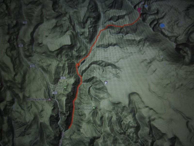
Trailhead...Intersection of West (503) and East Willow Creek Roads
Route...East Willow Creek to West Ridge
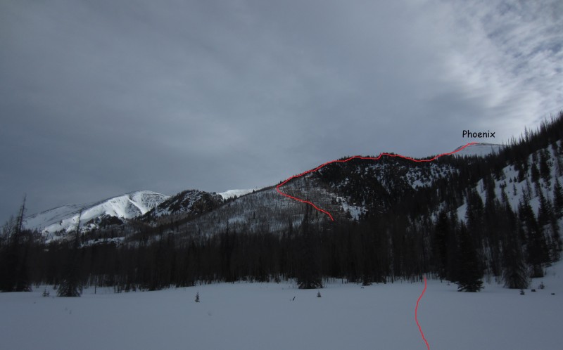
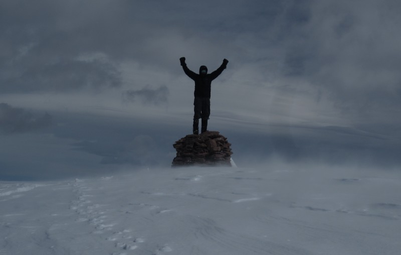
After reading his report, I was concerned about the descent from where they parked on 502, down into East Willow Creek. I didn't know much about the roads that go directly north from Creede, but thought a longer route from there would possibly be safer and save the hassle of having to climb back up to the car on the way out. I checked it out and found that you can drive a little past the intersection of 503 and a road that goes up East Willow Creek. There is a pretty large parking area next to a few buildings. The road that goes from here to Phoenix Park Mill Site must be pretty popular because there was a well beaten path the whole way. Because of this I was able to get to the Mill Site in about an hour. As Darin mentioned in his conditions report, this road has the potential of being a huge terrain trap under heavier snow conditions. I counted 8 wet slide paths that crossed this road. The traffic thinned a little after the mill and disappeared at Phoenix Park. From Phoenix Park it's hard to pick out which peak is Phoenix and I almost started climbing the wrong ridge. A quick check of the map and I was back on track. The west ridge of Phoenix is a beast. It's starts around 10,500' and seems endless. You don't see the huge summit cairn until you crest the final ridge. The clouds moved in just at the right time and kept the snow from getting too soft on the way down. When I got back to my vehicle, I dropped my phone on a rock and lost most of my pictures. I just have a few that I took with my camera.
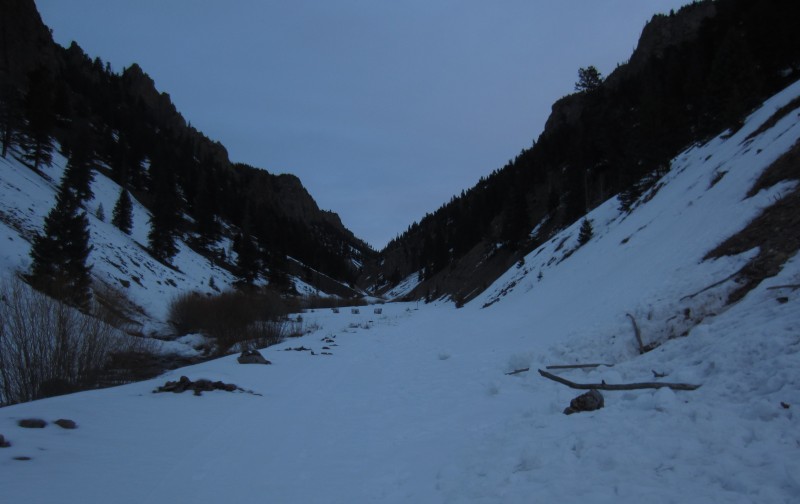
East Willow Creek Road
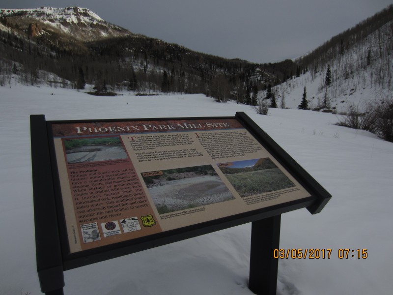
Phoenix Park Mill Site
Phoenix Park and the correct ridge...I was convinced that the peak in the distance was Phoenix
Summit cairn
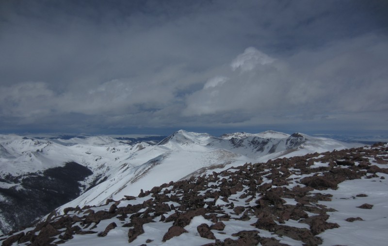
San Luis to the north
Route Map
Thumbnails for uploaded photos (click to open slideshow):
I don't think I fully appreciate all these centennial TRs yet, maybe in five or ten years! Nice job this winter dude!
Caution: The information contained in this report may not be accurate and should not be the only resource used in preparation for your climb. Failure to have the necessary experience, physical conditioning, supplies or equipment can result in injury or death. 14ers.com and the author(s) of this report provide no warranties, either express or implied, that the information provided is accurate or reliable. By using the information provided, you agree to indemnify and hold harmless 14ers.com and the report author(s) with respect to any claims and demands against them, including any attorney fees and expenses. Please read the 14ers.com Safety and Disclaimer pages for more information.
Please respect private property: 14ers.com supports the rights of private landowners to determine how and by whom their land will be used. In Colorado, it is your responsibility to determine if land is private and to obtain the appropriate permission before entering the property.
")


