Dates: March 3-5, 2017
Distance: ~32 miles
Elevation gain: ~10,000 ft
TH: Tigiwon road winter closure
Avy rating: yellow at all elevations with possibility of persistent and wind slabs
Participants: Jim Yikes, Jeff Heiderer, Ann Driggers, Natalie Moran, Will Seeber
With the avy rating in the Elks out of the comfort zone after they received over 2 feet of snow in the prior week, it was time to head back to the Sawatch. This would be my Sawatch 14er winter finisher and Jim's second to last peak. Ann and I started from the bottom of Tigiwon road by 11 am, after Jim and Jeff, who are very organized and as we later learned, started around 7 am. The road was nicely packed by snowmobiles, and made for an efficient travel. We got passed by several groups of snowmobiles from NOVA guides.

Here we go

Ann skinning up the road

NOVA guys had it pretty good. Next time!

At long last
In about 4 hours we reached the summer TH where we found Jeff's approach skis, sled and a freshly made snowshoe trench. After a short break, we started up towards the Half Moon pass. I was feeling pretty good up to this point, but this was about to change. Fatigue was setting in. We passed the Jim and Jeff's campsite and pushed towards the pass, where we arrived around 5 pm and went about setting up the camp and melting water.

Ann is persevering towards the pass

Sunset shadows on the pass

Our campsite - photo by Ann
Jim and Jeff showed up after 7pm, having broken trench all the way to the creek, a long 12 hour day for them. We promised to be ready by 5.30 am tomorrow and went to sleep. Unfortunately I didn't pick a flat enough spot for my tent, so this was one of the most uncomfortable nights for me, as I keep sliding off my sleeping pad. I dozed on and off, but eventually decided to get up around 4 am and start getting ready, since it takes me a long time in the morning. By 5.20 am when the guys showed up, I was almost ready, with Ann a few minutes behind. We set out from camp by 5.30 am behind guys. I was a little miffed since we promised them to help with trailbreaking duties. We followed their trench in the dark around the snowy slopes of Notch mountain with beacons on, but once we got to the shoulder, we checked Gaia and decided to forge our own path. We were concerned that the snowshoe trench won't be appropriate for skiing. We left the trench and skied down the gentle shoulder with slope not exceeding 25 degrees for a couple hundred feet. After that we crossed some shallow snow with protruding rocks and navigated through some tight vegetation. Snow transitioned from the dense powder to the suncrust on more open and southern aspects and we were pleased with the relative safety of our route. Gaining confidence in the snowpack, we traversed under the cliffs, skiing down into the creek bed and rejoining the snowshoe track. After transitioning back into the skin mode, we finally caught up to the guys, who were fighting deep snow on snowshoes. We took over the trailbreaking duties and set the skin track all the way to the treelline. Not many photos here, as the trailbreaking was laborious.  We were still making pretty good time though, popping on the North ridge shoulder around 8.30 am or so. I stashed my skis at the treeline, but Ann decided to skin up a little higher, eventually stashing her skis at the beginning of the rocky ridge. Guys were right on our heels. I think we all took a break at the treeline, stashed some gear, got some food in and started working our way up the ridge. The scenery was very distracting. We were still making pretty good time though, popping on the North ridge shoulder around 8.30 am or so. I stashed my skis at the treeline, but Ann decided to skin up a little higher, eventually stashing her skis at the beginning of the rocky ridge. Guys were right on our heels. I think we all took a break at the treeline, stashed some gear, got some food in and started working our way up the ridge. The scenery was very distracting.

Finally out of the trees. Winds were not bad (yet), just an occasional gust here and there

First good look at the mountain

Start of the North ridge with Jim and Jeff coming up

Snow sculptures

Mount Jackson and the giant cairn


Photo by Ann

We walked into the summit around 11.15 am and settled for a short break

Another order of business was to check out the Cross Couloir. It looked way nicer than when we skied in in June'13
Ann promised to be in Carbondale that night, so we started the descent fairly soon, but not before I used the cell reception to check the reports on Notch mountain. Right below the summit we ran into Will Seeber, who started at the parking lot at 4.30 am. Go Will!


Notch mountain from the ridge
As we were nearing the treeline around 1pm, the winds really picked up, so we were glad to be off the windy ridges. And we were looking forward to some skiing!
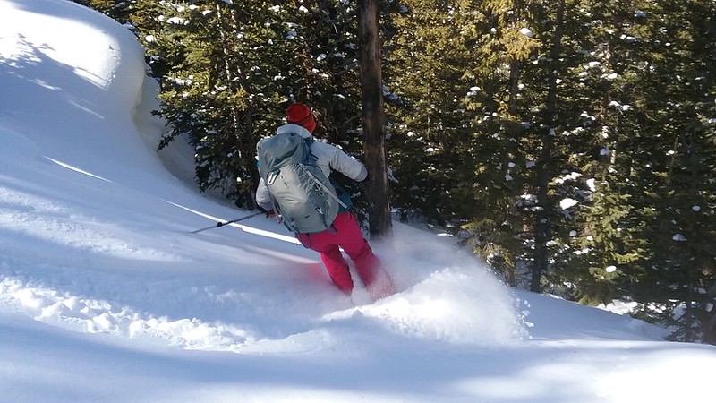
Some hard earned turns down into the Cross creek
From there was the part I was dreading, of course - a 1,000 reclimb back up to Half Moon pass. But it turned out not as bad as I feared, especially with Ann graciously setting in a skin track - we basically retraced our early morning route, confident that we can skin it up.

Mount Jackson and friends from the pass

Holy Cross from the pass

Happy camper

Our route up the pass in daylight

Our skin track up the gentle shoulder with the ski tracks from the morning still visible

Eventually we merged back with the guys' snowshoe trench and traversed under the steep snowy slopes of the Notch mountain, arriving at our camp by 3.15 pm. Ann had to be back at Carbondale, so she packed up her camp and soon was on the move. I was feeling pretty good and was hoping to get a new 13er for me, Notch mountain. I didn't have the time to check the weather forecast on the summit, so I checked it at the camp and my heart dropped. Wind advisory after 10 am with wind gusts over 65 mph! Even at 4 am the gusts were forecasted to be 47 mph. What to do? I was very worried, but still decided to go, but be ready to turn around if the winds got to be too much.

Camping with the view
I also got to take over Ann's much flatter camping spot, so I had a significantly better night of sleep. I was asleep by 6.30 pm and wide awake by 2.30 am. Winds didn't seem too bad, so after some hesitation, I cooked breakfast, clicked into skis and was on the go just before 4 am. I've always wanted to hike the Notch mountain for a sunrise summit, so it sort of made sense. After 15 minute approach, I stashed the skis at the bottom of the ridge and started boulder hopping, which went on for a while. I was feeling a little sluggish and route evaluation in the dark always seems to take longer for me. By 6 am I was on the summit ridge, which went on for half a mile, but the views were starting to unfold.

Holy Cross pre-dawn
My worst fear - strong winds - never materialized. Every time I'd hear the wind gust approaching, I put on more layers, but soon afterwards it would get too warm. For once the wind forecast didn't live up to it's brutality!

Here comes the sun


I finally reached the summit by 6.50 am, which took considerably longer than expected with all the postholing on the ridge and picture taking.

Snowy ridge on the descent

Last look at Holy Cross
After I peeled myself away from the summit, the descent went much quicker. The winds started to pick up and I could see a cold front approaching. Postholing downhill is much easier, I could see some shortcuts I didn't see in the dark, and I also got to glissade the face instead of boulder hopping. I was back at my ski stash in one hour, and back to camp by 8.15 am for just over 4 hr roundtrip. I wanted to eat a quick 2nd breakfast before the ski down, but the winds were not welcoming. So I quickly packed up the camp and was on the move by 8.45 am. Skiing variable snow wasn't that great with a heavy pack, but it went pretty quick and by 9.30 am I was back at the summer TH.
 Perfect corduroy - is this Vail resorts?
 Notch mountain from where I took skins off
I used skins for the 1st mile since it's trending uphill, but after taking them off, the next 7 miles only took me 40 minutes to ski. I couldn't think of a better skiing surface for tired legs on light ski setup weighted by 30+ lb pack. Backcountry skiing is clearly, clearly overrated. What a nice trip and it feels good to be done with the Sawatch! And Jim has only one peak left in winter. Onwards!
My GPS Tracks on Google Maps (made from a .GPX file upload):
|


