| Report Type | Full |
| Peak(s) |
Clinton Peak - 13,866 feet Buffalo Mountain - 12777 |
| Date Posted | 03/02/2017 |
| Date Climbed | 02/18/2017 |
| Author | eskermo |
| Riding Clinton and Buffalo |
|---|
|
Clinton Peak 13,857' South Slopes from Montgomery Reservoir 9.9 miles, 3,000' vertical 2/18/17 This route is not a great ski, in my opinion. It's even worse for snowboards. The snow was terrible. The riding wasn't very fun. There are a couple intermediate basins littered with big rocks that keep one from being able to ski a continuous line back to the road. And the road up Platte Gulch has more ups and downs than any sensible person touring would ever want to deal with. However, it was still an awesome climb to a high summit offering great views of the surrounding peaks, as well as different perspectives on familiar, nearby peaks. From the trailhead at the northwest corner of Montgomery Reservoir, the snow started immediately as it wrapped around the west side of the lake. I chatted briefly with a trio of ice climbers that took off around the same time. Lincoln Ice conditions below: 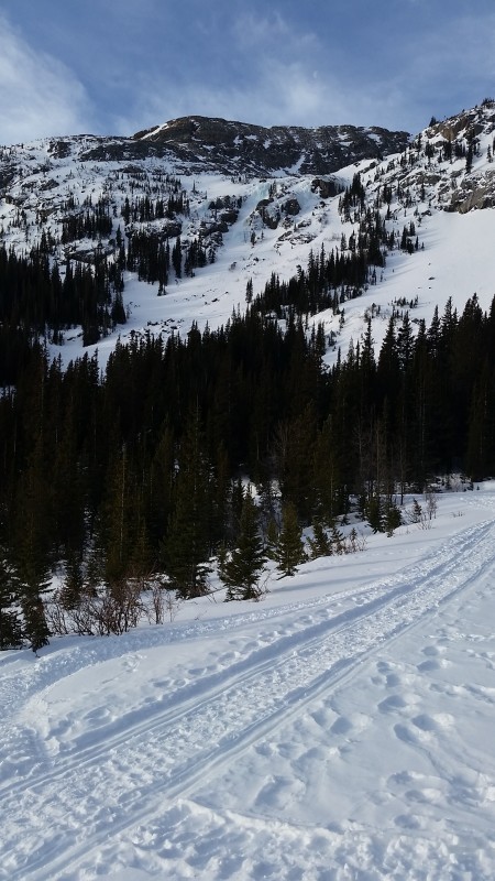  After passing the Magnolia Mine and entering Platte Gulch, I didn't see another person the rest of the day until rejoining the road on my descent. Well, aside from the throng on North Star and few dots on the Lincoln/Cameron/Democrat ridgelines. 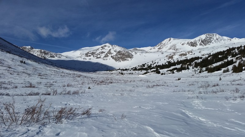  After a few miles of easy skinning, I jumped the gun a little and assumed I could safely angle and switchback my way up the steeper slope leading North toward Wheeler Lake. This led to some amusing struggles on bulletproof, wind-blasted snow, but I made it up to Wheeler Lake eventually. 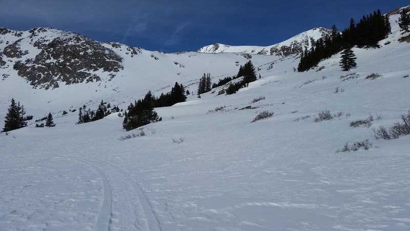 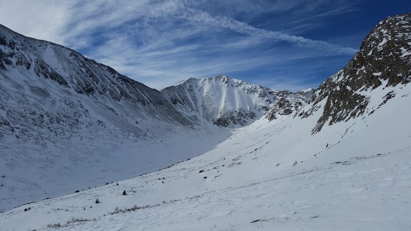 Shortly after arriving at the lake, I picked a decent-looking line up and west that I thought I could skin. Nope. The sun had been out in the morning with relatively little wind, which had softened up the top half inch of snow. However, the wind picked back up and clouds started moving through, making it quite a bit more chilly. This had refrozen the top 1/4" of the snow, leaving the 1/4" below it nice and wet. Sidehilling/switchbacking nightmares! I'd slam an edge into the hill and feel like I got some purchase on my edge and skin, but the wet snow underneath acted as a lubricant and rendered my skins useless. If only someone else was there to witness me sliding downhill and busting ass, over and over... I really need to get those splitboard crampons for this crap. So, perched precariously on this annoying slope 100' above Wheeler Lake, I strapped the planks to my pack, thinking booting up this short slope would be easier. It was equally awful, but I at least felt slightly more safe. And this way, if I started sliding downhill, I'd have less of a chance of flipping wildly out of control with my skis on and tearing an ACL. I'd kick 23 times with one boot before the snow gave enough to allow me to weight that boot, then I'd continue with the other boot. Finally, I made it up to the first bench above Wheeler Lake and took a long break. 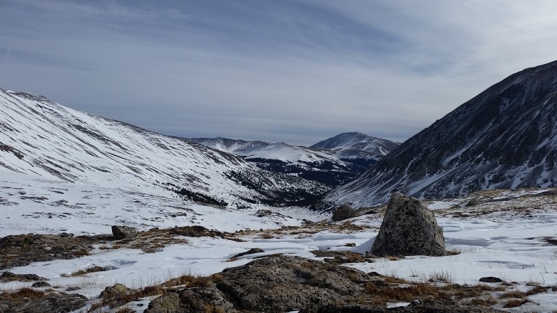  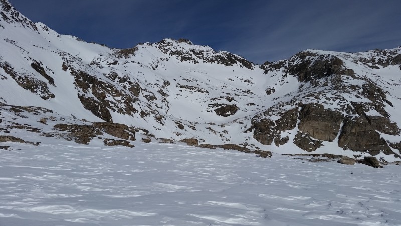 The going looked pretty boney from here, but I was convinced I could keep skins on at least until the final few hundred vertical to the summit. I skinned over a ton of rocks and did some finagling here and there, but made it to the upper basin eventually. From there I skinned north directly toward the summit of Clinton as long as feasibly possible. 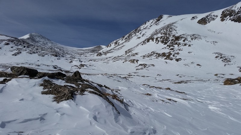 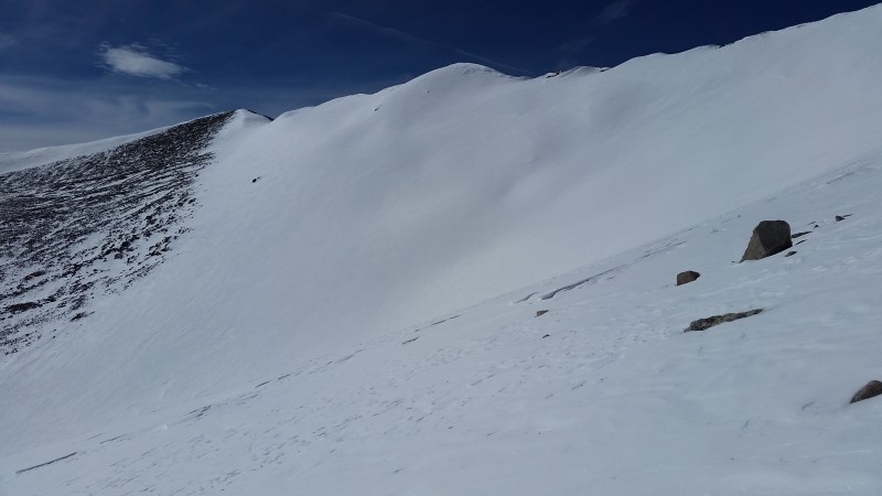 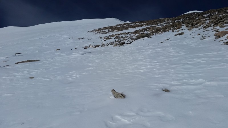 At around 13,360' the snow turned back to the just-above-Wheeler-Lake-type quality. It was equally as frustrating as it was funny. I threw the skis on my pack and suffered with endless kicksteps up about 100' vertical of snow until I reached dry ground. From there it was a steep talus and scree hike to the summit.  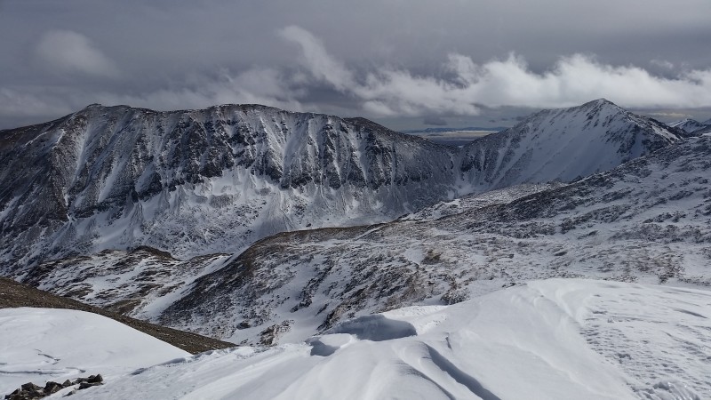 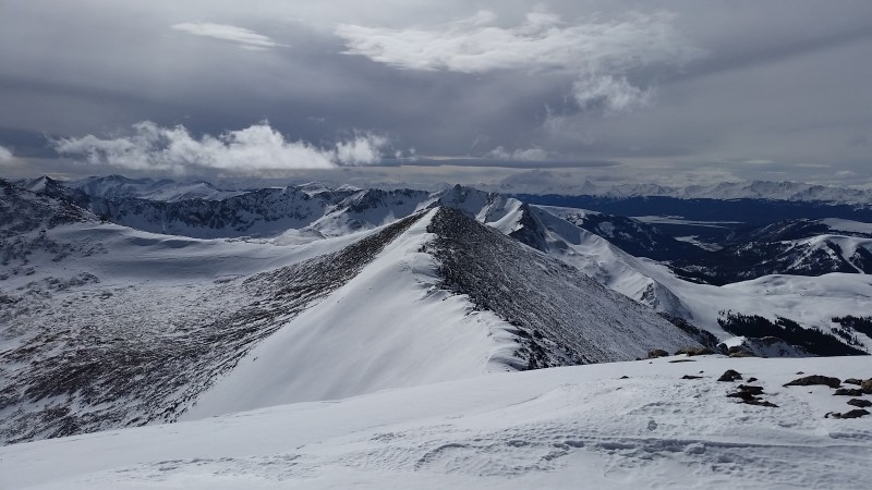 Below is a picture of "progress". 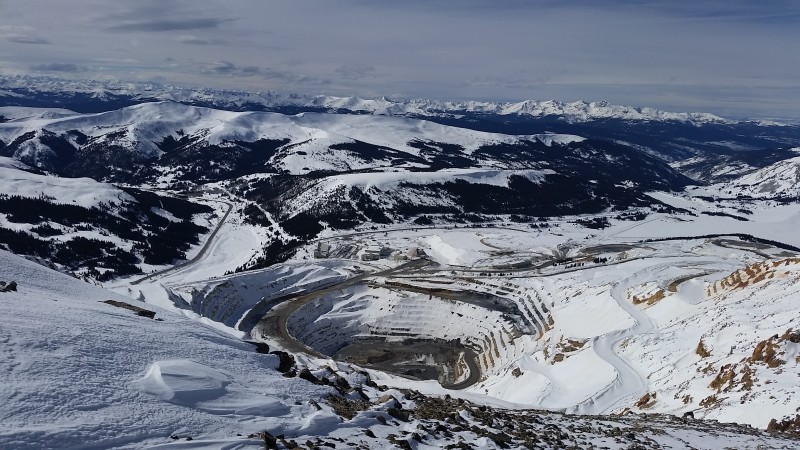 It quickly turned cold and windy on the summit. After a mad dash to take pictures, text my girlfriend, de-skin and re-board, I got off that summit as fast as possible. I was considering a traverse to McNamee and a ski off the other side of Traver, which seemed like a much better and continuous ski as viewed from the approach. There isn't any reason to not traverse to McNamee - after skiing down the ridge from the summit of Clinton, it's probably no more than a 5 - 10 minute hike with minimal elevation gain to the summit. But I was feeling like a wuss, freezing, and simply grateful to get this summit. Clipping in just a few yards from the true high point, I rode southwest down the skiers right side of the cornice, staying as close to the rocks and as far away from the edge as possible. I dropped skiers left into the lowest angle line available, made a couple cuts on the bulletproof snow, and pointed her down. The top few hundred feet down to the small tarn provided the best snow of the day - and that's not saying much.  Some might consider the rock snowboarding I performed through the upper basins as snowboard abuse. There really wasn't any reason to stay strapped in, aside from me simply being lazy and stubborn. Regardless, I hopped, edged, poled, and scraped my way out of the upper portions of the route, only unstrapping once for a brief uphill through a mine field that was not navigable on a snowboard. Once passing through the shark tank, I was able to strap back in and ride down to Wheeler Lake, where I ran out of gravity and had to hike about 100 yards. Shortly thereafter, I rejoined the road in Platte Gulch. You'd want to gouge out your eyes if I continue explaining each of the remaining 29 times I had to unstrap and hike a short way, cross country snowboard through flats and short ups, etc. You're welcome. 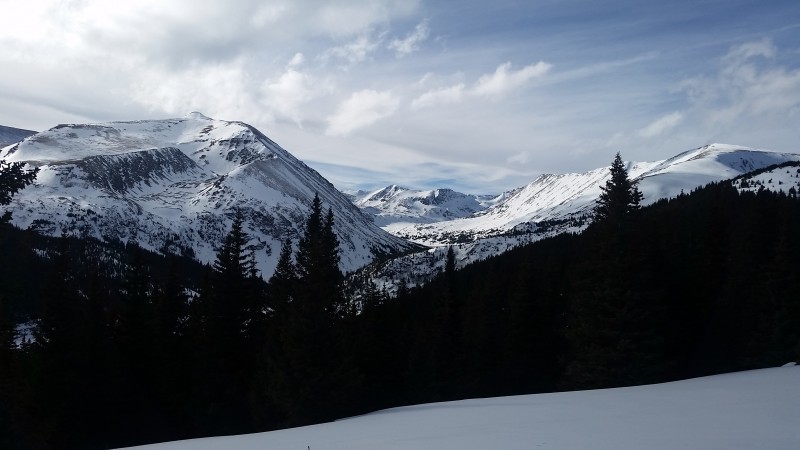 All told, it was 7 hours roundtrip on the dot. About an hour and 20 minutes to get down from the summit, and 5.5 hours to get up. My two cents: Just ski Traver instead. Buffalo Mountain 12,777' East Slopes from Ryan Gulch 4.75 miles, 3,000' vertical 2/19/17 As the crow flies, Buffalo Mountain is 17 miles due north of Clinton. How the heck was Clinton so bad, and Buffalo so good - just one day apart, on similar aspects, with no snow in between?! Mind boggling. The Ryan Gulch trailhead was bustling with weekend warriors and vacationing Texans Sunday morning. I took off at 9:25, just behind a trio of guys touring. No idea where they were heading - they smoked me at the start and I didn't see anyone else on skis the rest of the day. The first quick jaunt up the trail was easy enough, but locating the turnoff to the East Buffalo Mountain Trail was a little tricky. According to my GPS, I turned left at exactly 10,000' and 0.35 miles from the TH. I never did see a sign, trail blaze, or anything of the sort. A good clue would be to turn left at the high point of the trail (right around 10,000') before it starts descending. If the initial trail starts going downhill, you've passed it. I found segments of skin tracks, but they zigged and zagged all over the place. Instead, I took the most direct line possible. It was quite warm that morning, and I was disappointed to learn that the Glop Monster had already begun attacking innocent skiers and splitboarders. In February? REALLY?! 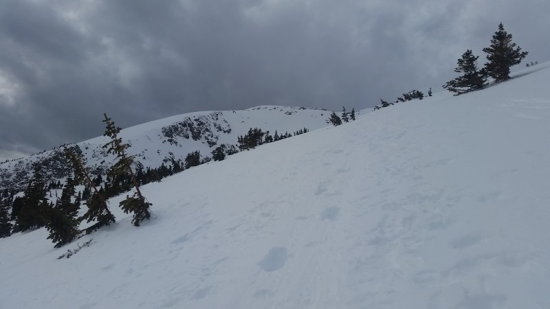 At treeline, the snow became more of a mixed bag. There were a couple old, switchbacking skin tracks of varying degrees of steepness. Sometimes I could stay in the steep ones, other times I needed to stay on the lower angle ones, and sometimes I just needed to make my own. Much of the snow was great for skinning, but there were a couple flashback moments to the prior day's struggles. 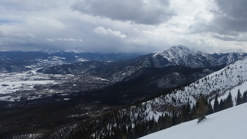  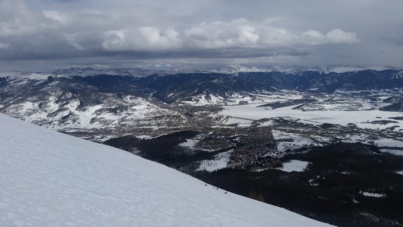 Above treeline and the Mushroom Cap, the snow was in much better condition for skinning. 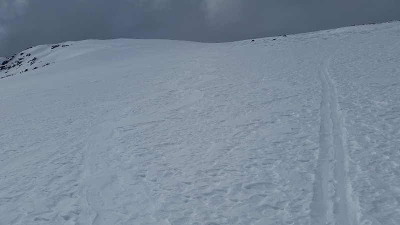 But that is also about the time the building snow squalls began moving in. 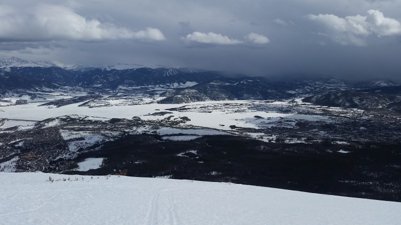 I was about to de-skin and head down as the clouds began to obscure visibility. I checked my GPS quickly, however, and saw that I had just over 100' vertical to the summit. Sure! Why not?  Once I reached what I thought was the summit, visibility was down to a couple hundred feet and the snow and wind had picked up considerably. I transitioned as quickly as possible and just before I was about to strap in, a brief window in the visibility revealed there was a slightly higher bump just a few hundred feet away. I sprinted over to tag the true summit, verified on my GPS that I was actually at the high point, and quickly strapped in. 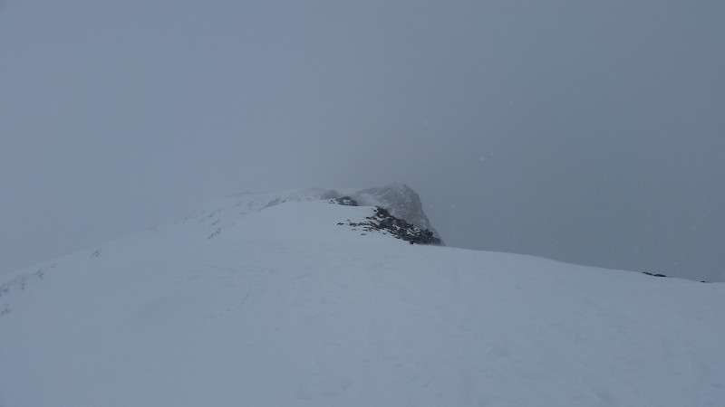  To my pleasant surprise, there were some pretty soft, awesome turns down to treeline! The sun had softened the snow just enough, and the cold and snow squalls that rolled in hadn't totally refrozen the top layer. This provided a somewhat punchy but still soft surface. Upon reaching treeline, I aimed to avoid the more southerly facing side of the slopes where there was some melt-freeze crust. Much softer snow was found on the more north and east facing aspects. Upon entering the trees, I found a sweet, mellow creek bed that was perfectly filled in with some surprisingly soft snow that I followed for quite a distance. 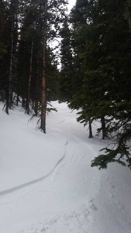 Assuming I'd eventually pop out onto the main trail, I kept sliding my way through the trees until I realized I should check the GPS. I had veered a bit too far south from the lower East Buffalo Trail and needed to cut hard skiers left. I was able to cut across the creek just above the trailhead, hop uphill a couple times to a ski track, and ride the short distance back to the parking area. Roundtrip time was 4 hours and 56 minutes - 4 hours 20 minutes to the summit, and 20 minutes from the summit back to the car. I was able to stay strapped in and kept the poles in my pack the entire way down. If I wasn't a dingbat, I would have stayed close to my skin track in the trees and I'm pretty sure it would have been possible to ski from the summit back to the car in under 10 minutes. What a perfect mountain for ski touring - especially for snowboarders. Can't wait to come back for some other lines Thumbnails for uploaded photos (click to open slideshow):
|
| Comments or Questions |
|---|
|
|
Caution: The information contained in this report may not be accurate and should not be the only resource used in preparation for your climb. Failure to have the necessary experience, physical conditioning, supplies or equipment can result in injury or death. 14ers.com and the author(s) of this report provide no warranties, either express or implied, that the information provided is accurate or reliable. By using the information provided, you agree to indemnify and hold harmless 14ers.com and the report author(s) with respect to any claims and demands against them, including any attorney fees and expenses. Please read the 14ers.com Safety and Disclaimer pages for more information.
Please respect private property: 14ers.com supports the rights of private landowners to determine how and by whom their land will be used. In Colorado, it is your responsibility to determine if land is private and to obtain the appropriate permission before entering the property.

