Download Agreement, Release, and Acknowledgement of Risk:
You (the person requesting this file download) fully understand mountain climbing ("Activity") involves risks and dangers of serious bodily injury, including permanent disability, paralysis, and death ("Risks") and you fully accept and assume all such risks and all responsibility for losses, costs, and damages you incur as a result of your participation in this Activity.
You acknowledge that information in the file you have chosen to download may not be accurate and may contain errors. You agree to assume all risks when using this information and agree to release and discharge 14ers.com, 14ers Inc. and the author(s) of such information (collectively, the "Released Parties").
You hereby discharge the Released Parties from all damages, actions, claims and liabilities of any nature, specifically including, but not limited to, damages, actions, claims and liabilities arising from or related to the negligence of the Released Parties. You further agree to indemnify, hold harmless and defend 14ers.com, 14ers Inc. and each of the other Released Parties from and against any loss, damage, liability and expense, including costs and attorney fees, incurred by 14ers.com, 14ers Inc. or any of the other Released Parties as a result of you using information provided on the 14ers.com or 14ers Inc. websites.
You have read this agreement, fully understand its terms and intend it to be a complete and unconditional release of all liability to the greatest extent allowed by law and agree that if any portion of this agreement is held to be invalid the balance, notwithstanding, shall continue in full force and effect.
By clicking "OK" you agree to these terms. If you DO NOT agree, click "Cancel"...
Time...5am - 2:45pm
Distance...14.2 miles
Elevation Gain...5595 feet
Trailhead...Cataract Gulch TH
Route...Road to Cuba Gulch, SE Ridge on American, Traverse to Jones
I think there may be a shorter way to access Jones in winter from Silverton, but I had no interest in driving all the way out there. I used this approach to climb Handies (via Boulder Gulch) a couple years ago and decided to give it a shot.
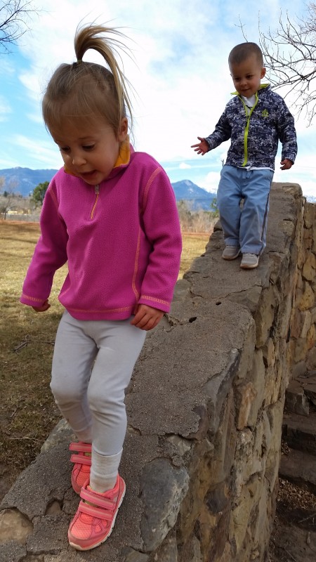
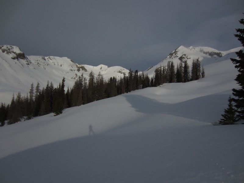
The road from Lake City to Sherman was half dry and half snow-packed. It does get a little slick towards the end, but it shouldn't be an issue for most vehicles. I slept under a full moon and headed out at 5am. My goal was to be back to the jeep at 3pm so I could be home before my 2 little cairns went to bed. Here they are practicing for Capitol.
There was a faint ski track on the road to Cuba Gulch, but it wasn't much help and ended after a mile or so. It is 2.5 miles to the Boulder Gulch turnoff and 3.5 miles to the Cuba Gulch TH.
From Cuba, I straight-lined the notorious Snare Stairs. I definitely prefer the snow-covered version.
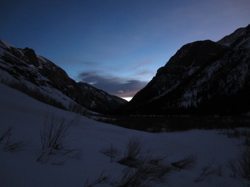
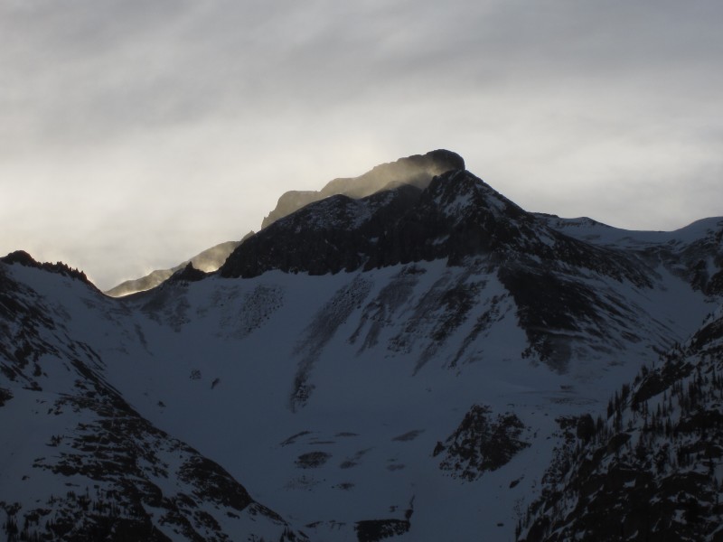
Sun starting to come up over a fire-breathing Half Peak
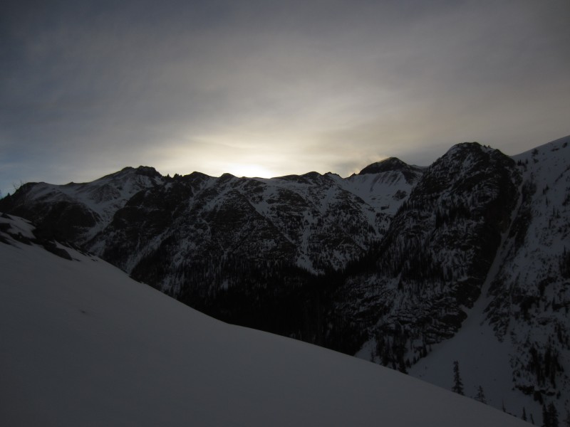
Upper North Snare...American and Jones come into view
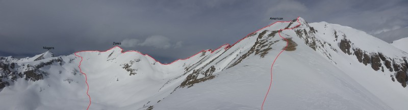
The sun came in and out all day making for some incredible lighting conditions. Here the SE ridge of American is highlighted. I made my way to the saddle on the right side of the ridge and then ascended the right skyline to the start of the ridge.
Oh...and there's Half Peak again.
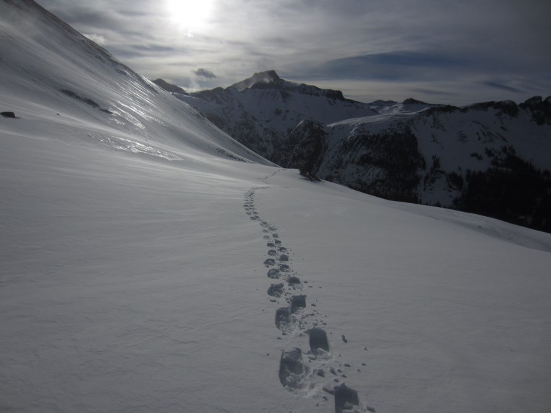
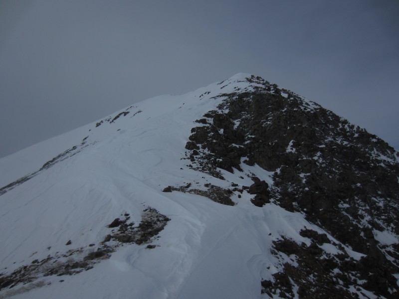
Route up and over American and Jones. The American ridge is not very difficult...just a few ups and downs to negotiate from the summit of American to the saddle with Jones.
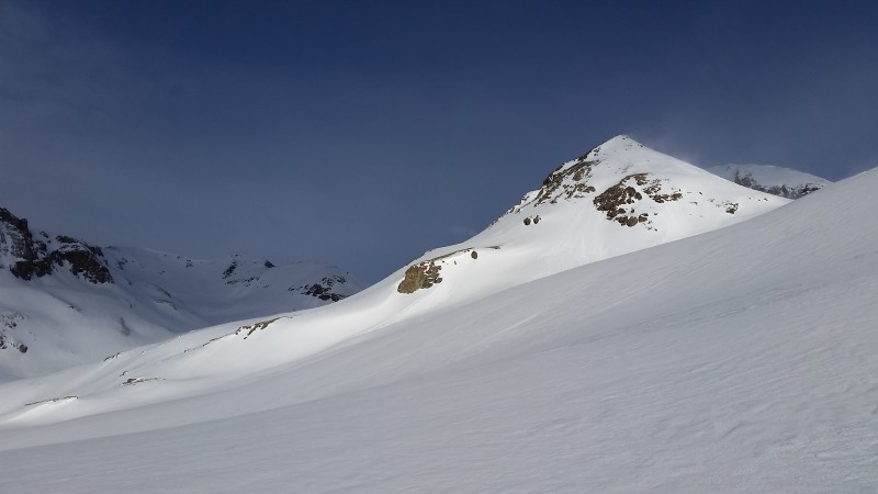
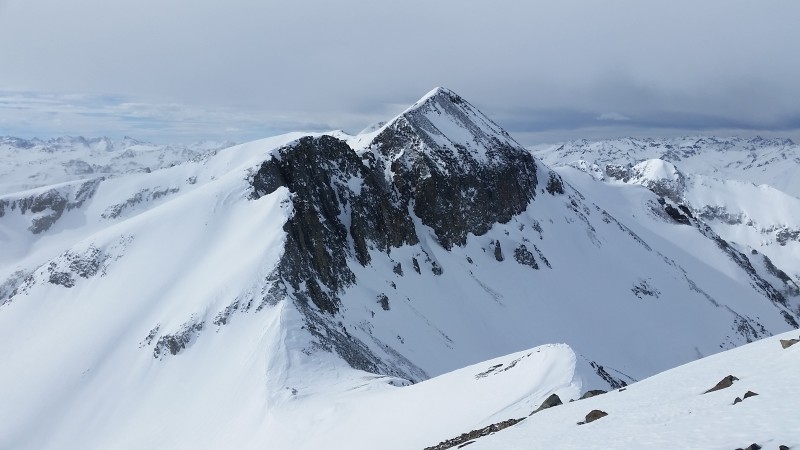
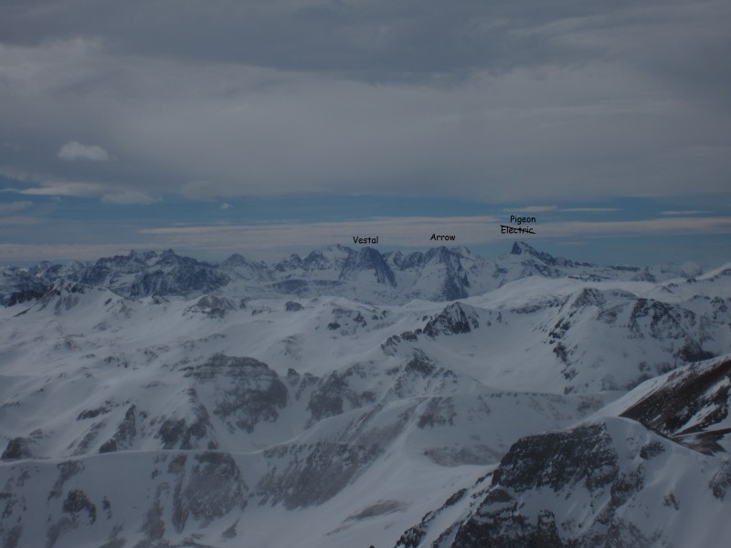
Here's the money shot of Jones. Such a great looking peak from this angle. There are a couple, short, class 3 sections on this ridge that look more difficult from a distance than they are up close.
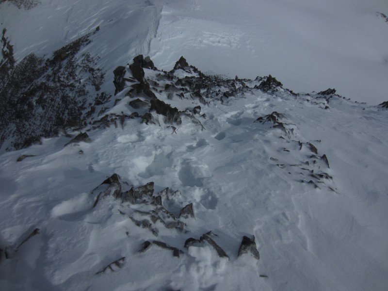
Looking down on the first crux...
And up on the second...
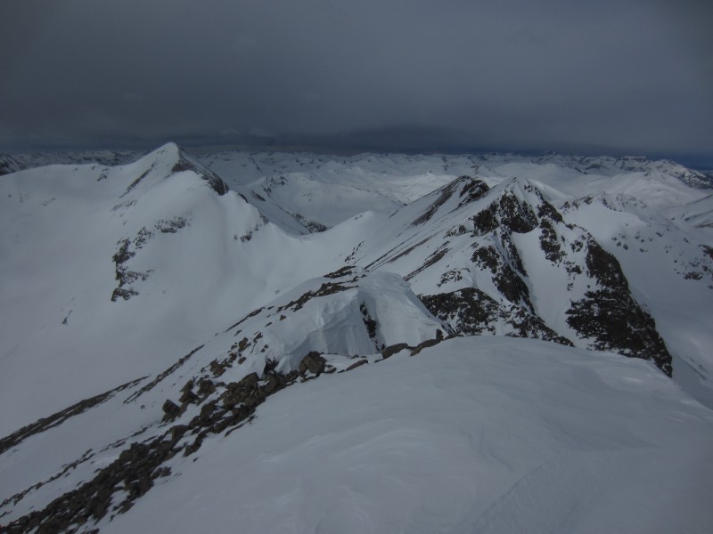
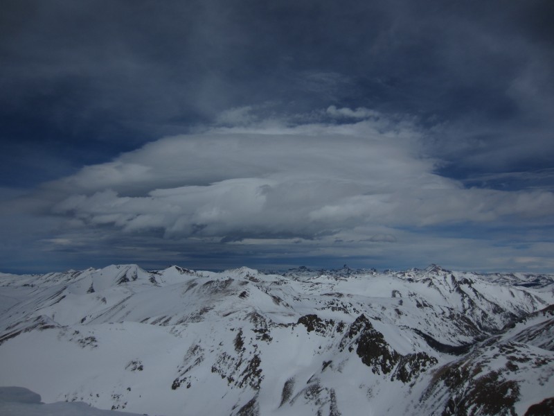
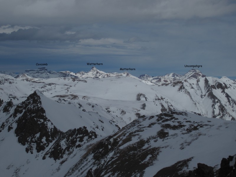
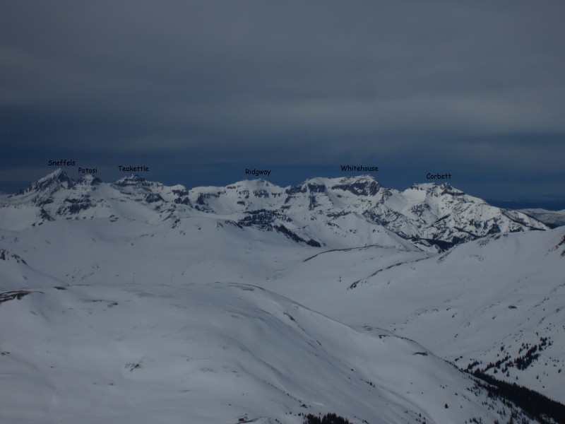
Mountain porn from the summit of Jones.
Summits for Shylah
I did some quick math and decided I would need to pass on Niagara if I wanted to be home by 7:30pm. For the descent, I continued down Jones' South Ridge until I found an un-corniced edge and was able to link up a few glissades between rock islands. Then I put it in cruise control and soaked in the views of Half Peak on the way back to Cuba Gulch.
Looking in the direction of Cataract Gulch
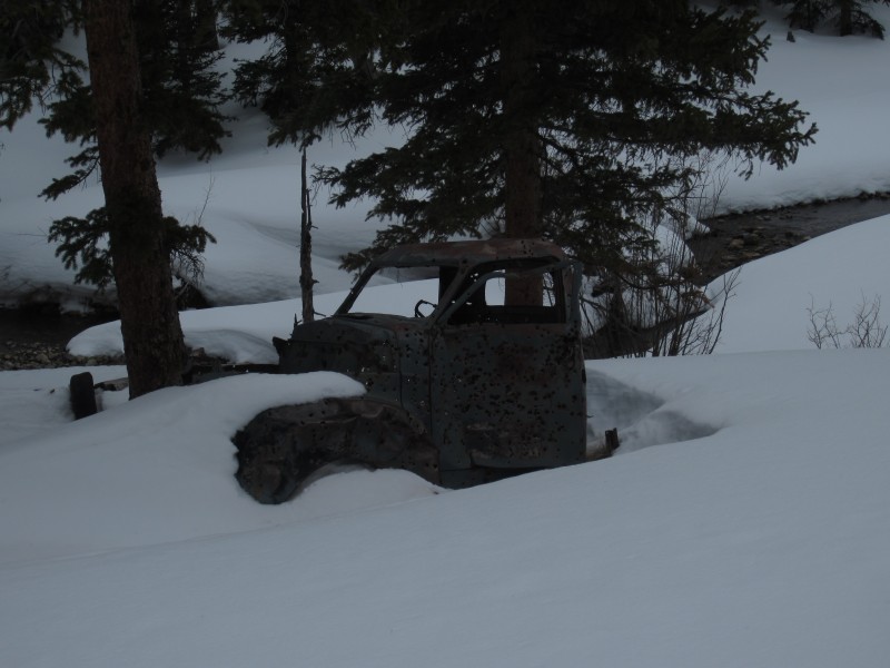
Anyone know the Little Blue children's books? I'm thinking of writing a new version...Little Blue Gets Shot and Left for Dead.
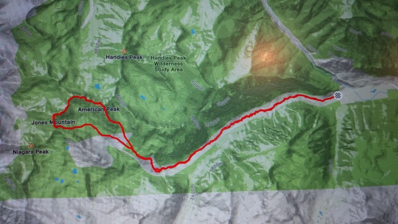
Strava route map
Thumbnails for uploaded photos (click to open slideshow):
When there's an opening photo of two cute kids, climbing like their Mad Dad Mike...you and Dani have done well raising those kids! I can't wait to be able to hike a peak with the Silvestro's someday!
yikes...I assume you will be going for Handies. I'll pm you a picture in a minute
Brooke & Ben love to hike and always want to hear about my trips when I get home. If I could take them with me I would. Until then we will keep practicing for the knife edge on Cap.
Having done these set of peaks from both sides and biking up and down those helluva blast snare stairs, to get home to kiss your two little cairns shows priorities and the reference also makes me laugh. What you are doing here with the winter Centennials is soon to be unprecedented. Keep going strong Mike! Little ones like me are sitting and reading your stories. I really like your maps at the end of the TR's.
Looks like most aspects are just caked in snow. I haven't been down to the area this winter yet, so it's great to see.
Caution: The information contained in this report may not be accurate and should not be the only resource used in preparation for your climb. Failure to have the necessary experience, physical conditioning, supplies or equipment can result in injury or death. 14ers.com and the author(s) of this report provide no warranties, either express or implied, that the information provided is accurate or reliable. By using the information provided, you agree to indemnify and hold harmless 14ers.com and the report author(s) with respect to any claims and demands against them, including any attorney fees and expenses. Please read the 14ers.com Safety and Disclaimer pages for more information.
Please respect private property: 14ers.com supports the rights of private landowners to determine how and by whom their land will be used. In Colorado, it is your responsibility to determine if land is private and to obtain the appropriate permission before entering the property.


")
")