Download Agreement, Release, and Acknowledgement of Risk:
You (the person requesting this file download) fully understand mountain climbing ("Activity") involves risks and dangers of serious bodily injury, including permanent disability, paralysis, and death ("Risks") and you fully accept and assume all such risks and all responsibility for losses, costs, and damages you incur as a result of your participation in this Activity.
You acknowledge that information in the file you have chosen to download may not be accurate and may contain errors. You agree to assume all risks when using this information and agree to release and discharge 14ers.com, 14ers Inc. and the author(s) of such information (collectively, the "Released Parties").
You hereby discharge the Released Parties from all damages, actions, claims and liabilities of any nature, specifically including, but not limited to, damages, actions, claims and liabilities arising from or related to the negligence of the Released Parties. You further agree to indemnify, hold harmless and defend 14ers.com, 14ers Inc. and each of the other Released Parties from and against any loss, damage, liability and expense, including costs and attorney fees, incurred by 14ers.com, 14ers Inc. or any of the other Released Parties as a result of you using information provided on the 14ers.com or 14ers Inc. websites.
You have read this agreement, fully understand its terms and intend it to be a complete and unconditional release of all liability to the greatest extent allowed by law and agree that if any portion of this agreement is held to be invalid the balance, notwithstanding, shall continue in full force and effect.
By clicking "OK" you agree to these terms. If you DO NOT agree, click "Cancel"...
Thursday, 3 November 2016
Route: Green Trail (east) ascent, Blue Trail (northeast) descent
Distance: ~2.1 miles R/T
Gain: ~1100 feet
Har Zefahot is a small mountain in southern Israel which stands relatively tall as the highest point in the Eilat Mountains. The group of mountains rises directly to the west of the Red Sea resort and port city of Eilat. Israel's territory at this point (no pun intended) is only 6 miles wide; therefore, from the summit of the mountain, the view extends across multiple countries. Zefahot is served by a few trailheads scattered along Route 90 to the southeast of the mountain, and the trails originating at these points collectively form the southern extents of the Israel National Trail, which traverses the country from south to north.
I joined my mom on a touristy trip over to Israel for just over a week in November 2016. Initially, I imagined one of the perks to be escaping the fall "mud season" here in Eagle County. It was later determined that we wouldn't even have a mud season; instead, the typically beautiful early autumn weather lasted until around Thanksgiving, and then we skipped right to winter. Hey, I'll take that pattern any year. The weather in Jerusalem (where we spent every night) was exactly like being home during the summer, except in Jerusalem we had barely any rain. Oh, was it gorgeous. Tel Aviv and Eilat were warmer, almost hot like Denver in the summer.
We allocated one day to explore Israel's "southern cone" area, which is dominated by the Negev Desert. As one drives south from Jerusalem, the terrain changes quickly, much like a shorter drive from coastal Southern California to the Mojave Desert. The land was barren, but it presented its own unique beauty.
We reached Eilat and decided I'd go for the hike while my mom got lunch and walked around town a bit with a couple of her friends who were also on the trip. I got dropped off at the Green Trailhead, which I would say is marked by the fast casual-looking eatery (I forgot the name of it) next to the Eilat Field School. A dirt access road crosses directly to the north of the restaurant by a campground and parking area, and toward the mountains.
It felt like trespassing, but certainly wasn't. After the fence corner, the trail turned sharply to the left and headed upward.
Heading up the flat beginning of the trail.
Oh, there's a sign up there. I must actually be going the right way!
I reached the information sign for the Eilat Mountains Nature Reserve and took note of some of the rules. One of them stuck out to me in particular...
Damn, I really wanted to hike in a military firing zone, but getting IDF permission sounds like way too much effort.
I walked on and noticed the trail markers, which were reassuring. Not that getting lost would be particularly easy, but this is an Israeli border area, after all.
You are on the green trail.
The trail kept a westward trajectory and eventually brought me to the base of quite the chossy slope, cut into sections by a few shallow gullies. Ah, reminds me of home.
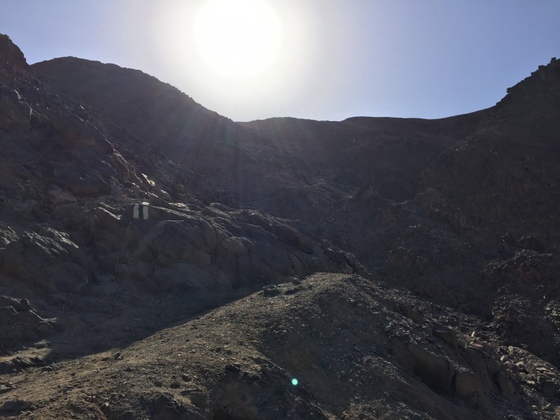
Heading into the Sun.
Sneffels, is that you?
The trail zig-zagged up the center of the gully and brought me to a ridge rather quickly. At this point, the Green Trail intersects another trail which begins a bit to the south on Route 90, perhaps half a mile or so (a little less than a km, I should say) closer to the border with Egypt.
Looking down the other side of the peak.
Double trouble!
I promptly reached the lofty summit of Har Zefahot. The views were certainly nothing to scoff at.
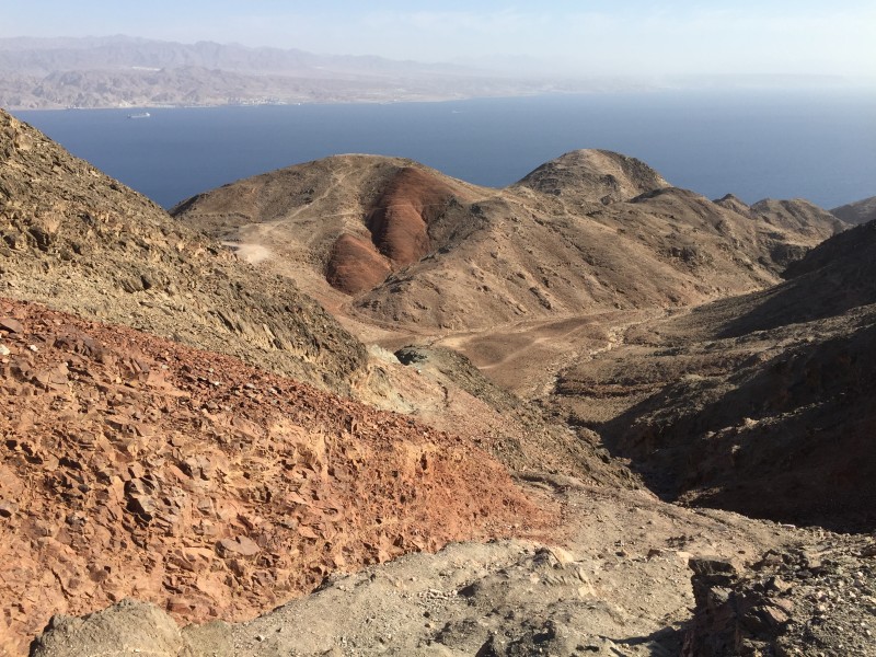
The view to the west from the summit. Less than a mile away is Egyptian territory.
The view to the north. You can see part of Eilat on the right.
The Israel-Jordan border lies in the middle of this valley. Eilat, in Israel, is on the left, while Aqaba, in Jordan, is the
A wider northwestern view.
This is the view where you see 4 countries at once. The foreground, of course, is Israel, and the middle of the picture is from where I came. The Israeli city of Eilat is on the far left of the photo, while just to the right is Jordan and the Jordanian city of Aqaba. As you approach the center of the photo, the background becomes Saudi Arabia. Finally, across the tip of the Red Sea lies Egypt on the far right of the photo.
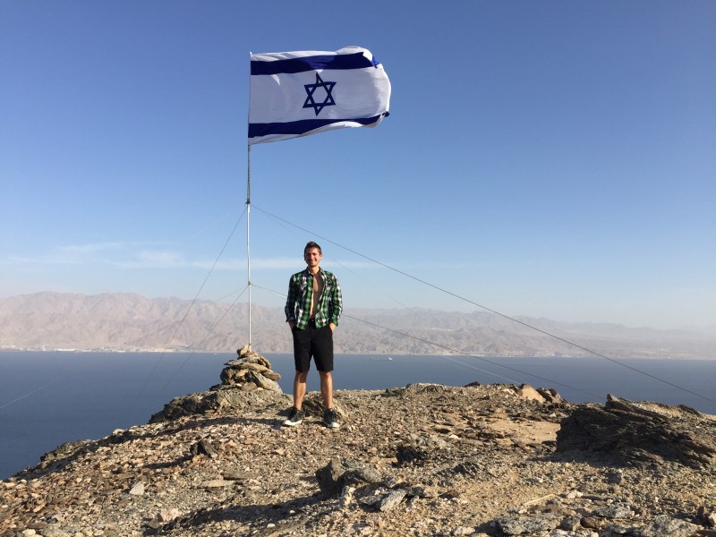
It was hot out, but the breeze kept me cool. Just to the east of Zefahot, there was a sub-summit across the basin on which flew an Israeli flag. As a lover of flags, I decided I had to make that sub-summit a part of my descent and turn my hike into a little loop. I began the descent to the northeast on the Blue Trail.
Looking down the Blue Trail.
Looking back toward the summit.
The next objective. You can just barely see the flag.
It wasn't long before it was time to leave the Blue Trail and cross-country hike along the ridge to reach the sub-peak. The Blue Trail would continue downward to the northeast, curve around to the southeast, and end at Route 90 at the northernmost trailhead.
Real class 2 begins now.
Getting to the sub-summit involved some fun hiking along the ridge, including careful foot placement on a particularly short but steep downhill section covered in scree.
Loose terrain.
After a brief burst of uphill, I reached the sub-peak.
Eilat; one of a kind.
To the west, I heard voices. On the summit of Zefahot, there were now 10 or so (likely) late teens/young adults. I'd seen nobody else since I started the hike, and I didn't see them to the north while I was on the summit, so I was left scratching my head wondering where they came from. I'm assuming they came from the north and I simply didn't see or hear them due to the terrain.
Yours truly. It was warm.
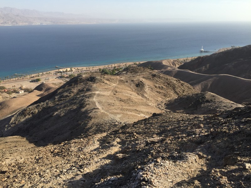
My descent looked simple. There was a social trail that led directly down the ridge to the trailhead from which I started. It was a bit loose in spots, but it did the job.
My easy descent back to the trailhead.
I was back at Route 90 in a timely manner, sitting outside that little restaurant and waiting for my ride, all the while admiring the dusty, seaside views. And yes, I did go stuff my face with falafel later that evening.
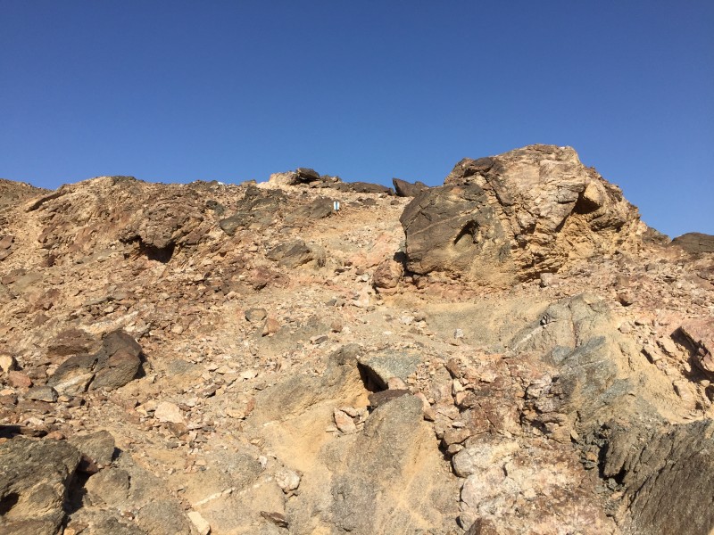
One of many.
~Tony
For some more information on this mountain, you can visit its Summitpost page here. The Summitpost page also includes a map which illustrates the trails of the mountain. I have to recommend this one; it's a special little peak and is a great way to get out and explore a unique part of Israel in addition to the usual sites found in and around the popular Jerusalem/Tel Aviv areas.
Regarding safety: Yes, this is a safe place to hike. Israel is on peaceful terms with both Egypt and Jordan, the Eilat area is internationally recognized Israeli territory, and the borders are very well-secured. I did not and would not think twice about hiking in this area.
Thumbnails for uploaded photos (click to open slideshow):
In 2010, I hiked as far as I was able to go, in view of the Israeli Radomes and military installation on the top of Mt. Hermon, the highest peak in Israel, 7300 ft approx, with a ski area in the Golan Heights overlooking Syria and to the west, Lebanon. I loved being up there.
Then with four IDF friends, we drove the Lebanese border 'wire' from the Mediterranean to Mt. Meron and all of us hiked to the summit of the second highest peak in Israel, in the upper Galilee. That evening, we all dined on fresh grilled marinated lamb, salads and laffa and pita with hummus, falafel, babaganoush, olives and great desserts in a remote Druze village on the Lebanese border.
Israel... what a great country!
Caution: The information contained in this report may not be accurate and should not be the only resource used in preparation for your climb. Failure to have the necessary experience, physical conditioning, supplies or equipment can result in injury or death. 14ers.com and the author(s) of this report provide no warranties, either express or implied, that the information provided is accurate or reliable. By using the information provided, you agree to indemnify and hold harmless 14ers.com and the report author(s) with respect to any claims and demands against them, including any attorney fees and expenses. Please read the 14ers.com Safety and Disclaimer pages for more information.
Please respect private property: 14ers.com supports the rights of private landowners to determine how and by whom their land will be used. In Colorado, it is your responsibility to determine if land is private and to obtain the appropriate permission before entering the property.
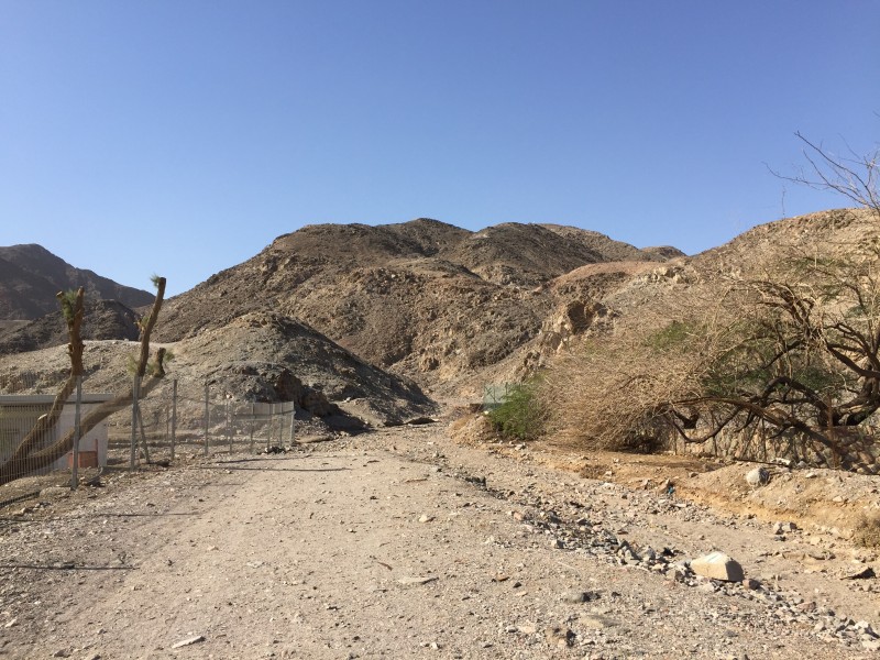


 Heading up the flat beginning of the trail.")
 Oh, there's a sign up there. I must actually be going the right way!")
 Damn, I really wanted to hike in a military firing zone, but getting IDF permission sounds like way too much effort.")
 You are on the green trail.")
 Heading into the Sun.")
 Sneffels, is that you?")
 Looking down the other side of the peak.")
 Double trouble!")
 The view to the north. You can see part of Eilat on the right.")
 The Israel-Jordan border lies in the middle of this valley. Eilat, in Israel, is on the left, while Aqaba, in Jordan, is the")
 Looking down the Blue Trail.")
 Looking back toward the summit.")
 The next objective. You can just barely see the flag.")
 Real class 2 begins now.")
 Loose terrain.")
 Yours truly. It was warm.")
 My easy descent back to the trailhead.")
 One of many.")


