Download Agreement, Release, and Acknowledgement of Risk:
You (the person requesting this file download) fully understand mountain climbing ("Activity") involves risks and dangers of serious bodily injury, including permanent disability, paralysis, and death ("Risks") and you fully accept and assume all such risks and all responsibility for losses, costs, and damages you incur as a result of your participation in this Activity.
You acknowledge that information in the file you have chosen to download may not be accurate and may contain errors. You agree to assume all risks when using this information and agree to release and discharge 14ers.com, 14ers Inc. and the author(s) of such information (collectively, the "Released Parties").
You hereby discharge the Released Parties from all damages, actions, claims and liabilities of any nature, specifically including, but not limited to, damages, actions, claims and liabilities arising from or related to the negligence of the Released Parties. You further agree to indemnify, hold harmless and defend 14ers.com, 14ers Inc. and each of the other Released Parties from and against any loss, damage, liability and expense, including costs and attorney fees, incurred by 14ers.com, 14ers Inc. or any of the other Released Parties as a result of you using information provided on the 14ers.com or 14ers Inc. websites.
You have read this agreement, fully understand its terms and intend it to be a complete and unconditional release of all liability to the greatest extent allowed by law and agree that if any portion of this agreement is held to be invalid the balance, notwithstanding, shall continue in full force and effect.
By clicking "OK" you agree to these terms. If you DO NOT agree, click "Cancel"...
Ouray
Time...4:45am - 12:30pm
Distance...13.2 miles
Elevation Gain...5115 feet
Trailhead...Winter Closure on CR 210, 3.5 miles from Little Cochetopa Creek TH
Route...NE Ridge
My first attempt on Ouray didn't go so well. I attempted it from Marshall Pass Road in March a few years ago and this is how I felt after wallowing for 4 hours in the trees...
When I was researching routes for this winter, I noticed there was a cabin for rent pretty far up CR 210 on the way to the Little Cochetopa TH. I called the owner told me the road was plowed about a mile past his place. He also went on to lecture me about how difficult a winter attempt on this peak would be, something about the Ouray wind cloud, and how experienced climbers took 10 hours to climb this route in summer. Challenge excepted. As it turns out, this route is not too difficult and pretty safe...definitely the way to climb it in winter. But it was still nice to have the extra motivation.
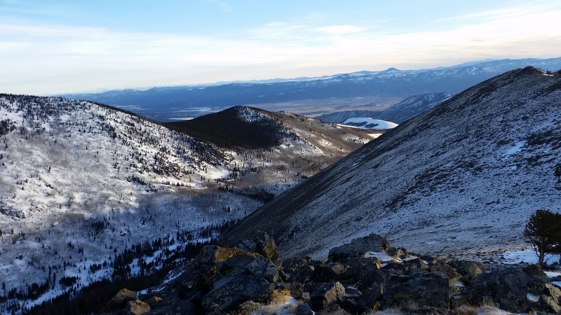
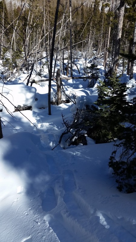
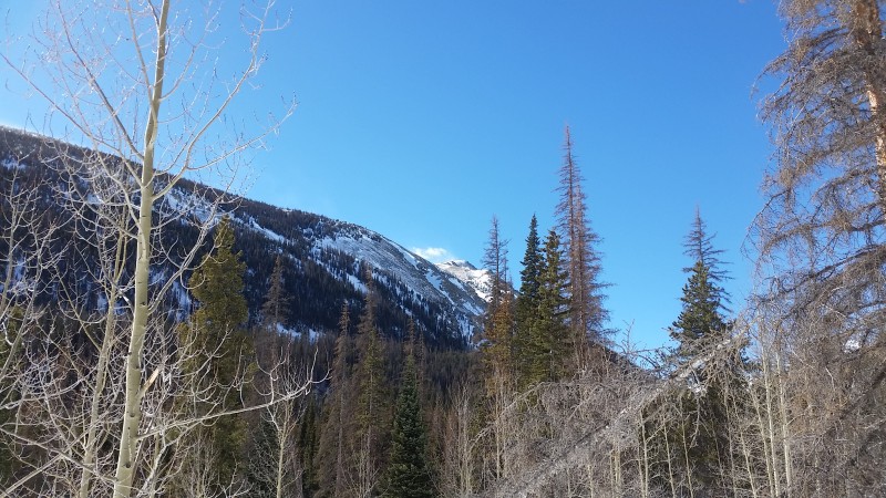
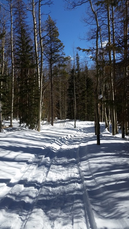
Slept at the plowed parking area at the road closure and got an early start so that I could get back in time for the Super Bowl. I was surprised to find a snowmobile track all the way to the Little Cochetopa Creek TH...about 3.5 miles from the closure. I still used shoes, but the track made for a smooth start to the day. From the TH, you just need to cross the creek and climb up the steep, north-facing hillside on your left to meet up with the ridge.
Sunrise and a cloud wave over the Sangres
Looking back down at Little Cochetopa Creek
Start at the ridge...as I broke out of the trees I immediately got hit with a strong right to left wind.
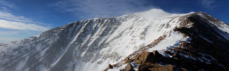
Higher up on the ridge...summit starting to come into view. The wind was no joke. I stayed on the right side of the ridge so that when I got knocked to the ground, I would be pushed into the rocks and not off the mountain. Seriously...it was that strong. Sarah T told me about a similar experience she had on Ouray. So the hype is real...all fear the OURAY WIND CLOUD!!!
Devil's Armchair...this part of the ridge has a few tricky sections that can be easily avoided on the right.
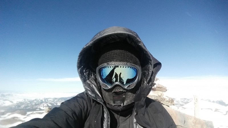
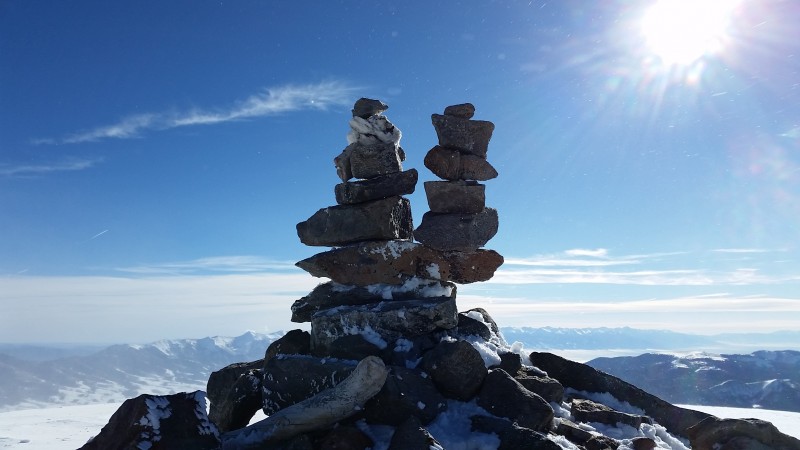
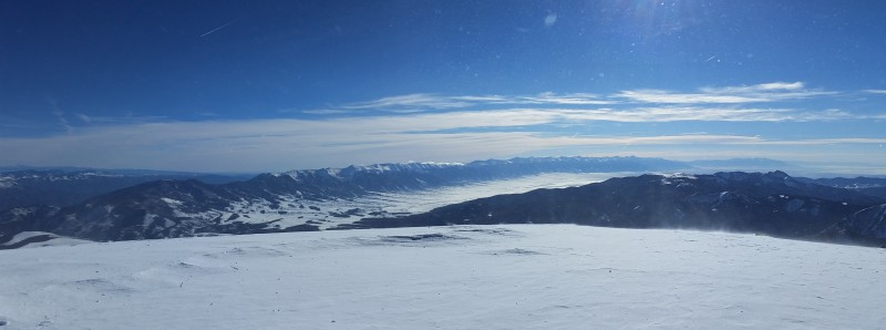
Got to the summit around 9:30, took a few pics, built my B&B cairns, admired the view of the whole length of the Sangres, and got the hell out of there.
Descent
Crossing Little Cochetopa Creek
Here's the hill you need to ascend to gain the ridge
Thank you sledheads
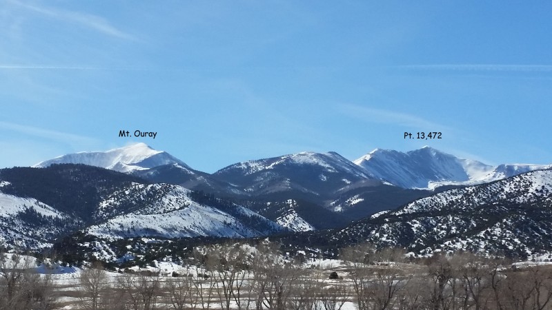
Looking back at Ouray and Pt. 13,472 from Hwy 50
Thumbnails for uploaded photos (click to open slideshow):
If I had known how bad the first half was going to be, I would have climbed 13,472. :)
Caution: The information contained in this report may not be accurate and should not be the only resource used in preparation for your climb. Failure to have the necessary experience, physical conditioning, supplies or equipment can result in injury or death. 14ers.com and the author(s) of this report provide no warranties, either express or implied, that the information provided is accurate or reliable. By using the information provided, you agree to indemnify and hold harmless 14ers.com and the report author(s) with respect to any claims and demands against them, including any attorney fees and expenses. Please read the 14ers.com Safety and Disclaimer pages for more information.
Please respect private property: 14ers.com supports the rights of private landowners to determine how and by whom their land will be used. In Colorado, it is your responsibility to determine if land is private and to obtain the appropriate permission before entering the property.


")


