Download Agreement, Release, and Acknowledgement of Risk:
You (the person requesting this file download) fully understand mountain climbing ("Activity") involves risks and dangers of serious bodily injury, including permanent disability, paralysis, and death ("Risks") and you fully accept and assume all such risks and all responsibility for losses, costs, and damages you incur as a result of your participation in this Activity.
You acknowledge that information in the file you have chosen to download may not be accurate and may contain errors. You agree to assume all risks when using this information and agree to release and discharge 14ers.com, 14ers Inc. and the author(s) of such information (collectively, the "Released Parties").
You hereby discharge the Released Parties from all damages, actions, claims and liabilities of any nature, specifically including, but not limited to, damages, actions, claims and liabilities arising from or related to the negligence of the Released Parties. You further agree to indemnify, hold harmless and defend 14ers.com, 14ers Inc. and each of the other Released Parties from and against any loss, damage, liability and expense, including costs and attorney fees, incurred by 14ers.com, 14ers Inc. or any of the other Released Parties as a result of you using information provided on the 14ers.com or 14ers Inc. websites.
You have read this agreement, fully understand its terms and intend it to be a complete and unconditional release of all liability to the greatest extent allowed by law and agree that if any portion of this agreement is held to be invalid the balance, notwithstanding, shall continue in full force and effect.
By clicking "OK" you agree to these terms. If you DO NOT agree, click "Cancel"...
I'm OK...A Snowshoe Marathon, 2 Cool Peaks and A Scare in the Sawatch
Coming to you here with my head down and a little embarrassed. But I think it's important to tell these stories so here it goes...
I make mistakes and I try to learn from them. The opportunity for mistakes is everywhere in winter mountaineering. I'm constantly evaluating route choice, snow conditions, remaining daylight, weather, energy level, etc. I try my best to make good decisions, but I am not perfect...far from it. I do accept the dangers that come with this activity, but I also do my best to mitigate those dangers whenever possible. That being said, I am guilty of feeling invincible at times. All it takes for me is a few trips where everything goes as planned...route goes, no signs of instability, no slides, back home in time to put the kids to bed...and I feel like I can do no wrong. Last week I had a day like this on the west side of Oklahoma.
Oklahoma
Date...Friday, January 27th
Time...7am - 6pm
Distance...15 miles
Elevation Gain...4040 feet
Trailhead...Winter Closure on Indy Pass Road, 2.2 miles from North Fork Lake Creek TH
Route...North Fork Lake Creek to Deer Pass to Fryingpan River Valley to SW Face to South Ridge
My original plan for climbing Oklahoma was to setup a Halfmoon camp and combine it with French and Casco. I'm always looking for daytrip options to limit my time away and when I started looking at my Lakawanna route, I realized I might be able to climb all three of those peaks in 2 daytrips from Indy Pass Road. It would be long, but looked doable. It also helped that I did a big loop of peaks in that area back in September, so I knew the area pretty well. I started out from the road closure at 7am.
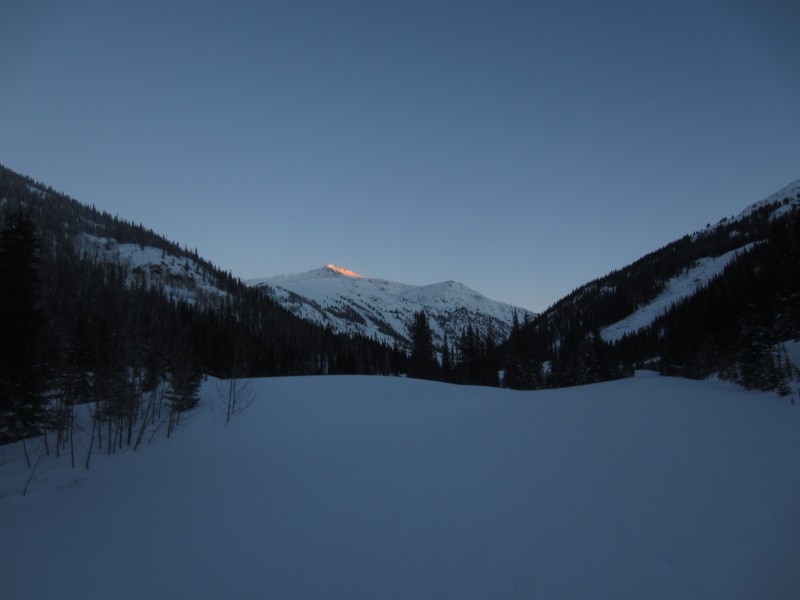
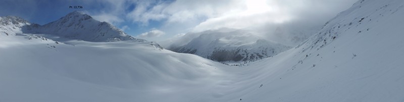
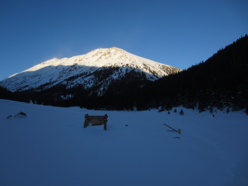
The first 13er to make an appearance was Pt. 13,500.
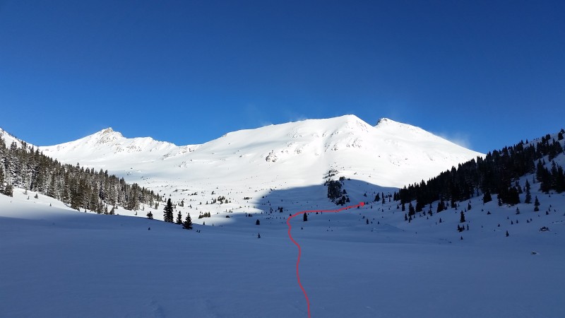
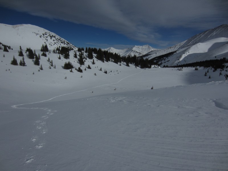
After a mile or so, Mt. Champion and Pt. 13,736 come into view. The route goes up this valley, around the back side of Pt. 13,736 and up over Deer Pass.
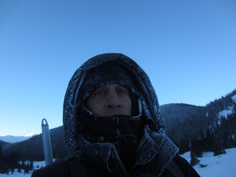
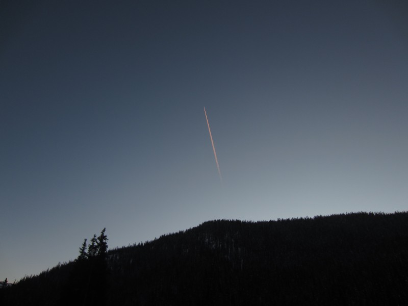
not as OLD as he looks in this picture MAN WINTER...It was -5 when I left the car and I don't know if it got warmer than that until much later in the day
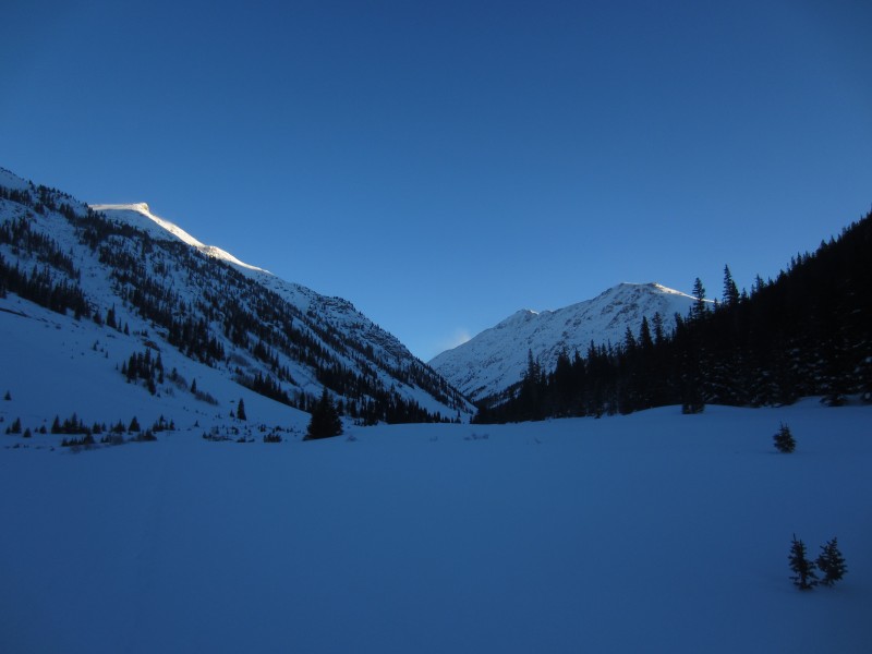
next point of navigation reference...Pt. 13,300A...get there and make a ralph
Next up on my tour of random 13ers...Deer Mtn. I was able to find a wrinkle in the slope up to Deer Pass that worked as a mini ridge and kept the avy danger low.
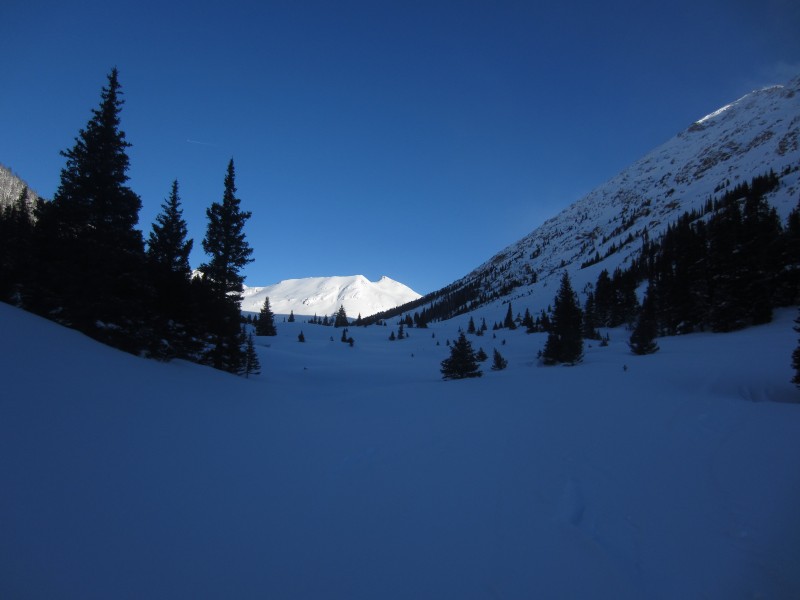
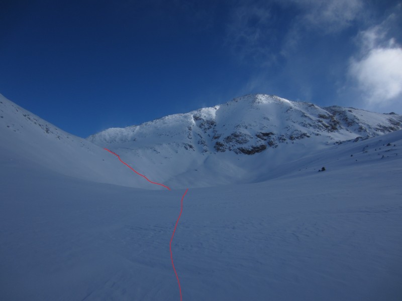
After 3 1/2 hours I had my first view of Oklahoma. It was still pretty far away, but felt reachable. This is where my questionable decision making started.
I had 2 options...I could drop down a few hundred feet and take the longer, harder route up Fryingpan Valley or I could cut across the north face of Deer Mtn and minimize the elevation gain and mileage. I tested the snow, picked out areas of concern on that slope and decided I was comfortable with option #2. At this point, I didn't question my decision at all and still feel ok with this choice. I found the snow to be an even consistency, without any noticeable hard layers and it wasn't very deep. The slope angle was in the danger zone, but there weren't any convexities, shooting cracks or signs of recent avy activity. I got through this area and into a safe zone pretty quickly.
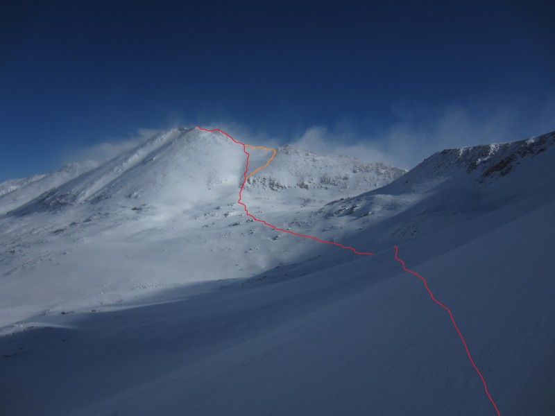
red line = ascent orange line = decent
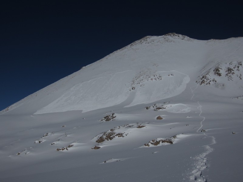
My next decision was how to gain the ridge. I chose this line because it would keep me out of the wind longer. The other option would be hiking up the valley to the right and hitting the ridge at the Deer - Oklahoma saddle. My thought was I could stay out of avy terrain by aiming for the rocks just to the right of the couloir and sticking to the rounded area with bare ground above it. I could see the slope to the left was loaded and convex and wanted nothing to do with it.
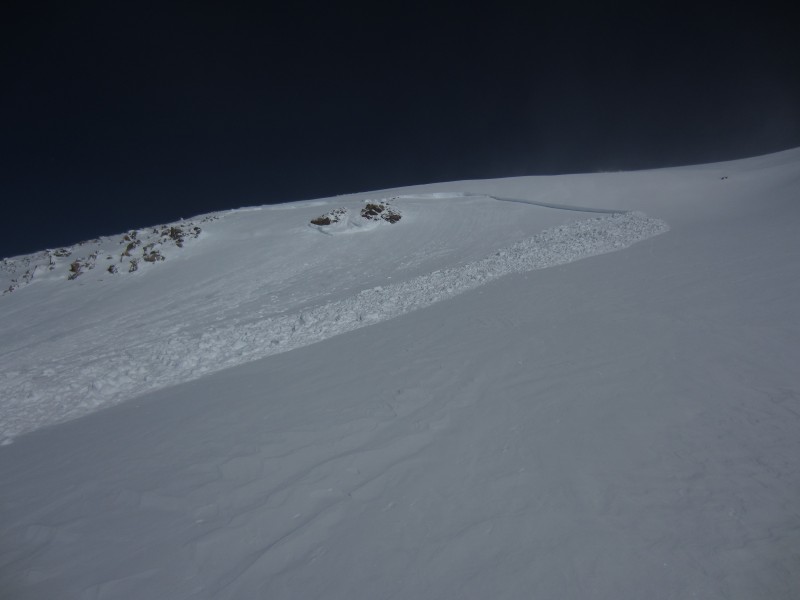
For some reason, I strayed a little too far to the left. I think it was just simply a matter of having my head down and getting slightly off course. I didn't hear anything, but could sense the ground moving around me. By the time I looked up, it was already over. It only lasted a few seconds. The second picture was taken on the way out and you can see where my tracks veered off to the left and then immediately back to the rocks on the right. That's where I was when this thing broke. Fortunately, the crown didn't continue across the slope above me. It wasn't very deep, and didn't run very far, but it definitely could have injured me. After taking everything in for a few minutes, I continued up to the ridge.
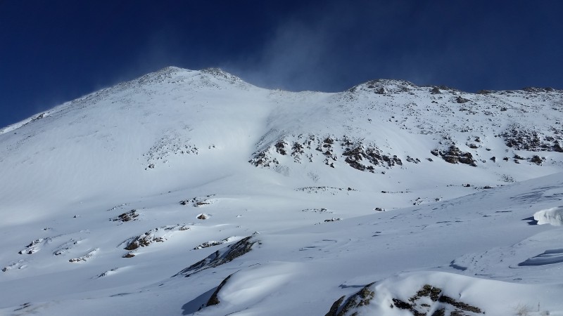
The ridge from top of the face to the summit went without issue
You underestimate the power of the dark side.
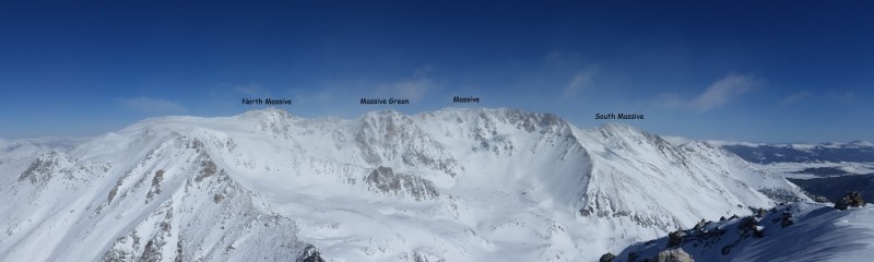
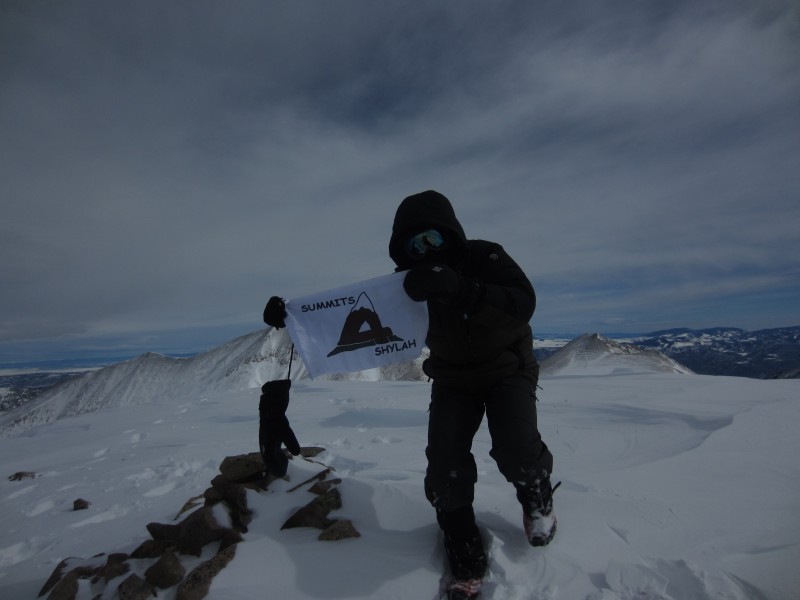
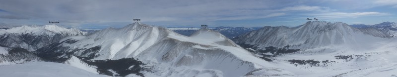
The 4 summits of Mt. Massive...in my opinion, they all count
Looking back down the ridge towards Deer Mtn...I went a little further out on the descent to avoid the steep finish up to the ridge. In this picture you can see the other option of gaining the ridge by way of that triangle shaped plateau.
The next decision I made was my worst of the day and the one I'm least proud of. On my way back across the valley I set off another little slide. You can see it in picture #11. It was tiny, but the significance was that the snow was continuing to show signs of instability. Despite these glaring warning signs, I convinced myself it was ok to follow my track back to Deer Pass instead of dropping down into Fryingpan Valley. My reasoning was that I tested that slope earlier and found it safe...it didn't get any sun all day so the structure shouldn't have changed much...and I would follow my track to the exact footstep as not to disturb any new snow. Nothing happened, but I was spooked the whole way across. Stupid, stupid, stupid. I was tired and the thought of breaking more trail encouraged me to make a bad decision.
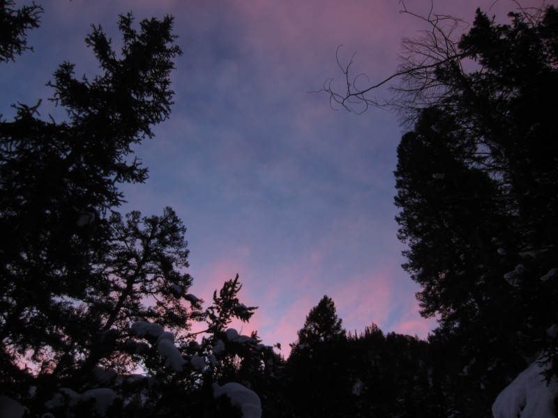
I was very relieved to get back to Deer Pass and put all the bad thoughts behind me. The hike out was stunning. I'm not a huge fan of that word, but don't know how else to describe it. Incredible beauty in every direction.
When I got back to the North Fork Lake Creek TH, I remembered taking a picture of this gate in September and tried to capture the same image.
Strava track...
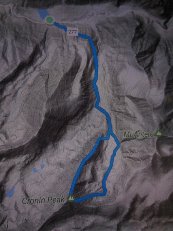
Cronin
Date...Saturday, January 28th
Time...6:45am - 2pm
Distance...11.7 miles
Elevation Gain...4446 feet
Trailhead...Baldwin Creek
Route...East Ridge Ascent, NE Ridge Descent
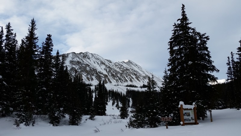
My original plan was to attempt French and Casco the next day, but I decided I needed more of a sure thing and something with little to no avy danger. I chose to give Cronin a shot. Slept at the Baldwin Creek TH and started out just before 7am. The sky was blowing up and there was a good trench in place to about 11,500'. The last mile or so was just a single ski track...possibly left by another member of the Mike club. Thanks $.
At the trail junction with the Baldwin Lake Trail, you get a good view of Cronin's NE Ridge. I thought this would be the safest route and just needed to find my way over to it.
At the point where you first see Antero, I broke into the trees to get across the valley and find a way up to the ridge. While doing this, I got this view of Cronin and changed my plan. I really liked the look of the wind-swept ridge on the far left.
From there I went straight up the valley to hit the lowest point of that ridge and took it all the way to the summit.
Shylah....I am you Uncle (vader voice)
At dawn, look to the East
I decided the NE ridge looked pretty appealing for a descent, so I made a nice loop out of it. Found some faint tracks on the ridge. $ Mike...that you?
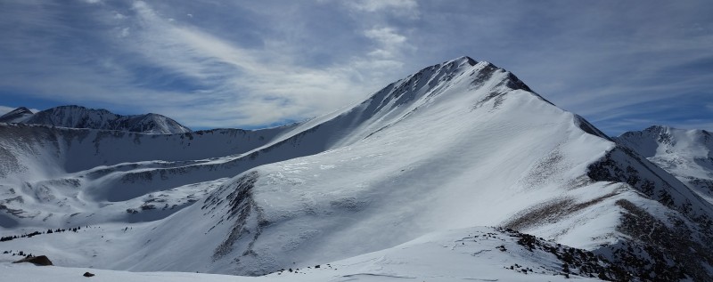
Cronin...in all it's winter glory
Strava track...
Thanks for reading everybody. Hoping this report is helpful and makes you think twice when picking your lines through the snow.
Thumbnails for uploaded photos (click to open slideshow):
Another very nice write-up and great photos. That Cronin NE ridge looks interesting - guess I'm gonna have to give that route a shot. Also - having been near a small slide once (got buried up to my ankles), I can appreciate how you must have felt on your (not so) OK slide. Yikes! Glad that the only that happened was an elevated heart rate...
I think it is great to share trips where things don't go as planned so others can learn. Glad that you are ok, and wish you continued success on your winter Centennials!
Caution: The information contained in this report may not be accurate and should not be the only resource used in preparation for your climb. Failure to have the necessary experience, physical conditioning, supplies or equipment can result in injury or death. 14ers.com and the author(s) of this report provide no warranties, either express or implied, that the information provided is accurate or reliable. By using the information provided, you agree to indemnify and hold harmless 14ers.com and the report author(s) with respect to any claims and demands against them, including any attorney fees and expenses. Please read the 14ers.com Safety and Disclaimer pages for more information.
Please respect private property: 14ers.com supports the rights of private landowners to determine how and by whom their land will be used. In Colorado, it is your responsibility to determine if land is private and to obtain the appropriate permission before entering the property.