Download Agreement, Release, and Acknowledgement of Risk:
You (the person requesting this file download) fully understand mountain climbing ("Activity") involves risks and dangers of serious bodily injury, including permanent disability, paralysis, and death ("Risks") and you fully accept and assume all such risks and all responsibility for losses, costs, and damages you incur as a result of your participation in this Activity.
You acknowledge that information in the file you have chosen to download may not be accurate and may contain errors. You agree to assume all risks when using this information and agree to release and discharge 14ers.com, 14ers Inc. and the author(s) of such information (collectively, the "Released Parties").
You hereby discharge the Released Parties from all damages, actions, claims and liabilities of any nature, specifically including, but not limited to, damages, actions, claims and liabilities arising from or related to the negligence of the Released Parties. You further agree to indemnify, hold harmless and defend 14ers.com, 14ers Inc. and each of the other Released Parties from and against any loss, damage, liability and expense, including costs and attorney fees, incurred by 14ers.com, 14ers Inc. or any of the other Released Parties as a result of you using information provided on the 14ers.com or 14ers Inc. websites.
You have read this agreement, fully understand its terms and intend it to be a complete and unconditional release of all liability to the greatest extent allowed by law and agree that if any portion of this agreement is held to be invalid the balance, notwithstanding, shall continue in full force and effect.
By clicking "OK" you agree to these terms. If you DO NOT agree, click "Cancel"...
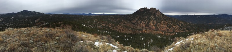
Since the CAIC rating for the entire state was orange or red we decided to stay closer to home and explore a "lesser" peak. Long Scraggy Peak is just north of Deckers in Pike NF. While the summit elevation is a mere 8812', a little route creativity made for a fun day.
Sometimes pre-trip research can take hours as a route may be described in multiple books or websites and there are numerous trip reports to review, but that's not the case with LSP--there just isn't much info on this peak. The TR by 14ers.com member Derek and the SummitPost page were all we had to reference. Also, the week before our hike forum member Jay521 posted a TR from nearby Little Scraggy Peak and later provided additional pictures and info on the conditons. Many thanks to each of you!
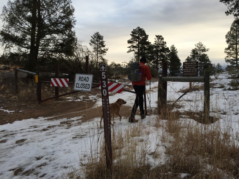
The above resources made it easy to locate the TH at the start of 530 (gated) on the east side of CO 126. We parked on the shoulder of 126 so we weren't blocking the gate.
TH at the start of 530 on the east side of CO 126
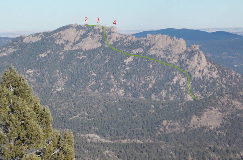
We left the TH at 8:00 am and like Derek's TR, our plan was to follow 530 until it intersected a road/trail coming from the south (Trail Jct 1 image 2 below). We looked at multiple maps prior to the hike and the USGS map (used by the Topo Maps app) was the only map which showed this trail. According to the map, it appears 530 ends at this trail junction, although the intersecting trail goes north and south. We continued south on this trail and followed it toward Pt. 7774 (orange pin on my map). We would return via the northern trail later in the day.
Marked up screen shot from the Topo Maps app showing our approximate route for the day
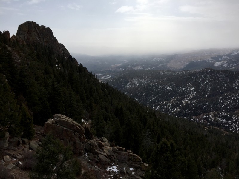
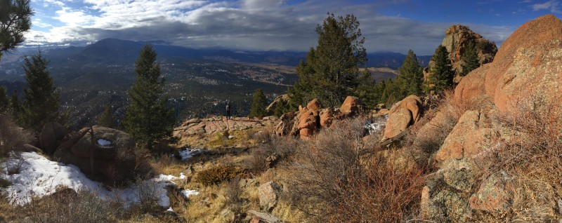
When we got close to Pt. 7774 we left the trail and bushwhacked up a slope to a small rocky ridge which gave us a nice view SW towards Little Scraggy Peak and Green Mountain behind it.
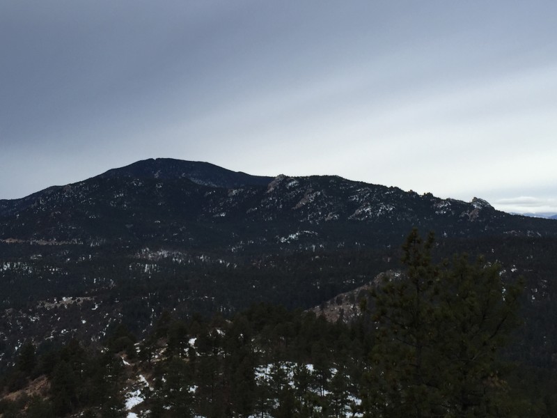
View from the small rocky ridge just west of Pt. 7774. Looking SW towards Little Scraggy Peak and Green Mountain.
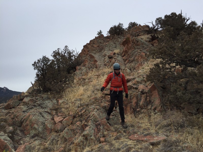
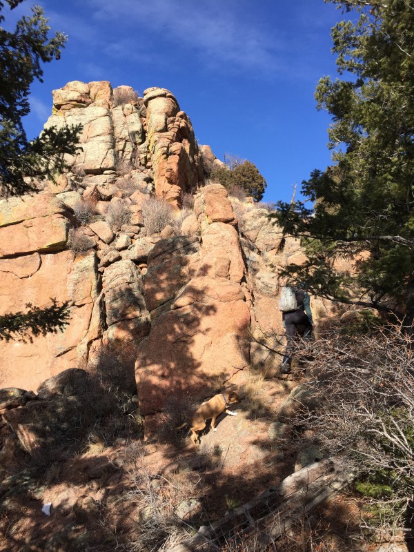
From here it was a short stroll to the base of Pt. 7774. Derek's TR says they climbed class 3/4 rock on the SW side to reach the top. While we often seek out the class 3/4 routes, I brought my dog, Zeke, along so we continued east around the south side looking for an easier way up and eventually found an obvious class 2 route up the east side.
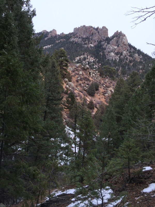
First unobstructed view of Pt. 7774 from the small rocky ridge
Approching Pt. 7774 from the west with Thunder Butte to the south
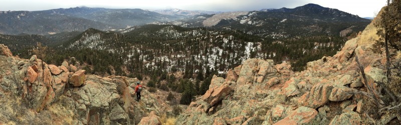
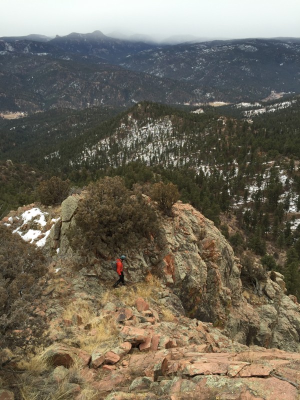
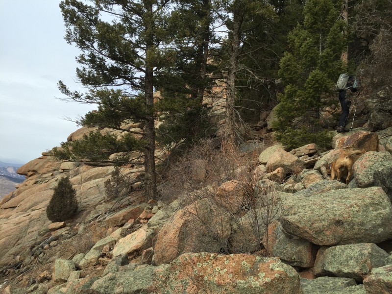
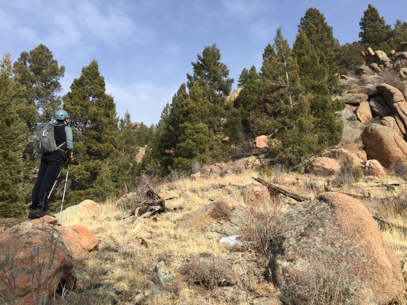
Nathan enjoying the scrambling options on the south side of Pt. 7774. The class 2 route I led Zeke up is left out of the pict
Thunder Butte (center top) in the snow to the south. Green Mt and Little Scraggy (right) to the west.
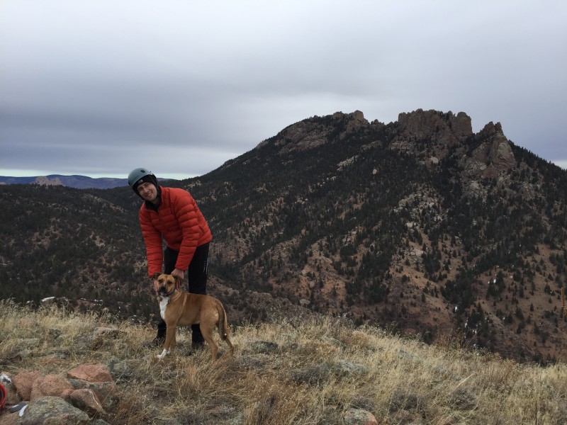
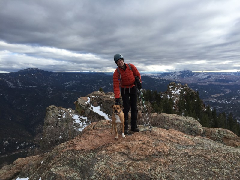
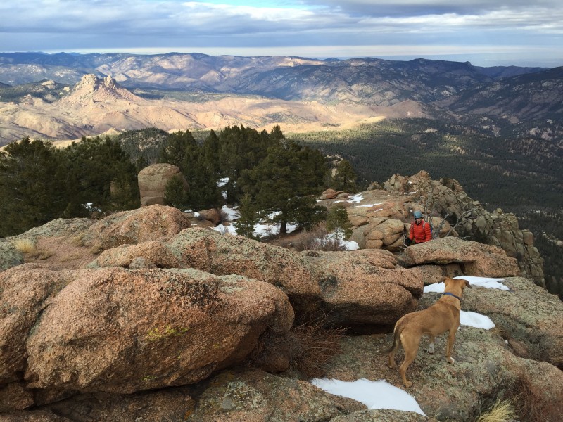
Nathan and Zeke on the summit of Pt. 7774. The Long Scraggy N Ridge route and Raleigh Pk are behind them.
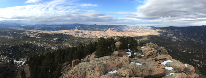
Summit views were worth the trip to Pt. 7774
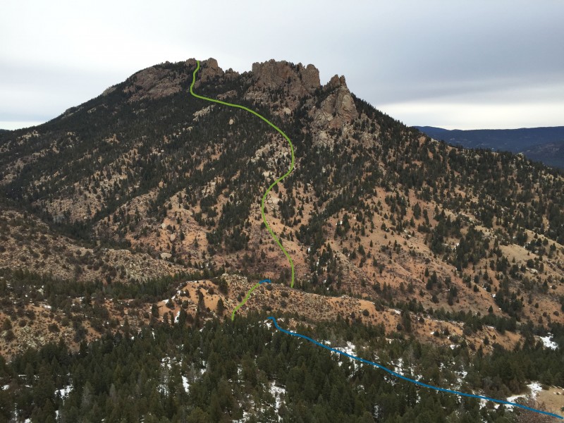
Pt. 7774 was definitely worth adding to our trip and I recommend it as a part of the Long Scraggy Peak adventure. On it's own Pt. 7774 is a relatively short hike and scramble with a great summit view for kids. From the summit we planned our ascent of Long Scraggy via the west slope. On the following picture I tried to show our route from Pt. 7774 down (blue line) to the creek and then up (green line) up the west slope. The small creek (which didn't have a lot of water, but it was flowing) was right at 7000' and is at the bottom of the most obvious gulley between Pt. 7774 and LSP.
From Pt. 7774, planning our route up LSP's west slope
Class 2 descent off Pt. 7774
Lower part of the class 2 route down the east side of Pt. 7774
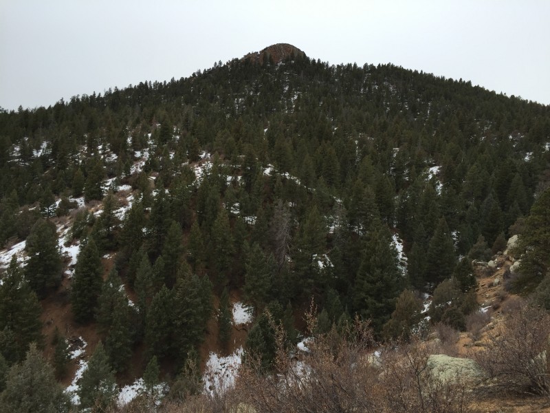
The forest was fairly open in places, so we followed the path of least resistance as we aimed for the base of LSP.
Looking up at LSP during our descent from Pt. 7774. We had to ascend/traverse the small ridge in the foreground before gettin
Looking back at Pt. 7774
After crossing the creek we started up the broad slope towards LSP's south summit.
Starting up the west slope of LSP with the south summits in the background
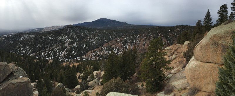
Part way up we paused to admire our route selection off Pt. 7774. Green Mountain is the highest point in the back with Little Scraggy in front of it (kind of hard to distinguish) and Pt. 7774 is the rocky point left of center.
Last view to the west before the trees got thicker
Once we were half way up the west slope of LSP the trees got thicker and we couldn't see very far ahead of us. We checked the elevation a few times and eventually traversed north across the west slope (staying in the trees and below the large rock formations) until we came to the treed gulley (shown in image 10) which leads to the summit area. On the Topo App screen shot (image 2 above) the "84" of the 8400' contour line is on this gulley.
Traversing the west slope of LSP
More traversing
Looking back (south) on where we came from. The south summit of LSP is on the left. Pt. 7774 in on the right.
Compared to willows, bushwhacking through the forest isn't too bad
Start of the gulley. The summit is visible in the trees. We went left through the tress; may have been easier to the right ov
The gulley provided some of the most difficult bushwhacking of the day (I'm sure there was an easier route), but it didn't last long and led us to the SW side of summit #3 as shown in this picture (photo credit to Jay521; used with permission from his TR on Little Scraggy).
Photo credit to Jay521 from 1 week earlier. Our approximate route from Pt. 7774 up LSP is marked.
A few shots from LSP summit #3.
From LSP summit #3 noted on previous image. True summit is obvious point on the left. South Platte River below. Devil's
Nice porch on the west side. True summit is on the right.
Minor bushwhack up the south side of the true summit
As you can in the previous images, the true summit (I believe it's #2 in Jay521's image) was very close. The north side of the summit has easier access.
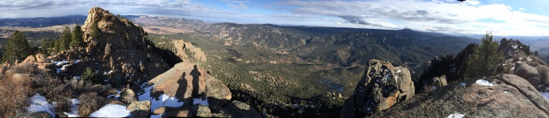
On the summit with plenty of great views.
"Scraggy" seemed like an appropriate name
Nice job guys! Devil's Head on the left. Thunder Butte on the right. Pikes (center) was in the clouds.
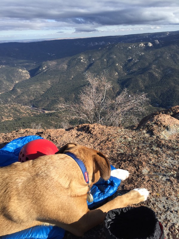
A well-deserved nap for Zeke. This was only his second hike of any significance and he did great.
Looking north from the summit. Raleigh Pk (center) and evidence of Buffalo Creek Fire from 1996. Denver is in the distance on
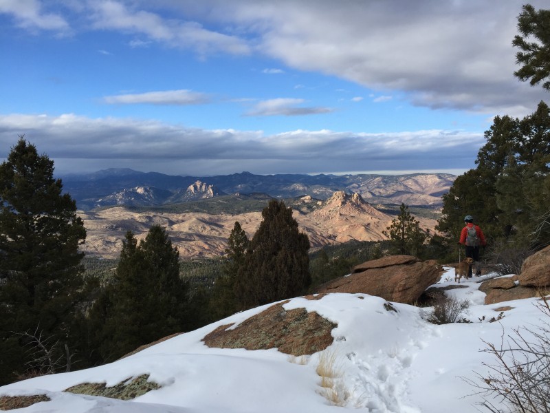
After a relaxing hour on the summit, we descended via the north ridge and regained the road/trail at the point marked Trail Jct 2 in image 2. The hike down was peaceful and uneventful and we arrived back at the TH just before dark. According to Nathan's Fitbit we covered about 12 miles (and he got 25,000 steps for the day!).
Starting down the N Ridge. Zeke had no interest in the 2' step across by Nathan. Alt is to Zeke's right and thru th
The most snow we encountered all day was on the N Ridge and justified carrying the gaiters
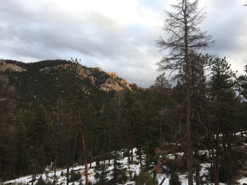
Back on the road. Final light on Long Scraggy.
Gear wise: we left the snowshoes in the car and carried spikes and gaiters. We wore the gaiters as we descended Long Scraggy's north ridge were we found the most snow of the day (and even then it wasn't a lot). We never used the spikes.
Next time we'll explore the dramatic looking south summits of LSP and maybe even find a route from the east side.
Thumbnails for uploaded photos (click to open slideshow):
Very nice report, Bob. Makes me want to do that one again. And add on 7774 this time, too. You took an interesting route up LSP and I will use this report as a guide when I head back to do it. Thanks!
Great little run through the jungle! Not too many can name Thunder Butte, kudos to you, but you really had a nice summit shot of Raleigh Peak and Cathedral Spires & Bishop Rock as well! 7774 is such a cool little fortress! Thanks for posting one for the little guys!
Been a while since I was there. Thanks to this report I may head up for a revisit Sunday.
Thanks for posting!
Caution: The information contained in this report may not be accurate and should not be the only resource used in preparation for your climb. Failure to have the necessary experience, physical conditioning, supplies or equipment can result in injury or death. 14ers.com and the author(s) of this report provide no warranties, either express or implied, that the information provided is accurate or reliable. By using the information provided, you agree to indemnify and hold harmless 14ers.com and the report author(s) with respect to any claims and demands against them, including any attorney fees and expenses. Please read the 14ers.com Safety and Disclaimer pages for more information.
Please respect private property: 14ers.com supports the rights of private landowners to determine how and by whom their land will be used. In Colorado, it is your responsibility to determine if land is private and to obtain the appropriate permission before entering the property.