Download Agreement, Release, and Acknowledgement of Risk:
You (the person requesting this file download) fully understand mountain climbing ("Activity") involves risks and dangers of serious bodily injury, including permanent disability, paralysis, and death ("Risks") and you fully accept and assume all such risks and all responsibility for losses, costs, and damages you incur as a result of your participation in this Activity.
You acknowledge that information in the file you have chosen to download may not be accurate and may contain errors. You agree to assume all risks when using this information and agree to release and discharge 14ers.com, 14ers Inc. and the author(s) of such information (collectively, the "Released Parties").
You hereby discharge the Released Parties from all damages, actions, claims and liabilities of any nature, specifically including, but not limited to, damages, actions, claims and liabilities arising from or related to the negligence of the Released Parties. You further agree to indemnify, hold harmless and defend 14ers.com, 14ers Inc. and each of the other Released Parties from and against any loss, damage, liability and expense, including costs and attorney fees, incurred by 14ers.com, 14ers Inc. or any of the other Released Parties as a result of you using information provided on the 14ers.com or 14ers Inc. websites.
You have read this agreement, fully understand its terms and intend it to be a complete and unconditional release of all liability to the greatest extent allowed by law and agree that if any portion of this agreement is held to be invalid the balance, notwithstanding, shall continue in full force and effect.
By clicking "OK" you agree to these terms. If you DO NOT agree, click "Cancel"...
In the days before heading down to Mexico to climb Orizaba, I stayed in Santa Fe to acclimatize, using the Sandia Mountains for a couple of warm up hikes to get my "mountain legs" after not having climbed anything in a couple of months and coming straight from sea level, thought this made for a good destination.
While having driven by them in the past, I had never actually hiked in the Sandia Mountains, so wanted to get up into the hills and check them out. Sandia Peak at 10,678ft was my target. For anyone with a similar itinerary or just wanting a great accessible hike to do, this proved to be a great option.
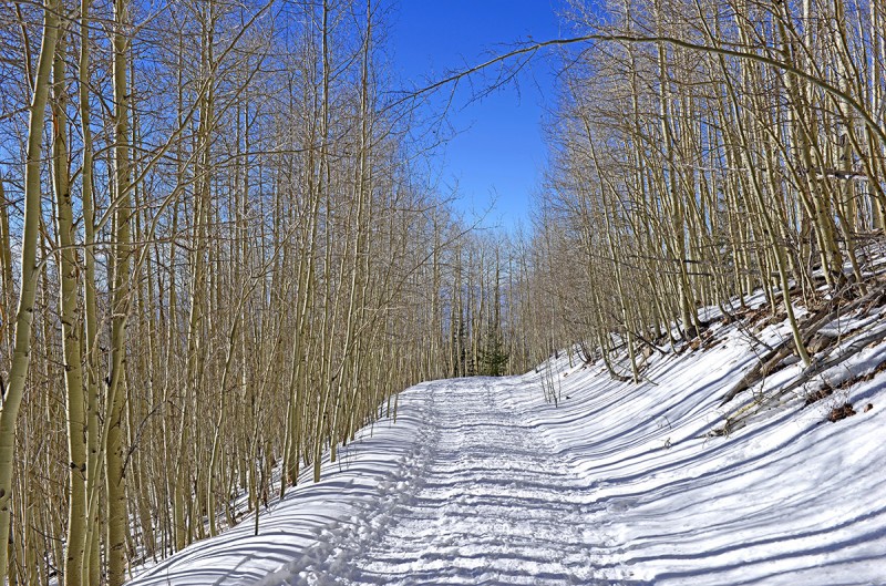
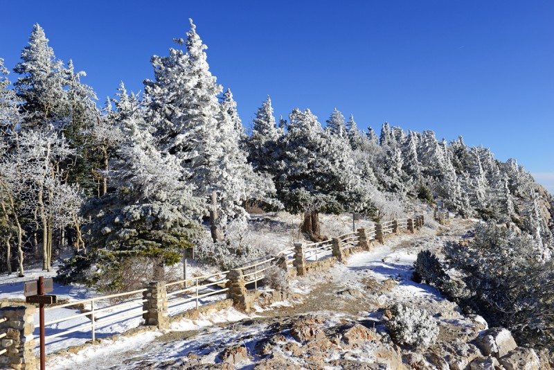
Before the storm came in, I went up to the Ski area north of Santa Fe and hiked up towards Lake Peak and spent some time around 11,000ft. This was a nice hike up and helped start the acclimatization process. There was plenty of snow here and made for a nice walk up the snow covered forest road.
A shot on the road up to Lake Peak before the storm came in. Postcard clear.
Sandia Peak Route details
Part of the reason I chose here was the ease of access for a rental car to get to the trailhead even if snow came in. The trailhead is located not far from Albuquerque along Route 25 off Exit 234 then up Forest Road 333. You'll have to pay a $3 parking fee, so have some singles handy. This area proved particularly useful after consecutive snowstorms blocked trailhead access further north in the Sangre de Cristos.
There are a few routes up to the Sandia Crest and Sandia Peak. I hiked up the La Luz Trail to the top which ascends the West Face of the mountain. Part of this route also hosts a mountain race in season.
I climbed Sandia Peak twice on the week, the first time with little snow left from a small storm and the second time after a new storm came in which made the landscape quite otherworldy.
Trailhead elevation: ~ 7,000ft,
Net vertical gain: ~ +3,800ft
Max Elevation: 10,678ft
Roundtrip distance: just under 15 miles
The Climb
This is more of a harder steep hike than climb as a nice trail exists and is primarily Class 1, with some Class 2 to the top. Snow and ice make the trip more interesting. There are a few trail junctions you'll have to pay attention for. Also as I found out, there is another newer unmarked route that climbs straight out of the valley which criss crosses the La Luz trail in a few spots, which makes route finding a bit confusing. Keep on the main trail when in doubt despite many "good looking" trails, many of which disappear if you follow them.
Poles and good boots definitely were valuable given the ice and snow. Had I worn by other boots or trailrunners, I would have needed traction and gaiters higher up. I'd say an axe, while helpful was optional if you already have good poles.
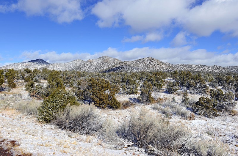
Clearing clouds over fresh snow enroute to the trailhead
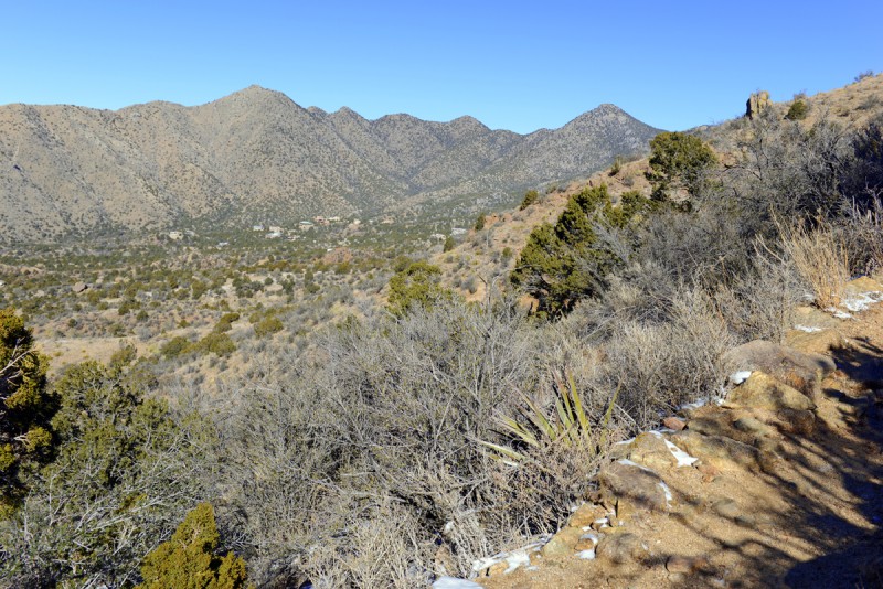
On the first hike up, there was not much snow on the first two miles of the trail and weather was clear but cold, with readings on the summit -5*F on the day. Looking at the photo below, you can see the frozen summit and ice covered antennas.
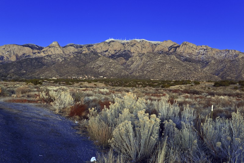
The Sandia Mountains rising out of the desert. Summit and the Crest is in middle of photo
A shot taken from about a mile up the route. Note almost no snow lower down on the first climb.
The route is very scenic the entire way as it climbs up from the valley below. The juniper and pinyon pine lower down give way to Ponderosa pine, then spruce and fir higher up.
The conditions on my second climb up a few days later were harsher and made for a more dramatic landscape, so my shots will focus on those. The weather also warmed up a bit, but still a bit cold.
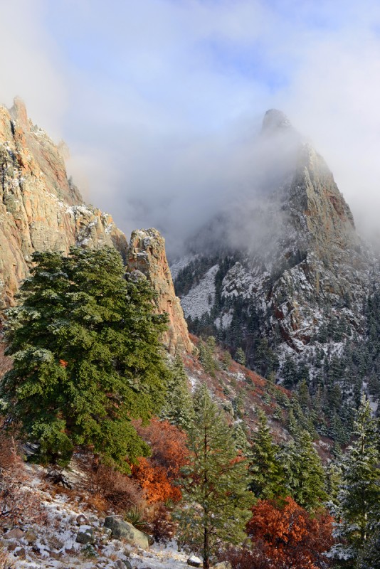
Leaves that lingered on trees combined with the rest of the terrain to make postcard like photos.
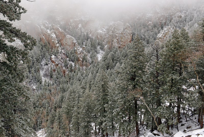
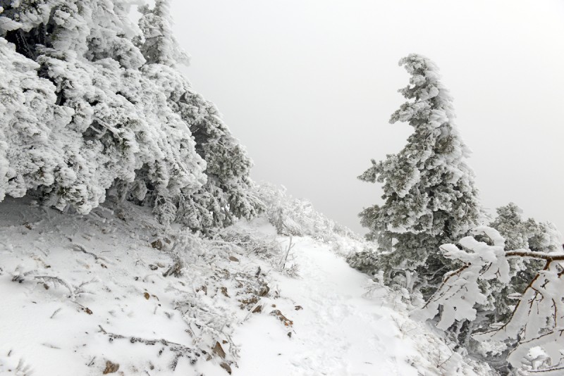
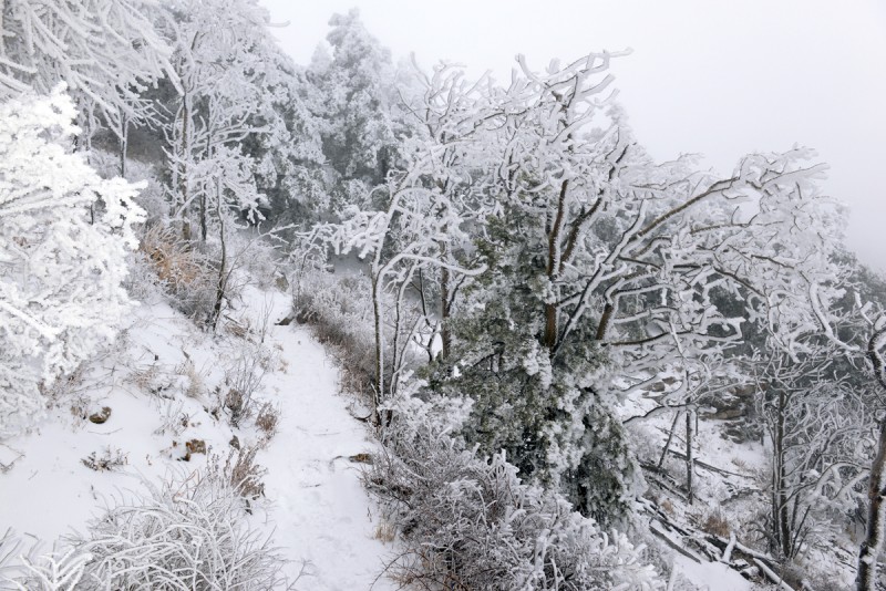
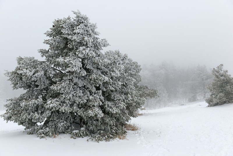
Fresh snow made for a picturesque scene and lower cloud cover soon whited out the landscape.
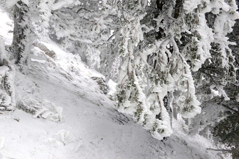
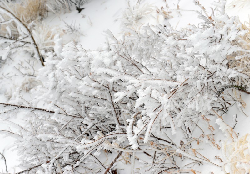
Ice covered most branches of all trees higher once you start climbing in the canyon (~9,000ft); Once you enter the canyon, any sunlight disappears and temperature drops an easy 10-15 degrees.
As I climbed higher up, it became a frozen landscape, ice and hardened snow defying gravity clinging on branches and rocks:
On a side note, the tube from my hydration bladder froze despite having an insulated hose. I was still able to get water out if I opened it up and I had a filled bottle in my pack, but word of advice to make sure you bring bottles or thicker insulation on your outlet hose in your hydration system if you're doing this in winter.
For the remainder of the day, it was a whiteout and fairly cold, with temperatures never getting above the teens. I climbed in three layers and felt comfortable, though if I stopped to eat or rest, I'd need to put my parker on as you felt the cold straight away. Wind higher up was also a factor and made it feel quite a bit colder once you were out of the forest in more open spots exposed to the weather.
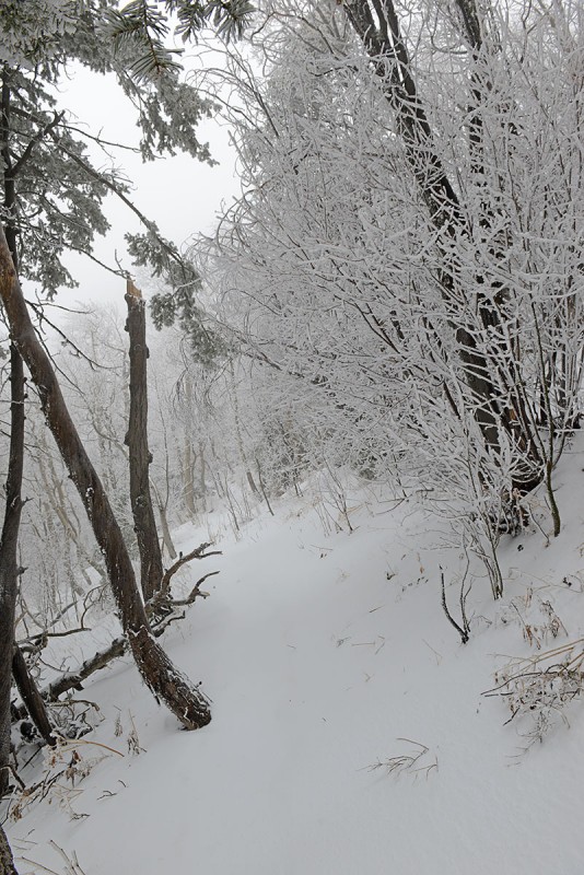
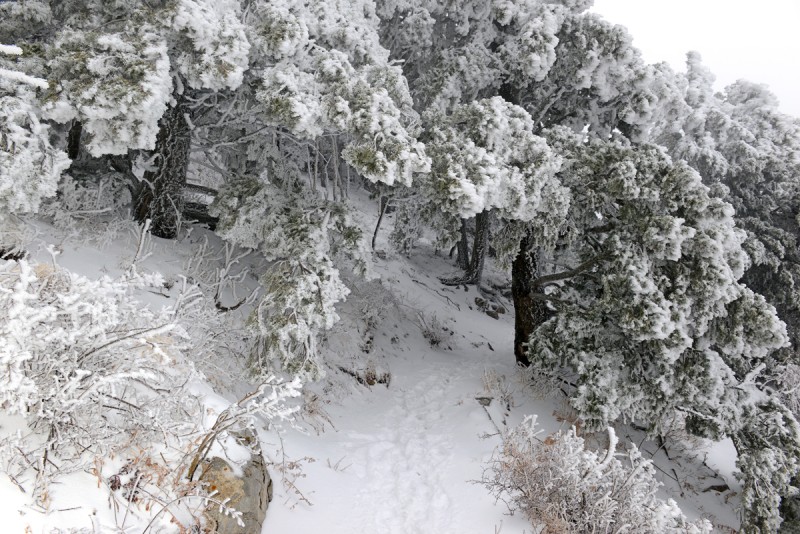
Higher up, no footprints existed:
This shot looks almost exactly like the scene high up on Whiteface mountain in Lake Placid a few years ago.
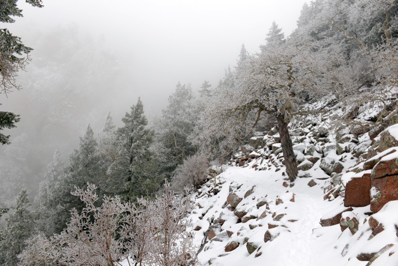
Looking like a northeast ice storm, branches were bent over from the weight of the ice and caked snow
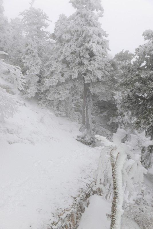
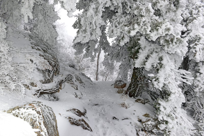
Higher up, trees were smaller and the snow and ice weighting the trees down formed tunnels you needed to walk through. I felt like I was entering Superman's Home.
While icy and snowy, most sections were able to be traversed without traction. I had an axe and crampons in my pack, but as I also had my Sportiva Nepals on, I was able to kick steps and didn't need crampons, though the axe came in handy in helping to negotiate terrain. These boots are not necessary for this climb, but since I was using them the following week in Mexico, I figured I'd hike in them here to break them in more and get the dust out.
Some of the terrain higher up either required traction, patience kicking steps or some walk around given the iced over steep rock. Microspikes probably would have been fine in most spots. Reminded me of the tightly packed routes in the Adirondacks in late Winter and Spring. There was more than one way up in many areas that were sketchy, especially around the ladder area just under the summit.
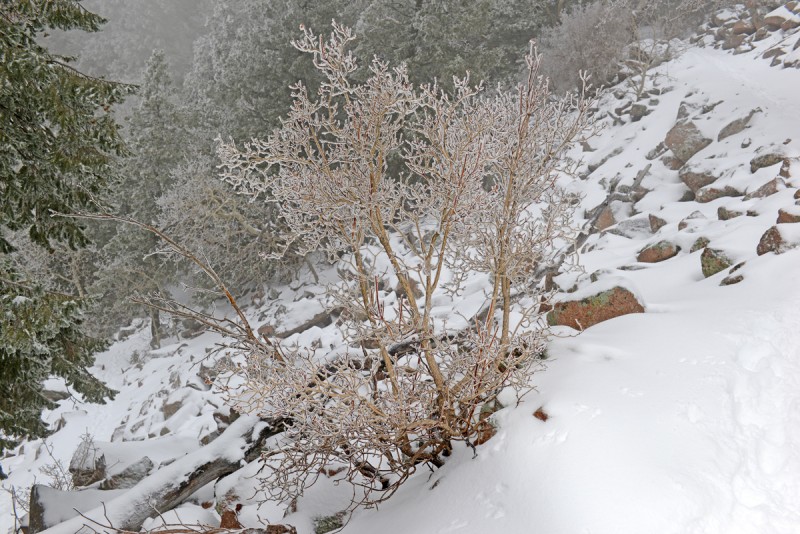
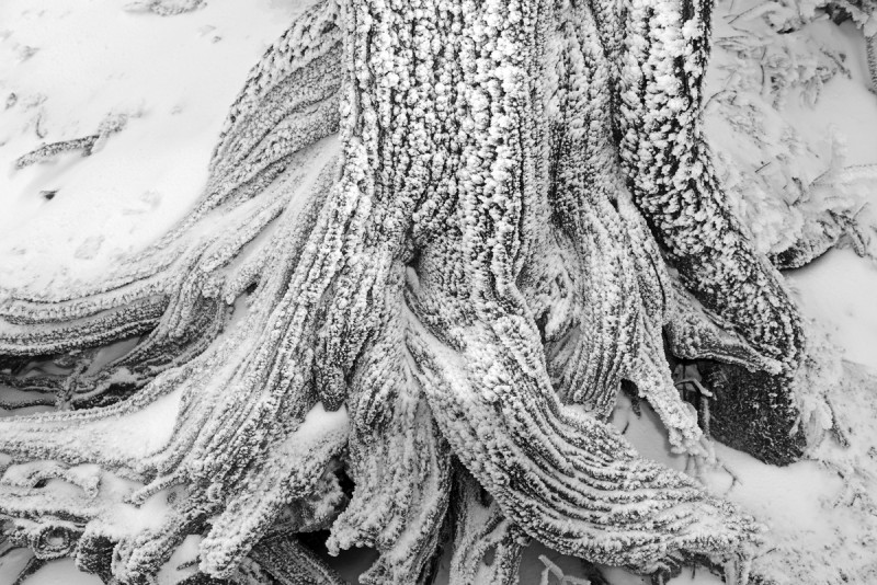
Frozen
Most everything was covered in rime ice and sticky snow which had since frozen.
It's amazing how high treeline is here
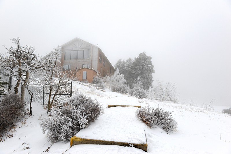
After having summited, I discovered there was a road to the top with a visitor center and parking lot as well as a dozen or more antennas, all covered with ice.
Pre Storm: Summit shots from the first climb when blue bird skies dominated
Post Storm: Summit shots from the second climb after/during the storm when things were socked in with little visibility:
A Tale of Two Climbs
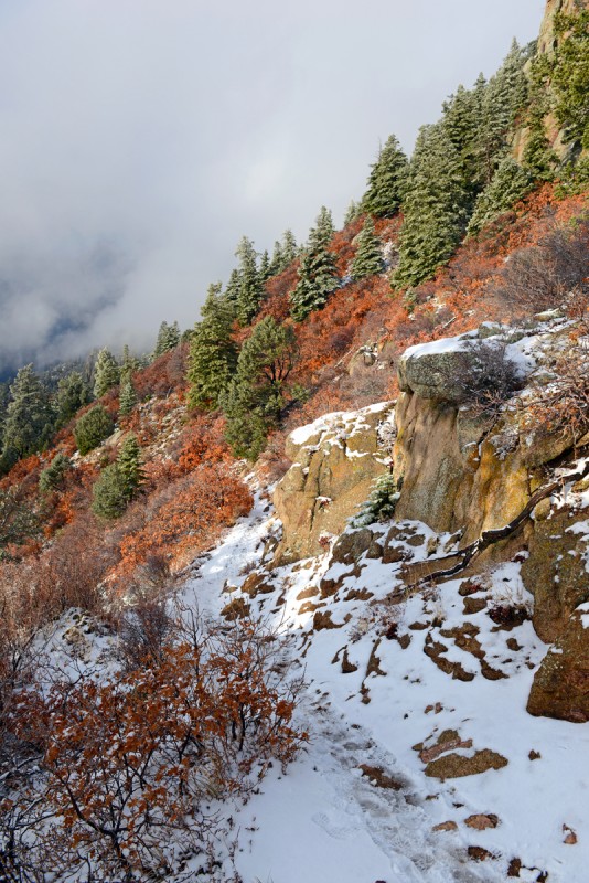
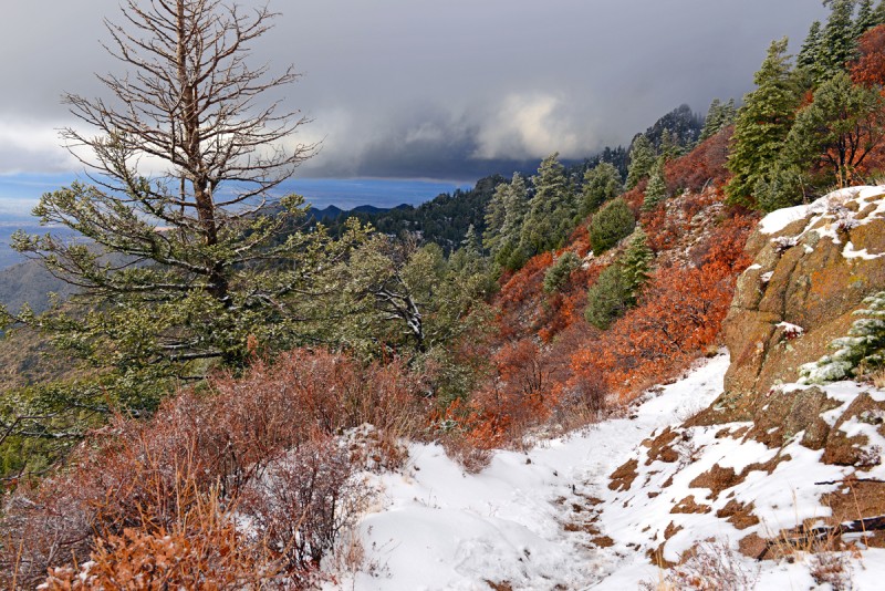
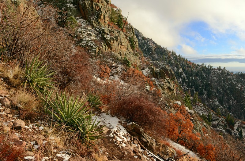
The descent from the summit on the second climb continued to be in a whiteout, though in the late afternoon at around 8,500ft or so, skies started to clear at sunset and the resultant light transformed the landscape and made for an amazing scene. Groundcovers and leaves turned all shades of red in the low angle winter sun. It made me realize how New Mexico earns its nickname as the "Land of Enchantment". Further down, snow was melting surprisingly fast given how cold it still was, suppose due to the direct exposure this slope has to the sun.
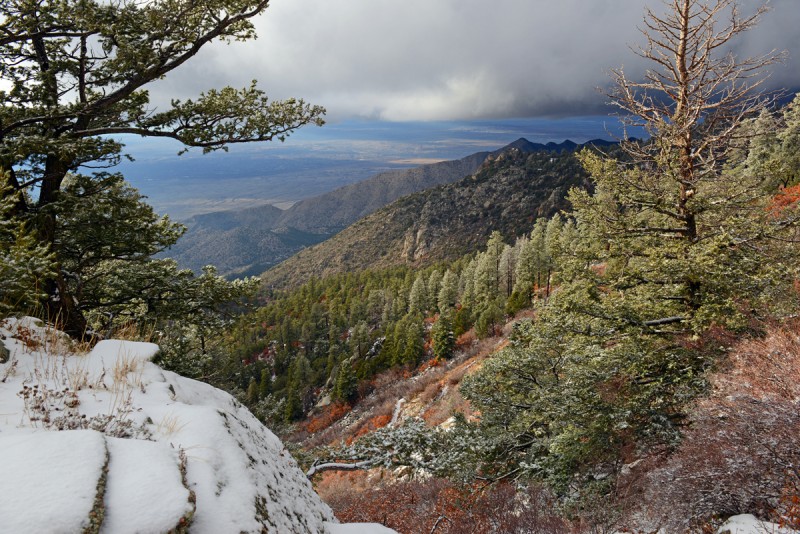
The storm receding and cloud ceiling lifting made for a dramatic surreal scene
Meltout - the afternoon sun did its job and melted much of the snow below 8,000ft fairly quickly
The Sandia Mountains rise up out of the New Mexican desert and form a long ridge north-south begging to be climbed. There are many towers and sheer rock faces adding to the vibrancy of the landscape and you'll pass through several life zones as you ascend higher out of the Sonoran into the alpine zone on the upper reaches of the mountain. These two climbs were great, easy to get to, stress free trailhead access and travel on scenic terrain all the way to the top. I'd highly recommend this for anyone in the area or destination in itself!
Thumbnails for uploaded photos (click to open slideshow):
I was not planning on making a report for this, but after seeing the pics once I downloaded them, and then with the weather the way it was, figured it was worthwhile to do and could help some folks who might be thinking of climbing it as it was a pretty cool place.
I lived in Albuquerque for over 10 years (high school through post-college) and know that trail very well. But your photos are better that anything I ever took, really great. I enjoyed your report, glad you enjoyed the Sandias!
-Tom
My buddies and I try to hike on and around Sandia when we make our yearly trip to the Fiery Foods Festival. It's a beautiful mountain, and your pictures helped capture that.
The contrast between orange and the snow is ethereal. Got to love the little peaks
Caution: The information contained in this report may not be accurate and should not be the only resource used in preparation for your climb. Failure to have the necessary experience, physical conditioning, supplies or equipment can result in injury or death. 14ers.com and the author(s) of this report provide no warranties, either express or implied, that the information provided is accurate or reliable. By using the information provided, you agree to indemnify and hold harmless 14ers.com and the report author(s) with respect to any claims and demands against them, including any attorney fees and expenses. Please read the 14ers.com Safety and Disclaimer pages for more information.
Please respect private property: 14ers.com supports the rights of private landowners to determine how and by whom their land will be used. In Colorado, it is your responsibility to determine if land is private and to obtain the appropriate permission before entering the property.