Download Agreement, Release, and Acknowledgement of Risk:
You (the person requesting this file download) fully understand mountain climbing ("Activity") involves risks and dangers of serious bodily injury, including permanent disability, paralysis, and death ("Risks") and you fully accept and assume all such risks and all responsibility for losses, costs, and damages you incur as a result of your participation in this Activity.
You acknowledge that information in the file you have chosen to download may not be accurate and may contain errors. You agree to assume all risks when using this information and agree to release and discharge 14ers.com, 14ers Inc. and the author(s) of such information (collectively, the "Released Parties").
You hereby discharge the Released Parties from all damages, actions, claims and liabilities of any nature, specifically including, but not limited to, damages, actions, claims and liabilities arising from or related to the negligence of the Released Parties. You further agree to indemnify, hold harmless and defend 14ers.com, 14ers Inc. and each of the other Released Parties from and against any loss, damage, liability and expense, including costs and attorney fees, incurred by 14ers.com, 14ers Inc. or any of the other Released Parties as a result of you using information provided on the 14ers.com or 14ers Inc. websites.
You have read this agreement, fully understand its terms and intend it to be a complete and unconditional release of all liability to the greatest extent allowed by law and agree that if any portion of this agreement is held to be invalid the balance, notwithstanding, shall continue in full force and effect.
By clicking "OK" you agree to these terms. If you DO NOT agree, click "Cancel"...
It was Steve Gladbach's trip reports that got me hooked on the winter 14ers. I remember how excited I got when he posted a report about a mountain that I had never seen draped in snow. It opened up a whole new world for me. Some of the ones that really stood out were...Holy Cross, Mt. Wilson, El Diente, North Maroon, and Chicago Basin. His stories of struggle and success blew my mind and inspired me to follow in his footsteps. Now every time I'm out there, especially when I'm alone, I think about him. I imagine he is looking down on me and commenting on every decision I make. He keeps me company on those long, lonely days.
I'm hoping I can continue his legacy by posting trip reports about my attempt on the winter centennials. I don't know if I'll be able to find the time it would take to climb some of the more remote San Juan cents, but I'm determined to climb as many as I can. I don't have the wit, humor or story telling abilities that Steve had, but I take a lot of pictures and will let them do the talking for me. If I can provide the same inspiration to others that Steve did for me, that would be pretty great.
Thanks for reading.
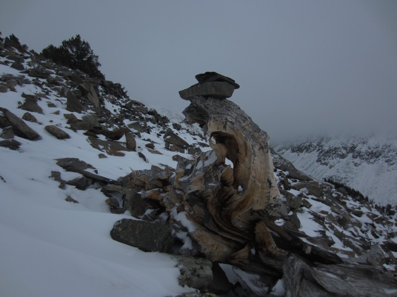
Columbia Point, Kitty Kat Carson and Obstruction Peak
Date...December 21st
Time...5:45am - 3:45pm
Distance...12.3 miles
Elevation Gain...6087 feet
Trailhead...Spanish Creek
Route...South Couloir to KC / CP Saddle, Ridge Up and Over All 3 Peaks, Down Bear's Playground
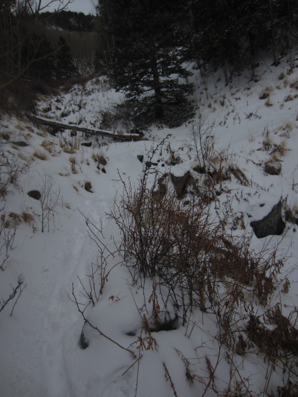
The trail starts on the south side of Spanish Creek, not the north side as written in Roach's book. I didn't notice in the dark, but the sign says this trail is private. Not sure if there is a more legitimate way to access the Spanish Creek Trail...maybe further up the road? Even in the dark, I found the trail was not too difficult to follow...much easier than Cottonwood Creek. The trail crosses over the creek a few times before staying high on the south side.
The Prow comes into view.
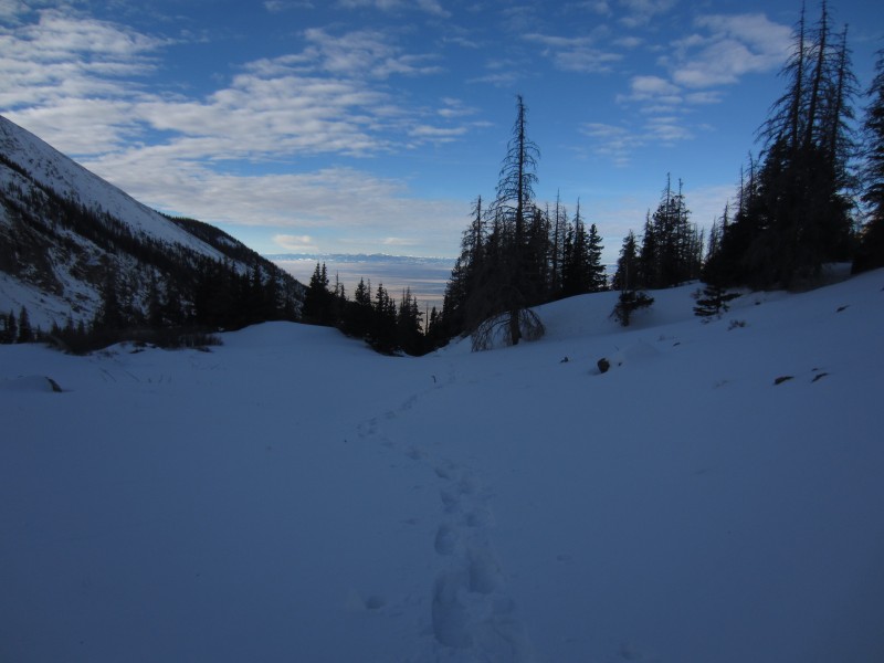
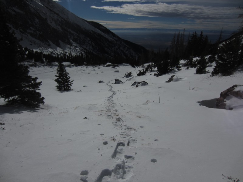
Looking back down the valley as I break out of the trees. There are 2 things that give me a jolt of energy during these winter hikes...the sun coming up after an alpine start and putting the trees behind me.
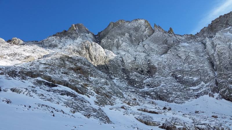
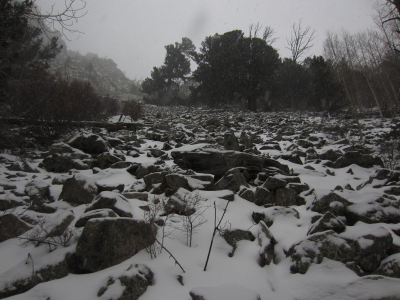
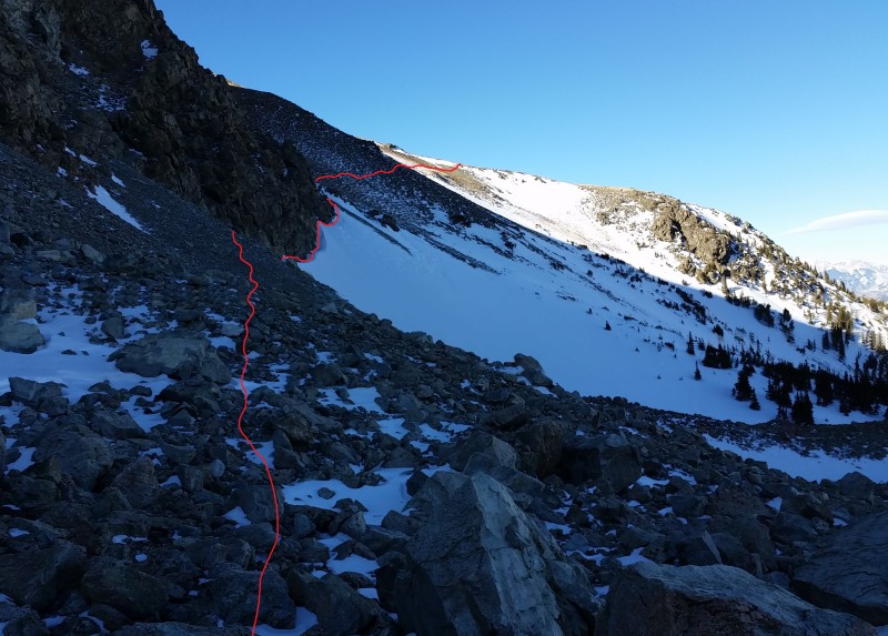
The South Couloir is bordered by the Prow on the left and the South Ridge of Columbia Point on the right.
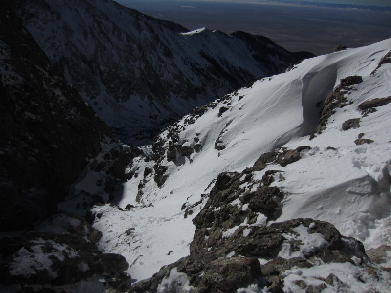
Avy danger was pretty much non-existent, but the snow was dry and unconsolidated so I opted for the rocks on the west side of the couloir. This made for trickier, but more efficient travel.
Top half of the couloir
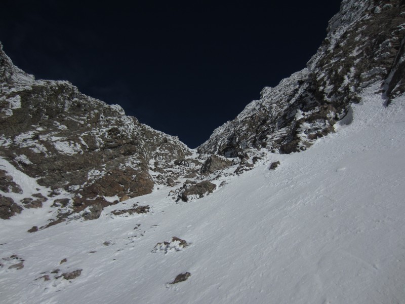
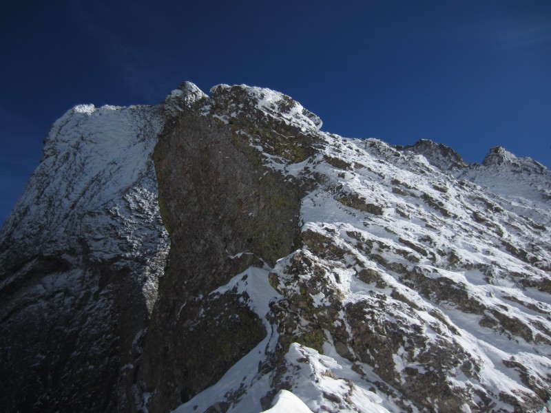
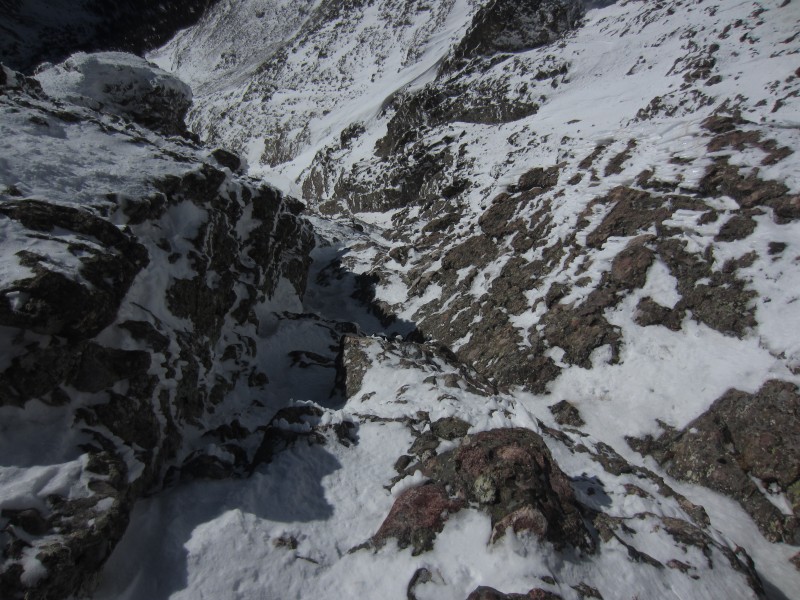
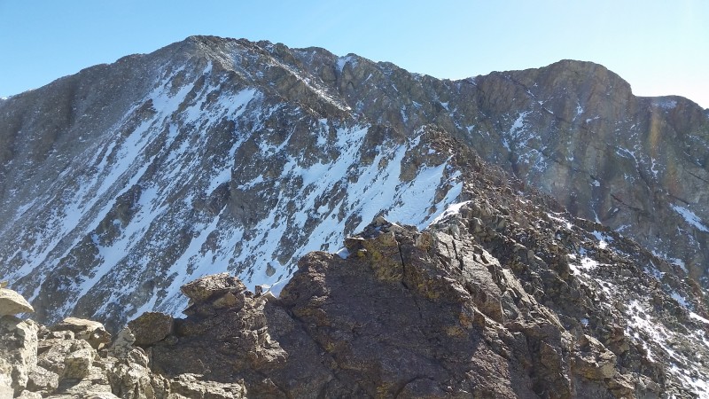
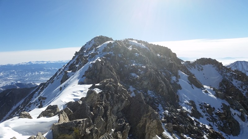
The only part of this day that I was worried about was the section of ridge from the saddle to the summit of CP. In the summer, this is just a 3rd class scramble. The snow-plastered rocks definitely elevate the difficulty.
The crux is the initial traverse to the right of a tower and then a steep, exposed gully that leads back up to the ridge. This is looking down the gully.
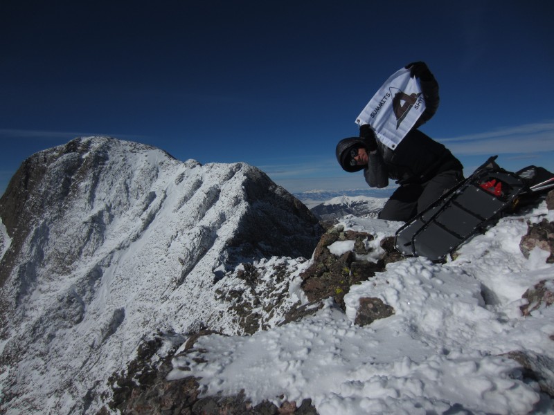
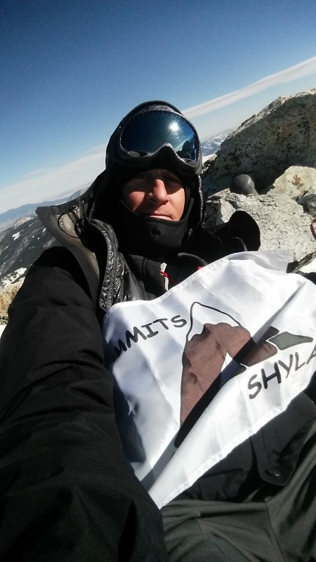
Summited at 12:15pm and the weather couldn't be better...temps in the 20's and no wind. I was able to get enough cell phone service to video chat with Dani, Brooke and Ben. Oh the comforts of modern day mountaineering.
Here I am flying my Summits for Shylah flag. Quick update on my niece...she is 5 years old now and her cancer is in remission. Back in November her wish for a princess-themed RV trip to Disneyland was granted by the Make-A-Wish Foundation as their 6000th wish.
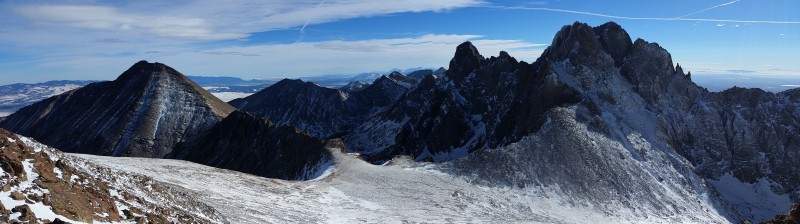
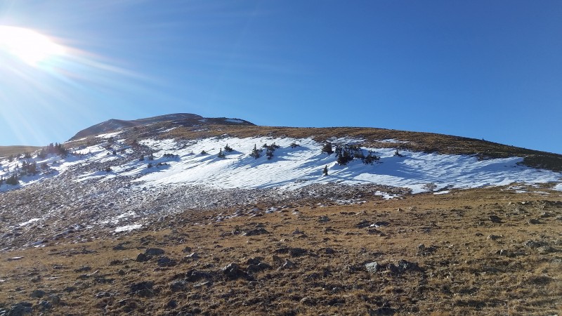
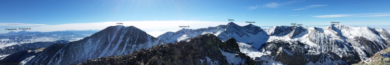
left to right...Obstruction, Kitty Kat, Columbia Point, Kat Carson and Challenger
left to right...Humboldt, Bear's Playground, Needle and Peak
On the way back out, I thought about Steve's dog Cooper and his epic journey down this valley back in May of 2011. If you don't know this story, it's worth the read.
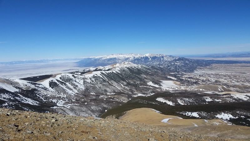
The views of Crestone Peak's north side did not disappoint.
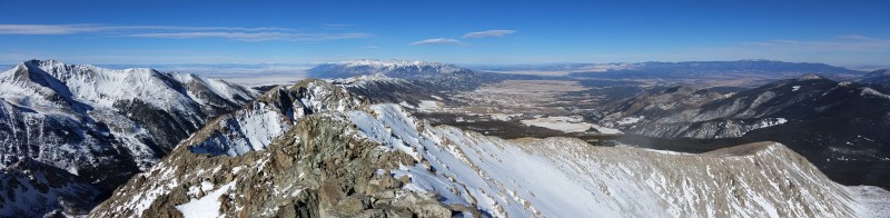
One of my favorite things about west side routes in the Sangres is this view and racing the sun on the hike out.
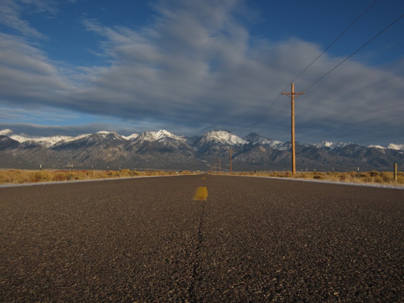
The road to Crestone. Namaste.
California Peak
Date...December 22nd
Time...7:45am - 2pm
Distance...9.5 miles
Elevation Gain...4807 feet
Trailhead...Zapata Falls
Route...Zapata Lake Trail to West Ridge
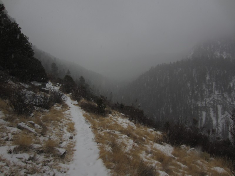
Snow was falling when I woke up in Alamosa, but I didn't have any issues getting to the Zapata Falls Trailhead.
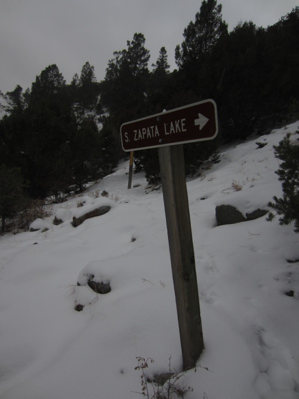
I followed the Zapata Lake Trail for 3 miles or so.
I wasn't sure about the best place to turn off the trail to gain the ridge. I chose this talus field on the way up, but should have waited another 1/4 mile where the trail crosses California Creek.
I was surprised to find cairns all the way through the trees on the ridge.
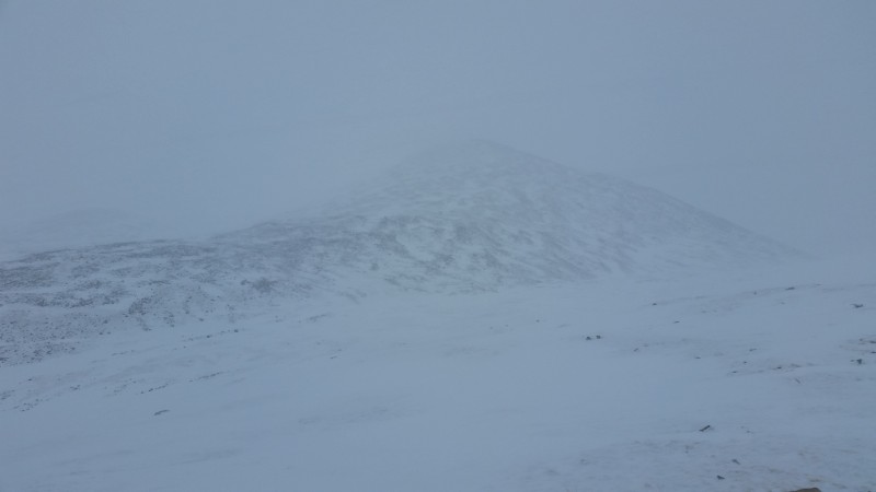
It snowed all day and made for some of the worst conditions I can remember. The wind was whipping and I had a hard time staying upright. And this ridge has an endless amount of false summits. This may not be the case when you can see where you are going, but on this day I was convinced I had the summit in sight at least 10 times. It felt like a bad dream.
Summited at 11:30am
When I turned to head back down, I was immediately disoriented. My tracks were gone and I could only see 50 feet or so. The batteries on my gps were dead and I really didn't want to have to fumble with a compass and map as cold as I was. Strava to the rescue! I pulled out my phone and was able to use my Strava track to stay on route. I had to check it every 3 minutes or so to correct my course. The descent back to treeline sucked, but could have been worse. I easily could have started down towards Lily Lake on the east side. This is why I always carry 3 forms of navigation.
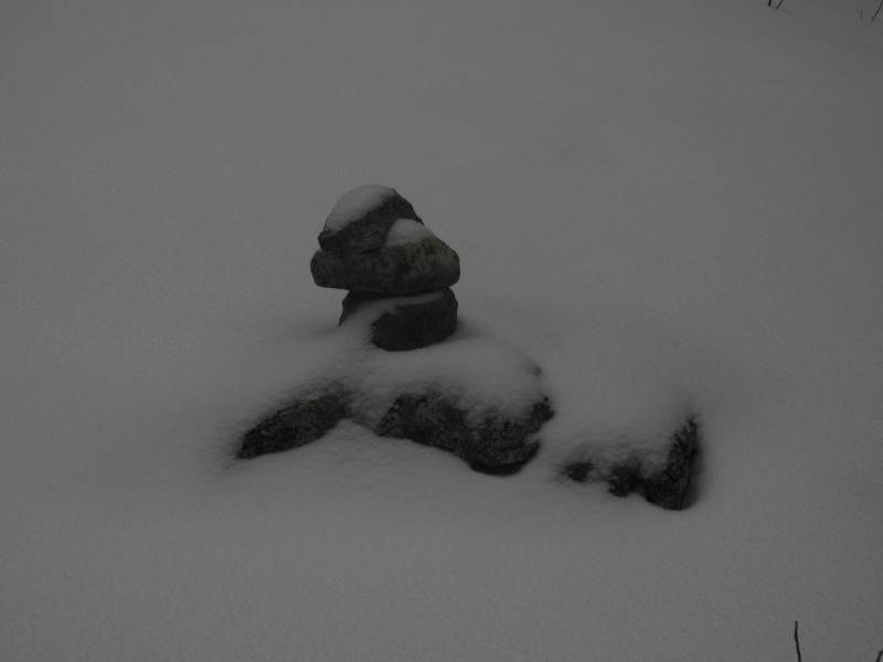
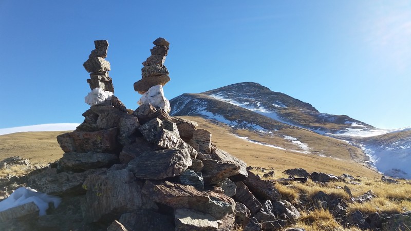
How great is this cairn?
Zapata Lake trail and the intersection with Californa Creek...this is the best place to leave the trail to access the ridge.
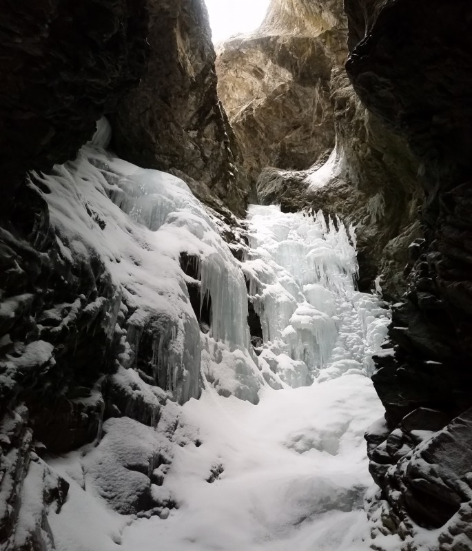
I took a quick detour to check out Zapata Falls
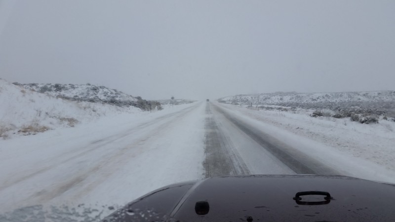
Just when I thought the fun was over, I got to drive home in these conditions. Fortunately, it stopped snowing after La Veta Pass and I was able to make the drive back the Springs in 3 hours.
Pt. 13,555 and Huerfano Peak
Date...December 30th
Time...6am - 4:45pm
Distance...16.8 miles
Elevation Gain...5708 feet
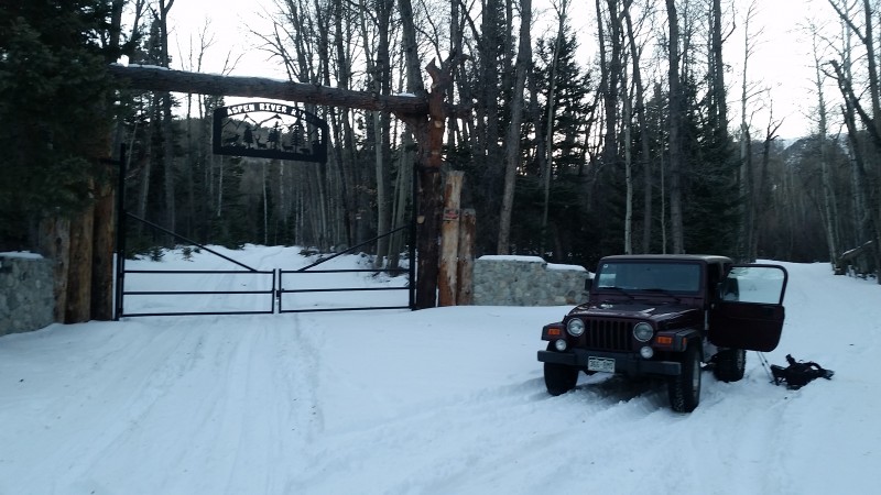
Trailhead...Aspen River Ranch on Huerfano Road
Route...Huerfano Road and Trail to NW Ridge, Down NE Ridge and North Slopes
I was able to drive as far as Aspen River Ranch on the Huerfano Road...and that was using chains on my tires for the last mile. This was about 2 miles further out than when we climbed Lindsey a few years ago. There is about 400 yards of soft, slick snow past the ranch that I wasn't comfortable attempting. After that, the road is pretty dry for the next 2 miles. If you are heading this way, you might want to bring a bike.
After about 2 miles, I strapped on the snowshoes and didn't take them off until I hit treeline. Mileage to the lower TH was about 4.5 miles
I knew I was getting close to the Lower Huerfano TH when I started seeing Blanca in the distance.
In this picture you can see the Huerfano trail cutting across the steep hillside and the start of the NW Ridge in the distance. Shortly after this clearing, I turned left into the trees and found my way over to the trail.
It is hard to locate at first, but the switchbacks further up are pretty easy to spot. This part of the route would definitely be the crux in snowier conditions.
There was very little snow on this ridge and I'm guessing that is not unusual. This ridge gets pounded by wind and this day was no exception.
Medano Pass and the Northern Sangres
I've climbed this route once before in the summer, but didn't remember too much about it. Here is the first view you get of Huerfano and the ridge as you approach the summit of Pt. 13,555'. The ridge has a menacing look to it from here, but it really isn't that bad. There are two towers that are easily passed on the right (west) side. I never found anything over class 3 and the west side of the ridge was pretty dry.
Second half of the ridge
Final stretch to the summit...took 90 minutes to get here from Pt. 13,555'
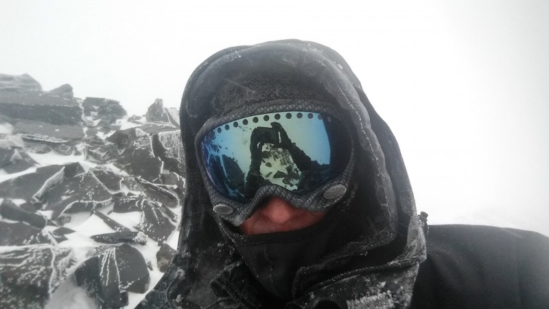
Shylah and I trying to stay out of the wind
If it wasn't so windy, I could have stayed up here for a long time. The view to the South is unreal.
I made a quick call to the fam and headed back down the mellow NE ridge. I knew I would have to do some cross-country work to get back to my trench in the trees, but this seemed like a quicker option and would hopefully keep me out of the wind.
I stayed on the ridge until the first bump and then headed down into the Dutch Creek drainage. Here is a look back up at the NW Ridge. I was able to stay on dry land across this area, aiming for the shadowed cliffs on the far right.
This part was a little tricky without an axe or campons, but my microspikes came in handy.
It was too windy on the summit to build my Brooke & Ben cairns, so I stopped just above treeline and built these...Pt. 13,555' in the distance.
One of my favorite things about hiking in the winter is the reward you get for all your uphill work. When I'm exhausted towards the end of a long day, I love to settle into the trail I broke and not have to think at all about where I need to go. The hike back out was pretty great. I almost didn't want it to end.
Thumbnails for uploaded photos (click to open slideshow):
I have no doubt Steve would be honored by this report and the homage you pay to him, although he would deflect it in some way and tell you that you inspire him. As you do me. I just don't have what it takes to do what you do in winter (or summer, or fall, or.....)!
Nice report Mike, thanks for posting your adventures. Your spot track doesn't do enough for me. ;)
"I followed the Zapata Lake Trail... 1/21/2017 1:36am
...for 3 miles or so. I wasn't sure about the best place to turn off the trail to gain the ridge."
Past the Wilderness marker there's a cairn (on right?) and an aspen on your left with "North Fork Trail" carved into the trunk. It runs through the trees and where it starts to descend to the right, you take a the fork to the left to continue up to the ridge. There's even trail above the last trees.
Caution: The information contained in this report may not be accurate and should not be the only resource used in preparation for your climb. Failure to have the necessary experience, physical conditioning, supplies or equipment can result in injury or death. 14ers.com and the author(s) of this report provide no warranties, either express or implied, that the information provided is accurate or reliable. By using the information provided, you agree to indemnify and hold harmless 14ers.com and the report author(s) with respect to any claims and demands against them, including any attorney fees and expenses. Please read the 14ers.com Safety and Disclaimer pages for more information.
Please respect private property: 14ers.com supports the rights of private landowners to determine how and by whom their land will be used. In Colorado, it is your responsibility to determine if land is private and to obtain the appropriate permission before entering the property.