| Report Type | Full |
| Peak(s) |
North Arapaho Peak - 13,513 feet South Arapaho Peak - 13,408 feet Mt. Toll - 12979 Pawnee Peak - 12943 |
| Date Posted | 10/30/2016 |
| Date Climbed | 09/17/2016 |
| Author | jfm3 |
| The Indian Peaks |
|---|
|
The Indian Peaks July 24, July 31, August 7, August 27 and September 17, 2016 Despite living in Boulder for four years, before this summer I had only twice ventured into the Indian Peaks. As I was planning my summer of mountain madness, I slowly discovered that the Indian Peaks are absolutely stuffed with trails, peaks and objectives that would perfectly suit my needs for mileage, vertical and sheer magnitude of effort. Even now, as the snow starts to fall up high, I am already planning even more training events in these mountains for next year. The High Lonesome Loop I first learned of the High Lonesome Loop a few years ago- I can't remember exactly when or where. Most likely I heard Adam talking about it, or read a trip report as I trawled through the world of mountain athlete blogs. While writing my July training plan I decided to schedule a run of High Lonesome towards the end of the month. I was unsure of how the session would go- could I truly run all/most of the loop, or would I be reduced to a hike? My trail/mountain running has improved immensely in the last few years but I still lack the skill to actually run up and down big peaks like so many in Boulder can. Regardless, I wanted to give the loop a try. 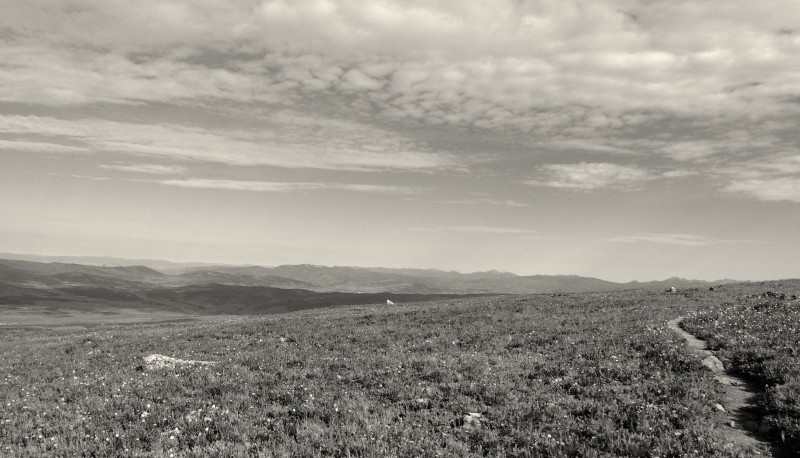 Despite reading many trip reports and trail descriptions about the high-altitude splendor of ridge running on this loop, the run did not start out in this fashion. After negotiating the rocky, boulder-strewn "road" out of the Hessie trailhead I settled into a steady run up the King Lake trail. Apart from the altitude, it was hard to tell a difference between running here and running in the Flatirons. There were, however, some tantalizing hints of what was to come. I could see a large mass of mountains to the west, flitting in and out of view through the dense forest. Because of my unfamiliarity with the area, I didn't really realize that I would soon be running across the top of the ridge ahead. The more immediate features that caught my attention were the railroad trestles on the hillside to the south. I vaguely knew that there used to be a railroad across Corona Pass, and that the now-abandoned line was a running/biking trail. 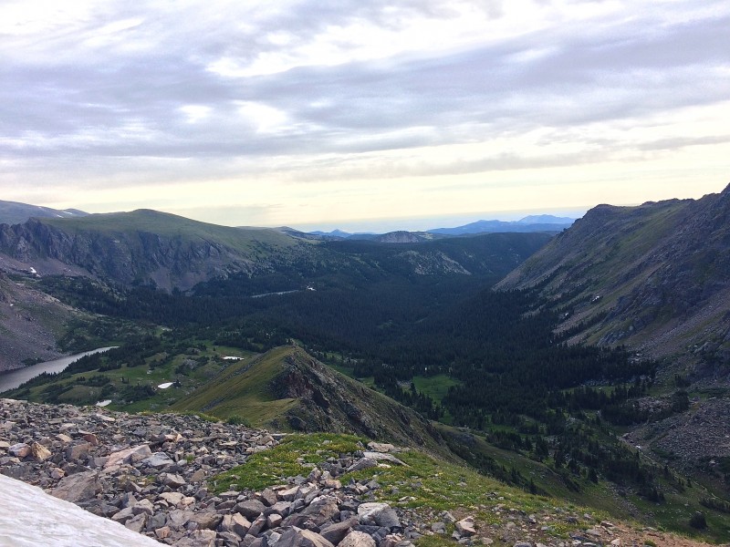 I soon discovered that the promised ridge running would be earned only by slogging up a seemingly interminable slope below King Lake. I had the lake marked on the GPS track on my watch and despite my constant glancing, the lake never seemed to get any closer. I eventually had to slow to a hike as I grunted up a few switchbacks, then through some willows, across a creek and up more switchbacks. I could see the ridge above, and the altimeter suggested I had only a few hundred feet until I was on top, but I couldn't see the lake. Soon the trail turned straight south and I could now see where it gained the ridge. Where was the lake??? As if on cue, my watch finally dinged and I could finally see the water, hidden behind a large talus block. The lake is nestled directly underneath the Continental Divide, hidden from all approaches. It had taken me about 2 hours to ascend the 6 miles and 2,400 feet to the lake from the car. After taking a fueling/drink break I headed up to the ridge. I figured that the trail had to turn north at some point, since there wasn't really anywhere else to go without dropping down the other side of the Divide. It took only a few minutes to bop up the 200 feet to the ridge. As I neared the crest, I could see a listing signpost sticking out of the tundra, arrows pointing this way and that. The GPS track showed the loop going to the right, and sure enough I could see a trail snaking up the next bluff to gain the true crest of the ridge. 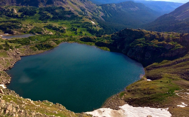 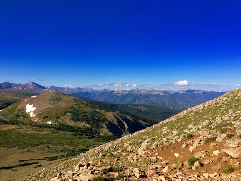 The moment I gained the ridge and looked to the south was the best of the entire run and instantly made the first 6 miles worth every second. I could see all of Winter Park, US 40 up and over Berthoud Pass, the mountains near the pass and I-70, Grays/Torreys Peaks and even parts of the Gore Range way to the west. I was the only person in sight and the air was completely still. Now I understood all the hype about the 3 miles along the High Lonesome trail. This section of the loop was unlike anything I've ever run- being on singletrack with the entire world spread out below is far different than hiking the typical 14er trail. I still had another 200 feet to gain before I was on the highest point of the ridge. 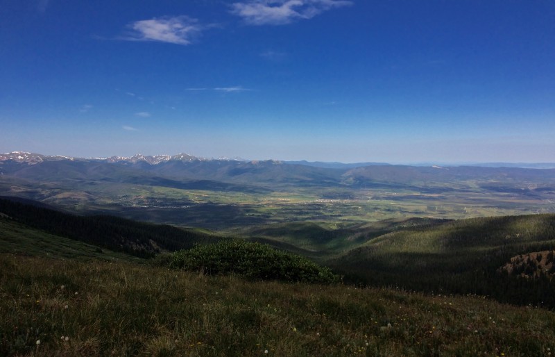 The 3 miles atop the Continental Divide are essentially flat, so running is easy and it's impossible to not stare across the sky. I cruised along, head constantly swiveling, identifying everything I could see below me. The jagged profiles of the 12ers and 13ers in the central Indian Peaks split the horizon ahead, with Longs Peak and the skyline of southern RMNP even further afield. I could see Devil's Thumb and Snow Mountain Ranch to the west. Many times I'd looked up from the ski trails at the ridge, and now I had both perspectives. The ridge quickly came to an end- time to cross the Divide and head back down. By the time I reached Devil's Thumb Pass I knew I was going to run the entire loop again this summer. The 3 miles atop the Divide made the entire run well worth the effort. Descending Devil's Thumb Pass proved to be a tricky affair. I crossed over the crest and immediately encountered a large snowdrift. No matter, I'll simply follow it to the solid ground ahead. I headed straight across and soon realized that the snow did not in fact extend to the ground, but instead ended abruptly above a 400-foot drop down to the tundra below. Hmmm. As it turns out, the drift was actually a cornice, and the downclimb was high enough that I couldn't just stroll off the snow. I slid down a few feet, then turned inward and kicked some shallow steps. 10 feet later I was back on solid ground, looking back along the considerable cornice. 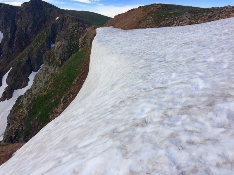 The remainder of the loop was trail running at its finest- secluded lakes, high ridges above the valley and not a person in sight until a few miles before the trailhead. I was tiring slightly but the location and run-ability of the loop far outweighed any feelings of fatigue or muscular pain. As I neared the end, I passed many groups of people both returning to Hessie and just starting up the trail. There is always a stark contrast between the afternoon hikers and me. They are wearing jeans and inching along, perhaps a bottle of water or a jacket in tow. I am plastered in dirt, mud, sweat and sunscreen, looking very much like I've been outside for the last 4 hours. Despite 14 miles already on the odometer, I still fly by everyone. I stopped at the largest creek crossing, a mile away from the end, and stuck my whole head in the water. This drew quite the odd look from some people perched on the bridge. It was hot and I was already covered in the preceding 14 miles, so what was one more rinse? I soon made it back to the car, tired and sore but exceptionally pleased with the run. The second time I ran the loop I was focused more on making it a quality running session rather than an equal combination of mountain adventure and training. Now that I knew the terrain, had an idea of the distance/effort and knew what awaited me on the Divide, I was able to control my pace and heart rate much better for the entire run. I ran efficiently on the 4 "flat" miles out of Hessie, only occasionally glancing up at the railroad trestles and ridge ahead. I quickly hiked the approach up to King Lake, gained the ridge and ran the very short spur out to Rollins/Corona Pass. The views of Winter Park were even better today, and I ran mostly on autopilot across the top of the ridge, letting my gaze wander. After stopping at Devil's Thumb Pass, I negotiated the cornice without hesitation and settled into a brisk clip down the trail, aware that I had 6 miles of excellent downhill awaiting me. With the bulk of the scenery behind me, I focused on maintaining a steady heart rate and good running pace even as I grew tired and the day grew hot. Because of the diversion to the first pass, the second loop was 15.5 miles, at that point the longest session I'd ever done on foot. With two High Lonesome Loops complete, plus another run in the Indian Peaks, I was now confident in my ability to truly run a long, technical route in the mountains. Pawnee Peak & Mt. Toll The weekend after I ran High Lonesome I ventured into the central Indian Peaks to start exploring the more rugged, prominent 12er and 13er summits accessible from Brainard Lake. 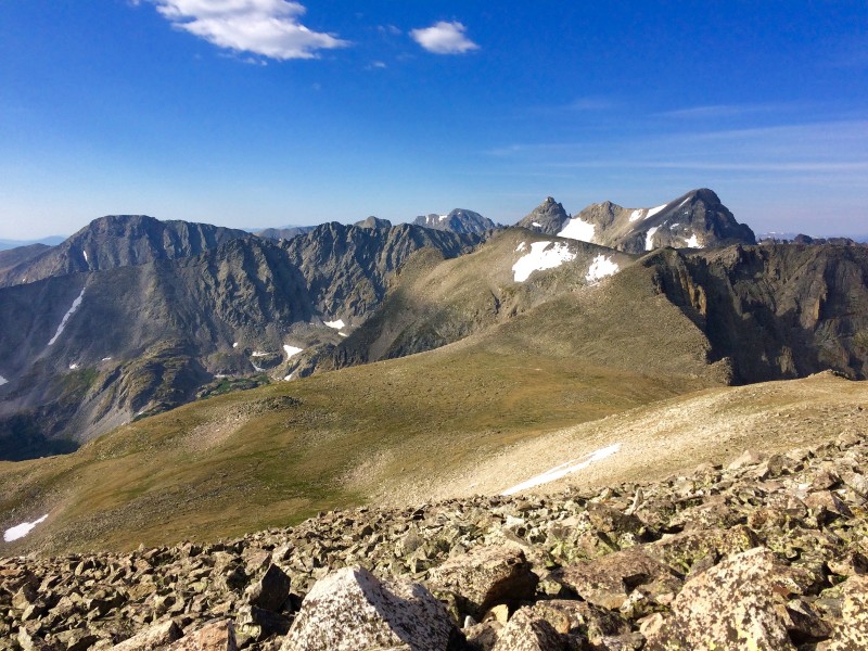 This particular run came only 12 hours after an epic day of training in Frisco that included a hike of Buffalo Mountain and a 37-mile rollerski. This was also my 6th epic mountain session in the last 9 days, and would be the end to a 67-hour month of training in July. Some fatigue would be expected, but I awoke at 4 am excited to go. I drove past Brainard to the trailhead as the sun was rising. The light was a washed-out red, glowing on and illuminating the enormous headwall of the Continental Divide to the west of the parking lot. My original plan was to run/hike up to Pawnee Pass, then ascend the 400 feet to Pawnee Peak, then see how I felt and what time it was before making a decision on Mt. Toll. The first 2 miles from Long Lake to Lake Isabelle flew by- the trail was flat, the air was calm and the jagged ridges of the Kasparov Traverse and Navajo Peak were tinged gold by the sun, casting shadows on the Isabelle Glacier, nestled high above the lake in the deep recesses of the mountains. The climbing started in earnest as soon as I passed Lake Isabelle. As I ascended the switchbacks I couldn't discern Pawnee Pass in the rock above- everything looked like a huge headwall. At 11,600 feet I gained the top of the large bluff overlooking Lake Isabelle. From here I could now see that there was a large shelf between me and the bottom of Shoshoni Peak, and that the trail to the Pass went up the side of this shelf and disappeared over the top. The ridge from Apache to Navajo was now much closer and looked even more rugged than before. 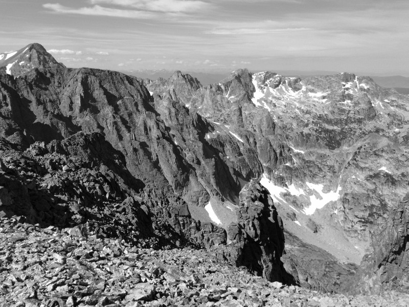 The remaining 900 feet up to Pawnee Pass was a mix of hiking and running- I would drop to a lower speed when the grade pitched up or when the footing was too uneven to really run. By the time I gained the pass the wind was blowing steadily. I took a picture at the sign, then followed the trail to the very western edge of the plateau before turning off to the spur up Pawnee Peak. Before heading up I took a look over the western side of the pass into the Cascade Creek "cathedral" on the other side. I could only see the upper reaches of the enormous cirque, but what I could see was staggeringly impressive. During my many hours of reading trip reports and route descriptions, the west side of Pawnee Pass was frequently mentioned as having some of the most extreme, improbable terrain anywhere in northern Colorado. What little I could see certainly seemed to fit this description. 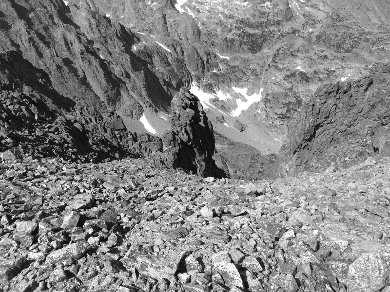 But the west side of Pawnee Pass would have to wait for a few weeks. I continued up the vaguely defined trail to Pawnee Peak. This 400-foot bop up the talus was remarkably similar to any number of 14ers- lots of rock and a vaguely defined "summit" somewhere out of sight behind a rock shoulder. I reached the top quickly and immediately donned my jacket and gloves. The wind was blowing steadily from the west and I hunkered down behind a rock shelter. I was only 2 hours into the outing, so I decided to head over to Mt. Toll. There was no trail over to Toll, so I headed west on the top of Pawnee for a ways and then descended directly down the talus. It was steep, but most of the rock was solid and I even found a few dirt trail segments. I broke into a slow run upon reaching the saddle between Pawnee and Toll, 400 feet below the two peaks. The running was short-lived, as I soon reached the bottom of Toll and started up the rocky, steep slope. Most of the climb up to the summit was class 2, though there were a few higher ledges/moves I made just because the rock was right in front of me. I reached the summit of Mt. Toll under 3 hours elapsed time from the start. This was much more of a summit than Pawnee- small, unencumbered on all sides and (miraculously) no wind at all. 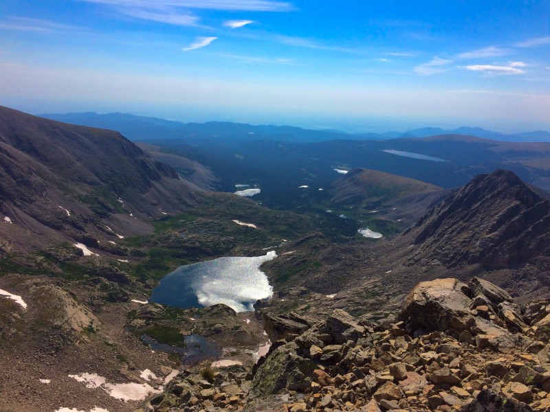 I spent almost 20 minutes on top of Toll, admiring the scenery and taking pictures. I went over to the west side of the summit and looked 3,500 feet down to the bottom of the Cascade Creek drainage. The northern downward view reviewed the 5th class scramble up a few cracks from the Paiute-Toll saddle. I could also see the peaks to the south, as well as distant views of the I-70 Front Range peaks and the mountains above Boulder. Eventually it was time to head down. I went straight down the talus, not really running but certainly moving faster than a hiking pace. Lots of descents of Fern and Shadow Canyons in Boulder, plus all the 14er routes, gave me a fair amount of confidence to speed down the rock. There were a few looser boulders that wobbled a few inches as I stepped on them, but I was quickly off them and onto the next. 10 minutes later I was back at the saddle, looking up the considerably steeper north side of Pawnee Peak. I ascended a different line than I descended on the way over to Toll, going directly up to a lingering snowdrift and then slowly gutting my way up the talus next to the snow. There was certainly no running here- just a hands on knees power hike up to the top, a quick break for photos and then an easy run down the other side to Pawnee Pass. I was now at about 3 hours of moving time, with another hour and change back to the car, which would be the perfect duration. Once I hit the trail at the sign atop the pass I settled into a pace that kept me between 145 and 155 bpm. The upper stage of the descent off the pass was fast- I had to take my jacket off because I got too hot. Once I dropped down below the second shelf, it was a truly downhill trail and I felt comfortable pushing the pace on the rocky, stair-like trail. I descended 1,300 feet in 30 minutes- not terribly fast, but this did include a stop to stow my jacket and a flat section above Lake Isabelle. I was starting to encounter the hordes of day hikers venturing out to the lake. Everyone was gracious about pulling off to the side and letting me run by. I came upon a few parties who were moving with a lot of gear or a lot of people, and rather than make them move, I simply ran over some rocks next to them, there and gone before they could really notice. The final 2 miles from Lake Isabelle back to the car went quickly- it's pretty easy to run at a good pace on a wide, flat dirt trail. I passed yet more people- I was now past the day hiker crowd and into the tourist crowd. Lots of people in jeans and sandals were wandering around as I flew by. When I finished, I sat for several minutes in the shade, reflecting on the run. I took many good pictures, kept a great heart rate, fueled well and avoided any mishaps. More importantly, I completed another mountain run, and I ran most of it. I was realizing that mountain running is not all running all the time- running the flats and descents are easy, but the trick is in knowing how to run the ascents, and when to break into a hike instead. On this outing, the sections of prolonged hiking were the two tiers of ascent up Pawnee Pass and the talus slopes up Pawnee Peak and Mt. Toll. Aside from these segments, I comfortably ran everything else. After running this route, sandwiched by two laps of High Lonesome, I was confident enough to plan my most ambitious route yet- Crater Lake from Brainard Lake. Pawnee Pass and Crater Lake I came across this route while scrolling through trailrunproject.com looking for another long run to do at the end of the summer. Despite completing an absolutely demanding, exhausting 20-mile circumnavigation of Glacier Gorge in RMNP only 6 days previously, I was still treating the Crater Lake run as the biggest and baddest entry of my summer running portfolio. It was similar to the GG loop in terms of numbers- 18 miles and 5,300 feet of vert, while GG was 20 miles and 4,800 feet. But, Crater Lake had several factors that upped the badass-ness. First was the committing nature of the run; it was an out and back in the truest sense. Once I crossed over Pawnee Pass I was committing myself to 14 additional miles of running, regardless of weather, or how I felt, or whatever. Second was the west side of Pawnee Pass. I knew the rough lay of the land from my Pawnee Peak run, but now I would descend (and then re-ascend) the entirety of the beast. Finally, this run really defined the word "isolated" for me. I did not see another living soul from Long Lake to the Cascade Creek trail junction on the way back from Crater Lake. Dangerous, I suppose (only if I were to be injured or incapacitated) but also a truly intimate way to experience nature. For the first 3.5 hours, I alone would be surveying, traversing and experiencing the landscape. The 4 am wakeup couldn't come fast enough. The first 4 miles/100 minutes were largely familiar, since this stretch was a repeat of the Pawnee Peak run from a month earlier. I reached the pass without incident, took a break to drink, eat & take photos, then prepared for the descent down the west side.  Almost immediately after dropping below the pass, the trail changed from good tundra to a precipitous, tenuous, rocky scratch of a line down an incredibly immense, rugged face. The trail surface was half scree, half loose rock, and was so cunningly constructed that I often couldn't see the next turn until I was right on top of it. After taking a few minutes to get my bearings on the rock, I looked up. The vista in front of me was the most improbable, wild, inaccessible terrain I'd ever seen in Colorado. The path, barely visible, plunged down the west face, switchbacking far, far below and eventually disappearing into the rock. To the right (north), an enormous ridge guarded by two huge ribs of rock extended 1,000 feet upward, blocking out any view of the peaks beyond. Ahead, the ground simply fell away to open air, revealing Pawnee Lake as a blue smudge on the valley floor. To the left, the face below Shoshoni Peak presented intimidatingly large spires and gendarmes that rose so severely off the ground that my whole sense of scale and orientation was disrupted. Somehow, a trail wended its way through this landscape, picking out a route down the face and across the tundra above Pawnee Lake. I had to keep returning my focus to the difficult footing on the trail, despite wanting to keep my eyes glued to the moonscape in front of me. I would periodically look back up to the pass, amazed by how far away and seemingly inaccessible it appeared. Before long I was down on the tundra, approaching the lake. Now the towers above were 3,000 feet off the valley floor, flanking the approach to the pass. Somehow, I would have to get back up that on the return trip. 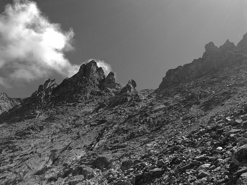 The miles past the lake and down to the Cascade Creek intersection were fairly routine- big mountain peaks and ridges above, lots of pine trees and underbrush near the trail. I cruised along here without too much thought or effort, focusing mostly on the views of Lone Eagle Peak, now to my left and up the next valley. As I neared Crater Lake, the ridges between me and Pawnee Lake got higher and higher. Lone Eagle Peak itself dominated the view ahead, while behind it the even more distant and inaccessible Apache Peak loomed, guarded by the gnarly, jagged profile of the Chessmen. Compared to the much more benign topography to the east of the Divide, this side of the Indian Peaks was almost frightening in its appearance. I reached Crater Lake in exactly 3 hours of moving time. I perched on a rock near the shore and surveyed the mountains ringing the lake. Lone Eagle Peak towered above everything else, its "summit" and connecting ridge commanding my attention. I found myself eyeing a line up the side, wondering if it exceeded class 4. Soon it was time to return. As soon as I left the lake, all I could think about was the monstrous climb that awaited me below Pawnee Pass. After the slight descent to Cascade Creek, it was 4 continuous miles and over 3,500 feet of ascent to the top of the pass. I hiked a fair amount of the trail up to Pawnee Lake, where I took a break and prepared myself for the next hour (or more) of the outing.  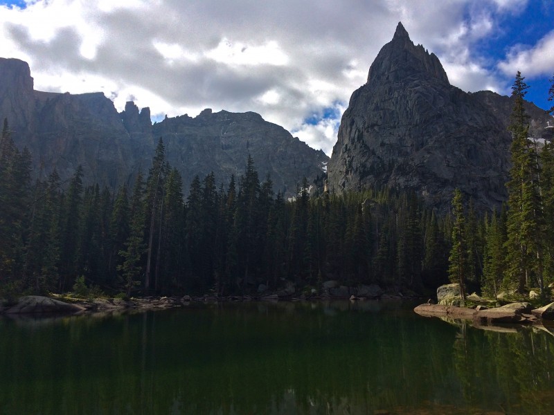 The first section to negotiate was the tundra stretch, which gained 500 feet from the lake. This was not very enjoyable- my legs were starting to fatigue and the trail was at an annoying grade somewhere between running and hiking. After slogging up to the rock, I settled into a hike and once again marveled at the impossible terrain around me. The face of the pass rose 2,000 feet directly above me. Despite the already-precipitous gradient, the almost-freestanding spires and towers were somehow more vertical than the larger face. My perspective was completely thrown off. Here I was, inching upward on a face of sheer rock that stretched to outer space. 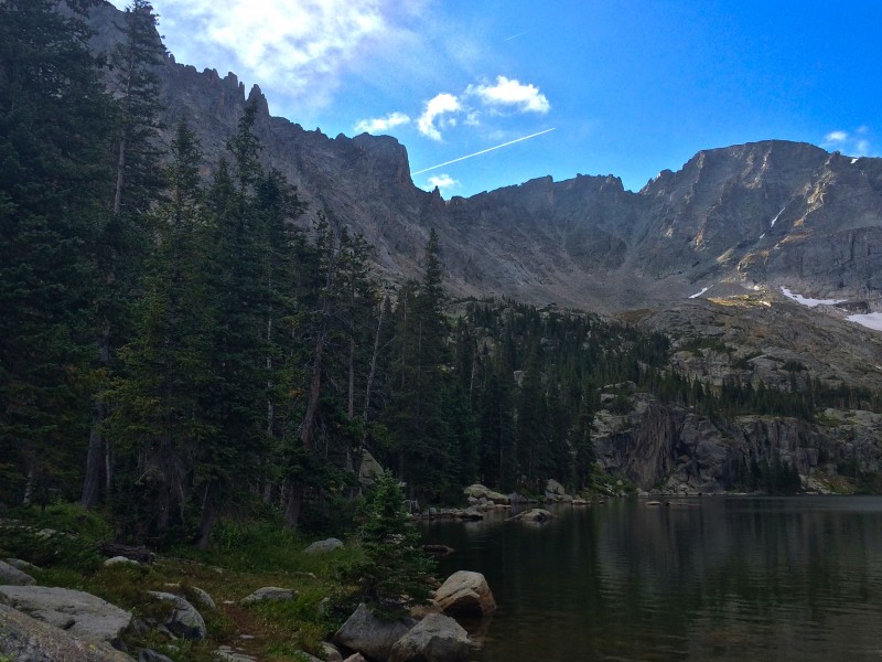 It took me 40 minutes to ascend the 1,300 feet up the face to the pass. I hiked the whole way, willing my legs to keep moving as the trail grew steeper. I had to stop about halfway up to put on my jacket, as the wind was growing stronger and colder. Because the trail climbs so severely, the top of the pass is hidden by the upper edge of the face. Not until I popped out on the tundra did the slope finally relinquish. The terrain instantly turned from rocky moonscape to rolling, talus-strewn tundra. I took several minutes at the pass to rest my legs, eat and catch my breath. Now that the vertical mile of ascent was finished, all that remained were 4 miles of downhill back to the car. My legs were certainly starting to fatigue, but after banging out the climb up the pass I was not so concerned about a long stretch of descending. Before continuing, I took one last look down the west face. 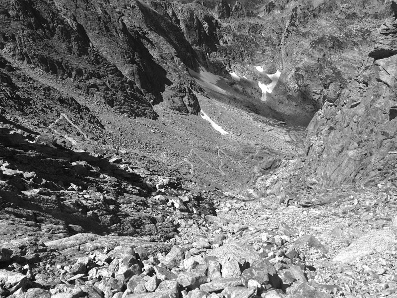 The next time I'm atop Pawnee Pass will likely be during one of next summer's huge training sessions. The Buchanan-Pawnee Pass Loop has been a "some day" outing I've thought about for several years, and now I finally have the fitness and experience necessary to do it without killing myself. It will be an extreme run, as any over 20 miles and a vertical mile are, but now I know how to ascend Pawnee Pass. After completing the Crater Lake run, my 4th Indian Peaks session, I was convinced that these mountains offered some of the best terrain and views in Colorado. The Arapaho Peaks My final training session in the Indian Peaks was in mid-September, when I summited both the Arapaho Peaks. My main goal with these mountains was to comfortably complete the traverse between the two summits. After gaining a modicum of class 3 experience throughout the summer, I wanted to extend my ability on a more difficult route. The hike up and down from South Arapaho Peak was as routine as it gets, so I will just detail the traverse. Upon reaching the top of South Arapaho Peak, my first item of action was to quickly put on every spare layer of clothing I had in my pack. It was probably 25 degrees with a brisk wind and large fluffy clouds blocking out most of the sun. After completing my usual summit routine of eating, drinking and taking pictures, I decided to get moving before I froze in place on a rock. As usual, I did an extensive amount of scouting and research before heading up the hill. The 14ers website lists the traverse as class 4, while most of the trip reports I read put it at a modest class 3, with sections both easier and somewhat harder. Most of the beta I found indicated a smooth slab climb and ensuing tower downclimb as the crux of the traverse. I went armed with a route description, but I wanted to use it only if I was truly stuck. 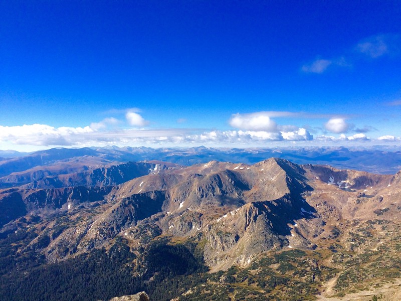 The first section of the traverse passed quickly- it was no harder than class 2 and I was more focused on warming up my hands than finding the best route through the rock. There was one slightly vertical section that was easily bypassed, and more wending along some easy sloped slabs. I was able to find a few of the faded orange arrows painted on the rock but the line forward was quite obvious. After descending a bit, I came around a corner and saw the crux slab. Well, that doesn't look too bad. I had to stem a move to actually get to the base of it, and then just pinch the top crack and take one big step in the middle of it while leveraging myself up. Not a problem. I thought the harder move was going up and over the rock tower at the top of the slab. With the wind whipping around, the top perch and narrow downclimb were definitely more exciting than the slab. I continued on through more slabs and ledges, trending west to follow the lowest path through a few more towers. Eventually I came to the second spot that often received mention in written accounts- a slightly overhung class 4 slab atop a crappy dirt gully. I entertained no thoughts about trying to go down the overhang, and instead scouted a decent route down the west side of the rock. This was class 3- some thin ledges and large steps, but the exposure wasn't tremendous and the rock was solid. I cleared the overhang without incident and started to ascend again, looking for the gully that would take me up the summit block of North Arapaho now looming directly overhead.  I again trended west, climbing upward along a mixture of dirt trail and large slabs. This route took me right up to the bottom of a gully on the west side of the summit block, which led right up to the top. The gully was a mixture of dirt and awkward boulders choked up at the top. Getting up was not hard, and I popped out about 30 feet below the true summit. The remaining rock was almost flat, sloping gradually upwards to the enormous summit cairn. 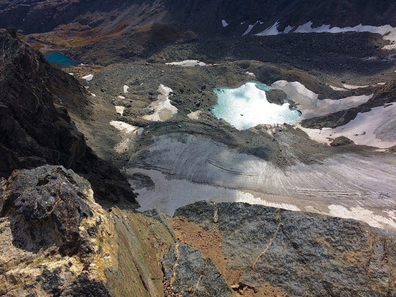 I hunkered down behind the cairn and surveyed the land. The glacier was right below my feet and I could see only part of the traverse. The summits in the central Indian Peaks overlapped each other to the north, with Longs Peak visible in the distance. I could also see directly east to Boulder and the Flatirons. As always, the perspective was much different from on top of the peak than down in town. Beyond the lakes near the glacier, the terrain was mostly lost in a haze of pine trees. Several of the lakes were almost minty green in color, contrasting with the white of the glacier and blue of the lakes farther down the valley. The return traverse offered a completely different perspective. Now I could see most of the line over to the back of the crux slab. The sun was also out. It took some time on the way over for my hands to warm up, so I was glad for the extra warmth. I headed off the summit and mistakenly took the wrong gully down. I realized my mistake about 20 feet down the chute, as the ground simply ended beyond a large rock. Below the rock was nothing but a steep dirt chute leading to an indistinct line of cliffs, then the glacier another 1,000 feet below. Well, we don't want to go that way. I quickly went back up, went farther west and located the correct gully. 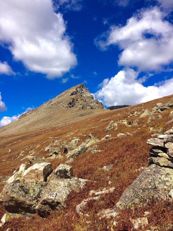 From here it was a quick downclimb and more easy scrambling through the ledges on the west side of the ridge before reaching the overhanging slab. Scrambling the thin network to the west was a fun way to bypass the area. After reaching the top of the ledge steps I continued on through the various sections of rock. As had become typical in my off-trail hiking and scrambling, unless I encountered a particularly noticeable or difficult area, the rock and routes largely blur together. I eventually reached the back of the crux slab and decided I didn't want to go up and over the tower and negotiate the downclimb of the slab. Instead, I found an exit to the west that led to a chute near the tower. The rock was fairly smooth here, but it wasn't steep and it was easy to find a route down to the ground. With the crux now behind me I made short work of the remaining scramble back up to the summit of South Arapaho Peak. My overall impression of the traverse was that it certainly had one or two sections that required careful attention, but it was no harder than Longs Peak or the Tenmiles. The routefinding was more involved simply because the terrain is more dispersed, but I never felt unsafe or uncomfortable finding a line or negotiating a section of rock. Compared to the bullseye expressway on Longs, I enjoyed picking my own way through the rock and challenging myself to find the most aesthetic or exciting route. This traverse also marked the end of my first outings in class 3 terrain. These should serve as a base for next summer and fall, when I am hoping to undertake several much more ambitious and exciting routes/objectives with scrambling and climbing. Thumbnails for uploaded photos (click to open slideshow):  The aptly named High Lonesome trail, meandering along the Continental Divide at 11,800 feet. This view is facing north. 7/24/")
 Looking east from just below Devil's Thumb Pass. Devil's Thumb Lake and Jasper Lake are visible, as are the back of the Flati")
 King Lake, seen from about 11,800 feet on the Continental Divide. The trail back to Hessie runs through the notch above the l")
 Winter Park and the mountains near Berthoud Pass, seen from 11,800 feet. 8/7/16")
 Looking down on Fraser, Tabernash, Devil's Thumb and Snow Mountain Ranch from just west of Devil's Thumb Pass. 7/24/16")
 The snow just below Devil's Thumb Pass.")
 Pawnee Pass, Shoshoni Peak, Apache Peak, Navajo Peak and North/South Arapaho Peaks visible along the Divide, looking south fr")
 The Cascade Creek Cathedral, seen while descending from Pawnee Peak.")
 Impossibly rugged terrain, 3,000 feet above the bottom of the valley near Pawnee Lake.")
 East view from the top of Mt. Toll. Blue Lake and Mitchell Lake are directly in front of me. Brainard Lake and Lefthand Reser")
 Looking back up at Pawnee Pass from maybe 600 feet below the top.")
 Re-ascending Pawnee Pass, looking up the sheer west face at the exit.")
 Lone Eagle Peak in the center, Apache Peak on the left, seen from above Cascade Creek.")
 Lone Eagle and Apache Peaks towering above Crater Lake.")
 The west face of Pawnee Pass, high above Pawnee Lake.")
 The west face of Pawnee Pass.")
 South view from South Arapaho Peak. Mt. Jasper is the closest peak, with Winter Park, High Lonesome and Grays/Torreys behind.")
 Looking back at the traverse. The overhang is the brown rock in the center. The crux slab is behind one of the towers farther")
 At the edge of the North Arapaho Peak summit. The Arapaho Glacier is directly below.")
 The large summit fin of South Arapaho Peak. The summit of North Arapaho is in shadow above the tundra, with two pairs of hike")
|
| Comments or Questions |
|---|
|
|
Caution: The information contained in this report may not be accurate and should not be the only resource used in preparation for your climb. Failure to have the necessary experience, physical conditioning, supplies or equipment can result in injury or death. 14ers.com and the author(s) of this report provide no warranties, either express or implied, that the information provided is accurate or reliable. By using the information provided, you agree to indemnify and hold harmless 14ers.com and the report author(s) with respect to any claims and demands against them, including any attorney fees and expenses. Please read the 14ers.com Safety and Disclaimer pages for more information.
Please respect private property: 14ers.com supports the rights of private landowners to determine how and by whom their land will be used. In Colorado, it is your responsibility to determine if land is private and to obtain the appropriate permission before entering the property.

