| Report Type | Full |
| Peak(s) |
Wilson Peak - 14,021 feet |
| Date Posted | 10/07/2016 |
| Date Climbed | 08/13/2016 |
| Author | JROSKA |
| Additional Members | mcklarry |
| Wilson Peak - Some Early Clouds |
|---|
|
Wilson Peak had been on my short list for the past two years, and during my preparation for it, I noticed a scarcity of trip reports focused specifically on this mountain. There are a few, but it seems like the general preference for those who publish reports is to include it in a grouping with Mt. Wilson and El Diente. I can certainly relate to why the preferred method is to climb these three peaks together. However, I recently hiked Wilson Peak as a day trip, really treasured the experience, and decided to show it some love through a report. As always, I made several interesting excursions to the high country during the summer, including my initial two 13ers, a Sneffels attempt, and a trip up the state's most expensive 14er summit. However, for me, Wilson Peak represented the centerpiece of the 2016 summer hiking season. This summit attempt was made on Saturday, August 13, with fellow 14ers.com member Larry McKenna (mcklarry). I normally work weekends, but had planned the weekend of August 12-14 off, with an original plan to climb Pyramid Peak with another party. However, he had another commitment arise, so I began to consider alternatives. I wanted to attempt something at least in the Class 3 realm, mulled over going solo, but had also been in contact with Larry via e-mail. Based on past experience, I was perhaps a bit apprehensive over teaming up with someone random from the .com. But with a little faith and prayer, I gave it a shot. Larry seemed very enthusiastic to attempt Wilson Peak, and I had really been hoping to get out there myself during the summer. Teaming up with Larry seemed to make sense. Plus, I don't really have a regular hiking partner. For mountain trips, I'd describe my structure as a small network, with a few solo hikes sprinkled in. I decided that branching out, and potentially expanding that network, was a step that I should definitely follow through on. I met Larry at his house at 11 AM on Friday the 12th, he introduced me to his wife, and I could tell right away that we would get along just fine. Feeling at ease, comfortable with someone new, we loaded up my Jeep Patriot and headed out to the San Juan's. We spent the 6 ½ hour drive conversing and enjoying the scenery of I-70.  Getting to know each other, discussing past experiences, going over potential scenarios, hiking partner stuff. Even though I had just travelled this same path a month prior, I was still struck at the growing presence of Mt. Sneffels as we headed south from Grand Junction.  Shortly before 6 PM we rolled into Ridgway & turned onto Highway 62, the home stretch to Placerville. Larry had booked a room at the Angler Inn. I wasn't originally fired up for that idea, preferring to camp. However, reading a few recent conditions reports documenting bear activity near the trailhead, was all the impetus needed to change my mind. Of course, upon arriving, we, two middle-aged heterosexual men who had just met each other, were greeted to the sight of a nice, king-sized, single bed in the middle of the hotel room. My initial frantic thought was, how cold might it get overnight while I sleep in the car. After we stood for 15 seconds or so staring in disbelief at the bed, Larry approached the front desk to rectify the issue. The reservation had indeed been for two separate beds, but a clerical error had occurred. A rollaway was promised and delivered. In the interim, we began arranging our gear for the morning. Upon reaching the car, Larry quickly realized that he had left his boots at home. We both agreed that the flip flops he had worn for the drive would be no match for a 5-mile hike up a Class 3 mountain. Likewise for my tennis shoes. And I started to wonder what was going on with this trip. These are the types of situations which, not very long ago, would have caused me to become frustrated or even angry. We had just driven over 300 miles, paid for a hotel, stood at the doorstep of Wilson Peak, with our planned start time less than 8 hours away, and only one of us had hiking boots. Once again I resorted to prayer. I truthfully told Larry that a summit was not be-all, end-all, and maybe we could just audible down to a simpler hike with attractive San Juan scenery. And that's when I noticed, lying below the hiking boots I had thrown behind the driver's seat, my pair of aging winter boots which I often use for work. In other words, I had brought two pairs of boots. In 2015 they had given me a nasty blister on Harvard but were also on my feet when I reached Crestone Needle's summit, and I offered them to Larry. Footwear, for obvious reasons, is among the more problematic gear items to effectively share, but we concluded that this offered the only chance of us summiting Wilson Peak and safely returning. Discussing the dilemma further over dinner, our general agreement was, if the boots failed early for Larry, we'd just head back and opt for a less strenuous hike. If we reached Silver Pick Basin or higher and he had to stop, I'd consider finishing solo. Not ideal, but again, as a team, we were cautiously exercising our only option to proceed. Six hours of tossing and turning would dash any hope I had of a comfortable hotel bed solving my long-time struggle with not being able to sleep at altitude. I may have drifted off for a total of 15-20 minutes at most. On a positive note, since I was awake most of the night, I did notice that the NOAA rain forecast improved to "10% before 9 AM". With a wind shift, this seemed to point toward a perfect day. Alarms went off at 3 AM, and I relayed the lack of sleep to Larry. Historically with no sleep I'm not good for much more than 3000 feet, but I felt very excited to get started; Wilson Peak had been on my radar for a long time. Larry promised a slow pace, which I knew would present my only opportunity of getting anywhere near the summit. So, each of us dealing with unique obstacles, understanding that our chances of summiting were not high, but still with great enthusiasm, we bolted out into the night. The trailhead road was fun, easy 4WD, and the stream crossing uneventful. 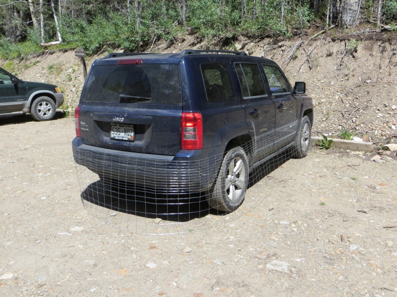 My new marmot fence was carefully placed, and at 4:30, we started hiking. Through the first mile, and after the turnoff toward Silver Pick, we employed a step-by-step approach. The boots seemed to be holding up for Larry, and I felt OK. We took turns leading, but Larry did a better job of controlling a steady pace. Not long after rounding the bend past the large outcropping and reaching the basin, first light greeted us. 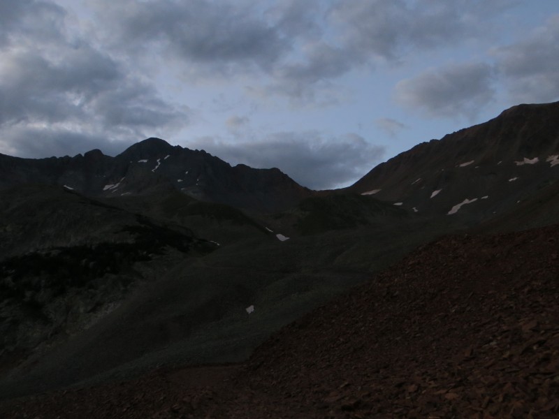 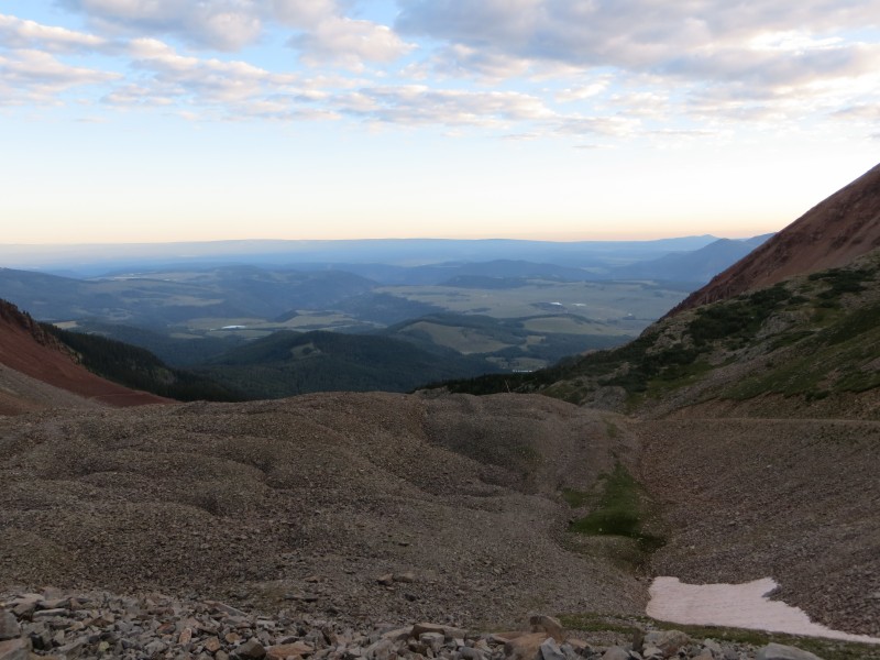 We observed building clouds, quite a bit for 6:30, but we reminded ourselves to pay no heed, since the forecast had called for a dry frontal passage in the morning.  The clouds appeared ominous for about an hour, but we never had any sense we were about to get rained on. The road steepened, and I began to drag a bit. 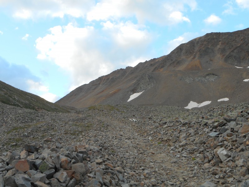 The slowed down pace had suited me well, and strangely I didn't feel incredibly tired, but dizziness had become a nuisance. Anything involving Class 3, I can deal with "tired", but I don't mess around with "dizzy". Now into steeper terrain, Larry was having no serious issues with the boots; my physical state became the primary focus. So, taking advantage of the improving weather, we took regular breaks on the steep slope heading up to the Rock of Ages saddle.  Once we reached the long straightaway heading to the saddle, I was feeling much better, much more into the climb. For the first time, I felt confident that I would reach the summit. 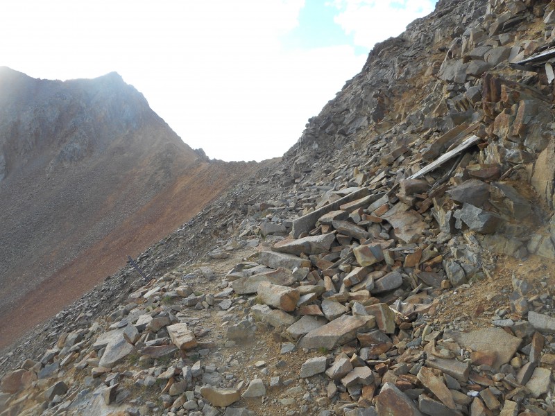 Shortly after 7:30, we reached the Rock of Ages saddle, and enjoyed the view of two 14ers I had never seen before. 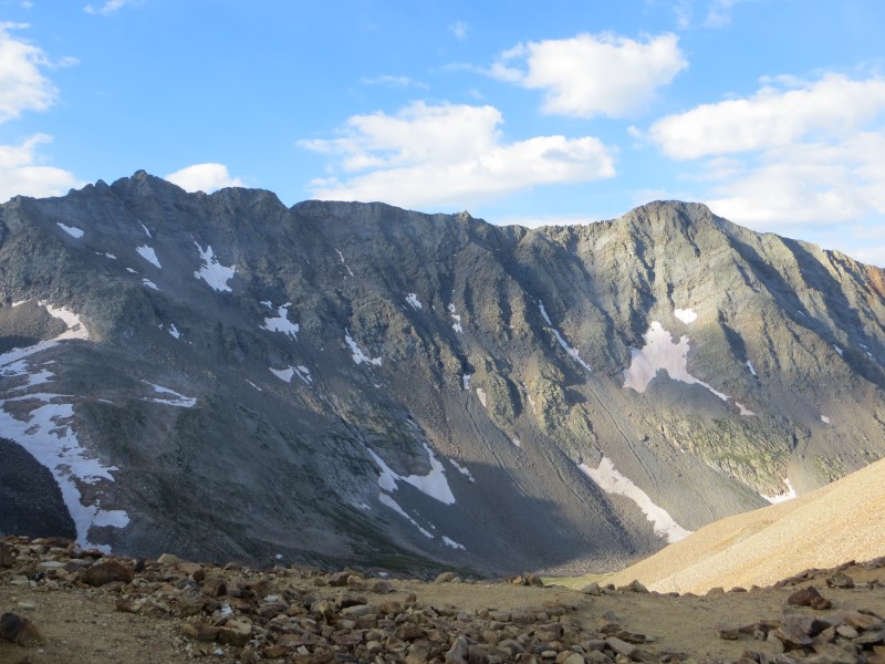 Of course, there was another break as we talked to some descending hikers. In all seriousness, the pace that Larry had set during the previous hour, and the willingness to make regular stops, made a huge difference for me. I've been on several other hikes where this luxury couldn't be afforded due to weather concerns, but that wasn't the case on this day. Tough to know for sure, but I have built up a solid database of experience in dealing with hiking 14ers on very little or no sleep. I don't believe I would have reached the saddle, had I been attempting to maintain a brisk pace. 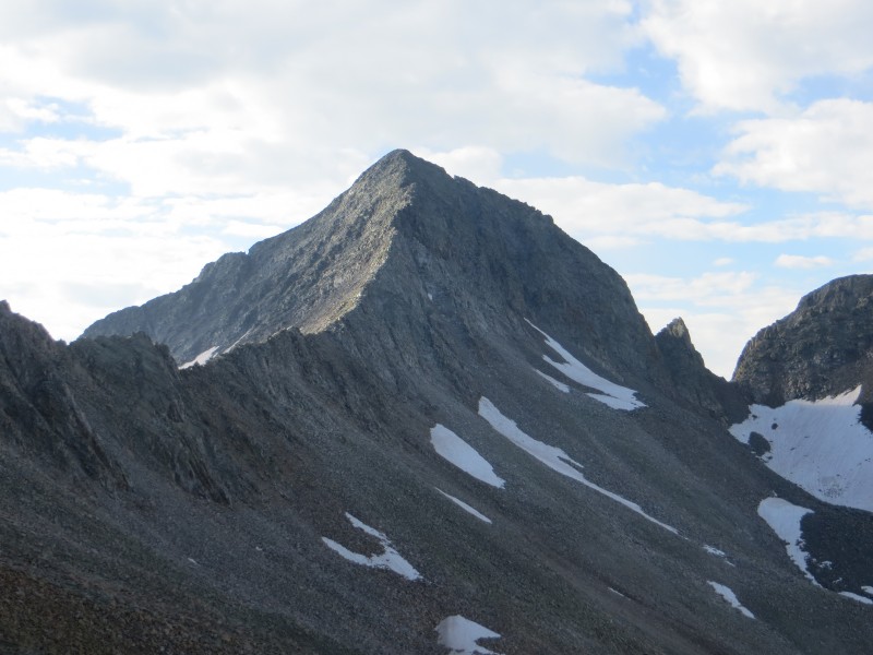 But that goal had been reached and passed, and we were quickly on our way toward the Gladstone saddle. Lots of flat, discus-like talus that seems low in friction and eager to move, in this area. 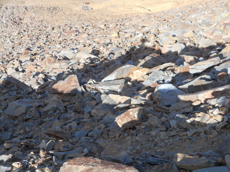 Every now and then I read reports of folks hiking 14ers in tennis shoes, I realize everyone's different and my ankles are 47 years old, but Wilson Peak doesn't seem like the best place for anything less than solid boots. At least 3 or 4 times in this area, I felt an ankle fixing to turn, as I stepped down, which is rare for me on any terrain. I could sense the boots preventing a more serious sprain. I'd also advise trekking poles up here. At the trailhead I left mine in the car because they always seem to get in the way, but just before daylight I changed my mind and found a makeshift stick while still in the woods. I was thankful for that; it was extremely helpful to have a third point of contact in that terrain around the saddles. After crossing the Gladstone saddle, we reached the Class 3 ledges.  Fun climbing, cairns here and there, but this section seemed like, pick your line. In this area, and up to the false summit, Larry and I functioned well as a team, with him in the lead checking route options first hand while I lagged behind, taking in a broader view. There didn't seem to be much need to test holds, but this short section is definitely Class 3 as advertised. To anyone considering the dropdown below the ledges to stay at Class 2, it sure appeared like it would be tedious and somewhat miserable to me. I really enjoyed taking the direct line.  Suddenly the false summit loomed close.  The rocks on this traverse didn't seem terribly loose, but again, just awkward footing. We forged ahead, and by 9:00, we stood on the false summit. And here, the inevitable stare-down of the true summit ensued. 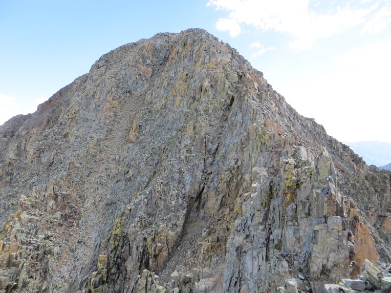 At this point, we would later agree, our behavior became a bit too deliberate, thoughtful and analytical. Despite the view ahead, neither of us could decipher the route up the summit slope. We observed a few climbers descend, and I consulted the 14ers.com crux picture, which helped. Still, we stared, studied, and procrastinated. The longer this went on, I actually began to dwell on the exposure, which isn't my nature at all. That's when Larry declared, "We just need to get moving on this". Good call. I always advise people who are apprehensive towards exposure to just focus on the task, and not to sightsee or overthink. Yet, despite both of us being "veterans" of Class 3, in Larry's case Class 4, we froze just a bit on that false summit. So it was definitely a therapeutic release to start the downclimb from the false summit, and experience the summit climb through direct contact, rather than mental exhaustion. 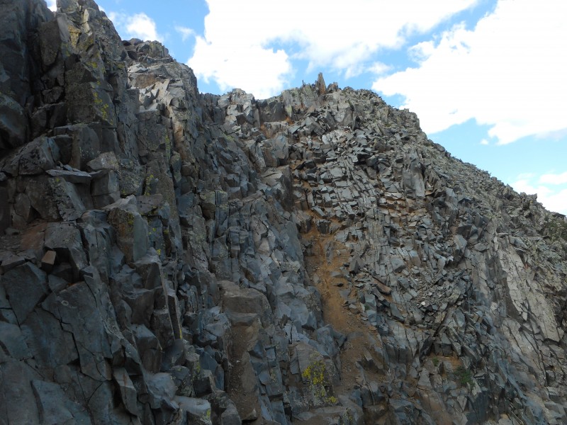 What had given me some pause was Photo #19 in the standard route description on the .com (similar to the photo above). After the downclimb, it appears to show a climber traversing laterally across an exposed area that doesn't appear to have many footholds. Not sure if this is an optical illusion, or if possibly we dropped down lower than where the man in the picture is, but the line Larry chose certainly didn't involve anything of that nature. We simply dropped down, found some (relatively) flat terrain, and climbed a line just to the right of the blackish gully insets in this picture below, exactly as shown in the 14ers.com route description. 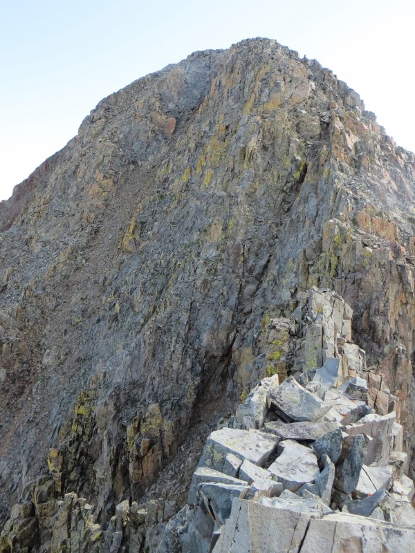 The final crux, 100 feet or so, was a lot of fun; I really enjoyed it. 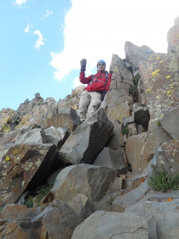 Exposed, yes. Four points of contact, of course. But I'd describe it as a straightforward, stable, climb to the summit with solid footholds and handholds. This grand finale reminded me very much of Wetterhorn. 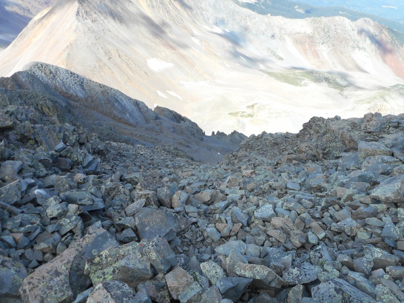 I did not encounter any portions that required extremely long reaches or steps. Just a short, solid, exciting Class 3 climb. The marquee event for the day. At 9:30, we stood on the summit of Wilson Peak. 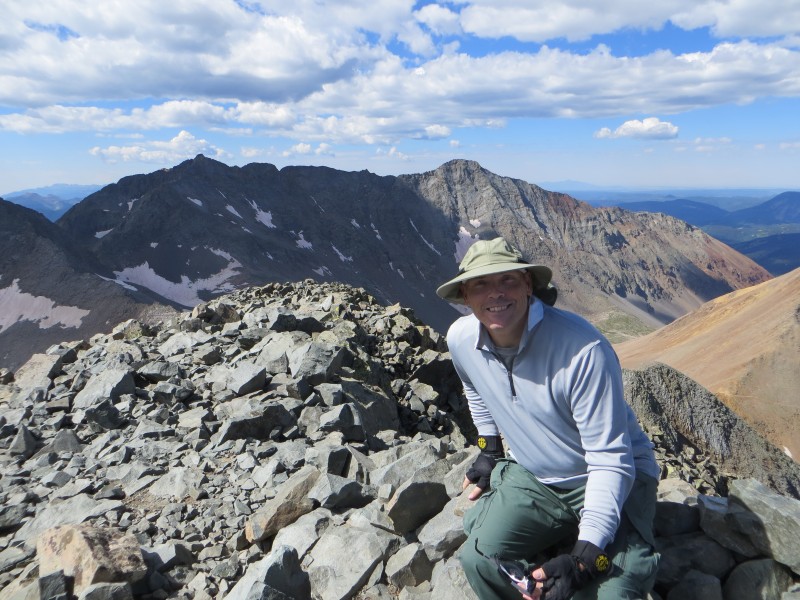 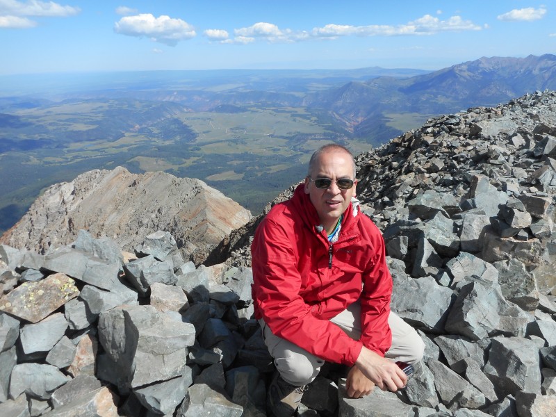 Relaxing atop Wilson Peak was very gratifying. Just 6 hours earlier as we headed up the trailhead road, while we were both cautiously optimistic, due to circumstances, neither of us had extremely high expectations of reaching the summit. This climb represented a classic example of two regular guys, who had been humbled a bit, showing up and simply doing the best we could, while accepting God's plan in the process. Ultimately we were rewarded with a summit on a beautiful day. 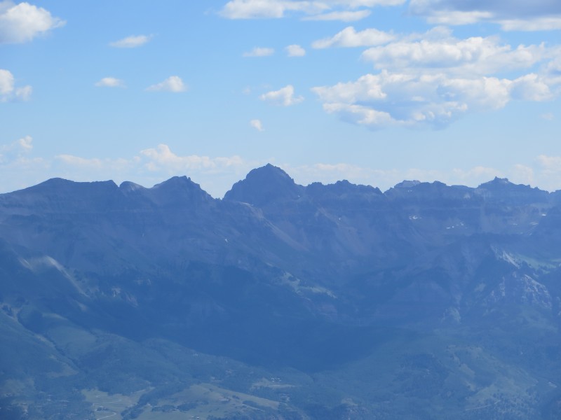 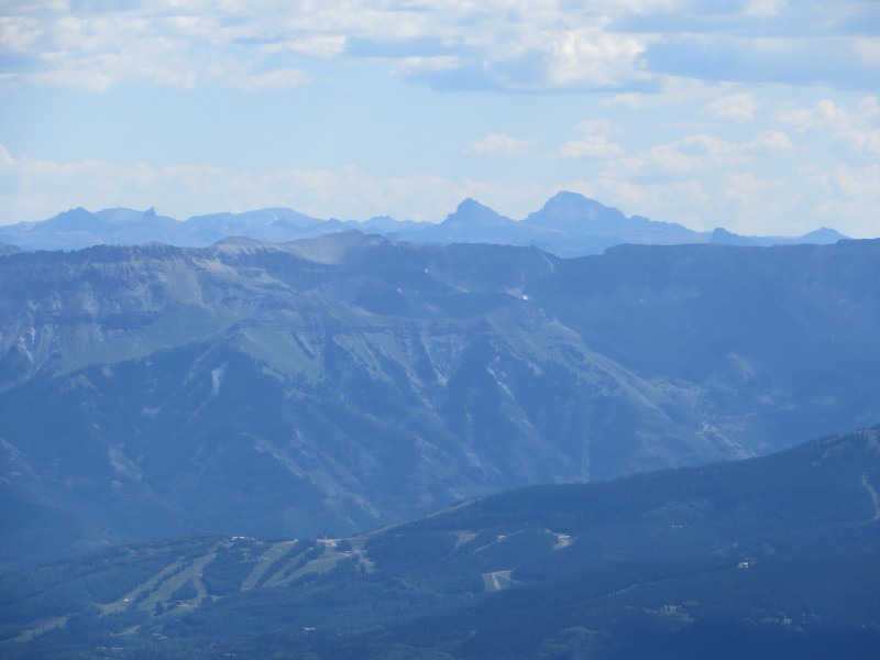 Clouds formed, but depth seemed to be lacking. No weather would develop on this day. 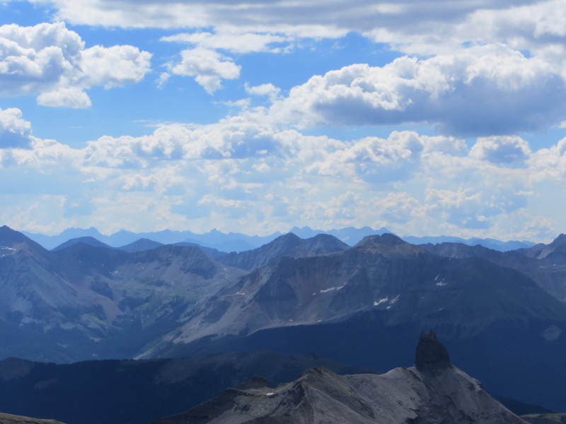 So after about 30 minutes of lounging on the summit and enjoying the view, we began the descent of the crux. 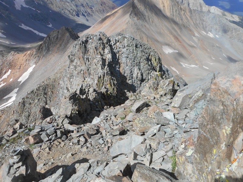 Since I had never "faced in" extensively on any Class 3 downclimb, I agreed to a coaching session in which Larry would lead, and then vocally guide me down the section, pointing out footholds as I faced in for the duration. To be honest, I found it unsettling because I have a tendency to want a broad view of what's ahead, and that's tough to attain while facing in. It didn't seem natural to me. However, I noticed an increased sense of stability and control. As Larry pointed out, if a foothold gives way while facing in, the hands / arms can still prevent a fall, whereas if this failure occurs while facing out, consequences will be severe. Certainly elementary to more accomplished climbers, but I had never considered this. So, I'll definitely need to become more comfortable with facing in, especially if I ever decide to attempt anything in the Class 4 arena. It's too bad I didn't realize that Wilson Peak is the official "Coors Light" mountain. Back to just below the false summit, this would have been a pristine location to crack open a cold one. 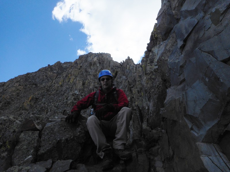 Once past the false summit, the descent continued in earnest. We quickly made our way through the Class 3 ledges, past the saddles, and enjoyed a lunch break near the mine building ruins.  Thankfully I was able to locate the makeshift walking stick where I stashed it on the ascent, as it really did come in handy throughout the descent. Next time I'll bring the trekking poles. But for today, nature's staff served me well.  Once below tree-line, wildflowers dominated the scenery.  One of my favorite aspects of Wilson Peak from Rock of Ages was the length of the hike. At just over 5 miles (one way), this made for a relatively quick descent and very reasonable day hike. Under the brilliant afternoon sunlight, the trailhead was upon us.  I had a lot of fun with Wilson Peak. It's a long trip from Denver but worth the drive. One reason why I enjoy an occasional driving option when visiting back home in Wisconsin is that it makes a 300-mile mountain drive seem like nothing. Again, the sporting finish brought flashbacks to my favorite peak, Wetterhorn, minus the extensive Class 3 gully climbing. In terms of my personal favorite 14er list, Wilson Peak will slot in 4th behind Wetterhorn, Crestone Needle, and Uncompahgre. I would at least enter Wilson Peak into the discussion of a nice option for a climber's "Class 3 Intro", perhaps with one caveat. The summit crux does appear somewhat ferocious from the false summit, and I suppose this could be problematic for anyone dealing with exposure issues. Again, I had a blast on the final pitch, but appearances can be deceiving. Unlike Wetterhorn you don't get that nice, sideways preview of the finish. This is more of a straight-on vantage point, and I do think it is steeper. But I strongly recommend Wilson Peak to someone who is new to Class 3 and wants to gain further experience. This was also a special climb because I really felt that it highlighted the benefits of working as a team, and how effective teamwork can accomplish a goal that would not have been reached by either individual alone. Larry would not have gotten far without boots, and with my sleep deprivation, in all likelihood, I would have worn out high up in Silver Pick Basin, had Larry not been holding us to a moderate but steady pace. We were thrown some curveballs before our hike even got started. To put it in football terms, we committed two early turnovers and fell behind 14-0 almost immediately. The morning clouds we observed around the peak at sunrise effectively symbolized our ominous beginning.  However, I felt that for two guys who had not even known each other for a full day, we handled the early adversity with humility, confidence, and trust in the Lord. I think we knew we'd work well as a team on the drive out there. So we stayed the course and followed our plan, and together, we reached the summit.  So I'm happy that Larry contacted me through 14ers.com; I think this connection shows what's still right about the website. This was definitely an interesting and enjoyable trip, and certainly rewarding to reach a 14er summit on a perfect weather day. And after gazing through the mid-morning hours at Mt. Wilson, El Diente, and the connecting traverse, we have already spied a goal for August 2017.  Thumbnails for uploaded photos (click to open slideshow):
|
| Comments or Questions | ||||||||||||||||||||||||
|---|---|---|---|---|---|---|---|---|---|---|---|---|---|---|---|---|---|---|---|---|---|---|---|---|
|
Caution: The information contained in this report may not be accurate and should not be the only resource used in preparation for your climb. Failure to have the necessary experience, physical conditioning, supplies or equipment can result in injury or death. 14ers.com and the author(s) of this report provide no warranties, either express or implied, that the information provided is accurate or reliable. By using the information provided, you agree to indemnify and hold harmless 14ers.com and the report author(s) with respect to any claims and demands against them, including any attorney fees and expenses. Please read the 14ers.com Safety and Disclaimer pages for more information.
Please respect private property: 14ers.com supports the rights of private landowners to determine how and by whom their land will be used. In Colorado, it is your responsibility to determine if land is private and to obtain the appropriate permission before entering the property.