| Report Type | Full |
| Peak(s) |
Split Mountain - 14058 Thunderbolt Peak - 14003 |
| Date Posted | 10/19/2016 |
| Date Climbed | 09/08/2016 |
| Author | JosephG |
| Additional Members | ngoodnight, jf32, clark |
| Split Decisions: Successful Forays in the Sierra |
|---|
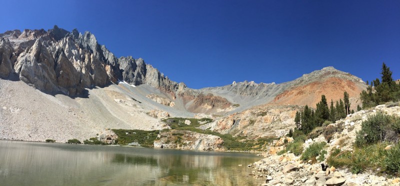 "I forget how enormous these mountains are." John uttered these words for the umpteenth time, this time just after daybreak, and I looked up again--way up--thinking our long day was just starting. Or re-starting, more accurately. We were sitting at Red Lake, having hiked for a good four hours already and covered somewhere around 4,000'-5,000' of gain. And there it was, Split Mountain, towering at least another 3,500' above us. Or, to put it another way, a normal day of gain in the Swatch.  To back up. It's September, just after Labor Day. After visiting Middle Palisade and Mount Sill the year before, this year our group set our sights on the Palisades and the lone peak of Split, wary of the former due to its sweeping exposure and of the latter because of its 4WD approach and uncertain route specs. Disclaimer: this report does not detail the mythical Thunderbolt to Split traverse. 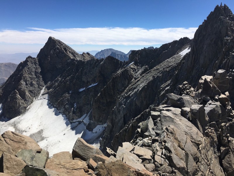 Thunderbolt Peak. We began our trip with a largely successful undertaking to the Palisade Crest. A leisurely start meant the Palisade traverse (Thunderbolt to Polemonium) was out. We instead enjoyed a fine out-and-back on Thunderbolt Peak, one of the three unofficial California 14ers (along with Starlight and Polemonium, all along this ridge).   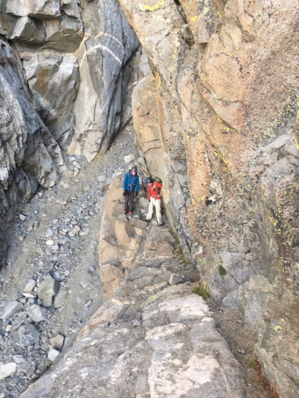  North Palisade is Thunderbolt's parent peak, but Thunderbolt has a reputation of its own with a 5.9 summit block that makes Sunlight's look like preschool. Because Thunderbolt is well-documented and both more or less straightforward and consistent (!) with its TRs and route descriptions, I'll skip all that and just show a few pictures. 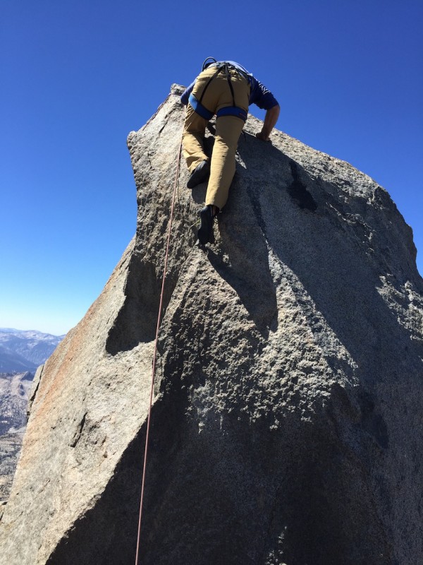 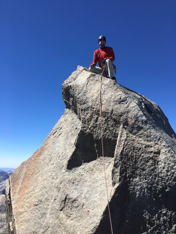  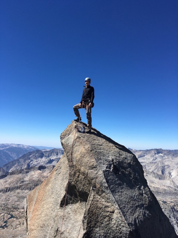 Unfortunately, Thunderbolt would be the only of the Palisade crest peaks we would summit, though we left with no dearth of beta for a future excursion. These peaks are nothing short of eye popping. 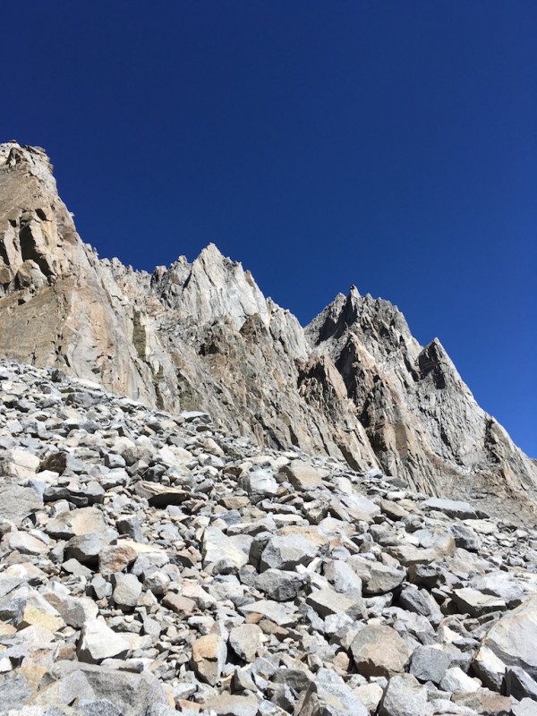 Dreaming of Starlight...  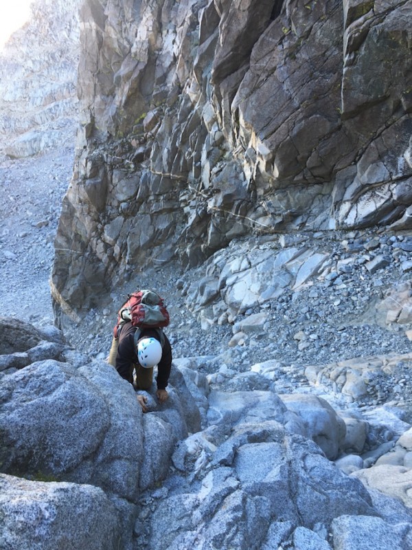 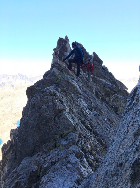 Split Mountain. On to Split. 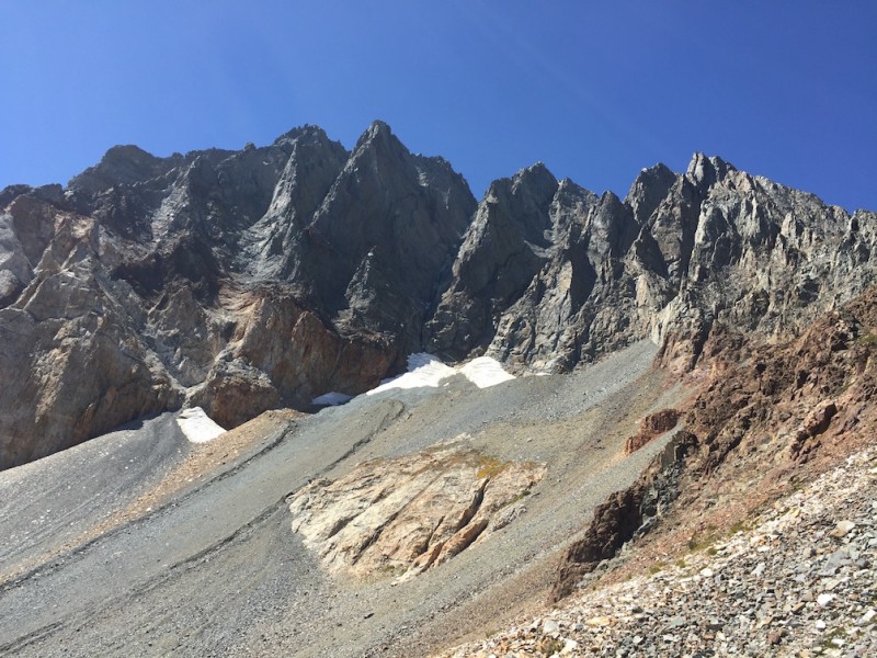 After a hot breakfast and a good night's sleep, half our group returned to San Francisco for work/life obligations. That left John and me, with a car likely ill-suited to reach the Split trailhead. To explain further: Split is the only CA14er that requires true 4WD capabilities to reach its TH (unlike the "4WD" road to Williamson, while represents the Williamson route's sole under-exaggeration). Numerous trips and forums describe the drive to Split with enjoyable terms like "narrow passage," "protruding pipes," and "scratched cars," as well as featuring the use of 2x6s to drive over rocks and rivulets, fording streams, and a steep 1,000' drop and re-gain to get to the TH. No thanks. Plan B sounded little better: an alternate driving route via Tinemaha Road, one that maybe/maybe not went on jeep trails and private property and could be captive to gated roads. I won't attempt to describe this one, since we didn't take it and the information is out there. Plan C, then. From looking at maps, it appeared we could start the standard approach and drive about nine and a half miles in, until we reached McMurray Meadows. At that point, we could bushwhack cross country through relatively flat terrain for just over two miles until we hit the TH. Sounds like a plan.  Directions. From Highway 395 in Big Pine, turn west on Cocker Road, which quickly becomes Glacier Lodge Road. This is the same start as the traditional drive to the TH. After 2.6 miles, take a hard left onto McMurray Meadows Road (again, same as normal driving directions). There are quite a few subsidiary road offshoots, but they are obviously lesser to the main McMurray Road. Stay on the McMurray road until around mile 9.2. The road is dirt, but it well maintained and easy driving. At mile 9.2 you reach McMurray Meadows, which will be apparent with fencing on your right (west) side. Just past the fencing, there are a number of areas to pull over and park. I don't recall our exact mileage point, but it was between 9.2 and 9.6 miles total from the start. At 9.7 miles there is, evidently, a sign indicating you are on the Red Lake Trail; if you see this sign, you have gone past the McMurray Meadow parking. Since we walked from there (not on the road), I won't regurgitate further directions. We drove the approach (easy), parked at a relatively obvious pull-out just past some fences in McMurray Meadows (which is well-marked on the USGS maps), and set our sights south by southwest to the trailhead. What followed was enjoyable walking through desert sage, across stream-carved ravines, through rattlesnake territory, and past innumerable animal bones until we arrived smack dab in the middle of nowhere, fortuitously by a small spring and an ill-defined trail. For added fun, the TH sign and parking area is about a quarter mile south; if you are driving in, turn right to get to the true TH, left to the sign and the parking area.  It helped having the TH coordinates: 37.03648, -118.35978. History. 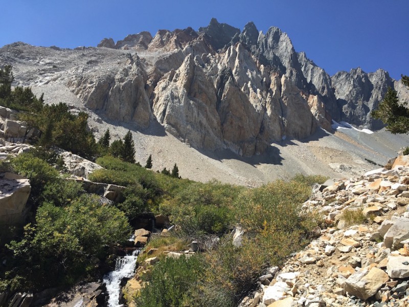 Formerly known as "South Palisade" or even "Southeast Palisade," Split Mountain is aptly named due to the east couloir that bisects its twin summits. Its true summit is on the north side. Split's first ascent is largely unknown, and consensus is that both Paiute and Shoshone Native Americans summited before any official recorded ascent, given the peak's presence surrounded by historical Native American lands. Captain George Wheeler of the U.S. Geological Survey provided the first recorded description of Split ("Southeast Palisade," as he termed it) somewhere between 1875 to 1879. Frank Saulque and his party of five represent the first recorded ascent in 1887, and in July of 1985 the mountain officially received the name of "Split." (Source credit: Porcella & Burns, Climbing California's Fourteeners (1st ed. 1998)). Split Mountain is not a part of the official Palisade group. Rather, it is an ostracized loner, with its own supporting cast of smaller mountains. Where's that trail? Both summitpost and Porcella/Burns highlight how Split's trail is a bit of an enigma. Given our experiences in California, we assumed this to be understatement. Turned out, the trail was significantly better than we'd expected; whether that be due to rock-bottom expectations, general trail improvement, or just our own dumb luck, I cannot say. We started our day at 2:30am sharp, and for the most part the trail was steep and straightforward. At all times, the trail is on the north side of Tinemaha Creek, despite a seductive use trail that has apparently lured many unfortunate hikers. Like any disreputable trail, however, it carried its charms. A note about our start time: we'd read somewhere that we were in for a 7,000', 22-mile day. We were partially right. On the ascent to Red Lake"again, about five miles into the hike and around 5,000' of gain"the trail goes through four lush "jungle"/vegetation zones. I say "jungle" in part to mirror existing TRs but also to connote just how different those zones are from the rest of the trail, which is dry, dusty, unshaded desert. The "jungle," in contrast, was wet, humid, muddy, and overgrown. Those areas also were the areas most likely to result in losing the trail. And indeed we did precisely that in the very first jungle zone, not two hours into our dark morning. The best advice I can give is similar to one I read in an SP description: if your "trail" suddenly gets incredibly difficult, you are not on it. There is a lower lake just before Red Lake, right around the time you enter a small sequoia grove. It is quite impressive to see these proud, towering trees just below tree line. With global warming, evidently tree line is reaching higher in elevations. These, though, were well established. After this lake, the faint trail tapers even further. Generally, stay on the north (right) side of the lake. You will angle towards the edge of a rock moraine, and there is a simple path through it and up to Red Lake. If you spend more than five paces in the willows, you have erred. There is plenty of dispersed camping from here to Red Lake. Take a moment at Red Lake to assess your route and re-stock on water, as there is none of the latter beyond (but plenty of opportunity to hone the former). The route generally scurries through easy cliff bands and then you enjoy a grunt up the obvious talus slope. Split is the obvious wall towering over the west, although its true summit is not apparent. 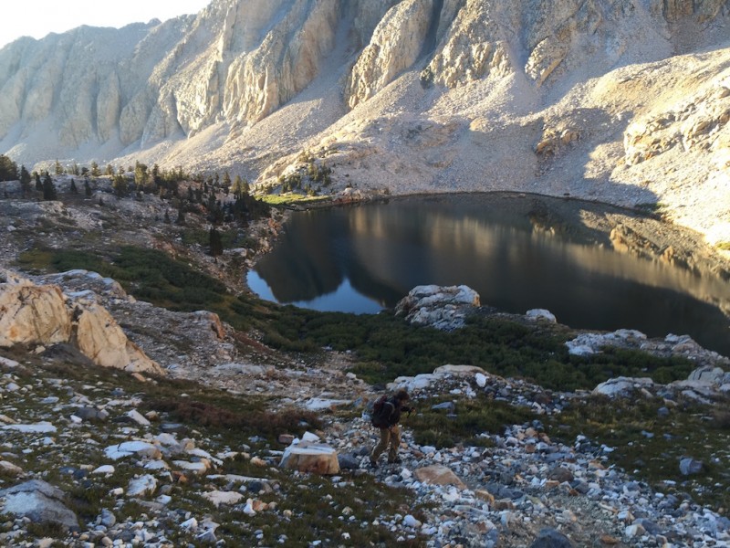 Do not go too far left here; rather, stay right of the obvious grass patch. It is no more than irritating class 2 boulder hopping. 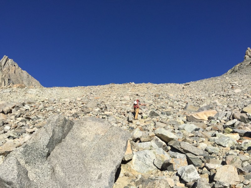 Once you reach the top of this little slope, you are not yet even to the Sierra Crest. Rather, you have a disheartening amount of additional boulder hopping stretched before you. You will be faced with this: 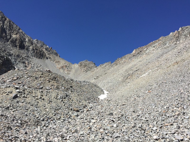 Do not go for the left-most "V" in the ridge, which is also the most obvious (or at least attractive) feature. Instead, go to the deeper v-notch to the right of it, which provides a much less aggravating ascent and yields the lower point on the Split-Prater saddle. But remember that left-most notch for your descent, as it provides a good and quick one. If you are lucky, there will be some snow in the bottom of this talus field. That greatly hastened our crossing. We followed the snow to its end, took a hard right, and went straight up the previously-referenced notch. From there, it was easy scrambling over to the base of the access gully to Splits upper slopes.   This part, and the climb up the access gully, I suspect are what yields Split's purported class 3 rating from Porcella/Burns. However, we found it nothing more than straightforward class 2, although with route-finding errors or "extra credit" forays I suppose class 3 could be achieved. 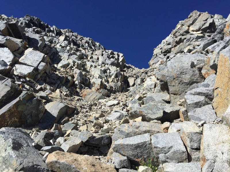 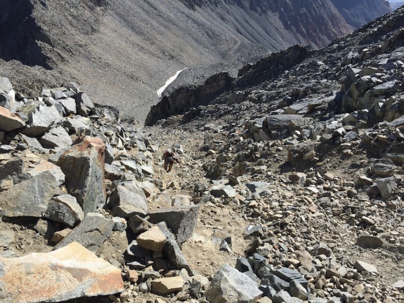 Now, it's California, so don't be fooled. Once we topped the ascent gully and got to Split's north slope, we felt confident that we saw the one false summit below the true. Wrong! Had we looked at (ok, believed) the GPS, we would have recognized that we still had 1,000' to go. The natural inclination is to go straight up and slightly left along the north slope, to the inviting false summit lording over the skyline. 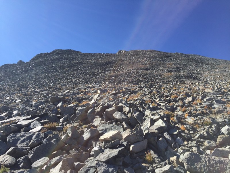 This is fool's gold. Rather, go up and slightly right, perhaps even along the north slope's "face." (If you look carefully, you will find several use trails.) From here, you will walk up to the ridge line and either bypass or surmount a LaPlata-ian number of false summits until you see this towering over you: Take heart, only 500' more to go. 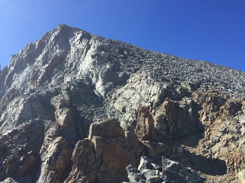 Stop. Summit time.  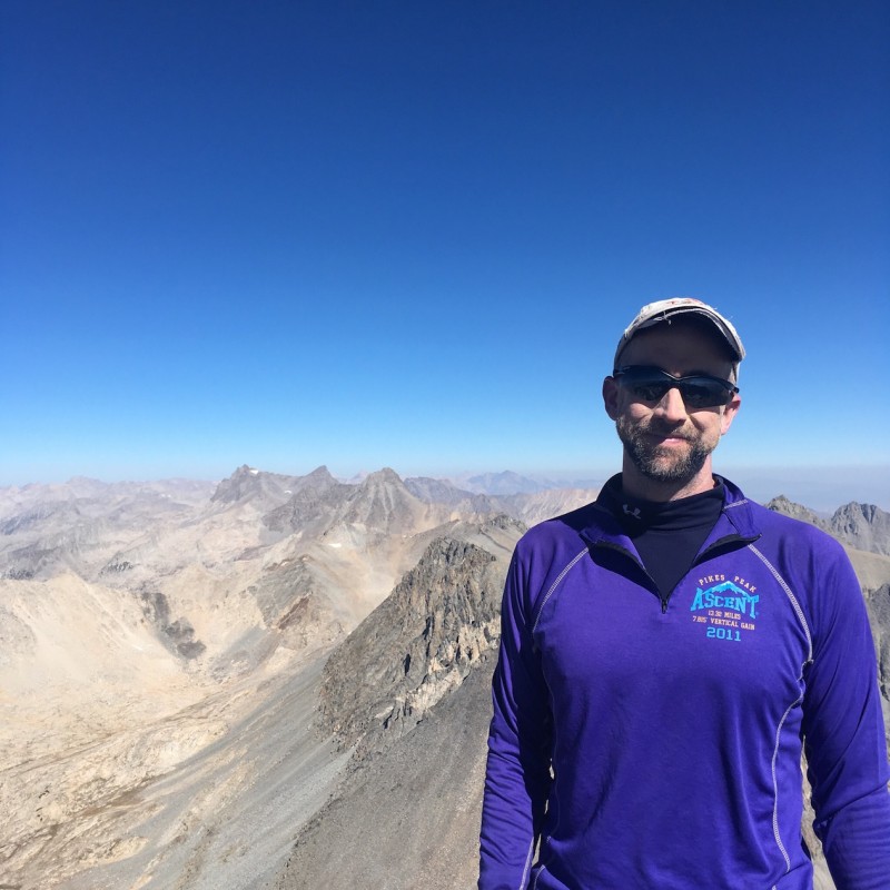 The promised land! It did not seem like the Sierra had received any precip in weeks, and the sky was blue and nearly cloudless. We lounged for some time, dreading the steep descent, from the miles of rock-hopping to the sunbaked, dust-choked trail to the tent (never mind the cross-country bushwhack back to the car). But the scenery was restorative. 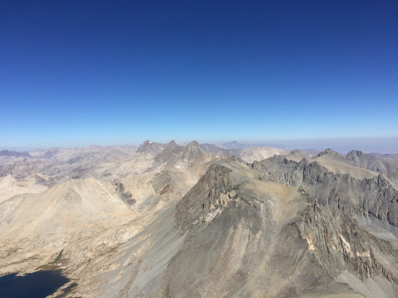 Descending. When we left, John and I agreed we would descend the aforementioned left-most gully. This provided some great scree-ing, and we were down in a blink. 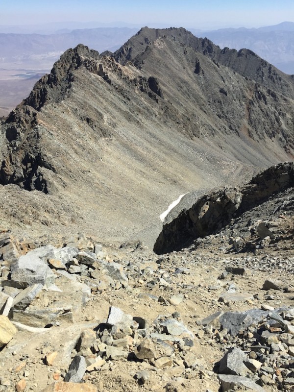 Descending it also confirmed that it would have been a bear to ascend. Down in the talus, we got some low-angle standing glissades (poor man's skiing?) on the snow. 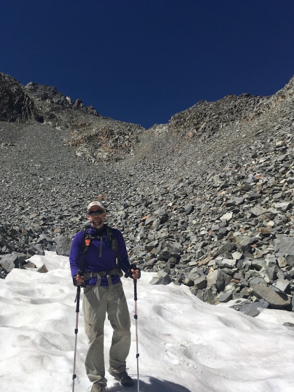 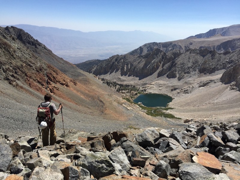 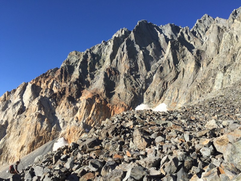 Presently, we were back to Red Lake and enjoying a mental break. The final hike out to the tent went quickly and only featured a few minor missteps, nothing worth mentioning besides that they're par for the course. 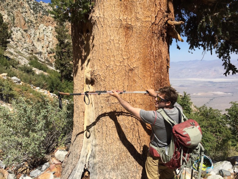 I will say this, however: I am not the best about steadily drinking water on climbs. I always bring several liters, and I almost always have a good portion left at the end of a day. Split really only has three, maybe four, reliable options: (1) the spring at the TH; (2) arguably you could cull some out of the stream in the second or third "jungle" zones; (3) the lake right before Red Lake; and (4) Red Lake, these last two being functionally the same. The trail is hot and constantly in the sun. Over the course of the day, I went through an unheard-of (for me) nine liters of water. And I was still dehydrated at the end. So plan accordingly. Now, I mentioned earlier that we only were partially right on the specs. The mileage, from TH to summit and back, was just over 14 miles (not the 22 we had feared). The vert, however, was just over 8,000'. I will leave the math to you, but I will note that there is minimal up and downs along the trail. Reflections. 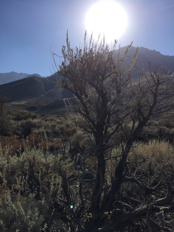 Split was a spectacular peak, significantly more enjoyable than I'd expected. Situated as it is between the Palisades to the north and the Whitney-Williamson-Russell Sierra to the south, its summit views are indisputably inspiring. But it also features a lot of lesser-seen Sierra vistas, and these alone make for enjoyable eye candy. I also highly recommend the non-4WD cross-country approach. I suspect our two-mile walk through the sage was actually faster than driving the road would have been, even with an adequate vehicle. It also added a wholly different element to the experience. As always, it was a great pleasure to be in California with some good friends. And it was equally nice to spend a little time in San Francisco after the hikes, re-acclimating to civilization before returning to the working world! All photos are courtesy of John, Nolan, Clark, and this author, who has been too lazy to cull through and individually identify who took what. 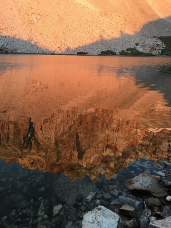 Split splits: Miles: 18.09 miles, inclusive of the two-mile car-to-TH bushwhack. Thus about 14 miles, give or take, from TH to summit and back. Vert: 8,308' of elevation gain/loss. Time: 15 hours total trip, car to car. Around 13 hours TH to summit and TH, including significant summit time. It was not a barnstorming pace, but it was no turtle race either. Just rewards:  As always, thanks for reading. I won't soon forget how enormous the Sierra are. At least until next time... Thumbnails for uploaded photos (click to open slideshow):
|
| Comments or Questions | |||||||||
|---|---|---|---|---|---|---|---|---|---|
|
Caution: The information contained in this report may not be accurate and should not be the only resource used in preparation for your climb. Failure to have the necessary experience, physical conditioning, supplies or equipment can result in injury or death. 14ers.com and the author(s) of this report provide no warranties, either express or implied, that the information provided is accurate or reliable. By using the information provided, you agree to indemnify and hold harmless 14ers.com and the report author(s) with respect to any claims and demands against them, including any attorney fees and expenses. Please read the 14ers.com Safety and Disclaimer pages for more information.
Please respect private property: 14ers.com supports the rights of private landowners to determine how and by whom their land will be used. In Colorado, it is your responsibility to determine if land is private and to obtain the appropriate permission before entering the property.


