Download Agreement, Release, and Acknowledgement of Risk:
You (the person requesting this file download) fully understand mountain climbing ("Activity") involves risks and dangers of serious bodily injury, including permanent disability, paralysis, and death ("Risks") and you fully accept and assume all such risks and all responsibility for losses, costs, and damages you incur as a result of your participation in this Activity.
You acknowledge that information in the file you have chosen to download may not be accurate and may contain errors. You agree to assume all risks when using this information and agree to release and discharge 14ers.com, 14ers Inc. and the author(s) of such information (collectively, the "Released Parties").
You hereby discharge the Released Parties from all damages, actions, claims and liabilities of any nature, specifically including, but not limited to, damages, actions, claims and liabilities arising from or related to the negligence of the Released Parties. You further agree to indemnify, hold harmless and defend 14ers.com, 14ers Inc. and each of the other Released Parties from and against any loss, damage, liability and expense, including costs and attorney fees, incurred by 14ers.com, 14ers Inc. or any of the other Released Parties as a result of you using information provided on the 14ers.com or 14ers Inc. websites.
You have read this agreement, fully understand its terms and intend it to be a complete and unconditional release of all liability to the greatest extent allowed by law and agree that if any portion of this agreement is held to be invalid the balance, notwithstanding, shall continue in full force and effect.
By clicking "OK" you agree to these terms. If you DO NOT agree, click "Cancel"...
Wyoming's Wind River Mountains are shorter than the 14ers...but they are significantly more remote, have way fewer people, harder "standard" routes, and real glaciers. They also run in an unbroken chain for 85 miles along the Continental Divide, oriented northwest to southeast, with no roads and only a few major trails crossing them.
My family has a ranch on Torrey Lake at the northern end of the range, and we love the local hikes, such as Lake Louise, the Glacier Trail, and exploring upper Torrey Creek. We had talked, not very seriously, about traversing the range for years. For the past 3 years, I worked in Google Earth, with guidebooks, and trip reports to create a plan. This was the year.
3 people, 2 dogs
26 days
200 miles (including side trips)
50,000 vertical feet elevation gain
8 ranked peaks (4 13ers)
4 major glaciers traversed
7,800 photos
10 hours of 4k cinema-quality footage
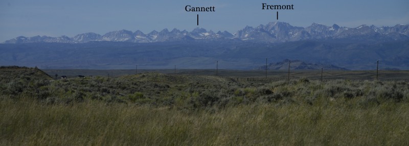
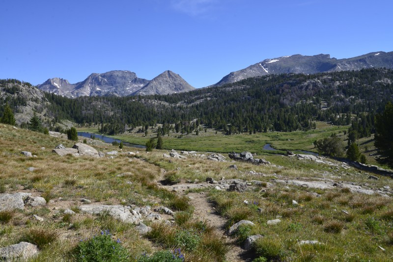
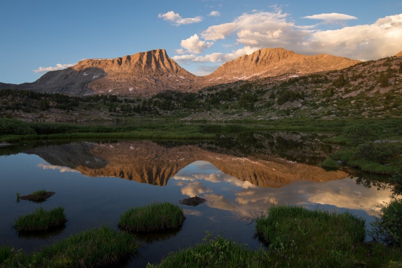
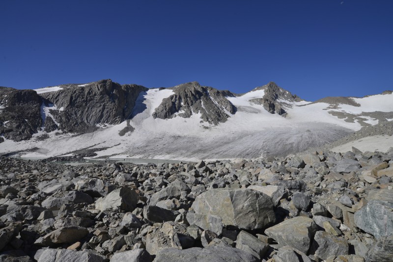
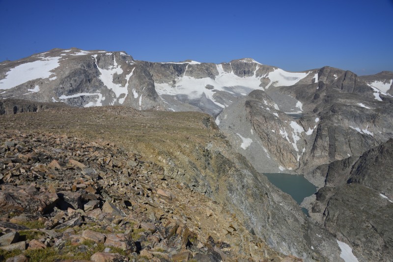
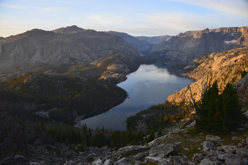
The northern third of the Wind River Range viewed from a distance. Hmm...that looks like a long way to walk.
northern third of the Wind River Range
We hired a taxi to drop off my parents, our 2 dogs, and myself at the Sweetwater Gap trailhead at the extreme southern end of the Wind River Range. The sound of our taxi fades away down the dirt road. The silence of the wilderness returns under brooding storm clouds as we begin our journey. Alea iacta est. The die is cast.
Mount Nystrom from the trailhead
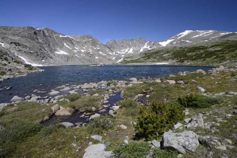
After what felt like a long 6 miles carrying 65 pounds of gear, I help set up camp at Sweetwater Gap. The marshes here drain to form the headwaters of the Sweetwater and Popo Agie Rivers. This peaceful meadow would be in stark contrast with tomorrow's campsite.
Sweetwater Gap
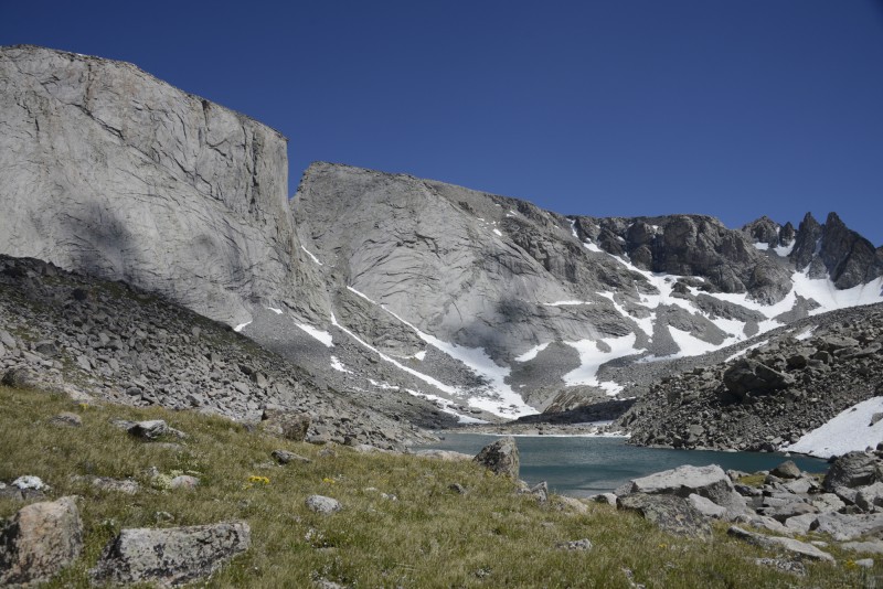
We wake up early and start hiking, because today is the crux of the southern part of our route. From an unnamed pass, we can see Wind River Peak, the only 13er in the southern half of the range.
Wind River Peak from unnamed pass above Poison Lake
Miles later, we pass Tayo Lake and begin ascending Wind River Peak with our backpacks. This is not a day hike--this is a traverse of the range, and we have to backpack over this mountain to continue.
Tayo Lake
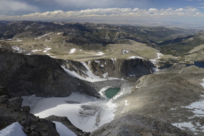
Well, that seemed steep. Maybe it was just the backpacks. I reach the summit solo (my parents stayed with the pack at a saddle), and gaze down onto this glacier at 5:00 p.m., which I am sure is a satisfactory summit time.
Wind River Glacier
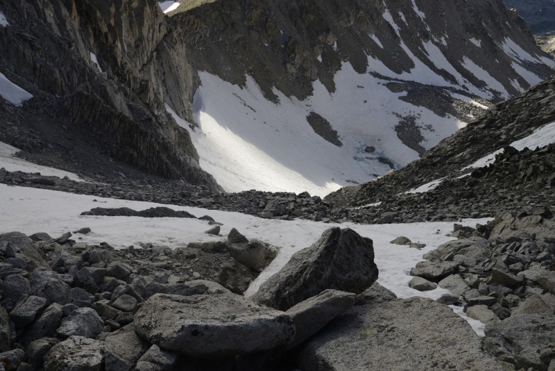
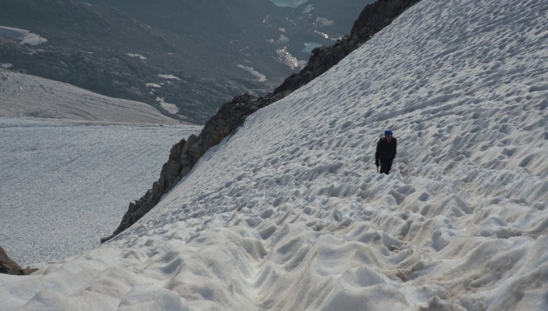
Now we have to descend. That can't be the right gully. Oh shoot, it is. The gully is well over 45 degrees in steepness and consists of the loosest rubble I have ever encountered. It is rather unnerving when you slide down some scree, try to take a break, lean on a sofa-sized boulder, feel it shift with a tiny budge, and then continue to descend right below it. Oh, and there's some little cliffs partway down. And a glacier at the bottom. And it's getting dark. Someone just knocked a rock loose above me, and it sprayed sparks into the air a few feet to my side. I'm traversing a steep glacier in the dark...with dogs. Good thing we have helmets, ice axes, crampons, and headlamps.
west gully
We set up camp on the toe of the glacier at midnight, making an 18+ hour day. The next morning, we look back up at the gully we descended.
camp below the gully
Sadly, our camp was only halfway through the horror. We spend our third day out making painfully slow progress over large talus, eventually exiting into the upper Black Joe Lake valley.
Lake 11,185 and Little El Capitan
The next day, we overcome some 3rd class cliff bands (easier said than done while carrying half one's body weight) while traversing around the shore of Black Joe Lake. Haystack Mountain reflects in the early morning. We continue lower, intersecting a trail and starting up again, crossing another alpine pass.
Haystack Mountain above Black Joe Lake
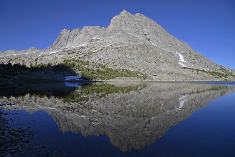
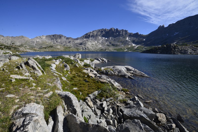
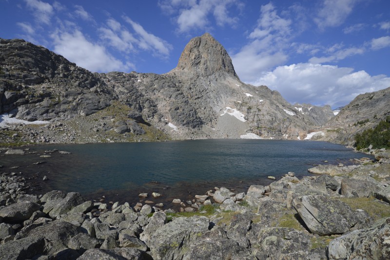
For some reason, I think I have seen pictures of this place before. (Cirque of the Towers, including Pingora and Wolfs Head, two of the 50 Classic Climbs)
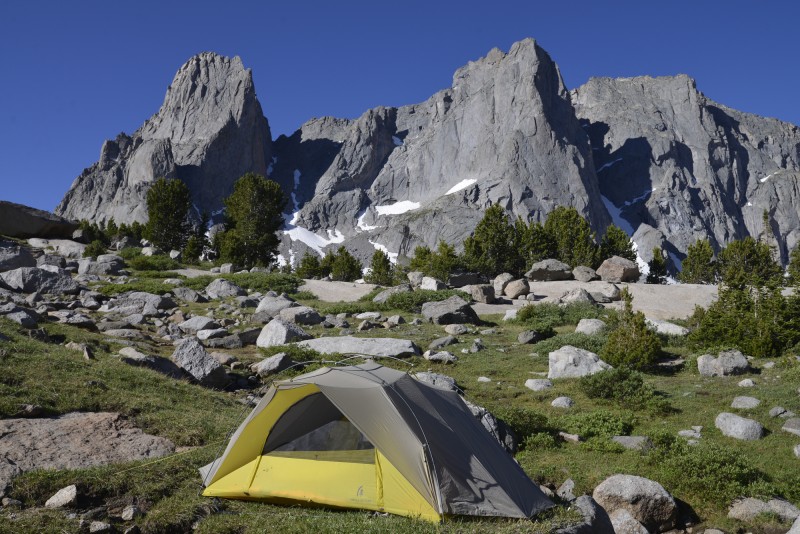
Pingora reflected in Lonesome Lake Warbonnet, Warrior 1, and Warrior 2 above camp Cirque of the Towers
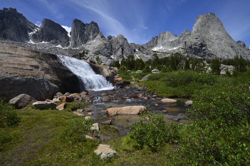
The days blur together. We walk a half marathon one day, and get up and do another 13+ miles the next day. We follow the Highline Trail, also the Continental Divide Trail, past the headwaters of Washakie Creek.
Washakie Creek
It's time to go climbing.
above Lake Sheila
We climb North Twin Lion. It is only mentioned in the dusty pages of old Bonney and Kelsey guidebooks, and nowhere else. The only proof it's ever been climbed before is a tiny cairn on the exposed summit. There is a cool natural crows-nest type rock formation just below the summit, and we enjoy the views of Pronghorn and Nylon Peaks to the north. I decide that I have officially earned the title "connoisseur of the obscure."
Pronghorn and Nylon Peaks from North Twin Lion
Mount Lander, at the headwaters of the North and South Forks of the Little Wind River. This 12er is more impressive than most our 14ers back here in Colorado.
Mount Lander
Baptiste Lake and the South Fork of the Little Wind. The North Face of Mount Hooker is shadowed and facing us. The easiest route is class 5.12 and 12 pitches.
South Fork of the Little Wind River
Sunset on Mount Bonneville (just another 12er) from camp in the South Fork of Boulder Creek. North Twin Lion, the peak we climbed, is the entirely shadowed peak in the background on the left.
Bonneville Basin (South Fork of Boulder Creek)
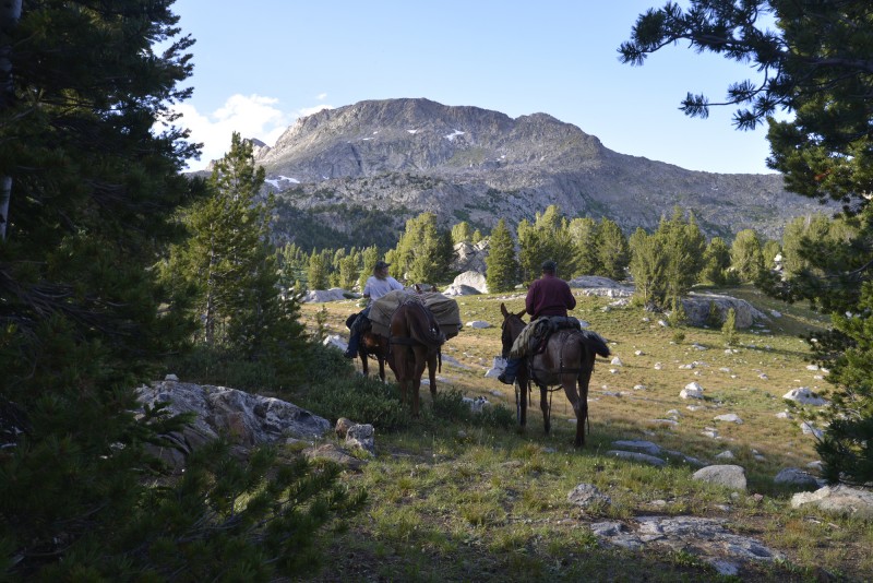
The next day, we cover the final miles to Middle Fork Lake, where we have arranged a horse packer resupply. Fresh batteries and food arrive, including another 5 pounds of chocolate...
resupply at Middle Fork Lake
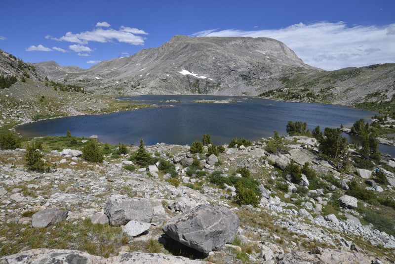
At this point, my feet have become quite sore, but this view of Halls Lake is inspiration to keep moving.
Halls Lake
We set up camp in a private slice of paradise in Europe Canyon.
Lake 10,542 in Europe Canyon
Another day, another half marathon, another lake, another mosquito bite, another sunset.
Angel Peaks from Bald Mountain Basin
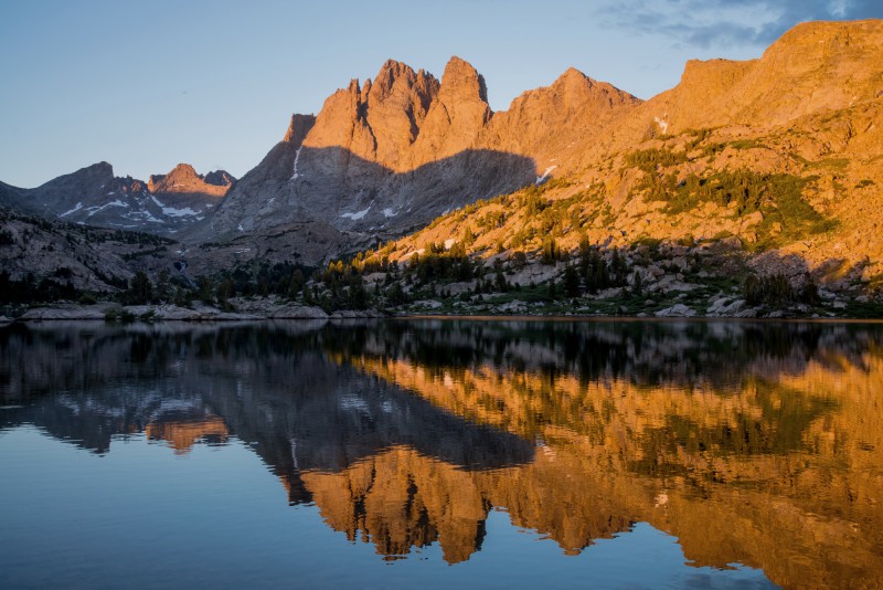
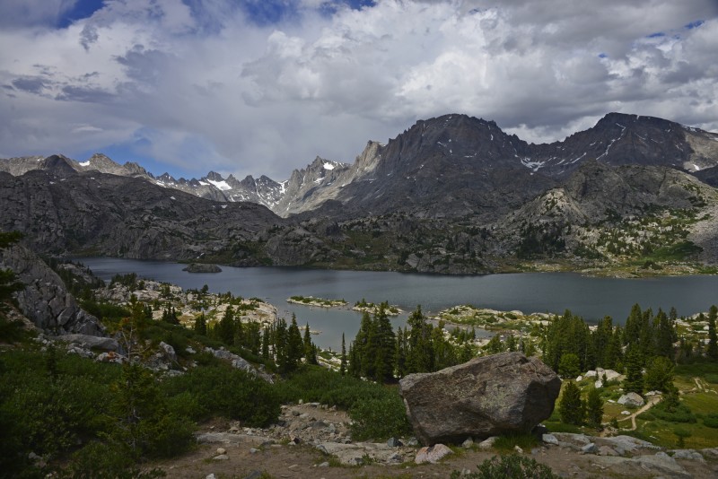
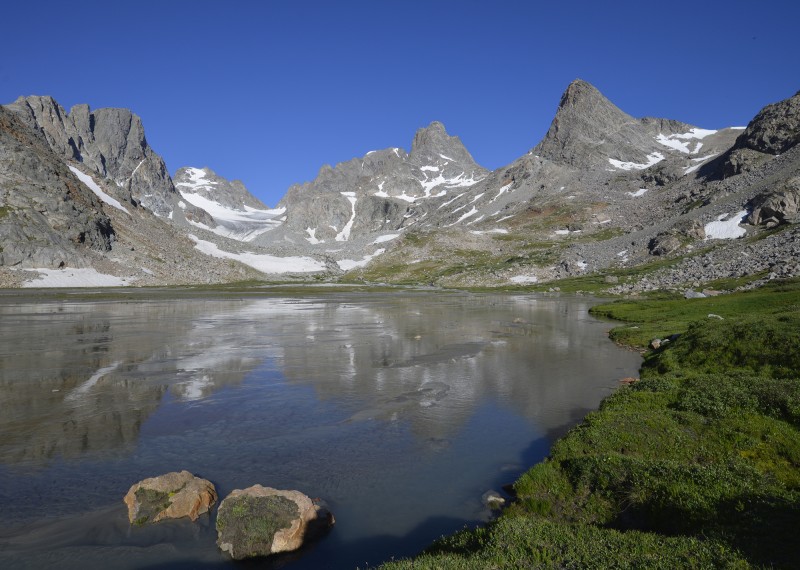
The only real storm we experienced dramatizes the landscape as we approach Island Lake, the locale first made famous by John C. Fremont and his 1842 expedition. Fremont Peak, the 3rd highest peak in Wyoming, is the prominent, shadowed peak that appears tallest in this photo.
Island Lake and environs
The next day, we climb Fremont Peak from Titcomb Basin. I look out over the massive Bull Lake Glaciers from the summit. Gannett Peak, the highest in the state, is visible in the background with its signature snowy summit ridge.
summit of Fremont Peak
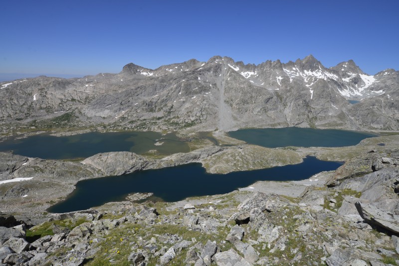
Our tent is somewhere between the 3 major lakes in Titcomb Basin.
Titcomb Basin
I get my first real taste of glacier travel while backpacking from Indian Basin to the North Fork of Bull Lake Creek, which is arguably the most remote area of the Wind Rivers.
terminus of the Knifepoint Glacier
The next day, we take a day trip into the upper cirque. It's interesting when you're crossing a moraine and suddenly a chair-sized piece of granite drops out from under your feet. This view looks toward Mount Sacagawea and the Sacagawea Glacier.
Sacagawea Glacier
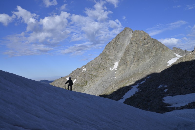
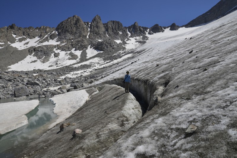
I descend the Helen Glacier with several 13ers in the background. This was a "rest day," because tomorrow is the crux of the remaining route.
Helen Glacier
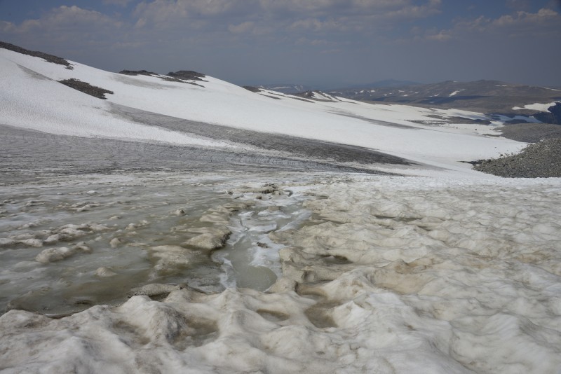
It's now or never. We have one more day's worth of food left, and we're in the most remote basin in Wyoming (the closest road is 20 glacier-scoured miles away). Blaurock Pass, at over 12,000 feet, is the key to our escape. It is the steep scree slop on the far right of the photo.
Glacial outwash in the North Fork of Bull Lake Creek
The ascent of the pass goes well, except for a little loose rock here and there. While descending the other side, we are rewarded with a classic view of tomorrow's objective: Gannett Peak, the highest mountain in Wyoming at 13,804 ft.
Gannett Peak from Blaurock Pass
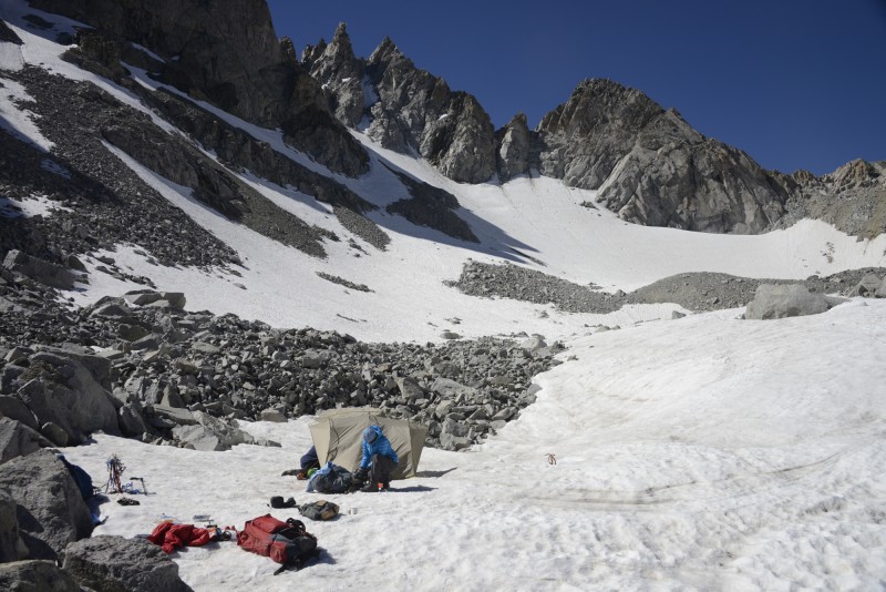
With a 4:00 a.m. start, we cross another massive moraine in the dark. We strike out onto the Gooseneck Glacier under a smoky haze from forest fires north of us.
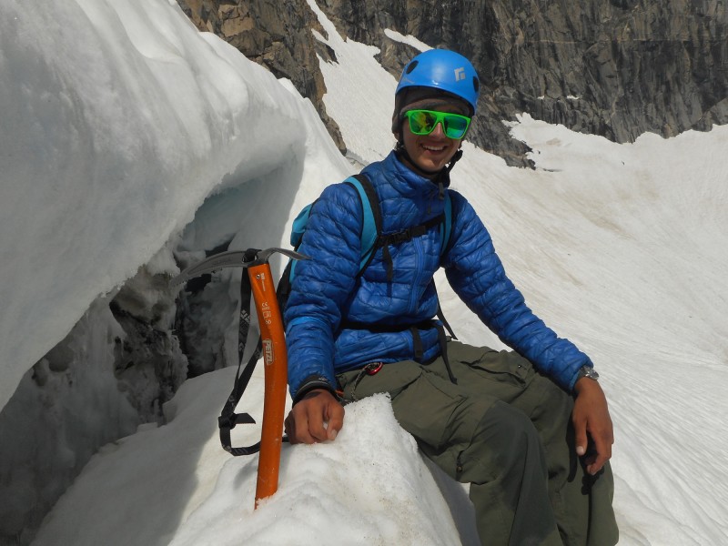
climbing the Gooseneck Glacier
The route ascends a 45-degree snow couloir directly above this bergshrund. Don't fall! (photo taken on the descent)
Gooseneck begschrund
My dad finishes the top part of the couloir.
top of the Gooseneck couloir
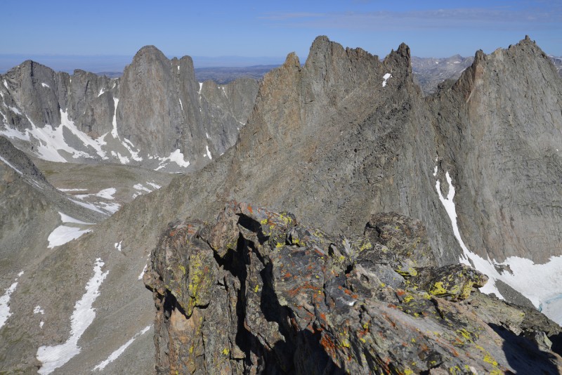
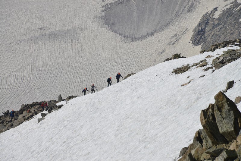
From high on the summit ridge, we are rewarded with classic alpine views of parties lower on the route. Look for people just below the bergshrund in the first picture.
view of the route from Gannett's summit ridge a NOLS group nearing the summit ridge with the Mammoth Glacier in the background
My dad and I are the first people to reach the summit today, at about 9:30 a.m.
summit of Wyoming
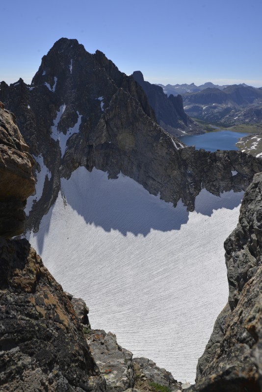
This is the view south. Fremont Peak is the large peak in the background with the glacier in its cirque.
view of the Dinwood Glacier and many 13ers
After returning to camp, we backpack down the Glacier Trail in the Dinwoody Valley to our second resupply. This is the view of Gannett from our camp.
Dinwoody Valley from the Inkwells trail junction
Days pass. We hike many miles, reaching the untrammeled Downs Fork.
Downs Lake
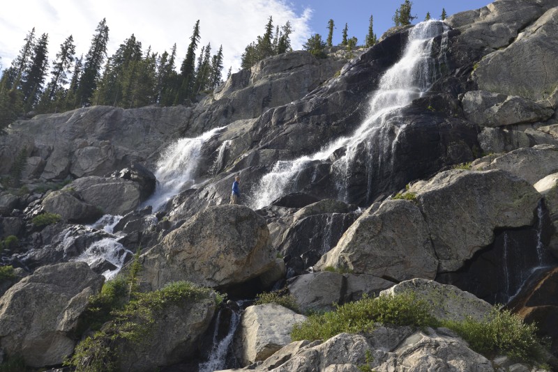
These are some rather large waterfalls. See if you can find me in the picture.
waterfalls above Lake 9,930
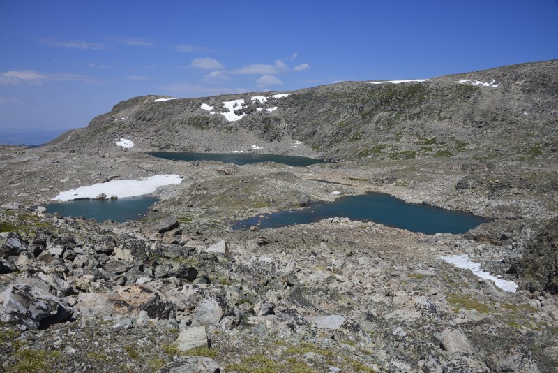
Bear's Tooth, another 12er, looms above this unnamed lake. The easiest route to the lake from the lower valley was solid 4th class.
Lake 10,705
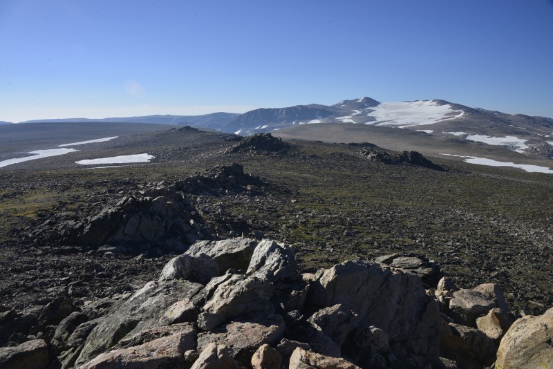
We look back on Downs Lake and the Dinwoody region of the Winds as we climb onto a high plateau. The summit register of this ranked plateau, called Goat Flat, shows an average of a few signatures per year.
Downs Fork and Downs Lake from Goat Flat
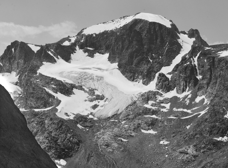
Our final 13er, Downs Mountain, dominates the headwaters of Torrey Creek. It is the northernmost 13er on the Continental Divide in North America. We backpack up the east face (on the left in the picture) just to the right of the large snowfield.
Downs Mountain and the East Torrey Glacier
We descend the 3+ mile-long Continental Glacier to reach a high camp at 12,600 ft. Large herds of Big Horn sheep frequent this area.
Continental Glacier
We spend a couple of nights at Dad's Lake and explore the headwaters of the Roaring Fork of the Green River.
Dad's Lake (most distant)
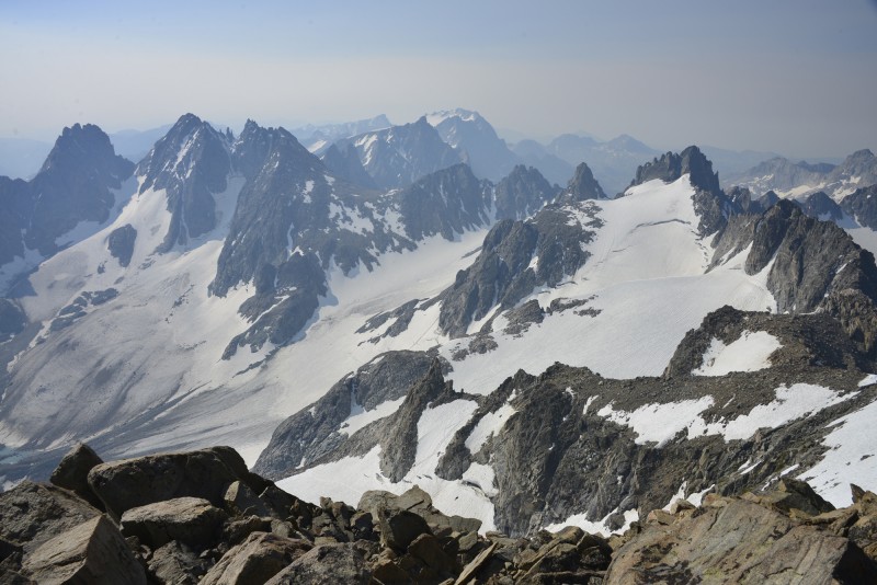
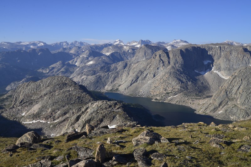
From the summit of Shale Mountain, we look over vast tundra to the distant Continental Glacier.
view south from the summit of Shale Mountain
Our last sunrise in the wilderness illuminates the grandeur of Ross Lake on West Torrey Creek.
Ross Lake and Middle Mountain
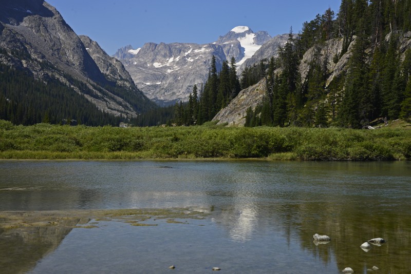
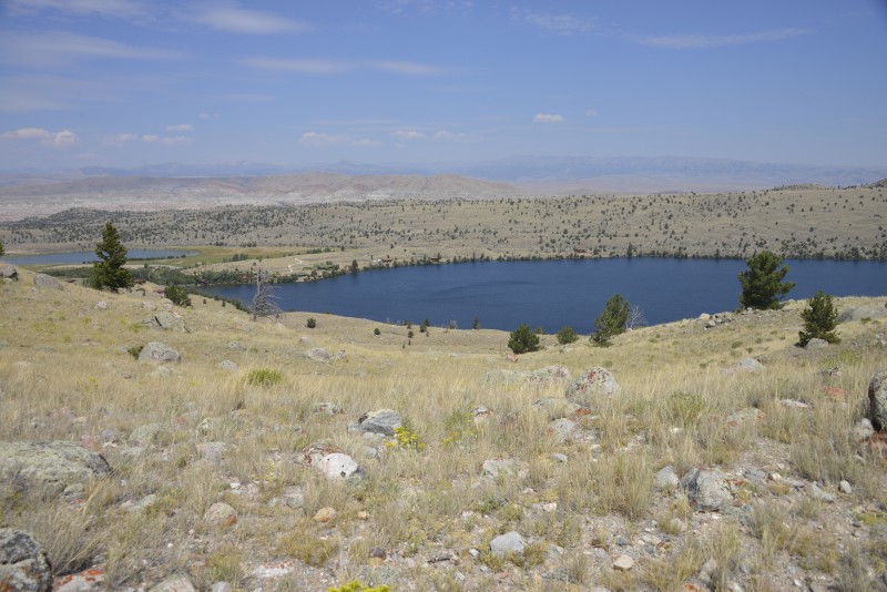
We hike to the summit of Whiskey Mountain, an 11er. When I climbed it at age 10, it was my second-ever summit. From near the top, we can see down to our ranch on Torrey Lake, where ice cream awaits.
Torrey Lake from the slopes of Whiskey Mountain
In terms of size, this was by far my largest-ever undertaking in the wilderness. Spending 26 days hiking in one direction while never crossing a road was an experience only possible in a select few areas of the contiguous US. More than half of our travel was off-trail simply because trails do not exist in many areas. In terms of success, we made it to perhaps two-thirds of the places I had planned to go. One could explore the range for a lifetime and still not visit every valley and climb every peak. In terms of motive, the question of "why spend 26 days doing that," the answer is "because it's there." As Mallory said, it's a challenge.
Should you decide to accept the challenge of the Winds, do yourself a favor and don't just follow a prescribed itinerary from someone else. Get a copy of the out-of-print Bonney & Bonney guidebook and try to make sense of the ratings and descriptions. Read Finis Mitchel's guidebook. Pick an unnamed lake on the map and make it a destination just "because it's there." Create your own, unique experience. Why? Because that's what the Winds are about. There are plenty of other mountain ranges for simple backpacking trips on prescribed routes with detailed descriptions. The Winds are about unknowns. That is why, for decades, writers have made their descriptions vague and left room for exploration. That's why the gpx file below is intentionally vague. That's why the Winds are unique.
Look for a feature documentary this summer focusing on this trip, with some history, geology, and other information thrown into the mix. Here is a teaser trailer:
My GPS Tracks on Google Maps (made from a .GPX file upload):
I really enjoyed this report, what an amazing month of travel! Having been to Island Lake and Titcomb basin, this really brings me back. So many other areas to explore in the Winds it is mind boggling!
"The North Face of Mount Hooker is shadowed and facing us. The easiest route is class 5.12 and 12 pitches." Impressive face or rock! Royal Robbins apparently did it 5.10 though with aid. If you like the obscure, the below mentions a lesser known scrambling route to the summit along with "the previous location of Mt. Hooker may have been the current Dike Mountain (the potential for puns based on the mountain's name are virtually endless)." http://www.summitpost.org/mount-hooker/153515
I am virtual travelling by reading your post. well done!
Caution: The information contained in this report may not be accurate and should not be the only resource used in preparation for your climb. Failure to have the necessary experience, physical conditioning, supplies or equipment can result in injury or death. 14ers.com and the author(s) of this report provide no warranties, either express or implied, that the information provided is accurate or reliable. By using the information provided, you agree to indemnify and hold harmless 14ers.com and the report author(s) with respect to any claims and demands against them, including any attorney fees and expenses. Please read the 14ers.com Safety and Disclaimer pages for more information.
Please respect private property: 14ers.com supports the rights of private landowners to determine how and by whom their land will be used. In Colorado, it is your responsibility to determine if land is private and to obtain the appropriate permission before entering the property.