| Report Type | Full |
| Peak(s) |
White Butte - 3506 |
| Date Posted | 09/21/2016 |
| Date Climbed | 08/18/2016 |
| Author | globreal |
| North Dakota Highpoint Adventure |
|---|
White Butte-3,506'17 August, 2016--Drive to Bowman, ND and camp at the Super 8 Motel 18 August, climb day Crew: Ian MacDonald, Dorthy MacDonald, Logs Rule, Mark Ericson, Britt Jones Roundtrip Mileage: a little more than 3 miles Vertical Gain: overall....not to many feet Climbing the state highpoints....in places like North Dakota?! Who would have thought a place like this could be so much fun? This 4 "State Highpoint August Extravaganza: started out in Utah climbing Kings Peak: www.14ers.com/php14ers/tripreport.php?trip=17381&cpgm=tripmine Then we went up to Idaho to climb Borah Peak: www.14ers.com/php14ers/tripreport.php?trip=17403&cpgm=tripmine Our 4th and final (easy) state highpoint in this clock-wise, driving loop, was suppose to be this one in North Dakota, White Butt. As it turned out, mother-nature threw us a curve ball...a snow storm. YES...a snow storm in August! So instead of climbing Granite Peak as our third state highpoint, we pushed Granite until later and drove ALL the way across Montana to North Dakota. The initial plan was to meet Ian and Dorthy MacDonald in Montana for Granite Peak. Ian and I actually planned to climb Granite Peak a year prior, and Ian planned it on the full moon. But, that stupid August snow storm motivated the MacDonald's to pull out. However, since they still had the time off from work, they decided to head to North Dakota. So Mark, Logs and I decided to go meet up with them instead of attempting the Montana highpoint in a snowstorm. We all rendezvoused at the Super 8 motel in Bowman, ND on August 17th. We hadn't planned to utilize any motels on this trip but with a forecast of yucky rain we opted out of a "drowned-rat experience." While we were driving across Montana, my wife was wonderful and Google searched for us the best-rated place to eat. She found Graziers Burgers and Beers. And burgers and beers was had by all at ...and we had a festive-fun dining out evening. On August 18th, we headed out for the highpoint of North Dakota. Thankfully the rained hadn't arrived yet. We followed the instructions on Summitpost.org: http://www.summitpost.org/white-butte/151926 There have been numerous changes and updates over the years and so I wasn't sure if we were going to run into problems. If you are coming from the south as we were from Bowman, we had to get to Amidon first. We took US 85 north and along the way we looked for roads heading east to save us some driving time. There were none (that we could find) close to this highpoint. So we had to go all the way north into Amidon. 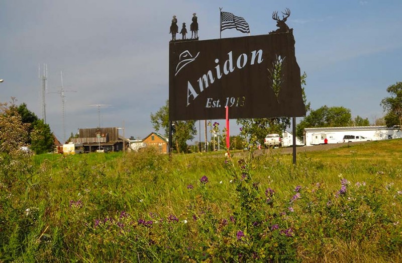 The highway turned due east and then went through town. There is not a lot in this thriving metropolis, and I think this picture says enough. 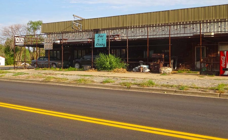 The summitpost.org directions say go east on US 85 for 2.0 miles from Amidon. That's how this north/south highway ended up being on an easterly direction to our turn, which Summit Post calls "a unmarked gravel road." Well, state highpointers will be happy to know it is marked. 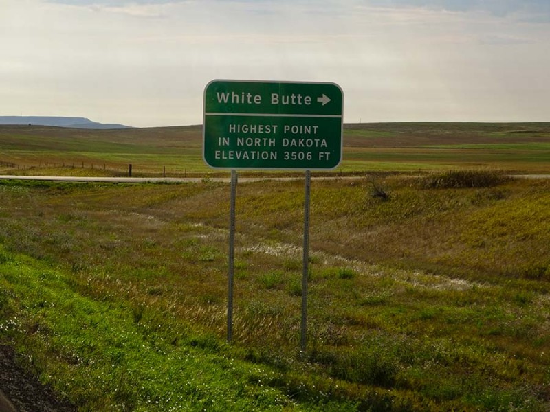 Ironically, there is no street sign on the right (south) side of the road as most would expect. However, on the north side of the road there is one. It's marked 140th Ave SW.  From here you turn right (south) on a gravel road and drive roughly five miles. At 5 miles on 140th Ave SW heading south, turn west (right) here on another gravel road. The dirt road heading west goes for 1.2 miles until you see this on the left side of the road. (Photo pointing south.)  We ponied up the $10 per vehicle for the right to hike on private property and....it's at this mailbox, where most instructions say...don't continue driving up this road to the farmhouse. So we didn't. 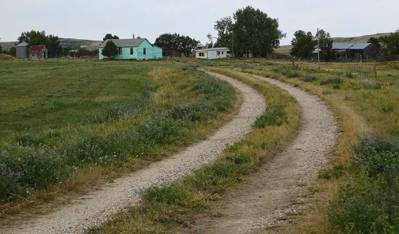 And the obvious instructions at this mailbox say....park here and don't drive on (south) up this road either. So again...we didn't. It was at this point that all of the sarcastic jokes began.... "Hey Dorthy, did you take your Diamox?" "Did anybody bring supplemental oxygen?" "I don't know if I can do this many verts in a day." 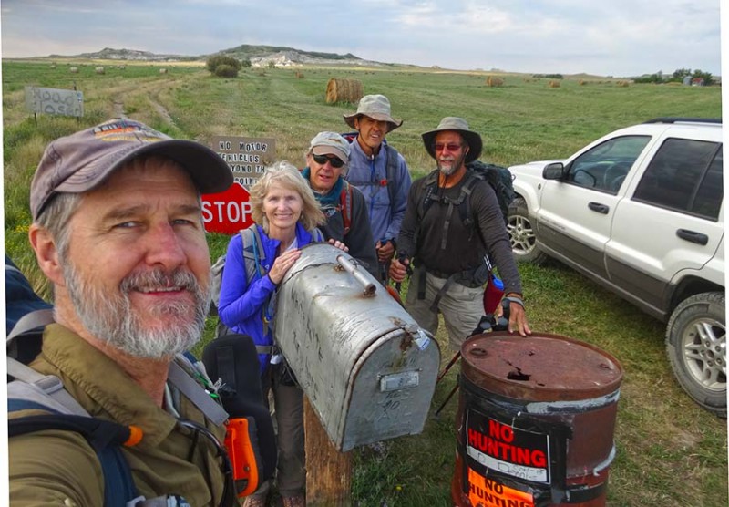 We were all in a jovial mood as we headed out to the North Dakota state highpoint....especially since the rainy storm had not arrived yet. 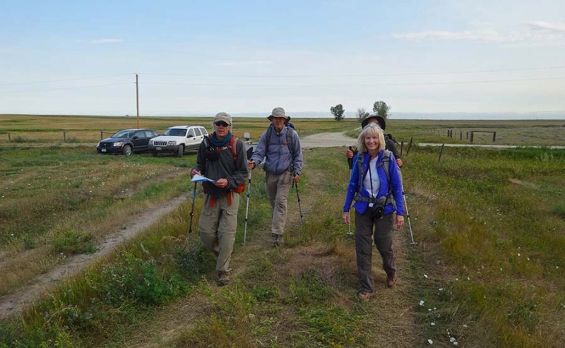 The route is a due south heading from the TH/parking area. For those climbing this in winter, I think you will be fine even there are no carins along the first part of this hike. Chances are, you will stay on course if you just follow along the fence line. Thankfully, Ian was route finding for us! 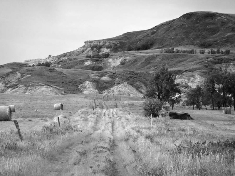 We did run into some confusion as we ran into a road block...and now there are two fence lines. 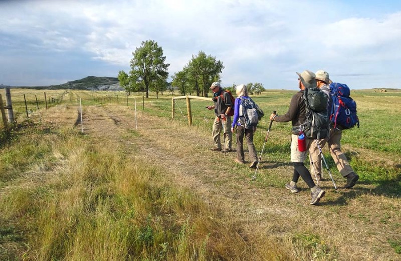 Oh Lord....what do we do!?  Tough route finding decisions! Thankfully we had read that there was an old abandoned farm house along the way. We saw it and knew we were ok and on course. 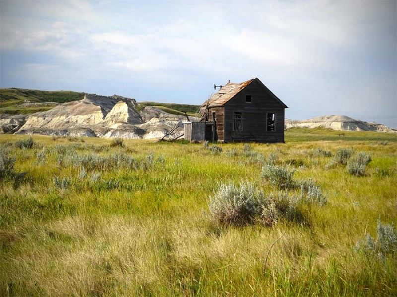 Just beyond the farm house was a former way of obtaining drinking water. A old fashioned windmill. This one obviously had seen it's better day.  That old farmhouse caught the attention of Mark and Logs. Not only did they take a lot of photos, but ventured up and in to scout out this old relic. 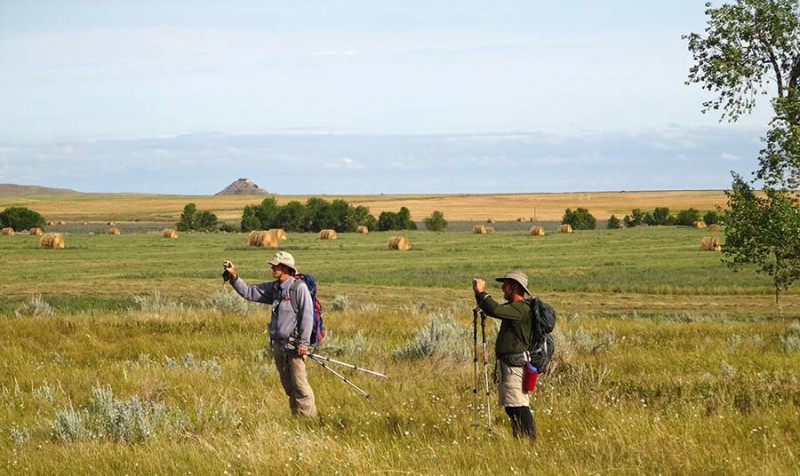 Their side-trip put them behind the rest of our group.  We decided to adhere to the mountaineers creed and to wait for them and not get separated, especially since the terrain took a drastic change... from prairie grass to chalk. You never know what dangers lurk ahead! 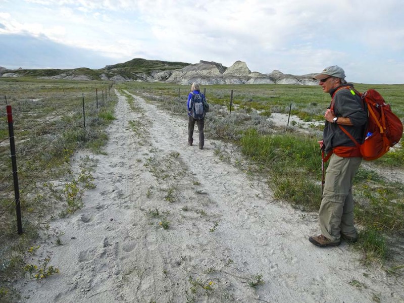 And lo and behold....a sink hole! 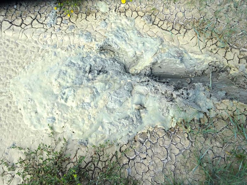 Poor Mark got sucked in...up to his ankles! Yuk! We almost lost him. 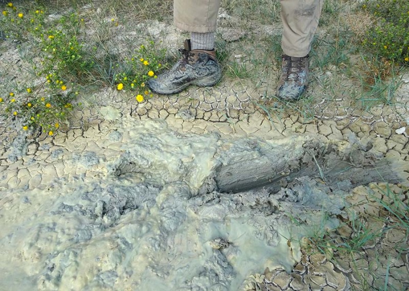 At the end of this road of chalk and quicksand, we made it to another fenced dead end. Thankfully, Dorthy found a gate opening that was unlocked. We figured this was the way to go. 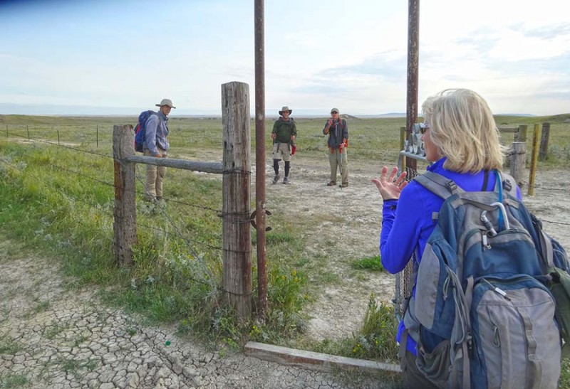 And yes...once again, we are heading due south along the (or another) fence line. While there are not carins, this appears to be the correct route. 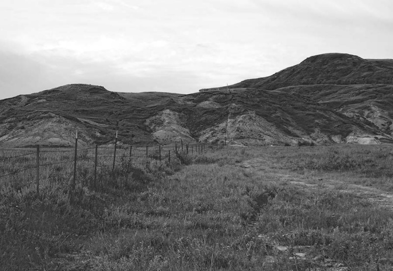 Ian wasn't so sure, so he pulled out his GPS, map, and instructions. 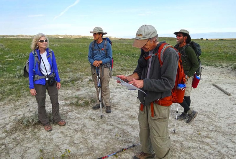 With some careful consulting of the coordinates, Ian gave us his best guess... 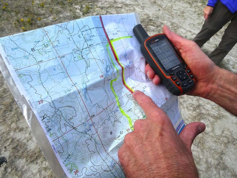 Further south we go. And as you can tell, the terrain is about to quickly change. Our 1 vertical foot per hour is about to ramp up to a bit more than that.  Mark ordered a extra-large, nature pizza and had it delivered.  And as we entered into this chalky maze, we were thrilled to have found a carin which told us we weren't lost. Praise God! It's amazing to see how much peace and comfort a carin can bring while in the backcountry. 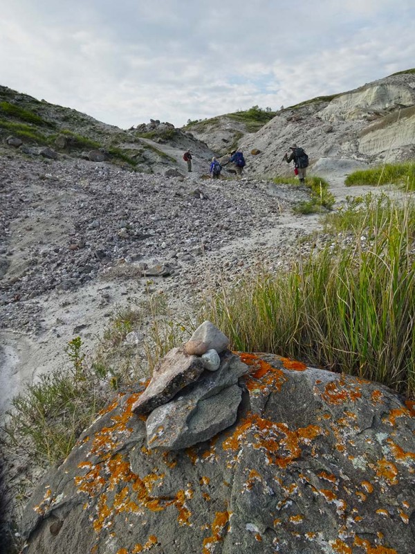 The path of least resistance took us a little west, and up a gully. Here is a photo looking back north and where we had come from.  A zoomed in photo just a little further west (left) of the road we hiked up shows the old VanDeals farmhouse. Our road/trail is out-of-frame to the right. 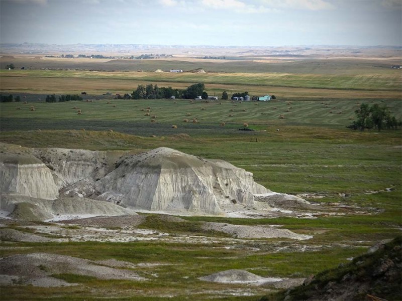 We eventually made it to the strand of trees mentioned in the summitpost.org route instructions. 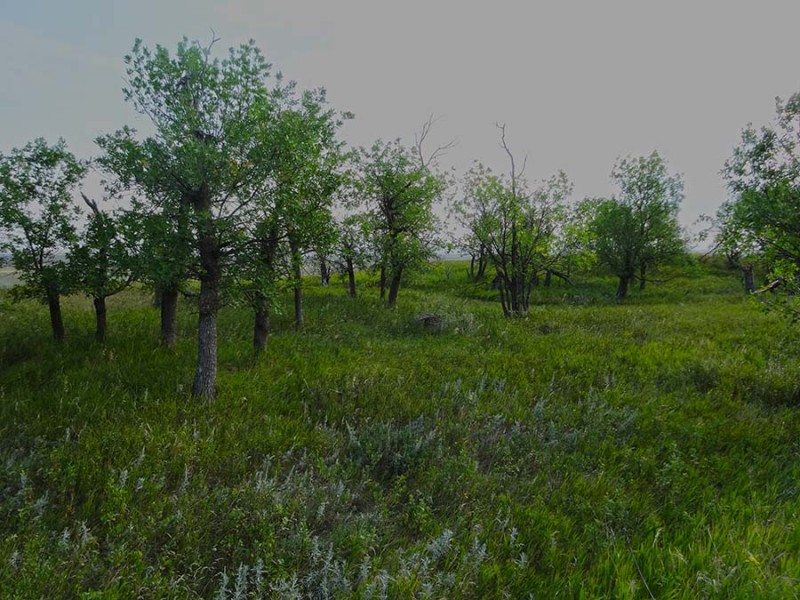 Once past the grove of trees, we could see the false summit further on south. 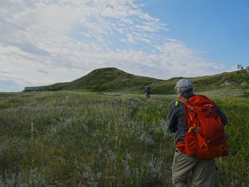 Higher up with a look back, gives a nice overview of the grove of trees we passed. Further past the strand of trees, you can easily see the road we hiked in a southerly direction. 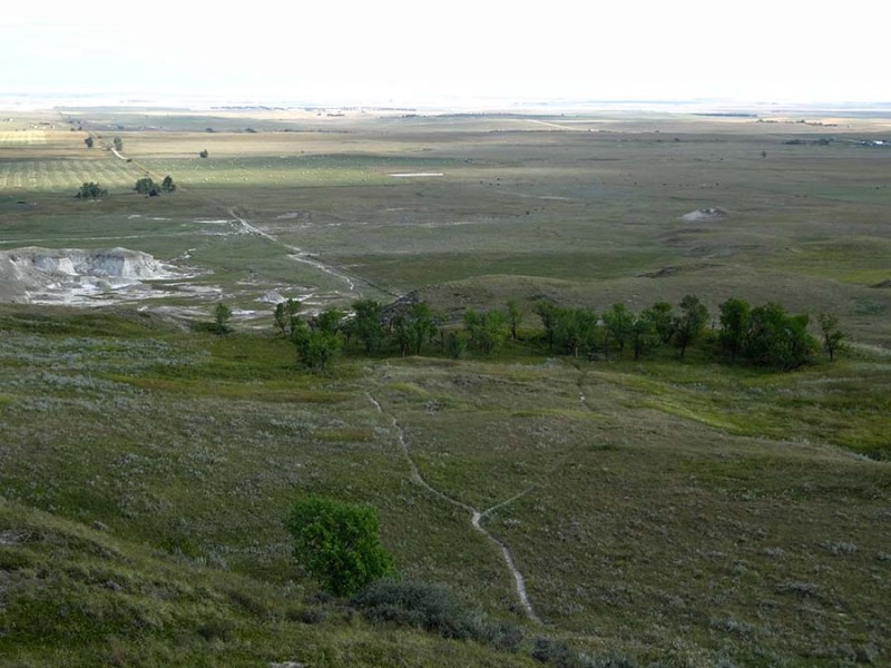 Now the terrain has entered into the dangerous avalanche angle! If climbing this in winter, be careful if this slope as snow-loaded! 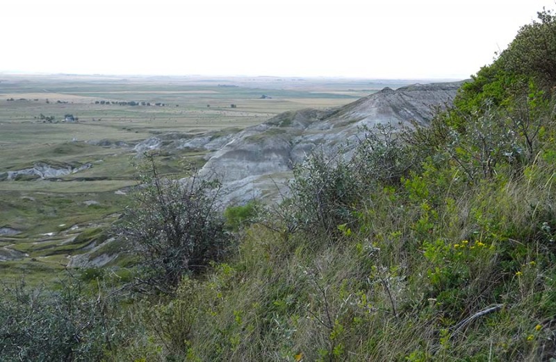 Once on top of the false-summit, the true summit can be seen off a short distance a way. We now have success in our sights as Mark and Dorthy ramp up on the final summit pitch. 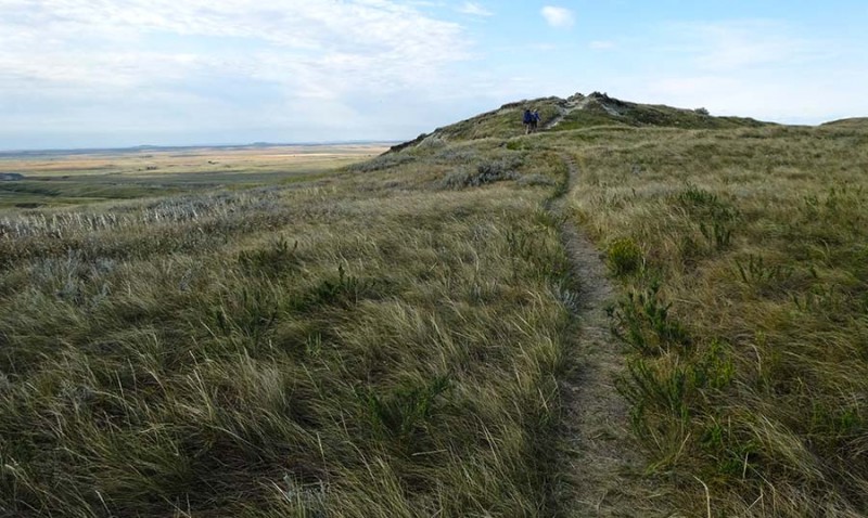 They made it! Successful celebratory summiteers! 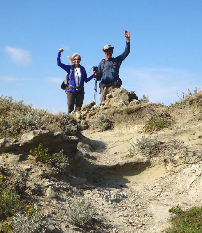 White Butte...the highpoint of the entire state of North Dakota. The elevated summit marker and ammo box are proof. 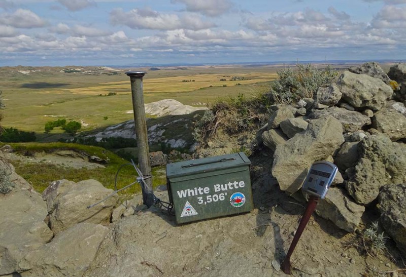 A look back from the summit block of our route and the road we hiked. This view is looking due north. 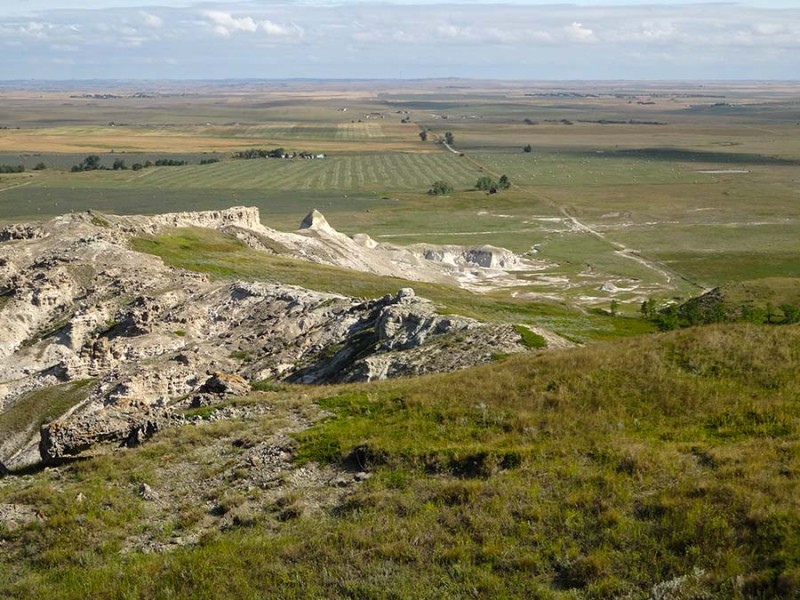 We had to get the obligatory group photo after we earned this hard fought for summit. 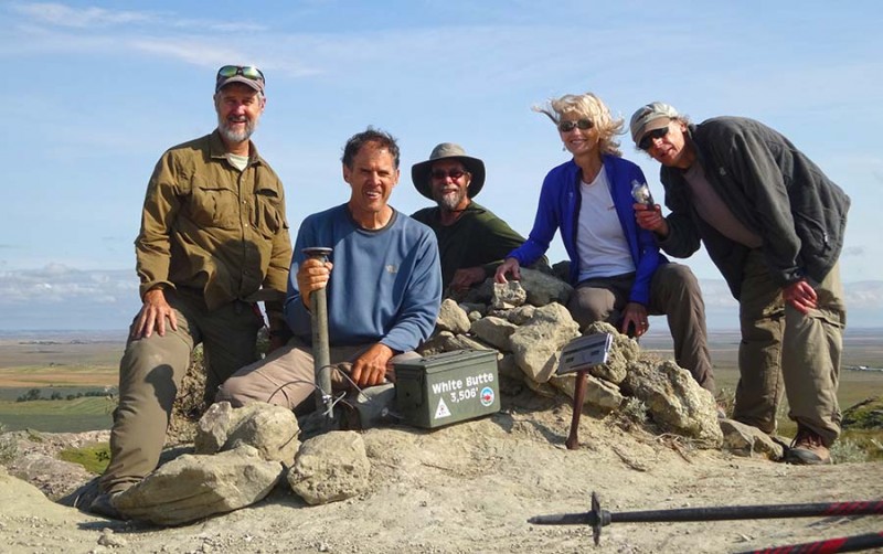 A look back to the south-east. 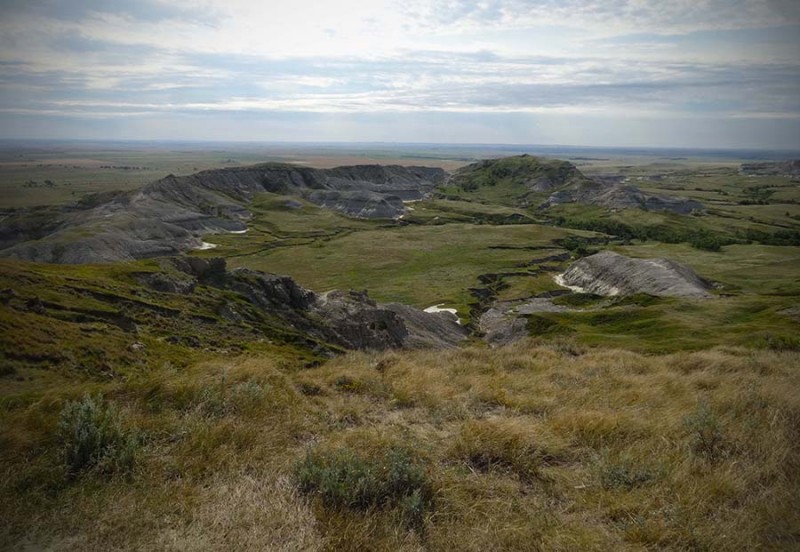 The winds were actually pretty stout up here for this day. Which is why I scouted around and found this wind-break a bit further to the south. If you ever climb this highpoint in a blizzard or hurricane, this could be useful beta to have! 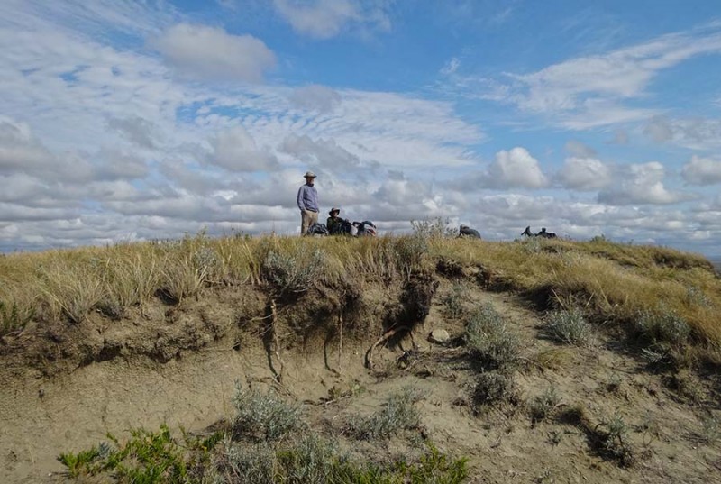 We spent a good amount of time on this summit enjoying our day and time together. We were thankful the incoming storm hadn't arrived yet. However the time to come down came. We decided to take the direct route down which followed the fence line the entire way. From up here you can see the white trail that ventured/angled towards the west that we took coming up. Either way works however.... 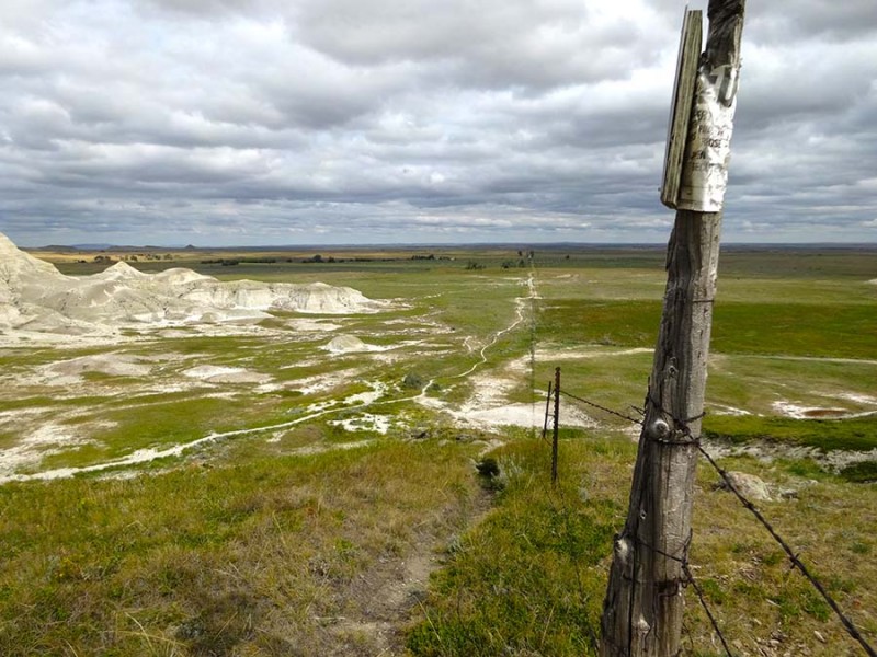 we soon discovered that this was a bit more challenging. In fact, Dorthy took a spill in this chalky choss. And it wasn't a pleasant spill. She injured her wrist which was extremely painful. In fact, when she returned home and got it x-rayed, she discovered she actually fractured a bone!  So as it turned out, one of the least difficult state highpoints of the 50, turned out to bring an injury to one of our party. Which just goes to show you that you can't take any of these peaks for granite. So very sorry for your injury Dorthy. Hope you heal up quickly. After our climb of the state highpoint, we all drove north to the Theodore Roosevelt National Park. I highly recommend a visit to these "badlands" in western North Dakota. The history about Teddy Roosevelt and his role in our national park system was wonderful to discover as well as seeing the landscapes he so treasured. Ian and Dorthy, it was a joy to meet up with you both even though is wasn't for our planned climb of Granite Peak....which was the next state highpoint in my State Highpoint August Extravaganza. You can find that trip report here: www.14ers.com/php14ers/tripreport.php?trip=17320&cpgm=tripmine So for now, we are 3 for 3! I am thankful to God for all he has given to us. Thumbnails for uploaded photos (click to open slideshow):
|
| Comments or Questions | |||||||||
|---|---|---|---|---|---|---|---|---|---|
|
Caution: The information contained in this report may not be accurate and should not be the only resource used in preparation for your climb. Failure to have the necessary experience, physical conditioning, supplies or equipment can result in injury or death. 14ers.com and the author(s) of this report provide no warranties, either express or implied, that the information provided is accurate or reliable. By using the information provided, you agree to indemnify and hold harmless 14ers.com and the report author(s) with respect to any claims and demands against them, including any attorney fees and expenses. Please read the 14ers.com Safety and Disclaimer pages for more information.
Please respect private property: 14ers.com supports the rights of private landowners to determine how and by whom their land will be used. In Colorado, it is your responsibility to determine if land is private and to obtain the appropriate permission before entering the property.


