| Report Type | Full |
| Peak(s) |
Mt Acoma - 10508 Twin Peaks - 11957 Mt Adams - 12121 Watanga Mtn - 12375 Hiamovi Mtn + Tower - 12395 Mt Irving Hale - 11754 Cooper Peak - 12296 "Blackfoot" - 12113 Thunderbolt Peak - 11938 |
| Date Posted | 09/13/2016 |
| Date Climbed | 09/10/2016 |
| Author | pbakwin |
| IPW NW 13 Summits |
|---|
|
Indian Peaks NW Loop with 13 summits 10-11 September 2016 with Mike Priddy After a suggestion by Mike, I thought I'd like to complete the Indian Peaks Wilderness summits. Roach lists about 50 summits, and to now I'd done roughly half. Most of what I haven't done are on the west side, hard to get to from my home in Boulder. So, I came up with a 2-day tour to clean up all the peaks in the remote NW corner of the IPW. We would try to get 13 summits: Acoma, Twin, "Roaring", Adams (in RMNP, but on the way), Watanga, Hiamovi, Hiamovi Tower, Irving Hale, Cooper, Marten, "Martenette", "Blackfoot" and Thunderbolt. A couple of reports on 14ers.com were helpful in planning. Steve Knapp & Brian Kalet did Irving Hale, the Hiamovis, Watanga, Adams, "Roaring" and Twin in a day from the Roaring Fork TH. Andrew Rose did a similar day trip, and then followed it with an ascent of Acoma from the Roaring Fork TH - exactly what we wanted to do and very encouraging since I had wondered if there would simply be too much downed timber to bushwhack up Acoma that way. Both these TRs have great photos and route descriptions. After a very cold night at the Roaring Fork TH, we started up the Knight Ridge trail at 8AM under absolutely clear skies - there was not a wisp of cloud the entire day. We saw 2 ladies starting up the trail, and these were the last people we saw until a ways down the Cascade Trail, more than 30 hours later! Up on top of Knight Ridge we left the trail and began a tedious, 3 mile bushwhack up the south side of Acoma. There were many downed trees and not much to recommend this route except that it was very direct, and there were loads of lovely ripe raspberries along the way. Whoever decided to name this insignificant shoulder on the west ridge of Twin is not going to get any atta-boys from me - Acoma is a pain. But the 'shwack went OK and soon we located the summit cairn and were admiring expansive views over Lake Granby and Shadow Lake. 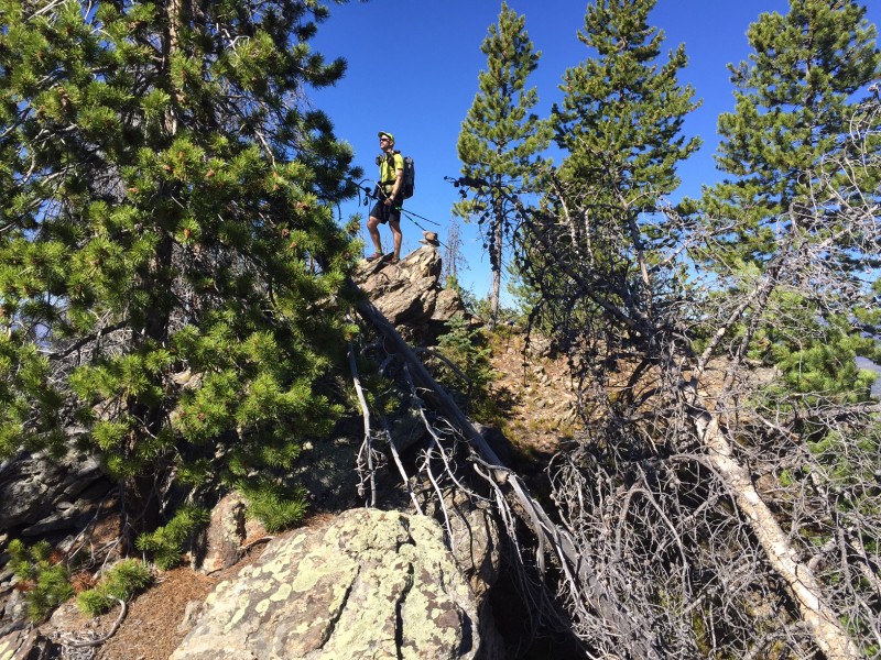 Bushwhacking and navigation were easier going up Twin, and our spirits were lifted as we finally broke out of the trees. We reached the summit of Twin just before noon. Getting over to "Roaring" was easy and quick - beautiful tundra hiking. We decended the short, dramatic Class 3 northeast ridge and traipsed on over to Adams, our first summit over 12,000'. Adams is in RMNP, but an easy add for us and really tough to come back and get later if Mike ever suggests tagging everything in the Park! 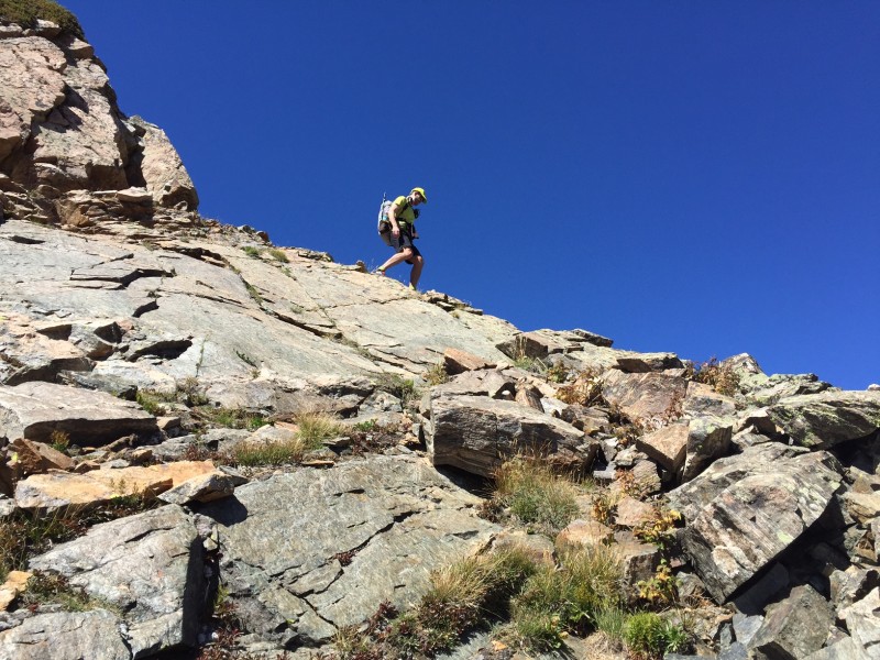 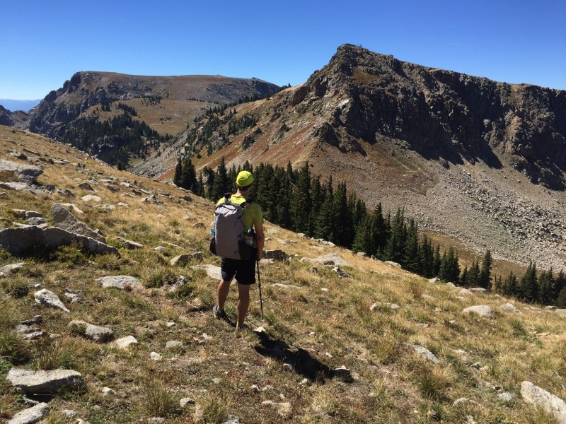 It was another quick, easy saunter over to Watanga, and we admired the views into Paradise Park, one of the most remote spots in RMNP. On the climb up Hiamovi I was beginning to notice the cumulative vert in my legs. We topped out at the high point of the trip (12,395') just before 3:30pm, and admired the rugged terrain over to Hiamovi Tower. Descending off Hiamovi was steep and loose, with a few Class 3 spots. The ascent of the Tower was short, fairly solid, and the only part of our trip that was cairned, which was helpful. After gawking over the dramatic east face of the Tower we retraced our route back to the Mtn-Tower saddle where we'd left our packs. We weren't exactly sure which way would be best to get to Irving Hale, so decided to more or less B-line it, descending several hundred feet to a small lake at about 11,150' and then climbing back up over a shoulder at around 11,600' before dropping again to intersect the Roaring Fork Trail at the Hiamovi - Irving Hale saddle. We dropped our packs again for the quick out-and-back on Irving Hale, thus completing all significant summits of the Roaring Fork drainage.  Returning to our packs we scooted on down the trail to Stone Lake, finding a great camp site right by the trail and just above the lake in the fading light of late evening. We'd had a full 11+ hour day and bagged 8 remote summits. Perfect so far! 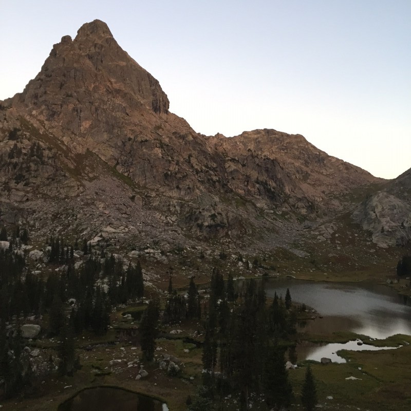 The night was mercifully warm and quite calm. I awoke at 5:30am and Mike was already rustling around, so it must be time to get up. We were fed, packed and gone in 45 minutes, heading on up the nasty, steep scree & gravel slope to the saddle north of Cooper (in retrospect it probably would have been better to ascend to the Cooper-Marten saddle). A thick layer of orographic cloud hung over the Continental Divide, and a stiff wind kept the day feeling quite chilly as we scrambed up the north ridge of Cooper and down talus to the Cooper-Marten saddle. 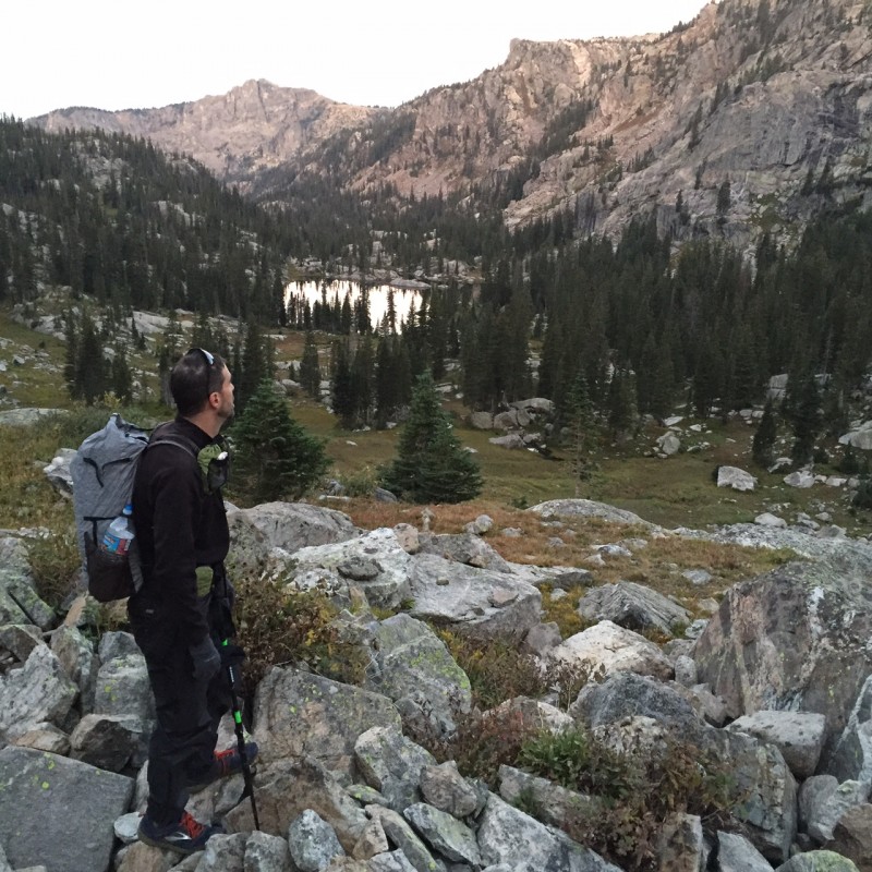 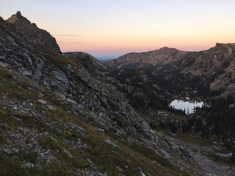 Marten had an interesting scramble to reach the summit - Class 3 but quite exposed feeling - and incredible views from the top. It is always very cool to see familiar territory from a new vantage point! We scrambled back down off the summit and cruised on over to "Martenette", and unnamed lump which boasts 310' of prominence. It was nice to get a "gimme" peak! 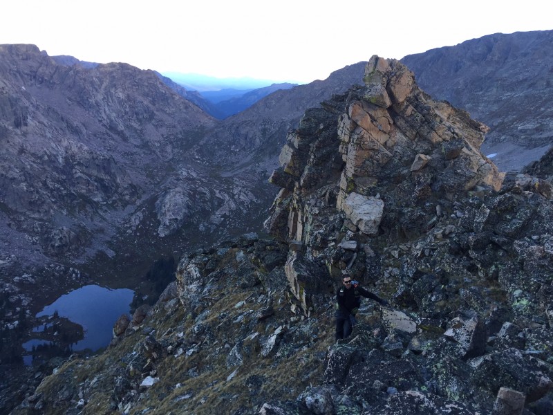 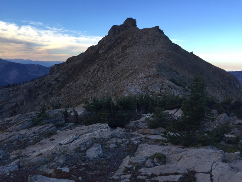 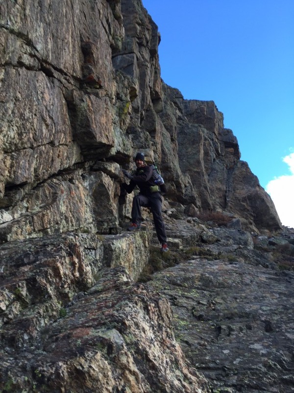  It was a quick descent and bushwhack down to the Gourd Lake Trail. So many of the IPW trails are steep and rocky, but this rather obscure trail boasts countless switchbacks, making the grade quite mellow, and the tread is remarkably smooth. A pleasure! We were on the Buchanan Pass Trail for only 15 minutes before turning south and crossing the creek - too soon, as we were soon humping up a super steep forested slope (the slope appears less steep a bit further to the southeast). Fortunately, the grade relented after a couple hundred vertical feet. The iPhone GPS coupled with Gaia was critical for navigating through the forest to the ridge leading to the "Blackfoot" - Thunderbolt saddle. It was a long ascent to the saddle, then a quick, 500' jaunt to the summit of "Blackfoot". The wind was so strong (and cold!) in this section that I had to remove my hat or it would have blown off. "Blackfoot" seems to be right in the center of the IPW, and has incredible views of Lone Eagle Cirque and the Mohling Traverse. 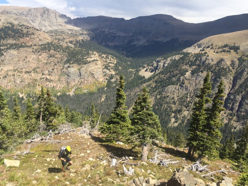 Our final summit, Thunderbolt, was an easy stroll from "Blackfoot", followed by a STEEP 2200' descent straight down to the Cascade Creek Trail. It was then a quick 2 hour hike back to the Roaring Fork TH to complete our loop, which came out to nominally 35 miles (though definitely quite a bit more) with about 14,000' of elevation gain for 13 "official" summits. 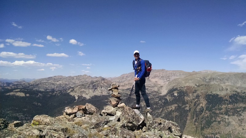 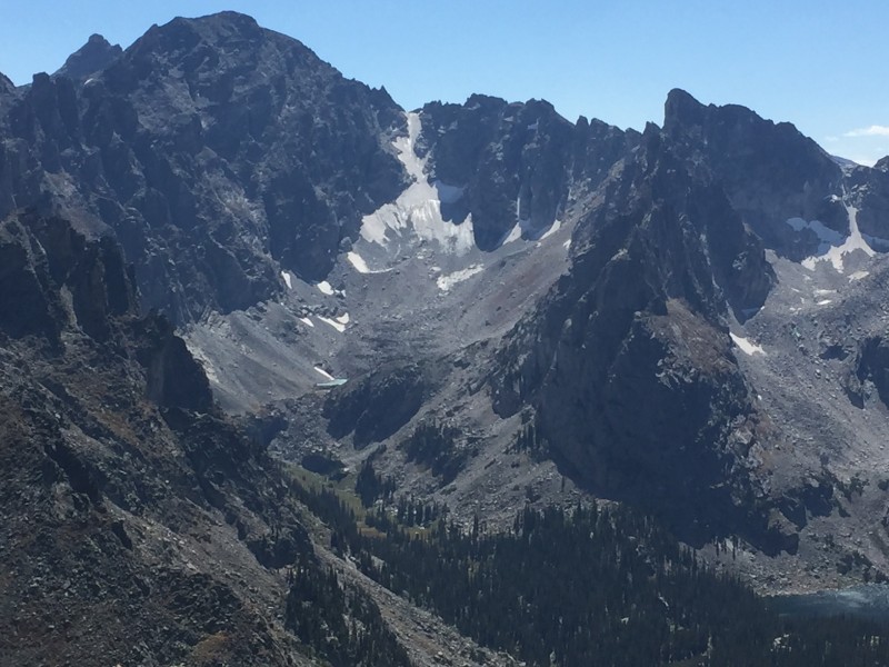 Roaring Fork TH (8281'), 8:04 Acoma (10508'), 10:46 Twin (11957'), 11:55 "Roaring" (11721'), 12:35 Adams (12121'), 13:20 Watanga (12375'), 14:07 Hiamovi (12395'), 15:25 Hiamovi Tower (12220'), 16:16 Irving Hale (11754'), 18:12 Stone Lake camp (arrive), 19:25 Stone Lake camp (depart), 6:13 Cooper (12296'), 7:47 Marten (12041'), 8:48 "Martenette" (11361'), 9:40 "Blackfoot" (12113'), 13:14 Thunderbolt (11938'), 13:42 Cascade Trail, 14:35 Roaring Fork TH, 16:35 Note that the GPS track provided here is approximate and was put together from lines drawn on caltopo.com, other people's GPS tracks, and some points from Mike's SPOT tracker, which malfunctioned for much of the trip. Thumbnails for uploaded photos (click to open slideshow):
|
| Comments or Questions | ||||||||||||
|---|---|---|---|---|---|---|---|---|---|---|---|---|
|
Caution: The information contained in this report may not be accurate and should not be the only resource used in preparation for your climb. Failure to have the necessary experience, physical conditioning, supplies or equipment can result in injury or death. 14ers.com and the author(s) of this report provide no warranties, either express or implied, that the information provided is accurate or reliable. By using the information provided, you agree to indemnify and hold harmless 14ers.com and the report author(s) with respect to any claims and demands against them, including any attorney fees and expenses. Please read the 14ers.com Safety and Disclaimer pages for more information.
Please respect private property: 14ers.com supports the rights of private landowners to determine how and by whom their land will be used. In Colorado, it is your responsibility to determine if land is private and to obtain the appropriate permission before entering the property.