Download Agreement, Release, and Acknowledgement of Risk:
You (the person requesting this file download) fully understand mountain climbing ("Activity") involves risks and dangers of serious bodily injury, including permanent disability, paralysis, and death ("Risks") and you fully accept and assume all such risks and all responsibility for losses, costs, and damages you incur as a result of your participation in this Activity.
You acknowledge that information in the file you have chosen to download may not be accurate and may contain errors. You agree to assume all risks when using this information and agree to release and discharge 14ers.com, 14ers Inc. and the author(s) of such information (collectively, the "Released Parties").
You hereby discharge the Released Parties from all damages, actions, claims and liabilities of any nature, specifically including, but not limited to, damages, actions, claims and liabilities arising from or related to the negligence of the Released Parties. You further agree to indemnify, hold harmless and defend 14ers.com, 14ers Inc. and each of the other Released Parties from and against any loss, damage, liability and expense, including costs and attorney fees, incurred by 14ers.com, 14ers Inc. or any of the other Released Parties as a result of you using information provided on the 14ers.com or 14ers Inc. websites.
You have read this agreement, fully understand its terms and intend it to be a complete and unconditional release of all liability to the greatest extent allowed by law and agree that if any portion of this agreement is held to be invalid the balance, notwithstanding, shall continue in full force and effect.
By clicking "OK" you agree to these terms. If you DO NOT agree, click "Cancel"...
our first view of Kings Peak 13 August, 2016--Drive to Utah and pack in
14 August, 2016"climb day
15 August, 2016"pack out day and drive to Idaho for Borah Peak
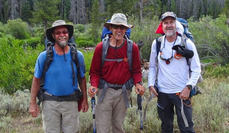
Crew: Logs Rule, Mark Ericson, Britt Jones
I have entered in earnest into what I call "my adult scavenger hunt." It's traveling across America to stand on top of each state highpoint. I have been amazed to see how popular this highpointing is. It's crazy and it's the next list I've latched on to after climbing all of Colorado's ranked 14ers, unranked 14ers, and Colorado's Centennials (100 highest ranked peaks).
Much of my beta for this peak came from Bob Bolton/Matt Lemke's SummitPost page:
The info on here is accurate, current, and reliable... as of August 2016, at least for the Henry's Fork
trailhead and the standard route we took.
On this trip, I had the idea of doing a giant, clock-wise, driving loop to go for Utah, Idaho,
Montana, and North Dakota all in one big butt-numbing road trip. Since I am a CMC trip leader,
I posted my STATE HIGHPOINT AUGUST EXTRAVGANZA on the CMC calendar (cmc.org)
to see if I could possibly find another partner to join me. My goal was to find
someone else to come along since my wife doesn't like me climbing alone. I also wanted
someone to split the gas bill with, since I was going to be driving over
2,500 miles! It worked as two climbers signed up on the CMC site. Logs (L), Mark (C), Britt (R)
We left Colorado at o-dark-thirty. Our route took us from the front range of Colorado,
north to Wyoming, and then west via I-80 to the northwest corner of Utah. My desire for the early start
was to get to the Henry's Fork trailhead in the afternoon. Be forewarned, this place
is busy in summer. We almost didn't find a parking spot at the congested trailhead.
We had 7.5 miles to hike in to our desire camping location at Dollar Lake.
I wanted a location that had water and was hoping to get there before dark, in time
to set up camp.
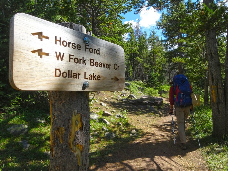
We had no problem finding this very popular trail. Once on it, we found that
route finding wouldn't be to difficult. Besides many people climbing this states'
highpoint, many people are on this trail to run and to go fishing. This surprised me since it's not
very close to Salt Lake City or any other major city. this trail was deep and wide
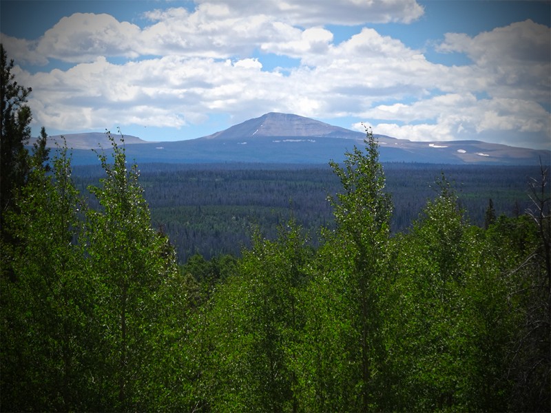
This is a very mellow trail with not much elevation gain. It's a beautiful area in the
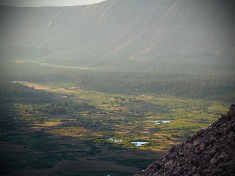
High Uintas Wilderness Area. Kings seen on the approach
It was nice to see a few signs pointing the way, especially when the time comes to cross the creek at Elkhart Crossing.
Continue on up the trail where there was a small log bridge constructed that makes easy passage. It's nice to know you are on route!
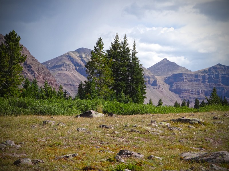
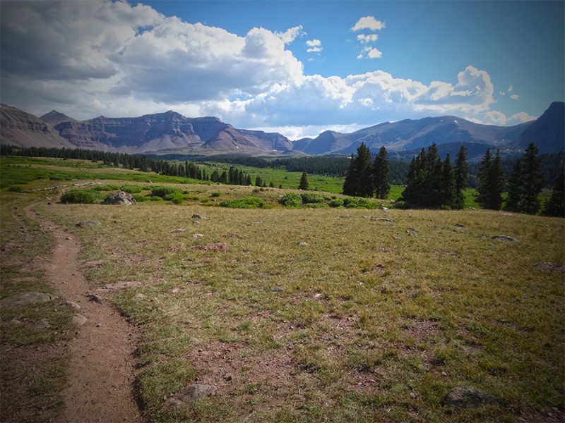
After the creek crossing, we came out of the forest and entered into open areas where
the views were spectacular. Here we ran into a father whose daughter wanted to stand on the top of Utah! wide open spaces
Our majestic goal came into view off in the distance. Kings Peak standing mighty
proud. Kings!
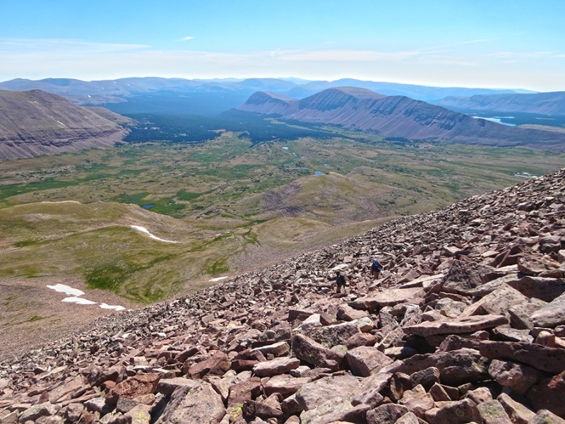
There is nothing but gorgeous scenery in this Henry's Fork Basin. I was really
enjoying this hike in absolutely perfect weather on this August day. looks like a cattle trail
We left the parking lot around 1:30 and made it to Dollar Lake by 5:30pm.
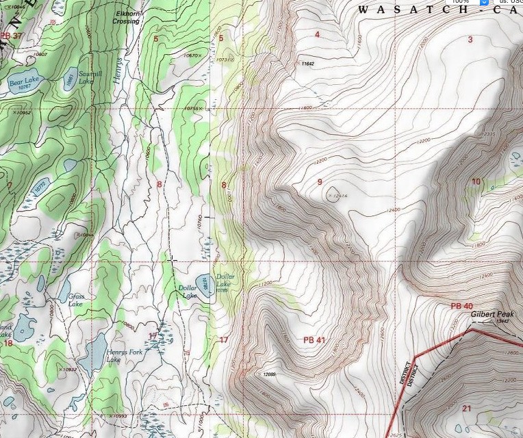
I had talked with another climbing friend and fellow state high pointer Sue Personett,
before this trip. She gave me some advice on how to find
Dollar Lake since it isn't visible from the trail. She mentioned to look for the
giant horseshoe indention in the mountainous ridge off to the left as you are
hiking in going south. You will hike until you are almost past the far (southerly)
curve of the horseshoe. It is here that you turn left towards that southern part
of the horseshoe. The elevation is just below 7,800 feet. Look at this map. the trail is in the trees at the point of turning left for Dollar Lake
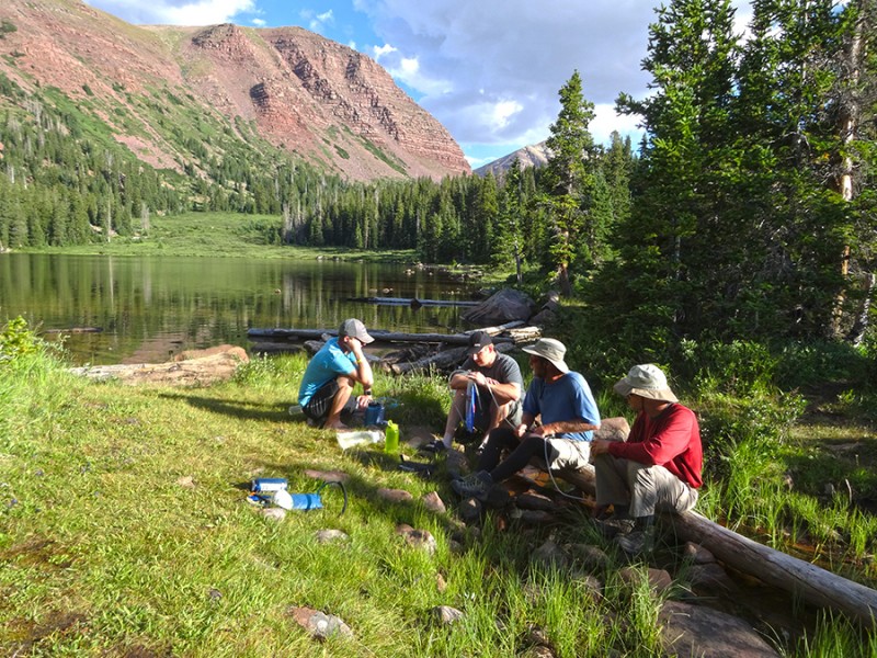
Our first order of business, setting up camp. camp!
During this time, we had some other climbers come visit. They had climbed Kings today, and then got back to camp where theiir water filter
had broke and were in need up borrowing one. Logs loaned them his
filter and then we all went to water-up on the edge of Dollar Lake. water fill up
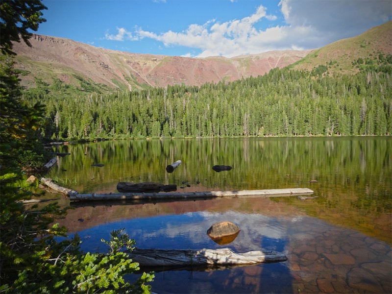
This was a very tranquil and serene place on this warm afternoon. Peaceful and calm
come to mind as we relaxed this summer evening. Dollar Lake
Looking across Dollar Lake a short time before sundown gave us a glimpse of
tomorrow's goal. Kings Peak can be seen far off in the distance in the shadows. sunset at Dollar Lake!
We hit the hay soon after sundown as we had planned an alpine start. Having
studied the route, it looked like the trail was pretty straightforward...heading
due south towards Gunsight Pass. We didn't think we would have any trouble
hiking this in the dark so our plan was to leave a hour before sunrise. This worked
just fine. We could easily follow the trail in the dark and got to Gunsight Pass
in the early morning light. (Gunsight Pass is the low spot directly under under
the clouds in previous photo.)
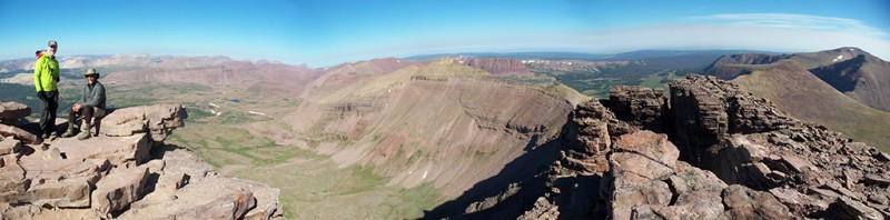
At the top of Gunsight Pass at 11,888', the views over the into Painter's Basin
were just gorgeous at sunrise. the views from Gunsight Pass Painter Basin
The standard route takes you right over the pass and down into Painter's Basin, but I don't recommend it.
Yes, this would be the path of least resistance, but it is not the shortest route by far.
To do this you lose a lot of elevation and hike extra distance to go down and around that way.
If you are okay with a little scrambling, take a sharp right/west right at the top of
Gunsight Pass and take the direct route towards Anderson Pass underneath 13,103'. the short cut-direct towards Anderson Pass
It involves some sections of talus hopping and route finding as there are several
rabbit trails with carins everywhere. Taking this adventurous route sure seems to save a good amount of
time and distance going more direct. there is some Class 3 scrambling in here
After a short time of extra exertion, the effort pays off as you reach easy hiking
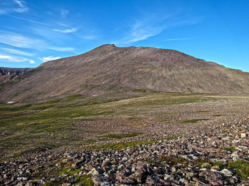
on tundra and a nice view of Kings Peak. Logs (L), Britt (R)
King's Peak looks easy from here. Kings Peak
We actually talked about heading straight up. We climb stuff like that all
the time here in Colorado, right? But, we decided to get back on the standard route and head for
Anderson Pass which is the low spot left of those two points off in the distance on the right. Anderson Pass
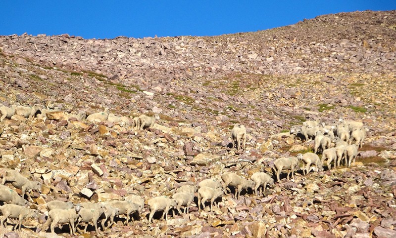
Well, guess what....we ran into some of the locals. And yes, right on our trail!
Who would have thought we would hit a traffic jam here in this wilderness?
Of course all of the sheep jokes coming out now were really baaaaaaad! The locals...
And I tell ya, looking at these guys, it seemed they were saying, "git off my
mountain!" Leave!
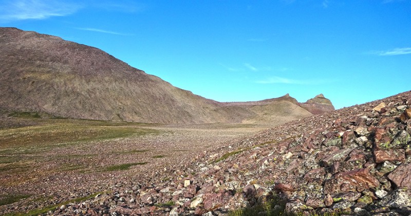
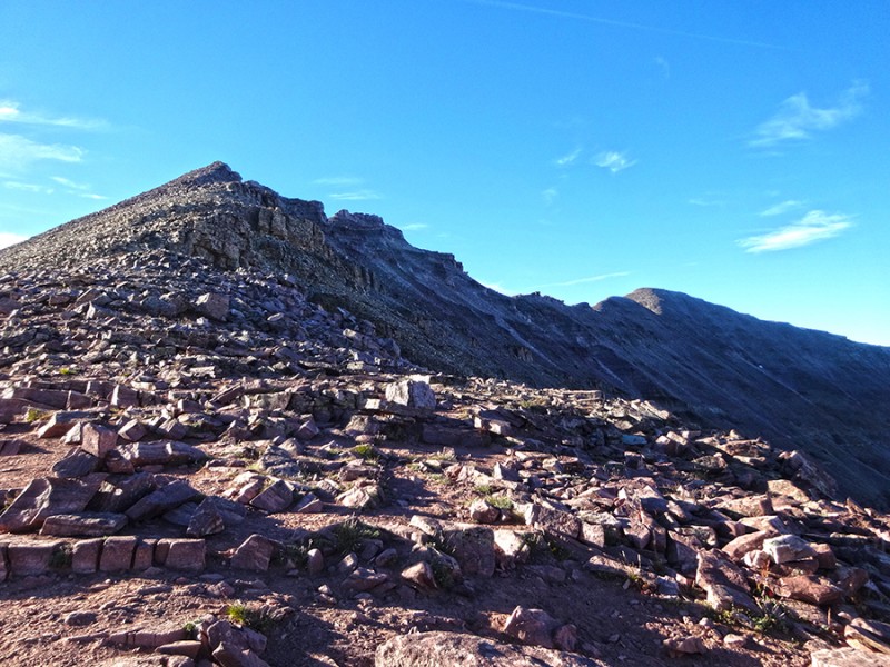
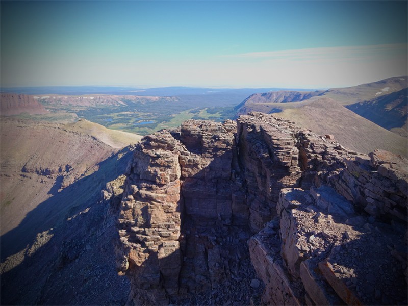
Once we made it up to Anderson Pass, it was time to turn left/back south. When we looked up.....oh wow! Is that the high point way back there? Woah...that's a long, long way! the ridge
After hiking part way up this ridge and checking my GPS, I discovered that we were
correct, Kings Peak is the one in the middle. South Kings Peak (the one off in the
distance) is 16' lower at 13,512'. Whew!
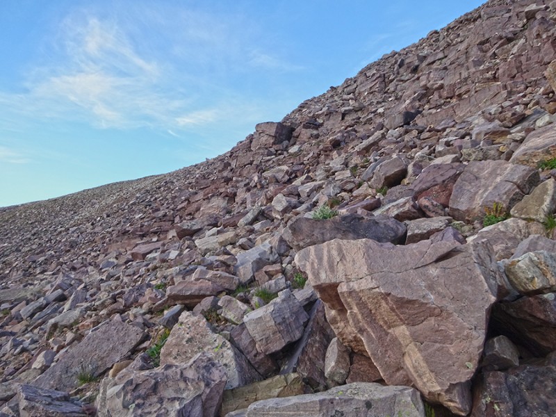
Hiking this ridge wasn't so bad at first. It seemed relatively easy and what I was
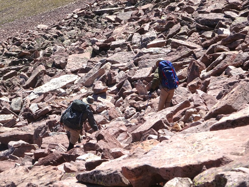
expecting. However, a little later the trail totally disappeared and it became more difficult with some bizarre rock pieces. blocks!
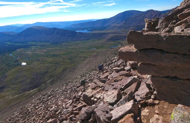
...talus hopping and scrambling. I
thought we would be sticking to the ridge proper, but as it turned out, we had
some high winds and it was better to stay east of the ridge. not an easy trail talus hopping
Higher near the top and about � of the way up, we got back on the ridge and
what a view Logs found! Logs enjoying the views to the west
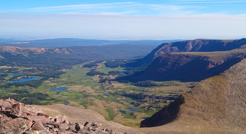
Looking back to the north we got the most wonderful view back into Henry's Fork
Basin where we could easily see the horseshoe in the ridge and Dollar Lake. looking back north at Henry's Fork Basin
After more talus hopping and scrambling than what was anticipated, we finally made
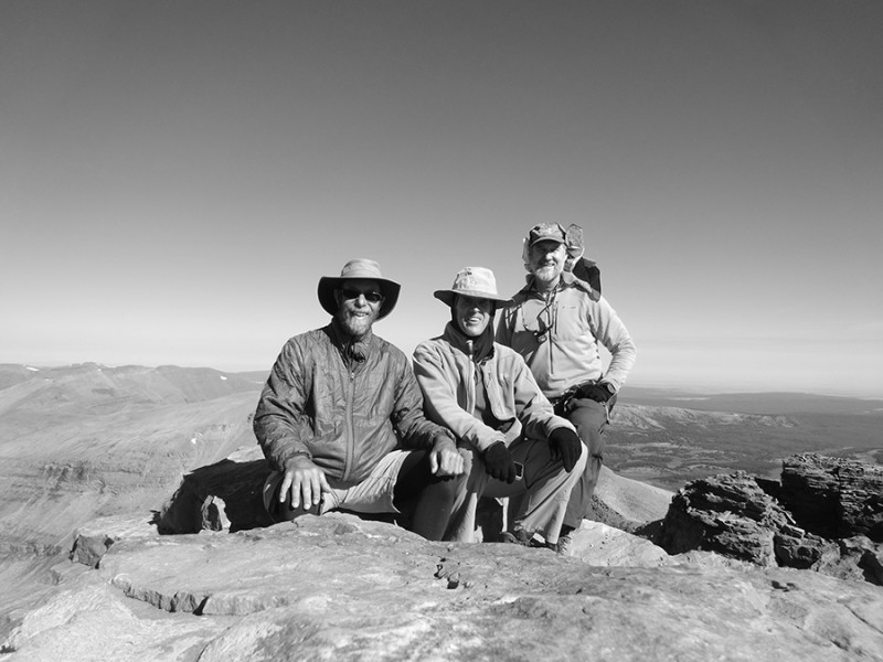
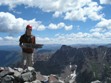
our first goal of this State Highpoint August Extravaganza...Utah's highpoint! summit!
This sarcastic group of three amigos became happy climbers to get another state highpoint
under our belts. summit selfie
This turned out to be one really beautiful place to visit. photo courtesy Mark Ericson
And this mountain has some character to go with it. Great climb! a little air
And you know what...since we were Colorado climbers, we did decide to take the direct
route off of the mountain instead of following the ridgeline back to Anderson Pass! direct route back this rock was loose and wobbly
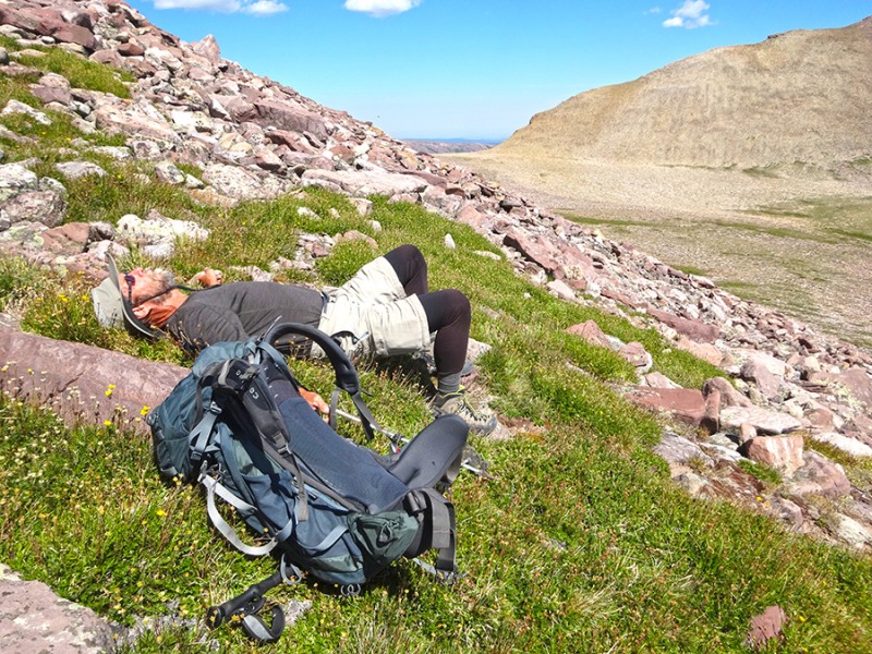
It was such a nice warm day, we decided to take a nap once we reach some tundra.
It's not everyday that you get such pristine weather as this, and the time to enjoy it.
We knew this was a long route at 28 miles round trip. So we planned a second night
back at our Dollar Lake camp. So, there was no reason to hurry down off this mountain.
What a nice change from most climbs. Now this is what climbing and enjoying God's creation is suppose to
be all about, right?
it's time to relax
Up next...we climbed Borah Peak, the Idaho state highpoint.
Thumbnails for uploaded photos (click to open slideshow):
Britt, I was up there about this time last year. I thought it was a fantastic hike with great camping. I came down the direct route as well; with all of the tippy rocks I was glad to be back on the tundra and wished I had taken the ridge route back to the pass.
I took the extra night after the summit and loved it. Logistics get kind of weird if you are back at the car at 5pm; you are still a long ways from anywhere.
Britt - I always thought I was the happiest guy around but when I see pics of you with your proverbial smile, I realize I'm still on the JV team. Nice, nice report!
Henry Fork is actually less than 3 hours drive from SLC, plus contains the state highpoint which makes it very popular.
On top of that, the gradual elevation change has made the "King's in a Day" trail run more popular recently within the running community.
Caution: The information contained in this report may not be accurate and should not be the only resource used in preparation for your climb. Failure to have the necessary experience, physical conditioning, supplies or equipment can result in injury or death. 14ers.com and the author(s) of this report provide no warranties, either express or implied, that the information provided is accurate or reliable. By using the information provided, you agree to indemnify and hold harmless 14ers.com and the report author(s) with respect to any claims and demands against them, including any attorney fees and expenses. Please read the 14ers.com Safety and Disclaimer pages for more information.
Please respect private property: 14ers.com supports the rights of private landowners to determine how and by whom their land will be used. In Colorado, it is your responsibility to determine if land is private and to obtain the appropriate permission before entering the property.