| Report Type | Full |
| Peak(s) |
Pigeon Peak - 13,977 feet Turret Peak - 13,837 feet |
| Date Posted | 09/01/2016 |
| Date Climbed | 08/28/2016 |
| Author | Yikes |
| Purgatory to Pigeon via N Pigeon Creek (aka Turn Eon) |
|---|
|
Hikers: The Usual Suspects (me, myself and the ever elusive I) Distance, elevation: 28 miles, 8800 "Poor trail", "Steep bushwhack", "Brutally steep" - Roach. Thanks Gerry, you have me sold. I need to punish myself a little, and not with coal smoke and motion sickness. I'm not a fan of the train, if you can't tell. So what's an extra 19 miles? Apparently a lot. Having only four Centennials left to climb, I decided to give myself a break from the office and take a three day weekend down in the San Juans. My hiking this summer has been a little sporadic, so I figured I would go "easy" with Pigeon/Turret and save the harder ones (Jagged, Vestal) for later. I was also inspired by Matt's awesome trip report. Most of my winter hikes this past season were 15+ miles, so I figured I could easily tackle the 28 miler in summer conditions as a two day hike. It ended up being a bit of a death march (apologies to the survivors of Bataan). Trying to work around the recent storms, I drove down to Durango from Salida on Saturday afternoon. I knew I wouldn't sleep well in the tent, so booked a room at the Fairfield Inn. Durango is a very popular tourist destination, and the hotels were charging top dollar during the prime season. I didn't appreciate the bill, but I did appreciate the comfortable bed. After checking in, I walked over to the downtown to load up on calories. Many of the Main Street restaurants were packed (not my scene), so I made my way over to Fifth Street Eatery where I was seated at a nice quiet patio table out on the grass. I highly recommend the restaurant and their southern fried chicken (probably some of the best I've had). I slept in till 6:45, went down for the hotel's continental breakfast (nothing special) and loaded up the truck for the 30 min drive up to Purgatory. The trailhead is easy to find, just turn right at the entrance to the ski resort and park at the lake a hundred yards down the road. There is plenty of parking. The Purgatory Flats Tail leads you about 4 miles down to the Animas River. The trail is in great shape, although I did get my pants soaked hiking through tall grass in "the flats". There are a few side trails, but the main route is pretty obvious. The trail eventually climbs high above the Cascade Creek, where you hike along a pretty steep drop-off (pay attention to your feet...you definitely don't want to trip off the side of this trail). 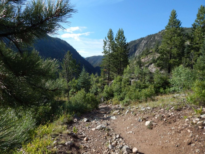 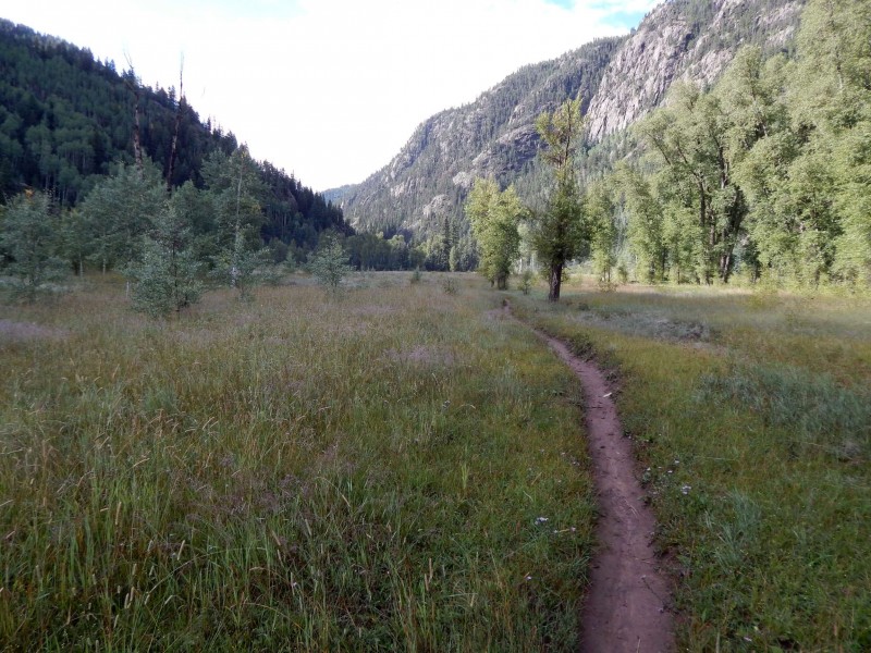 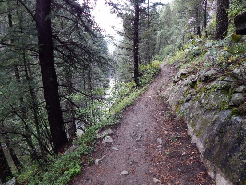 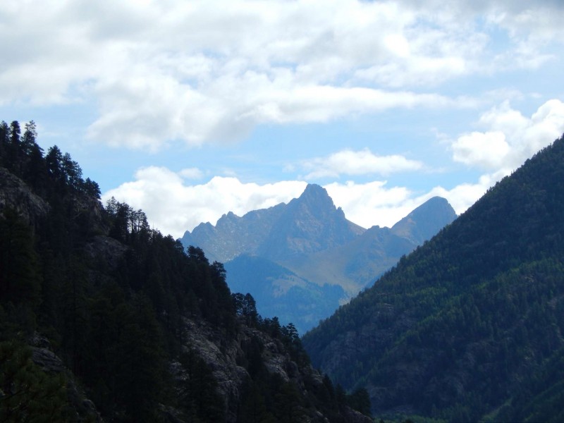 Once at the river, you cross over the sturdy suspension bridge and then cross the railroad tracks. The Animas River Trail starts at the railroad bridge. 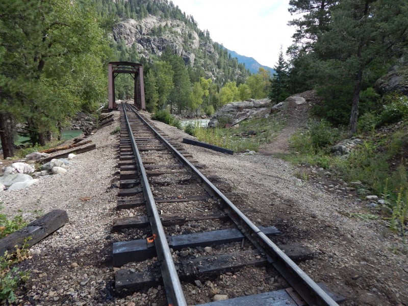 I had hiked up the Animas River Trail with Jeff on our Chicago Basin Winter 14ers trip several years back, so this trail section was familiar. At the time, the trail was light on snow, heavy on ice. Fortunately, no ice this time of year and my pack was 20 pounds lighter, so the hike went smoothly. There are many wonderful camping sites on this trail, but it was still too early and I continued on. I was planning on camping around 11,500 and knew the hill climb would be strenuous, so I took my time on this section of trail and conserved my energy. I had thought about camping at Needleton, but that would have been a rough summit day. 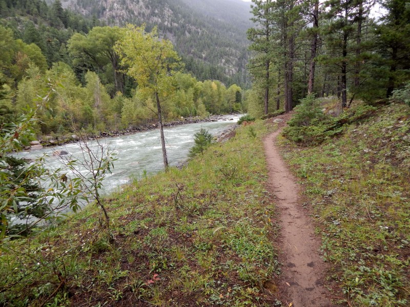 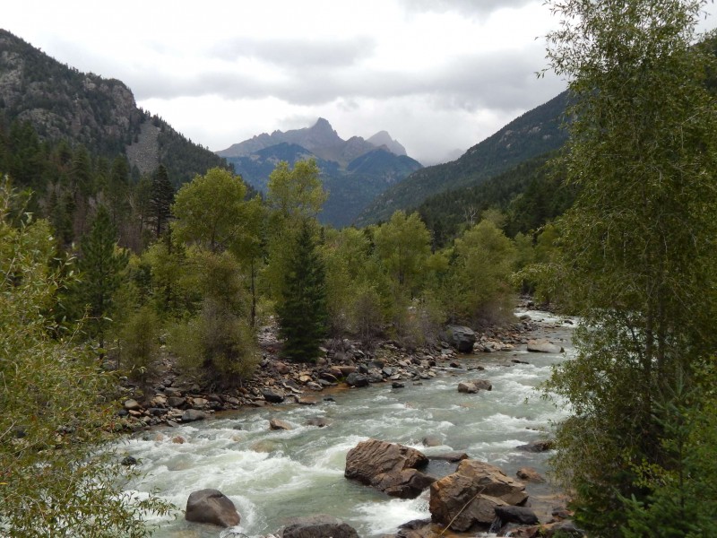 I made it to Needleton around 1:30 and crossed the bridge just to see if a train was arriving. It wasn't, so I crossed back over and headed up to the Ruby/Pigeon trail. I had attempted Pigeon/Turret a few years back, but the summit attempt was thwarted by a September snow storm that dumped more than a foot of snow on us . The N Pigeon Creek Trail is as advertised.. steep and (somewhat) brutal. It is well defined until the Ruby Creek split, but then is a p.i.t.a. bushwhack from 9800 - 11000. It starts out well enough with some sparse cairns, but the cairns peter out and you spend a lot of time second guessing your route. You see what looks like a faint trail that lasts for about...50 feet and then totally disappears, only to see a different faint trail 50 feet to the side... which lasts for about.... 50 feet. Repeat ad nauseum. 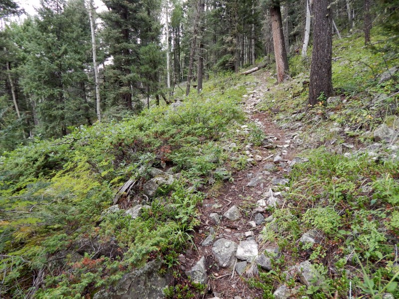 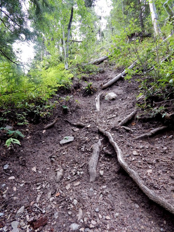 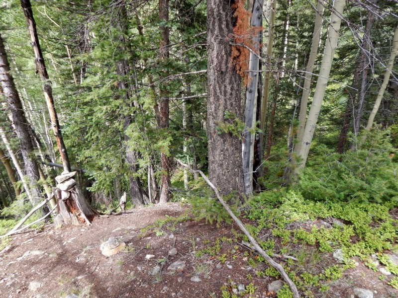 Finally around 11,000 feet, the ground starts to level out and the trees thin. I was growing pretty tired at that point and found a small (almost, but not quite) flat spot in the trees at 11,500. After setting up my tent and grabbing a bite to eat, I hiked up to treeline to check out the sights. It immediately started to sprinkle, so I booked back to the tent where it then poured for several hours straight. Rain at that elevation equals probable snow at 13k+. Was I going to be denied Pigeon/Turret again??? I figured it wouldn't help things worrying about it, so went to sleep (around 7pm) and tossed and turned until 5:30. After quickly getting ready, I hiked up to the basin. The meadow up in the basin is large enough for about 500 tents, perhaps they will hold the next Gentlemen of the Road music festival up there. Pigeon was showing a bit of snow/graupel and I wanted to give it a chance to melt a little, so I headed over to start with Turret. It was a decent trail up to the saddle, and then a stroll across the tundra to the Turret summit block.  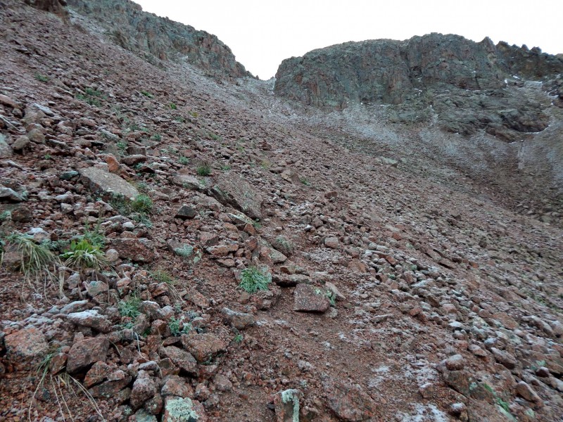 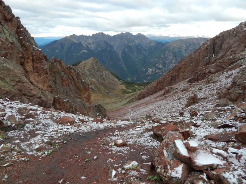 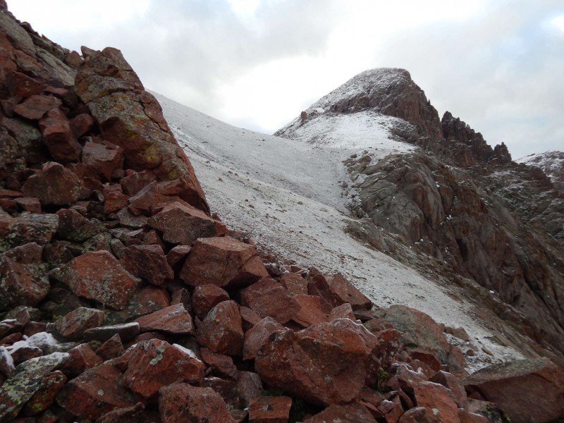 I was fortunate to see a few avian friends. 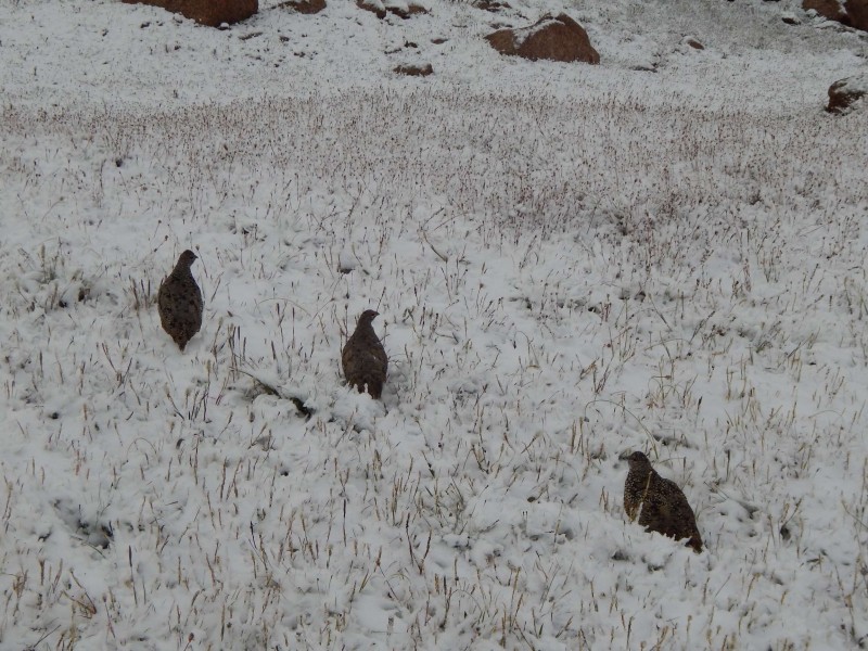 The climb up to the Turret summit was snow covered talus, but nothing too difficult. I was happy to make #97 and the views were pretty nice with snow covered peaks in all direction. 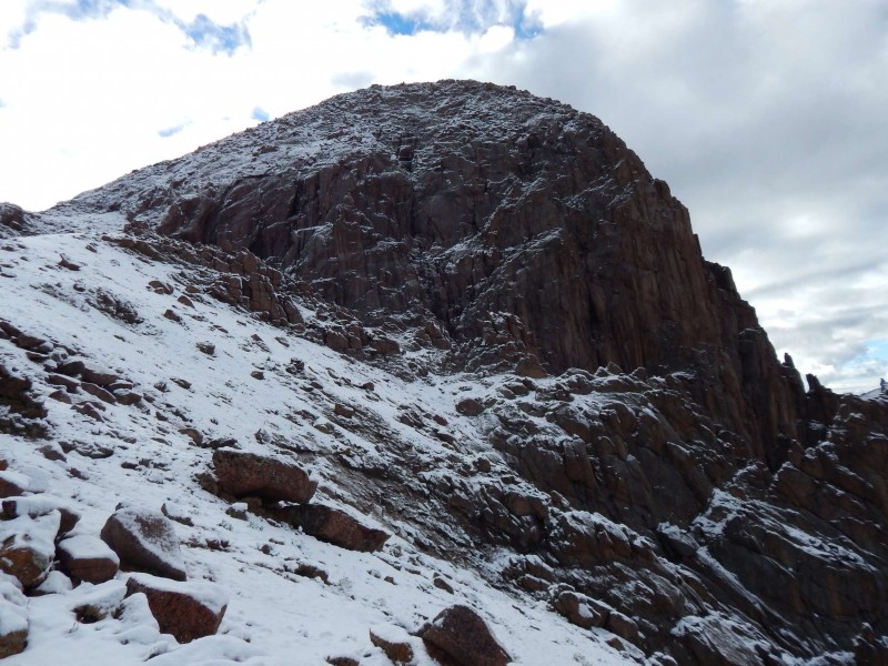 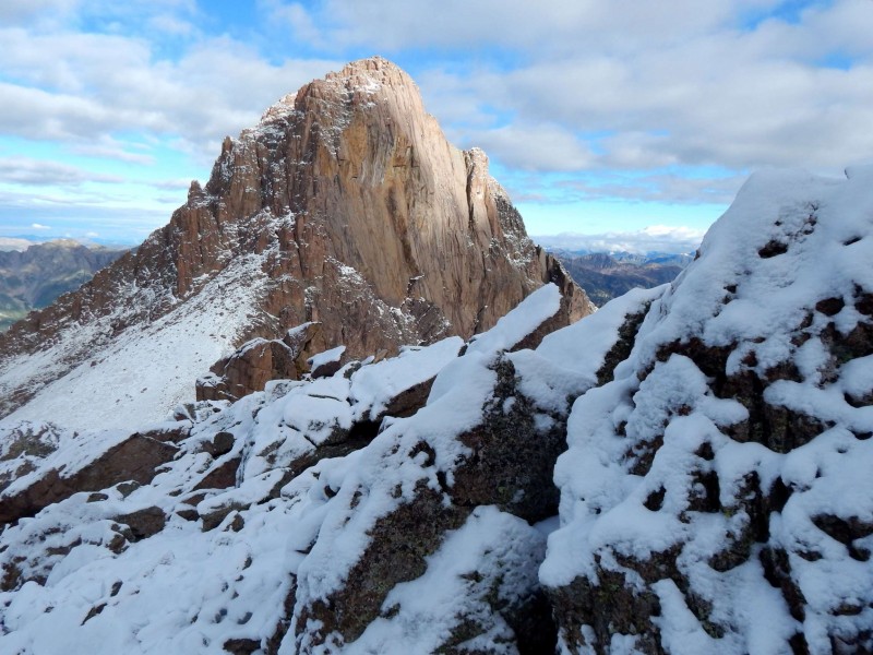 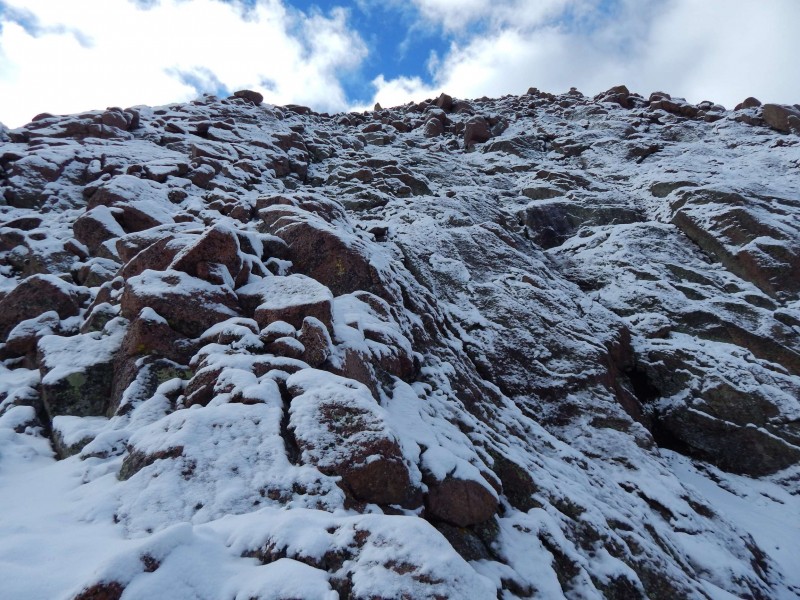 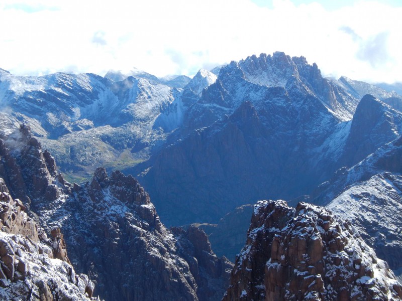 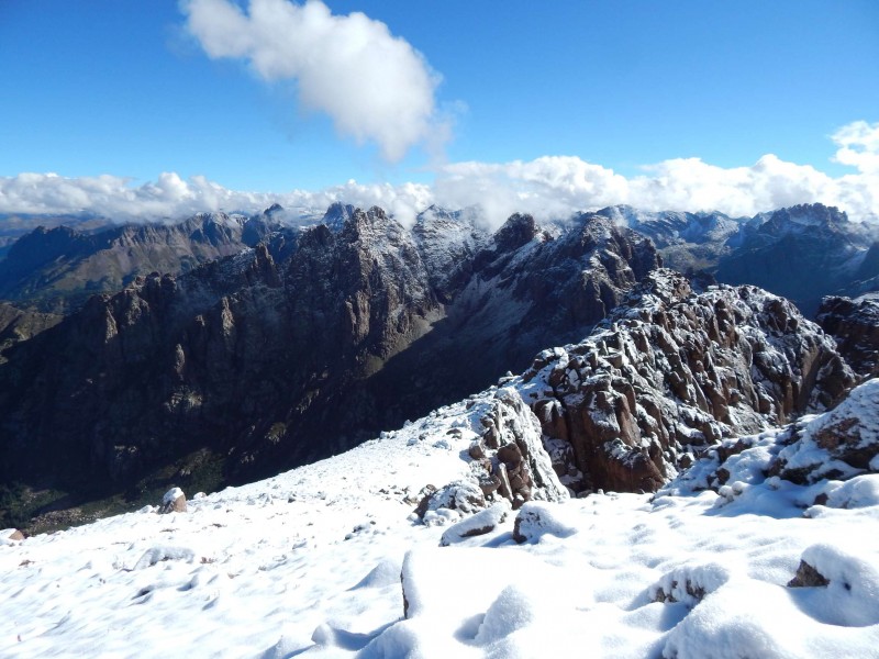 After making a quick call home, I descended several thousand feet to start the Pigeon climb. It is a little frustrating being soooo close to the Pigeon summit and have to start from the bottom again. The climb up Pigeon was a little more difficult than Turret, with the snow covered grass becoming slick as it melted later in the day. So I took my time and eventually made it up to the final stretch. After peaking over the sheer north face, I poked around trying to find the easiest route up. I'm not sure if I took the "official" route, but my initial path felt a little sketchy (with the snow), so I checked out several other no-go options and came back to my first choice. A few thoughtful moves put me above the crux (and above a bit of a drop-off), and then it was easy Class 3 to the summit. 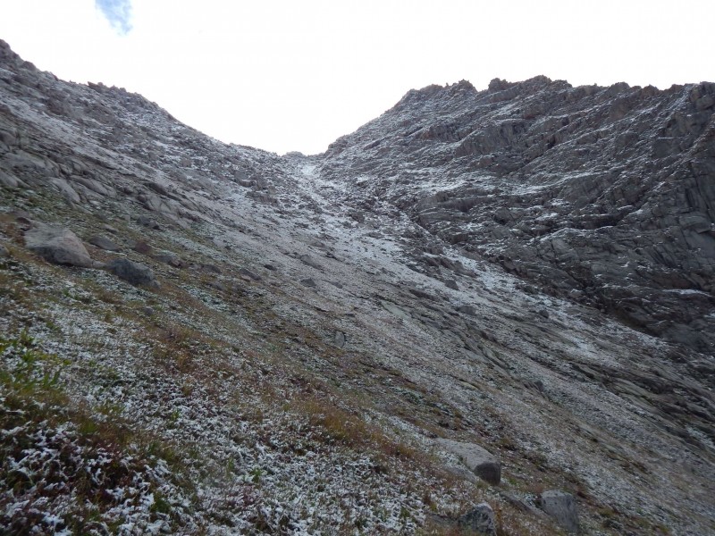 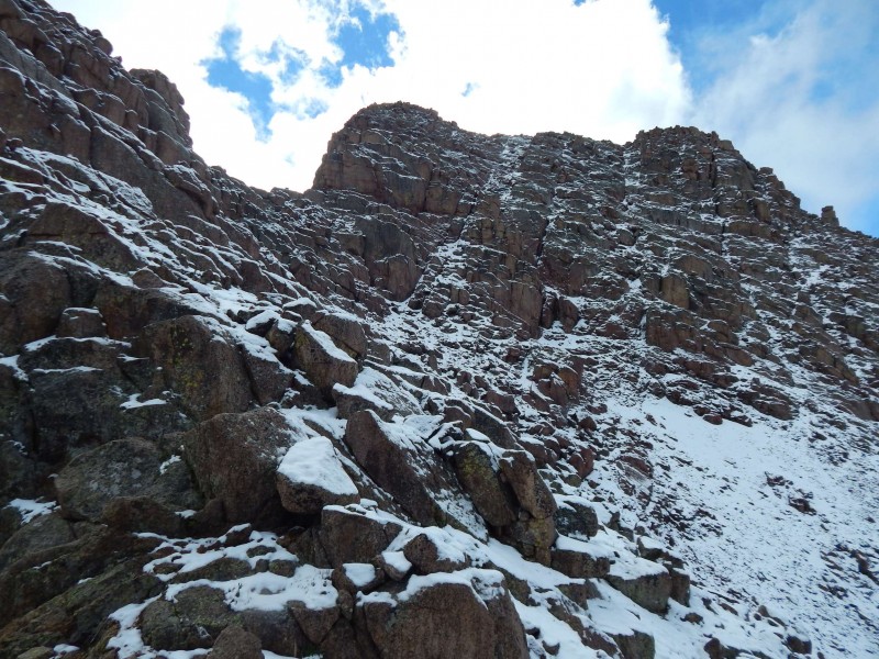 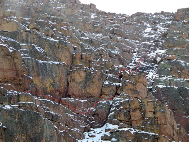  Another quick text home and I headed down, hoping to avoid any afternoon thunderstorms. It took a while to hike down the wet slopes and reach the tent. I packed up in about 10 minutes, ate a few bites and headed down into bushwhack hell. It started well enough, with a well-defined trail having lots of cairns....until the trail just disappeared. Not sure how it goes from superhighway to nothing so quickly. There are pleasant bushwhacks and then there is N Pigeon Creek Bushwhack. Think tight aspen, steep/loose talus, downed trees and no idea if you are heading in the right direction (even when the GPS says you are). I didn't want to risk a sprained ankle (and the wrath of SAR), so took my time descending that 1200 feet. I was ecstatic to regain the Ruby Creek trail, even as unenjoyable a trail that one is. I finally made it down to the Animas River, just in time for the downpour. It rained for the several hours it took to hike down to the Cascade Wye, the passing trains mocking me as I stumbled under my own power. I nervously peered around ever corner waiting for mother bear with cubs. I was hiking as fast as I could, but it felt like I would never get there. The rain finally stopped and I was treated to a nice red glowing sunset. I went to replenish my water at the Animas, but the orangish sediment and the recent toxic mine spill held me back; I would be rationing my remaining supply. It was getting dark when I started on the Cascade Creek Trail and I went into zombie mode for the long hike back to the car. I was trying to get back to the truck before 9pm so I could drive down to Durango for a late meal, but my 10pm arrival killed that plan, so I had to settle for a Palisade peach I had waiting in the truck. I had originally planned on driving back to Denver, or at least Salida, after the hike. But I didn't think I could stay awake more than a few minutes, so I crashed in the back of the truck. I woke at 5 and drove down to Durango, stopping at Denny's for the truck driver special and then the long drive back to Denver. So in retrospect, would I take the train if doing it again? If you asked me as I stumbled to the truck, I would have definitely said yes. But if you ask me now? I'm not sure. Perhaps I have a short memory. If nothing else, I would spend a second night camping out, probably down on the Animas River Trail to break up the hike out. Thumbnails for uploaded photos (click to open slideshow):
|
| Comments or Questions | ||||||||||||
|---|---|---|---|---|---|---|---|---|---|---|---|---|
|
Caution: The information contained in this report may not be accurate and should not be the only resource used in preparation for your climb. Failure to have the necessary experience, physical conditioning, supplies or equipment can result in injury or death. 14ers.com and the author(s) of this report provide no warranties, either express or implied, that the information provided is accurate or reliable. By using the information provided, you agree to indemnify and hold harmless 14ers.com and the report author(s) with respect to any claims and demands against them, including any attorney fees and expenses. Please read the 14ers.com Safety and Disclaimer pages for more information.
Please respect private property: 14ers.com supports the rights of private landowners to determine how and by whom their land will be used. In Colorado, it is your responsibility to determine if land is private and to obtain the appropriate permission before entering the property.


