Download Agreement, Release, and Acknowledgement of Risk:
You (the person requesting this file download) fully understand mountain climbing ("Activity") involves risks and dangers of serious bodily injury, including permanent disability, paralysis, and death ("Risks") and you fully accept and assume all such risks and all responsibility for losses, costs, and damages you incur as a result of your participation in this Activity.
You acknowledge that information in the file you have chosen to download may not be accurate and may contain errors. You agree to assume all risks when using this information and agree to release and discharge 14ers.com, 14ers Inc. and the author(s) of such information (collectively, the "Released Parties").
You hereby discharge the Released Parties from all damages, actions, claims and liabilities of any nature, specifically including, but not limited to, damages, actions, claims and liabilities arising from or related to the negligence of the Released Parties. You further agree to indemnify, hold harmless and defend 14ers.com, 14ers Inc. and each of the other Released Parties from and against any loss, damage, liability and expense, including costs and attorney fees, incurred by 14ers.com, 14ers Inc. or any of the other Released Parties as a result of you using information provided on the 14ers.com or 14ers Inc. websites.
You have read this agreement, fully understand its terms and intend it to be a complete and unconditional release of all liability to the greatest extent allowed by law and agree that if any portion of this agreement is held to be invalid the balance, notwithstanding, shall continue in full force and effect.
By clicking "OK" you agree to these terms. If you DO NOT agree, click "Cancel"...
Who: Team of three - me, myself and I Distance: 6.5 miles RT
Planning on wrapping up the Winter 14ers this upcoming season, I want to have some familiarity with the routes. Especially considering that the winter routes are not always the well-worn summer trails. For Handies, the typical winter approach is via Boulder Gulch, and not via the summer routes of American Basin or Grizzly Gulch. The few Boulder Gulch trip reports mention an unclear start to the trail, especially when trying to locate it in the dark (which is the expected condition when starting the hike in winter). I thought I should test-drive the route in summer to make sure I won't be slowed down in winter with unclear direction. And I figured some people may want the gpx file...
I drove down to Lake City on Sunday evening, thinking a few hours of sleep in the back of the truck at the trailhead was a little better than leaving the house at 3am. The familiar drive to Lake City passed by quickly and I made my way down to the Cataract Gulch trailhead. The road roughened up a bit for the remaining 2.5 miles to Boulder Gulch. A bit rocky and lots of waterbars, probably not something for a Suburu (but I could be wrong). The trail starts shortly after you drive across the creek (the only water crossing on the road up to that point). At the top of the short hill there is a decent camping/parking spot on the left. It was taken, so I drove another .2 miles to another larger parking area. I had a trouble finding a level spot, so spent my few hours of rest sliding downhill in the back of the X.
The hike is pretty short, so I waited until sunrise before starting on the trail. I wanted to record the best route on the GPS and didn't want to walk around in circles in the dark. There is a small cairn (3 rocks) next to the road where the trail starts (half way up the hill from the creek to the parking spot), but it was difficult to find the trail in the small meadow. Once in the trees, several trails converge onto the primary trail. The trail is occasionally faint and passes through some tall willows, but in general is pretty obvious all the way up to the basin.
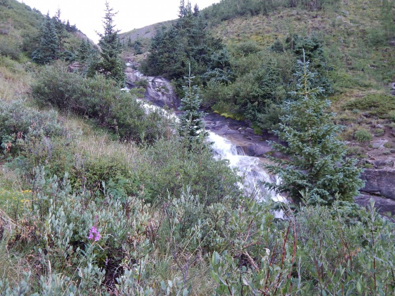
The lower section of the creek has lots of cascades and waterfalls, so I'm not sure how easy it is to just "walk up the creek" in winter. The trail remains on the left side of the creek, although it may be tempting to walk the tundra on the less vegetated right side of the creek.
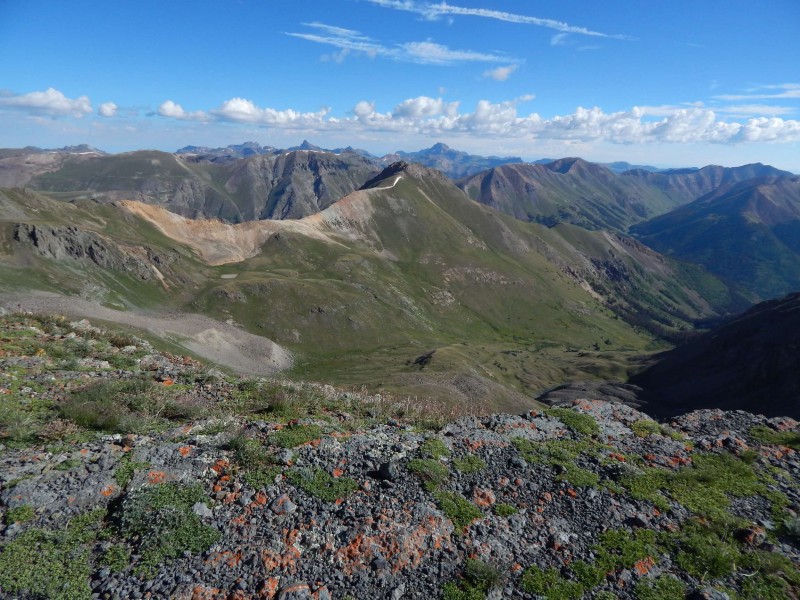
Start of the Boulder Gulch "trail" (trail starts in the near aspen) Cascades in Boulder Gulch Looking back to Half Peak Start of the SE Ridge
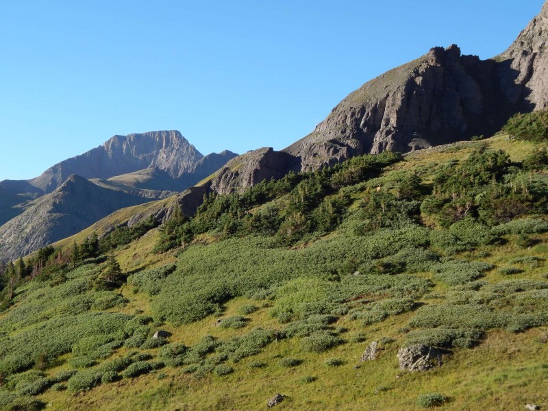
I decided to ascend the SE ridge and descend the S ridge, so I could determine which path would be easier in winter. I think I favor the grassier SE ridge with the short scramble, as the talus fields on the S ridge weren't as enjoyable.
Looking across to the S Ridge (descent)
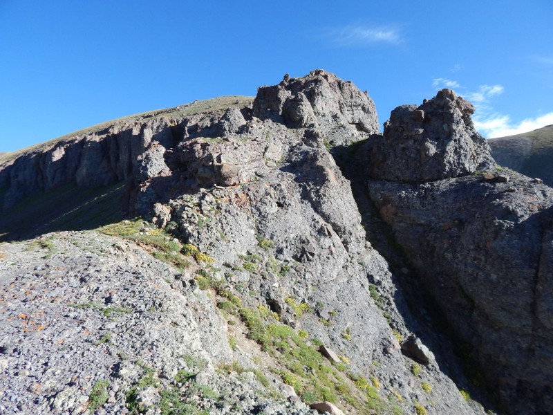
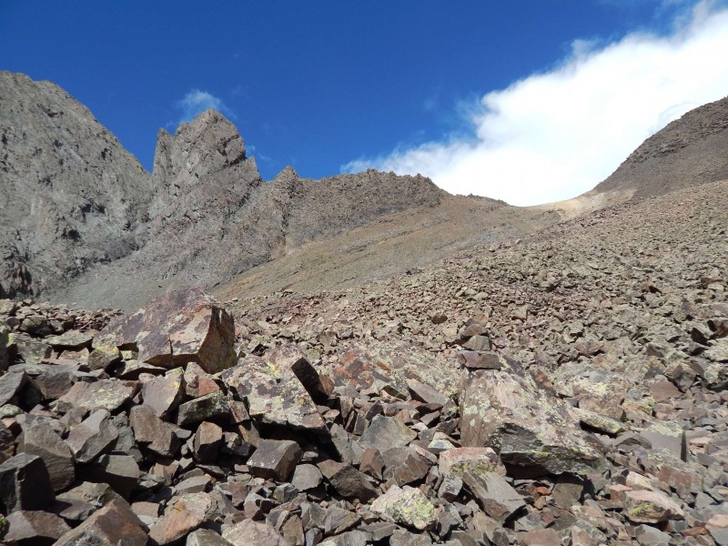
There was one short scramble on crumbly rock with some cliffs, but it was only a few moves. If you really don't like scrambling, it seems like you can traverse a little lower on the left side and regain the ridge via a gully.
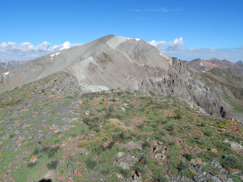
Only scrambling section on this ridge Final ridge to Handies summit Looking into Grizzly Gulch Talus field coming off S Ridge
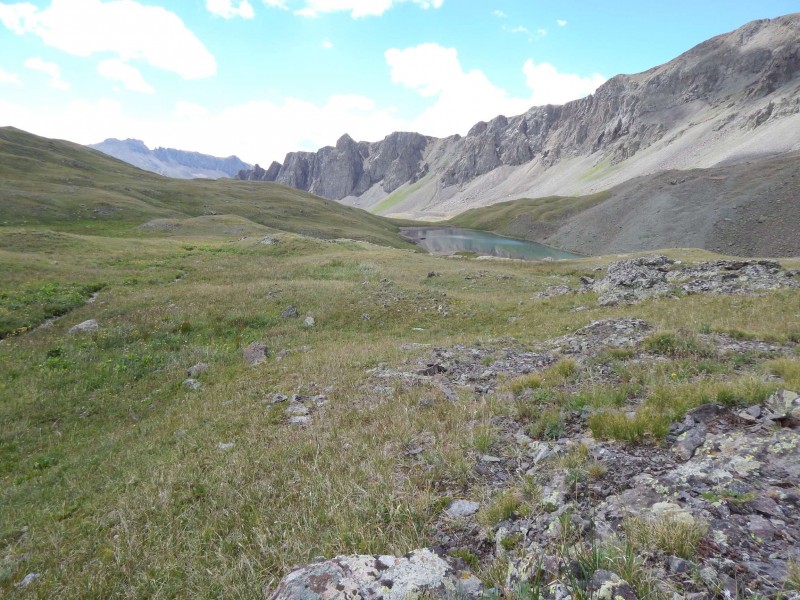
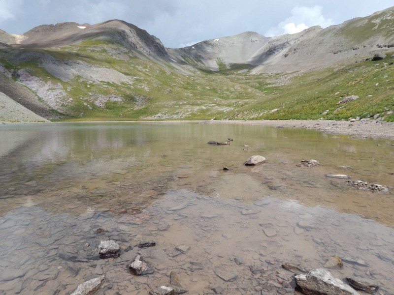
There was a nice lake which would have been a good place to hang out, but the storm clouds were building and I wanted to get down to the truck before the rain (I didn't make it). Gentle basin At lake, looking back at Handies GoogleEarth
Later for now Handies, see ya this winter!
My GPS Tracks on Google Maps (made from a .GPX file upload):
I was wondering if you have completed this in winter yet. A friend and I are headed there in a little over a week. We are using your GPX and where wondering if you had any further information. Thanks and hope to hear back.
Caution: The information contained in this report may not be accurate and should not be the only resource used in preparation for your climb. Failure to have the necessary experience, physical conditioning, supplies or equipment can result in injury or death. 14ers.com and the author(s) of this report provide no warranties, either express or implied, that the information provided is accurate or reliable. By using the information provided, you agree to indemnify and hold harmless 14ers.com and the report author(s) with respect to any claims and demands against them, including any attorney fees and expenses. Please read the 14ers.com Safety and Disclaimer pages for more information.
Please respect private property: 14ers.com supports the rights of private landowners to determine how and by whom their land will be used. In Colorado, it is your responsibility to determine if land is private and to obtain the appropriate permission before entering the property.