Peaks in the order climbed:
UN 13,110, UN 13,230 A and Mt Nebo - August 12
Silex & Guardian - August 13
Peaks 9 & 8 - August 14
Hunchback - August 15
Dates: August 12-August 15 (4 days), 8 peaks (1 unranked)
Trailhead: Beartown 4WD TH
Mileage: ~25 miles
Vertical: ~13,700 ft gain
Partner: Grizzly Adams
It was time for another multi-day Weminuche trip. This time we decided to start from Beartown and focus on the Silex-Guardian group. Shawn and I met in Silverton and departed for the Beartown TH by 7.15 am. Since Friday looked like the best weather of the weekend (20% chance of rain after 2pm), we were hoping to add a few peaks to the pack in.
~3,800 ft ascent, ~4,700 ft descent, 9+ miles, 9.5 hours (5.5 hours for Nebo group from the turnoff)
The drive to Beartown took quite some time in a stock 4x4. Last mile was particularly slow going, but we didn't bottom out, so it all that matters. We geared up and finally departed TH around 10 am. The weather was looking perfect - a fall-like, crisp day.
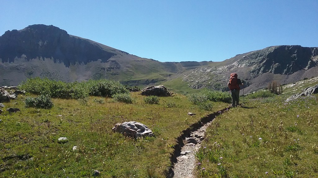
In about an hour and a half we reached Vallecito trail-Nebo creek intersection, coincidentally running into couple of other backpacking parties. About 50 feet up the Nebo creek trail, we got off trail, stashed our overnight packs at an undisclosed location and organized our daypacks for a peak-bagging excursion. In the process I discovered that I left my water filter and almost all my snack food in Shawn's car. Oops! Thankfully, Shawn offered to use his water filter. After filtering water, we were on our way around noon. After getting into the basin, we began with UN 13,110 as we reasoned it would provide the best view of the group. Indeed, it was a nice perch. From there we dropped down to the saddle and ascended the ridge to UN 13,230 A. The ridge provided our first taste of Class 4 of the trip (completely optional) and another grand view of Rio Grande Pyramid. From there it was a final push to Mt Nebo, our last peak for the day. Again, we decided against the easiest route and instead enjoyed some quality scrambling up the ridge. Translated from Russian, Nebo means "Sky", so metaphorically we got to touch the sky on this trip. The views on top were such that we commented that we probably died and went to heaven. Our only unsolved puzzle was the descent. We spied a promising looking shortcut gully on the approach, and after confirming from the saddle that it goes, we dropped in. The descent was very quick and efficient, except the talus field at the bottom. Once back on trail, we hit the cruise control and returned to our (heavy!) packs around 5.30 pm. We still had the remaining backpack into the Stormy gulch. I fully expected to find a trail, but unfortunately we were not able to locate it due to overshooting the key waterfall crossing. As a result, we had a highly unpleasant and tiring 2-hour bushwhack on game trails into the Stormy gulch basin. It affected the choice of our campsite, as we decided to stop by 7.30 pm in waning daylight at the first flat meadow and 0.5 miles short the start of the routes. Despite slightly more effort required the next 2 mornings, it worked out just fine.
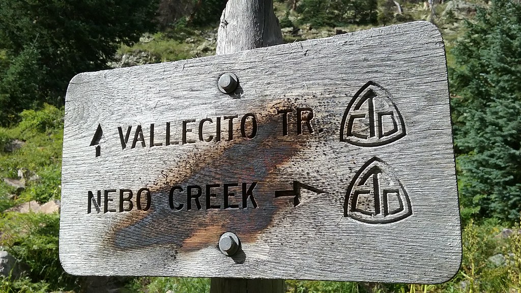
Choose your adventure
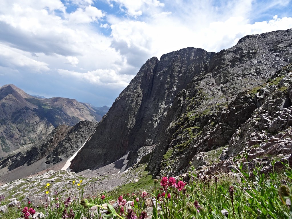
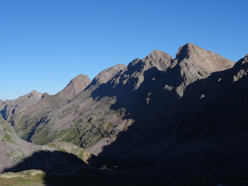
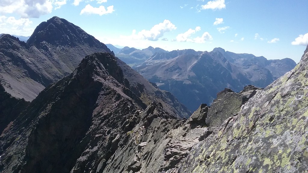
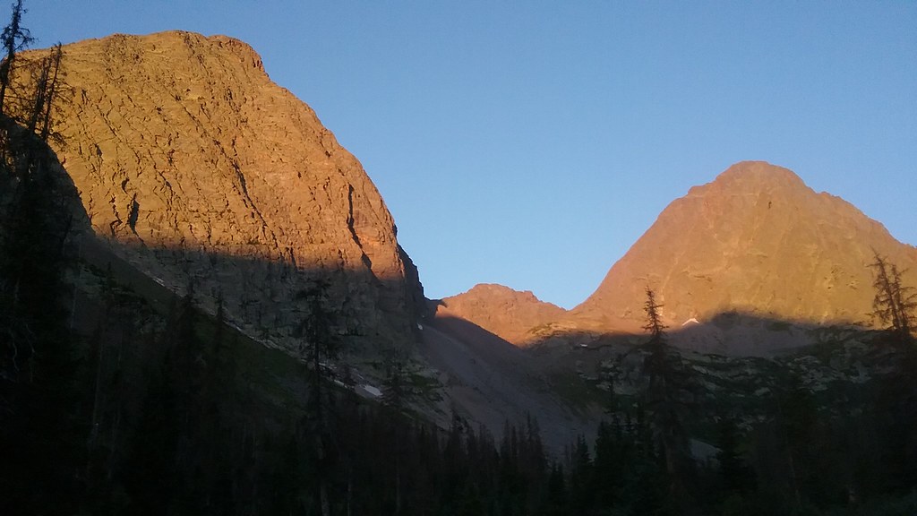
First look at Grenadiers from Nebo creek drainage
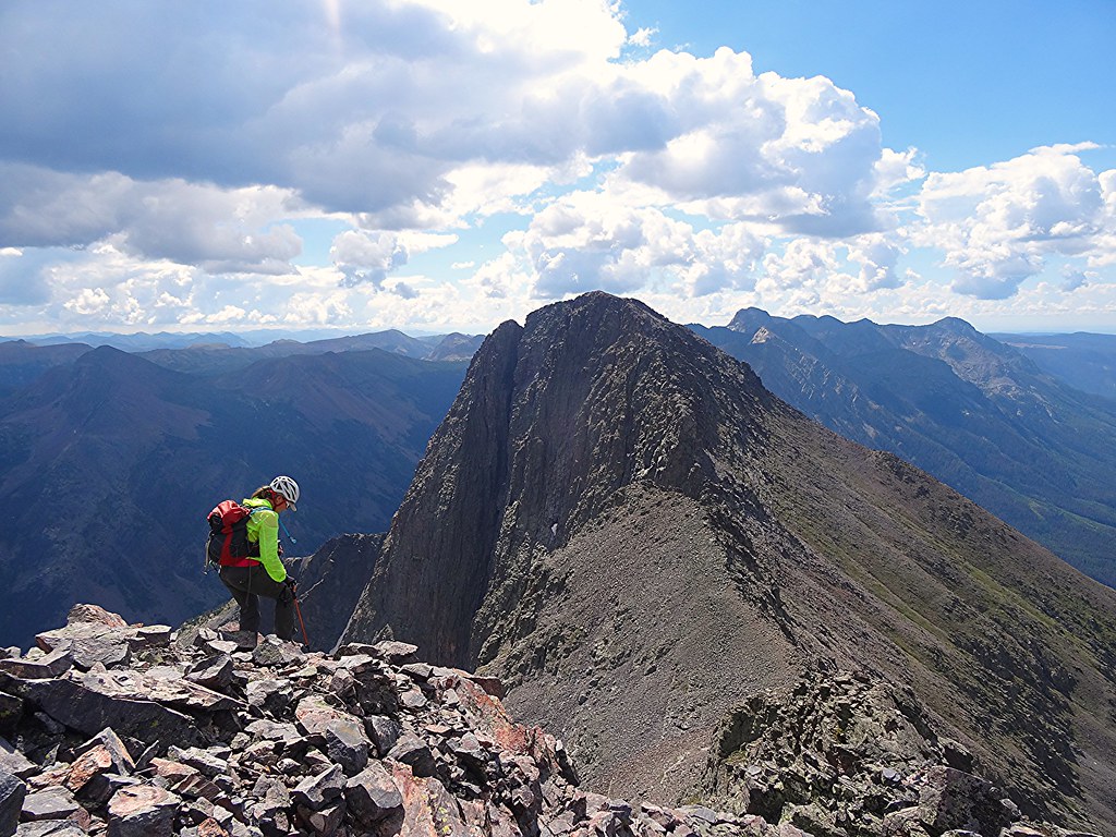
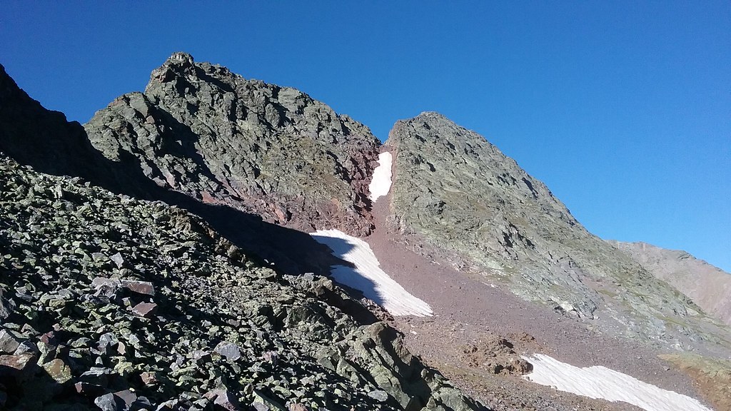
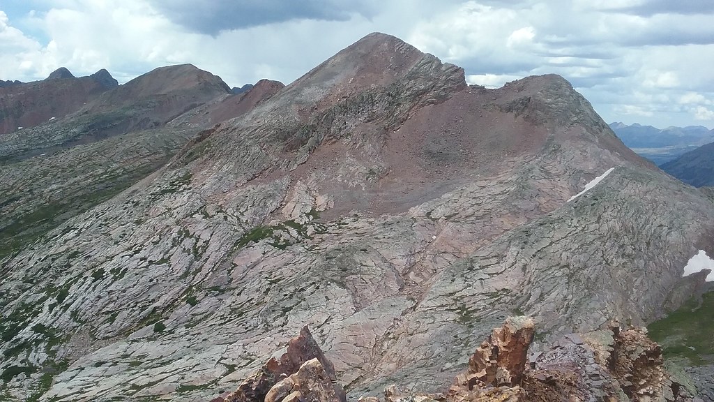
The low point of the ridge marks our descent gully, Mt. Nebo on the right
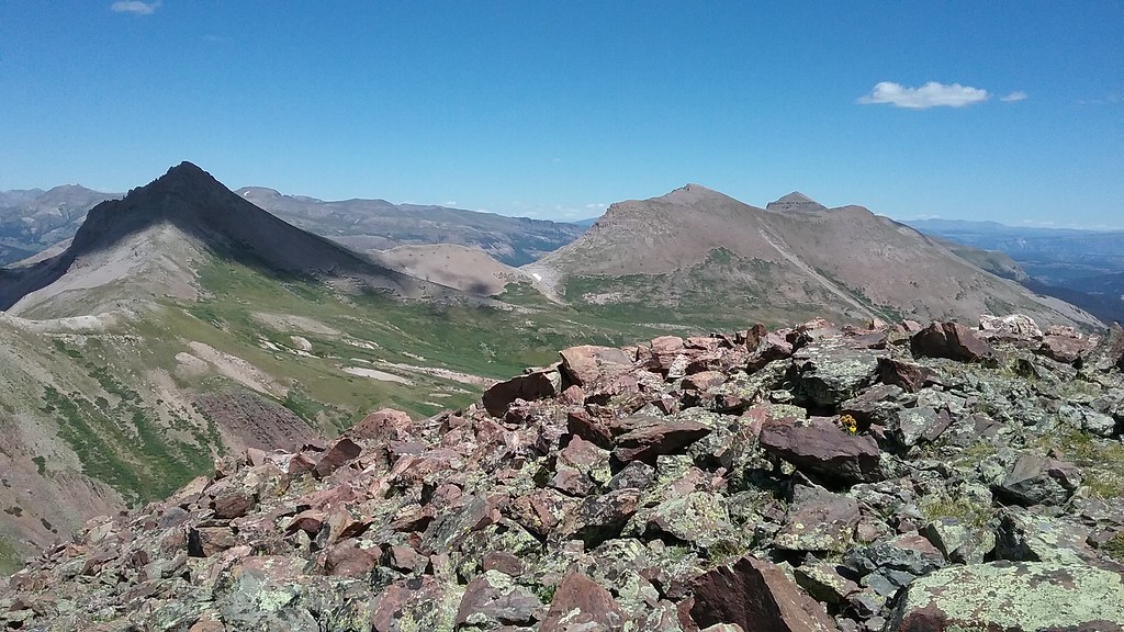
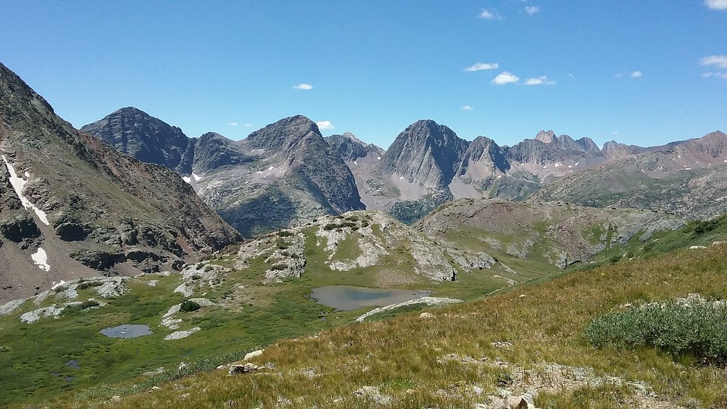
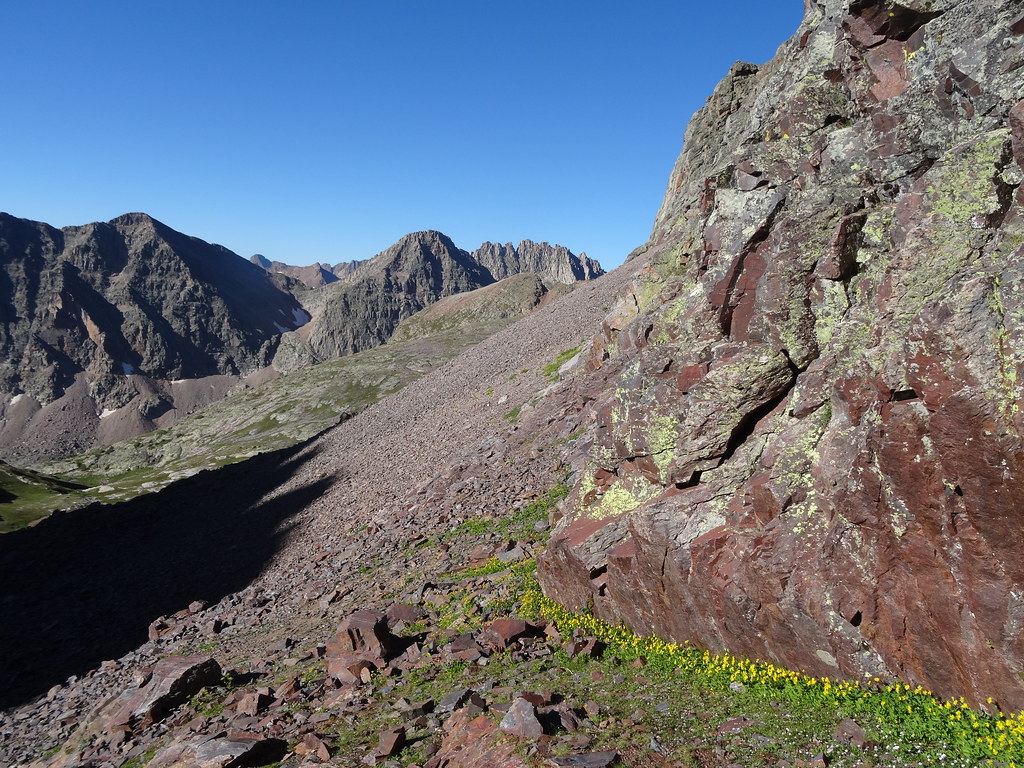
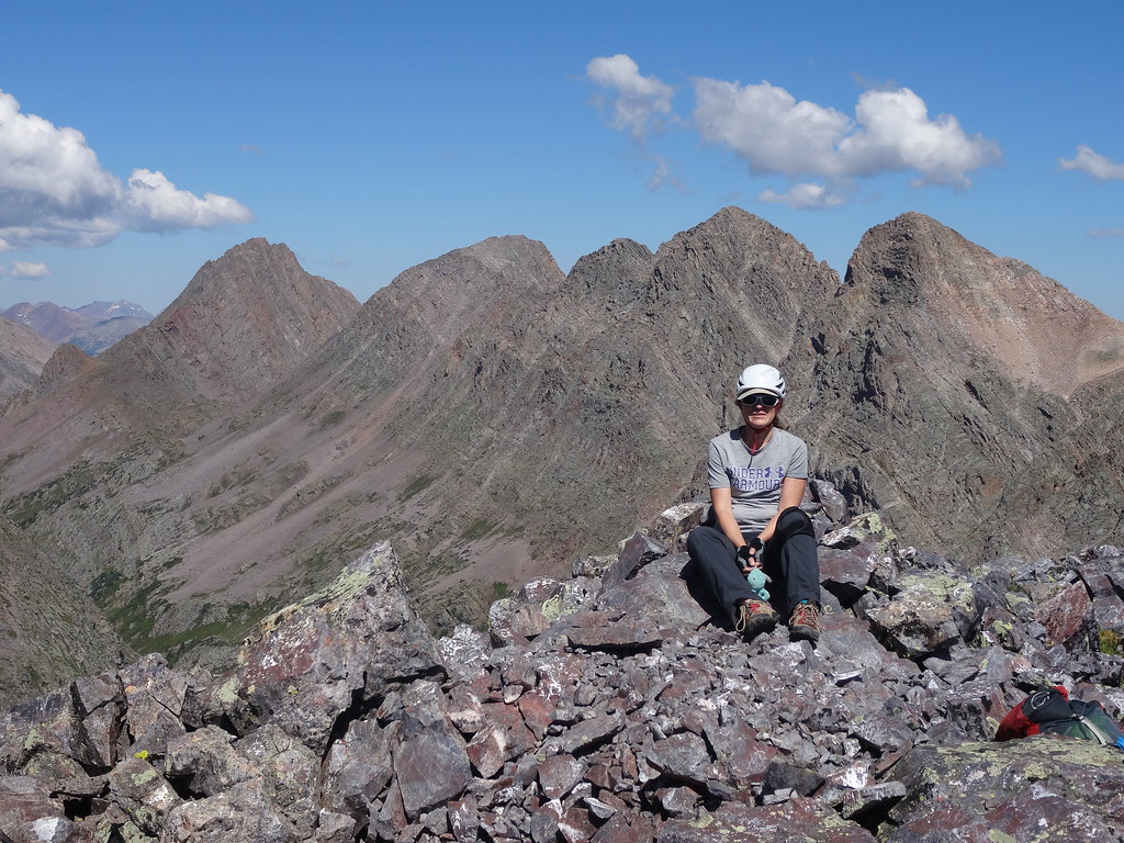
Ute ridge 13ers as seen from the summit of UN 13,110
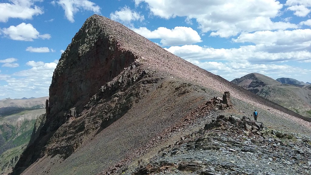
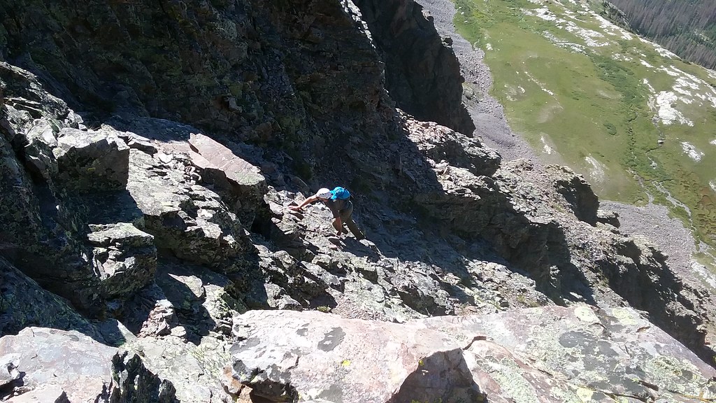
Ascending Pt 13,230 A
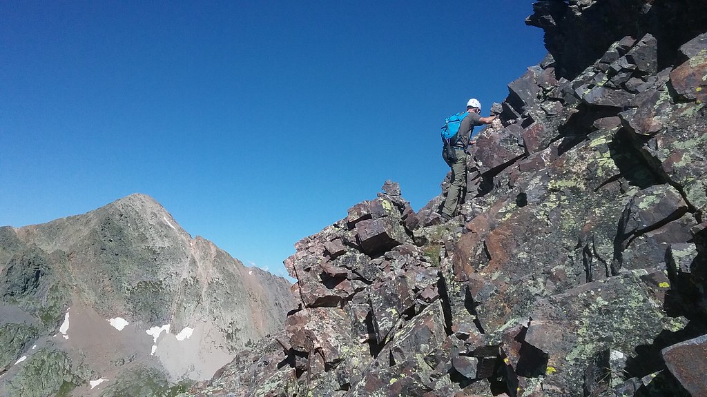
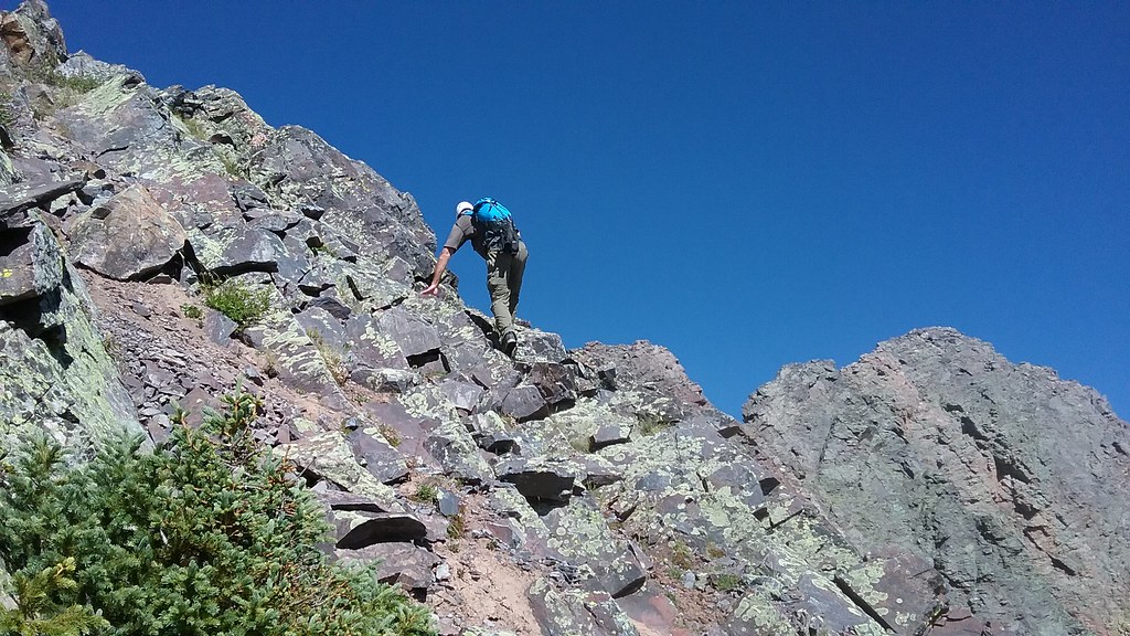
Scrambling up Mt. Nebo ridge
Mt Nebo summit ~4pm
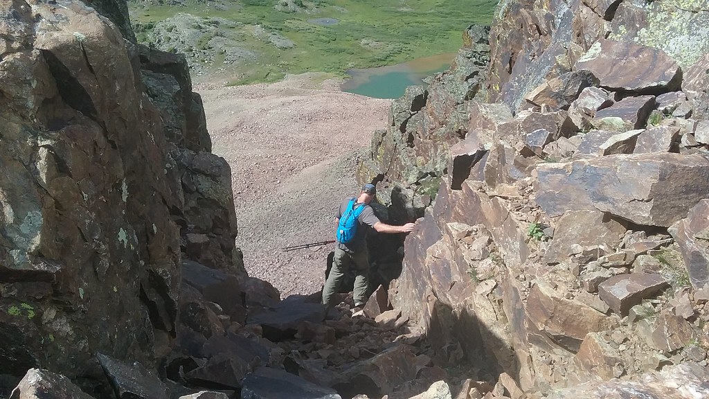
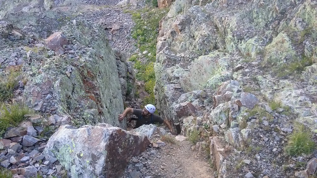
Shawn drops into our descent gully
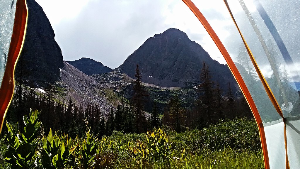
Home sweet home in Stormy gulch (taken the next day)
~4,100 ft ascent/descent, 5 miles, 9 hours
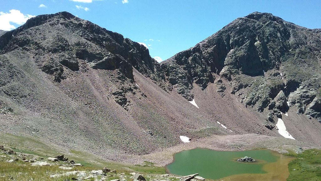
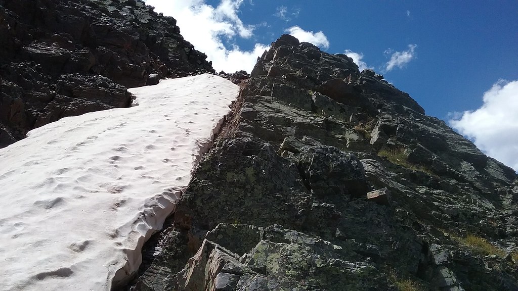
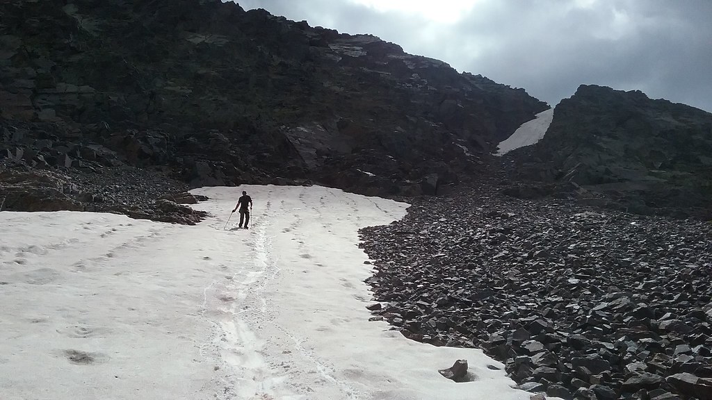
Next morning, we put on our best game faces and departed the camp around 6.30 am, about 30 min later than planned. We bushwhacked on game trails further up the basin looking for a good trail I spotted last year on the backpack up Trinity creek. After finding the trail, it was smooth sailing up to Silex lake. From there we identified the Silex-Pk 9 saddle and started climbing. I utilized a snowfield partway up and then bailed on some rocks once the snow ended. To our surprise we ran into another party of 2 at the saddle. The two guys were on a mission and apparently did a full ridge traverse from Guardian to Storm King. With a more pedestrian goal of Mt Silex we picked our way up the face, topping out by 10 am. We spent about 30 minutes on the summit enjoying the views, but then it was a go time - the ridge traverse to Guardian. We were enjoying the scrambling on solid rock so much that we decided to stay on the ridge as much as possible. Some route-finding was required, but climbing was fairly obvious and not exceeding Class 4. From the first saddle, we skirted the middle section staying as high as possible. We skirted the first tower on the Guardian ridge, but then gained the direct ridge line and stayed on it to the summit, where we arrived around noon. The climbing was very fun and again, pretty solid. The views were amazing, but worried about incoming clouds we departed after about 20 minutes. We retraced our steps down the ridge line. I did manage to get cliffed out by staying on the ridge too long, but was able to climb back up and pick another class 4 chimney to get down. No big deal. I really didn't feel like traversing the Silex face back to the Pk 9 saddle, so we decided to explore the alternative route that we spied from Nebo and on the pack in. We reversed our steps back to the first saddle with Silex (the saddle closest to Guardian cliffs out in a major way). From there we zig zagged down the slope avoiding the major cliffs (which wasn't difficult) and got to explore a pretty incredible basin with great scenery. Down low we were able to link up some game trails and cruised back into the camp by 3 pm.
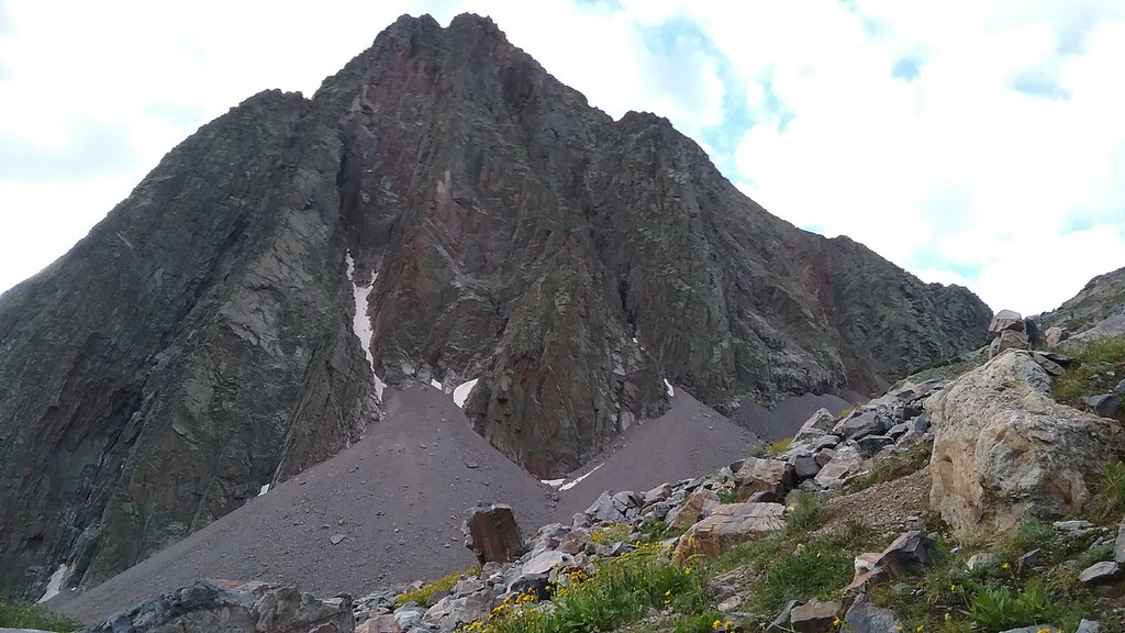
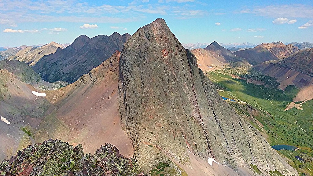
Mt Silex on the approach
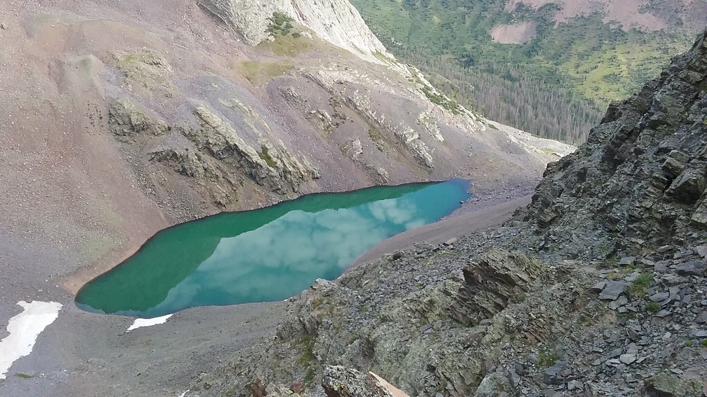
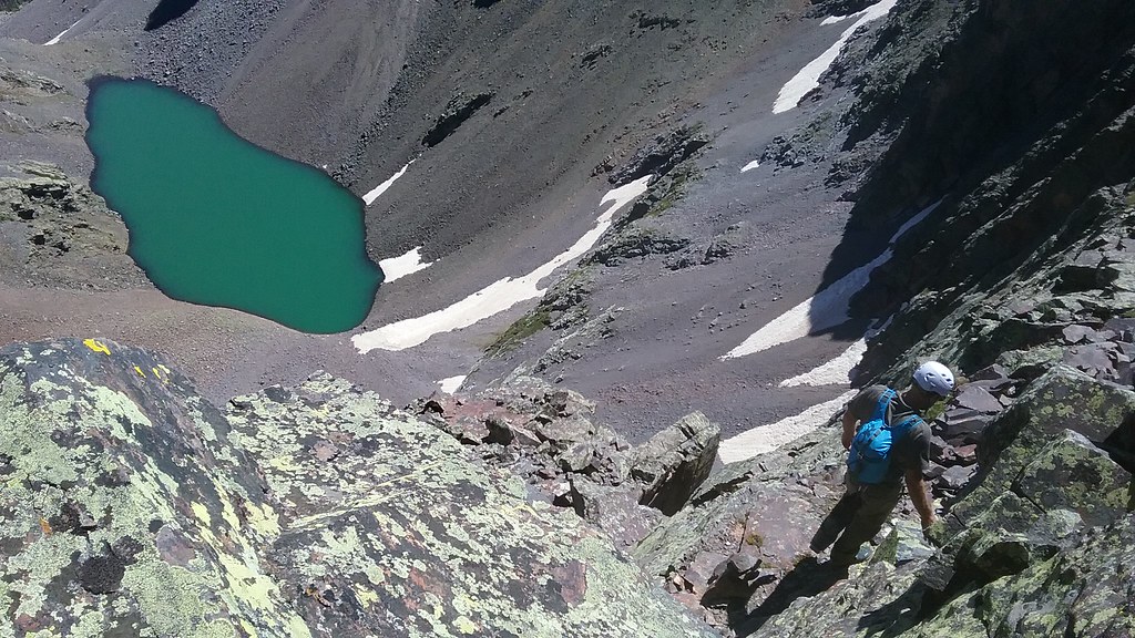
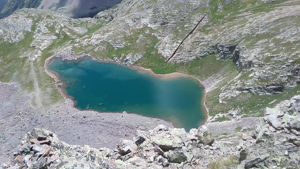
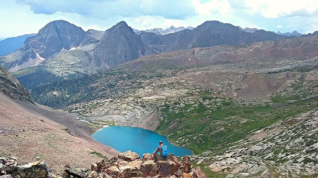
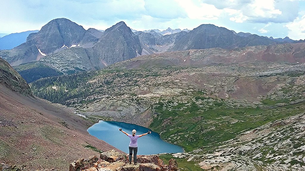
Lake Silex from the gully
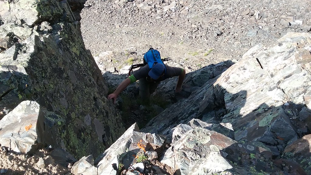
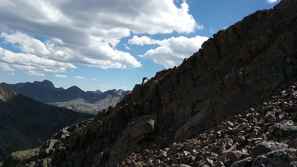
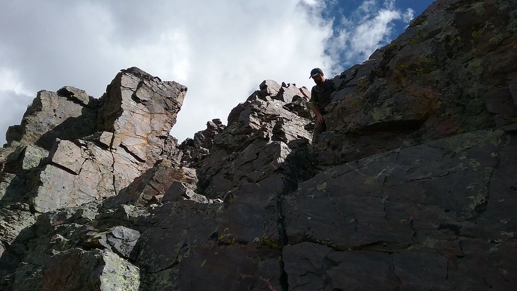
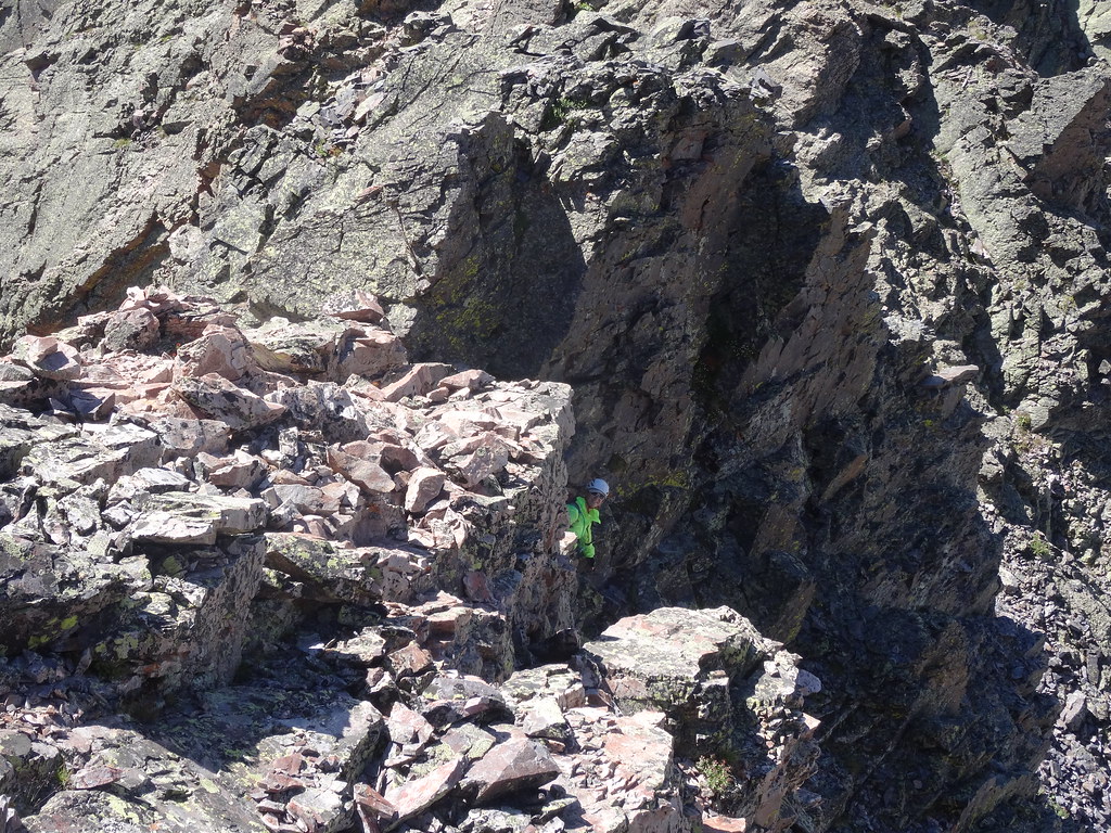
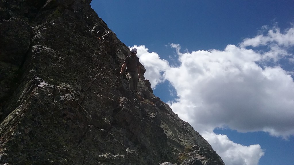
Shawn climbs the first of the series of Class 4 chimneys that day
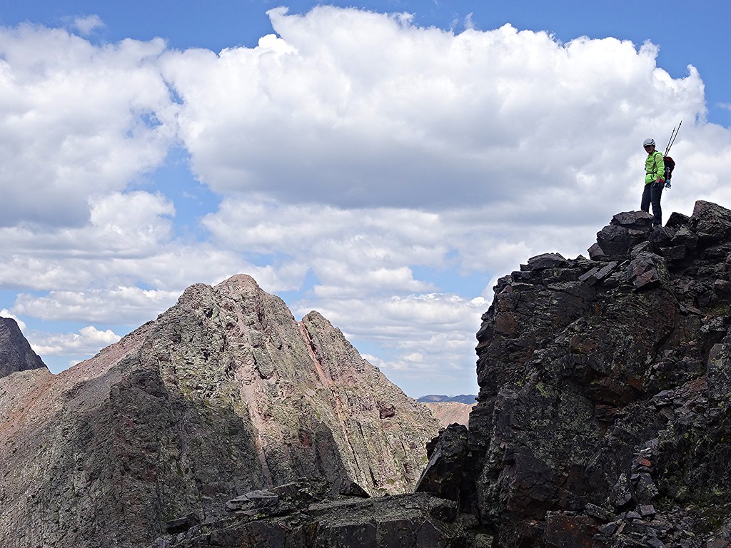
Storm King is the king
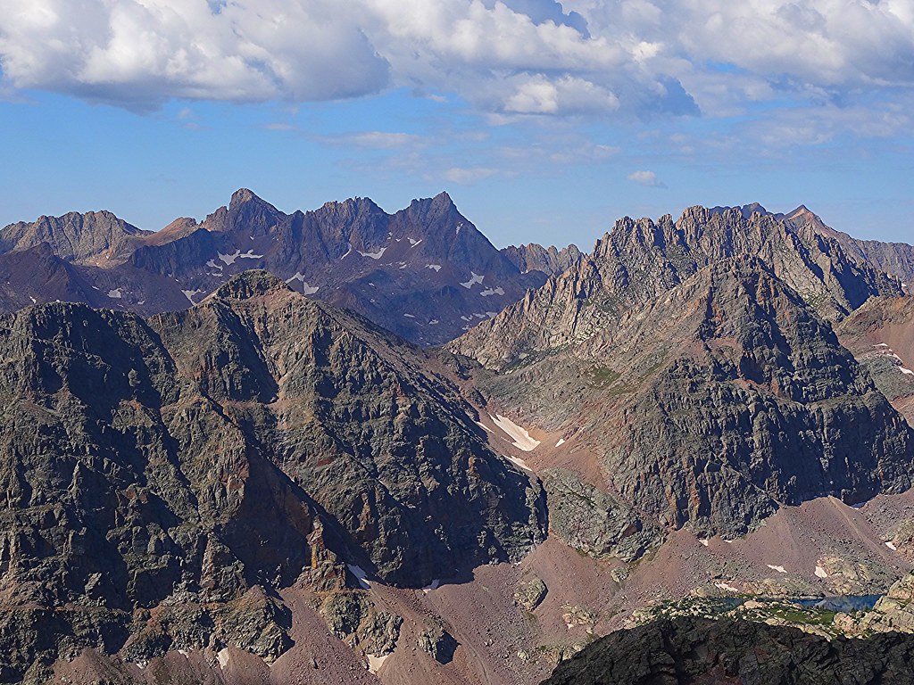
Big guns from Silex
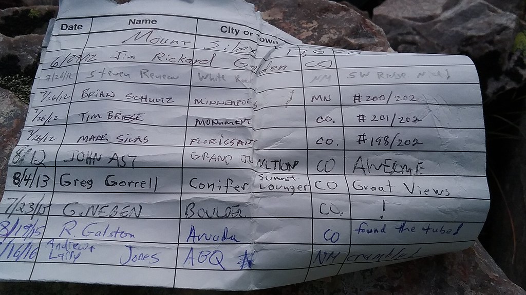
Bring a pen
Ridge fun begins - ridge direct traverse to Guardian
and continues for a while
Ridge downclimb - photo by Shawn
Zoom in by Shawn
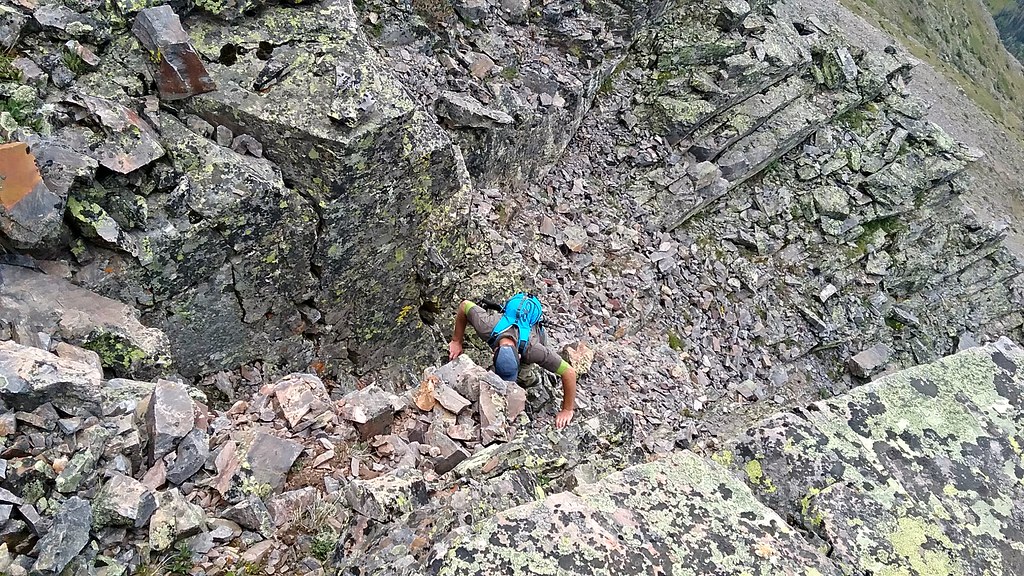
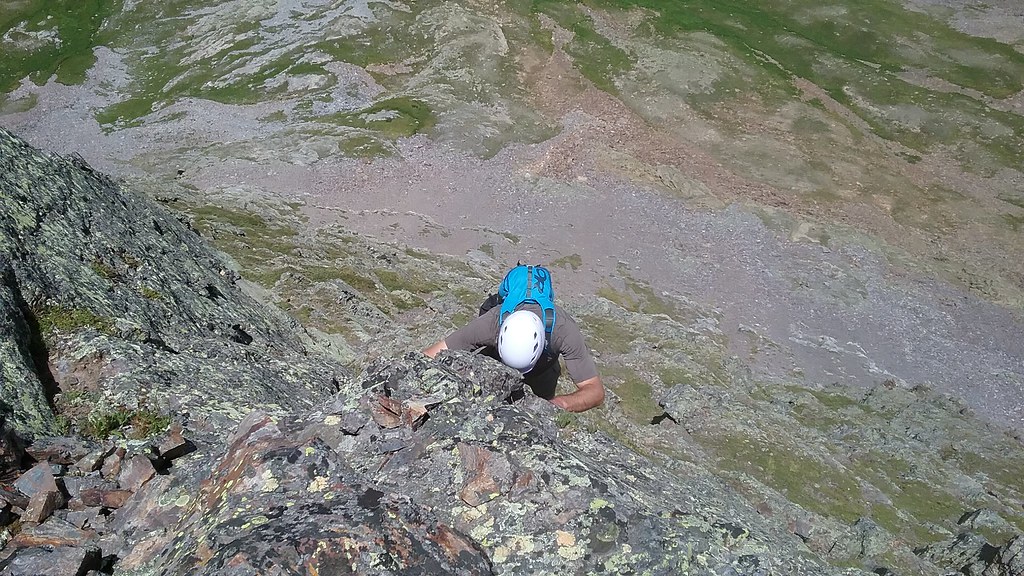
More Class 4 chimneying up the Guardian ridge
More Class 4 chimneying
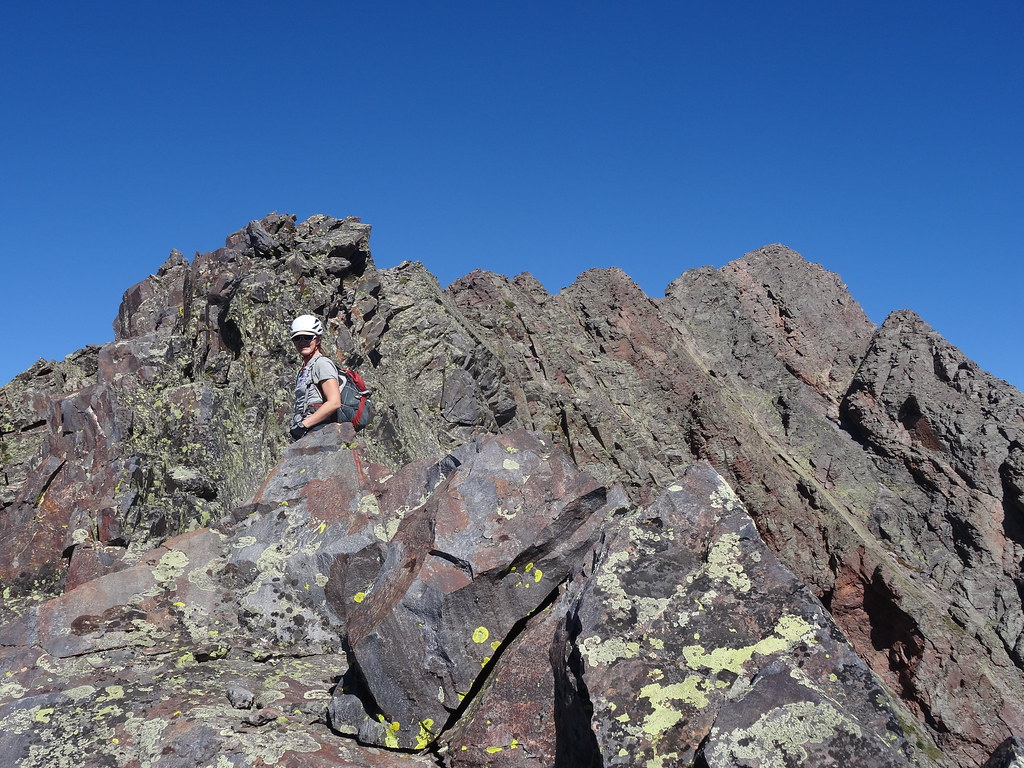
Navigating the ridge
Reversing the route
Guardian on the descent - photo by Shawn
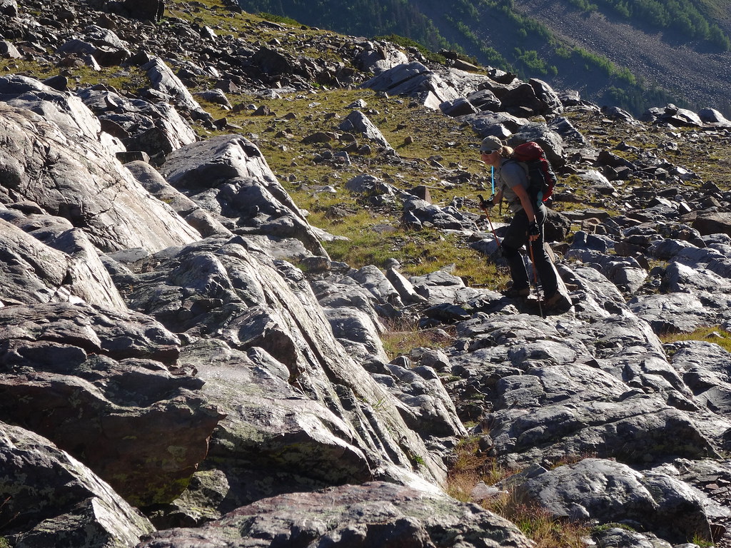
Descending huge white slabs
Back into Stormy gulch
~3,300 ft ascent/descent, 5 miles, 10.5 hours
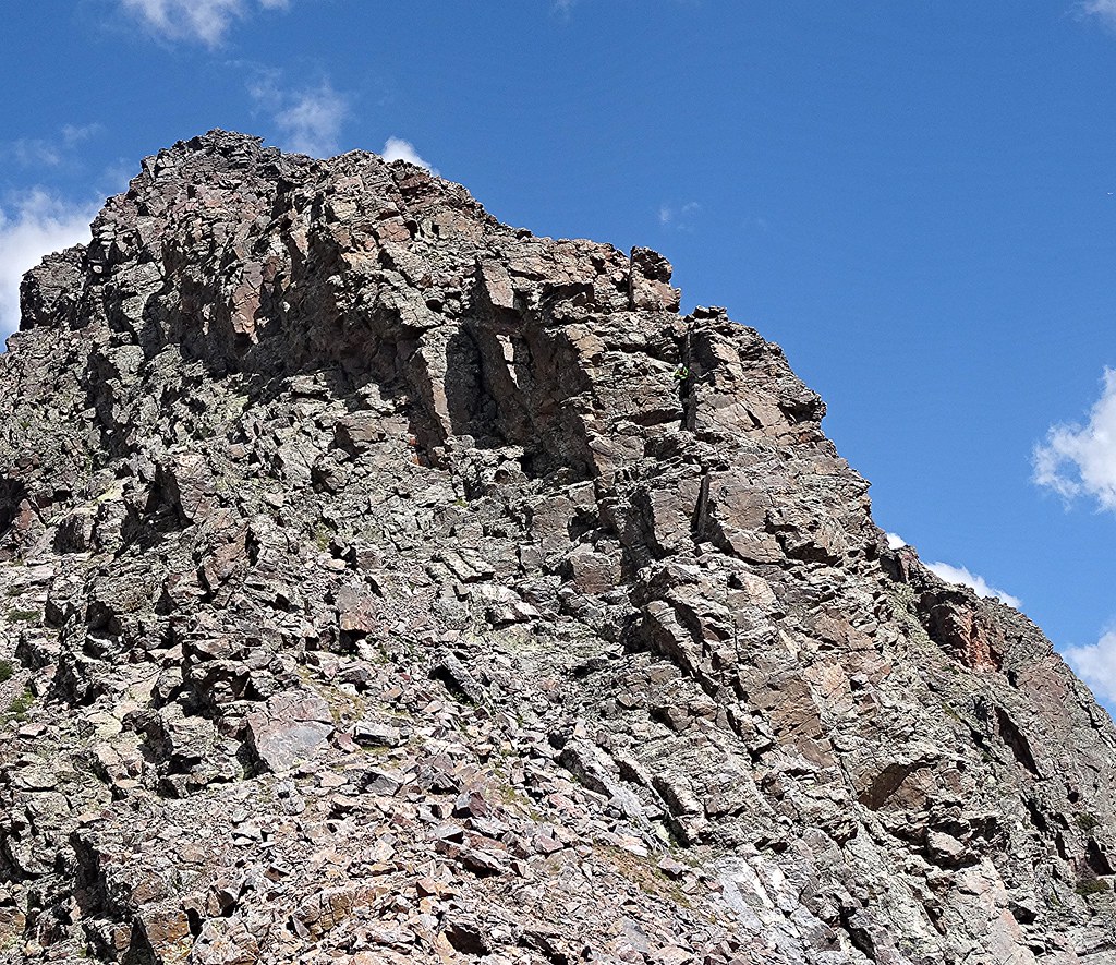
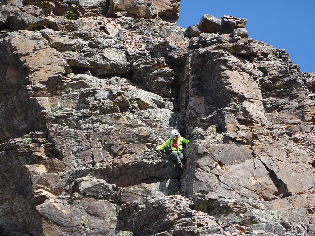
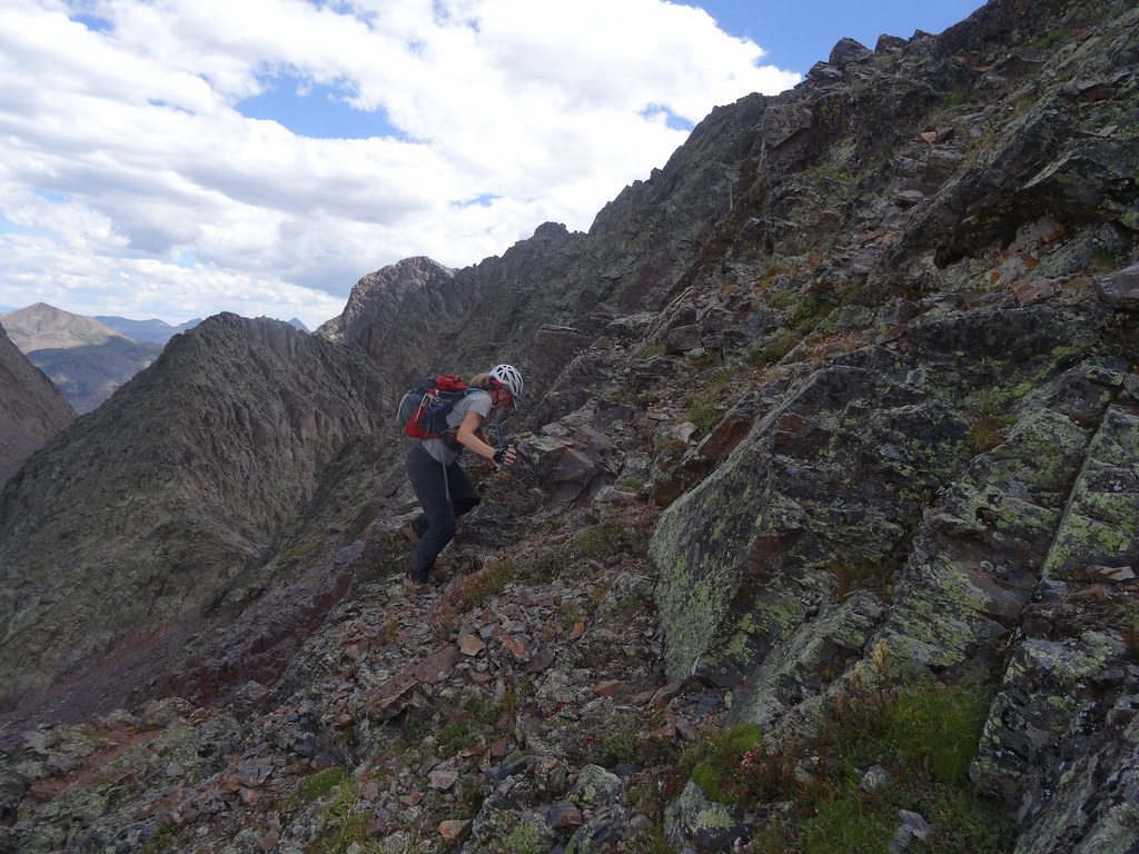
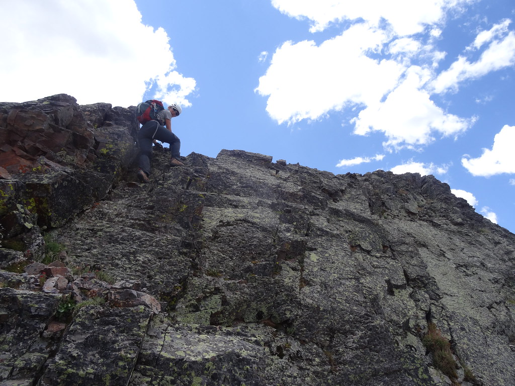
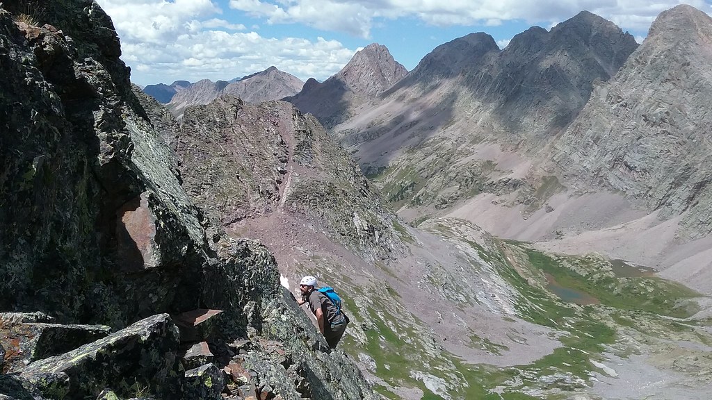
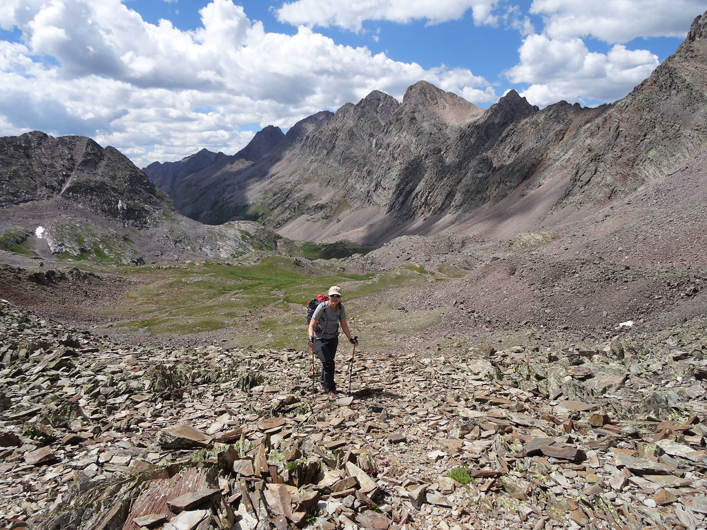
This day was highly anticipated and it didn't disappoint. Overall, this was the highlight of the trip. We left the camp a little earlier, at 6 am and this time decided to explore the boulder field as the ascent route. We are not sure which route is quicker. The boulder field route is shorter but more tedious due to the never-ending talus. In the early morning we didn't have much problem with it and were able to catch a spectacular alpenglow on both Silex and Storm King (the morning prior was cloudy). By 8 am we were approaching the Pk 8- Storm King saddle. After brief map consultation as to which saddle to take, we aimed for the one closest to Pk 8 and it worked out just fine. Soon we were standing at the saddle taking in the unbelievable views of Jagged and Leviathan in the distance. From there we joined a faint, but very helpful trail leading to the bottom of the green ramp. For some reason I thought it started further up. After Class 3-4 section to gain the grassy ramp, we were on our way, encouraged by multiple cairns. After traversing for a while, we took an opportunity to gain the ridge a bit earlier. After topping out near the ridge by 10 am we saw some cairns, but decided to gain the ridge proper. Well, this is where the real fun started. The ridge is very exposed and we burnt a good amount of time navigating an acceptable line. After deciding we needed to move faster, we dropped down from the ridge only to end up on some very exposed ledge. I was glad to have some climbing background to navigate the route. This was turning out to be quite a bit harder than I expected and the going was very slow, blowing thru all my time estimates. About half-way up the ridge I made a conscientious decision to stick to cairns and the path of least resistance, trying to preserve some energy. Still, when I saw the final section leading to the summit, I couldn't resist getting on some loose class 5 crack. Finally reaching the summit around 11.30 am we spent some time taking it all in and even discussing alternative descent routes. We were concerned that the descent will take too long and we would miss a shot at Pk 8 due to the incoming weather. In the end, we decided to reverse route - a good choice. Much better route finding and we were able to get down in a New York minute - (40 minutes to be exact) - or considerably faster than our ascent time. Once on the grassy ramp, I started booking it to the saddle with Pk 8, with Shawn having trouble to keep up. I told him it was my summit fever kicking in. There was no peak on this trip more highly anticipated than Peak 8. With very limited beta, it was exploration time. I did consult with SarahT about the route and I remember the gully she and Dominic went up from the prior trip. However, we chose not to bring crampons for the snow, simply hoping for some Hail Mary pass. Interestingly enough, we got it. After descending from the Pk 9-8 saddle for maybe 100 feet, we were able to do a lateral traverse to the bottom of the couloir. Yes, there was snow, but I was looking at some scrambling options. The right side above the couloir in particular caught my attention. It looked like a blocky solid class 3 scrambling. And it was. It was so good that Shawn quickly abandoned his gully route and joined me on the face. In fact, he took it one step further, engaging in completely unnecessary, but so fun looking class 5 option. I just asked him please not to fall, and he didn't. In a very short amount of time we were at the top of the gully. From there, the climbing got a bit more serious, but still mostly stayed in the Class 3-4 realm. Only one short section of the ridge gave me pause and I would probably rate it 4+ or very low 5 due to looseness and exposure (I bypassed this section on the way down, but Shawn downclimbed it). The rest of the ridge was fun, but very exposed. The summit couldn't possibly have better views. Although unranked, the peak felt very rewarding and worth doing. After gawking at nearby peaks for awhile, we began the scramble back down. After we were done, Shawn summed it up as "is it over already?". We were even able to catch a couple of glissades (in August!) to quicken the descent to the Pk 8 - Storm King saddle. We had aspirations to repeat Storm King (which we both climbed on prior trips), but overall fatigue had already set in and we were running behind the schedule already. We made a conservative decision to head back to camp. Except we still had a mile of a talus slog, which really took it's toll, particularly on me. By the time we hit the grass, I was practically limping. We finally rolled into the camp by 4.30 pm and I went directly into the creek to ice the feet and knees. The idea of hiking a big loop tomorrow seemed very far fetched. I definitely didn't feel like packing the camp and backpacking a few miles towards Hunchback for an attempt of White Dome and Pk One tomorrow. Modification to our plan was needed. After 3 straight days of hiking and 7 peaks, I felt an easier day was in order. As such, we decided to stick around Stormy gulch for another night and pack out tomorrow. I was still hoping to tag at least Hunchback mountain on the hike out. Together, we came up with another peak group near Silverton for our Day 5, and satisfied, ate a big dinner and retired early.
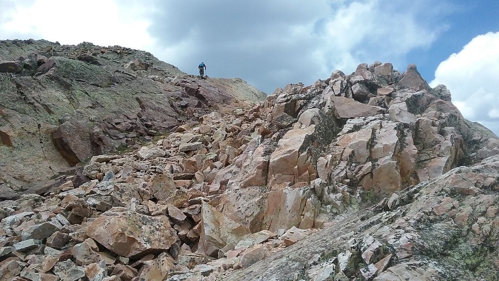
Gaining the Pk 8 - Storm King saddle
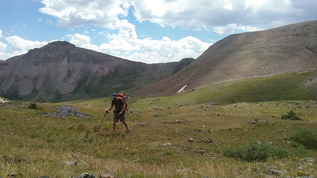
Not a bad day to play in Weminuche
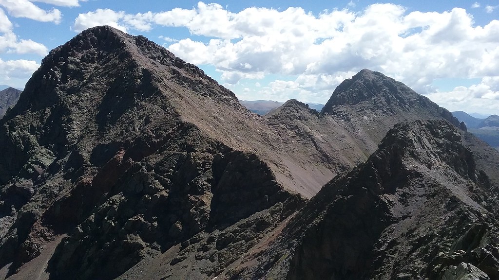
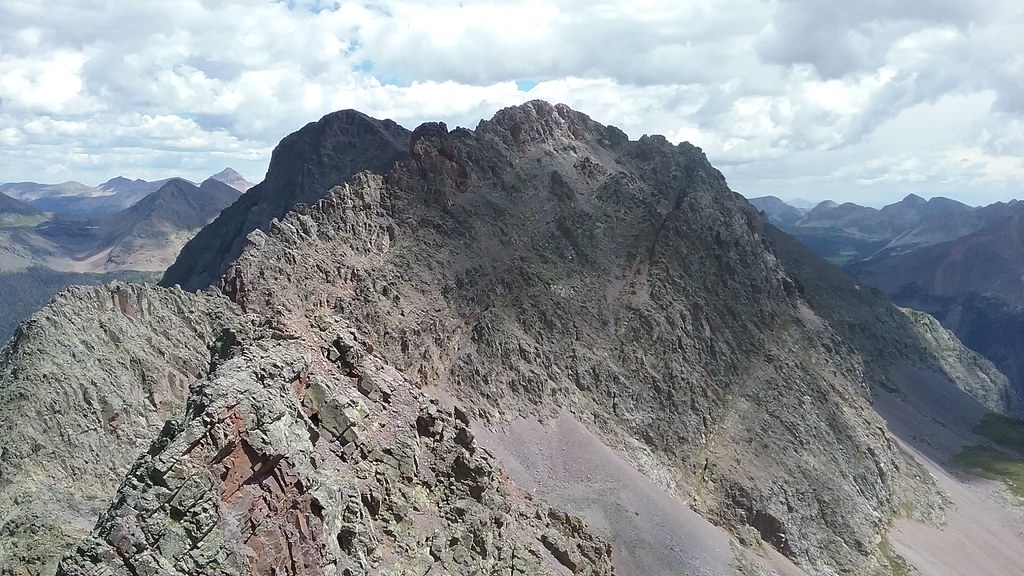
Peak 8 and the saddle to the left we aimed for
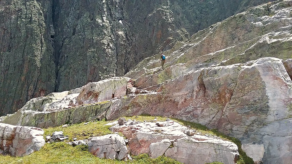
Vallecito, Leviathan, Jagged and the infamous flower ramp on Pk 8.
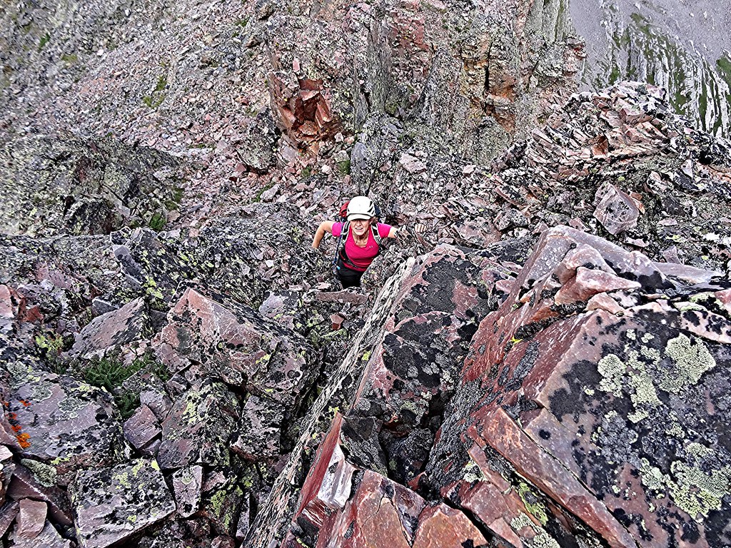
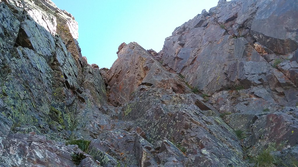
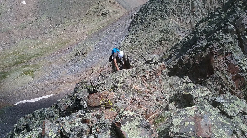
Shawn climbing the chimney to gain the grassy ramp on Pk 9
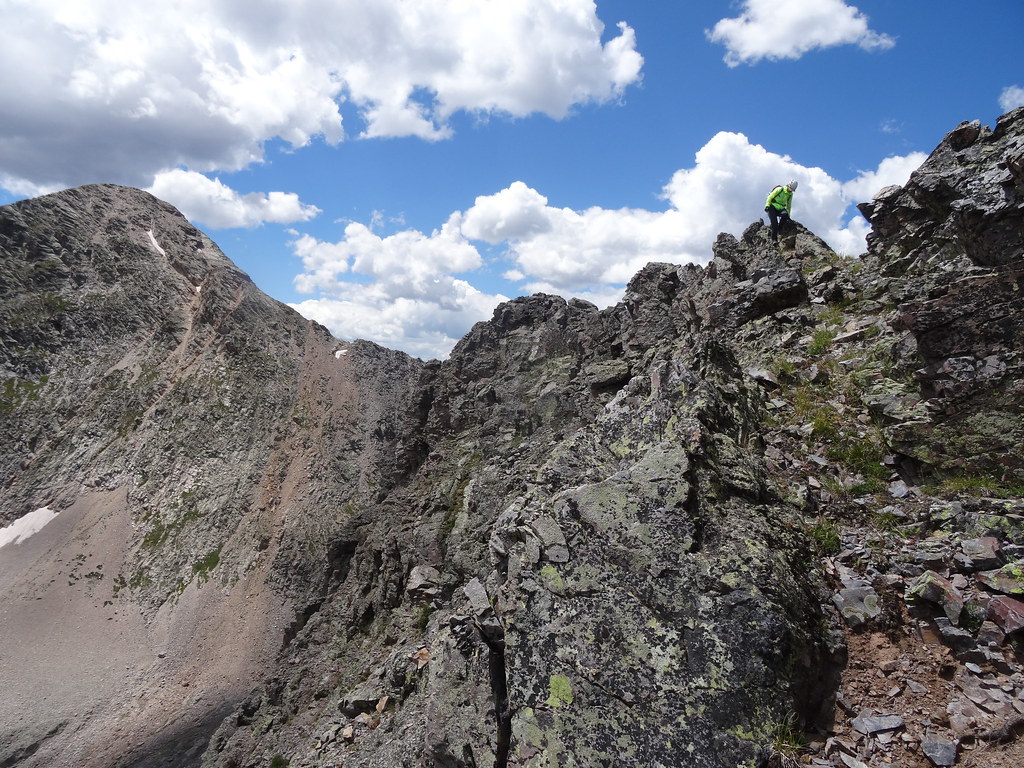
Shawn climbs the initial gully towards the ridge
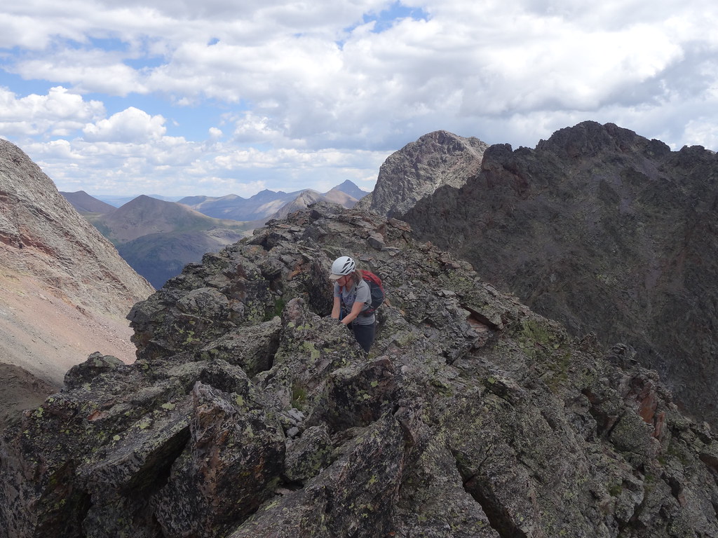
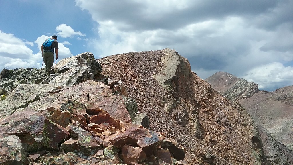
Navigating the ridge on Pk 9
On Pk 9 ridge, summit is to the right
More ridge climbing
Exposed and narrow ridge
Class 5 crack option near the summit
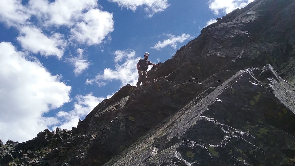
Topping out near the summit
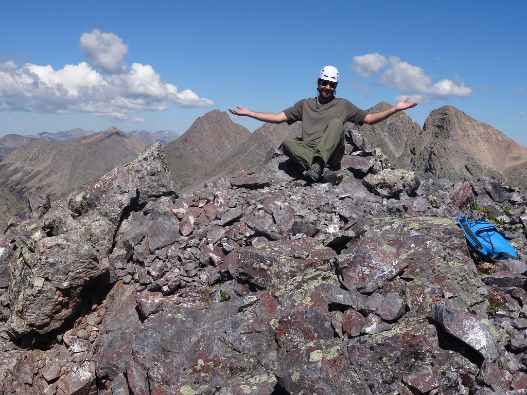
Ta-dam!
On cloud 9
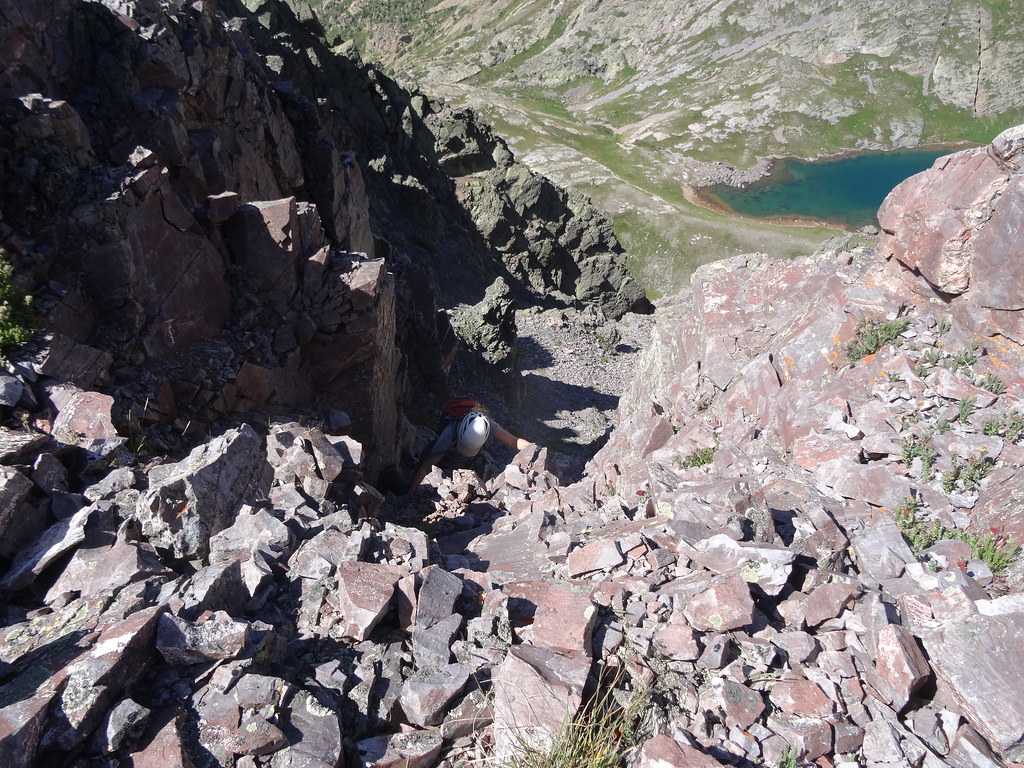
Downclibing standard Class 4 option on the descent
Exposure on the descent
Silex and Guardian from Pk 9 ridge
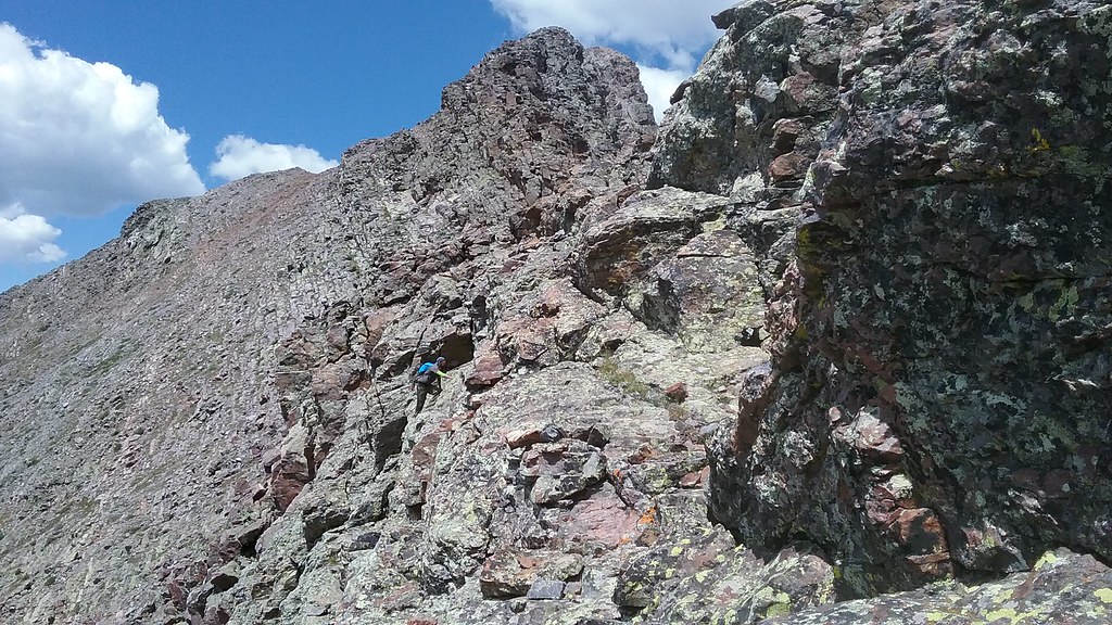
Starting up Pk 8 - blocky ridge route to the right of the snow gully
Climbing the ridge on Pk 8
The ridge steepens
Shawn decides to up the ante and Class 5 it - completely unnecessary
Climbing looked fun, but I stuck to the ridge
Ridge climbing
Summit ridge
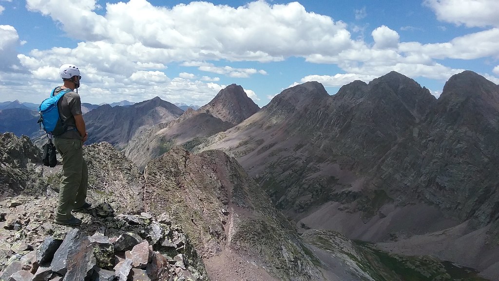
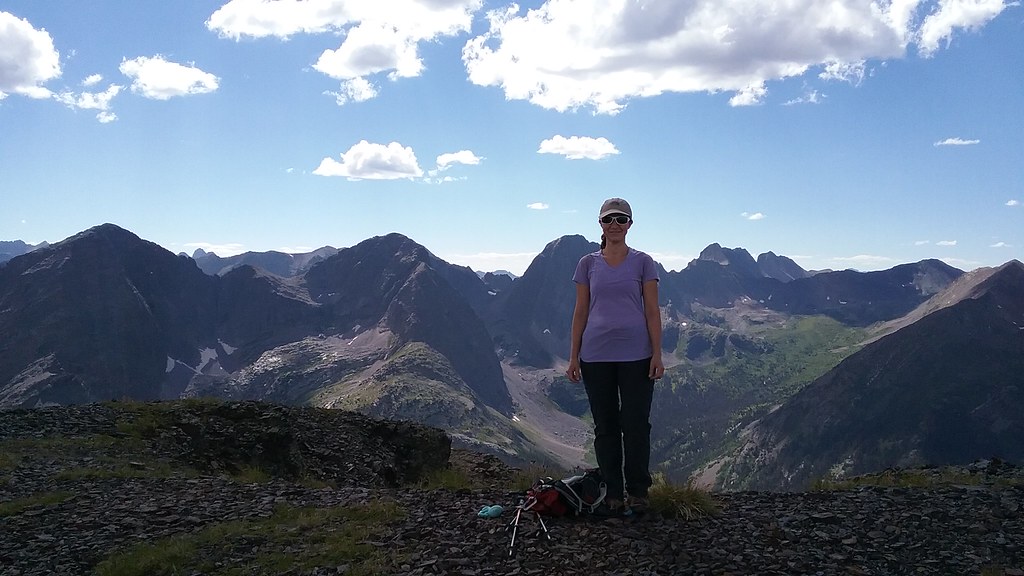
Taking in the summit views
Views
Pk 9 from Pk 8
Navigating the ridge on the descent. Pk 7 in the background
Ridge downclimb
Ridge downclimb
Glissading opportunity
Gaining the saddle with Storm King
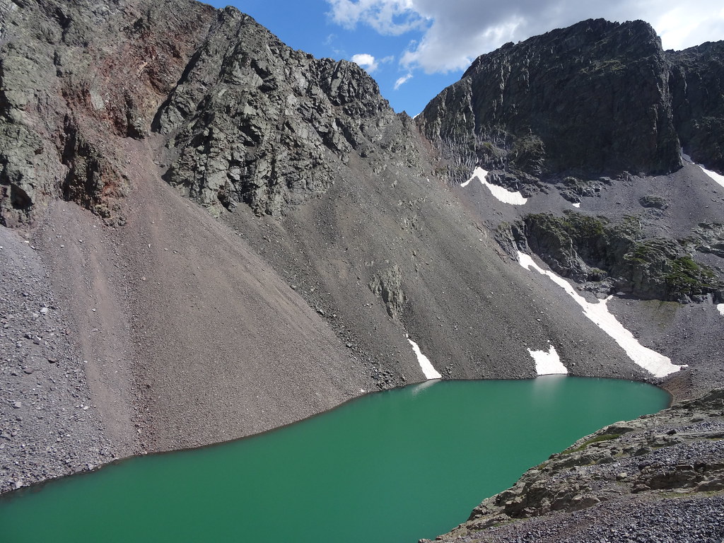
Lake Silex
~2,500 ft ascent/1,600 ft descent, 5 miles, 6.5 hours
I woke up at a very reasonable hour of 6.30 am after 9+ hours of restful sleep. I poked my head out of the tent and immediately woke up Shawn - the alpenglow on Storm King was at its peak. We ate a big breakfast, (very) leisurely packed up the camp and started the trek back around 9.40 am. This time we very quickly came upon a good trail at the edge of the basin and 35 minutes later were crossing the Valecito creek by the waterfall. We clearly had better route finding on the way back...Ughh, at this point we really wished we'd found that trail on the way in and had more energy to set up the camp further up the basin. Oh well. From the 10,600 ft crossing, it was a 2k grunt back to the top of the pass, where we arrived at noon. From our excellent vantage point we could see the weather starting to build over the Chicago basin, but we were hoping it would hold long enough for us to summit Hunchback mountain. After stashing the overnight packs near the pass and picking up our day packs we departed around 12.30 pm. I was not expecting much from a hike, but I was proven wrong. The ridge hike is very scenic and the summit offered the sweeping views of Weminuche. We stayed there for about 40 minutes, unable to peel ourselves off from the observation deck. Weather decided to make clear that we should leave, so we did. We hurried back to the pass where we arrived around 2.30 pm. After shouldering our (lighter) overnight packs for the last time, we reached the Beartown TH and the truck around 3 pm. We saw the first drops of rain once we got in the vehicle. One cannot really ask for more. The drizzle soon stopped and after couple of hours we got back into Silverton in time for the meal at Handlebars and to prepare for our next day adventure.
Alpenglow from campsite
Approaching Hunchback pass
Heading up Hunchback
White Dome visible in the background - not this time
White Dome and One from the summit of Hunchback
Watching the storms brew and enjoying the views
Until next time, Weminuche
To be continued...
My GPS Tracks on Google Maps (made from a .GPX file upload):
|