| Report Type | Full |
| Peak(s) |
"Fancy Peak" - 13,176 feet |
| Date Posted | 08/07/2016 |
| Date Climbed | 07/21/2016 |
| Author | Tony1 |
| Fancy Pants |
|---|
Fancy PeakThursday, 21 July 2016 Route: South Ridge from Fancy Pass Distance: ~8.7 miles R/T Gain: ~3200 feet Hikers: Tony and Michelle An anticipated slow Thursday morning at work made for a good time for my coworker and friend, Michelle, and I to head out for a nearby peak. We chose Fancy Peak, a 13er located southwest of Red Cliff in the Holy Cross Wilderness. Access to the peak is provided by the Fancy Pass trail, which originates near Homestake Road and takes hikers past Fancy Lake, over Fancy Pass, and to Treasure Vault Lake. The trail connects with the Missouri Lakes trail near Treasure Vault Lake, which is the trail many use to access nearby 13er Savage Peak. More info on the Fancy Pass trail can be found here. We set out from Avon just before 5:00, drove up Homestake Road (hope you like washboard; Chaffee CR 390 (BelOx, etc.) is child's play compared to this), went up the access road to the TH, and were hiking by 6:00. We made our way up the trail and were at Fancy Lake by the time daylight was in full swing.   After a brief break at the lake, we turned at the junction to continue up the trail to the pass. The terrain makes a quick transition from dense forest to a rocky upper basin. A decently sized snowfield still lingered over the trail before it steepened for the final ascent to the pass near 12,400'. 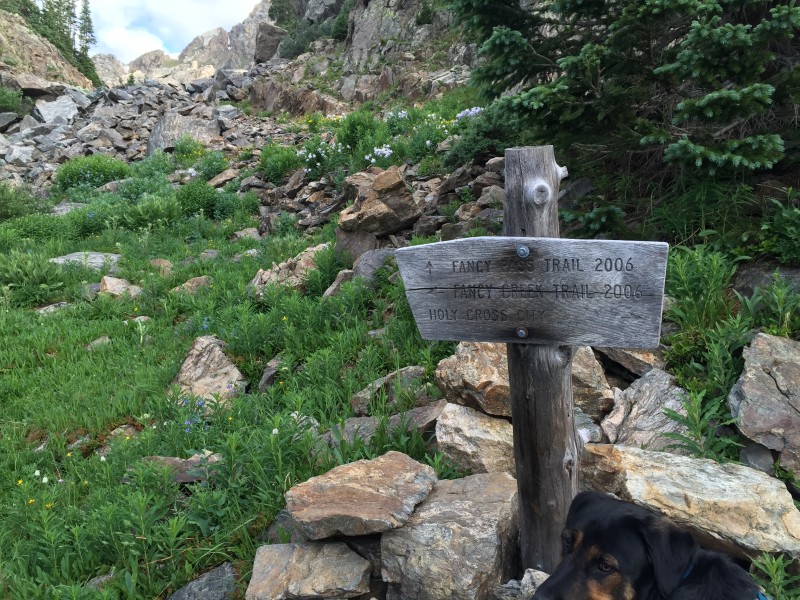 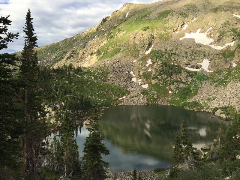   Upon reaching the pass, I was blown away. Trust me on this... the view opens and slaps you right in the face with incredible beauty. I'll let the pictures do the talking.  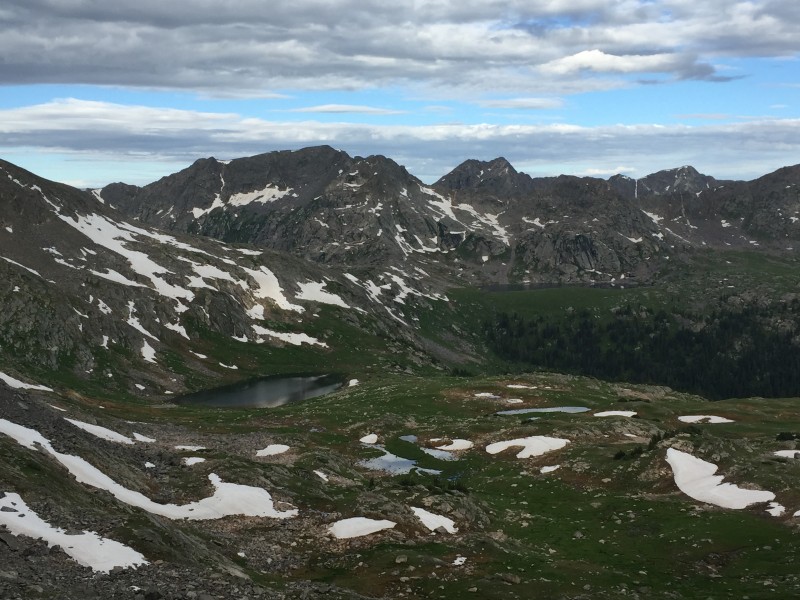 After another brief break at the pass, we followed the trail down just a bit before leaving it and starting our ascent up the steep grass. The ridge direct does not go during this part of the hike if you want to keep things at class 2. The grass is a simple but steep ascent, speckled with small areas of talus and slippery scree. There are faint trail sections in this area, and we utilized them when possible. We hiked up the grass--bearing northeast--until we reached the ridge after the point where it mellows out. This point seems to be a little above 12,900'. 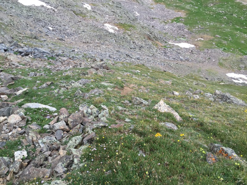  The following picture is a small pano from where we gained the ridge.  From the point where the ridge mellows to the summit, the terrain is intermittent grass and small talus. There were a couple of areas where we traversed below the ridge crest by simply taking the path of least resistance. It's all class 2 talus hopping at its hardest. There is one false summit about halfway between where we gained the ridge and the summit, but it's not too disheartening. The elevation gain from the ridge access to the summit is only about 300 feet.  We ascended one last, quick, steep talus section to the summit, where we found (gasp) a register! What a rarity these days. This thing had entries dating back to 2011 with only a few pages filled out. I recognized several. Not many people come up this one. The views of the Holy Cross Wilderness, the rest of the northern Sawatch, and the Elks were lit. Am I using that term right? 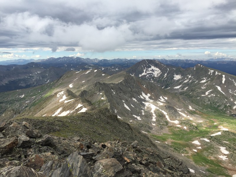  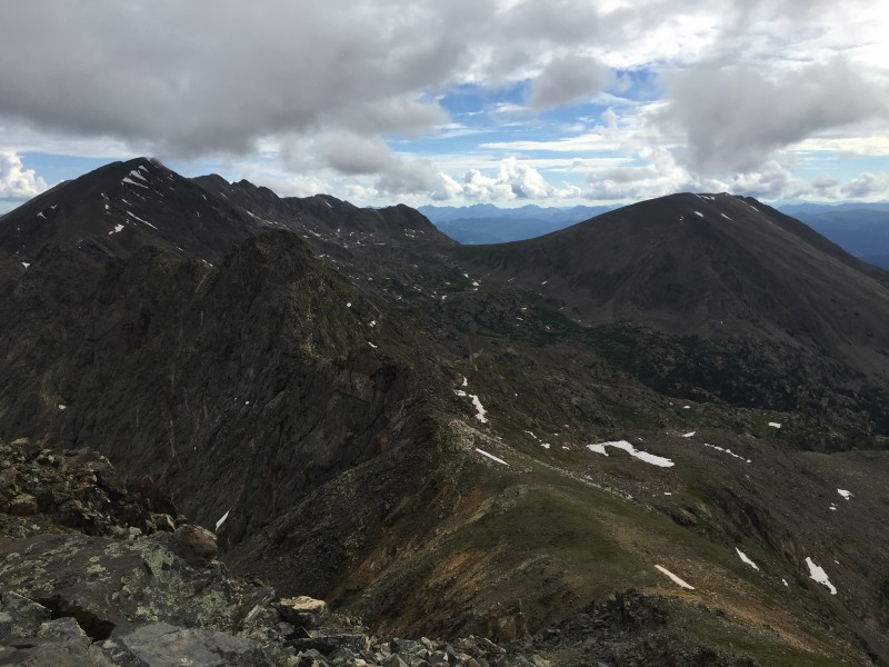   Of course, I had to dress the part.  From Fancy Pass to the summit, it's about 0.6 miles one way and 800 feet of elevation gain. We cut our summit break a bit short due to darkening clouds and started back down the ridge. When we reached the spot where it was time to descend the steep grass, we had an easier time finding trail sections and used them to help make the descent down this steep area less tedious. 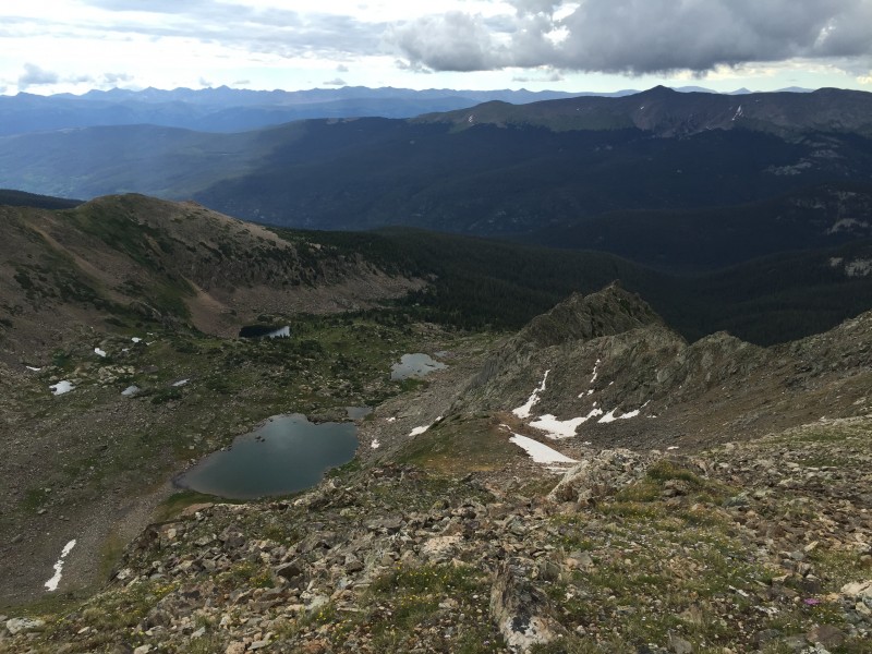  Upon reaching the main trail, we made the short, 20-something foot ascent back to the pass and took one last moment to appreciate the wide open view.  We made our way back down to Fancy Lake and took yet another break to take in all the beauty. 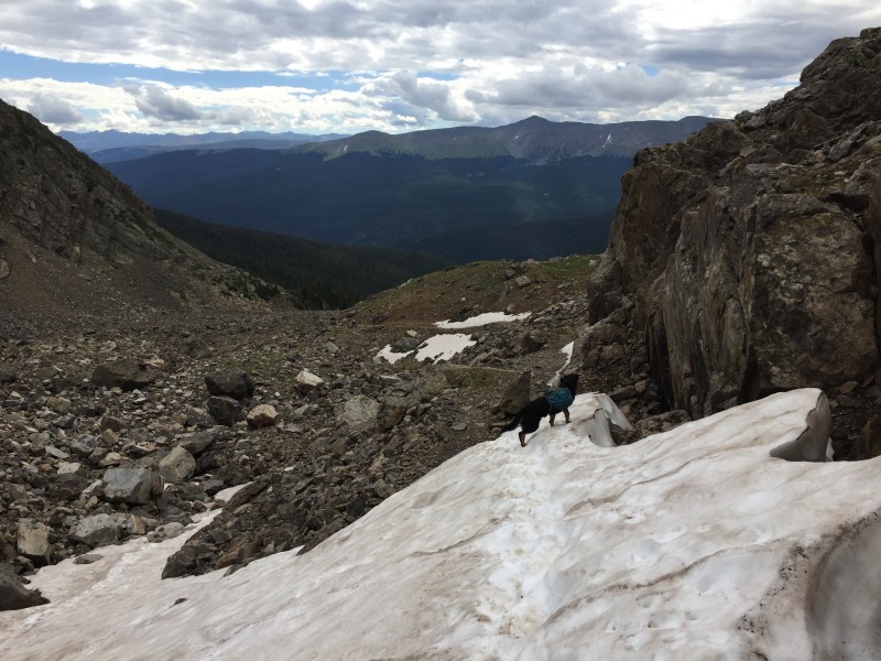   We left the lake and made a 50-minute descent back to the trailhead, arriving just before noon. During the descent, we passed many people coming up, most of whom were going only to Fancy Lake, but plenty were also going over the pass for the Fancy-Treasure Vault-Missouri Lakes circuit, most as a backpack trip. I didn't think this area was so popular, but I have to say I was pleasantly surprised. It's great to see people out enjoying such a nice place. Of course, Michelle and I were the only ones who went for the peak! 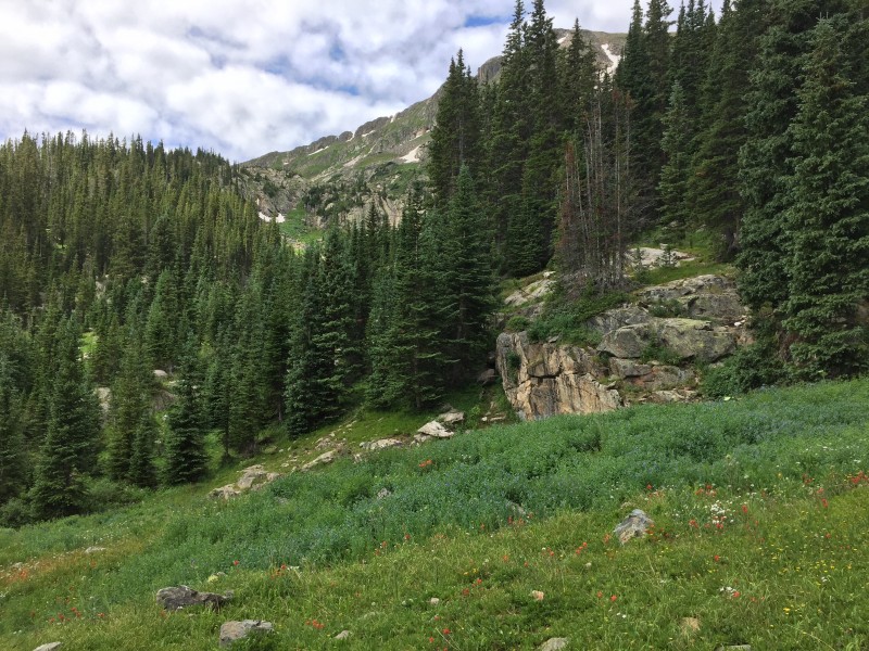 I have a habit of recommending to others practically every hike I do, but this one I really recommend. If you're looking for a 13er in the Holy Cross Wilderness, can't go wrong with this one. Oh, wait, there was also this:  Thanks for reading! -Tony Thumbnails for uploaded photos (click to open slideshow):  Fancy Lake in the morning.")
 The trail junction is signed.")
 Rising above Fancy Lake.")
 Approaching the upper basin.")
 Looking back; Michelle makes her way across the snow.")
 Treasure Vault Lake with 12ers in the background.")
 Ascending the steep grassy slope.")
 Straddling the transition.")
 Looking up the ridge. If I'm remembering correctly, that is the false summit.")
 Looking south from the summit toward Savage Peak (R) and Mount Massive (L).")
 Looking northwest from the summit. Sven looks over his kingdom.")
 Looking northeast from the summit toward the Holy Cross area (L) and Whitney Peak (R).")
 Sometimes you gotta be fancy.")
 Pyramid Peak (L) and the Maroon Bells (R).")
 Mulhall Lakes, southeast of the peak.")
 A little notch in the ridge on the descent.")
 One last look in this area.")
 Descending from the pass.")
 Descending toward Fancy Lake with 13er Homestake Peak in the background.")
 Midday views at Fancy Lake.")
 Forested terrain on the descent.")
 Yikes!")
|
| Comments or Questions | |||
|---|---|---|---|
|
Caution: The information contained in this report may not be accurate and should not be the only resource used in preparation for your climb. Failure to have the necessary experience, physical conditioning, supplies or equipment can result in injury or death. 14ers.com and the author(s) of this report provide no warranties, either express or implied, that the information provided is accurate or reliable. By using the information provided, you agree to indemnify and hold harmless 14ers.com and the report author(s) with respect to any claims and demands against them, including any attorney fees and expenses. Please read the 14ers.com Safety and Disclaimer pages for more information.
Please respect private property: 14ers.com supports the rights of private landowners to determine how and by whom their land will be used. In Colorado, it is your responsibility to determine if land is private and to obtain the appropriate permission before entering the property.


