| Report Type | Full |
| Peak(s) |
Whitecross Mountain - 13,553 feet |
| Date Posted | 08/07/2016 |
| Date Climbed | 07/08/2016 |
| Author | Tony1 |
| Whitecross + Lake from Grizzly Gulch |
|---|
Whitecross MountainFriday, 8 July 2016 Route: Grizzly Gulch with extra credit (lake) Distance: ~8.2 miles R/T Gain: ~3500 feet I made a long weekend trip down to the San Juans to join Ryan (RyGuy) and Nicole (14erAddict), plus John and Wiladee (both of whom I met for the first time), on a few peaks. In between our Thursday hike of Half Peak and our Saturday hike of Stewart Peak and Baldy Alto, the rest of the group took a rest day, since they'd been wandering all over the area's mountains for the past week. I decided I'd spend the day going out for something on the easier side and chose Whitecross Mountain. After our dinner in Lake City, I drove back up Hinsdale CR 30/Cinnamon Pass Road to the Grizzly Gulch trailhead, parked the car, and set up the car hotel for the night. I set an alarm, but with the good forecast, ultimately ignored it and simply rose with the sun in the morning. I ate some breakfast, tried to get Sven to eat his, and set off on the Grizzly Gulch/Handies trail somewhere between 7:30 and 8:00. I'd been up this trail once before while taking my sister up her first 14er (is Handies a legit choice or what?), so the bluebell-covered forest floor was a familiar and welcome sight. I forgot how steep the trail was, though. That Missouri Gulch is NOT the state's only steep trail up to treeline, FYI! After breaking treeline, we followed the trail as it makes an ascending traverse along Whitecross' south slopes toward a flatter part of the gulch and the creek crossing "landmark." 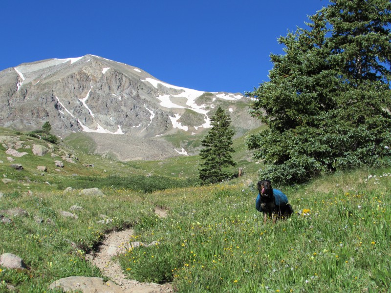 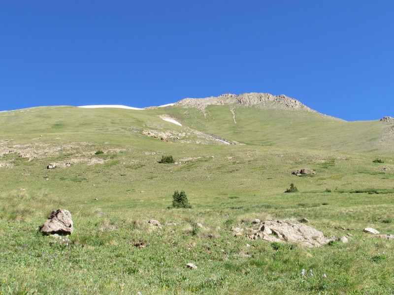  We continued to use the trail as it turned to the northwest up the bench, and paused at the cairn pictured below. From here to the summit of Whitecross, it's about 1.1 miles of hiking one-way. This spot is at around 12,700' in elevation. 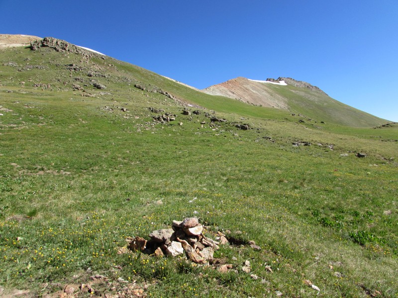 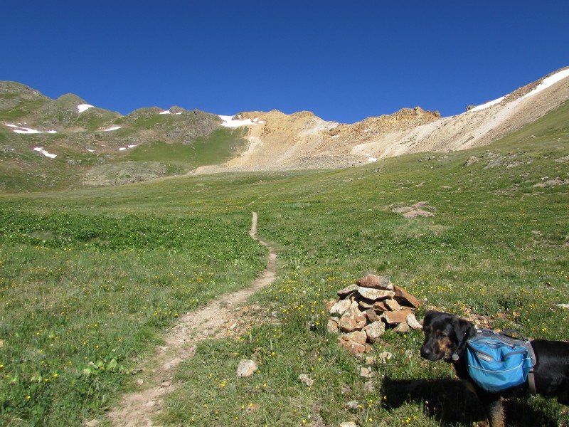 Here, we left the trail to gain the ridge almost directly to the north at the 13,000' saddle between Handies and Whitecross. It was pretty easy class 2 off-trail hiking with scattered chunks of talus and a bit of scree.  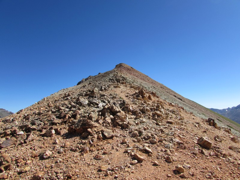 After reaching the ridge, we followed it directly to the summit, only contouring to climber's left about 50 feet below the summit when the terrain becomes very blocky. The rock on the way up the ridge was split into sections of different colors, which was pretty cool. 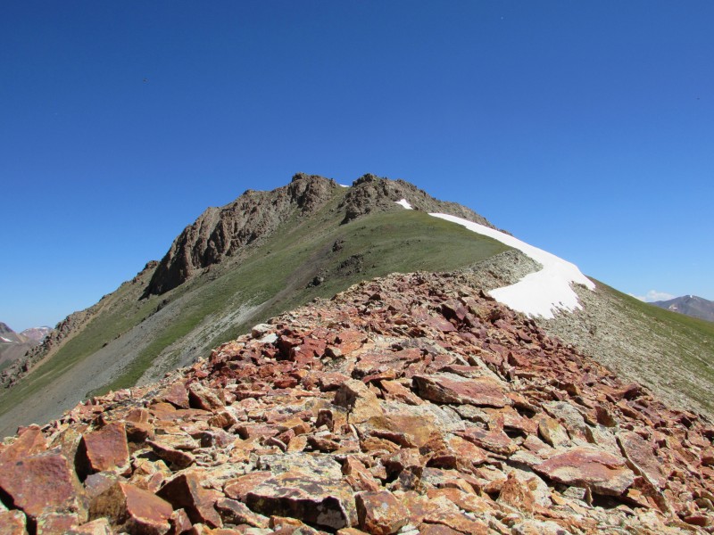 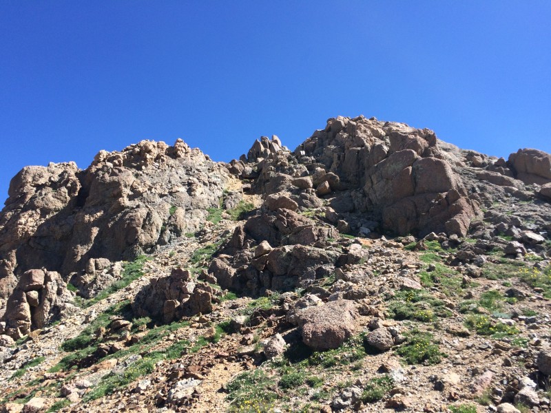 After the contour, we ascended up the remaining grassy/easy scree slope to the "summit saddle," and then turned left up a quick, blocky class 2 pitch to the top. 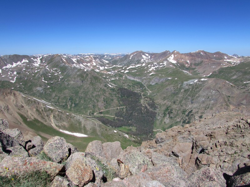 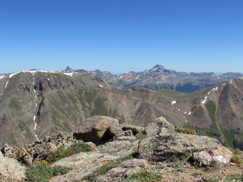 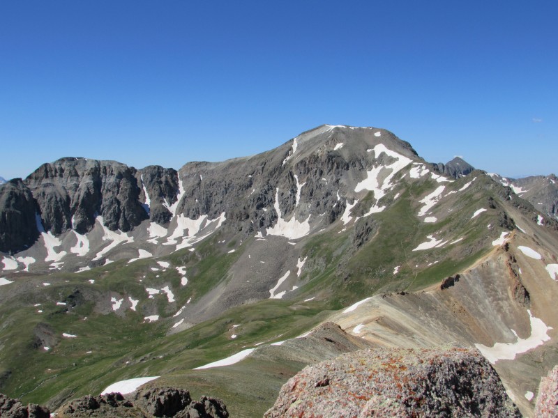 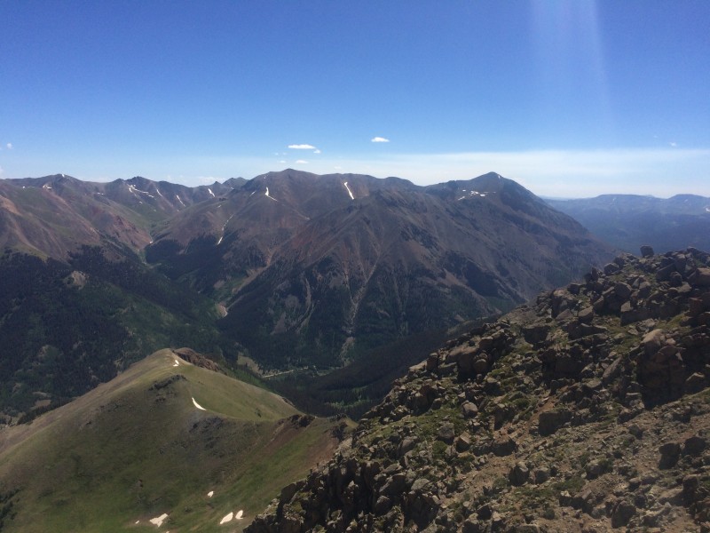 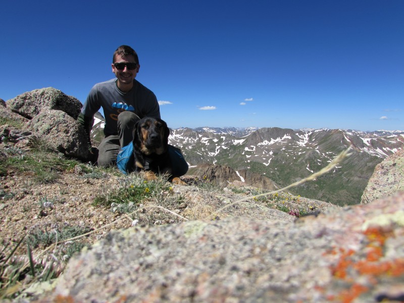 The summit was calm and sunny, and I believe we reached it around 10:30. We rested for about half an hour before heading down. Just after beginning of the descent, I paused to take a closer look at a lake I noticed earlier, perched above Grizzly Gulch to the south. The water in this lake might be some of the bluest I'd ever seen. Looking at the gulch, I noticed a trail that leads up to the bench where the lake is located. "I have to go see this up close," I thought.  We re-traced our steps back to the saddle, to the cairn along the Handies trail, down to the creek crossing, and began looking for the faint trail after several minutes of descending from the crossing. I could never locate it from the Handies trail, so we left the trail after one of the minor creek crossings and started a slight ascending traverse over to the talus field between us and the "choke point" of the bench above us to the southeast. Turns out I deleted the pictures I took of the trail from above, otherwise I'd post them here for reference. Whoops. After a couple minutes, I found the trail and we followed it across a couple lingering snowfields, through the aforementioned talus not still covered in snow, and toward the creek that drains the lake as it flows down the slope. The trail turns to follow the creek and ascends up the steep, grassy slope, through the choke point, and then mellows and fades as it approaches the lake. It took maybe a half hour to reach the lake from the point we left the main Handies trail. 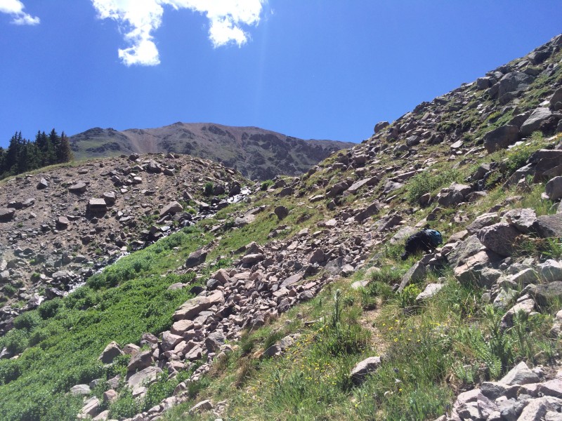 Upon reaching the lake, I was glad I decided to take the detour to come up here. It was gorgeous. Of course, pictures never do it justice.  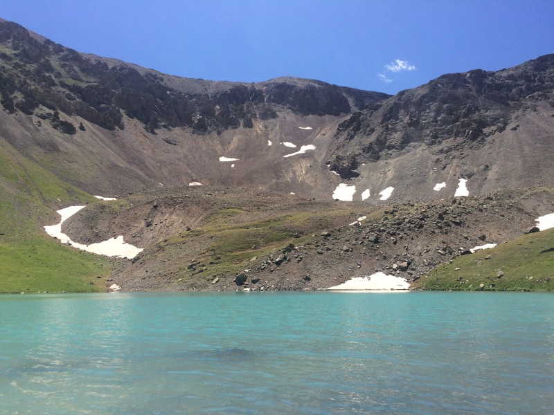  The lake doesn't seem to be named, either. Google found nothing. Let's name it Sven Lake. I like that. Or Whitecross Lake; that one makes sense. After all, the view of the peak from the lake is great, and vise-versa. 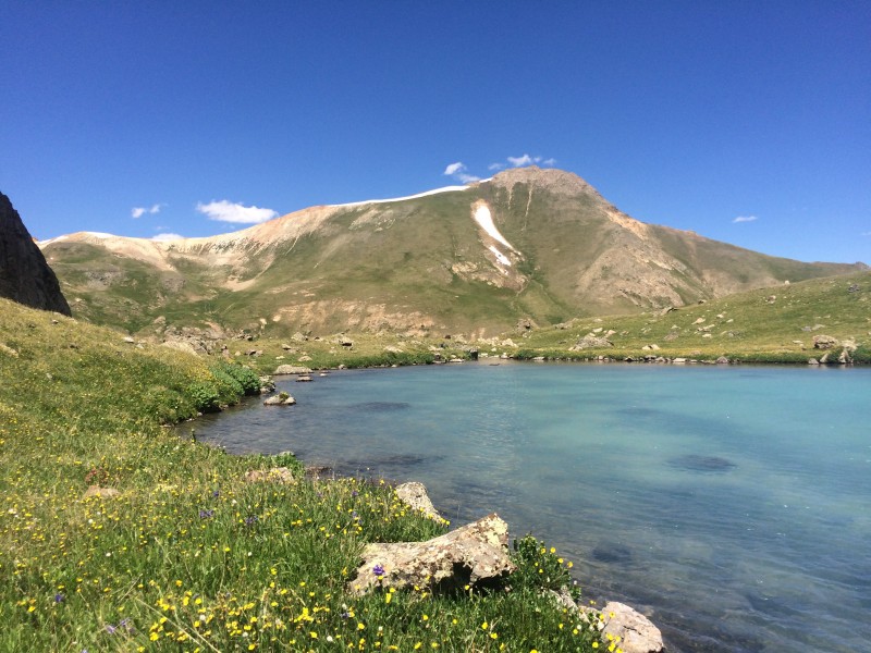 After a decent break at the lake, we turned and found the trail back near the choke point and followed it back down into Grizzly Gulch, turning off of it near the bottom to cross the creek and intercept the main trail in an easy area. Overall, the detour added about a mile of roundtrip hiking and about 400 feet of elevation gain. 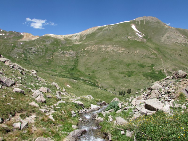 The rest of the hike involved a simple descent back to the trailhead on the main trail. 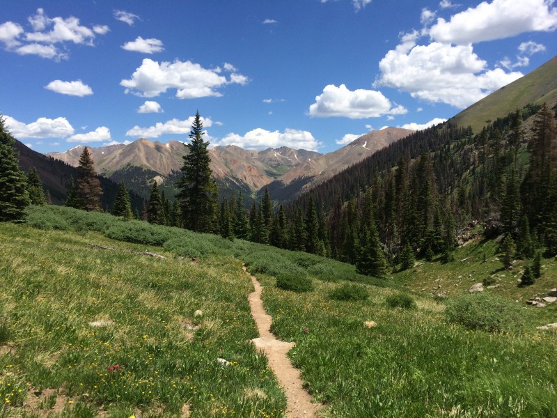 If you're looking for a 13er in the Lake City area with good access, a straightforward route, and great views, Whitecross is a great choice. I also highly recommend the addition of the lake to your Handies/Whitecross/Grizzly Gulch outing. It's a bit more effort than seeing Sloan Lake on the American Basin side of the mountain, but equally as rewarding. You can see the lake's location relative to the Handies, Whitecross, and the main Grizzly Gulch trail here. Thanks for reading! -Tony Thumbnails for uploaded photos (click to open slideshow):
|
| Comments or Questions | ||||||
|---|---|---|---|---|---|---|
|
Caution: The information contained in this report may not be accurate and should not be the only resource used in preparation for your climb. Failure to have the necessary experience, physical conditioning, supplies or equipment can result in injury or death. 14ers.com and the author(s) of this report provide no warranties, either express or implied, that the information provided is accurate or reliable. By using the information provided, you agree to indemnify and hold harmless 14ers.com and the report author(s) with respect to any claims and demands against them, including any attorney fees and expenses. Please read the 14ers.com Safety and Disclaimer pages for more information.
Please respect private property: 14ers.com supports the rights of private landowners to determine how and by whom their land will be used. In Colorado, it is your responsibility to determine if land is private and to obtain the appropriate permission before entering the property.


